| Product Image |
Resource Name- |
Price |
Manufacturer |
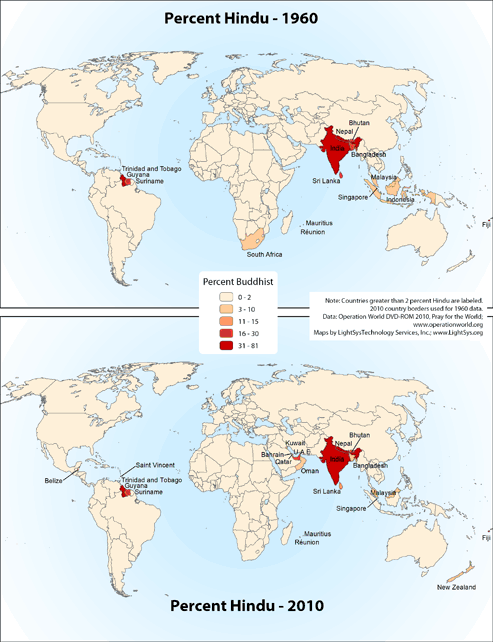 |
· Type: Maps · Map Date: 2019 · Data Source: Operation World 2010 DVD-ROM. · Partners: Operation World/GMI, LightSys Technology Services · Collection: Projects 2019 · Size: 8½ x 11 inches, portrait · Categories: Type :: Maps Continent/Region :: World Topic :: Statistical Topic :: Religions, General :: Hinduism |
... more info
|
|
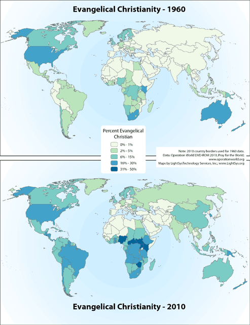 |
· Type: Maps · Map Date: 2018 · Data Source: Operation World 2010 DVD-ROM and Pray for the World · Partners: Operation World/GMI, LightSys Technology Services · Collection: Projects 2018 · Size: 8½ x 11 inches, landscape · Categories: Type :: Maps Continent/Region :: World Topic :: Statistical Topic :: Religions, Christianity :: Adherents, Churches, and Denoms Partners :: LightSys Technology Services... |
... more info
|
|
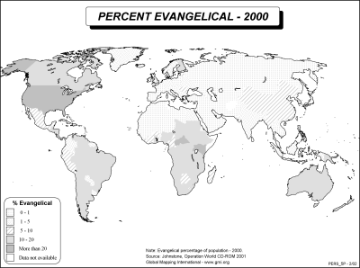 |
·Type: Maps ·Description: Evangelicals in 2000 ·Map Date: 2002 ·Producer: Global Mapping International ·Collection: Worldwide Perspectives (WV 2002) ·Size: 8½ x 11 Inches, landscape ·Categories: Type :: Maps Collection :: GMI Map Collections :: Worldwide Perspectives (WV 2002) Continent/Region :: World Topic :: Statistical Partners :: Global Mapping International Topic :: Religions, Christianity :: Adherents, Churches, and Denoms |
... more info
Max: 1
|
|
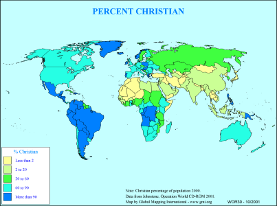 |
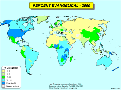
·Type: Maps ·Description: Country level divisions of the percent Christian ·Map Date: 2000 ·Producer: Global Mapping International ·Collection: General World Maps (WV 2002) ·Size: 8½ x 11 Inches, landscape ·Categories: Type :: Maps Collection :: GMI Map Collections :: General World Maps (WV 2002) Continent/Region :: World Topic :: Statistical Partners :: Global Mapping International Topic :: Religions, Christianity :: Adherents, Churches,... |
... more info
Max: 1
|
|
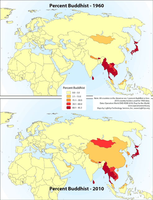 |
· Type: Maps · Map Date: 2019 · Data Source: Operation World 2010 DVD-ROM. · Partners: Operation World/GMI, LightSys Technology Services · Collection: Projects 2019 · Size: 8½ x 11 inches, portrait · Categories: Type :: Maps Continent/Region :: World Topic :: Statistical Topic :: Religions, General :: Buddhism |
... more info
|
|
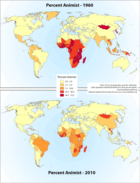 |
· Type: Maps · Map Date: 2019 · Data Source: Operation World 2010 DVD-ROM and Pray for the World. · Partners: Operation World/GMI, LightSys Technology Services · Collection: Projects 2019 · Size: 8½ x 11 inches, portrait · Categories: Type :: Maps Continent/Region :: World Topic :: Statistical Topic :: Religions, General :: Traditional/Animist |
... more info
|
|
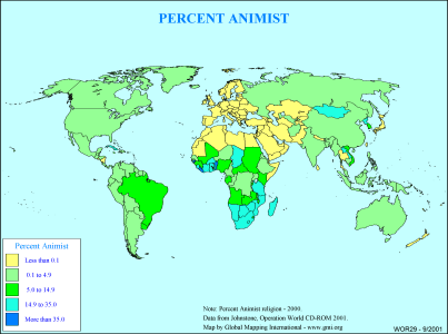 |
·Type: Maps ·Description: Country level divisions of the percent Animist ·Map Date: 2000 ·Producer: Global Mapping International ·Collection: General World Maps (WV 2002) ·Size: 8½ x 11 Inches, landscape ·Categories: Type :: Maps Collection :: GMI Map Collections :: General World Maps (WV 2002) Continent/Region :: World Topic :: Statistical Partners :: Global Mapping International Topic :: Religions, General :: Traditional/Animist |
... more info
Max: 1
|
|
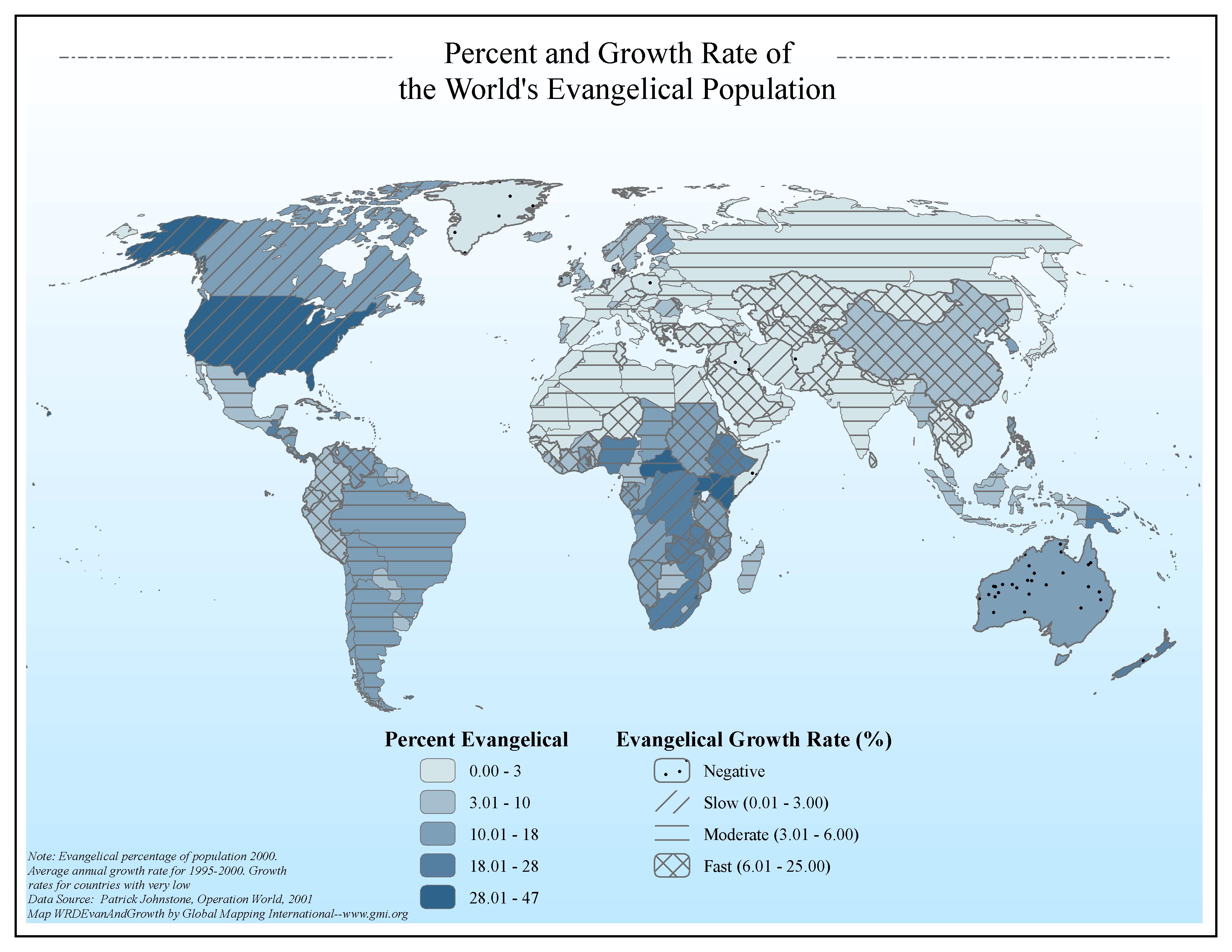 |
·Type: Maps ·Map Date: 2006 ·Data Source: Patrick Johnstone, Operation World, 2001 ·Producer: Global Mapping International ·Collection: Intro to Missions (GMMS 2007) ·Size: 8½ x 11 inches, landscape ·Categories: Type :: Maps Continent/Region :: World Topic :: Statistical Collection :: GMI Map Collections :: Intro to Missions (GMMS 2007) Partners :: Global Mapping International Topic :: Religions, Christianity :: Adherents, Churches, and... |
... more info
Max: 1
|
|
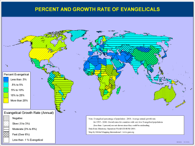 |
·Type: Maps ·Description: Evangelical percent and Growth Rate ·Map Date: 2001 ·Producer: Global Mapping International ·Collection: Intro to Mission (WorldVue 2002) ·Size: 8½ x 11 Inches, landscape ·Categories: Type :: Maps Collection :: GMI Map Collections :: Intro to Mission (WorldVue 2002) Continent/Region :: World Topic :: Statistical Partners :: Global Mapping International Topic :: Religions, Christianity :: Adherents, Churches, and... |
... more info
Max: 1
|
|
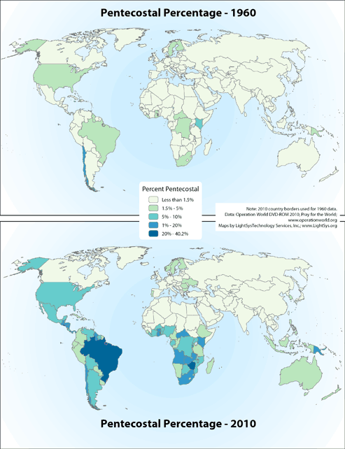 |
· Type: Maps · Map Date: 2019 · Data Source: Operation World 2010 DVD-ROM and Pray for the World · Partners: Operation World/GMI, LightSys Technology Services · Collection: Projects 2019 · Size: 8½ x 11 inches, landscape · Categories: Type :: Maps Continent/Region :: World Topic :: Statistical Topic :: Religions, Christianity :: Adherents, Churches, and Denoms Partners :: LightSys Technology Services... |
... more info
Max: 1
|
|
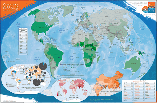 |
This colored Spanish map (60.96 cm by 91.44 cm) highlights information and statistics found in Operation Muro Mundo and in Pray for the World. The main map includes the percentage of Christians in the 30 largest countries, the number of the least-reached peoples in each country, and the percentage of Christians by province of China and India. For more information go to Operation World Wall Map on the Operation World website. The above link opens in a new tab. |
... more info
|
|
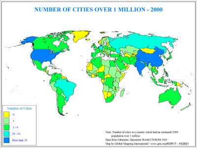 |
·Type: Maps ·Description: Country level distribution of number of cities over 1 million in 2 ·Map Date: 2000 ·Producer: Global Mapping International ·Collection: General World Maps (WV 2002) ·Size: 8½ x 11 Inches, landscape ·Categories: Type :: Maps Collection :: GMI Map Collections :: General World Maps (WV 2002) Continent/Region :: World Topic :: Demography Partners :: Global Mapping International |
... more info
Max: 1
|
|
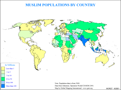 |
·Type: Maps ·Description: Muslim Populations by Country ·Map Date: 2000 ·Producer: Global Mapping International ·Collection: General World Maps (WV 2002) ·Size: 8½ x 11 Inches, landscape ·Categories: Type :: Maps Collection :: GMI Map Collections :: General World Maps (WV 2002) Continent/Region :: World Topic :: Statistical Partners :: Global Mapping International Topic :: Religions, General :: Islam |
... more info
Max: 1
|
|
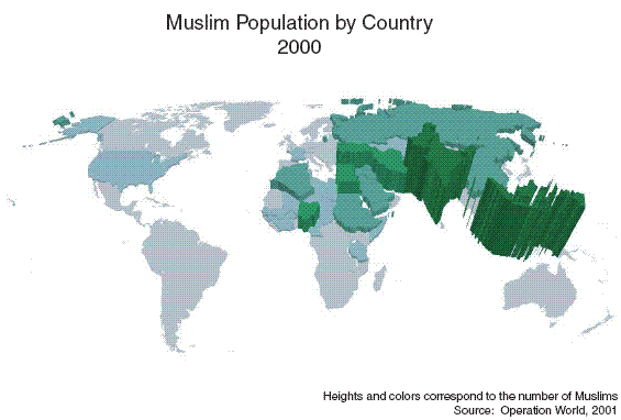 |
·Type: Maps ·Map Date: 27 February 2007 ·Data Source: Operation World 2001 ·Producer: Global Mapping International ·Collection: Projects 2007 ·Size: 8½ by 11 inches, landscape ·Categories: Type :: Maps Continent/Region :: World Topic :: Statistical Topic :: Strategy Partners :: Global Mapping International Collection :: GMI Map Collections :: Projects 2007 Topic :: Religions, General :: Islam |
... more info
Max: 1
|
|
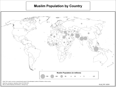 |
·Type: Maps ·Description: Symbol based map of Muslim population by country ·Map Date: 2002 ·Producer: Global Mapping International ·Collection: The World of Islam (WV 2002) ·Size: 8½ x 11 Inches, landscape ·Note: Windows Metafile and Metafile in Word forms of this map require the GMISym.ttf font ·Categories: Type :: Maps Collection :: GMI Map Collections :: The World of Islam (WV 2002) Continent/Region :: World Topic :: Statistical... |
... more info
Max: 1
|
|
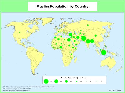 |
·Type: Maps ·Description: Symbol based map of Muslim population by country ·Map Date: 2000 ·Producer: Global Mapping International ·Collection: The World of Islam (WV 2002) ·Size: 8½ x 11 Inches, landscape ·Note: Windows Metafile and Metafile in Word forms of this map require the GMISym.ttf font ·Categories: Type :: Maps Collection :: GMI Map Collections :: The World of Islam (WV 2002) Continent/Region :: World Topic :: Statistical... |
... more info
Max: 1
|
|
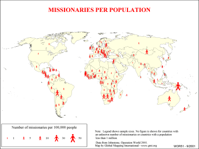 |
·Type: Maps ·Description: Country level divisions of missionaries per population ·Map Date: 2000 ·Producer: Global Mapping International ·Collection: General World Maps (WV 2002) ·Size: 8½ x 11 Inches, landscape ·Note: Windows Metafile and Metafile in Word forms of this map require the GMISym.ttf font ·Categories: Type :: Maps Collection :: GMI Map Collections :: General World Maps (WV 2002) Continent/Region :: World Topic ::... |
... more info
Max: 1
|
|
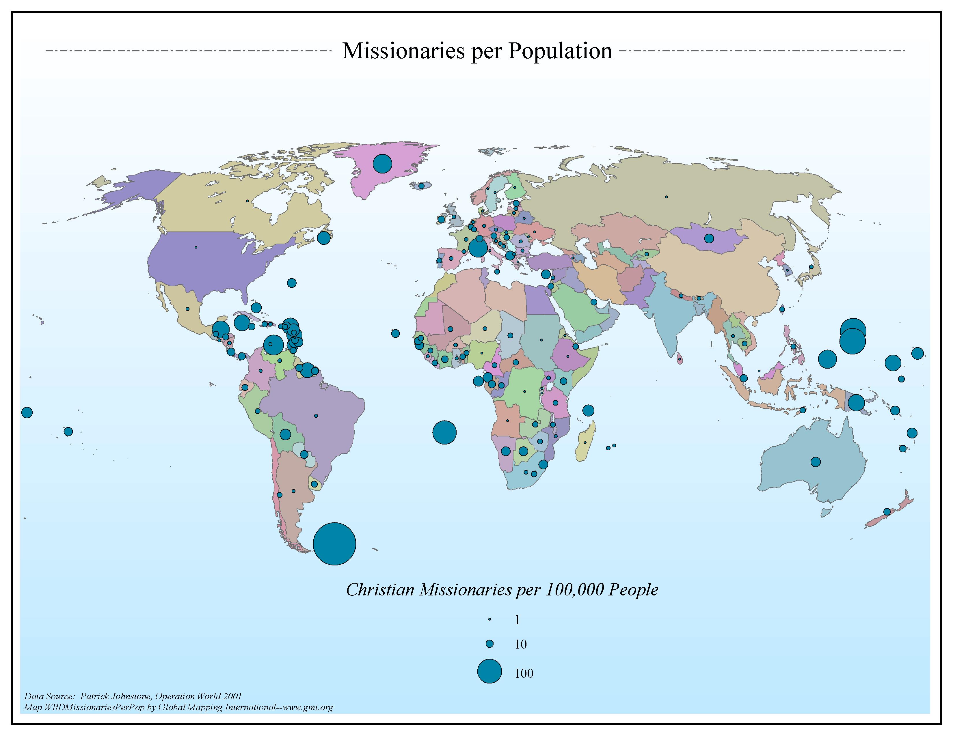 |
·Type: Maps ·Map Date: 2006 ·Data Source: Patrick Johnstone, Operation World 2001 ·Producer: Global Mapping International ·Collection: General World Maps (GMMS 2007) ·Size: 8½ x 11 inches, landscape ·Categories: Type :: Maps Continent/Region :: World Topic :: Statistical Topic :: Strategy Collection :: GMI Map Collections :: General World Maps (GMMS 2007) Partners :: Global Mapping International |
... more info
Max: 1
|
|
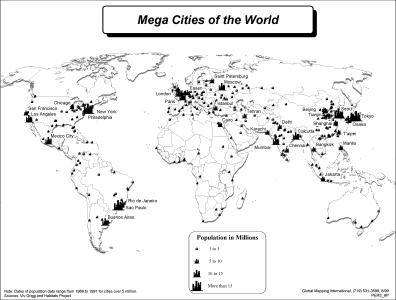 |
·Type: Maps ·Description: Maga Cities of The World ·Map Date: 2002 ·Producer: Global Mapping International ·Collection: Worldwide Perspectives (WV 2002) ·Size: 8½ x 11 Inches, landscape ·Note: Windows Metafile and Metafile in Word forms of this map require the GMISym.ttf font ·Categories: Type :: Maps Collection :: GMI Map Collections :: Worldwide Perspectives (WV 2002) Continent/Region :: World Topic :: Demography Partners ::... |
... more info
Max: 1
|
|
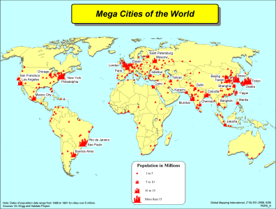 |
·Type: Maps ·Description: Maga Cities of The World ·Map Date: 2002 ·Producer: Global Mapping International ·Collection: Worldwide Perspectives (WV 2002) ·Size: 8½ x 11 Inches, landscape ·Note: Windows Metafile and Metafile in Word forms of this map require the GMISym.ttf font ·Categories: Type :: Maps Collection :: GMI Map Collections :: Worldwide Perspectives (WV 2002) Continent/Region :: World Topic :: Demography Partners ::... |
... more info
Max: 1
|
|
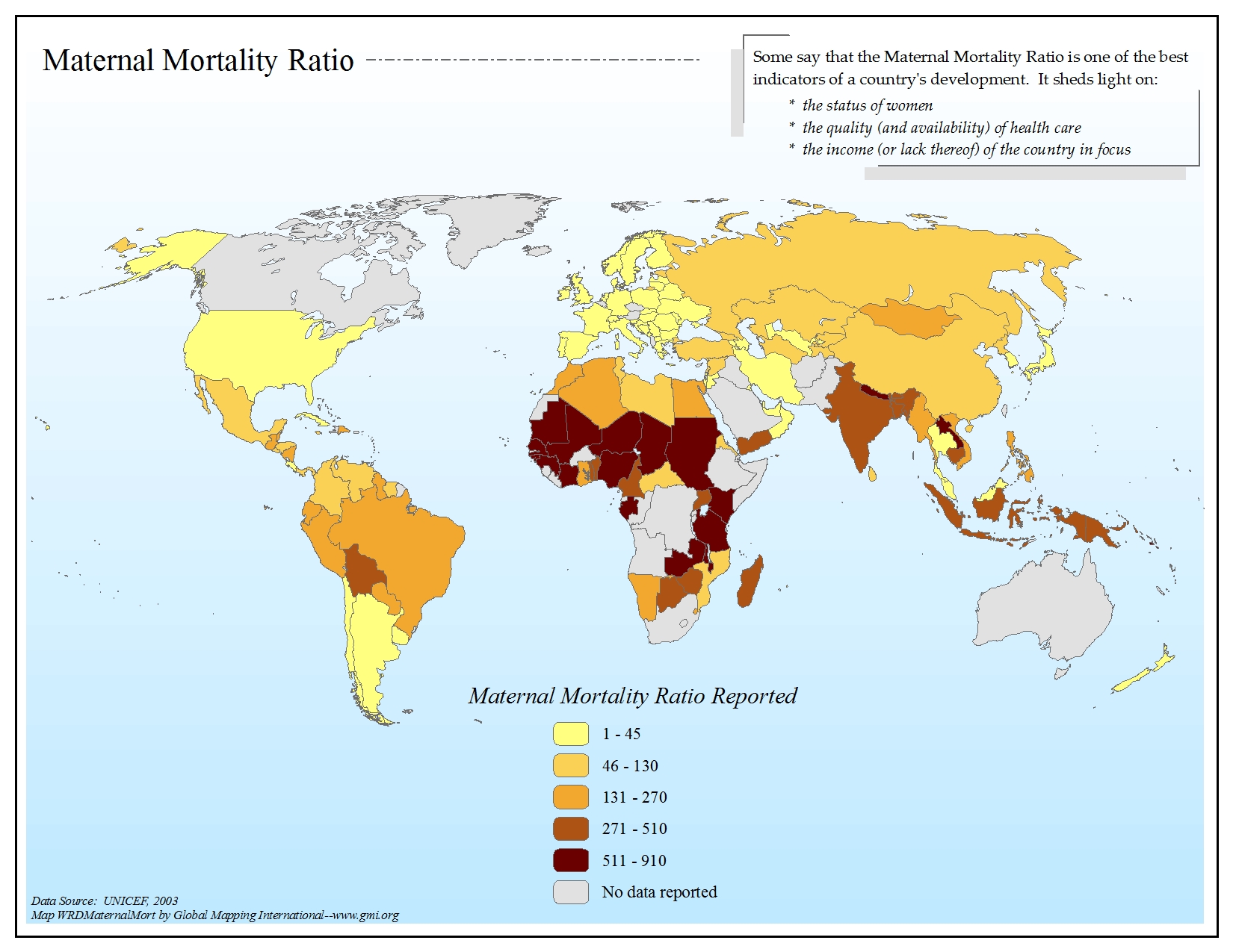 |
·Type: Maps ·Map Date: 2006 ·Data Source: UNICEF, 2003 ·Producer: Global Mapping International ·Collection: General World Maps (GMMS 2007) ·Size: 8½ x 11 inches, landscape ·Categories: Type :: Maps Continent/Region :: World Topic :: Statistical Topic :: Social Collection :: GMI Map Collections :: General World Maps (GMMS 2007) Partners :: Global Mapping International |
... more info
Max: 1
|
|
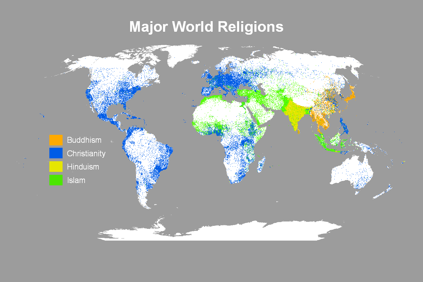 |
·Type: Maps ·Map Date: 2009 ·Data Source: Operation World 2001 ·Producer: Global Mapping International ·Collection: Projects 2009 ·Size: 30 by 20 inches, landscape ·Categories: Type :: Maps Continent/Region :: World Topic :: Statistical Partners :: Global Mapping International Topic :: Religions, General :: Multiple/Other Collection :: GMI Map Collections :: Projects 2009 |
... more info
Max: 1
|
|
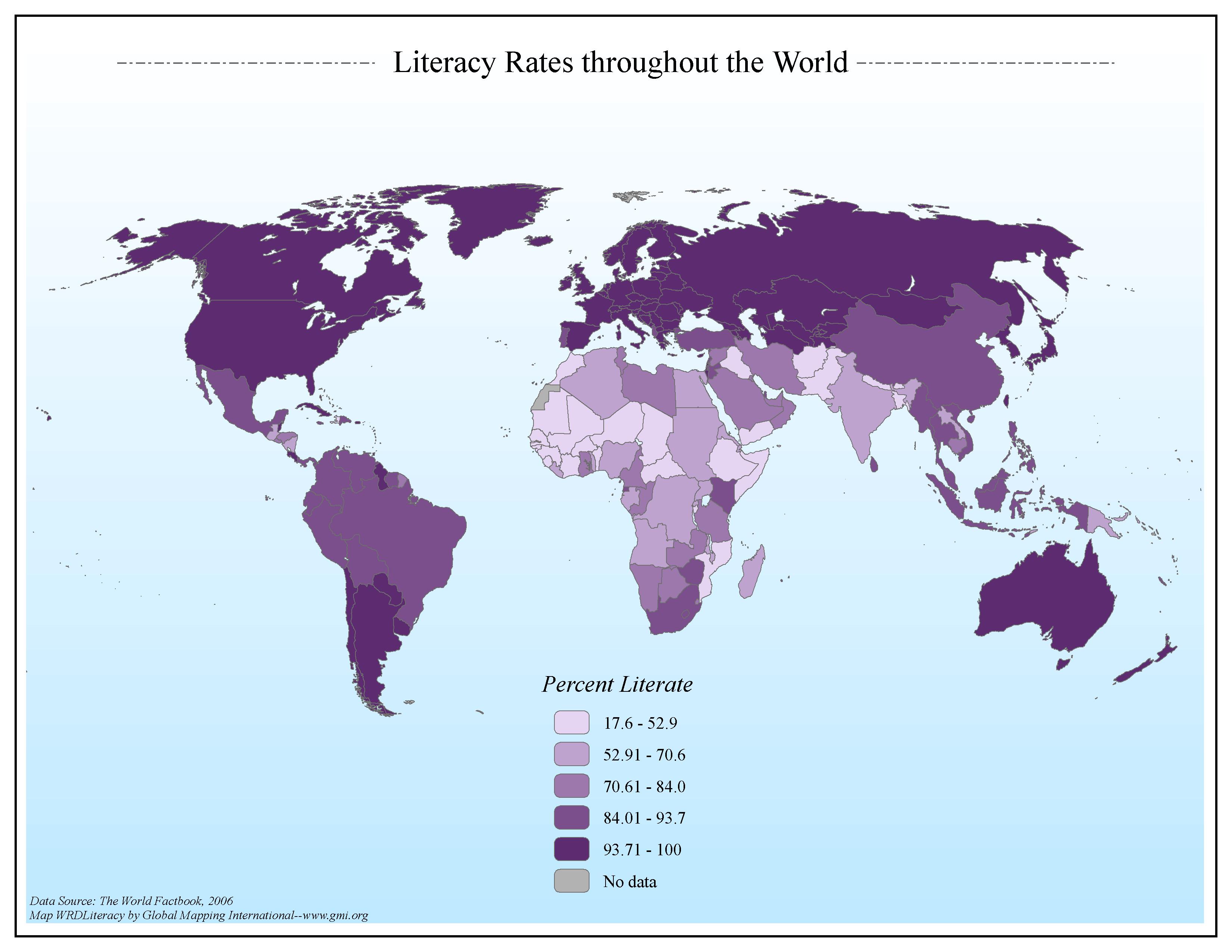 |
·Type: Maps ·Map Date: 2006 ·Data Source: The World Factbook, 2006 ·Producer: Global Mapping International ·Collection: Factbook (GMMS 2007) ·Size: 8½ x 11 inches, landscape ·Categories: Type :: Maps Continent/Region :: World Topic :: Statistical Topic :: Social Collection :: GMI Map Collections :: Factbook (GMMS 2007) Collection :: GMI Map Collections :: General World Maps (GMMS 2007) Partners :: Global Mapping International |
... more info
Max: 1
|
|
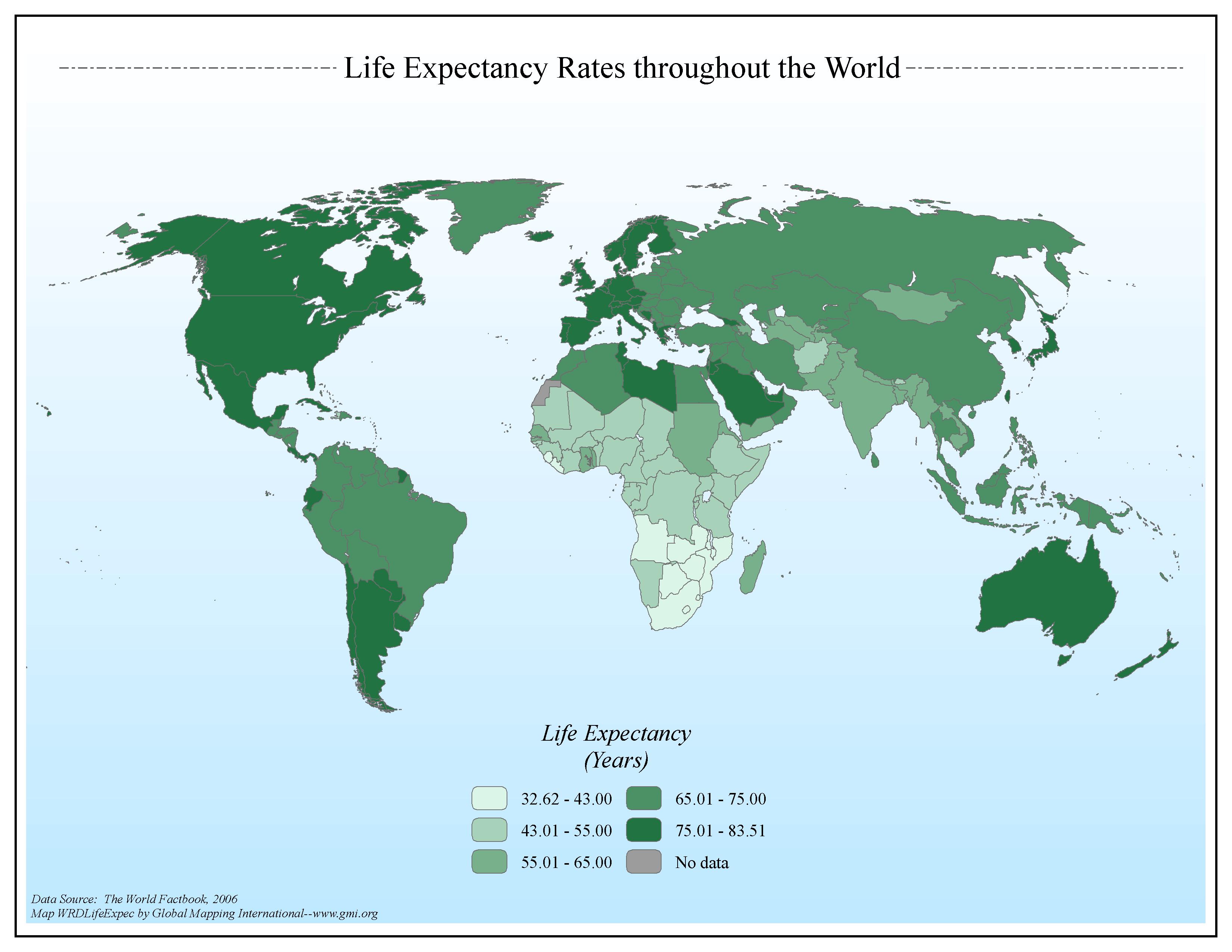 |
·Type: Maps ·Map Date: 2006 ·Data Source: The World Factbook, 2006 ·Producer: Global Mapping International ·Collection: Factbook (GMMS 2007) ·Size: 8½ x 11 inches, landscape ·Categories: Type :: Maps Continent/Region :: World Topic :: Statistical Topic :: Social Collection :: GMI Map Collections :: Factbook (GMMS 2007) Collection :: GMI Map Collections :: General World Maps (GMMS 2007) Partners :: Global Mapping International |
... more info
Max: 1
|
|