| Product Image |
Resource Name- |
Price |
Manufacturer |
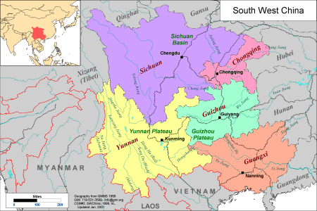 |
·Type: Maps ·Description: Political Map of South-Weastern China ·Map Date: 2001 ·Producer: Global Mapping International ·Collection: China SW Minorities (WV 2002) ·Size: 8½ x 11 Inches, landscape ·Note: Windows Metafile and Metafile in Word forms of this map require the GMISym.ttf font ·Categories: Type :: Maps Collection :: GMI Map Collections :: China SW Minorities (WV 2002) Continent/Region :: Asia Country :: China Partners ::... |
... more info
Max: 1
|
|
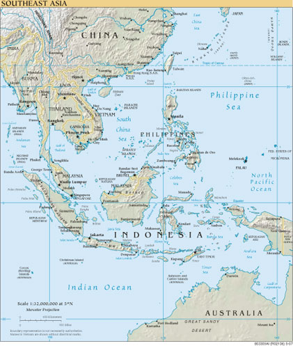 |
·Type: Maps ·Map Date: 2007 ·Producer: US Government ·Collection: World Factbook reference maps ·Size: 421x497 px, portrait ·Categories: Type :: Maps Continent/Region :: Asia Collection :: World Factbook reference maps Partners :: U.S. Government |
... more info
Max: 1
|
|
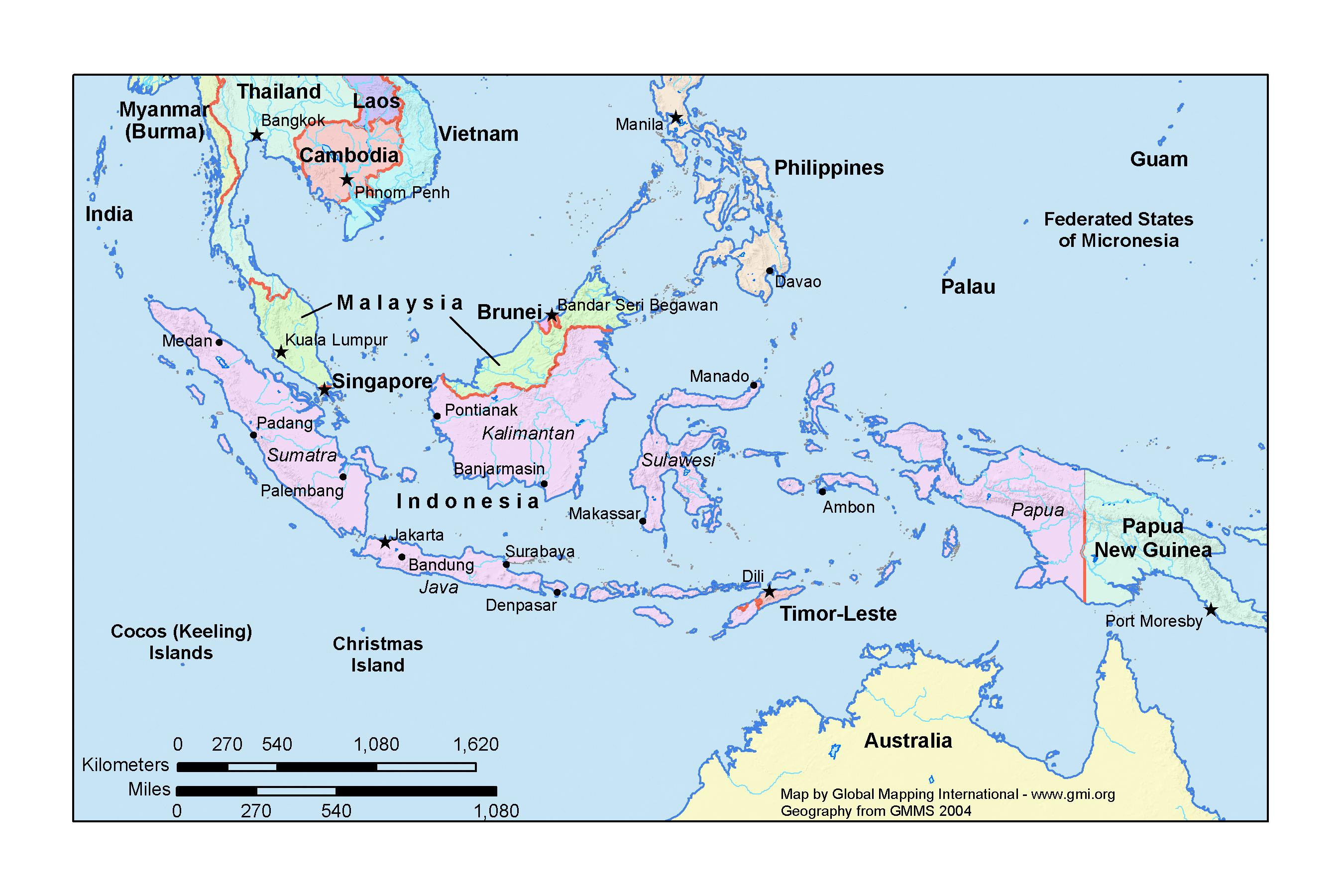 |
·Type: Maps ·Map Date: 2005 ·Producer: GMI ·Collection: Projects 2005 ·Size: 6 by 9 inches, landscape ·Categories: Type :: Maps Continent/Region :: Asia Partners :: Global Mapping International Collection :: GMI Map Collections :: Projects 2005 Topic :: Geography :: Maps |
... more info
Max: 1
|
|
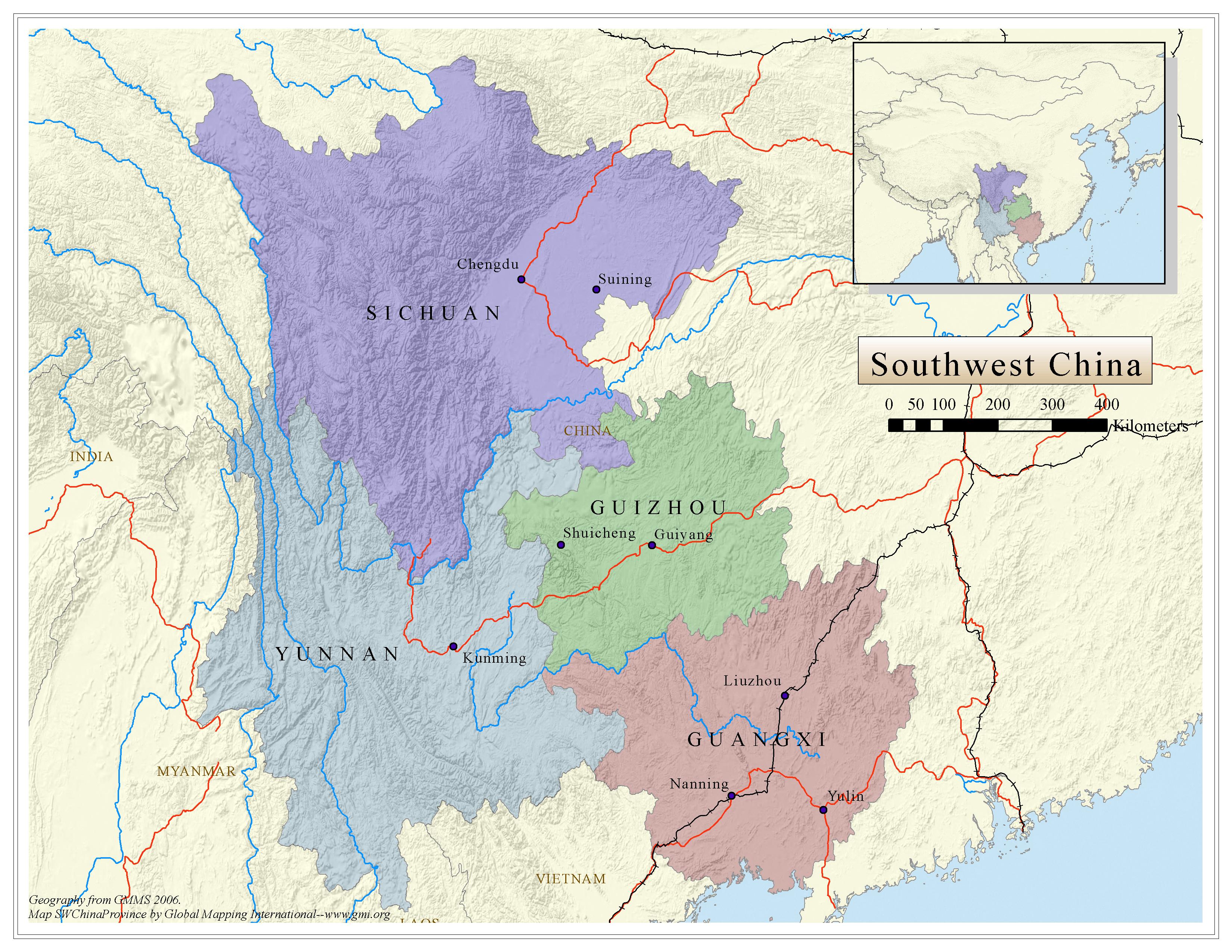 |
·Type: Maps ·Map Date: 2006 ·Data Source: Geography from GMMS 2006. ·Producer: Global Mapping International ·Collection: China SW Minorities (GMMS 2007) ·Size: 8½ x 11 inches, landscape ·Categories: Type :: Maps Continent/Region :: Asia Country :: China Collection :: GMI Map Collections :: China SW Minorities (GMMS 2007) Partners :: Global Mapping International Topic :: Geography :: Maps |
... more info
Max: 1
|
|
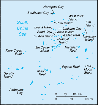 |
·Type: Maps ·Description: Spratly Islands (Factbook) ·Map Date: 2007 ·Producer: US Government ·Collection: World Factbook country maps ·Size: 328x354 px, landscape ·Categories: Type :: Maps Continent/Region :: Asia Collection :: World Factbook country maps Country :: Spratly Islands Partners :: U.S. Government |
... more info
Max: 1
|
|
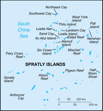 |
·Type: Maps ·Description: Spratly Islands (World Factbook, modified to add country name) ·Map Date: 2007 ·Producer: US Government modified by Joshua Project ·Collection: World Factbook country maps ·Size: 328x354 px, landscape ·Categories: Type :: Maps Continent/Region :: Asia Collection :: World Factbook country maps Country :: Spratly Islands Partners :: U.S. Government |
... more info
Max: 1
|
|
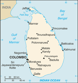 |
·Type: Maps ·Description: Sri Lanka (Factbook) ·Map Date: 2007 ·Producer: US Government ·Collection: World Factbook country maps ·Size: 329x353 px, landscape ·Categories: Type :: Maps Country :: Sri Lanka Continent/Region :: Asia Collection :: World Factbook country maps Partners :: U.S. Government |
... more info
Max: 1
|
|
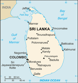 |
·Type: Maps ·Description: Sri Lanka (World Factbook, modified to add country name) ·Map Date: 2007 ·Producer: US Government modified by Joshua Project ·Collection: World Factbook country maps ·Size: 329x353 px, landscape ·Categories: Type :: Maps Country :: Sri Lanka Continent/Region :: Asia Collection :: World Factbook country maps Partners :: U.S. Government |
... more info
Max: 1
|
|
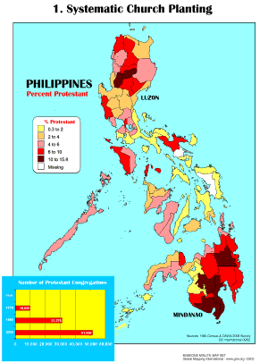 |
·Type: Maps ·Description: Systematic Church Planting ·Map Date: 1990 ·Producer: Global Mapping International ·Collection: Missions Minute (WorldVue 2002) ·Size: 8½ x 11 Inches, portrait ·Categories: Type :: Maps Collection :: GMI Map Collections :: Missions Minute (WorldVue 2002) Continent/Region :: Asia Topic :: Statistical Topic :: Strategy Topic :: Concepts Type :: Graphs Country :: Philippines Partners :: Global Mapping International... |
... more info
Max: 1
|
|
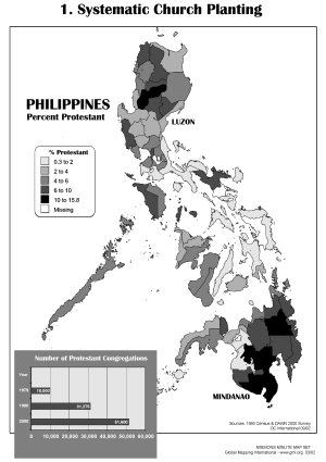 |
·Type: Maps ·Description: Systematic Church Planting ·Map Date: 2002 ·Producer: Global Mapping International ·Collection: Missions Minute (WorldVue 2002) ·Size: 8½ x 11 Inches, portrait ·Categories: Type :: Maps Collection :: GMI Map Collections :: Missions Minute (WorldVue 2002) Continent/Region :: Asia Topic :: Statistical Topic :: Strategy Topic :: Concepts Type :: Graphs Country :: Philippines Partners :: Global Mapping International... |
... more info
Max: 1
|
|
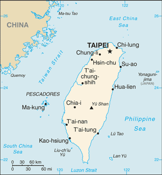 |
·Type: Maps ·Description: Taiwan (Factbook) ·Map Date: 2007 ·Producer: US Government ·Collection: World Factbook country maps ·Size: 328x353 px, landscape ·Categories: Type :: Maps Continent/Region :: Asia Collection :: World Factbook country maps Country :: Taiwan Partners :: U.S. Government |
... more info
Max: 1
|
|
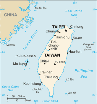 |
·Type: Maps ·Description: Taiwan (World Factbook, modified to add country name) ·Map Date: 2007 ·Producer: US Government modified by Joshua Project ·Collection: World Factbook country maps ·Size: 328x353 px, landscape ·Categories: Type :: Maps Continent/Region :: Asia Collection :: World Factbook country maps Country :: Taiwan Partners :: U.S. Government |
... more info
Max: 1
|
|
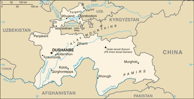 |
·Type: Maps ·Description: Tajikistan (Factbook) ·Map Date: 2007 ·Producer: US Government ·Collection: World Factbook country maps ·Size: 634x324 px, landscape ·Categories: Type :: Maps Continent/Region :: Asia Collection :: World Factbook country maps Country :: Tajikistan Partners :: U.S. Government |
... more info
Max: 1
|
|
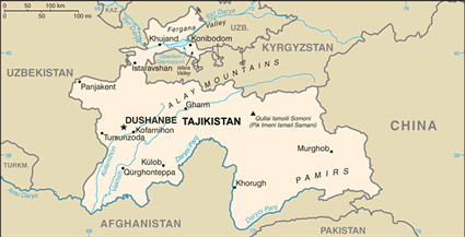 |
·Type: Maps ·Description: Tajikistan (World Factbook, modified to add country name) ·Map Date: 2007 ·Producer: US Government modified by Joshua Project ·Collection: World Factbook country maps ·Size: 634x324 px, landscape ·Categories: Type :: Maps Continent/Region :: Asia Collection :: World Factbook country maps Country :: Tajikistan Partners :: U.S. Government |
... more info
Max: 1
|
|
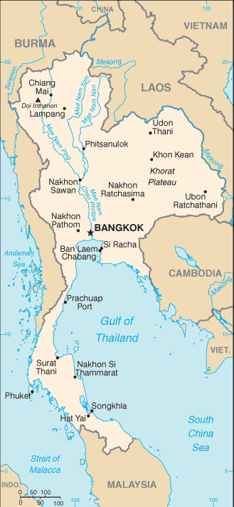 |
·Type: Maps ·Description: Thailand (Factbook) ·Map Date: 2007 ·Producer: US Government ·Collection: World Factbook country maps ·Size: 329x713 px, landscape ·Categories: Type :: Maps Continent/Region :: Asia Collection :: World Factbook country maps Country :: Thailand Partners :: U.S. Government |
... more info
Max: 1
|
|
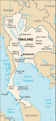 |
·Type: Maps ·Description: Thailand (World Factbook, modified to add country name) ·Map Date: 2007 ·Producer: US Government modified by Joshua Project ·Collection: World Factbook country maps ·Size: 329x713 px, landscape ·Categories: Type :: Maps Continent/Region :: Asia Collection :: World Factbook country maps Country :: Thailand Partners :: U.S. Government |
... more info
Max: 1
|
|
 |
·Type: Documents ·Full title: The 35/45 Turkic Window: A Gateway to the Muslim World ·Date: August 16, 1999 ·Authors: Luis Bush ·Producer: AD2000 and Beyond Movement ·Collection: Publications ·Pages: 12 ·Categories: Type :: Documents Continent/Region :: Asia Topic :: Strategy Partners :: AD2000 Topic :: Movements :: Global Movements Collection :: AD2000 Movement Archives :: Publications |
... more info
Max: 1
|
|
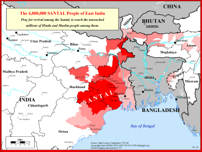 |
·Type: Maps ·Description: The Santal People in Eastern India ·Map Date: 1999 ·Producer: Global Mapping International ·Collection: Reaching India (WorldVue 2002) ·Size: 8½ x 11 Inches, landscape ·Note: Windows Metafile and Metafile in Word forms of this map require the GMISym.ttf font ·Categories: Type :: Maps Collection :: GMI Map Collections :: Reaching India (WorldVue 2002) Continent/Region :: Asia Topic :: Strategy Country ::... |
... more info
Max: 1
|
|
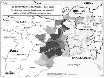 |
·Type: Maps ·Description: The Santal People in Eastern India ·Map Date: 2002 ·Producer: Global Mapping International ·Collection: Reaching India (WorldVue 2002) ·Size: 8½ x 11 Inches, landscape ·Note: Windows Metafile and Metafile in Word forms of this map require the GMISym.ttf font ·Categories: Type :: Maps Collection :: GMI Map Collections :: Reaching India (WorldVue 2002) Continent/Region :: Asia Topic :: Strategy Country ::... |
... more info
Max: 1
|
|
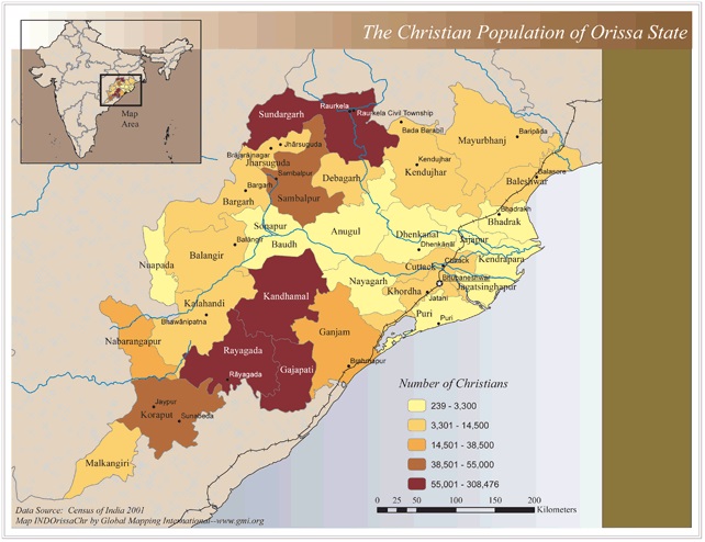 |
·Type: Maps ·Map Date: 2006 ·Data Source: Census of India 2001 ·Producer: Global Mapping International ·Collection: Reaching India (GMMS 2007) ·Size: 8½ x 11 inches, landscape ·Categories: Type :: Maps Continent/Region :: Asia Topic :: Statistical Country :: India Collection :: GMI Map Collections :: Reaching India (GMMS 2007) Partners :: Global Mapping International Topic :: Religions, Christianity :: Adherents, Churches, and Denoms |
... more info
Max: 1
|
|
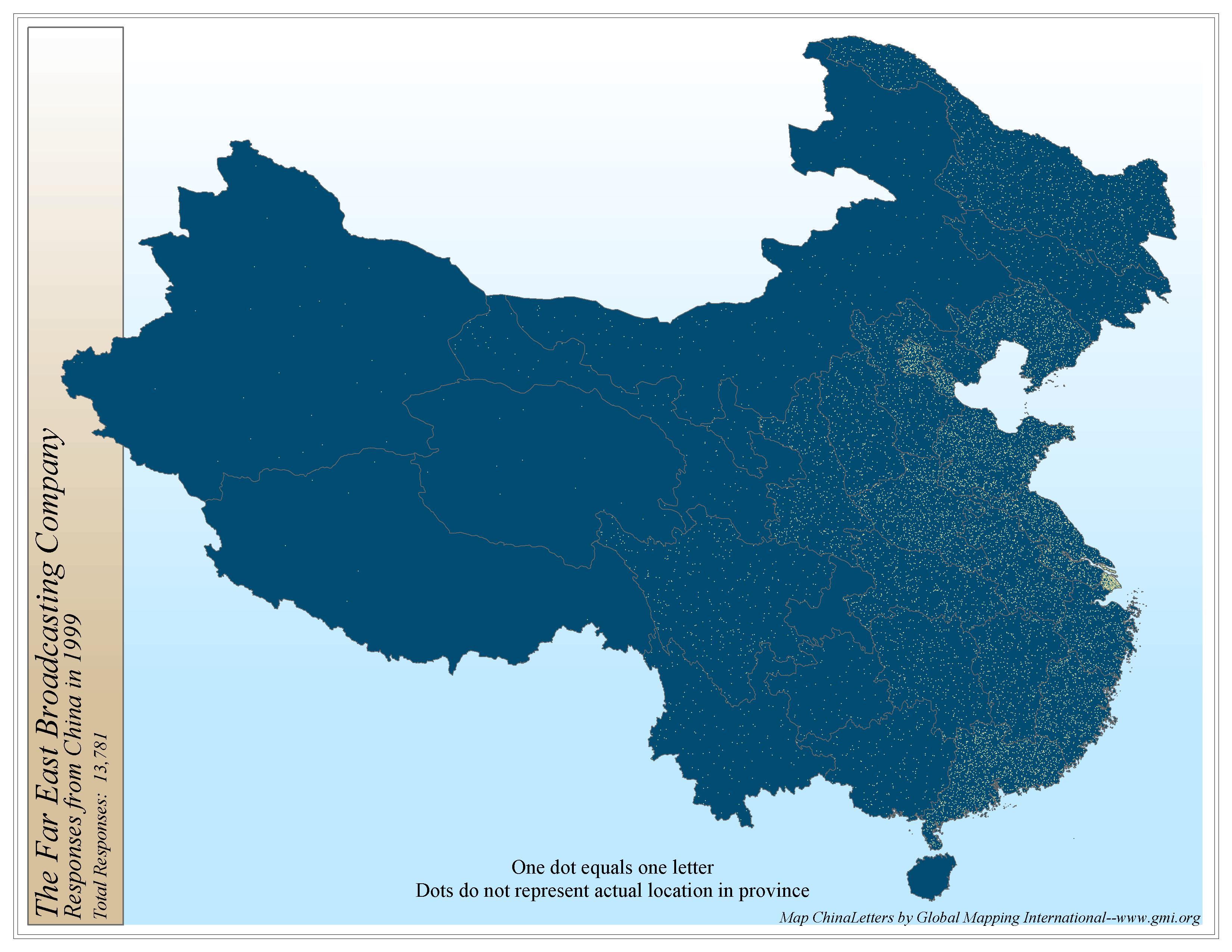 |
·Type: Maps ·Map Date: 2006 ·Producer: Global Mapping International ·Collection: Intro to Missions (GMMS 2007) ·Size: 8½ x 11 inches, landscape ·Categories: Type :: Maps Continent/Region :: Asia Topic :: Statistical Topic :: Strategy Country :: China Collection :: GMI Map Collections :: Intro to Missions (GMMS 2007) Partners :: Global Mapping International |
... more info
Max: 1
|
|
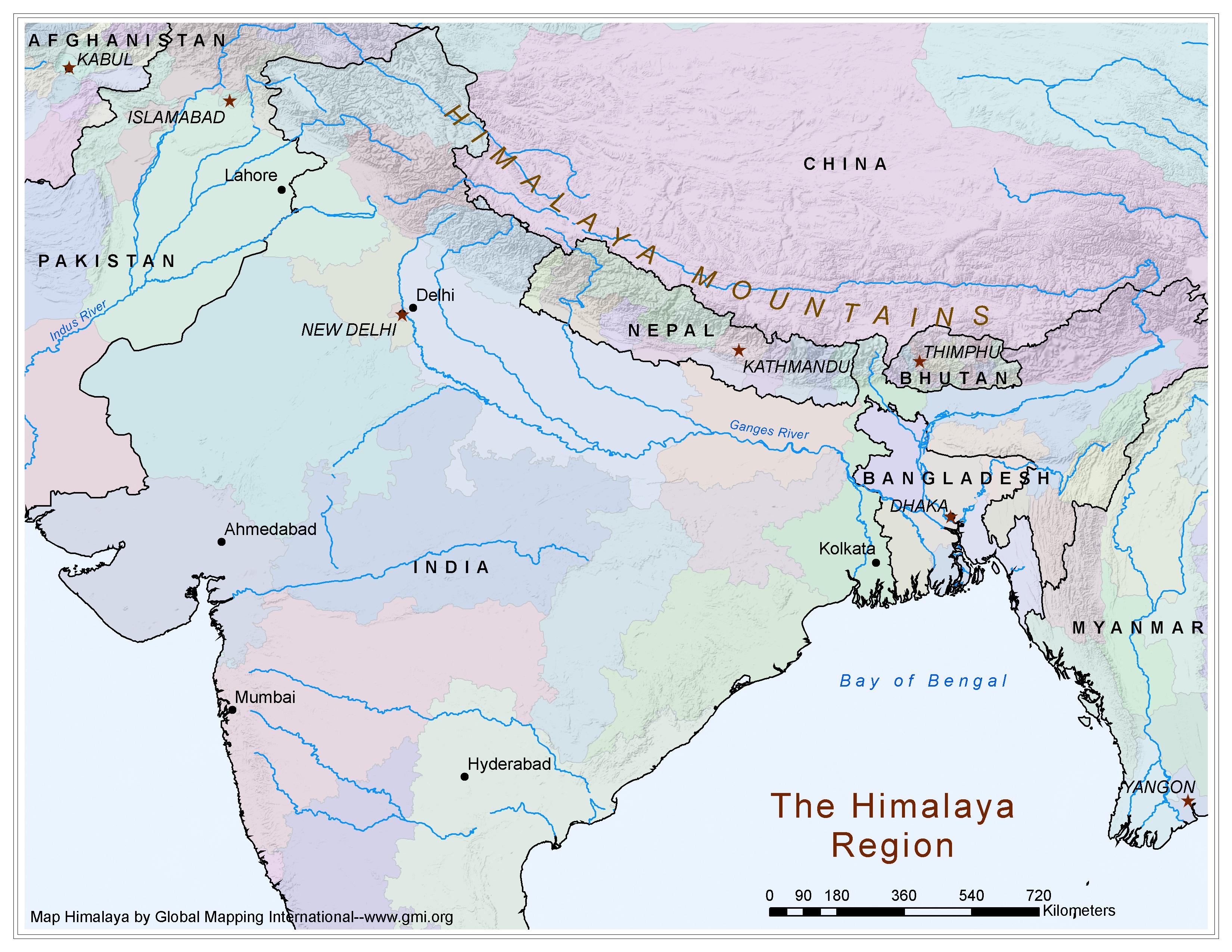 |
·Type: Maps ·Map Date: 2006 ·Producer: Global Mapping International ·Collection: Himalayan Budd Ppl (GMMS 2007) ·Size: 8½ x 11 inches, landscape ·Categories: Type :: Maps Continent/Region :: Asia Collection :: GMI Map Collections :: Himalayan Budd Ppl (GMMS 2007) Partners :: Global Mapping International Topic :: Geography :: Maps |
... more info
Max: 1
|
|
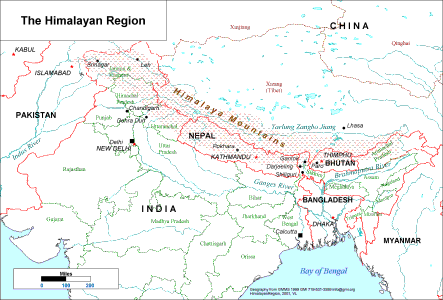 |
·Type: Maps ·Description: Political/Physical Map of the Himalayan Region ·Map Date: 2001 ·Producer: Global Mapping International ·Collection: Himalayan Buddhist Ppl (WV 2002) ·Size: 8½ x 11 Inches, landscape ·Note: Windows Metafile and Metafile in Word forms of this map require the GMISym.ttf font ·Categories: Type :: Maps Collection :: GMI Map Collections :: Himalayan Buddhist Ppl (WV 2002) Continent/Region :: Asia Partners ::... |
... more info
Max: 1
|
|
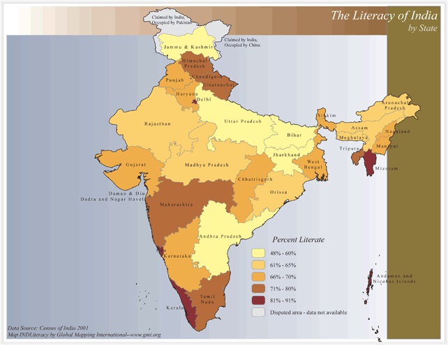 |
·Type: Maps ·Map Date: 2006 ·Data Source: Census of India 2001 ·Producer: Global Mapping International ·Collection: Reaching India (GMMS 2007) ·Size: 8½ x 11 inches, landscape ·Categories: Type :: Maps Continent/Region :: Asia Topic :: Statistical Topic :: Social Country :: India Collection :: GMI Map Collections :: Reaching India (GMMS 2007) Partners :: Global Mapping International |
... more info
Max: 1
|
|
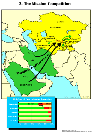 |
·Type: Maps ·Description: The Competition between missions ·Map Date: 2001 ·Producer: Global Mapping International ·Collection: Missions Minute (WorldVue 2002) ·Size: 8½ x 11 Inches, portrait ·Categories: Type :: Maps Collection :: GMI Map Collections :: Missions Minute (WorldVue 2002) Continent/Region :: Asia Topic :: Statistical Topic :: Strategy Topic :: Concepts Type :: Graphs Partners :: Global Mapping International Topic ::... |
... more info
Max: 1
|
|