| Product Image |
Resource Name- |
Price |
Manufacturer |
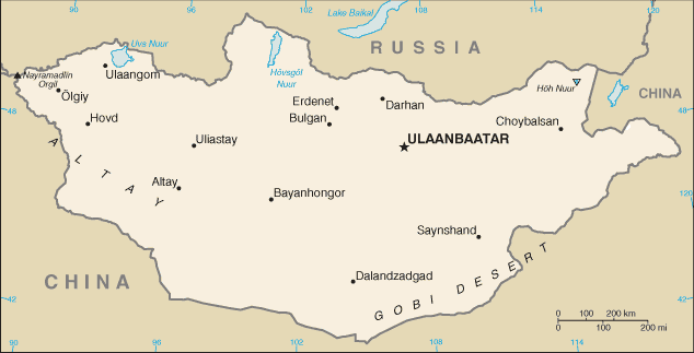 |
·Type: Maps ·Description: Mongolia (Factbook) ·Map Date: 2007 ·Producer: US Government ·Collection: World Factbook country maps ·Size: 328x713 px, landscape ·Categories: Type :: Maps Continent/Region :: Asia Collection :: World Factbook country maps Country :: Mongolia Partners :: U.S. Government |
... more info
Max: 1
|
|
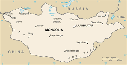 |
·Type: Maps ·Description: Mongolia (World Factbook, modified to add country name) ·Map Date: 2007 ·Producer: US Government modified by Joshua Project ·Collection: World Factbook country maps ·Size: 328x713 px, landscape ·Categories: Type :: Maps Continent/Region :: Asia Collection :: World Factbook country maps Country :: Mongolia Partners :: U.S. Government |
... more info
Max: 1
|
|
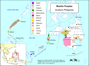 |
·Type: Maps ·Description: Major Muslim Peoples in Southern Philippines ·Map Date: 2001 ·Producer: Global Mapping International ·Collection: Muslim Ppl Isl SE Asia (WV 2002) ·Size: 8½ x 11 Inches, landscape ·Note: Windows Metafile and Metafile in Word forms of this map require the GMISym.ttf font ·Categories: Type :: Maps Collection :: GMI Map Collections :: Muslim Ppl Isl SE Asia (WV 2002) Continent/Region :: Asia Topic :: Peoples,... |
... more info
Max: 1
|
|
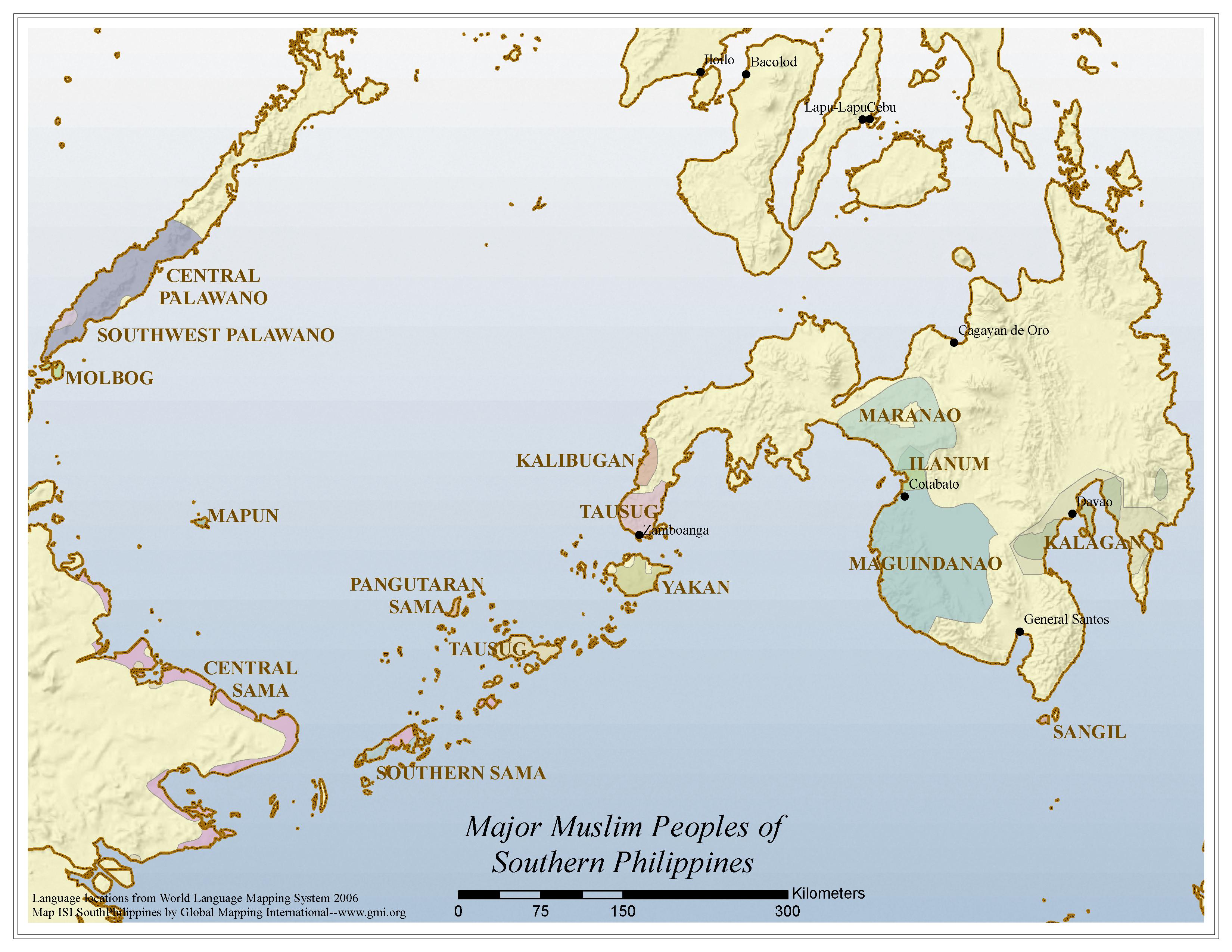 |
·Type: Maps ·Map Date: 2006 ·Data Source: Language locations from World Language Mapping System 2006 ·Producer: Global Mapping International ·Collection: Muslim Ppl Is. SE Asia GMMS 2007 ·Size: 8½ x 11 inches, landscape ·Categories: Type :: Maps Continent/Region :: Asia Topic :: Peoples, multiple or unknown Country :: Philippines Collection :: GMI Map Collections :: Muslim Ppl Is. SE Asia GMMS 2007 Partners :: Global Mapping International |
... more info
Max: 1
|
|
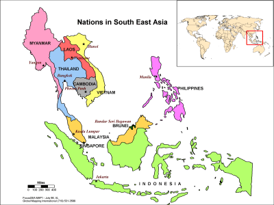 |
·Type: Maps ·Description: Political map of the Nations in Southeast Asia ·Map Date: 1998 ·Producer: Global Mapping International ·Collection: Focus South East Asia (WV 2002) ·Size: 8½ x 11 Inches, landscape ·Note: Windows Metafile and Metafile in Word forms of this map require the GMISym.ttf font ·Categories: Type :: Maps Collection :: GMI Map Collections :: Focus South East Asia (WV 2002) Continent/Region :: Asia Partners ::... |
... more info
Max: 1
|
|
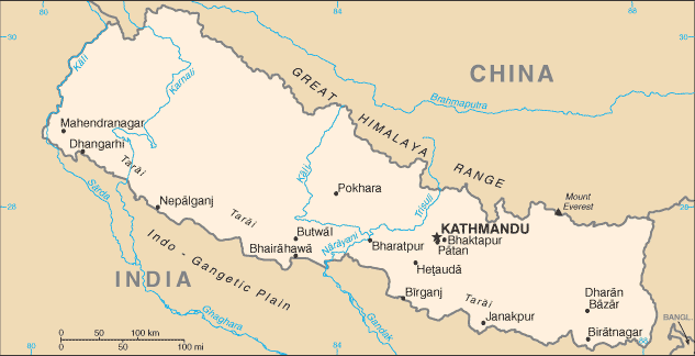 |
·Type: Maps ·Description: Nepal (Factbook) ·Map Date: 2007 ·Producer: US Government ·Collection: World Factbook country maps ·Size: 330x355 px, landscape ·Categories: Type :: Maps Continent/Region :: Asia Country :: Nepal Collection :: World Factbook country maps Partners :: U.S. Government |
... more info
Max: 1
|
|
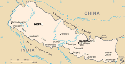 |
·Type: Maps ·Description: Nepal (World Factbook, modified to add country name) ·Map Date: 2007 ·Producer: US Government modified by Joshua Project ·Collection: World Factbook country maps ·Size: 330x355 px, landscape ·Categories: Type :: Maps Continent/Region :: Asia Country :: Nepal Collection :: World Factbook country maps Partners :: U.S. Government |
... more info
Max: 1
|
|
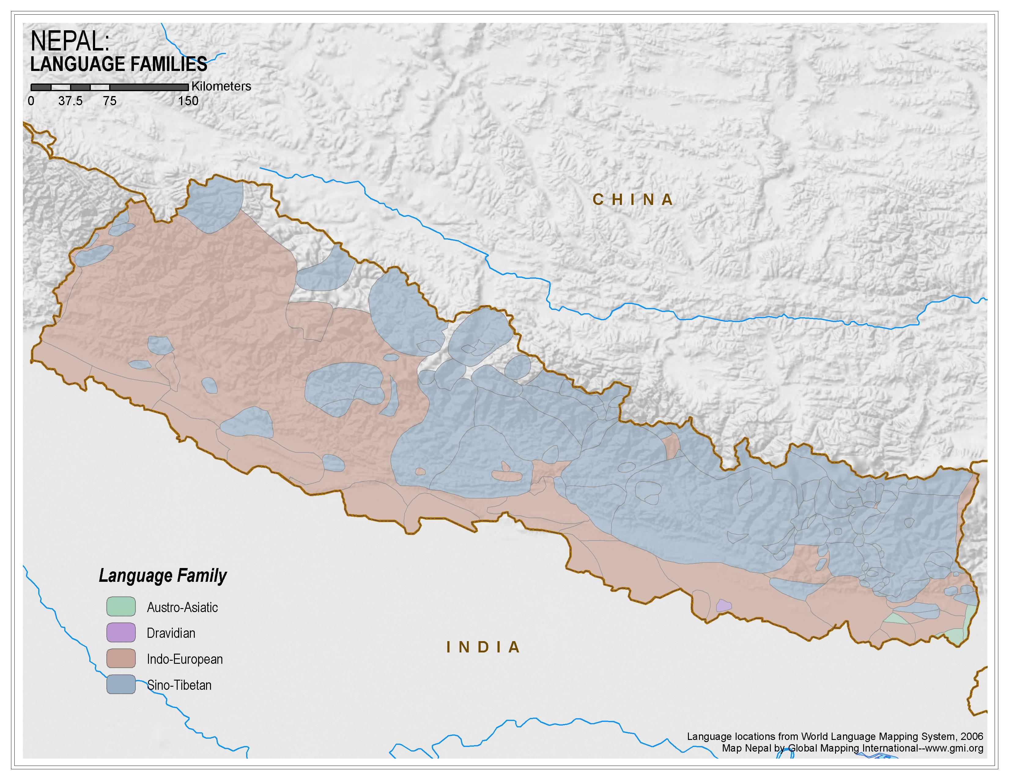 |
·Type: Maps ·Map Date: 2006 ·Data Source: World Language Mapping System, 2006 ·Producer: Global Mapping International ·Collection: Himalayan Budd Ppl (GMMS 2007) ·Size: 8½ x 11 inches, landscape ·Categories: Type :: Maps Continent/Region :: Asia Topic :: Peoples, multiple or unknown Country :: Nepal Collection :: GMI Map Collections :: Himalayan Budd Ppl (GMMS 2007) Partners :: Global Mapping International |
... more info
Max: 1
|
|
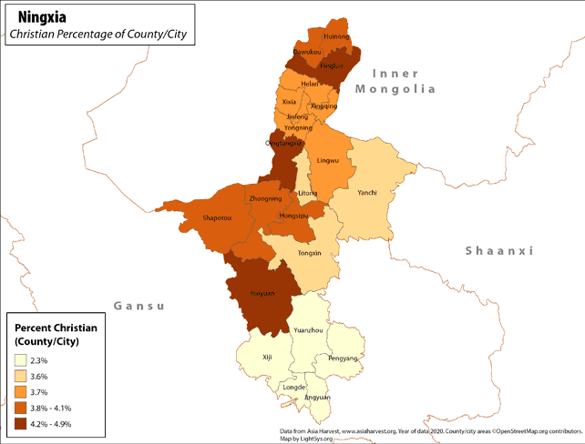 |
· Type: Maps · Map Date: 2019 · Data Source: Asia Harvest; county/city areas © OpenStreetMap contributors, http://www.openstreetmap.org/copyright. Data available under the Open Database License · Partners: LightSys Technology Services · Collection: Projects 2019 · Size: 8½ x 11 inches, landscape · Categories: Type :: Maps Continent/Region :: Asia Country :: China Topic :: Statistical Topic :: Religions,... |
... more info
|
|
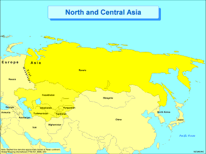 |
·Type: Maps ·Description: Political Map of North and Central Asia ·Map Date: 2002 ·Producer: Global Mapping International ·Collection: Regions (WorldVue 2002) ·Size: 8½ x 11 Inches, landscape ·Categories: Type :: Maps Continent/Region :: Asia Partners :: Global Mapping International Collection :: GMI Map Collections :: Regions (WorldVue 2002) Topic :: Geography :: Maps |
... more info
Max: 1
|
|
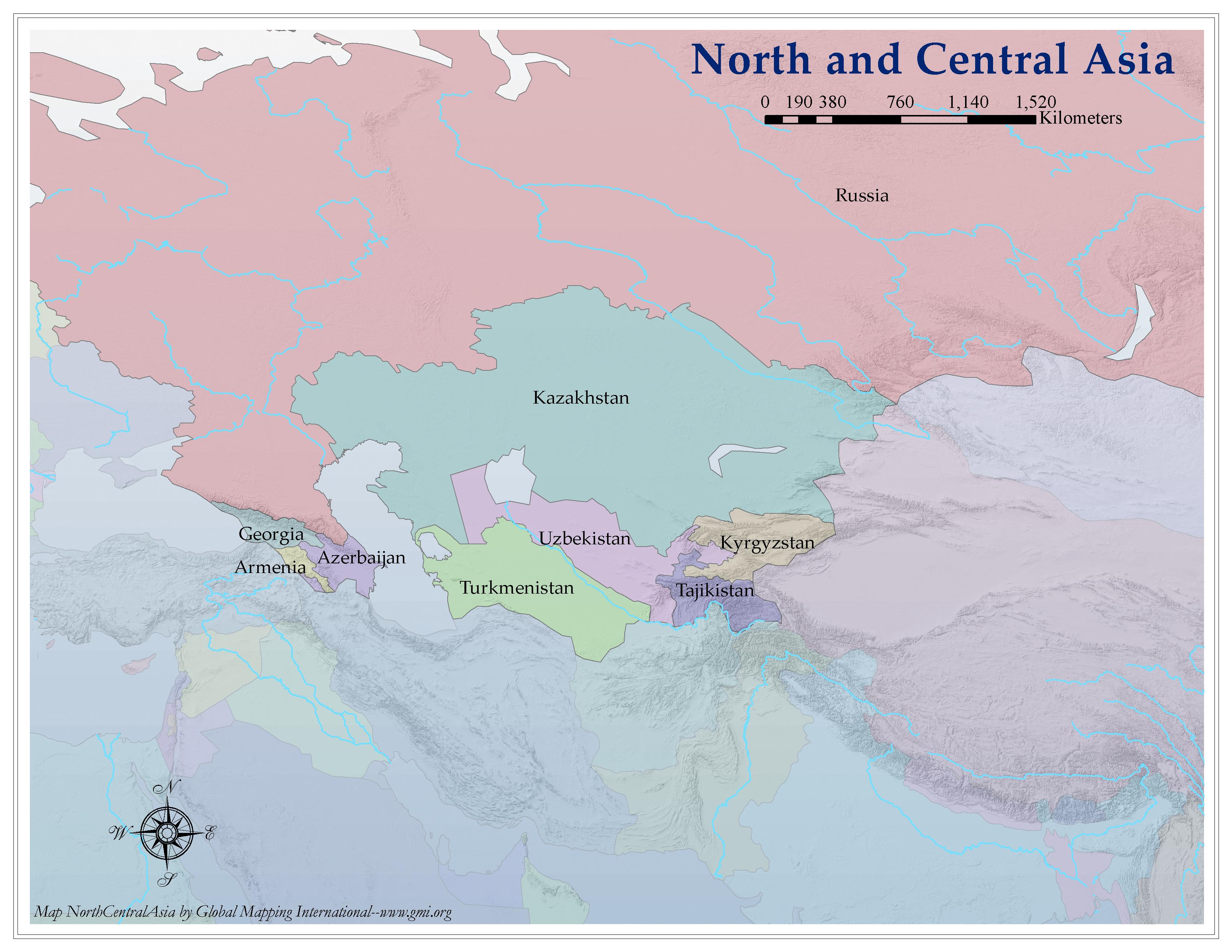 |
·Type: Maps ·Map Date: 2006 ·Producer: Global Mapping International ·Collection: Regions (GMMS 2007) ·Size: 8½ x 11 inches, landscape ·Categories: Type :: Maps Continent/Region :: Asia Partners :: Global Mapping International Collection :: GMI Map Collections :: Regions (GMMS 2007) Topic :: Geography :: Maps |
... more info
Max: 1
|
|
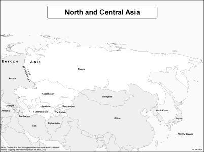 |
·Type: Maps ·Description: Political Map of North and Central Asia ·Map Date: 2002 ·Producer: Global Mapping International ·Collection: Regions (WorldVue 2002) ·Size: 8½ x 11 Inches, landscape ·Categories: Type :: Maps Continent/Region :: Asia Partners :: Global Mapping International Collection :: GMI Map Collections :: Regions (WorldVue 2002) Topic :: Geography :: Maps |
... more info
Max: 1
|
|
 |
·Type: Documents ·Date: 31 May 1996 ·Authors: Unknown ·Producer: AD2000 and Beyond Movement ·Collection: Regional/Country Reports ·Pages: 1 ·Categories: Type :: Documents Continent/Region :: Asia Topic :: Strategy Partners :: AD2000 Collection :: AD2000 Movement Archives :: AD2000 Archive CD-ROM Selections :: Regional/Country Reports Topic :: Movements :: Global Movements |
... more info
Max: 1
|
|
 |
·Type: Documents ·Date: 30 May 1996 ·Authors: John Thompson ·Producer: AD2000 and Beyond Movement ·Collection: Regional/Country Reports ·Pages: 1 ·Categories: Type :: Documents Continent/Region :: Asia Topic :: Strategy Partners :: AD2000 Collection :: AD2000 Movement Archives :: AD2000 Archive CD-ROM Selections :: Regional/Country Reports Topic :: Movements :: Global Movements |
... more info
Max: 1
|
|
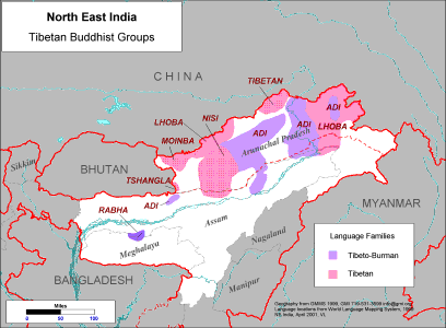 |
·Type: Maps ·Description: Major Tibetan Buddhist Groups in North East India ·Map Date: 2001 ·Producer: Global Mapping International ·Collection: Himalayan Buddhist Ppl (WV 2002) ·Size: 8½ x 11 Inches, landscape ·Note: Windows Metafile and Metafile in Word forms of this map require the GMISym.ttf font ·Categories: Type :: Maps Collection :: GMI Map Collections :: Himalayan Buddhist Ppl (WV 2002) Continent/Region :: Asia Topic ::... |
... more info
Max: 1
|
|
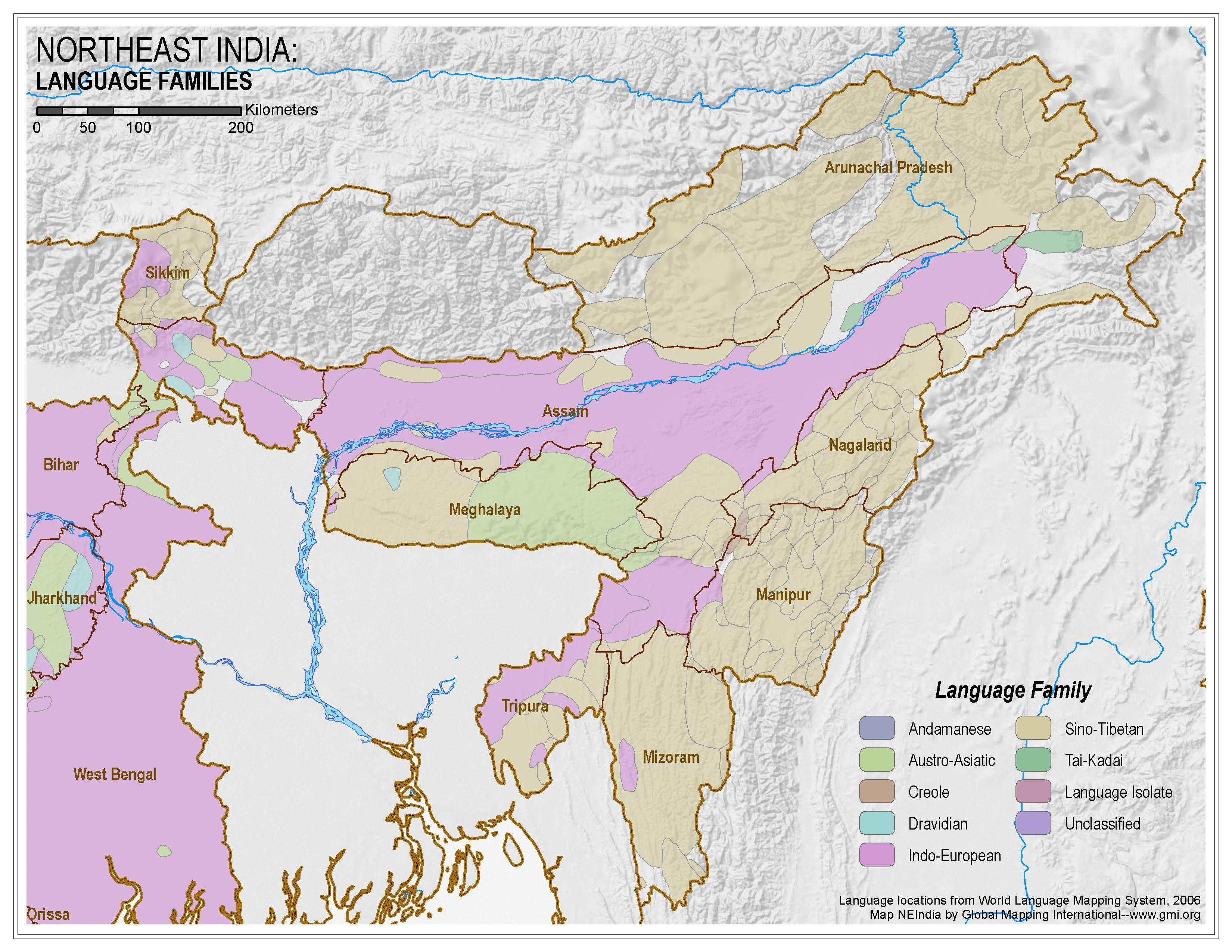 |
·Type: Maps ·Map Date: 2006 ·Data Source: World Language Mapping System, 2006 ·Producer: Global Mapping International ·Collection: Himalayan Budd Ppl (GMMS 2007) ·Size: 8½ x 11 inches, landscape ·Categories: Type :: Maps Continent/Region :: Asia Topic :: Peoples, multiple or unknown Country :: India Collection :: GMI Map Collections :: Himalayan Budd Ppl (GMMS 2007) Partners :: Global Mapping International |
... more info
Max: 1
|
|
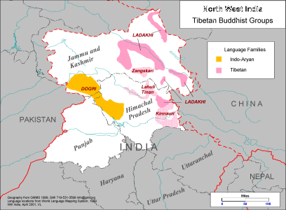 |
·Type: Maps ·Description: Tibetan Buddhist Groups in North West India ·Map Date: 1999 ·Producer: Global Mapping International ·Collection: Himalayan Buddhist Ppl (WV 2002) ·Size: 8½ x 11 Inches, landscape ·Note: Windows Metafile and Metafile in Word forms of this map require the GMISym.ttf font ·Categories: Type :: Maps Collection :: GMI Map Collections :: Himalayan Buddhist Ppl (WV 2002) Continent/Region :: Asia Topic :: Peoples,... |
... more info
Max: 1
|
|
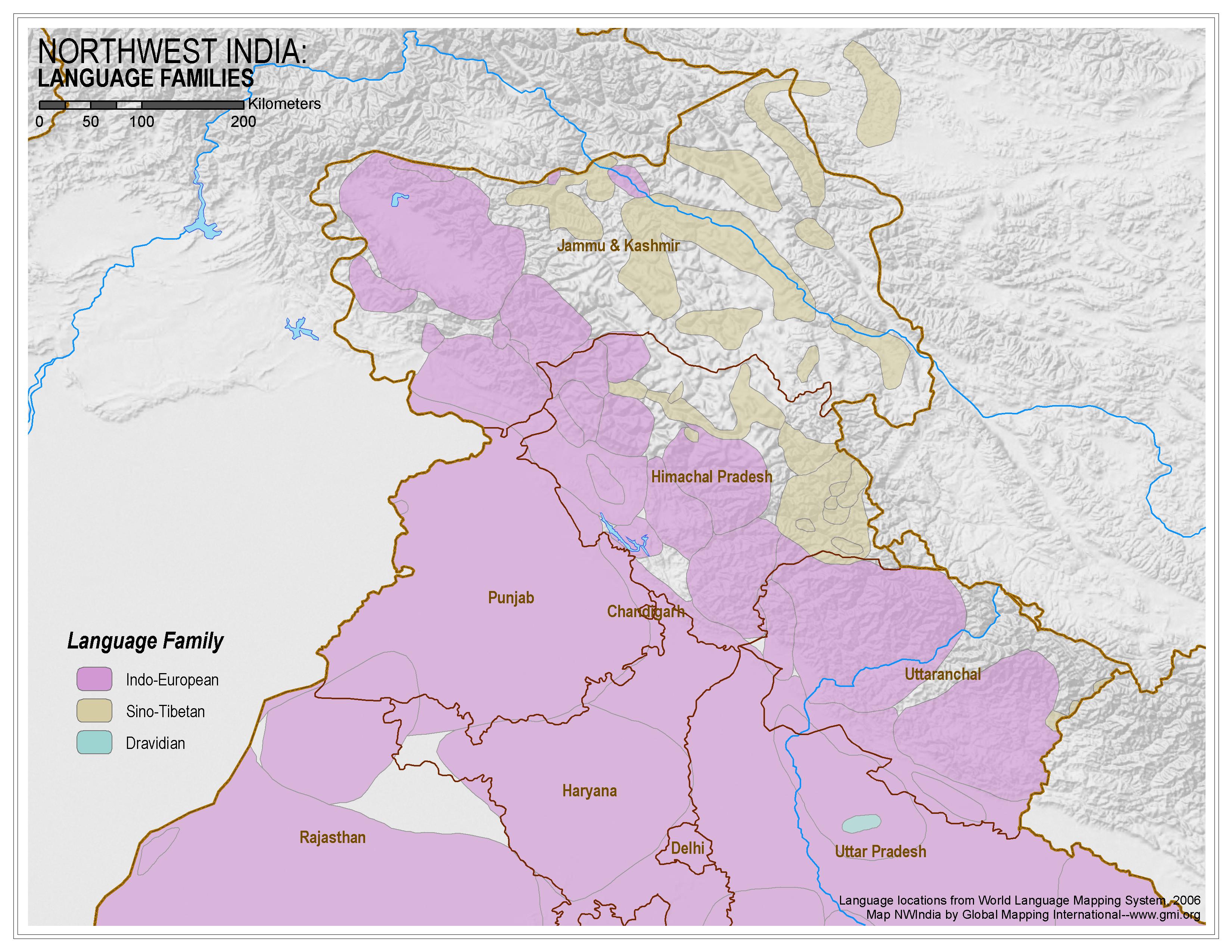 |
·Type: Maps ·Map Date: 2006 ·Data Source: World Language Mapping System, 2006 ·Producer: Global Mapping International ·Collection: Himalayan Budd Ppl (GMMS 2007) ·Size: 8½ x 11 inches, landscape ·Categories: Type :: Maps Continent/Region :: Asia Topic :: Peoples, multiple or unknown Country :: India Collection :: GMI Map Collections :: Himalayan Budd Ppl (GMMS 2007) Partners :: Global Mapping International |
... more info
Max: 1
|
|
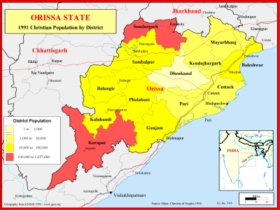 |
·Type: Maps ·Description: Christian Population of Orissa state in 1991 ·Map Date: 1999 ·Producer: Global Mapping International ·Collection: Reaching India (WorldVue 2002) ·Size: 8½ x 11 Inches, landscape ·Note: Windows Metafile and Metafile in Word forms of this map require the GMISym.ttf font ·Categories: Type :: Maps Collection :: GMI Map Collections :: Reaching India (WorldVue 2002) Continent/Region :: Asia Topic :: Statistical... |
... more info
Max: 1
|
|
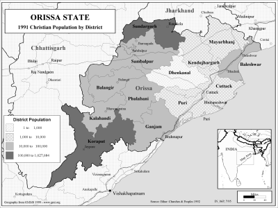 |
·Type: Maps ·Description: Christian Population of Orissa state in 1991 ·Map Date: 2002 ·Producer: Global Mapping International ·Collection: Reaching India (WorldVue 2002) ·Size: 8½ x 11 Inches, landscape ·Note: Windows Metafile and Metafile in Word forms of this map require the GMISym.ttf font ·Categories: Type :: Maps Collection :: GMI Map Collections :: Reaching India (WorldVue 2002) Continent/Region :: Asia Topic :: Statistical... |
... more info
Max: 1
|
|
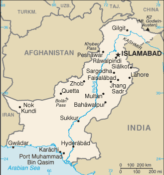 |
·Type: Maps ·Description: Pakistan (Factbook) ·Map Date: 2007 ·Producer: US Government ·Collection: World Factbook country maps ·Size: 330x355 px, landscape ·Categories: Type :: Maps Continent/Region :: Asia Collection :: World Factbook country maps Country :: Pakistan Partners :: U.S. Government |
... more info
Max: 1
|
|
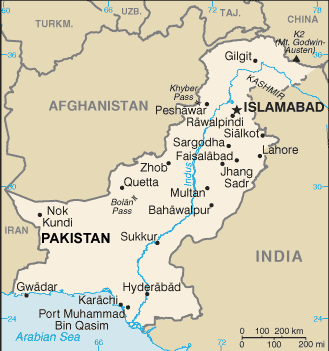 |
·Type: Maps ·Description: Pakistan (World Factbook, modified to add country name) ·Map Date: 2007 ·Producer: US Government modified by Joshua Project ·Collection: World Factbook country maps ·Size: 330x355 px, landscape ·Categories: Type :: Maps Continent/Region :: Asia Collection :: World Factbook country maps Country :: Pakistan Partners :: U.S. Government |
... more info
Max: 1
|
|
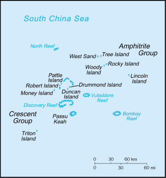 |
·Type: Maps ·Description: Paracel Islands (Factbook) ·Map Date: 2007 ·Producer: US Government ·Collection: World Factbook country maps ·Size: 328x351 px, landscape ·Categories: Type :: Maps Continent/Region :: Asia Collection :: World Factbook country maps Country :: Paracel Islands Partners :: U.S. Government |
... more info
Max: 1
|
|
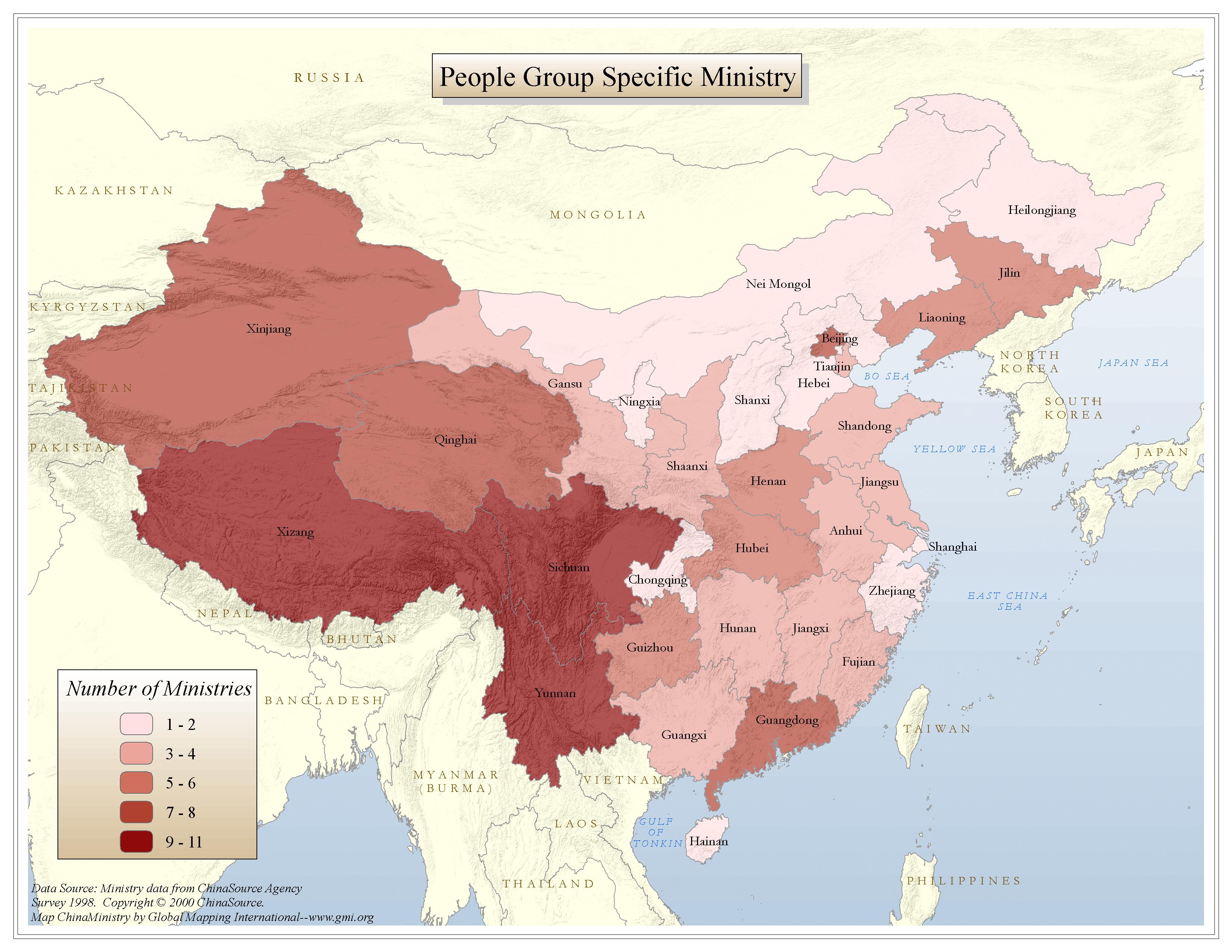 |
·Type: Maps ·Map Date: 2006 ·Data Source: ChinaSource ·Producer: Global Mapping International ·Collection: China Mobilization (GMMS 2007) ·Size: 8½ x 11 inches, landscape ·Categories: Type :: Maps Continent/Region :: Asia Topic :: Strategy Topic :: Peoples, multiple or unknown Country :: China Collection :: GMI Map Collections :: China Mobilization (GMMS 2007) Partners :: Global Mapping International |
... more info
Max: 1
|
|
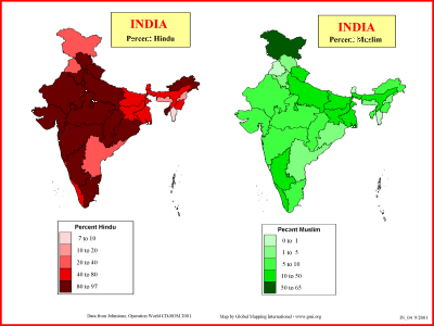 |
·Type: Maps ·Description: Percent Hindu and Muslim in India ·Map Date: 2001 ·Producer: Global Mapping International ·Collection: Reaching India (WorldVue 2002) ·Size: 8½ x 11 Inches, landscape ·Categories: Type :: Maps Collection :: GMI Map Collections :: Reaching India (WorldVue 2002) Continent/Region :: Asia Topic :: Statistical Country :: India Partners :: Global Mapping International Topic :: Religions, General :: Multiple/Other |
... more info
Max: 1
|
|