Asia
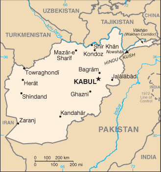
Afghanistan map (World Factbook)
·Type: Maps ·Description: Afghanistan (Factbook) ·Map Date: 2007 ·Producer: US Government ·Collection: World Factbook country maps ·Size: 329x352 px, portrait ·Categories: Type :: Maps...
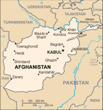
Afghanistan map (World Factbook, modified)
·Type: Maps ·Description: Afghanistan (World Factbook, modified to add country name) ·Map Date: 2007 ·Producer: US Government modified by Joshua Project ·Collection: World Factbook country maps ·Size:...
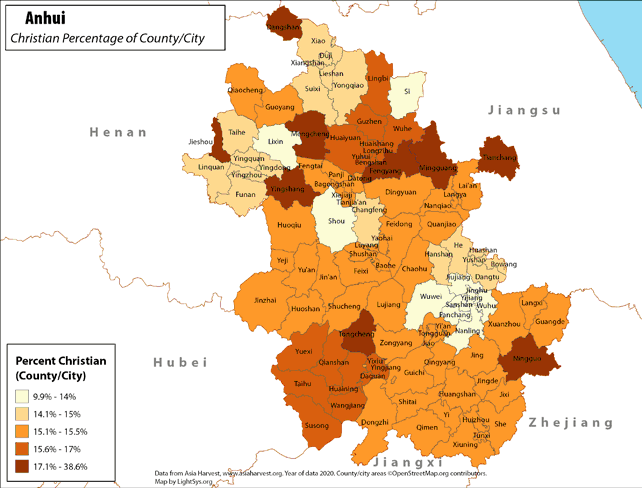
Anhui - Christian Percentage of County/City
· Type: Maps · Map Date: 2018 · Data Source: Asia Harvest; county/city areas © OpenStreetMap contributors, http://www.openstreetmap.org/copyright. Data available under the Open Database License...
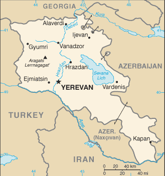
Armenia map (World Factbook)
·Type: Maps ·Description: Armenia (Factbook) ·Map Date: 2007 ·Producer: US Government ·Collection: World Factbook country maps ·Size: 329x351 px, portrait ·Categories: Type :: Maps Continent/Region...
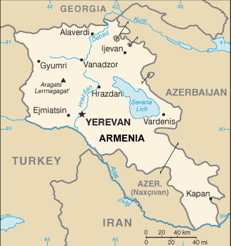
Armenia map (World Factbook, modified)
·Type: Maps ·Description: Armenia (World Factbook, modified to add country name) ·Map Date: 2007 ·Producer: US Government modified by Joshua Project ·Collection: World Factbook country maps ·Size: 329x351...
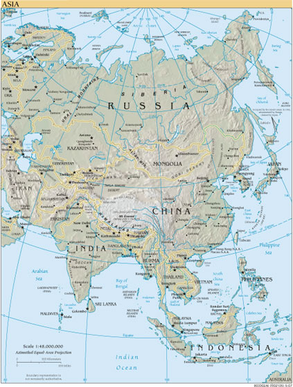
Asia
·Type: Maps ·Map Date: 2007 ·Producer: US Government ·Collection: World Factbook reference maps ·Size: 423x557 px, portrait ·Categories: Type :: Maps Continent/Region :: Asia Collection :: World Factbook...
Asia (Operation World)
Largest Religion: Muslim Number Languages: 2,322 Population: 4,679,660,580 For more information go to Asia on the Operation World website. The above link opens in a new tab.
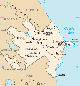
Azerbaijan map (World Factbook)
·Type: Maps ·Description: Azerbaijan (Factbook) ·Map Date: 2007 ·Producer: US Government ·Collection: World Factbook country maps ·Size: 328x352 px, portrait ·Categories: Type :: Maps...
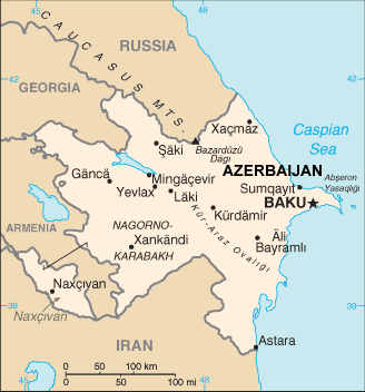
Azerbaijan map (World Factbook, modified)
·Type: Maps ·Description: Azerbaijan (World Factbook, modified to add country name) ·Map Date: 2007 ·Producer: US Government modified by Joshua Project ·Collection: World Factbook country maps ·Size:...
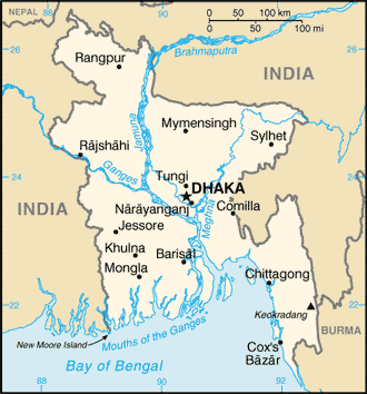
Bangladesh map (World Factbook)
·Type: Maps ·Description: Bangladesh (Factbook) ·Map Date: 2007 ·Producer: US Government ·Collection: World Factbook country maps ·Size: 328x353 px, portrait ·Categories: Type :: Maps...
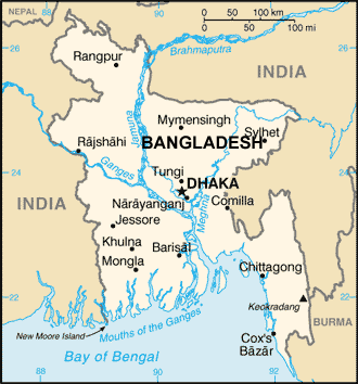
Bangladesh map (World Factbook, modified)
·Type: Maps ·Description: Bangladesh (World Factbook, modified to add country name) ·Map Date: 2007 ·Producer: US Government modified by Joshua Project ·Collection: World Factbook country maps ·Size:...
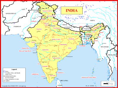
Basemap of India
·Type: Maps ·Description: Political map of India ·Map Date: 1999 ·Producer: Global Mapping International ·Collection: Reaching India (WorldVue 2002) ·Size: 8½ x 11 Inches, landscape ·Note:...
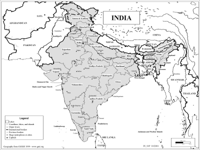
Basemap of India (BW)
·Type: Maps ·Description: Political map of India ·Map Date: 2002 ·Producer: Global Mapping International ·Collection: Reaching India (WorldVue 2002) ·Size: 8½ x 11 Inches, landscape ·Note:...
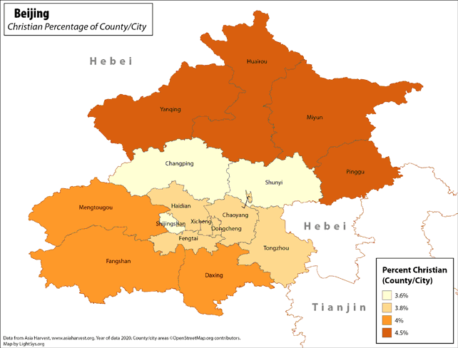
Beijing - Christian Percentage of County/City
· Type: Maps · Map Date: 2019 · Data Source: Asia Harvest; county/city areas © OpenStreetMap contributors, http://www.openstreetmap.org/copyright. Data available under the Open Database License...
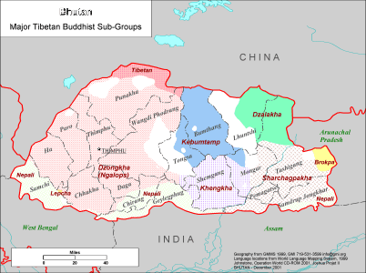
Bhutan - Major Tibetan Buddhist Sub-Groups
·Type: Maps ·Description: Major Tibetan Buddhist Groups in Bhutan ·Map Date: 2001 ·Producer: Global Mapping International ·Collection: Himalayan Buddhist Ppl (WV 2002) ·Size: 8½ x 11 Inches,...
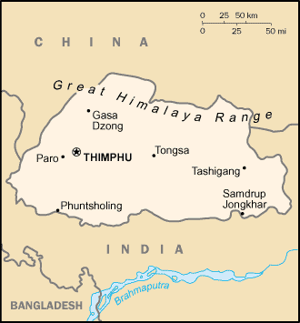
Bhutan map (World Factbook)
·Type: Maps ·Description: Bhutan (Factbook) ·Map Date: 2007 ·Producer: US Government ·Collection: World Factbook country maps ·Size: 327x353 px, portrait ·Categories: Type :: Maps Continent/Region ::...
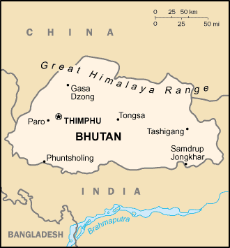
Bhutan map (World Factbook, modified)
·Type: Maps ·Description: Bhutan (World Factbook, modified to add country name) ·Map Date: 2007 ·Producer: US Government modified by Joshua Project ·Collection: World Factbook country maps ·Size: 327x353...
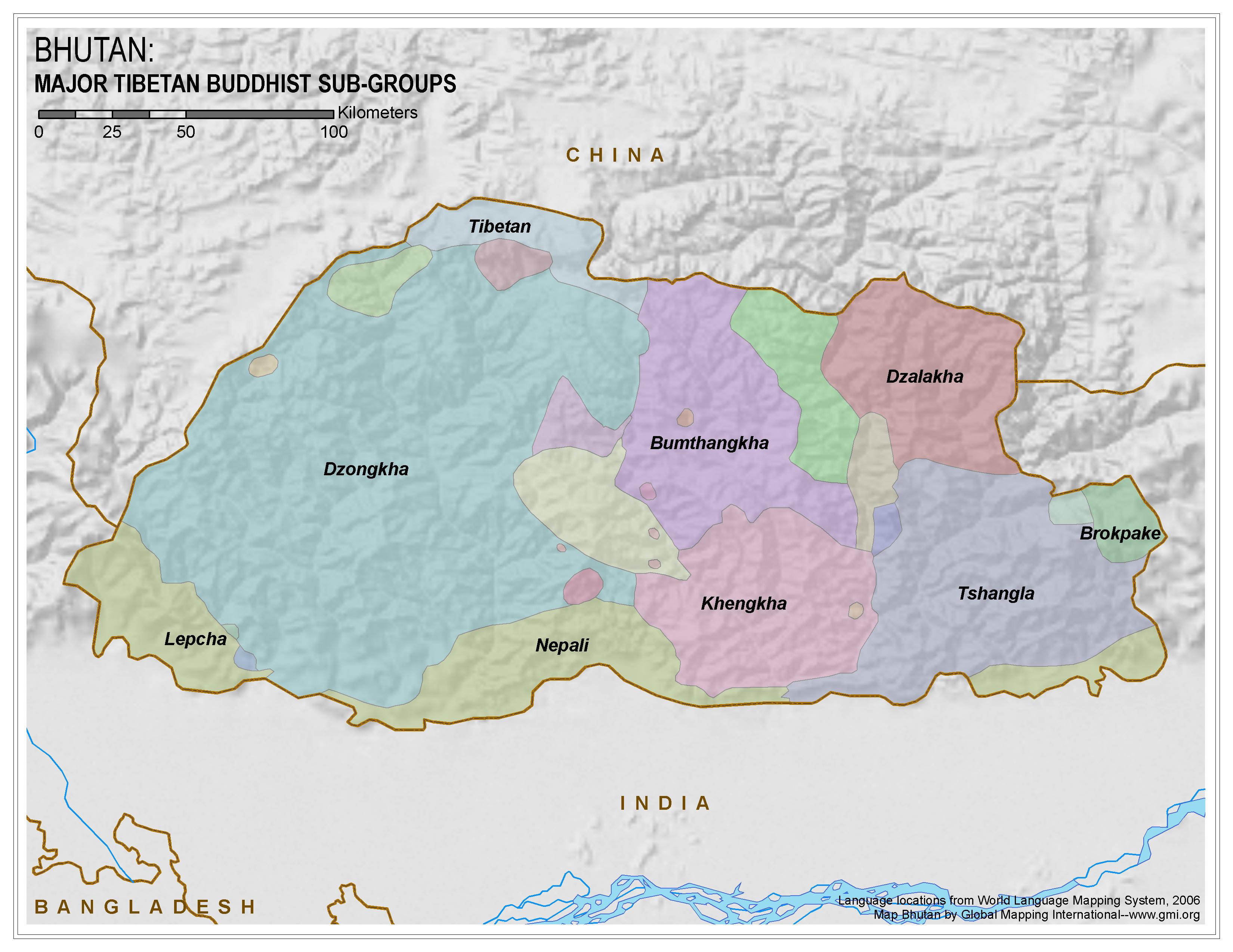
Bhutan: Major Tibetan Buddhist Sub-Groups
·Type: Maps ·Map Date: 2006 ·Data Source: World Language Mapping System 2006 ·Producer: Global Mapping International ·Collection: Himalayan Budd Ppl (GMMS 2007) ·Size: 8½ x 11 inches, landscape...
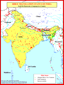
Bible Translation Status of India
·Type: Maps ·Description: Bible Translations of India ·Map Date: 1991 ·Producer: Global Mapping International ·Collection: Reaching India (WorldVue 2002) ·Size: 8½ x 11 Inches, portrait ·Note:...
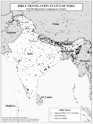
Bible Translation Status of India (BW)
·Type: Maps ·Description: Bible Translations of India ·Map Date: 2002 ·Producer: Global Mapping International ·Collection: Reaching India (WorldVue 2002) ·Size: 8½ x 11 Inches, portrait ·Note:...
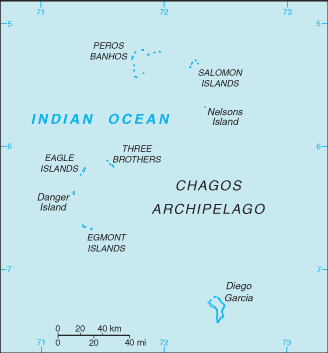
British Indian Ocean Territory map (World Factbook)
·Type: Maps ·Description: British Indian Ocean Territory (Factbook) ·Map Date: 2007 ·Producer: US Government ·Collection: World Factbook country maps ·Size: 330x355 px, portrait ·Categories: Type ::...
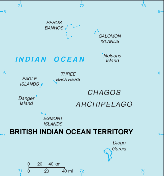
British Indian Ocean Territory map (World Factbook, modified)
·Type: Maps ·Description: British Indian Ocean Territory (World Factbook, modified to add country name) ·Map Date: 2007 ·Producer: US Government modified by Joshua Project ·Collection: World Factbook country maps...
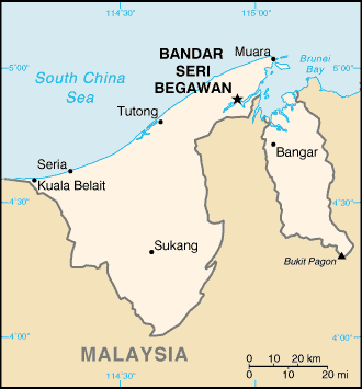
Brunei map (World Factbook)
·Type: Maps ·Description: Brunei (Factbook) ·Map Date: 2007 ·Producer: US Government ·Collection: World Factbook country maps ·Size: 330x353 px, portrait ·Categories: Type :: Maps Continent/Region ::...
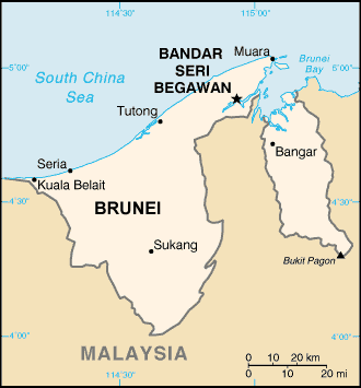
Brunei map (World Factbook, modified)
·Type: Maps ·Description: Brunei (World Factbook, modified to add country name) ·Map Date: 2007 ·Producer: US Government modified by Joshua Project ·Collection: World Factbook country maps ·Size: 330x353...
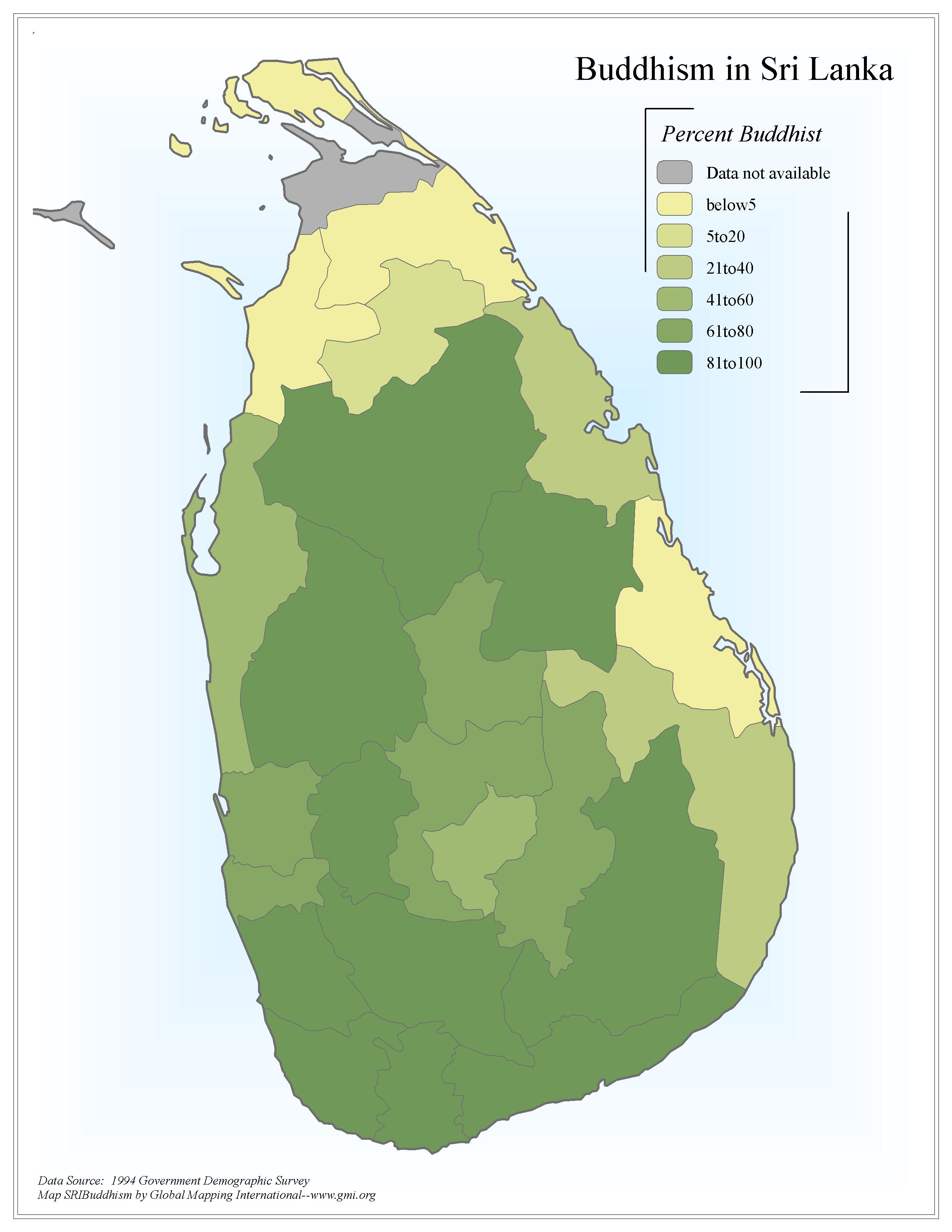
Buddhism in Sri Lanka
·Type: Maps ·Map Date: 2006 ·Data Source: 1994 Government Demographic Survey ·Producer: Global Mapping International ·Collection: Sri Lanka (GMMS 2007) ·Size: 8½ x 11 inches, portrait...
Burma map (World Factbook)
·Type: Maps ·Description: Burma (Factbook) ·Map Date: 2007 ·Producer: US Government ·Collection: World Factbook country maps ·Size: 329x352 px, portrait ·Categories: Type :: Maps Continent/Region ::...
Burma map (World Factbook, modified)
·Type: Maps ·Description: Burma (World Factbook, modified to add country name) ·Map Date: 2007 ·Producer: US Government modified by Joshua Project ·Collection: World Factbook country maps ·Size: 329x352 px,...
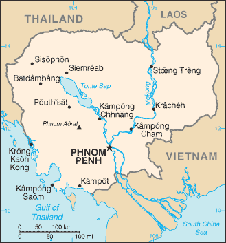
Cambodia map (World Factbook)
·Type: Maps ·Description: Cambodia (Factbook) ·Map Date: 2007 ·Producer: US Government ·Collection: World Factbook country maps ·Size: 329x332 px, portrait ·Categories: Type :: Maps Continent/Region...
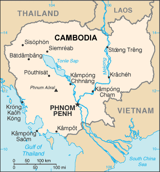
Cambodia map (World Factbook, modified)
·Type: Maps ·Description: Cambodia (World Factbook, modified to add country name) ·Map Date: 2007 ·Producer: US Government modified by Joshua Project ·Collection: World Factbook country maps ·Size: 329x332...
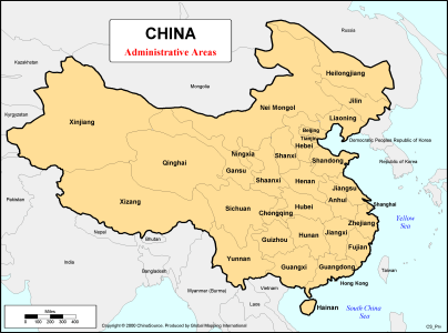
China - Administrative Areas
·Type: Maps ·Description: first-level (province) administrative divisions of China ·Map Date: 2000 ·Producer: Global Mapping International ·Collection: China Mobilization (WV 2002) ·Size: 8½ x 11...

