| Product Image |
Resource Name |
Price |
Manufacturer+ |
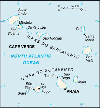 |
·Type: Maps ·Description: Cape Verde (World Factbook, modified to add country name) ·Map Date: 2007 ·Producer: US Government modified by Joshua Project ·Collection: World Factbook country maps ·Size: 326x350 px, portrait ·Categories: Type :: Maps Continent/Region :: Africa Collection :: World Factbook country maps Country :: Cape Verde Partners :: U.S. Government |
... more info
Max: 1
|
|
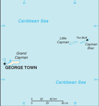 |
·Type: Maps ·Description: Cayman Islands (Factbook) ·Map Date: 2007 ·Producer: US Government ·Collection: World Factbook country maps ·Size: 634x324 px, portrait ·Categories: Type :: Maps Collection :: World Factbook country maps Country :: Cayman Islands Partners :: U.S. Government |
... more info
Max: 1
|
|
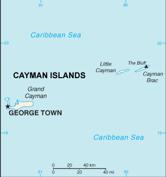 |
·Type: Maps ·Description: Cayman Islands (World Factbook, modified to add country name) ·Map Date: 2007 ·Producer: US Government modified by Joshua Project ·Collection: World Factbook country maps ·Size: 634x324 px, portrait ·Categories: Type :: Maps Collection :: World Factbook country maps Country :: Cayman Islands Partners :: U.S. Government |
... more info
Max: 1
|
|
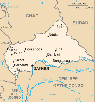 |
·Type: Maps ·Description: Central African Republic (Factbook) ·Map Date: 2007 ·Producer: US Government ·Collection: World Factbook country maps ·Size: 330x355 px, portrait ·Categories: Type :: Maps Continent/Region :: Africa Collection :: World Factbook country maps Country :: Central African Republic Partners :: U.S. Government |
... more info
Max: 1
|
|
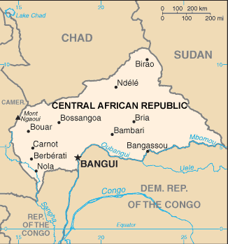 |
·Type: Maps ·Description: Central African Republic (World Factbook, modified to add country name) ·Map Date: 2007 ·Producer: US Government modified by Joshua Project ·Collection: World Factbook country maps ·Size: 330x355 px, portrait ·Categories: Type :: Maps Continent/Region :: Africa Collection :: World Factbook country maps Country :: Central African Republic Partners :: U.S. Government |
... more info
Max: 1
|
|
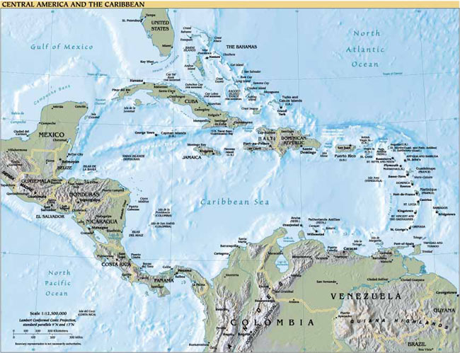 |
·Type: Maps ·Map Date: 2007 ·Producer: US Government ·Collection: World Factbook reference maps ·Size: 650x499 px, landscape ·Categories: Type :: Maps Collection :: World Factbook reference maps Continent/Region :: Latin America Partners :: U.S. Government |
... more info
Max: 1
|
|
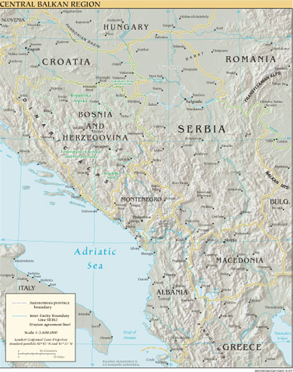 |
·Type: Maps ·Map Date: 2007 ·Producer: US Government ·Collection: World Factbook reference maps ·Size: 420x534 px, portrait ·Categories: Type :: Maps Collection :: World Factbook reference maps Partners :: U.S. Government |
... more info
Max: 1
|
|
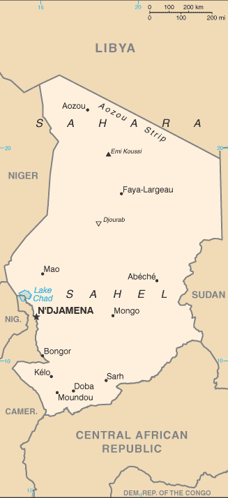 |
·Type: Maps ·Description: Chad ·Map Date: 2007 ·Producer: US Government ·Collection: World Factbook country maps ·Size: 633x324 px, portrait ·Categories: Type :: Maps Continent/Region :: Africa Collection :: World Factbook country maps Country :: Chad Partners :: U.S. Government |
... more info
Max: 1
|
|
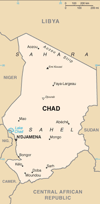 |
·Type: Maps ·Description: Chad (World Factbook, modified to add country name) ·Map Date: 2007 ·Producer: US Government modified by Joshua Project ·Collection: World Factbook country maps ·Size: 633x324 px, portrait ·Categories: Type :: Maps Continent/Region :: Africa Collection :: World Factbook country maps Country :: Chad Partners :: U.S. Government |
... more info
Max: 1
|
|
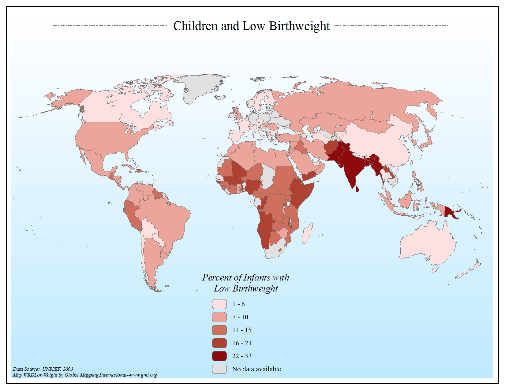 |
·Type: Maps ·Map Date: 2006 ·Data Source: UNICEF, 2003 ·Producer: Global Mapping International ·Collection: General World Maps (GMMS 2007) ·Size: 8½ x 11 inches, landscape ·Categories: Type :: Maps Continent/Region :: World Topic :: Statistical Collection :: GMI Map Collections :: General World Maps (GMMS 2007) Partners :: Global Mapping International Topic :: Health |
... more info
Max: 1
|
|
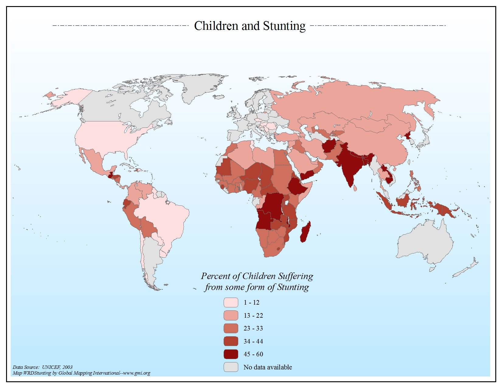 |
·Type: Maps ·Map Date: 2006 ·Data Source: UNICEF, 2003 ·Producer: Global Mapping International ·Collection: General World Maps (GMMS 2007) ·Size: 8½ x 11 inches, landscape ·Categories: Type :: Maps Continent/Region :: World Topic :: Statistical Collection :: GMI Map Collections :: General World Maps (GMMS 2007) Partners :: Global Mapping International Topic :: Health |
... more info
Max: 1
|
|
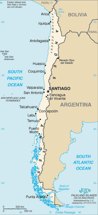 |
·Type: Maps ·Description: Chile (Factbook) ·Map Date: 2007 ·Producer: US Government ·Collection: World Factbook country maps ·Size: 330x355 px, portrait ·Categories: Type :: Maps Collection :: World Factbook country maps Country :: Chile Partners :: U.S. Government |
... more info
Max: 1
|
|
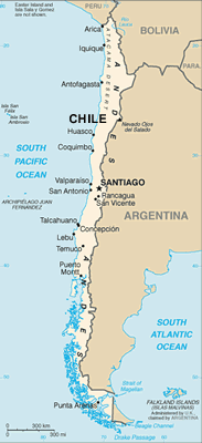 |
·Type: Maps ·Description: Chile (World Factbook, modified to add country name) ·Map Date: 2007 ·Producer: US Government modified by Joshua Project ·Collection: World Factbook country maps ·Size: 330x355 px, portrait ·Categories: Type :: Maps Collection :: World Factbook country maps Country :: Chile Partners :: U.S. Government |
... more info
Max: 1
|
|
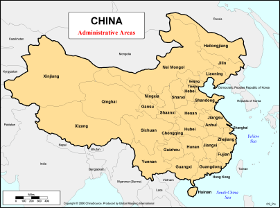 |
·Type: Maps ·Description: first-level (province) administrative divisions of China ·Map Date: 2000 ·Producer: Global Mapping International ·Collection: China Mobilization (WV 2002) ·Size: 8½ x 11 Inches, landscape ·Note: Updated version of this map exists. See China by Province ·Categories: Type :: Maps Collection :: GMI Map Collections :: China Mobilization (WV 2002) Continent/Region :: Asia Country :: China Partners :: Global... |
... more info
Max: 1
|
|
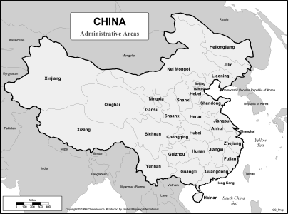 |
·Type: Maps ·Description: first-level (province) administrative divisions of China ·Map Date: 2002 ·Data Source: ChinaSource ·Producer: Global Mapping International ·Collection: China Mobilization (WV 2002) ·Size: 8½ x 11 Inches, landscape ·Categories: Type :: Maps Collection :: GMI Map Collections :: China Mobilization (WV 2002) Continent/Region :: Asia Country :: China Partners :: Global Mapping International Topic :: Geography... |
... more info
Max: 1
|
|
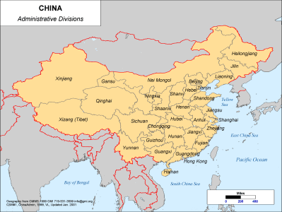 |
·Type: Maps ·Description: Administrative divisions of Southwest China ·Map Date: 2001 ·Producer: Global Mapping International ·Collection: China SW Minorities (WV 2002) ·Size: 8½ x 11 Inches, landscape ·Categories: Type :: Maps Collection :: GMI Map Collections :: China SW Minorities (WV 2002) Continent/Region :: Asia Country :: China Partners :: Global Mapping International Topic :: Geography :: Maps |
... more info
Max: 1
|
|
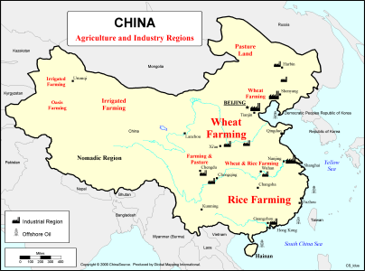 |
·Type: Maps ·Description: Agricultural and Industrial Region Divisions ·Map Date: 2000 ·Producer: Global Mapping International ·Collection: China Mobilization (WV 2002) ·Size: 8½ x 11 Inches, landscape ·Note: Windows Metafile and Metafile in Word forms of this map require the GMISym.ttf font ·Categories: Type :: Maps Collection :: GMI Map Collections :: China Mobilization (WV 2002) Continent/Region :: Asia Topic :: Demography... |
... more info
Max: 1
|
|
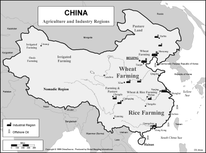 |
·Type: Maps ·Description: Agricultural and Industrial Region Divisions ·Map Date: 2002 ·Data Source: ChinaSource ·Producer: Global Mapping International ·Collection: China Mobilization (WV 2002) ·Size: 8½ x 11 Inches, landscape ·Note: Windows Metafile and Metafile in Word forms of this map require the GMISym.ttf font ·Categories: Type :: Maps Collection :: GMI Map Collections :: China Mobilization (WV 2002) Continent/Region... |
... more info
Max: 1
|
|
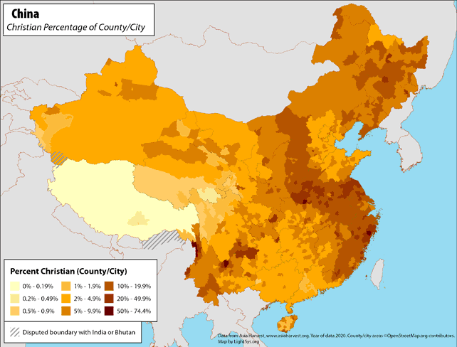 |
· Type: Maps · Map Date: 2019 · Data Source: Asia Harvest; county/city areas © OpenStreetMap contributors, http://www.openstreetmap.org/copyright. Data available under the Open Database License · Partners: LightSys Technology Services · Collection: Projects 2019 · Size: 8½ x 11 inches, landscape · Categories: Type :: Maps Continent/Region :: Asia Country :: China Topic :: Statistical Topic :: Religions,... |
... more info
|
|
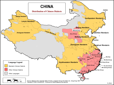 |
·Type: Maps ·Description: China - Divisions of the distributions of chinese dialects ·Map Date: 2000 ·Producer: Global Mapping International ·Collection: China Mobilization (WV 2002) ·Size: 8½ x 11 Inches, landscape ·Note: Windows Metafile and Metafile in Word forms of this map require the GMISym.ttf font ·Categories: Type :: Maps Collection :: GMI Map Collections :: China Mobilization (WV 2002) Continent/Region :: Asia Country ::... |
... more info
Max: 1
|
|
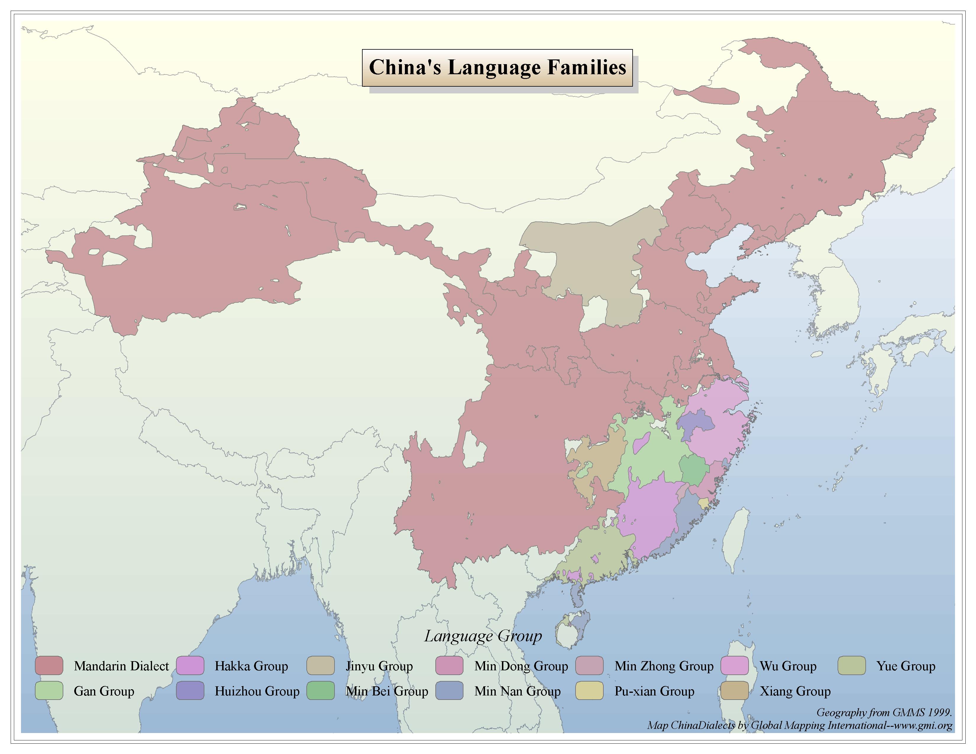 |
·Type: Maps ·Map Date: 2006 ·Data Source: GMMS 1999 ·Producer: Global Mapping International ·Collection: China Mobilization (GMMS 2007) ·Size: 8½ x 11 inches, landscape ·Categories: Type :: Maps Continent/Region :: Asia Country :: China Collection :: GMI Map Collections :: China Mobilization (GMMS 2007) Partners :: Global Mapping International Topic :: Language and Translation |
... more info
Max: 1
|
|
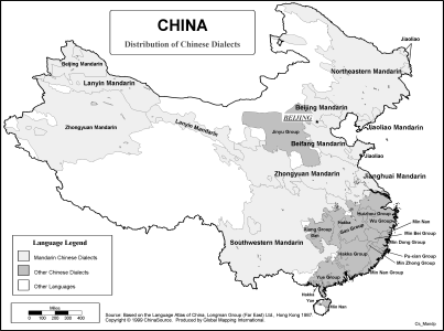 |
·Type: Maps ·Description: China - Divisions of the distributions of chinese dialects ·Map Date: 2002 ·Data Source: ChinaSource ·Producer: Global Mapping International ·Collection: China Mobilization (WV 2002) ·Size: 8½ x 11 Inches, landscape ·Note: Windows Metafile and Metafile in Word forms of this map require the GMISym.ttf font ·Categories: Type :: Maps Collection :: GMI Map Collections :: China Mobilization (WV 2002)... |
... more info
Max: 1
|
|
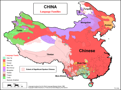 |
·Type: Maps ·Description: Divisions of language families in China ·Map Date: 2000 ·Producer: Global Mapping International ·Collection: China Mobilization (WV 2002) ·Size: 8½ x 11 Inches, landscape ·Categories: Type :: Maps Collection :: GMI Map Collections :: China Mobilization (WV 2002) Continent/Region :: Asia Country :: China Partners :: Global Mapping International Topic :: Language and Translation |
... more info
Max: 1
|
|
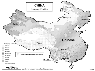 |
·Type: Maps ·Description: Divisions of language families in China ·Map Date: 2002 ·Data Source: ChinaSource ·Producer: Global Mapping International ·Collection: China Mobilization (WV 2002) ·Size: 8½ x 11 Inches, landscape ·Categories: Type :: Maps Collection :: GMI Map Collections :: China Mobilization (WV 2002) Continent/Region :: Asia Country :: China Partners :: Global Mapping International Topic :: Language and Translation |
... more info
Max: 1
|
|
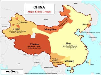 |
·Type: Maps ·Description: Divisions of major ethnic groups in China ·Map Date: 2000 ·Producer: Global Mapping International ·Collection: China Mobilization (WV 2002) ·Size: 8½ x 11 Inches, landscape ·Categories: Type :: Maps Collection :: GMI Map Collections :: China Mobilization (WV 2002) Continent/Region :: Asia Topic :: Peoples, multiple or unknown Country :: China Partners :: Global Mapping International |
... more info
Max: 1
|
|