Maps
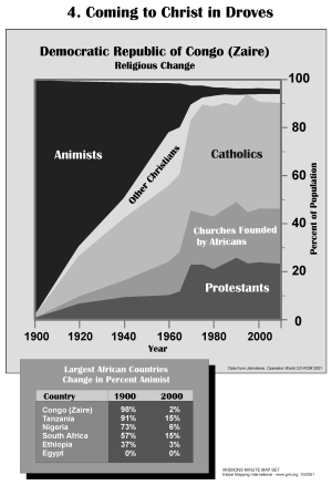
Coming to Christ in Droves (BW)
·Type: Maps ·Description: Large Groups Coming to Christ ·Map Date: 2002 ·Producer: Global Mapping International ·Collection: Missions Minute (WorldVue 2002) ·Size: 8½ x 11 Inches, portrait...
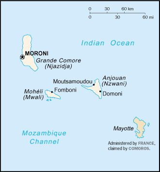
Comoros map (World Factbook)
·Type: Maps ·Description: Comoros (Factbook) ·Map Date: 2007 ·Producer: US Government ·Collection: World Factbook country maps ·Size: 329x355 px, portrait ·Categories: Type :: Maps Continent/Region...
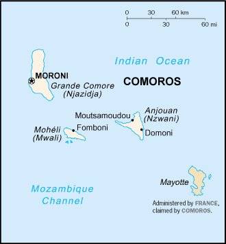
Comoros map (World Factbook, modified)
·Type: Maps ·Description: Comoros (World Factbook, modified to add country name) ·Map Date: 2007 ·Producer: US Government modified by Joshua Project ·Collection: World Factbook country maps ·Size: 329x355...
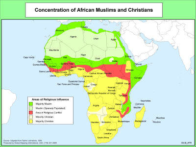
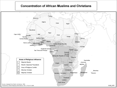
Concentration of African Muslims and Christians
·Type: Maps ·Description: Density of African Muslim and Christian Populations ·Map Date: 2000 ·Producer: Global Mapping International ·Collection: The World of Islam (WV 2002) ·Size: 8½ x 11 Inches,...
Concentration of African Muslims and Christians (BW)
·Type: Maps ·Description: Density of African Muslim and Christian Populations ·Map Date: 2002 ·Producer: Global Mapping International ·Collection: The World of Islam (WV 2002) ·Size: 8½ x 11 Inches,...
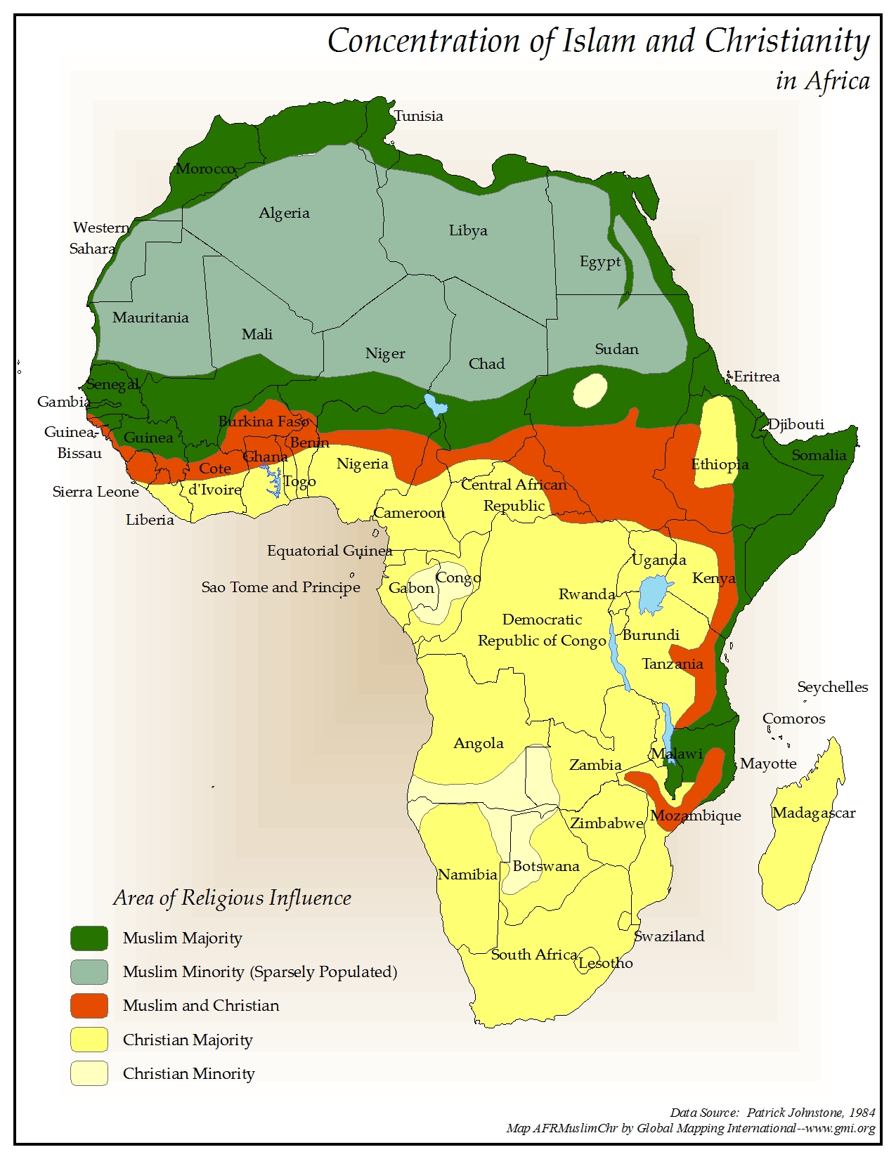
Concentration of Islam and Christianity in Africa
·Type: Maps ·Map Date: 2006 ·Data Source: Patrick Johnstone, 1984 ·Producer: Global Mapping International ·Collection: Reaching Africa (GMMS 2007) ·Size: 8½ x 11 inches, portrait ·Categories:...
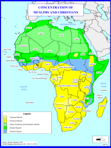
Concentration of Muslims and Christians
·Type: Maps ·Description: Concentration of Muslims and Christians in Africa ·Map Date: 1998 ·Producer: Global Mapping International ·Collection: Reaching Africa (WorldVue 2002) ·Size: 8½ x 11 Inches,...
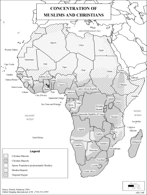
Concentration of Muslims and Christians (BW)
·Type: Maps ·Description: Concentration of Muslims and Christians in Africa ·Map Date: 2002 ·Producer: Global Mapping International ·Collection: Reaching Africa (WorldVue 2002) ·Size: 8½ x 11 Inches,...
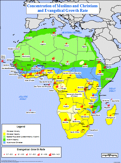
Concentration of Muslims and Christians, Evangelical Growth Rate
·Type: Maps ·Full title: Concentration of Muslims and Christians and Evangelical Growth Rate ·Map Date: 2006 ·Data Source: Muslim/Christian concentrations - Patrick Johnstone 1984, Evangelical Growth Rate - Johnstone,...
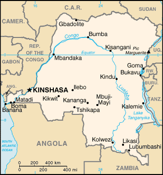
Congo, Democratic Republic of the map (World Factbook)
·Type: Maps ·Description: Congo, Democratic Republic of the (Factbook) ·Map Date: 2007 ·Producer: US Government ·Collection: World Factbook country maps ·Size: 330x353 px, portrait ·Categories: Type...
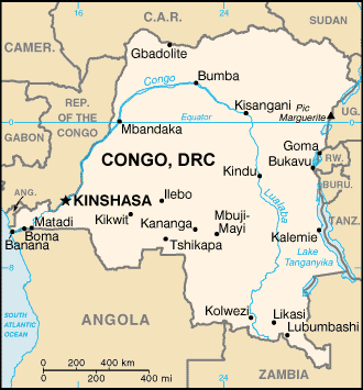
Congo, Democratic Republic of the map (World Factbook, modified)
·Type: Maps ·Description: Congo, Democratic Republic of the (World Factbook, modified to add country name) ·Map Date: 2007 ·Producer: US Government modified by Joshua Project ·Collection: World Factbook country...
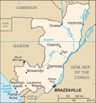
Congo, Republic of the map (World Factbook)
·Type: Maps ·Description: Congo, Republic of the (Factbook) ·Map Date: 2007 ·Producer: US Government ·Collection: World Factbook country maps ·Size: 327x714 px, portrait ·Categories: Type :: Maps...
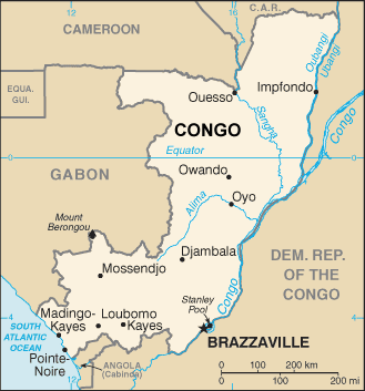
Congo, Republic of the map (World Factbook, modified)
·Type: Maps ·Description: Congo, Republic of the (World Factbook, modified to add country name) ·Map Date: 2007 ·Producer: US Government modified by Joshua Project ·Collection: World Factbook country maps...
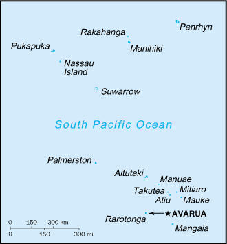
Cook Islands map (World Factbook)
·Type: Maps ·Description: Cook Islands (Factbook) ·Map Date: 2007 ·Producer: US Government ·Collection: World Factbook country maps ·Size: 634x324 px, portrait ·Categories: Type :: Maps...
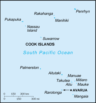
Cook Islands map (World Factbook, modified)
·Type: Maps ·Description: Cook Islands (World Factbook, modified to add country name) ·Map Date: 2007 ·Producer: US Government modified by Joshua Project ·Collection: World Factbook country maps ·Size:...
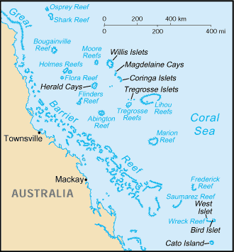
Coral Sea Islands map (World Factbook)
·Type: Maps ·Description: Coral Sea Islands (Factbook) ·Map Date: 2007 ·Producer: US Government ·Collection: World Factbook country maps ·Size: 328x353 px, portrait ·Categories: Type :: Maps...
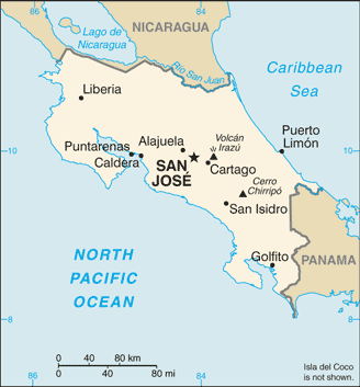
Costa Rica map (World Factbook)
·Type: Maps ·Description: Costa Rica (Factbook) ·Map Date: 2007 ·Producer: US Government ·Collection: World Factbook country maps ·Size: 328x352 px, landscape ·Categories: Type :: Maps Collection ::...
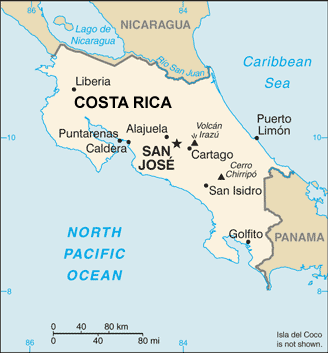
Costa Rica map (World Factbook, modified)
·Type: Maps ·Description: Costa Rica (World Factbook, modified to add country name) ·Map Date: 2007 ·Producer: US Government modified by Joshua Project ·Collection: World Factbook country maps ·Size:...
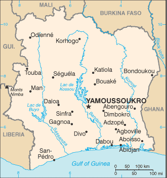
Cote d'Ivoire map (World Factbook)
·Type: Maps ·Description: Cote d'Ivoire (Factbook) ·Map Date: 2007 ·Producer: US Government ·Collection: World Factbook country maps ·Size: 329x713 px, landscape ·Categories: Type :: Maps...
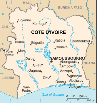
Cote d'Ivoire map (World Factbook, modified)
·Type: Maps ·Description: Cote d'Ivoire (World Factbook, modified to add country name) ·Map Date: 2007 ·Producer: US Government modified by Joshua Project ·Collection: World Factbook country maps ·Size:...
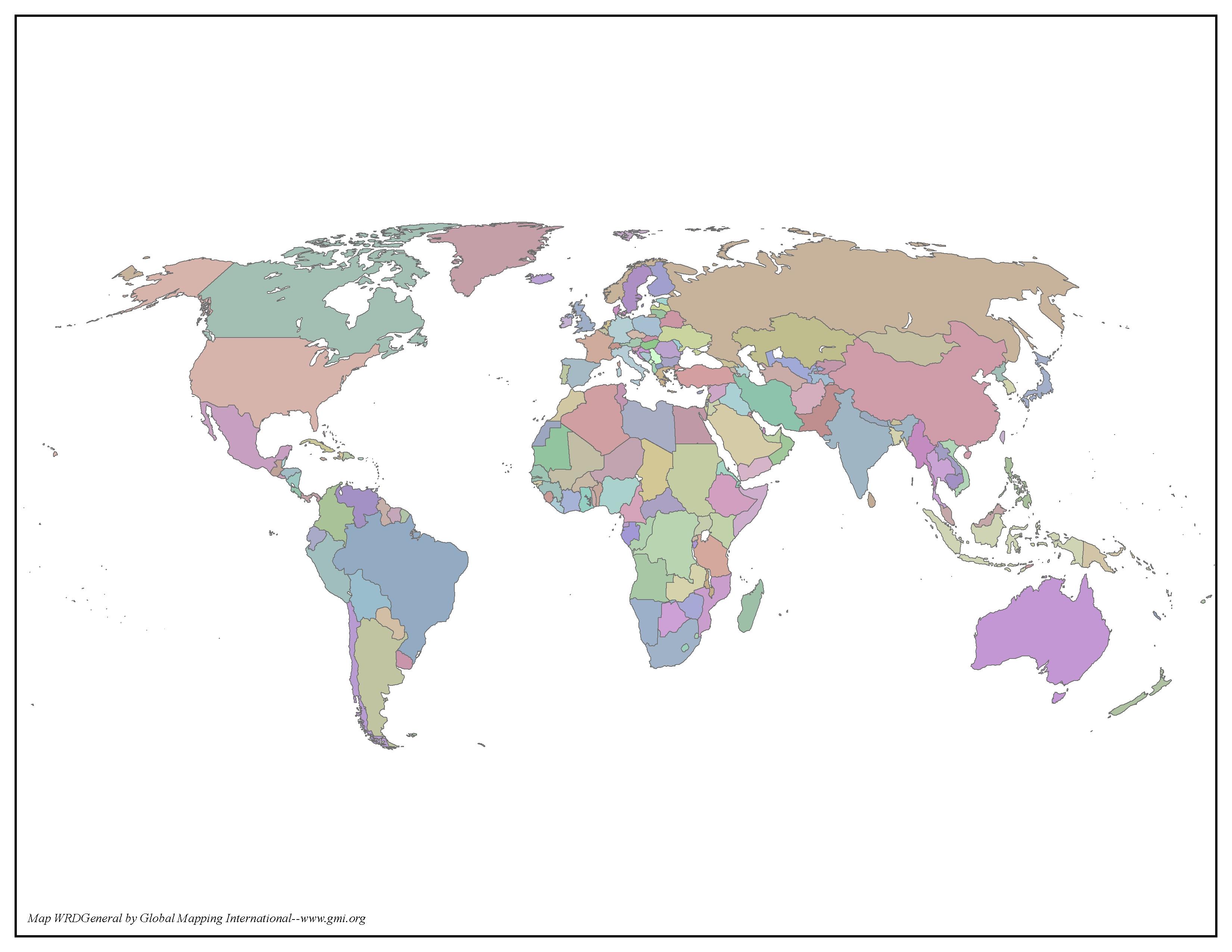
Countries of the World
·Type: Maps ·Map Date: 2006 ·Producer: Global Mapping International ·Collection: General World Maps (GMMS 2007) ·Size: 8½ x 11 inches, landscape ·Categories: Type :: Maps Continent/Region :: World...
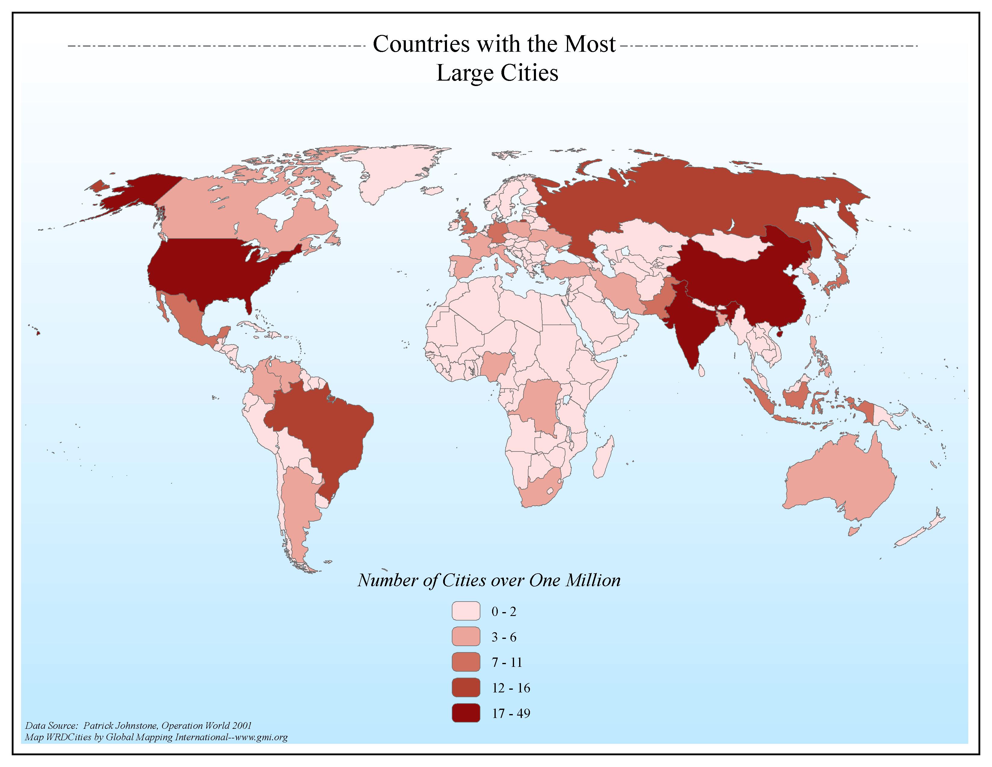
Countries with the Most Large Cities
·Type: Maps ·Map Date: 2006 ·Data Source: Patrick Johnstone, Operation World 2001 ·Producer: Global Mapping International ·Collection: General World Maps (GMMS 2007) ·Size: 8½ x 11 inches, landscape...
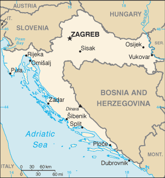
Croatia map (World Factbook)
·Type: Maps ·Description: Croatia (Factbook) ·Map Date: 2007 ·Producer: US Government ·Collection: World Factbook country maps ·Size: 328x352 px, landscape ·Categories: Type :: Maps Continent/Region...
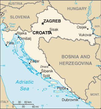
Croatia map (World Factbook, modified)
·Type: Maps ·Description: Croatia (World Factbook, modified to add country name) ·Map Date: 2007 ·Producer: US Government modified by Joshua Project ·Collection: World Factbook country maps ·Size: 328x352...
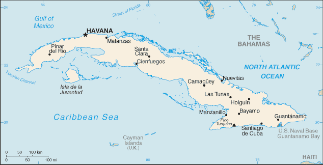
Cuba map (World Factbook)
·Type: Maps ·Description: Cuba (Factbook) ·Map Date: 2007 ·Producer: US Government ·Collection: World Factbook country maps ·Size: 328x353 px, landscape ·Categories: Type :: Maps Collection :: World...
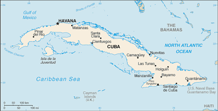
Cuba map (World Factbook, modified)
·Type: Maps ·Description: Cuba (World Factbook, modified to add country name) ·Map Date: 2007 ·Producer: US Government modified by Joshua Project ·Collection: World Factbook country maps ·Size: 328x353 px,...
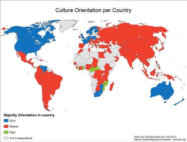
Cultural Orientation per Country
· Type: Maps · Map Date: 2017 2017 · Data Source: http://theculturetest.com · Producer: Global Mapping International · Collection: Projects 2017 · Size: 8½ x 11 inches,...
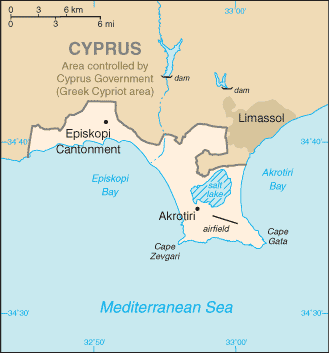
Cyprus (Akrotiri Sovereign Base Area) map (World Factbook)
·Type: Maps ·Description: Akrotiri Sovereign Base Area (British air force base), portion of Cyprus (Factbook) ·Map Date: 2007 ·Producer: US Government ·Collection: World Factbook country maps ·Size: 329x353...
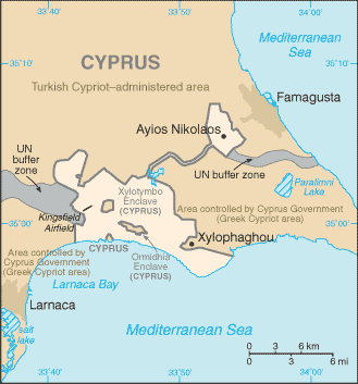
Cyprus (Dhekelia Soverign Base Area) map (World Factbook)
·Type: Maps ·Description: Cyprus (Dhekelia Soverign Base Area) (Factbook) ·Map Date: 2007 ·Producer: US Government ·Collection: World Factbook country maps ·Size: 329x353 px, landscape ·Categories:...
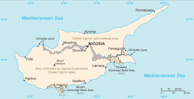
Cyprus map (World Factbook)
·Type: Maps ·Description: Cyprus (Factbook) ·Map Date: 2007 ·Producer: US Government ·Collection: World Factbook country maps ·Size: 330x355 px, landscape ·Categories: Type :: Maps Continent/Region...

