Maps
Areas Of Taiwan Where Avg. Church Size is Less Than 100 People
·Type: Maps ·Full title: Areas Of Taiwan For Which the Average Protestant Church Membership Size Is Less Than 100 People ·Map Date: April 2009 ·Data Source: 2007 Taiwan Church Annual Report ·Producer: George...
Areas Of Taiwan Where Total Church Size is Less Than 100 People
·Type: Maps ·Full title: Areas Of Taiwan For Which Total Protestant Church Membership Is Less Than 100 People ·Map Date: May 2009 ·Data Source: 2007 Taiwan Church Annual Report ·Producer: George McFall...
Argentina map (World Factbook)
·Type: Maps ·Description: Argentina (Factbook) ·Map Date: 2007 ·Producer: US Government ·Collection: World Factbook country maps ·Size: 330x354 px, portrait ·Categories: Type :: Maps Collection ::...
Argentina map (World Factbook, modified)
·Type: Maps ·Description: Argentina (World Factbook, modified to add country name) ·Map Date: 2007 ·Producer: US Government modified by Joshua Project ·Collection: World Factbook country maps ·Size: 330x354...
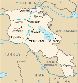
Armenia map (World Factbook)
·Type: Maps ·Description: Armenia (Factbook) ·Map Date: 2007 ·Producer: US Government ·Collection: World Factbook country maps ·Size: 329x351 px, portrait ·Categories: Type :: Maps Continent/Region...
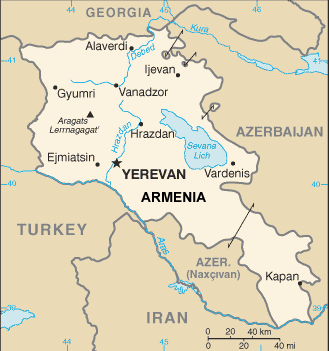
Armenia map (World Factbook, modified)
·Type: Maps ·Description: Armenia (World Factbook, modified to add country name) ·Map Date: 2007 ·Producer: US Government modified by Joshua Project ·Collection: World Factbook country maps ·Size: 329x351...
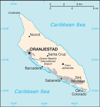
Aruba map (World Factbook)
·Type: Maps ·Description: Aruba (Factbook) ·Map Date: 2007 ·Producer: US Government ·Collection: World Factbook country maps ·Size: 329x354 px, portrait ·Categories: Type :: Maps Collection :: World...
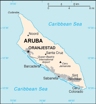
Aruba map (World Factbook, modified)
·Type: Maps ·Description: Aruba (World Factbook, modified to add country name) ·Map Date: 2007 ·Producer: US Government modified by Joshua Project ·Collection: World Factbook country maps ·Size: 329x354 px,...
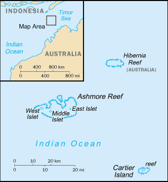
Ashmore and Cartier Islands map (World Factbook)
·Type: Maps ·Description: Ashmore and Cartier Islands (Factbook) ·Map Date: 2007 ·Producer: US Government ·Collection: World Factbook country maps ·Size: 330x713 px, portrait ·Categories: Type ::...
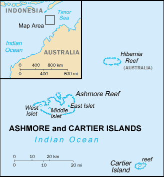
Ashmore and Cartier Islands map (World Factbook, modified)
·Type: Maps ·Description: Ashmore and Cartier Islands (World Factbook, modified to add country name) ·Map Date: 2007 ·Producer: US Government modified by Joshua Project ·Collection: World Factbook country maps...
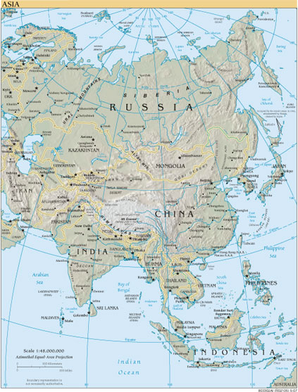
Asia
·Type: Maps ·Map Date: 2007 ·Producer: US Government ·Collection: World Factbook reference maps ·Size: 423x557 px, portrait ·Categories: Type :: Maps Continent/Region :: Asia Collection :: World Factbook...
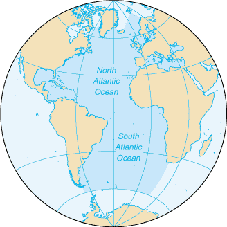
Atlantic Ocean map (World Factbook)
·Type: Maps ·Description: Atlantic Ocean (Factbook) ·Map Date: 2007 ·Producer: US Government ·Collection: World Factbook country maps ·Size: 328x328 px, portrait ·Categories: Type :: Maps Collection...
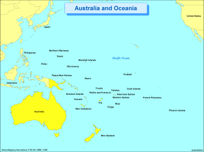
Australia and Oceania
·Type: Maps ·Description: Political Map of Australia and Oceania ·Map Date: 2002 ·Producer: Global Mapping International ·Collection: Regions (WorldVue 2002) ·Size: 8½ x 11 Inches, landscape...
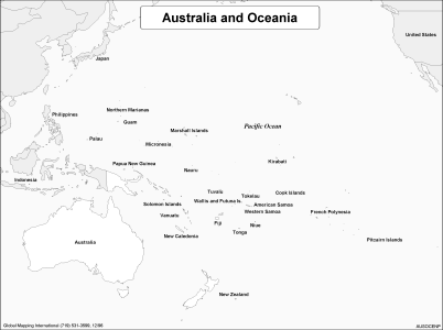
Australia and Oceania (BW)
·Type: Maps ·Description: Political Map of Australia and Oceania ·Map Date: 2002 ·Producer: Global Mapping International ·Collection: Regions (WorldVue 2002) ·Size: 8½ x 11 Inches, landscape...
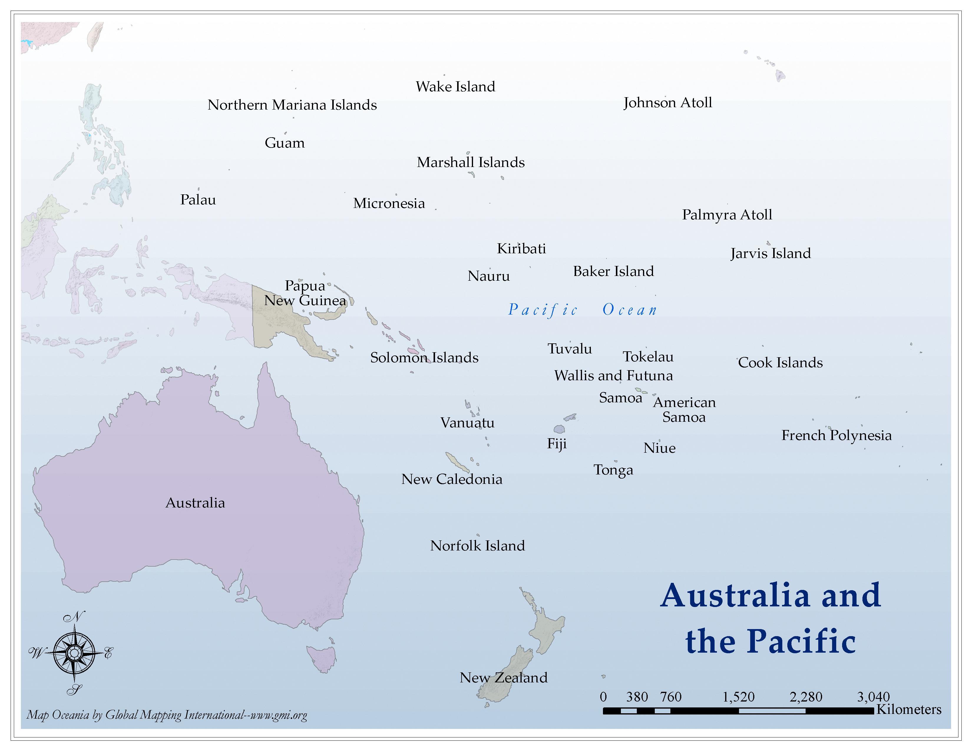
Australia and the Pacific
·Type: Maps ·Map Date: 2006 ·Producer: Global Mapping International ·Collection: Regions (GMMS 2007) ·Size: 8½ x 11 inches, landscape ·Categories: Type :: Maps Continent/Region :: Oceania Partners ::...
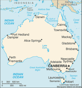
Australia map (World Factbook)
·Type: Maps ·Description: Australia (Factbook) ·Map Date: 2007 ·Producer: US Government ·Collection: World Factbook country maps ·Size: 331x355 px, portrait ·Categories: Type :: Maps Continent/Region...
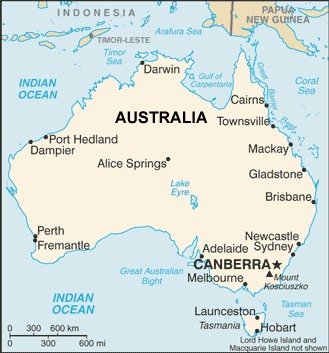
Australia map (World Factbook, modified)
·Type: Maps ·Description: Australia (World Factbook, modified to add country name) ·Map Date: 2007 ·Producer: US Government modified by Joshua Project ·Collection: World Factbook country maps ·Size: 331x355...
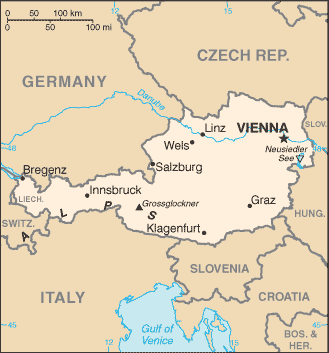
Austria map (World Factbook)
·Type: Maps ·Description: Austria (Factbook) ·Map Date: 2007 ·Producer: US Government ·Collection: World Factbook country maps ·Size: 329x352 px, portrait ·Categories: Type :: Maps Continent/Region...
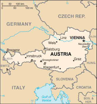
Austria map (World Factbook, modified)
·Type: Maps ·Description: Austria (World Factbook, modified to add country name) ·Map Date: 2007 ·Producer: US Government modified by Joshua Project ·Collection: World Factbook country maps ·Size: 329x352...
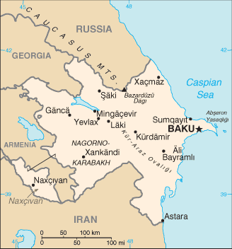
Azerbaijan map (World Factbook)
·Type: Maps ·Description: Azerbaijan (Factbook) ·Map Date: 2007 ·Producer: US Government ·Collection: World Factbook country maps ·Size: 328x352 px, portrait ·Categories: Type :: Maps...
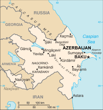
Azerbaijan map (World Factbook, modified)
·Type: Maps ·Description: Azerbaijan (World Factbook, modified to add country name) ·Map Date: 2007 ·Producer: US Government modified by Joshua Project ·Collection: World Factbook country maps ·Size:...
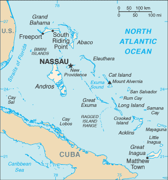
Bahamas, The map (World Factbook)
·Type: Maps ·Description: Bahamas, The (Factbook) ·Map Date: 2007 ·Producer: US Government ·Collection: World Factbook country maps ·Size: 328x353 px, portrait ·Categories: Type :: Maps Collection ::...
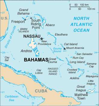
Bahamas, The map (World Factbook, modified)
·Type: Maps ·Description: Bahamas, The (World Factbook, modified to add country name) ·Map Date: 2007 ·Producer: US Government modified by Joshua Project ·Collection: World Factbook country maps ·Size:...
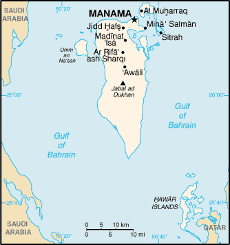
Bahrain map (World Factbook)
·Type: Maps ·Description: Bahrain (Factbook) ·Map Date: 2007 ·Producer: US Government ·Collection: World Factbook country maps ·Size: 329x353 px, portrait ·Categories: Type :: Maps Continent/Region...
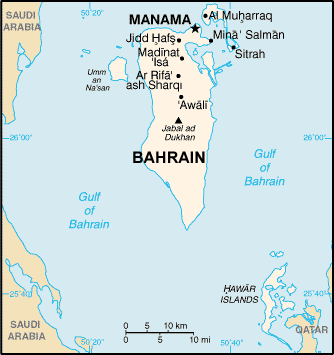
Bahrain map (World Factbook, modified)
·Type: Maps ·Description: Bahrain (World Factbook, modified to add country name) ·Map Date: 2007 ·Producer: US Government modified by Joshua Project ·Collection: World Factbook country maps ·Size: 329x353...
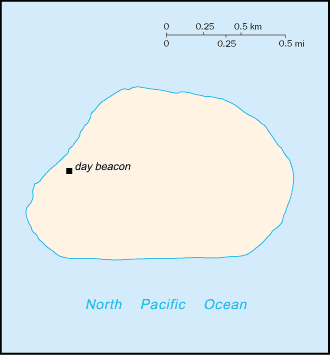
Baker Island map (World Factbook)
·Type: Maps ·Description: Baker Island (Factbook) ·Map Date: 2007 ·Producer: US Government ·Collection: World Factbook country maps ·Size: 328x352 px, portrait ·Categories: Type :: Maps...
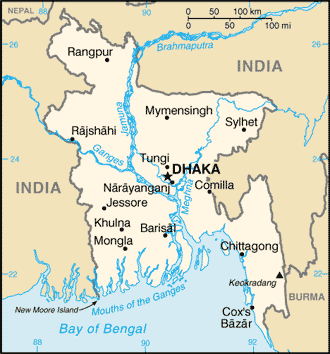
Bangladesh map (World Factbook)
·Type: Maps ·Description: Bangladesh (Factbook) ·Map Date: 2007 ·Producer: US Government ·Collection: World Factbook country maps ·Size: 328x353 px, portrait ·Categories: Type :: Maps...
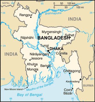
Bangladesh map (World Factbook, modified)
·Type: Maps ·Description: Bangladesh (World Factbook, modified to add country name) ·Map Date: 2007 ·Producer: US Government modified by Joshua Project ·Collection: World Factbook country maps ·Size:...
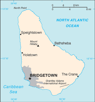
Barbados map (World Factbook)
·Type: Maps ·Description: Barbados (Factbook) ·Map Date: 2007 ·Producer: US Government ·Collection: World Factbook country maps ·Size: 330x355 px, portrait ·Categories: Type :: Maps Collection ::...
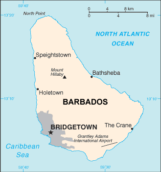
Barbados map (World Factbook, modified)
·Type: Maps ·Description: Barbados (World Factbook, modified to add country name) ·Map Date: 2007 ·Producer: US Government modified by Joshua Project ·Collection: World Factbook country maps ·Size: 330x355...

