Maps
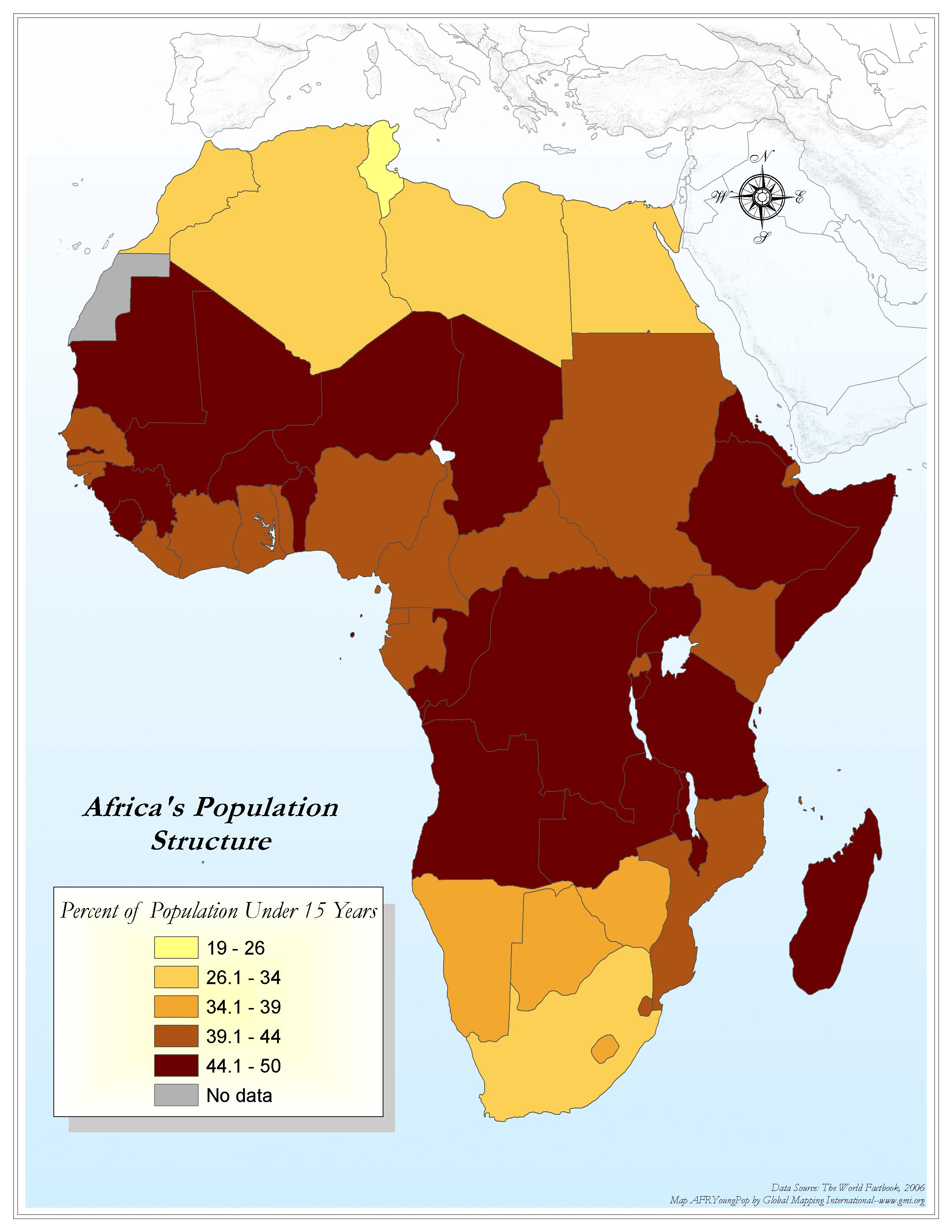
Africa's Population Structure
·Type: Maps ·Map Date: 2006 ·Data Source: World Factbook 2006 ·Producer: Global Mapping International ·Collection: Factbook (GMMS 2007) ·Size: 8½ x 11 inches, portrait ·Categories: Type ::...
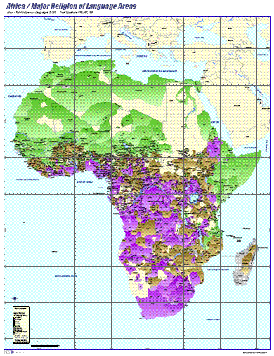
Africa- Major Religion of Language Areas
·Type: Maps ·Map Date: 2006 ·Data Source: ILS International ·Producer: ILS International ·Collection: Wall Maps ·Size: 36 by 46.6 inches, portrait ·Categories: Type :: Maps Continent/Region :: Africa...
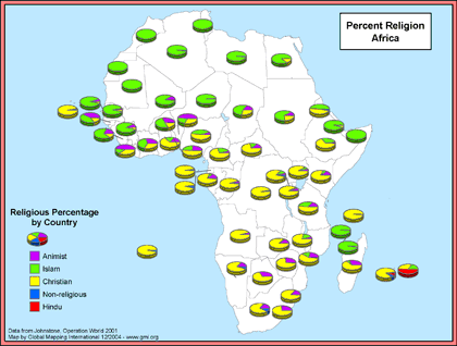
Africa- Percent Religion
·Type: Maps ·Map Date: December 2004 ·Data Source: Johnstone, Operation World 2001 ·Producer: Global Mapping International ·Collection: General Maps ·Size: 8.5 by 11 inches, landscape ·Categories:...
.gif)
Africa- Population Density (Landscan)
·Type: Maps ·Map Date: 2008 ·Data Source: Landscan, 2002 ·Producer: Global Mapping International ·Collection: General Maps ·Size: 8.5 by 11 inches, portrait ·Categories: Type :: Maps...
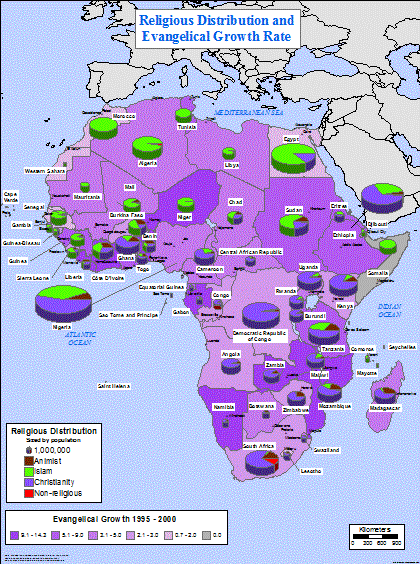
Africa- Religious Distribution and Evangelical Growth Rate
·Type: Maps ·Map Date: February 2004 ·Data Source: Johnstone, Operation World CD-Rom, 2001 ·Producer: Global Mapping International ·Collection: General Maps ·Size: 36 by 48 inches, portrait...
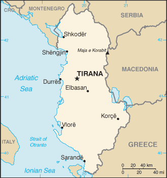
Albania map (World Factbook)
·Type: Maps ·Description: Albania (Factbook) ·Map Date: 2007 ·Producer: US Government ·Collection: World Factbook country maps ·Size: 330x353 px, portrait ·Categories: Type :: Maps Continent/Region...
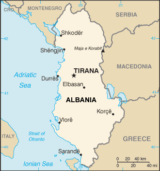
Albania map (World Factbook, modified)
·Type: Maps ·Description: Albania (World Factbook, modified to add country name) ·Map Date: 2007 ·Producer: US Government modified by Joshua Project ·Collection: World Factbook country maps ·Size: 330x353...
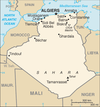
Algeria map (World Factbook)
·Type: Maps ·Description: Algeria (Factbook) ·Map Date: 2007 ·Producer: US Government ·Collection: World Factbook country maps ·Size: 328x352 px, portrait ·Categories: Type :: Maps Continent/Region...
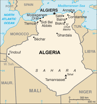
Algeria map (World Factbook, modified)
·Type: Maps ·Description: Algeria (World Factbook, modified to add country name) ·Map Date: 2007 ·Producer: US Government modified by Joshua Project ·Collection: World Factbook country maps ·Size: 328x352...
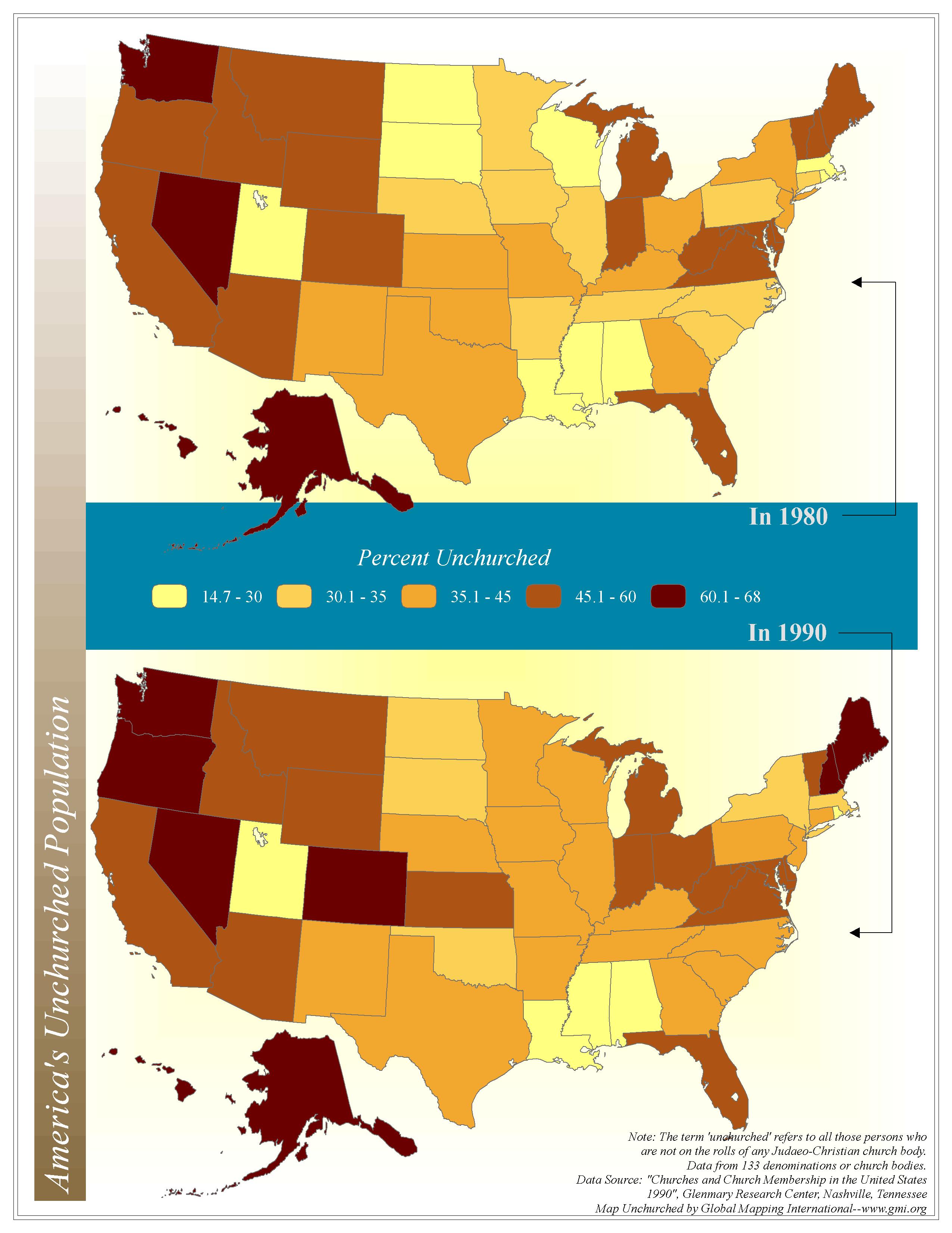
America's Unchurched Population
·Type: Maps ·Map Date: 2006 ·Data Source: Churches and Church Membership in the United States 1990, Glenmary Research Center, Nashville, Tennessee ·Producer: Global Mapping International ·Collection: Intro to...
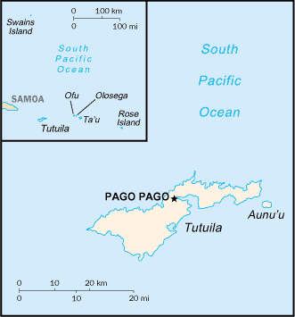
American Samoa map (World Factbook)
·Type: Maps ·Description: American Samoa (Factbook) ·Map Date: 2007 ·Producer: US Government ·Collection: World Factbook country maps ·Size: 329x354 px, portrait ·Categories: Type :: Maps...
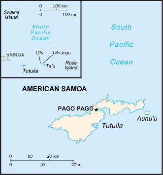
American Samoa map (World Factbook, modified)
·Type: Maps ·Description: American Samoa (World Factbook, modified to add country name) ·Map Date: 2007 ·Producer: US Government modified by Joshua Project ·Collection: World Factbook country maps ·Size:...
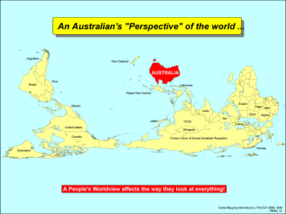
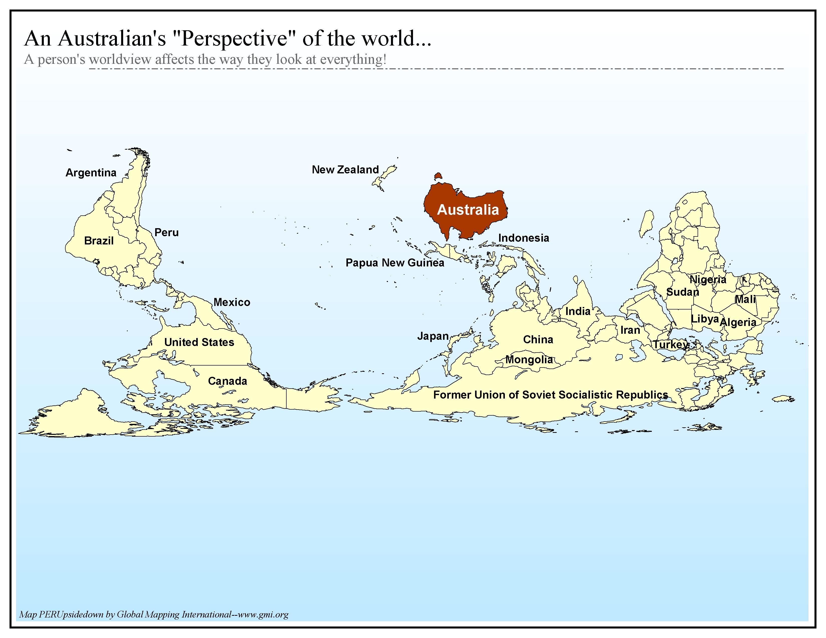
An Australian's "Perspective" of the World
·Type: Maps ·Description: The Australian Perspective of the World ·Map Date: 2002 ·Producer: Global Mapping International ·Collection: Worldwide Perspectives (WV 2002) ·Size: 8½ x 11 Inches,...
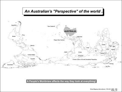
An Australian's "Perspective" of the World (BW)
·Type: Maps ·Description: The Australian Perspective of the World ·Map Date: 2002 ·Producer: Global Mapping International ·Collection: Worldwide Perspectives (WV 2002) ·Size: 8½ x 11 Inches,...
An Australian's "Perspective" of the world...
·Type: Maps ·Map Date: 2006 ·Producer: Global Mapping International ·Collection: Worldwide Perspectives GMMS 2007 ·Size: 8½ x 11 inches, landscape ·Categories: Type :: Maps Continent/Region :: World...
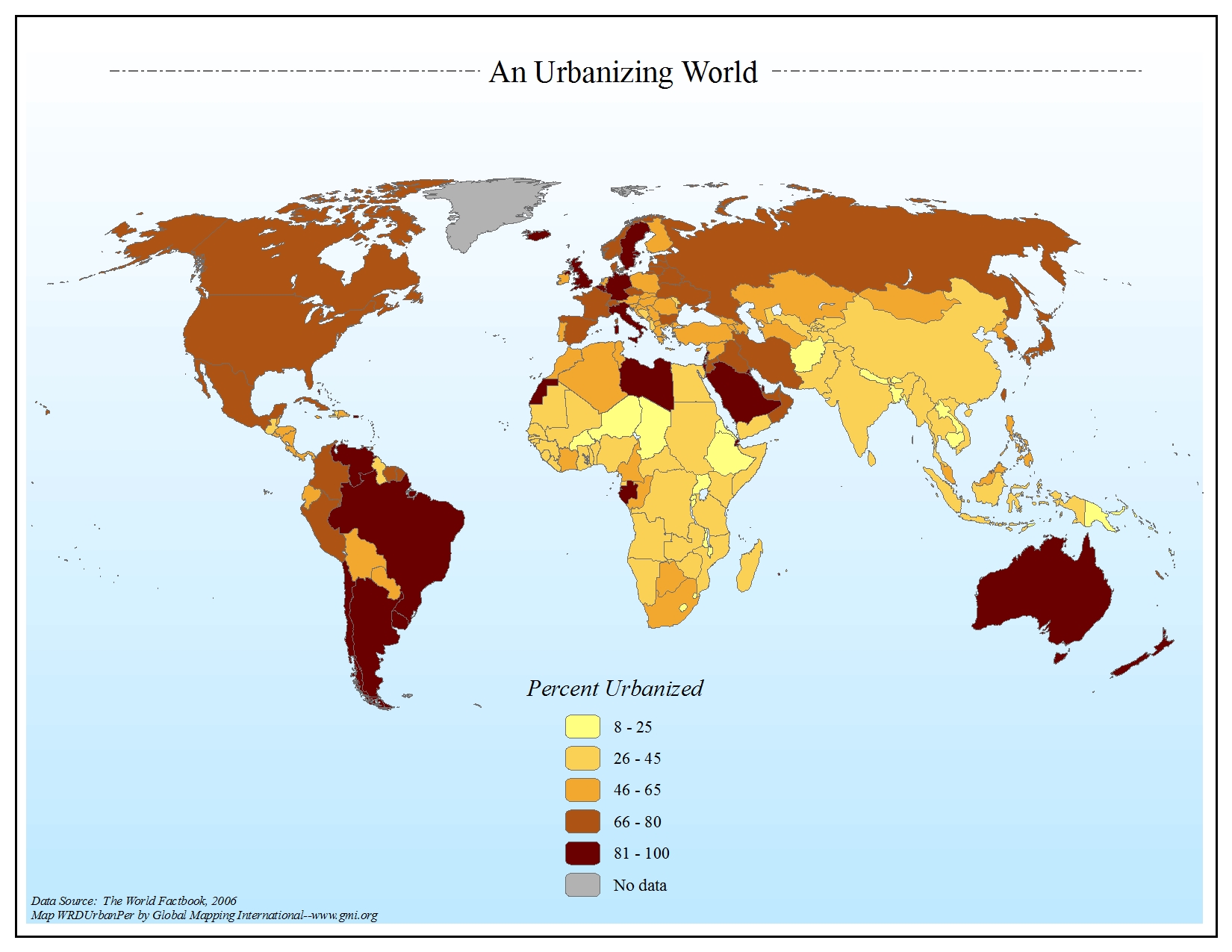
An Urbanizing World
·Type: Maps ·Map Date: 2006 ·Data Source: The World Factbook, 2006 ·Producer: Global Mapping International ·Collection: Factbook (GMMS 2007) ·Size: 8½ x 11 inches, landscape ·Categories: Type...
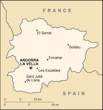
Andorra map (World Factbook)
·Type: Maps ·Description: Andorra (Factbook) ·Map Date: 2007 ·Producer: US Government ·Collection: World Factbook country maps ·Size: 329x354 px, portrait ·Categories: Type :: Maps Continent/Region...
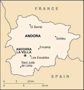
Andorra map (World Factbook, modified)
·Type: Maps ·Description: Andorra (World Factbook, modified to add country name) ·Map Date: 2007 ·Producer: US Government modified by Joshua Project ·Collection: World Factbook country maps ·Size: 329x354...
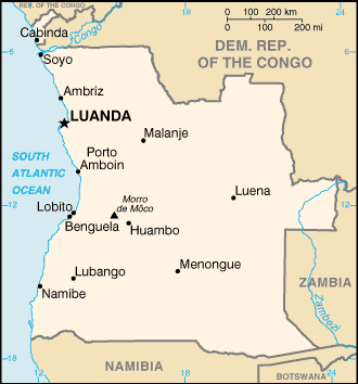
Angola map (World Factbook)
·Type: Maps ·Description: Angola (Factbook) ·Map Date: 2007 ·Producer: US Government ·Collection: World Factbook country maps ·Size: 329x351 px, portrait ·Categories: Type :: Maps Continent/Region ::...
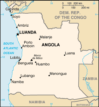
Angola map (World Factbook, modified)
·Type: Maps ·Description: Angola (World Factbook, modified to add country name) ·Map Date: 2007 ·Producer: US Government modified by Joshua Project ·Collection: World Factbook country maps ·Size: 329x351...
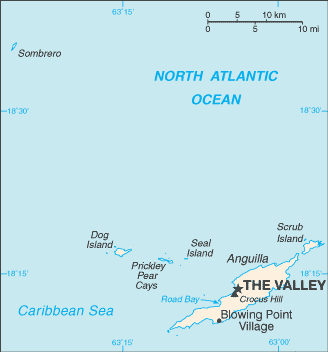
Anguilla map (World Factbook)
·Type: Maps ·Description: Anguilla (Factbook) ·Map Date: 2007 ·Producer: US Government ·Collection: World Factbook country maps ·Size: 328x355 px, portrait ·Categories: Type :: Maps Collection ::...
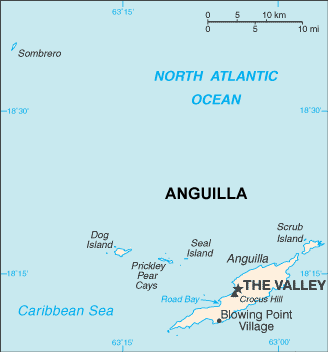
Anguilla map (World Factbook, modified)
·Type: Maps ·Description: Anguilla (World Factbook, modified to add country name) ·Map Date: 2007 ·Producer: US Government modified by Joshua Project ·Collection: World Factbook country maps ·Size: 328x355...
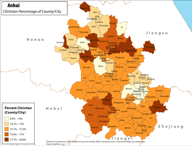
Anhui - Christian Percentage of County/City
· Type: Maps · Map Date: 2018 · Data Source: Asia Harvest; county/city areas © OpenStreetMap contributors, http://www.openstreetmap.org/copyright. Data available under the Open Database License...
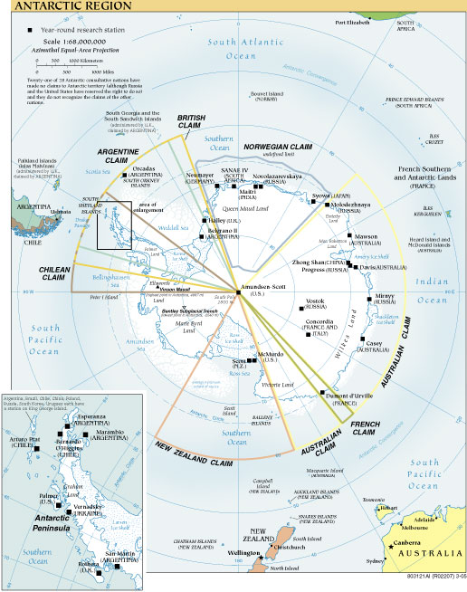
Antarctic Region
·Type: Maps ·Map Date: 2007 ·Producer: US Government ·Collection: World Factbook reference maps ·Size: 516x654 px, portrait ·Categories: Type :: Maps Collection :: World Factbook reference maps...
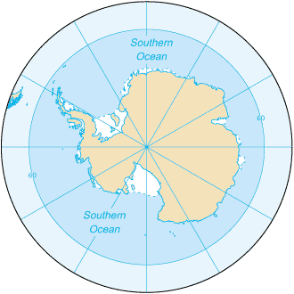
Antarctica
·Type: Maps ·Description: Antarctica ·Map Date: 2007 ·Producer: US Government ·Collection: World Factbook country maps ·Size: 329x352 px, landscape ·Categories: Type :: Maps Continent/Region ::...
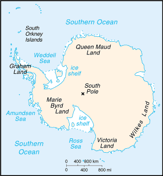
Antarctica (very general) map (World Factbook)
·Type: Maps ·Description: Antarctica (Factbook) ·Map Date: 2007 ·Producer: US Government ·Collection: World Factbook country maps ·Size: 328x352 px, portrait ·Categories: Type :: Maps...
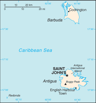
Antigua and Barbuda map (World Factbook)
·Type: Maps ·Description: Antigua and Barbuda (Factbook) ·Map Date: 2007 ·Producer: US Government ·Collection: World Factbook country maps ·Size: 329x354 px, portrait ·Categories: Type :: Maps...
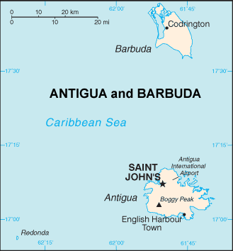
Antigua and Barbuda map (World Factbook, modified)
·Type: Maps ·Description: Antigua and Barbuda (World Factbook, modified to add country name) ·Map Date: 2007 ·Producer: US Government modified by Joshua Project ·Collection: World Factbook country maps...
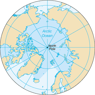
Arctic Ocean map (World Factbook)
·Type: Maps ·Description: Arctic Ocean (Factbook) ·Map Date: 2007 ·Producer: US Government ·Collection: World Factbook country maps ·Size: 329x330 px, landscape ·Categories: Type :: Maps...
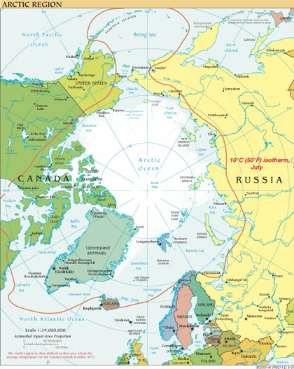
Arctic Region
·Type: Maps ·Map Date: 2007 ·Producer: US Government ·Collection: World Factbook reference maps ·Size: 420x527 px, portrait ·Categories: Type :: Maps Collection :: World Factbook reference maps...

