| Product Image |
Resource Name- |
Price |
Manufacturer |
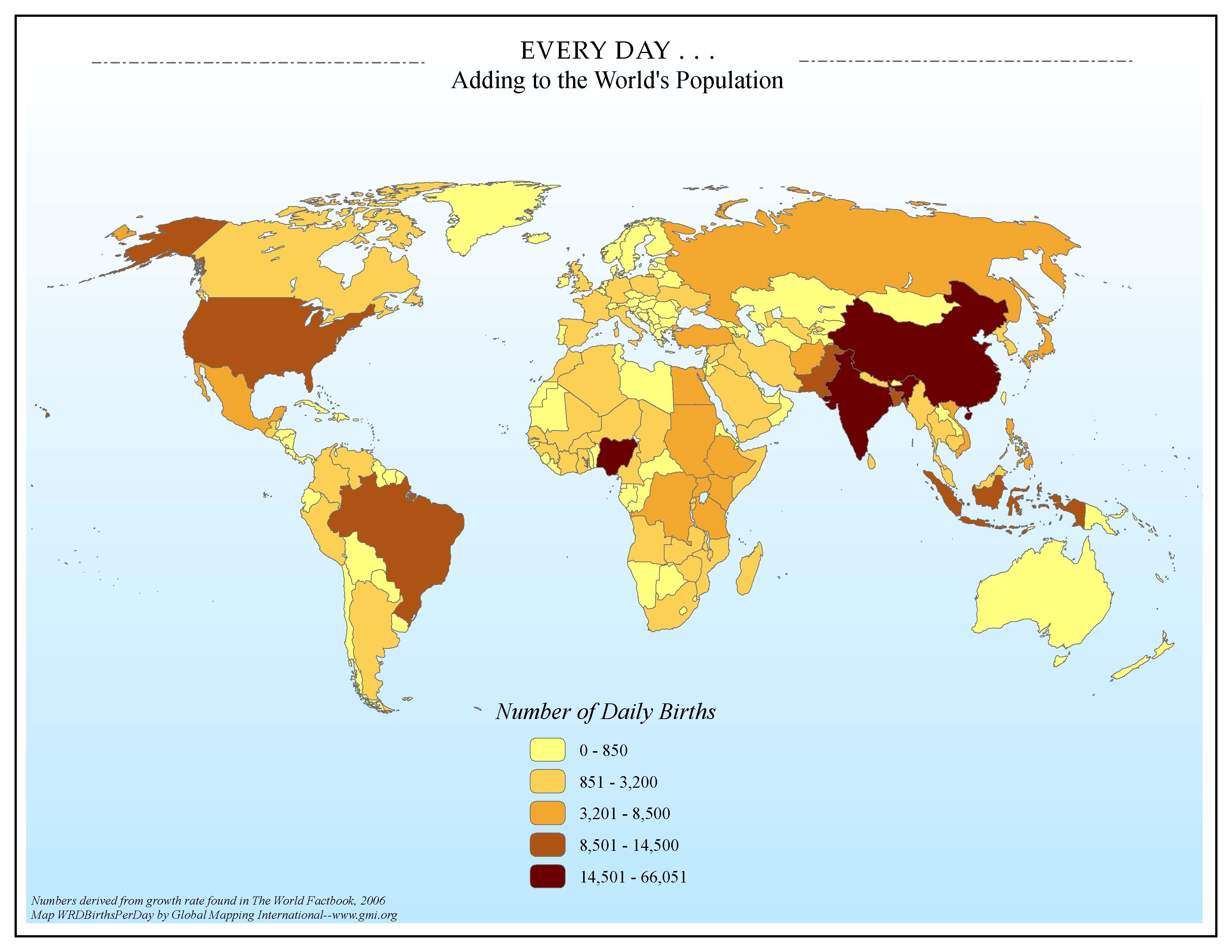 |
·Type: Maps ·Map Date: 2006 ·Data Source: Numbers derived from growth rate found in The World Factbook, 2006 ·Producer: Global Mapping International ·Collection: Factbook (GMMS 2007) ·Size: 8½ x 11 inches, landscape ·Categories: Type :: Maps Continent/Region :: World Topic :: Statistical Topic :: Demography Collection :: GMI Map Collections :: Factbook (GMMS 2007) Collection :: GMI Map Collections :: General World Maps (GMMS 2007) Partners :: Global Mapping International |
... more info
Max: 1
|
|
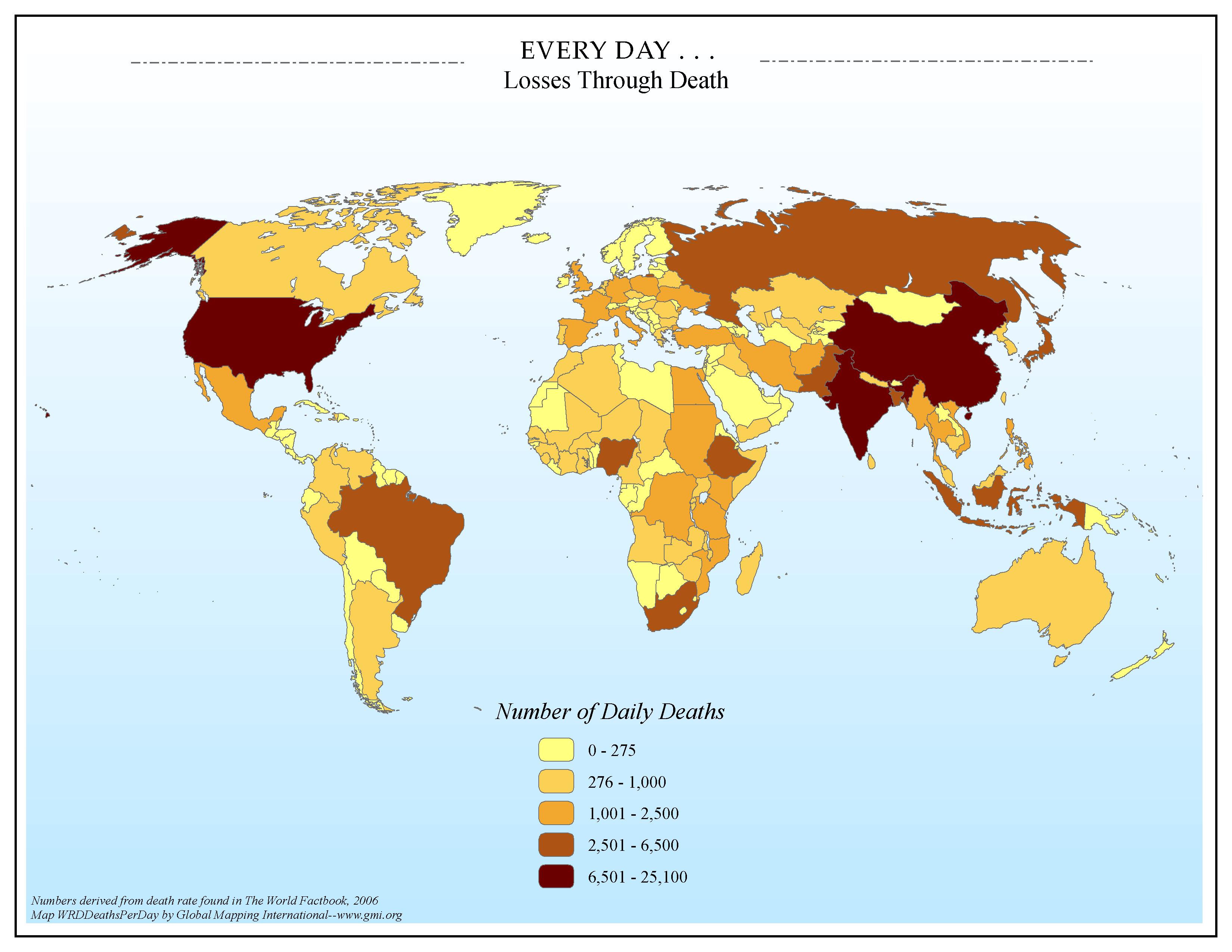 |
·Type: Maps ·Map Date: 2006 ·Data Source: Numbers derived from death rate found in The World Factbook, 2006 ·Producer: Global Mapping International ·Collection: Factbook (GMMS 2007) ·Size: 8½ x 11 inches, landscape ·Categories: Type :: Maps Continent/Region :: World Topic :: Statistical Topic :: Social Collection :: GMI Map Collections :: Factbook (GMMS 2007) Collection :: GMI Map Collections :: General World Maps (GMMS 2007) Partners ::... |
... more info
Max: 1
|
|
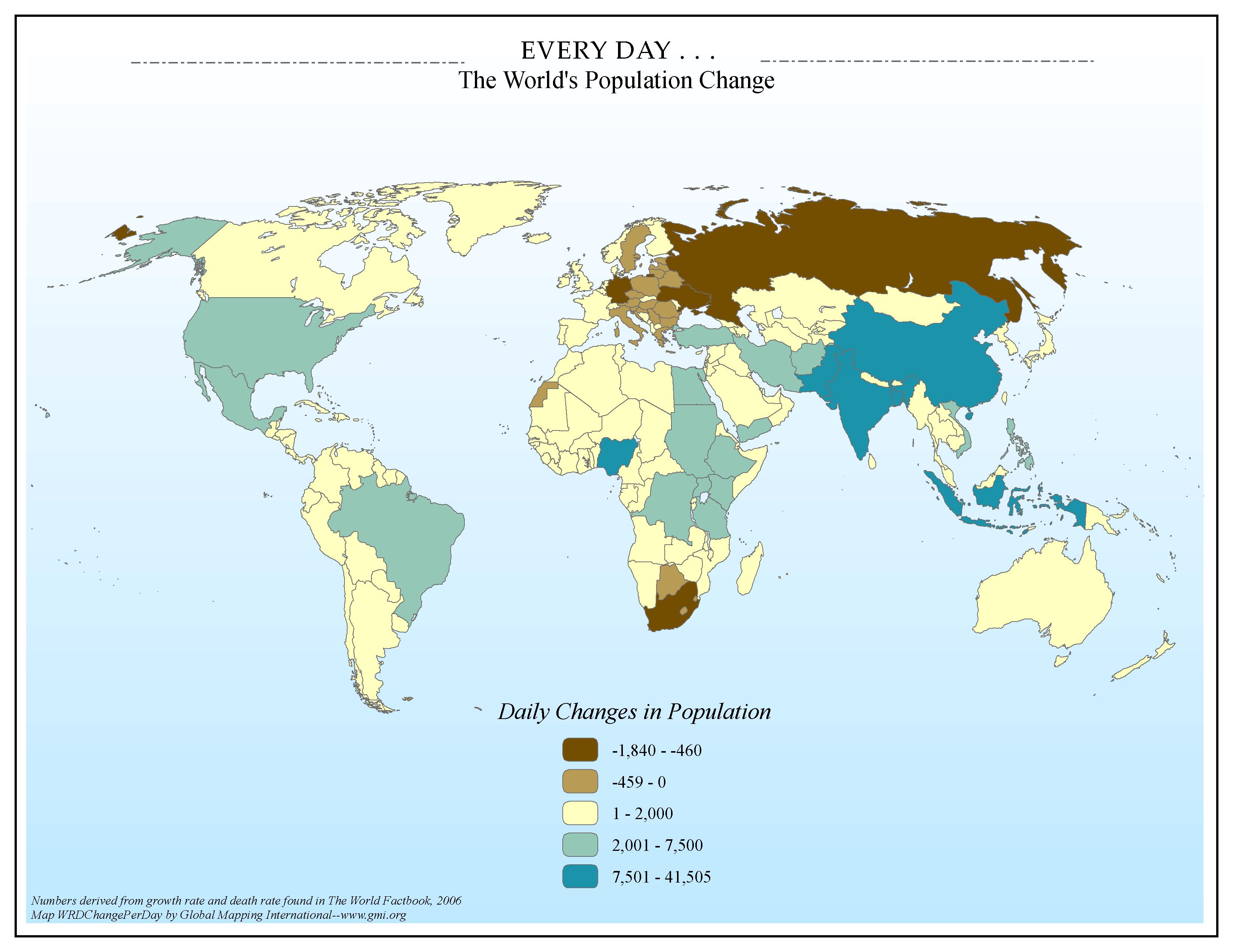 |
·Type: Maps ·Map Date: 2006 ·Data Source: Numbers derived from growth rate and death rate found in The World Factbook, 2006 ·Producer: Global Mapping International ·Collection: Factbook (GMMS 2007) ·Size: 8½ x 11 inches, landscape ·Categories: Type :: Maps Continent/Region :: World Topic :: Statistical Topic :: Demography Collection :: GMI Map Collections :: Factbook (GMMS 2007) Collection :: GMI Map Collections :: General World Maps (GMMS 2007) Partners :: Global Mapping International |
... more info
Max: 1
|
|
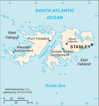 |
·Type: Maps ·Description: Falkland Islands (Factbook) ·Map Date: 2007 ·Producer: US Government ·Collection: World Factbook country maps ·Size: 328x713 px, landscape ·Categories: Type :: Maps Collection :: World Factbook country maps Partners :: U.S. Government Country :: Falkland Islands |
... more info
Max: 1
|
|
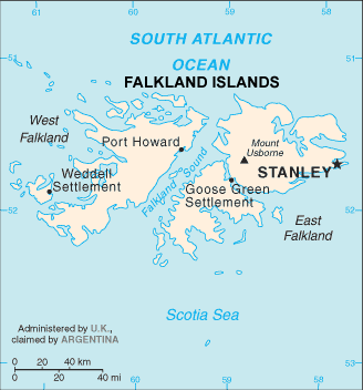 |
·Type: Maps ·Description: Falkland Islands (World Factbook, modified to add country name) ·Map Date: 2007 ·Producer: US Government modified by Joshua Project ·Collection: World Factbook country maps ·Size: 328x713 px, landscape ·Categories: Type :: Maps Collection :: World Factbook country maps Partners :: U.S. Government |
... more info
Max: 1
|
|
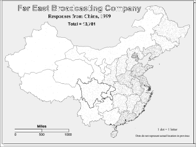 |
·Type: Maps ·Description: Responses from China in 1999 to the Far East Broadcasting Company ·Map Date: 2002 ·Producer: Global Mapping International ·Collection: Intro to Mission (WorldVue 2002) ·Size: 8½ x 11 Inches, landscape ·Note: Windows Metafile and Metafile in Word forms of this map require the GMISym.ttf font ·Categories: Type :: Maps Collection :: GMI Map Collections :: Intro to Mission (WorldVue 2002) Continent/Region ::... |
... more info
Max: 1
|
|
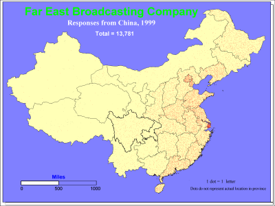 |
·Type: Maps ·Description: Responses from China in 1999 to the Far East Broadcasting Company ·Map Date: 1999 ·Producer: Global Mapping International ·Collection: Intro to Mission (WorldVue 2002) ·Size: 8½ x 11 Inches, landscape ·Note: Windows Metafile and Metafile in Word forms of this map require the GMISym.ttf font ·Categories: Type :: Maps Collection :: GMI Map Collections :: Intro to Mission (WorldVue 2002) Continent/Region ::... |
... more info
Max: 1
|
|
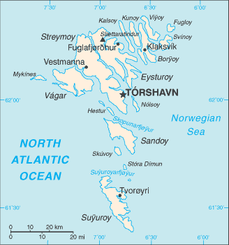 |
·Type: Maps ·Description: Faroe Islands (Factbook) ·Map Date: 2007 ·Producer: US Government ·Collection: World Factbook country maps ·Size: 328x352 px, landscape ·Categories: Type :: Maps Continent/Region :: Europe Collection :: World Factbook country maps Country :: Faroe Islands Partners :: U.S. Government |
... more info
Max: 1
|
|
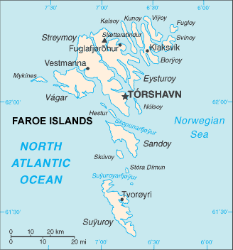 |
·Type: Maps ·Description: Faroe Islands (World Factbook, modified to add country name) ·Map Date: 2007 ·Producer: US Government modified by Joshua Project ·Collection: World Factbook country maps ·Size: 328x352 px, landscape ·Categories: Type :: Maps Continent/Region :: Europe Collection :: World Factbook country maps Country :: Faroe Islands Partners :: U.S. Government |
... more info
Max: 1
|
|
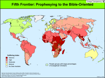 |
·Type: Maps ·Description: Prophesying to the Bible-Oriented is the Fith Frontier ·Map Date: 1999 ·Producer: Global Mapping International ·Collection: Omega Model of Mission (WV 2002) ·Size: 8½ x 11 Inches, landscape ·Categories: Type :: Maps Collection :: GMI Map Collections :: Omega Model of Mission (WV 2002) Continent/Region :: World Topic :: Strategy Topic :: Concepts Partners :: Global Mapping International |
... more info
Max: 1
|
|
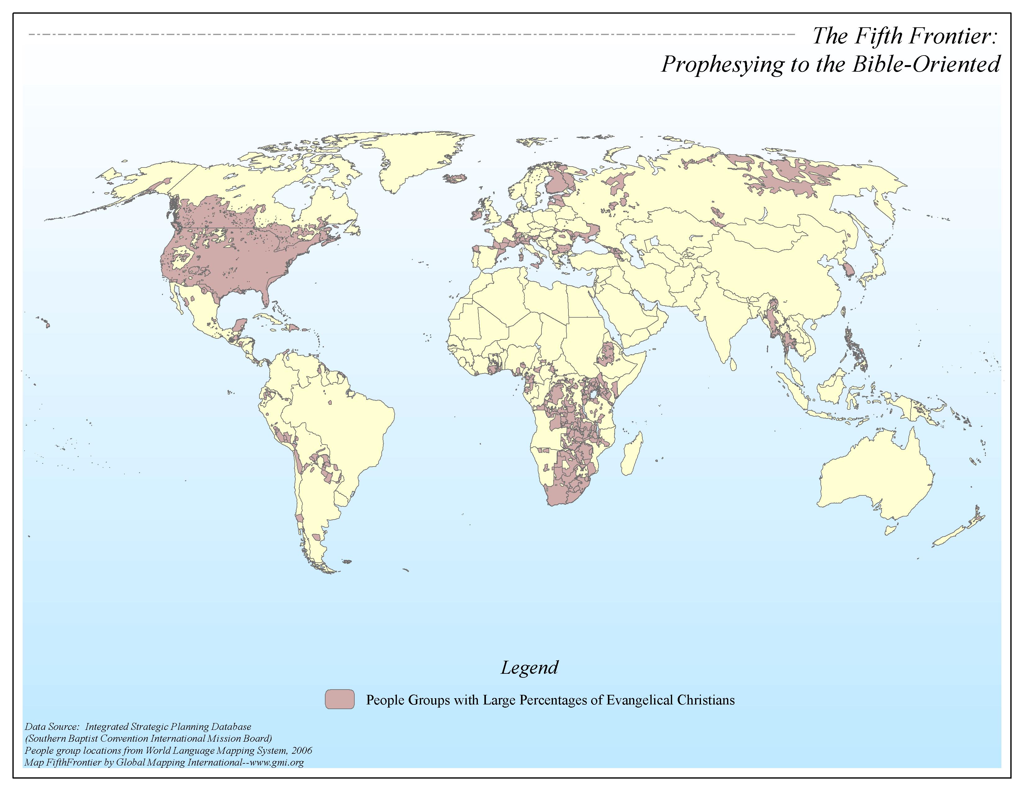 |
·Type: Maps ·Map Date: 2006 ·Data Source: Integrated Strategic Planning Database (SBC-IMB) People group locations from World Language Mapping System, 2006 ·Producer: Global Mapping International ·Collection: Omega Model of Mission GMMS 2007 ·Size: 8½ x 11 inches, landscape ·Categories: Type :: Maps Continent/Region :: World Topic :: Strategy Topic :: Concepts Collection :: GMI Map Collections :: Omega Model of Mission GMMS 2007 Partners... |
... more info
Max: 1
|
|
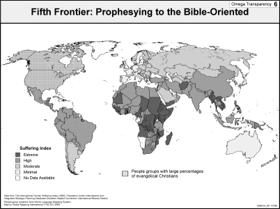 |
·Type: Maps ·Description: Prophesying to the Bible-Oriented is the Fith Frontier ·Map Date: 2002 ·Producer: Global Mapping International ·Collection: Omega Model of Mission (WV 2002) ·Size: 8½ x 11 Inches, landscape ·Categories: Type :: Maps Collection :: GMI Map Collections :: Omega Model of Mission (WV 2002) Continent/Region :: World Topic :: Strategy Topic :: Concepts Partners :: Global Mapping International |
... more info
Max: 1
|
|
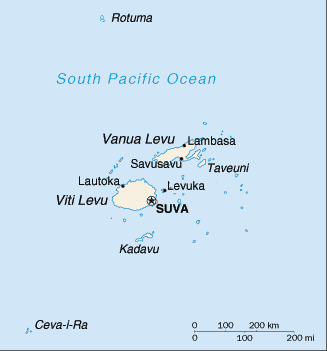 |
·Type: Maps ·Description: Fiji (Factbook) ·Map Date: 2007 ·Producer: US Government ·Collection: World Factbook country maps ·Size: 329x352 px, landscape ·Categories: Type :: Maps Continent/Region :: Oceania Collection :: World Factbook country maps Country :: Fiji Partners :: U.S. Government |
... more info
Max: 1
|
|
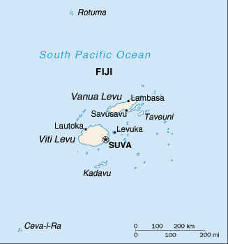 |
·Type: Maps ·Description: Fiji (World Factbook, modified to add country name) ·Map Date: 2007 ·Producer: US Government modified by Joshua Project ·Collection: World Factbook country maps ·Size: 329x352 px, landscape ·Categories: Type :: Maps Continent/Region :: Oceania Collection :: World Factbook country maps Country :: Fiji Partners :: U.S. Government |
... more info
Max: 1
|
|
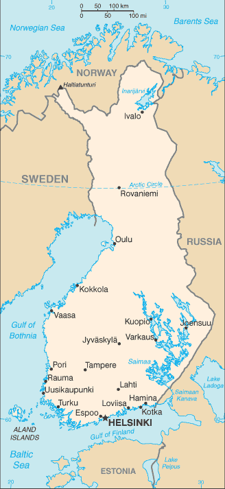 |
·Type: Maps ·Description: Finland (Factbook) ·Map Date: 2007 ·Producer: US Government ·Collection: World Factbook country maps ·Size: 329x353 px, landscape ·Categories: Type :: Maps Continent/Region :: Europe Collection :: World Factbook country maps Country :: Finland Partners :: U.S. Government |
... more info
Max: 1
|
|
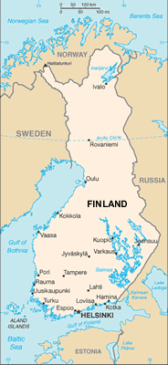 |
·Type: Maps ·Description: Finland (World Factbook, modified to add country name) ·Map Date: 2007 ·Producer: US Government modified by Joshua Project ·Collection: World Factbook country maps ·Size: 329x353 px, landscape ·Categories: Type :: Maps Continent/Region :: Europe Collection :: World Factbook country maps Country :: Finland Partners :: U.S. Government |
... more info
Max: 1
|
|
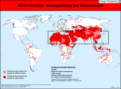 |
·Type: Maps ·Description: Evangelizing the Disoriented is the First Frontier ·Map Date: 1999 ·Producer: Global Mapping International ·Collection: Omega Model of Mission (WV 2002) ·Size: 8½ x 11 Inches, landscape ·Categories: Type :: Maps Collection :: GMI Map Collections :: Omega Model of Mission (WV 2002) Continent/Region :: World Topic :: Strategy Topic :: Concepts Topic :: Peoples, multiple or unknown Partners :: Global Mapping... |
... more info
Max: 1
|
|
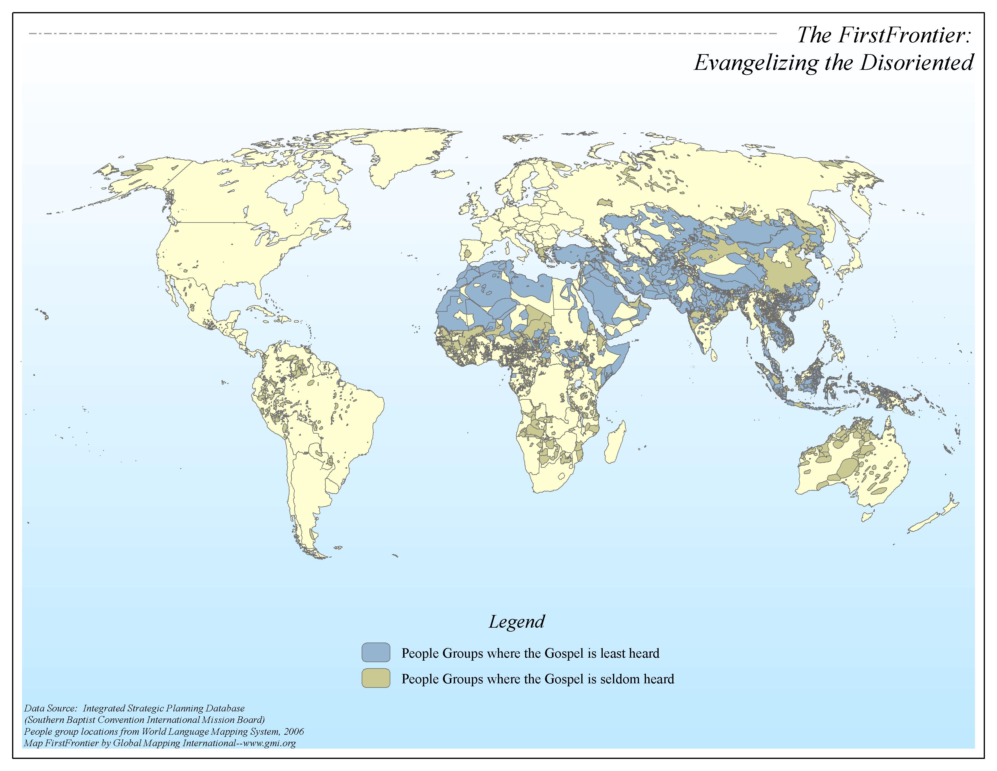 |
·Type: Maps ·Map Date: 2006 ·Data Source: Integrated Strategic Planning Database (SBC-IMB) People group locations from World Language Mapping System, 2006 ·Producer: Global Mapping International ·Collection: Omega Model of Mission GMMS 2007 ·Size: 8½ x 11 inches, landscape ·Categories: Type :: Maps Continent/Region :: World Topic :: Strategy Topic :: Concepts Collection :: GMI Map Collections :: Omega Model of Mission GMMS 2007 Partners... |
... more info
Max: 1
|
|
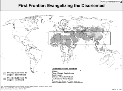 |
·Type: Maps ·Description: Evangelizing the Disoriented is the First Frontier ·Map Date: 2002 ·Producer: Global Mapping International ·Collection: Omega Model of Mission (WV 2002) ·Size: 8½ x 11 Inches, landscape ·Categories: Type :: Maps Collection :: GMI Map Collections :: Omega Model of Mission (WV 2002) Continent/Region :: World Topic :: Strategy Topic :: Concepts Topic :: Peoples, multiple or unknown Partners :: Global Mapping... |
... more info
Max: 1
|
|
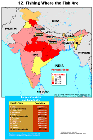 |
·Type: Maps ·Description: Fishing Where the Fish Are ·Map Date: 2001 ·Producer: Global Mapping International ·Collection: Missions Minute (WorldVue 2002) ·Size: 8½ x 11 Inches, portrait ·Categories: Type :: Maps Collection :: GMI Map Collections :: Missions Minute (WorldVue 2002) Continent/Region :: Middle East Topic :: Statistical Topic :: Strategy Topic :: Concepts Type :: Graphs Country :: India Partners :: Global Mapping International... |
... more info
Max: 1
|
|
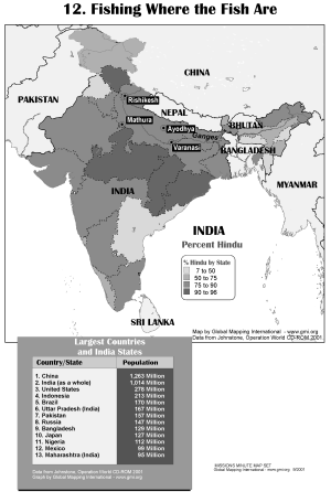 |
·Type: Maps ·Description: Fishing Where the Fish Are ·Map Date: 2002 ·Producer: Global Mapping International ·Collection: Missions Minute (WorldVue 2002) ·Size: 8½ x 11 Inches, portrait ·Categories: Type :: Maps Collection :: GMI Map Collections :: Missions Minute (WorldVue 2002) Continent/Region :: Middle East Topic :: Statistical Topic :: Strategy Topic :: Concepts Type :: Graphs Country :: India Partners :: Global Mapping International... |
... more info
Max: 1
|
|
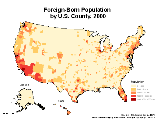 |
·Type: Maps ·Description: ·Collection: Projects 2007 ·Categories: Type :: Maps Country :: United States of America Topic :: Demography Partners :: Global Mapping International Collection :: GMI Map Collections :: Projects 2007 ·Collection: Projects 2007 ·Categories: Type :: Maps Country :: United States of America Topic :: Demography Partners :: Global Mapping International Collection :: GMI Map Collections :: Projects 2007 |
... more info
Max: 1
|
|
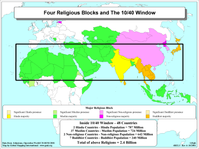 |
·Type: Maps ·Description: Religious Blocks in the 10/40 Window ·Map Date: 2001 ·Producer: Global Mapping International ·Collection: The 10/40 Window (WorldVue 2002) ·Size: 8½ x 11 Inches, landscape ·Categories: Type :: Maps Collection :: GMI Map Collections :: The 10/40 Window (WorldVue 2002) Topic :: Statistical Topic :: Concepts Partners :: Global Mapping International Topic :: Religions, General :: Multiple/Other Continent/Region ::... |
... more info
Max: 1
|
|
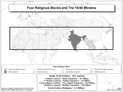 |
·Type: Maps ·Description: Religious Blocks in the 10/40 Window ·Map Date: 2002 ·Producer: Global Mapping International ·Collection: The 10/40 Window (WorldVue 2002) ·Size: 8½ x 11 Inches, landscape ·Categories: Type :: Maps Collection :: GMI Map Collections :: The 10/40 Window (WorldVue 2002) Topic :: Statistical Topic :: Concepts Partners :: Global Mapping International Topic :: Religions, General :: Multiple/Other Continent/Region ::... |
... more info
Max: 1
|
|
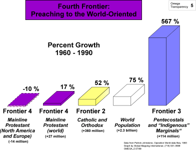 |
·Type: Maps ·Description: Preaching to the World-Oriented is the Fourth Frontier ·Map Date: 1999 ·Producer: Global Mapping International ·Collection: Omega Model of Mission (WV 2002) ·Size: 8½ x 11 Inches, landscape ·Categories: Type :: Maps Collection :: GMI Map Collections :: Omega Model of Mission (WV 2002) Continent/Region :: World Topic :: Strategy Topic :: Concepts Type :: Graphs Partners :: Global Mapping International |
... more info
Max: 1
|
|