| Product Image |
Resource Name- |
Price |
Manufacturer |
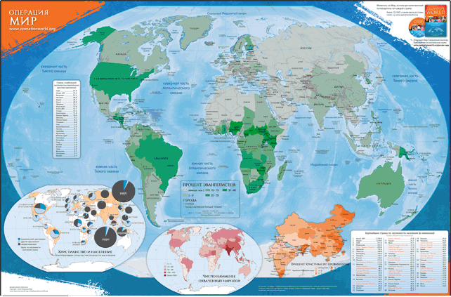 |
Доступно на английском, французском, португальском и испанском языках. Эта полноцветная карта мира содержит статистику и информацию, представленные в 7-м издании «Операция мир» (2010) и «Молитва за мир». Размер карты: 36" x 24" (60,96 см x 91,44 см). Главная карта отображает процент... |
... more info
|
|
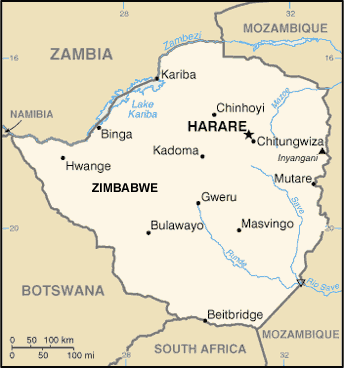 |
·Type: Maps ·Description: Zimbabwe (World Factbook, modified to add country name) ·Map Date: 2007 ·Producer: US Government modified by Joshua Project ·Collection: World Factbook country maps ·Size: 344x368 px, landscape ·Categories: Type :: Maps Continent/Region :: Africa Collection :: World Factbook country maps Country :: Zimbabwe Partners :: U.S. Government |
... more info
Max: 1
|
|
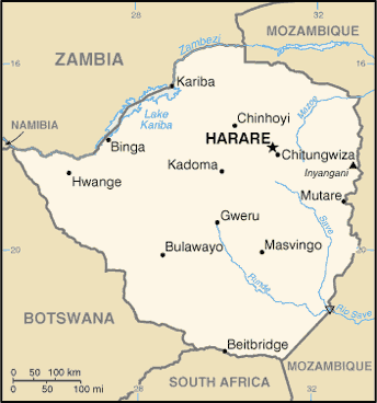 |
·Type: Maps ·Description: Zimbabwe (Factbook) ·Map Date: 2007 ·Producer: US Government ·Collection: World Factbook country maps ·Size: 344x368 px, landscape ·Categories: Type :: Maps Continent/Region :: Africa Collection :: World Factbook country maps Country :: Zimbabwe Partners :: U.S. Government |
... more info
Max: 1
|
|
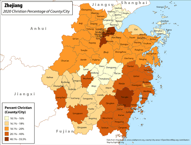 |
· Type: Maps · Map Date: 2017 · Data Source: Asia Harvest; county/city areas © OpenStreetMap contributors, http://www.openstreetmap.org/copyright. Data available under the Open Database License · Producer: LightSys Technology Services · Collection: Projects 2017 · Size: 8½ x 11 inches, landscape · Categories: Type :: Maps Continent/Region :: Asia Country :: China Topic :: Statistical Topic :: Religions,... |
... more info
|
|
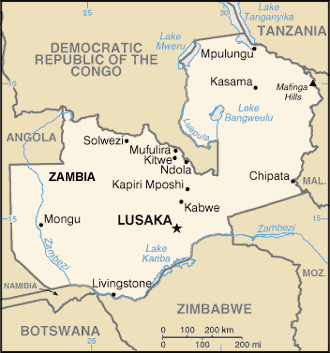 |
·Type: Maps ·Description: Zambia (World Factbook, modified to add country name) ·Map Date: 2007 ·Producer: US Government modified by Joshua Project ·Collection: World Factbook country maps ·Size: 330x353 px, landscape ·Categories: Type :: Maps Continent/Region :: Africa Collection :: World Factbook country maps Country :: Zambia Partners :: U.S. Government |
... more info
Max: 1
|
|
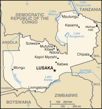 |
·Type: Maps ·Description: Zambia (Factbook) ·Map Date: 2007 ·Producer: US Government ·Collection: World Factbook country maps ·Size: 330x353 px, landscape ·Categories: Type :: Maps Continent/Region :: Africa Collection :: World Factbook country maps Country :: Zambia Partners :: U.S. Government |
... more info
Max: 1
|
|
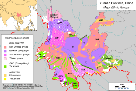 |
·Type: Maps ·Description: Major Ethnic Groups in Yunnan Province in China ·Map Date: 2001 ·Producer: Global Mapping International ·Collection: China SW Minorities (WV 2002) ·Size: 8½ x 11 Inches, landscape ·Note: Windows Metafile and Metafile in Word forms of this map require the GMISym.ttf font ·Categories: Type :: Maps Collection :: GMI Map Collections :: China SW Minorities (WV 2002) Continent/Region :: Asia Topic :: Peoples,... |
... more info
Max: 1
|
|
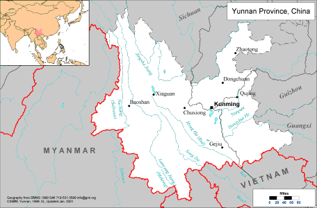 |
·Type: Maps ·Description: Political Map of Yunnan Province in China ·Map Date: 2001 ·Producer: Global Mapping International ·Collection: China SW Minorities (WV 2002) ·Size: 8½ x 11 Inches, landscape ·Note: Windows Metafile and Metafile in Word forms of this map require the GMISym.ttf font ·Categories: Type :: Maps Collection :: GMI Map Collections :: China SW Minorities (WV 2002) Continent/Region :: Asia Country :: China Partners... |
... more info
Max: 1
|
|
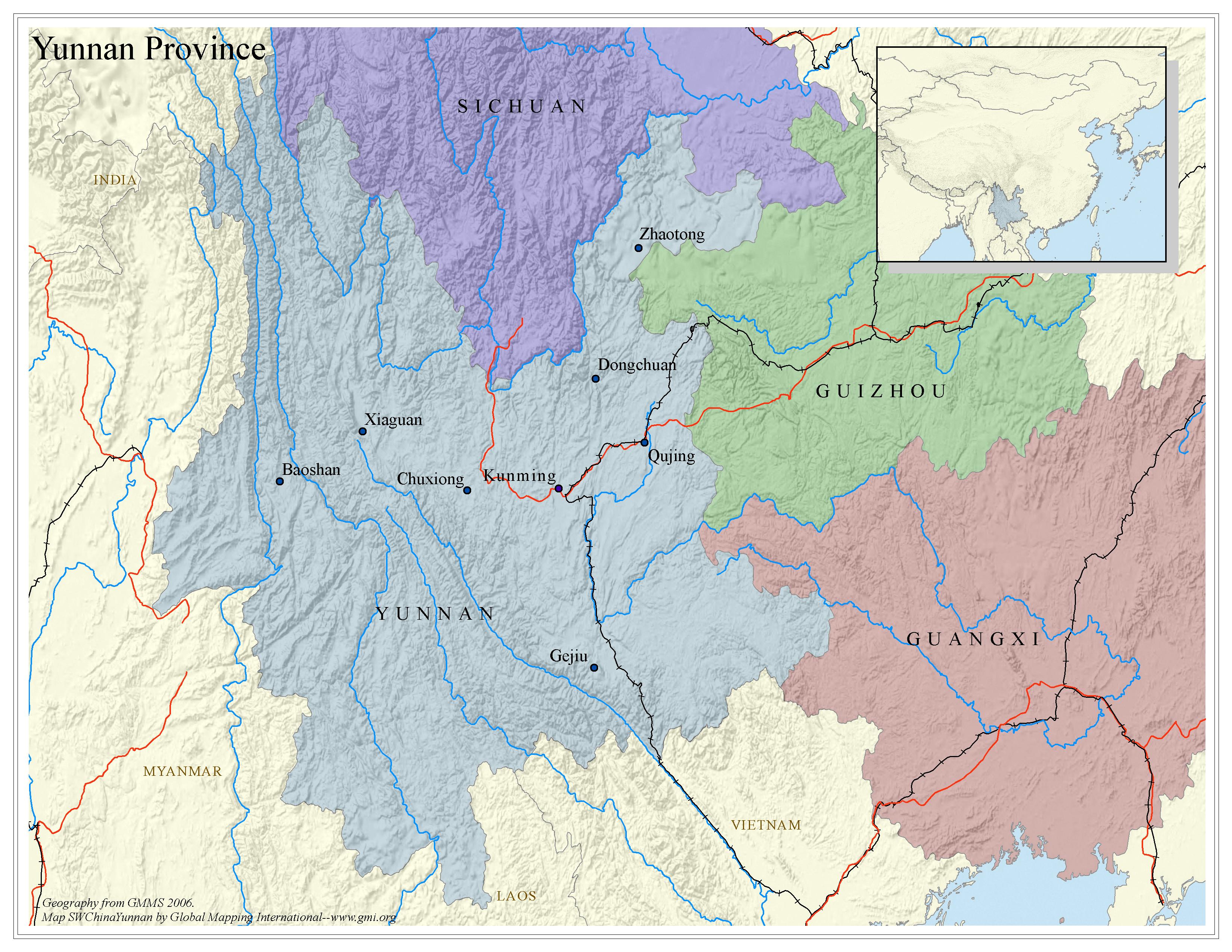 |
·Type: Maps ·Map Date: 2006 ·Data Source: Geography from GMMS 2006. ·Producer: Global Mapping International ·Collection: China SW Minorities (GMMS 2007) ·Size: 8½ x 11 inches, landscape ·Categories: Type :: Maps Continent/Region :: Asia Country :: China Collection :: GMI Map Collections :: China SW Minorities (GMMS 2007) Partners :: Global Mapping International Topic :: Geography :: Maps |
... more info
Max: 1
|
|
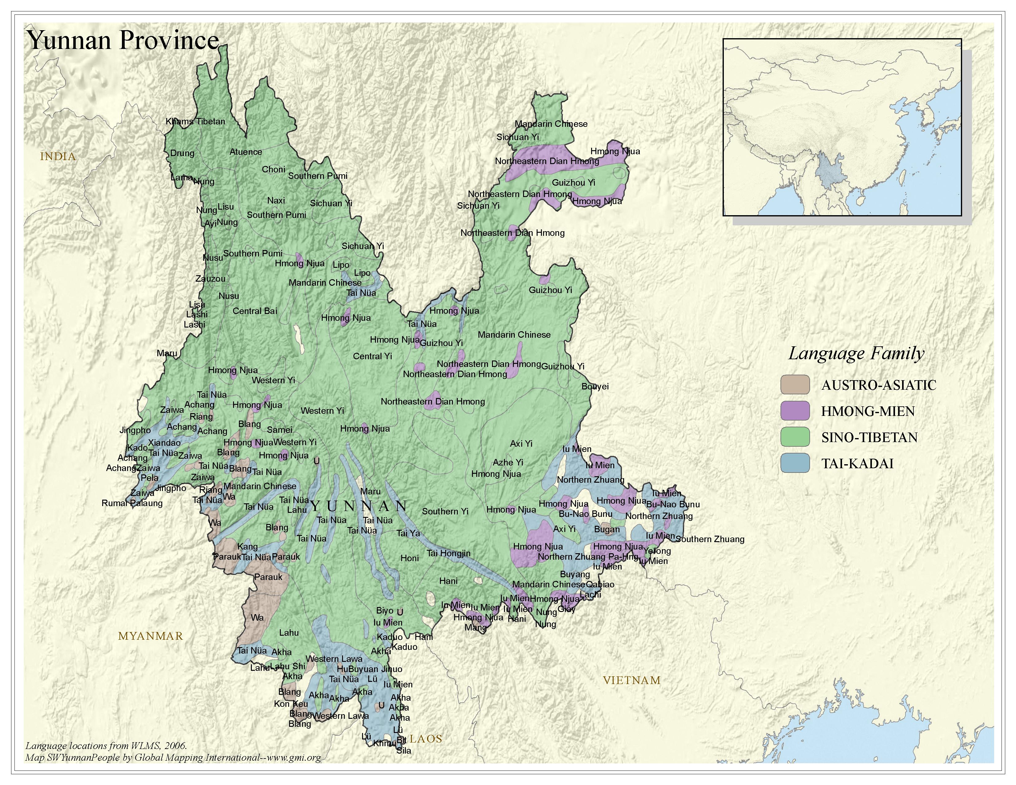 |
·Type: Maps ·Map Date: 2006 ·Data Source: Language locations from WLMS 2006. ·Producer: Global Mapping International ·Collection: China SW Minorities (GMMS 2007) ·Size: 8½ x 11 inches, landscape ·Categories: Type :: Maps Continent/Region :: Asia Topic :: Peoples, multiple or unknown Country :: China Collection :: GMI Map Collections :: China SW Minorities (GMMS 2007) Partners :: Global Mapping International |
... more info
Max: 1
|
|
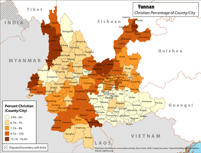 |
· Type: Maps · Map Date: 2018 · Data Source: Asia Harvest; county/city areas © OpenStreetMap contributors, http://www.openstreetmap.org/copyright. Data available under the Open Database License · Partners: LightSys Technology Services · Collection: Projects 2018 · Size: 8½ x 11 inches, landscape · Categories: Type :: Maps Continent/Region :: Asia Country :: China Topic :: Statistical Topic :: Religions,... |
... more info
|
|
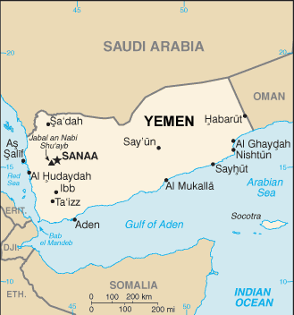 |
·Type: Maps ·Description: Yemen (World Factbook, modified to add country name) ·Map Date: 2007 ·Producer: US Government modified by Joshua Project ·Collection: World Factbook country maps ·Size: 329x352 px, landscape ·Categories: Type :: Maps Continent/Region :: Middle East Collection :: World Factbook country maps Country :: Yemen Partners :: U.S. Government |
... more info
Max: 1
|
|
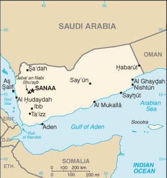 |
·Type: Maps ·Description: Yemen (Factbook) ·Map Date: 2007 ·Producer: US Government ·Collection: World Factbook country maps ·Size: 329x352 px, landscape ·Categories: Type :: Maps Continent/Region :: Middle East Collection :: World Factbook country maps Country :: Yemen Partners :: U.S. Government |
... more info
Max: 1
|
|
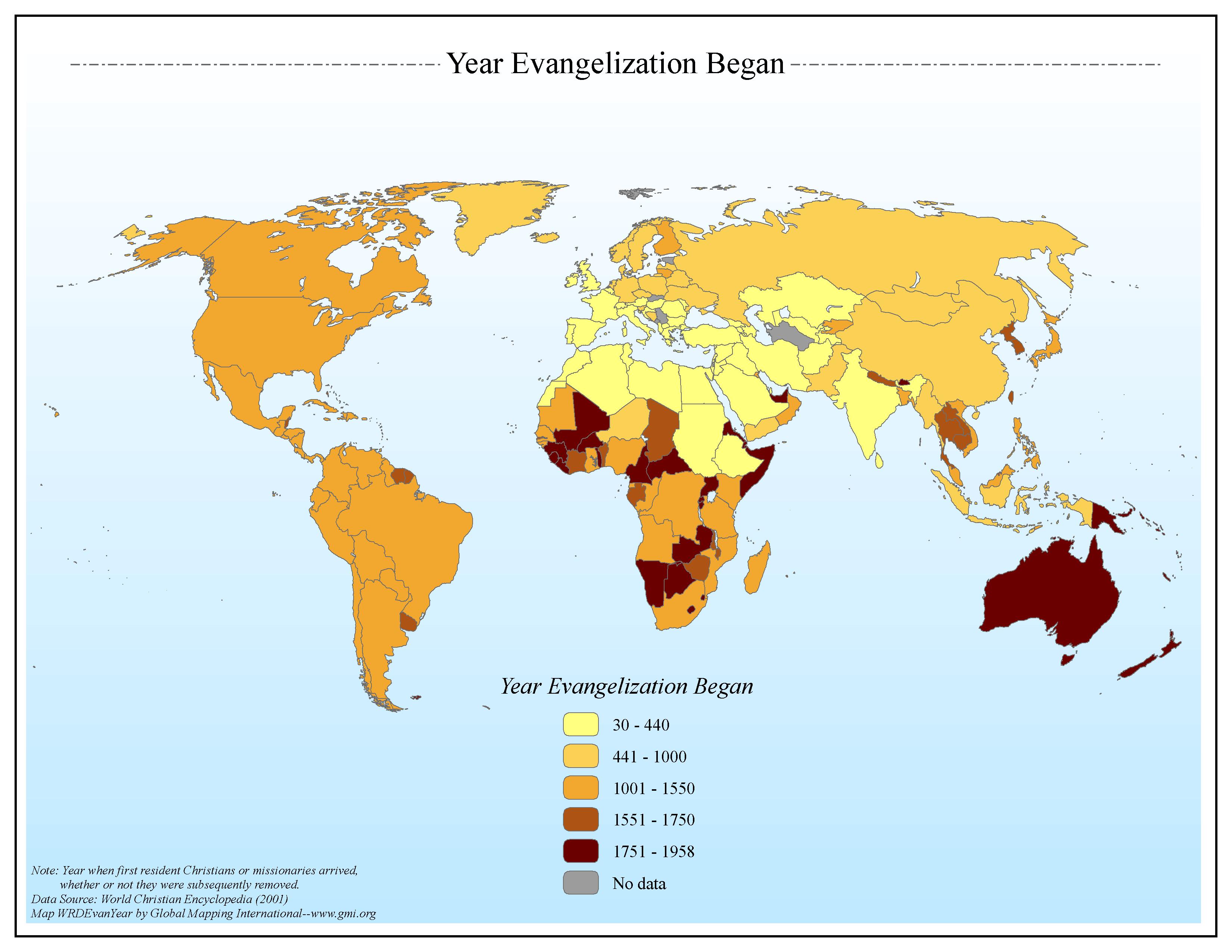 |
·Type: Maps ·Map Date: 2006 ·Data Source: World Christian Encyclopedia (2001) ·Producer: Global Mapping International ·Collection: General World Maps (GMMS 2007) ·Size: 8½ x 11 inches, landscape ·Categories: Type :: Maps Continent/Region :: World Topic :: History Collection :: GMI Map Collections :: General World Maps (GMMS 2007) Partners :: Global Mapping International |
... more info
Max: 1
|
|
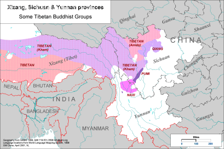 |
·Type: Maps ·Description: Some Tibetan Buddhist Groups in Xizang, Shchuan & Yunnan provinces ·Map Date: 2001 ·Producer: Global Mapping International ·Collection: Himalayan Buddhist Ppl (WV 2002) ·Size: 8½ x 11 Inches, landscape ·Categories: Type :: Maps Collection :: GMI Map Collections :: Himalayan Buddhist Ppl (WV 2002) Continent/Region :: Asia Topic :: Peoples, multiple or unknown Country :: China Partners :: Global Mapping... |
... more info
Max: 1
|
|
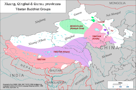 |
·Type: Maps ·Description: Tibetan Buddhist Groups in Xizang, Qinghai & Gansu provinces ·Map Date: 2001 ·Producer: Global Mapping International ·Collection: Himalayan Buddhist Ppl (WV 2002) ·Size: 8½ x 11 Inches, landscape ·Categories: Type :: Maps Collection :: GMI Map Collections :: Himalayan Buddhist Ppl (WV 2002) Continent/Region :: Asia Country :: China Partners :: Global Mapping International |
... more info
Max: 1
|
|
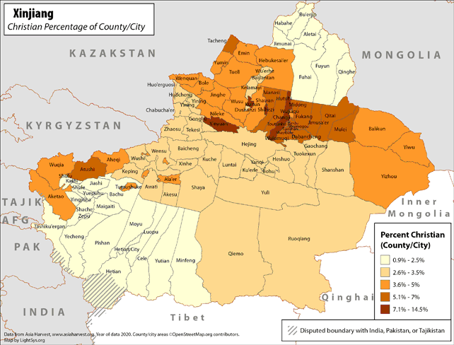 |
· Type: Maps · Map Date: 2019 · Data Source: Asia Harvest; county/city areas © OpenStreetMap contributors, http://www.openstreetmap.org/copyright. Data available under the Open Database License · Partners: LightSys Technology Services · Collection: Projects 2019 · Size: 8½ x 11 inches, landscape · Categories: Type :: Maps Continent/Region :: Asia Country :: China Topic :: Statistical Topic :: Religions,... |
... more info
|
|
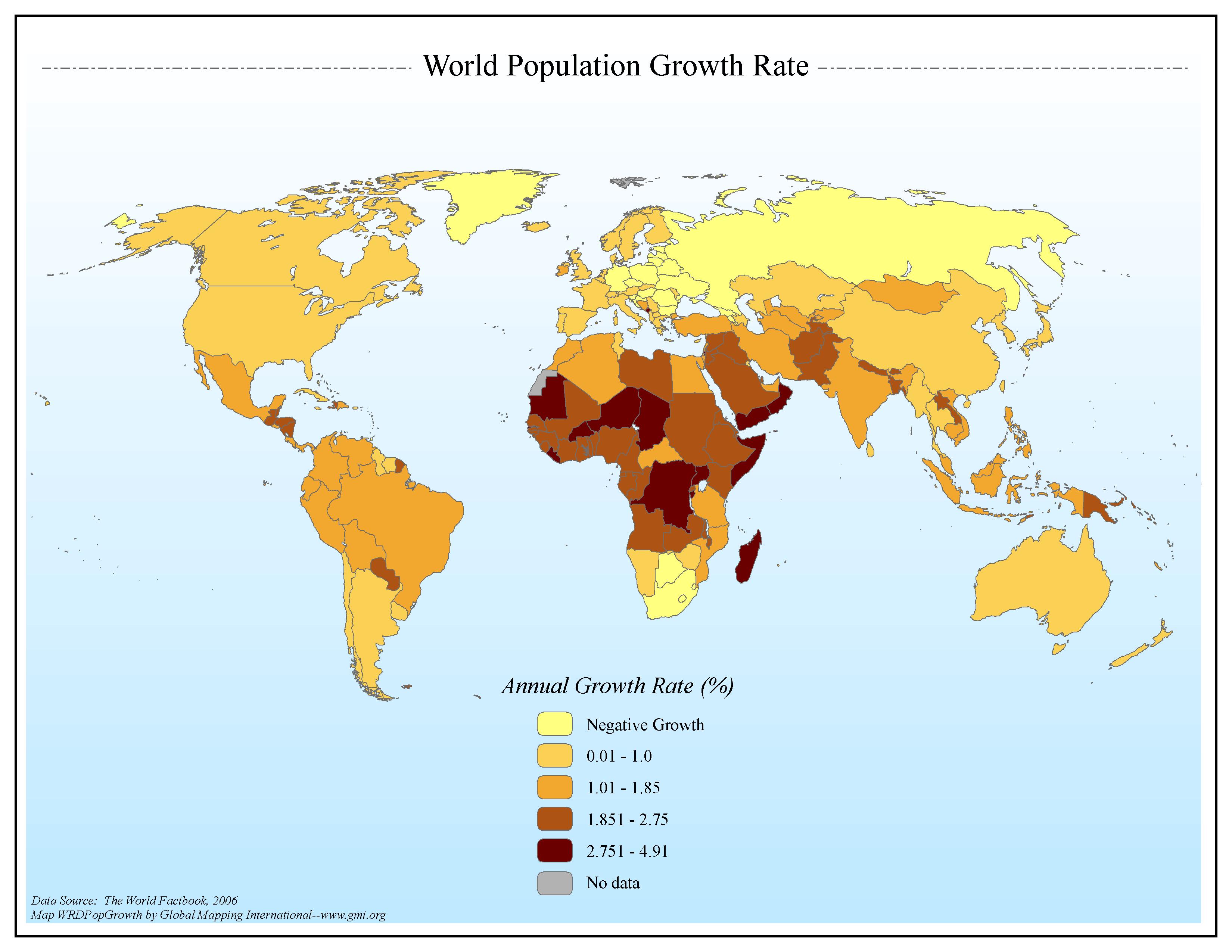 |
·Type: Maps ·Map Date: 2006 ·Data Source: The World Factbook, 2006 ·Producer: Global Mapping International ·Collection: Factbook (GMMS 2007) ·Size: 8½ x 11 inches, landscape ·Categories: Type :: Maps Continent/Region :: World Topic :: Statistical Topic :: Demography Collection :: GMI Map Collections :: Factbook (GMMS 2007) Collection :: GMI Map Collections :: General World Maps (GMMS 2007) Partners :: Global Mapping International |
... more info
Max: 1
|
|
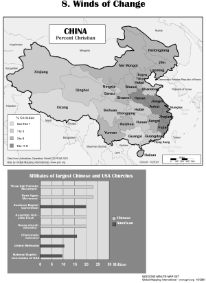 |
·Type: Maps ·Description: The Winds of Change ·Map Date: 2002 ·Producer: Global Mapping International ·Collection: Missions Minute (WorldVue 2002) ·Size: 8½ x 11 Inches, portrait ·Categories: Type :: Maps Collection :: GMI Map Collections :: Missions Minute (WorldVue 2002) Continent/Region :: Asia Topic :: Statistical Topic :: Concepts Type :: Graphs Country :: China Partners :: Global Mapping International Topic :: Religions,... |
... more info
Max: 1
|
|
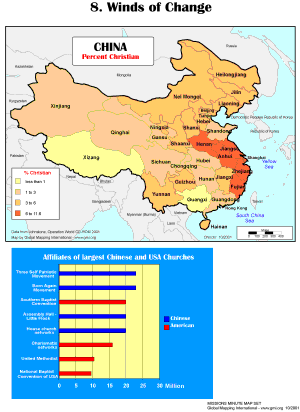 |
·Type: Maps ·Description: The Winds of Change ·Map Date: 2001 ·Producer: Global Mapping International ·Collection: Missions Minute (WorldVue 2002) ·Size: 8½ x 11 Inches, portrait ·Categories: Type :: Maps Collection :: GMI Map Collections :: Missions Minute (WorldVue 2002) Continent/Region :: Asia Topic :: Statistical Topic :: Concepts Type :: Graphs Country :: China Partners :: Global Mapping International Topic :: Religions,... |
... more info
Max: 1
|
|
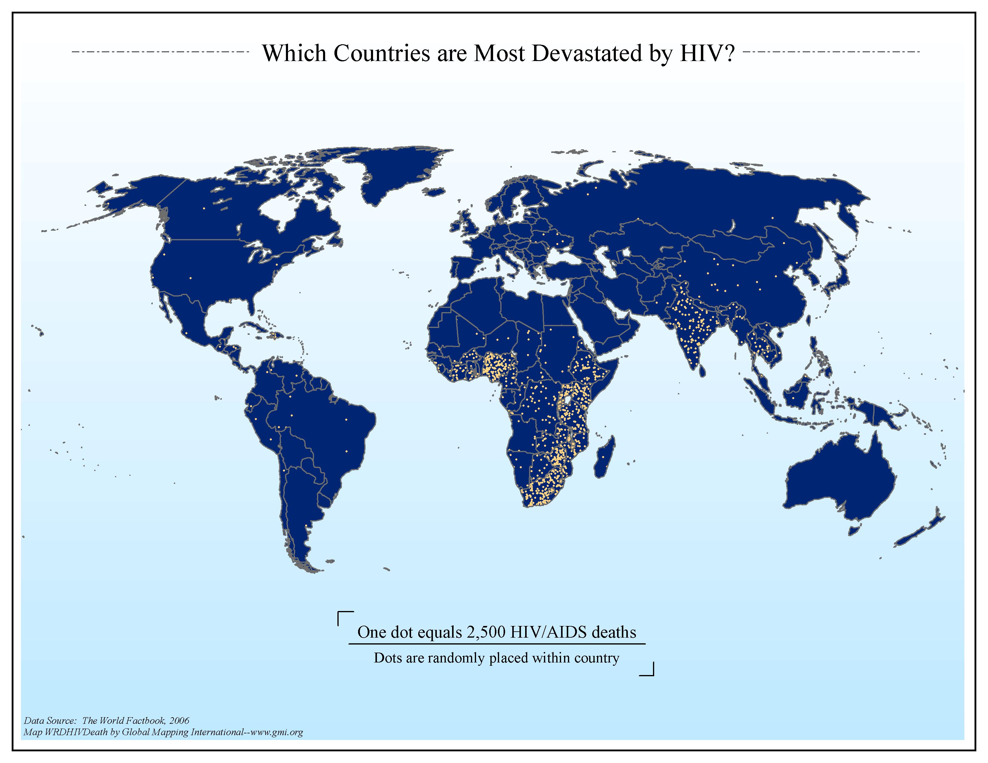 |
·Type: Maps ·Map Date: 2006 ·Data Source: The World Factbook, 2006 ·Producer: Global Mapping International ·Collection: Factbook (GMMS 2007) ·Size: 8½ x 11 inches, landscape ·Categories: Type :: Maps Continent/Region :: World Topic :: Statistical Collection :: GMI Map Collections :: Factbook (GMMS 2007) Collection :: GMI Map Collections :: General World Maps (GMMS 2007) Partners :: Global Mapping International Topic :: Health |
... more info
Max: 1
|
|
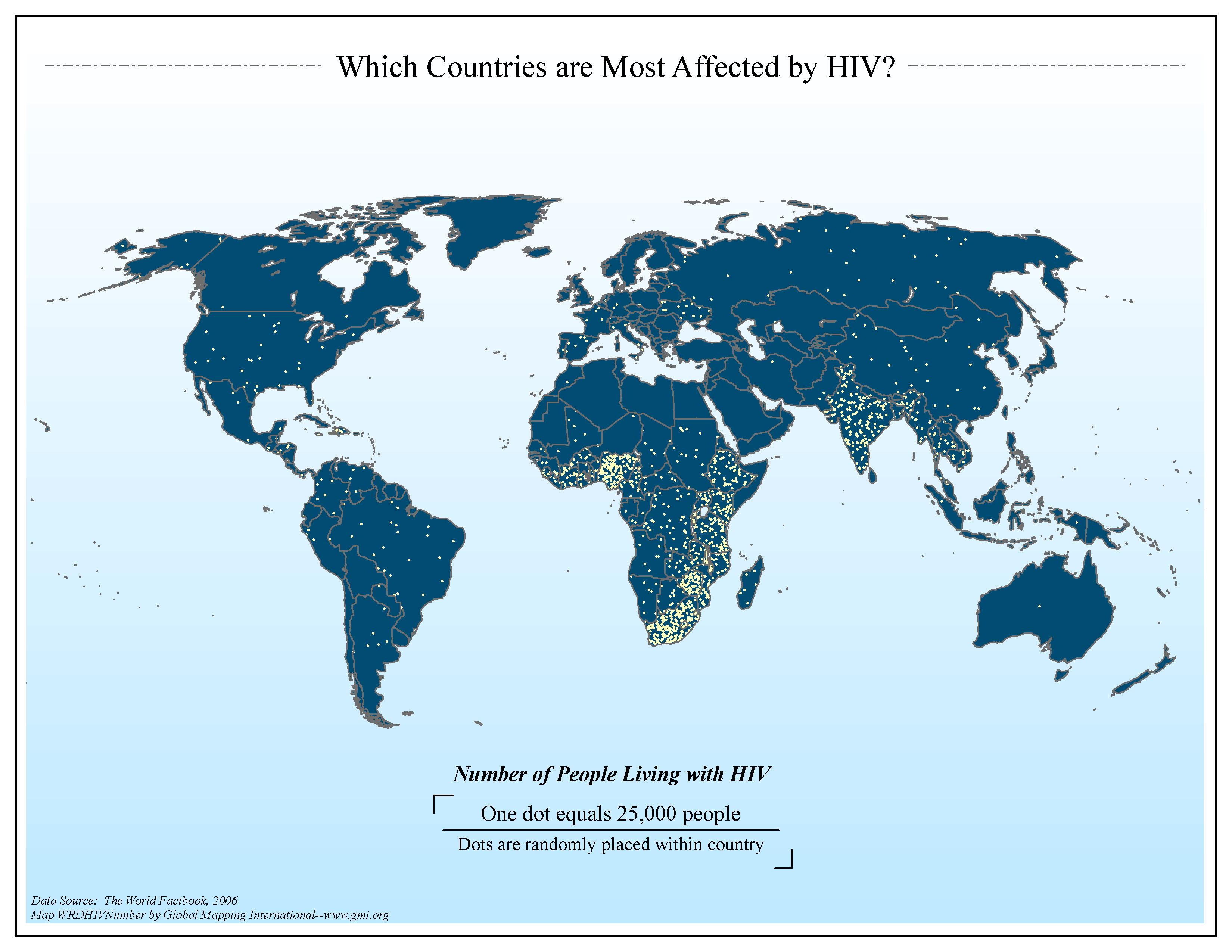 |
·Type: Maps ·Map Date: 2006 ·Data Source: The World Factbook, 2006 ·Producer: Global Mapping International ·Collection: Factbook (GMMS 2007) ·Size: 8½ x 11 inches, landscape ·Categories: Type :: Maps Continent/Region :: World Topic :: Statistical Collection :: GMI Map Collections :: Factbook (GMMS 2007) Collection :: GMI Map Collections :: General World Maps (GMMS 2007) Partners :: Global Mapping International Topic :: Health |
... more info
Max: 1
|
|
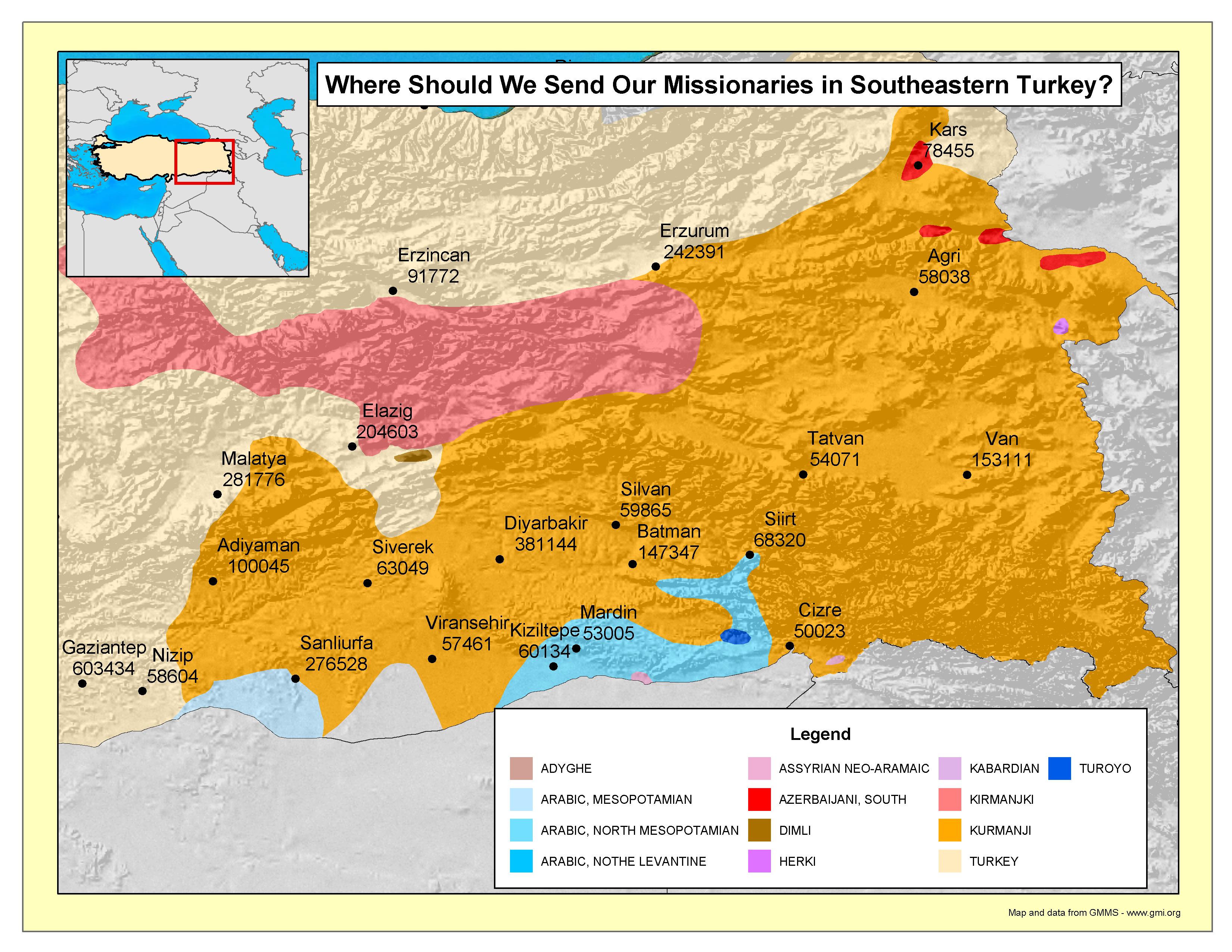 |
·Type: Maps ·Map Date: 2003 ·Producer: GMI ·Collection: Projects 2003 ·Size: 8½ by 11 inches, landscape ·Categories: Type :: Maps Topic :: Strategy Country :: Turkey Partners :: Global Mapping International Collection :: GMI Map Collections :: Projects 2003 |
... more info
Max: 1
|
|
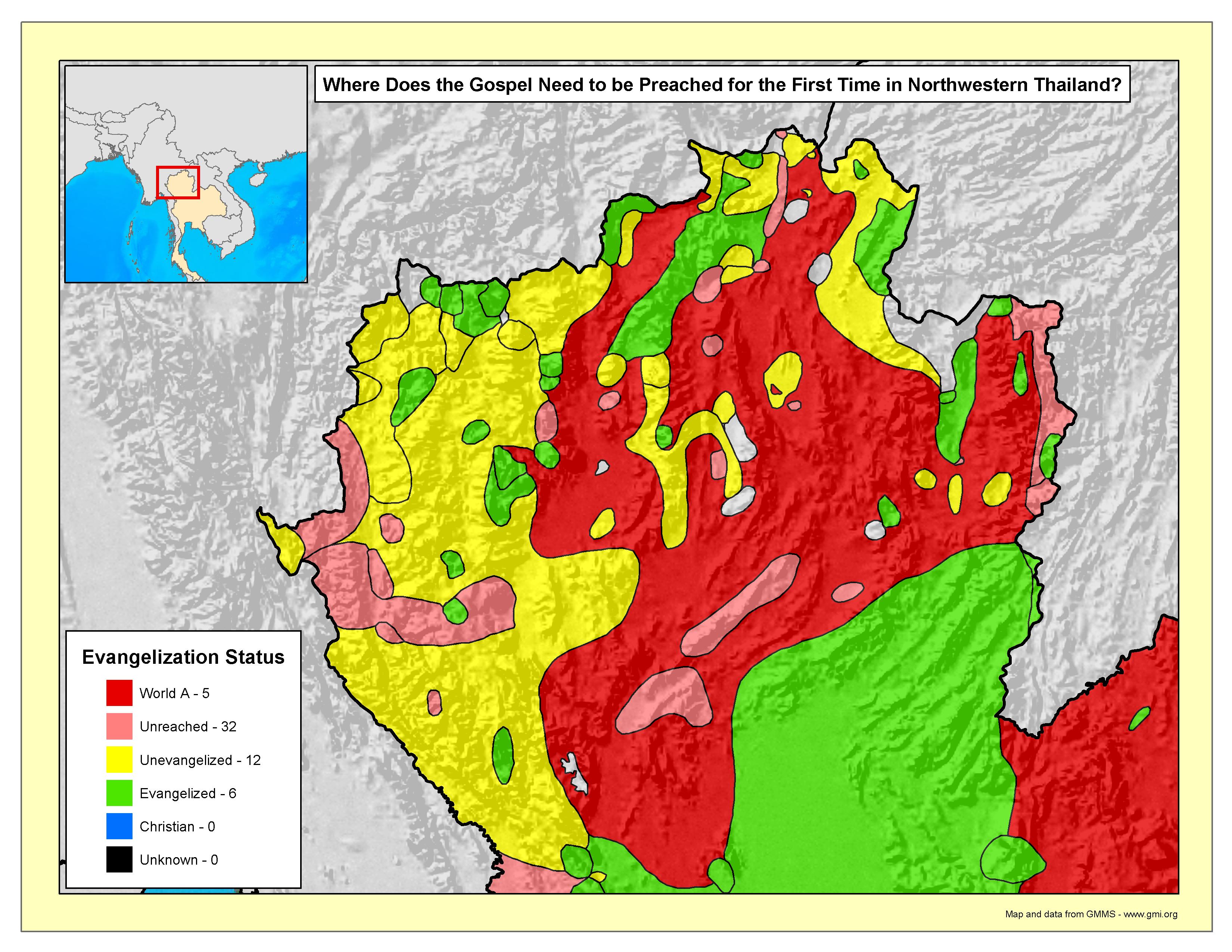 |
·Type: Maps ·Map Date: 2003 ·Producer: GMI ·Collection: Projects 2003 ·Size: 8½ by 11 inches, landscape ·Categories: Type :: Maps Topic :: Strategy Country :: Thailand Partners :: Global Mapping International Collection :: GMI Map Collections :: Projects 2003 Topic :: Religions, Christianity :: Evangelism and Church Planting |
... more info
Max: 1
|
|
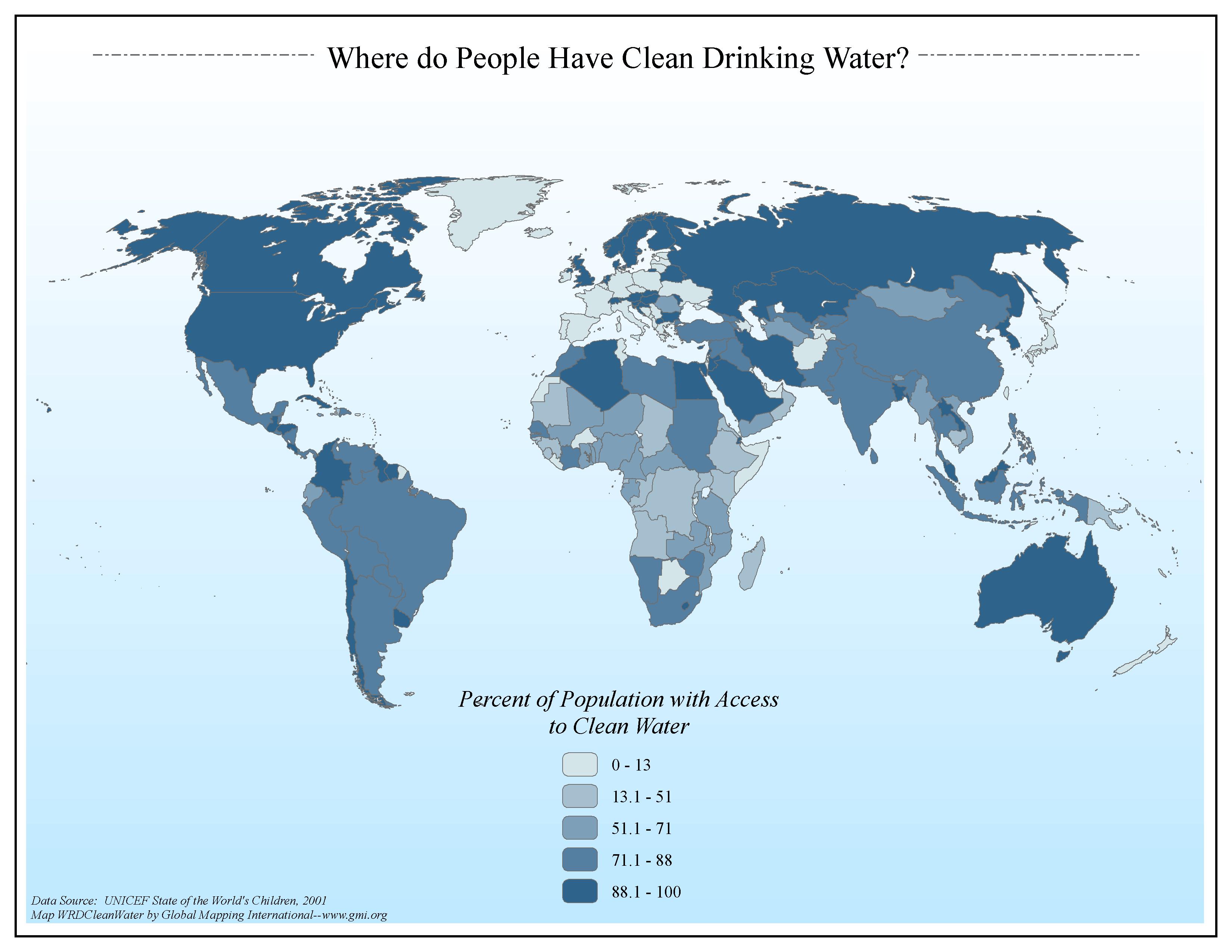 |
·Type: Maps ·Map Date: 2006 ·Data Source: UNICEF State of the World's Children, 2001 ·Producer: Global Mapping International ·Collection: General World Maps (GMMS 2007) ·Size: 8½ x 11 inches, landscape ·Categories: Type :: Maps Continent/Region :: World Topic :: Statistical Topic :: Social Collection :: GMI Map Collections :: General World Maps (GMMS 2007) Partners :: Global Mapping International |
... more info
Max: 1
|
|