China
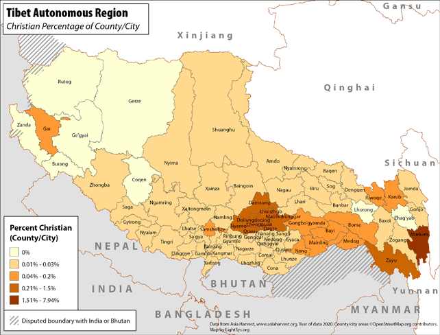
Tibet Autonomous Region - Christian Percentage of County/City
· Type: Maps · Map Date: 2018 · Data Source: Asia Harvest; county/city areas © OpenStreetMap contributors, http://www.openstreetmap.org/copyright. Data available under the Open Database License...
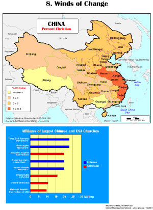
Winds of Change
·Type: Maps ·Description: The Winds of Change ·Map Date: 2001 ·Producer: Global Mapping International ·Collection: Missions Minute (WorldVue 2002) ·Size: 8½ x 11 Inches, portrait ·Categories:...
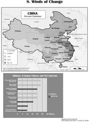
Winds of Change (BW)
·Type: Maps ·Description: The Winds of Change ·Map Date: 2002 ·Producer: Global Mapping International ·Collection: Missions Minute (WorldVue 2002) ·Size: 8½ x 11 Inches, portrait ·Categories:...
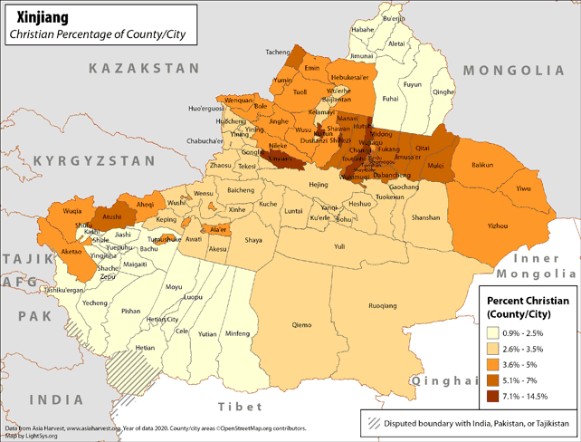
Xinjiang - Christian Percentage of County/City
· Type: Maps · Map Date: 2019 · Data Source: Asia Harvest; county/city areas © OpenStreetMap contributors, http://www.openstreetmap.org/copyright. Data available under the Open Database License...
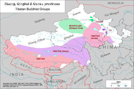
Xizang, Qinghai & Gansu provinces - Tibetan Buddhist Groups
·Type: Maps ·Description: Tibetan Buddhist Groups in Xizang, Qinghai & Gansu provinces ·Map Date: 2001 ·Producer: Global Mapping International ·Collection: Himalayan Buddhist Ppl (WV 2002) ·Size: 8½...
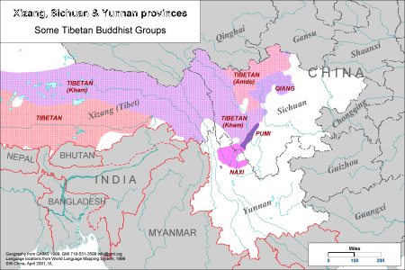
Xizang, Sichuan & Yunnan provinces - Some Tibetan Buddhist Gro
·Type: Maps ·Description: Some Tibetan Buddhist Groups in Xizang, Shchuan & Yunnan provinces ·Map Date: 2001 ·Producer: Global Mapping International ·Collection: Himalayan Buddhist Ppl (WV 2002) ·Size:...
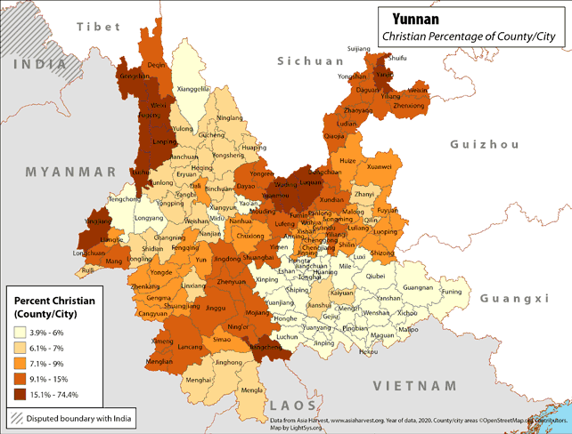
Yunnan - Christian Percentage of County/City
· Type: Maps · Map Date: 2018 · Data Source: Asia Harvest; county/city areas © OpenStreetMap contributors, http://www.openstreetmap.org/copyright. Data available under the Open Database License...
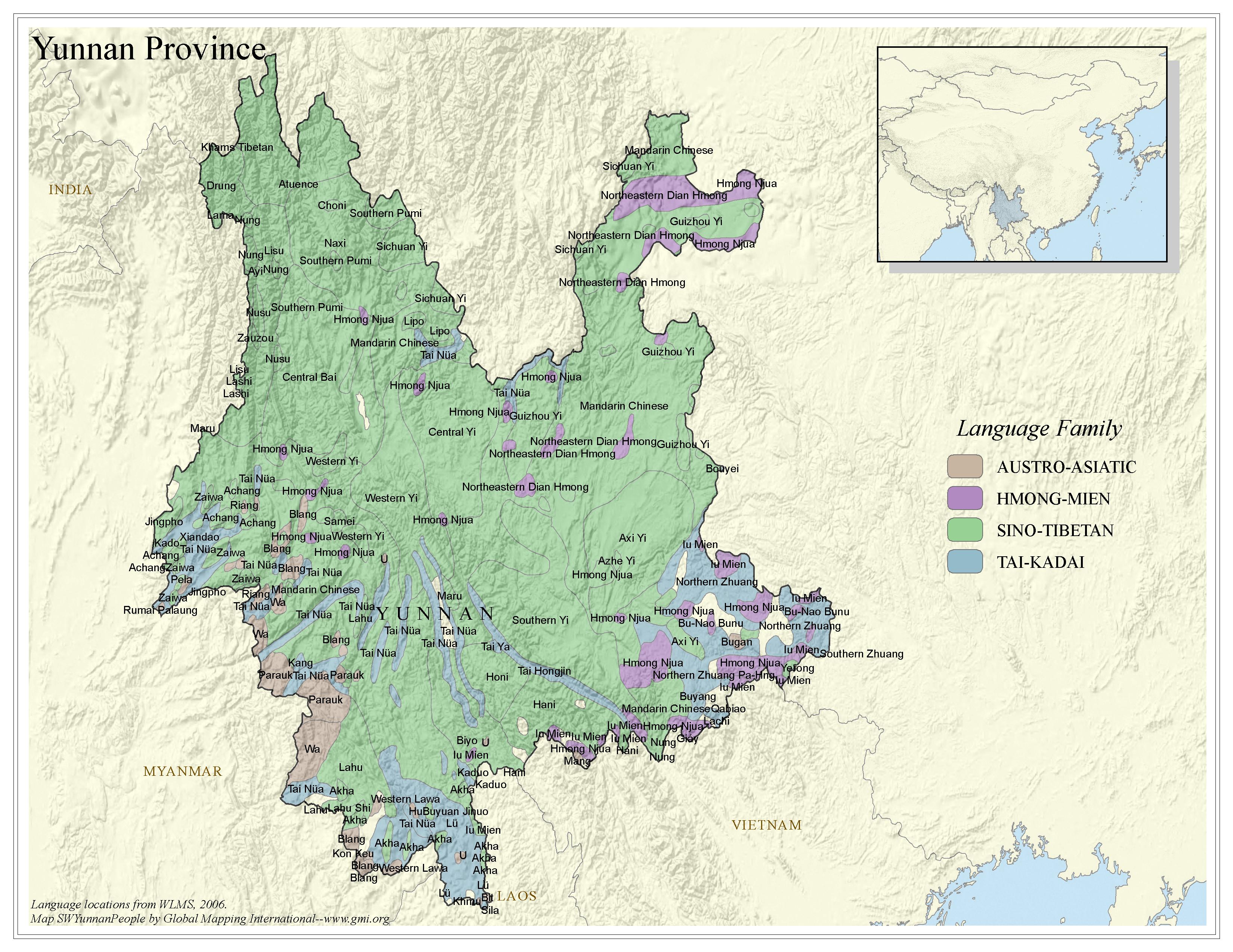
Yunnan Province - Peoples
·Type: Maps ·Map Date: 2006 ·Data Source: Language locations from WLMS 2006. ·Producer: Global Mapping International ·Collection: China SW Minorities (GMMS 2007) ·Size: 8½ x 11 inches, landscape...
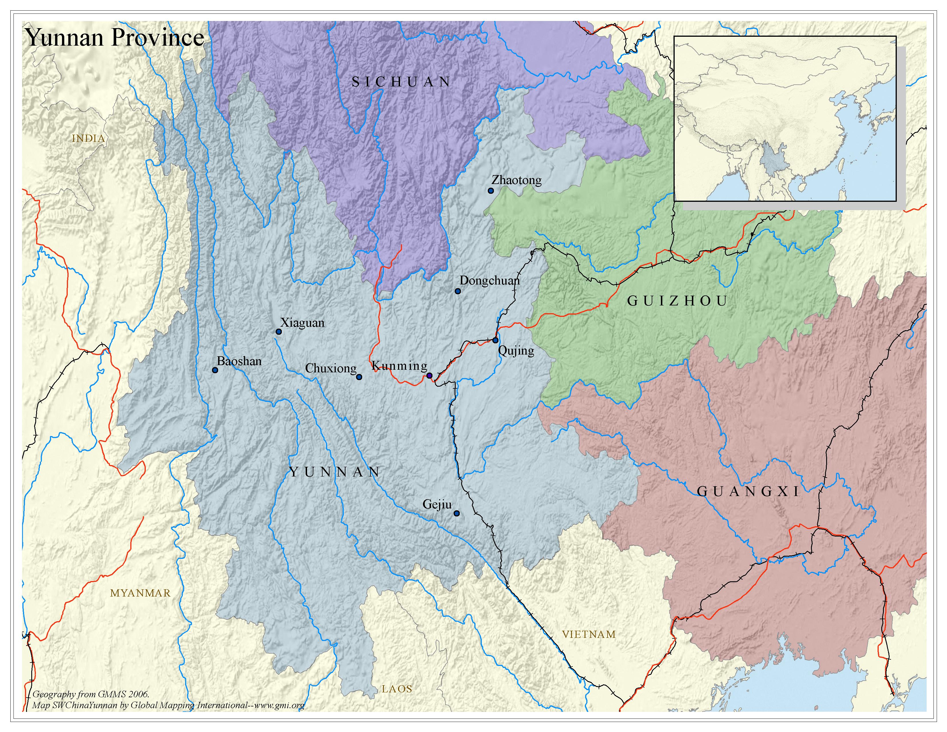
Yunnan Province - Political map
·Type: Maps ·Map Date: 2006 ·Data Source: Geography from GMMS 2006. ·Producer: Global Mapping International ·Collection: China SW Minorities (GMMS 2007) ·Size: 8½ x 11 inches, landscape...
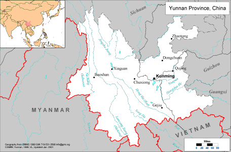
Yunnan Province, China
·Type: Maps ·Description: Political Map of Yunnan Province in China ·Map Date: 2001 ·Producer: Global Mapping International ·Collection: China SW Minorities (WV 2002) ·Size: 8½ x 11 Inches, landscape...
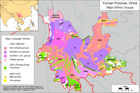
Yunnan Province, China - Major Ethnic Groups
·Type: Maps ·Description: Major Ethnic Groups in Yunnan Province in China ·Map Date: 2001 ·Producer: Global Mapping International ·Collection: China SW Minorities (WV 2002) ·Size: 8½ x 11 Inches,...
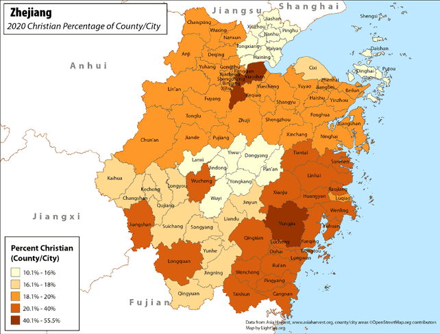
Zhejiang - Christian Percentage of County/City
· Type: Maps · Map Date: 2017 · Data Source: Asia Harvest; county/city areas © OpenStreetMap contributors, http://www.openstreetmap.org/copyright. Data available under the Open Database License...

Boy Bathing / China / Han
·Type: Images ·Data Source: YWAM/John Fries ·Collection: YWAM-John Fries ·Categories: Country :: China Collection :: YWAM-John Fries Partners :: YWAM-John Fries Topic :: Images: Country :: China Topic :: Peoples,...

Forbidden Palace In Tienemen Square, Beijing / China / Chinese
·Type: Images ·Data Source: YWAM/John Fries ·Collection: YWAM-John Fries ·Categories: Country :: China Collection :: YWAM-John Fries Partners :: YWAM-John Fries Topic :: Images: Country :: China Topic :: Peoples,...

McDonalds / China / Chinese
·Type: Images ·Data Source: YWAM/John Fries ·Collection: YWAM-John Fries ·Categories: Country :: China Collection :: YWAM-John Fries Partners :: YWAM-John Fries Topic :: Images: Country :: China Topic :: Peoples,...
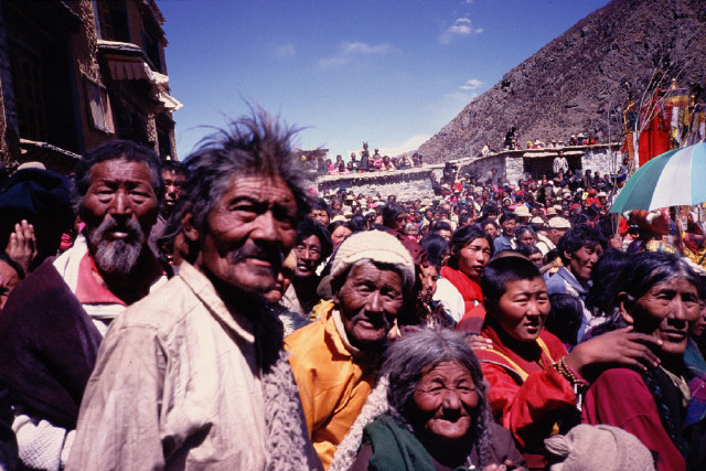
Pilgrimage / China
·Type: Images ·Collection: YWAM-John Fries ·Categories: Topic :: Peoples, multiple or unknown Country :: China Collection :: YWAM-John Fries Partners :: YWAM-John Fries Topic :: Images: Country :: China Type :: Images :: by...

River Boat Houses, Yangtze River / China
·Type: Images ·Data Source: YWAM/John Fries ·Collection: YWAM-John Fries ·Categories: Country :: China Collection :: YWAM-John Fries Partners :: YWAM-John Fries Topic :: Images: Country :: China Type :: Images :: by...

Temple / China
·Type: Images ·Collection: YWAM-John Fries ·Categories: Topic :: Peoples, multiple or unknown Country :: China Collection :: YWAM-John Fries Partners :: YWAM-John Fries Topic :: Images: Country :: China Type :: Images :: by...

Untitled 334 / China
·Type: Images ·Data Source: OC/SEPAL/David Marshall ·Collection: YWAM-John Fries ·Categories: Topic :: Peoples, multiple or unknown Country :: China Collection :: YWAM-John Fries Partners :: YWAM-John Fries Topic ::...

Untitled 335 / China
·Type: Images ·Data Source: OC/SEPAL/David Marshall ·Collection: YWAM-John Fries ·Categories: Topic :: Peoples, multiple or unknown Country :: China Collection :: YWAM-John Fries Partners :: YWAM-John Fries Topic ::...

Untitled 336 / China
·Type: Images ·Data Source: OC/SEPAL/David Marshall ·Collection: YWAM-John Fries ·Categories: Topic :: Peoples, multiple or unknown Country :: China Collection :: YWAM-John Fries Partners :: YWAM-John Fries Topic ::...

Untitled 337 / China
·Type: Images ·Data Source: OC/SEPAL/David Marshall ·Collection: YWAM-John Fries ·Categories: Topic :: Peoples, multiple or unknown Country :: China Collection :: YWAM-John Fries Partners :: YWAM-John Fries Topic ::...
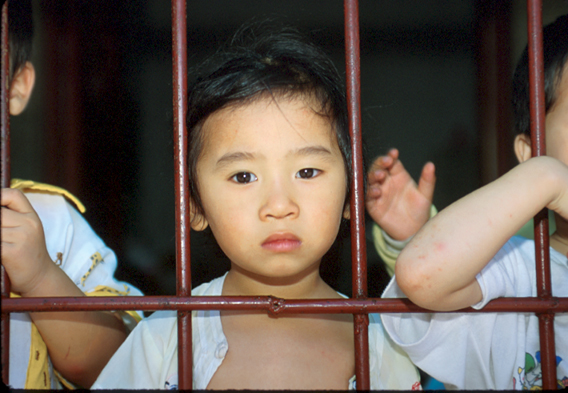
Untitled 338 / China
·Type: Images ·Data Source: OC/SEPAL/David Marshall ·Collection: YWAM-John Fries ·Categories: Topic :: Peoples, multiple or unknown Country :: China Collection :: YWAM-John Fries Partners :: YWAM-John Fries Topic ::...
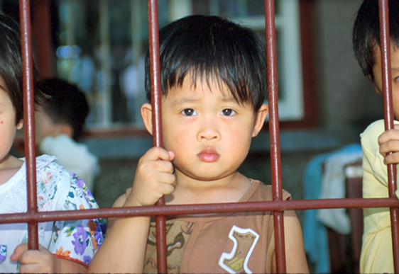
Untitled 339 / China
·Type: Images ·Data Source: OC/SEPAL/David Marshall ·Collection: YWAM-John Fries ·Categories: Topic :: Peoples, multiple or unknown Country :: China Collection :: YWAM-John Fries Partners :: YWAM-John Fries Topic ::...

Untitled 340 / China
·Type: Images ·Data Source: OC/SEPAL/David Marshall ·Collection: YWAM-John Fries ·Categories: Topic :: Peoples, multiple or unknown Country :: China Collection :: YWAM-John Fries Partners :: YWAM-John Fries Topic ::...

Untitled 341 / China
·Type: Images ·Data Source: OC/SEPAL/David Marshall ·Collection: YWAM-John Fries ·Categories: Topic :: Peoples, multiple or unknown Country :: China Collection :: YWAM-John Fries Partners :: YWAM-John Fries Topic ::...

Untitled 342 / China
·Type: Images ·Data Source: OC/SEPAL/David Marshall ·Collection: YWAM-John Fries ·Categories: Topic :: Peoples, multiple or unknown Country :: China Collection :: YWAM-John Fries Partners :: YWAM-John Fries Topic ::...
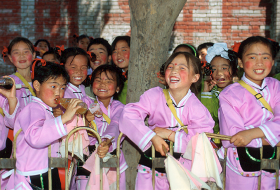
Untitled 343 / China
·Type: Images ·Data Source: OC/SEPAL/David Marshall ·Collection: YWAM-John Fries ·Categories: Topic :: Peoples, multiple or unknown Country :: China Collection :: YWAM-John Fries Partners :: YWAM-John Fries Topic ::...

Untitled 344 / China
·Type: Images ·Data Source: OC/SEPAL/David Marshall ·Collection: YWAM-John Fries ·Categories: Topic :: Peoples, multiple or unknown Country :: China Collection :: YWAM-John Fries Partners :: YWAM-John Fries Topic ::...

Untitled 345 / China
·Type: Images ·Data Source: OC/SEPAL/David Marshall ·Collection: YWAM-John Fries ·Categories: Topic :: Peoples, multiple or unknown Country :: China Collection :: YWAM-John Fries Partners :: YWAM-John Fries Topic ::...

