| Product Image |
Resource Name- |
Price |
Manufacturer |
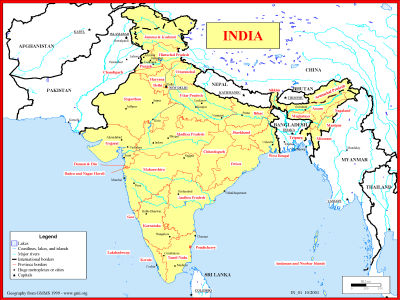 |
·Type: Maps ·Description: Political map of India ·Map Date: 1999 ·Producer: Global Mapping International ·Collection: Reaching India (WorldVue 2002) ·Size: 8½ x 11 Inches, landscape ·Note: Windows Metafile and Metafile in Word forms of this map require the GMISym.ttf font ·Categories: Type :: Maps Collection :: GMI Map Collections :: Reaching India (WorldVue 2002) Continent/Region :: Asia Country :: India Partners :: Global Mapping... |
... more info
Max: 1
|
|
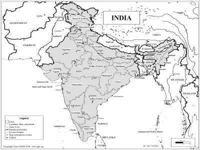 |
·Type: Maps ·Description: Political map of India ·Map Date: 2002 ·Producer: Global Mapping International ·Collection: Reaching India (WorldVue 2002) ·Size: 8½ x 11 Inches, landscape ·Note: Windows Metafile and Metafile in Word forms of this map require the GMISym.ttf font ·Categories: Type :: Maps Collection :: GMI Map Collections :: Reaching India (WorldVue 2002) Continent/Region :: Asia Country :: India Partners :: Global Mapping... |
... more info
Max: 1
|
|
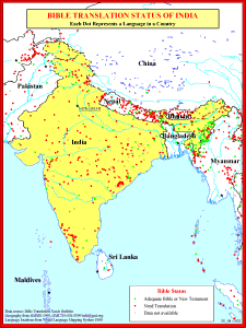 |
·Type: Maps ·Description: Bible Translations of India ·Map Date: 1991 ·Producer: Global Mapping International ·Collection: Reaching India (WorldVue 2002) ·Size: 8½ x 11 Inches, portrait ·Note: Windows Metafile and Metafile in Word forms of this map require the GMISym.ttf font ·Categories: Type :: Maps Collection :: GMI Map Collections :: Reaching India (WorldVue 2002) Continent/Region :: Asia Topic :: Statistical Country :: India... |
... more info
Max: 1
|
|
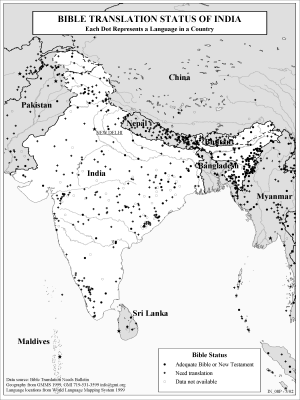 |
·Type: Maps ·Description: Bible Translations of India ·Map Date: 2002 ·Producer: Global Mapping International ·Collection: Reaching India (WorldVue 2002) ·Size: 8½ x 11 Inches, portrait ·Note: Windows Metafile and Metafile in Word forms of this map require the GMISym.ttf font ·Categories: Type :: Maps Collection :: GMI Map Collections :: Reaching India (WorldVue 2002) Continent/Region :: Asia Topic :: Statistical Country :: India... |
... more info
Max: 1
|
|
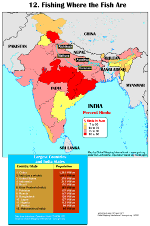 |
·Type: Maps ·Description: Fishing Where the Fish Are ·Map Date: 2001 ·Producer: Global Mapping International ·Collection: Missions Minute (WorldVue 2002) ·Size: 8½ x 11 Inches, portrait ·Categories: Type :: Maps Collection :: GMI Map Collections :: Missions Minute (WorldVue 2002) Continent/Region :: Middle East Topic :: Statistical Topic :: Strategy Topic :: Concepts Type :: Graphs Country :: India Partners :: Global Mapping International... |
... more info
Max: 1
|
|
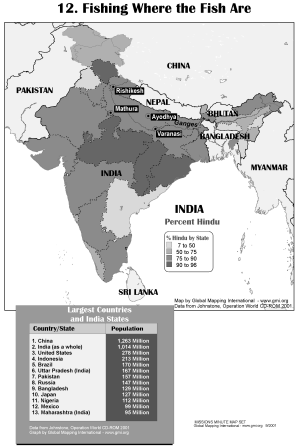 |
·Type: Maps ·Description: Fishing Where the Fish Are ·Map Date: 2002 ·Producer: Global Mapping International ·Collection: Missions Minute (WorldVue 2002) ·Size: 8½ x 11 Inches, portrait ·Categories: Type :: Maps Collection :: GMI Map Collections :: Missions Minute (WorldVue 2002) Continent/Region :: Middle East Topic :: Statistical Topic :: Strategy Topic :: Concepts Type :: Graphs Country :: India Partners :: Global Mapping International... |
... more info
Max: 1
|
|
 |
Much of the time we do not think intentionally about how we make decisions in our ministry efforts. This is even truer cross-culturally. If you are an Indian leader, this Missiographic will hopefully provide some perspective on dynamics of decision making in your country. If you are a non-Indian leader, we hope this Missiographic will help you better understand your Indian partners and serve alongside them more effectively. For more information go to How India Leaders Make Ministry Decisions on... |
... more info
|
|
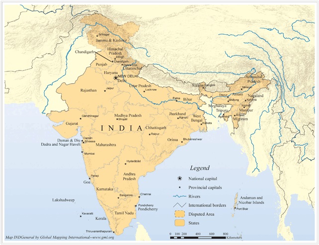 |
·Type: Maps ·Map Date: 2006 ·Producer: Global Mapping International ·Collection: Reaching India (GMMS 2007) ·Size: 8½ x 11 inches, landscape ·Categories: Type :: Maps Continent/Region :: Asia Country :: India Collection :: GMI Map Collections :: Reaching India (GMMS 2007) Partners :: Global Mapping International Topic :: Geography :: Maps |
... more info
Max: 1
|
|
 |
Progress Scale: Unreached Population: 1,417,173,000 Area Square Miles: 1,269,340 Capital: New Delhi % Literacy: 74.00 % Hinduism: 80.14 % Professing Christian: 2.32 % Evangelical: 0.00 For more information go to India on the Joshua Project website. The above link opens in a new tab. |
... more info
Max: 1
|
|
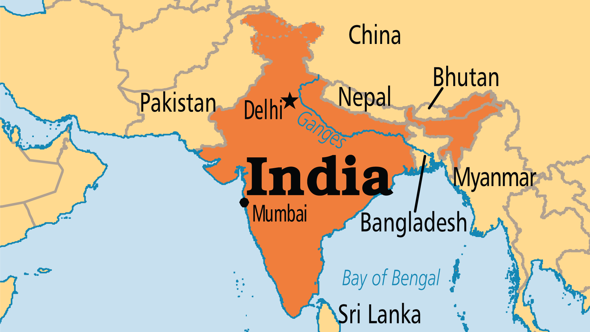 |
Largest Religion: Hindu Number People Groups: 2493 Number Languages: 456 Official Language: Constitutionally there are 22 official languages. The official language is Hindi (spoken by 40% of the population). English is a subsidiary official language For more information go to India on the Operation World website. The above link opens in a new tab. |

Max: 1
|
|
 |
Government: Federal Republic Major People Groups: South Asian Peoples GDP Per Capita: $7,200 Literacy Rate: 71.20% Unreached: 89.80% For more information go to India on the Prayercast website. The above link opens in a new tab. |

Max: 1
|
|
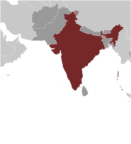 |
Area: 3,287,263 Population: 1,326,093,247 July 2020 est. Life Expectancy: 69.70 Net migration rate: 0.00 2020 est. GDP (real growth rate): 4.86 2019 est. Internet Users: 446,759,327 For more information go to India on the World Factbook website. The above link opens in a new tab. |

Max: 1
|
|
 |
NOTE: The most recent year's information is shown below. Click on the year to see all years for this indicator. ECONOMY2014 34 Energy imports, net (% of energy use)2014 805 Electric power consumption (kWh per capita)2016 0.81 Pump price for diesel fuel (US$ per liter)2016 0.97 Pump price for gasoline (US$ per liter)2018 167.6 Consumer price index (2010 =... |
... more info
|
|
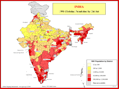 |
·Type: Maps ·Description: 1991 Chrisitian Population by district ·Map Date: 2001 ·Producer: Global Mapping International ·Collection: Reaching India (WorldVue 2002) ·Size: 8½ x 11 Inches, landscape ·Categories: Type :: Maps Collection :: GMI Map Collections :: Reaching India (WorldVue 2002) Continent/Region :: Asia Topic :: Statistical Country :: India Partners :: Global Mapping International Topic :: Religions, Christianity :: Adherents,... |
... more info
Max: 1
|
|
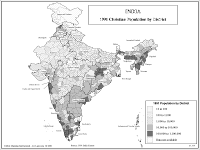 |
·Type: Maps ·Description: 1991 Chrisitian Population by district ·Map Date: 2002 ·Producer: Global Mapping International ·Collection: Reaching India (WorldVue 2002) ·Size: 8½ x 11 Inches, landscape ·Categories: Type :: Maps Collection :: GMI Map Collections :: Reaching India (WorldVue 2002) Continent/Region :: Asia Topic :: Statistical Country :: India Partners :: Global Mapping International Topic :: Religions, Christianity :: Adherents,... |
... more info
Max: 1
|
|
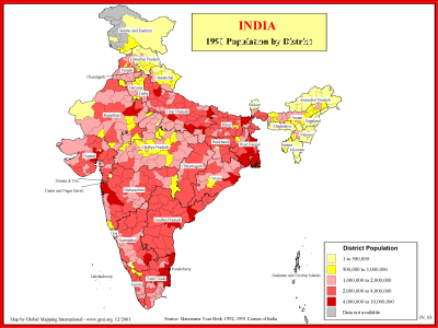 |
·Type: Maps ·Description: 1991 Population by district in India ·Map Date: 2001 ·Producer: Global Mapping International ·Collection: Reaching India (WorldVue 2002) ·Size: 8½ x 11 Inches, landscape ·Categories: Type :: Maps Collection :: GMI Map Collections :: Reaching India (WorldVue 2002) Continent/Region :: Asia Topic :: Statistical Topic :: Demography Country :: India Partners :: Global Mapping International |
... more info
Max: 1
|
|
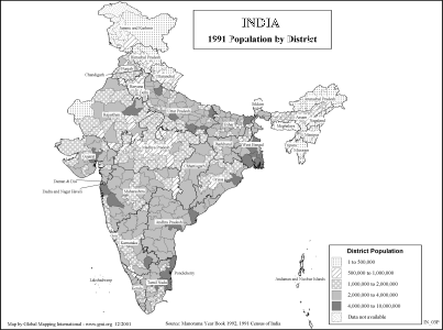 |
·Type: Maps ·Description: 1991 Population by district in India ·Map Date: 2002 ·Producer: Global Mapping International ·Collection: Reaching India (WorldVue 2002) ·Size: 8½ x 11 Inches, landscape ·Categories: Type :: Maps Collection :: GMI Map Collections :: Reaching India (WorldVue 2002) Continent/Region :: Asia Topic :: Statistical Topic :: Demography Country :: India Partners :: Global Mapping International |
... more info
Max: 1
|
|
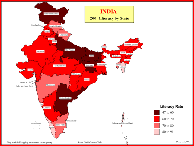 |
·Type: Maps ·Description: Statewide Literacy in 2001 ·Map Date: 2001 ·Producer: Global Mapping International ·Collection: Reaching India (WorldVue 2002) ·Size: 8½ x 11 Inches, landscape ·Categories: Type :: Maps Collection :: GMI Map Collections :: Reaching India (WorldVue 2002) Continent/Region :: Asia Topic :: Statistical Topic :: Social Country :: India Partners :: Global Mapping International |
... more info
Max: 1
|
|
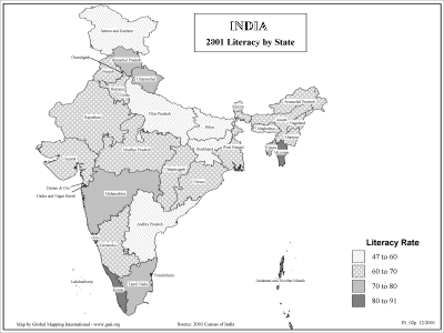 |
·Type: Maps ·Description: Statewide Literacy in 2001 ·Map Date: 2002 ·Producer: Global Mapping International ·Collection: Reaching India (WorldVue 2002) ·Size: 8½ x 11 Inches, landscape ·Categories: Type :: Maps Collection :: GMI Map Collections :: Reaching India (WorldVue 2002) Continent/Region :: Asia Topic :: Statistical Topic :: Social Country :: India Partners :: Global Mapping International |
... more info
Max: 1
|
|
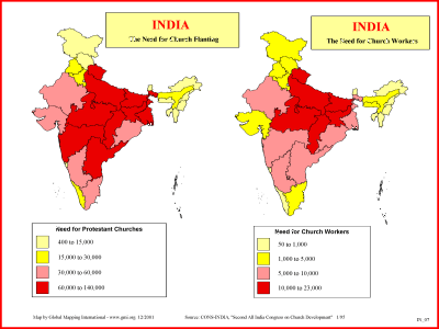 |
·Type: Maps ·Description: India's need for Church Planting Workers ·Map Date: 2001 ·Producer: Global Mapping International ·Collection: Reaching India (WorldVue 2002) ·Size: 8½ x 11 Inches, landscape ·Categories: Type :: Maps Collection :: GMI Map Collections :: Reaching India (WorldVue 2002) Continent/Region :: Asia Topic :: Statistical Topic :: Strategy Country :: India Partners :: Global Mapping International |
... more info
Max: 1
|
|
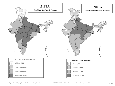 |
·Type: Maps ·Description: India's need for Church Planting Workers ·Map Date: 2002 ·Producer: Global Mapping International ·Collection: Reaching India (WorldVue 2002) ·Size: 8½ x 11 Inches, landscape ·Categories: Type :: Maps Collection :: GMI Map Collections :: Reaching India (WorldVue 2002) Continent/Region :: Asia Topic :: Statistical Topic :: Strategy Country :: India Partners :: Global Mapping International |
... more info
Max: 1
|
|
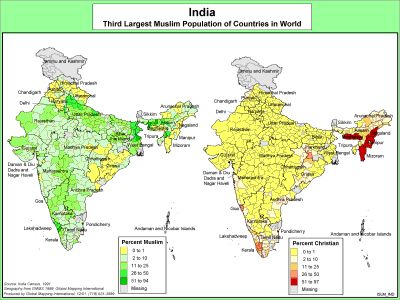 |
·Type: Maps ·Description: India's Muslim Population ·Map Date: 2000 ·Producer: Global Mapping International ·Collection: The World of Islam (WV 2002) ·Size: 8½ x 11 Inches, landscape ·Categories: Type :: Maps Collection :: GMI Map Collections :: The World of Islam (WV 2002) Continent/Region :: Asia Topic :: Statistical Country :: India Partners :: Global Mapping International Topic :: Religions, General :: Multiple/Other |
... more info
Max: 1
|
|
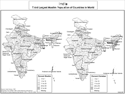 |
·Type: Maps ·Description: India's Muslim Population ·Map Date: 2002 ·Producer: Global Mapping International ·Collection: The World of Islam (WV 2002) ·Size: 8½ x 11 Inches, landscape ·Categories: Type :: Maps Collection :: GMI Map Collections :: The World of Islam (WV 2002) Continent/Region :: Asia Topic :: Statistical Country :: India Partners :: Global Mapping International Topic :: Religions, General :: Multiple/Other |
... more info
Max: 1
|
|
 |
·Type: Images ·Collection: World Factbook country flags ·Small size: 83 x 56 px ·Large size: 454 x 302 px ·Categories: Country :: India Collection :: World Factbook country flags Partners :: U.S. Government Topic :: Flags Topic :: Images: Country :: India Type :: Images :: by country :: India |
... more info
Max: 1
|
|
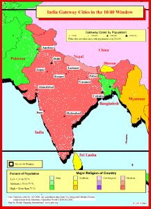 |
·Type: Maps ·Description: Gateway Cities in India to the 10/40 Window ·Map Date: 2001 ·Producer: Global Mapping International ·Collection: Reaching India (WorldVue 2002) ·Size: 8½ x 11 Inches, portrait ·Note: Windows Metafile and Metafile in Word forms of this map require the GMISym.ttf font ·Categories: Type :: Maps Collection :: GMI Map Collections :: Reaching India (WorldVue 2002) Continent/Region :: Asia Topic :: Statistical... |
... more info
Max: 1
|
|