| Product Image |
Resource Name- |
Price |
Manufacturer |
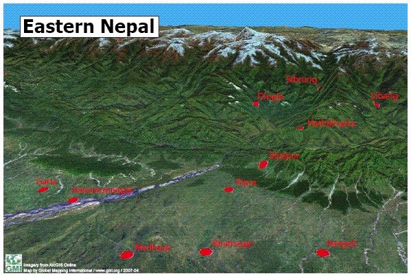 |
·Type: Maps ·Map Date: 16 April 2007 ·Data Source: ·Producer: Global Mapping International ·Collection: Projects 2007 ·Size: 8½ by 11 inches, landscape ·Categories: Type :: Maps Country :: Nepal Partners :: Global Mapping International Collection :: GMI Map Collections :: Projects 2007 Topic :: Geography :: Maps ·Producer: Global Mapping International ·Collection: Projects 2007 ·Size: 8½ by 11 inches,... |
... more info
Max: 1
|
|
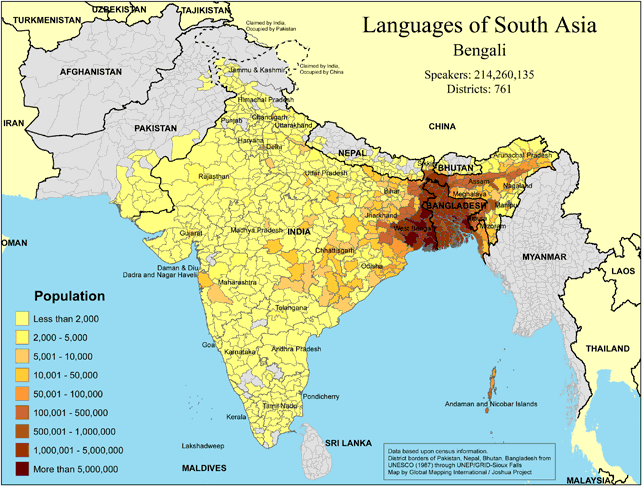 |
·Type: Maps ·Map Date: 2018 ·Data Source: Omid, based on census information ·Partners: OMID 2018 ·Size: 8.27 by 11.69 inches, landscape ·Categories: Type :: Maps Continent/Region :: Asia Country :: Bangladesh Country :: India Country :: Nepal Country :: Bhutan Partners :: OMID Collection :: Map Collections :: OMID 2018 Topic :: Language and Translation |
... more info
|
|
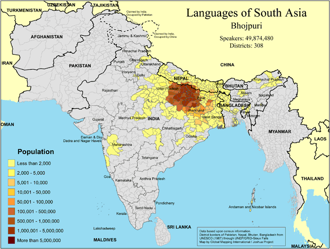 |
·Type: Maps ·Map Date: 2018 ·Data Source: Omid, based on census information ·Partners: OMID 2018 ·Size: 8.27 by 11.69 inches, landscape ·Categories: Type :: Maps Continent/Region :: Asia Country :: India Country :: Nepal Country :: Bangladesh Partners :: OMID Collection :: Map Collections :: OMID 2018 Topic :: Language and Translation |
... more info
|
|
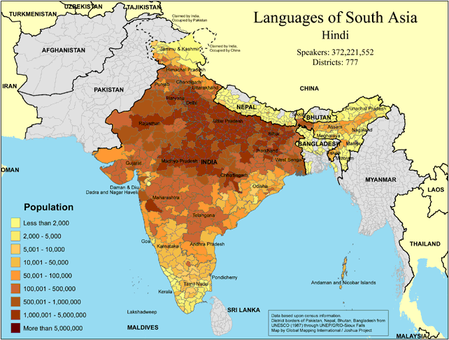 |
·Type: Maps ·Map Date: 2018 ·Data Source: Omid, based on census information ·Partners: OMID 2018 ·Size: 8.27 by 11.69 inches, landscape ·Categories: Type :: Maps Continent/Region :: Asia Country :: India Country :: Nepal Country :: Bhutan Partners :: OMID Collection :: Map Collections :: OMID 2018 Topic :: Language and Translation |
... more info
|
|
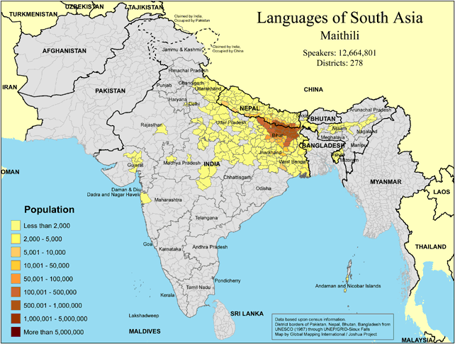 |
·Type: Maps ·Map Date: 2018 ·Data Source: Omid, based on census information ·Partners: OMID 2018 ·Size: 8.27 by 11.69 inches, landscape ·Categories: Type :: Maps Continent/Region :: Asia Country :: India Country :: Nepal Partners :: OMID Collection :: Map Collections :: OMID 2018 Topic :: Language and Translation |
... more info
|
|
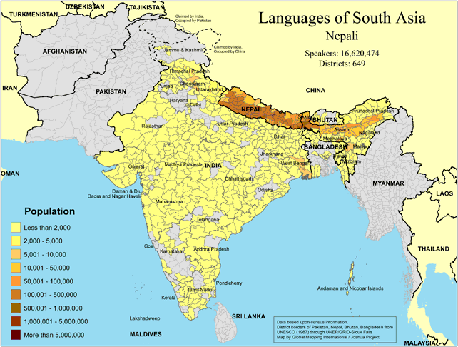 |
·Type: Maps ·Map Date: 2018 ·Data Source: Omid, based on census information ·Partners: OMID 2018 ·Size: 8.27 by 11.69 inches, landscape ·Categories: Type :: Maps Continent/Region :: Asia Country :: Nepal Country :: India Country :: Bhutan Country :: Bangladesh Partners :: OMID Collection :: Map Collections :: OMID 2018 Topic :: Language and Translation |
... more info
|
|
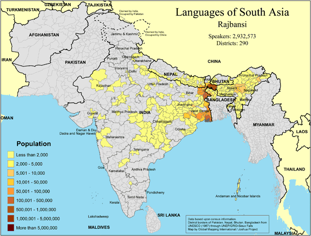 |
·Type: Maps ·Map Date: 2018 ·Data Source: Omid, based on census information ·Partners: OMID 2018 ·Size: 8.27 by 11.69 inches, landscape ·Categories: Type :: Maps Continent/Region :: Asia Country :: India Country :: Nepal Partners :: OMID Collection :: Map Collections :: OMID 2018 Topic :: Language and Translation |
... more info
|
|
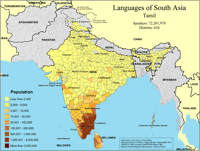 |
·Type: Maps ·Map Date: 2018 ·Data Source: Omid, based on census information ·Partners: OMID 2018 ·Size: 8.27 by 11.69 inches, landscape ·Categories: Type :: Maps Continent/Region :: Asia Country :: India Country :: Sri Lanka Country :: Nepal Country :: Bangladesh Country :: Bhutan Partners :: OMID Collection :: Map Collections :: OMID 2018 Topic :: Language and Translation |
... more info
|
|
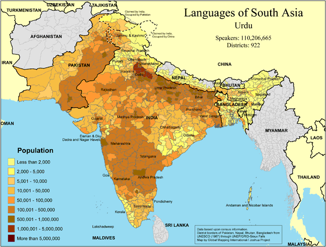 |
·Type: Maps ·Map Date: 2018 ·Data Source: Omid, based on census information ·Partners: OMID 2018 ·Size: 8.27 by 11.69 inches, landscape ·Categories: Type :: Maps Continent/Region :: Asia Country :: Pakistan Country :: India Country :: Nepal Country :: Bangladesh Partners :: OMID Collection :: Map Collections :: OMID 2018 Topic :: Language and Translation |
... more info
|
|
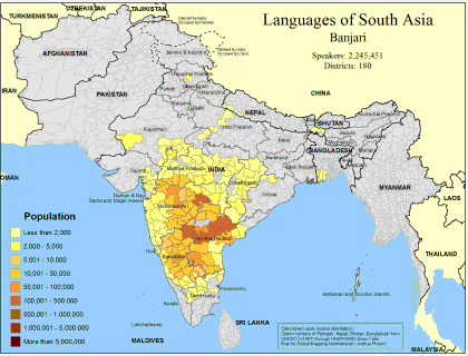 |
·Type: Maps ·Map Date: February 2008 ·Data Source: Census Information, UNESCO (1987) through UNEP/GRID-Sioux Falls ·Producer: Global Mapping International and The Joshua Project ·Size: 11.7 by 8.27 inches, landscape ·Categories: Type :: Maps Continent/Region :: Asia Topic :: Demography Country :: Nepal Country :: India Country :: Bangladesh Partners :: Global Mapping International Topic :: Language and Translation Partners :: Joshua Project |
... more info
Max: 1
|
|
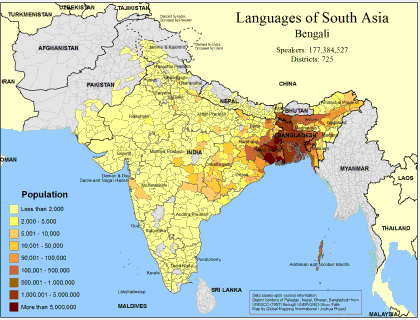 |
·Type: Maps ·Map Date: February 2008 ·Data Source: Census Information, UNESCO (1987) through UNEP/GRID-Sioux Falls ·Producer: Global Mapping International and The Joshua Project ·Size: 11.7 by 8.27 inches, landscape ·Categories: Type :: Maps Continent/Region :: Asia Topic :: Demography Country :: Nepal Country :: India Country :: Bangladesh Country :: Pakistan Partners :: Global Mapping International Topic :: Language and Translation Partners ::... |
... more info
Max: 1
|
|
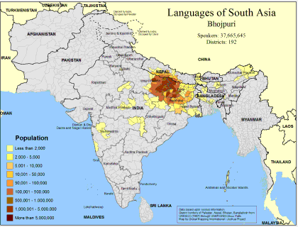 |
·Type: Maps ·Map Date: February 2008 ·Data Source: Census Information, UNESCO (1987) through UNEP/GRID-Sioux Falls ·Producer: Global Mapping International and The Joshua Project ·Size: 11.7 by 8.27 inches, landscape ·Categories: Type :: Maps Continent/Region :: Asia Topic :: Demography Country :: Nepal Country :: India Country :: Bangladesh Partners :: Global Mapping International Topic :: Language and Translation Partners :: Joshua Project |
... more info
Max: 1
|
|
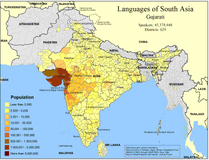 |
·Type: Maps ·Map Date: February 2008 ·Data Source: Census Information, UNESCO (1987) through UNEP/GRID-Sioux Falls ·Producer: Global Mapping International and The Joshua Project ·Size: 11.7 by 8.27 inches, landscape ·Categories: Type :: Maps Country :: Sri Lanka Continent/Region :: Asia Topic :: Demography Country :: Nepal Country :: India Country :: Bangladesh Country :: Pakistan Partners :: Global Mapping International Topic :: Language and... |
... more info
Max: 1
|
|
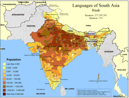 |
·Type: Maps ·Map Date: February 2008 ·Data Source: Census Information, UNESCO (1987) through UNEP/GRID-Sioux Falls ·Producer: Global Mapping International and The Joshua Project ·Size: 11.7 by 8.27 inches, landscape ·Categories: Type :: Maps Continent/Region :: Asia Topic :: Demography Country :: Nepal Country :: India Country :: Bangladesh Partners :: Global Mapping International Topic :: Language and Translation Partners :: Joshua Project |
... more info
Max: 1
|
|
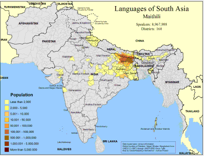 |
·Type: Maps ·Map Date: February 2008 ·Data Source: Census Information, UNESCO (1987) through UNEP/GRID-Sioux Falls ·Producer: Global Mapping International and The Joshua Project ·Size: 11.7 by 8.27 inches, landscape ·Categories: Type :: Maps Continent/Region :: Asia Topic :: Demography Country :: Nepal Country :: India Country :: Bangladesh Partners :: Global Mapping International Topic :: Language and Translation Partners :: Joshua Project |
... more info
Max: 1
|
|
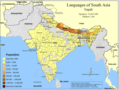 |
·Type: Maps ·Map Date: February 2008 ·Data Source: Census Information, UNESCO (1987) through UNEP/GRID-Sioux Falls ·Producer: Global Mapping International and The Joshua Project ·Size: 11.7 by 8.27 inches, landscape ·Categories: Type :: Maps Continent/Region :: Asia Topic :: Demography Country :: Nepal Country :: India Country :: Bangladesh Country :: Burma Partners :: Global Mapping International Topic :: Language and Translation Partners :: Joshua... |
... more info
Max: 1
|
|
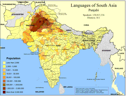 |
·Type: Maps ·Map Date: February 2008 ·Data Source: Census Information, UNESCO (1987) through UNEP/GRID-Sioux Falls ·Producer: Global Mapping International and The Joshua Project ·Size: 11.7 by 8.27 inches, landscape ·Categories: Type :: Maps Continent/Region :: Asia Topic :: Demography Country :: Nepal Country :: India Country :: Afghanistan Country :: Bangladesh Country :: Pakistan Partners :: Global Mapping International Topic :: Language and... |
... more info
Max: 1
|
|
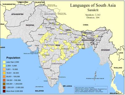 |
·Type: Maps ·Map Date: February 2008 ·Data Source: Census Information, UNESCO (1987) through UNEP/GRID-Sioux Falls ·Producer: Global Mapping International and The Joshua Project ·Size: 11.7 by 8.27 inches, landscape ·Categories: Type :: Maps Continent/Region :: Asia Topic :: Demography Country :: Nepal Country :: India Partners :: Global Mapping International Topic :: Language and Translation Partners :: Joshua Project |
... more info
Max: 1
|
|
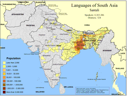 |
·Type: Maps ·Map Date: February 2008 ·Data Source: Census Information, UNESCO (1987) through UNEP/GRID-Sioux Falls ·Producer: Global Mapping International and The Joshua Project ·Size: 11.7 by 8.27 inches, landscape ·Categories: Type :: Maps Continent/Region :: Asia Topic :: Demography Country :: Nepal Country :: India Country :: Bangladesh Partners :: Global Mapping International Topic :: Language and Translation Partners :: Joshua Project |
... more info
Max: 1
|
|
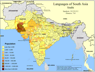 |
·Type: Maps ·Map Date: February 2008 ·Data Source: Census Information, UNESCO (1987) through UNEP/GRID-Sioux Falls ·Producer: Global Mapping International and The Joshua Project ·Size: 11.7 by 8.27 inches, landscape ·Categories: Type :: Maps Continent/Region :: Asia Topic :: Demography Country :: Nepal Country :: India Country :: Bangladesh Country :: Pakistan Partners :: Global Mapping International Topic :: Language and Translation Partners ::... |
... more info
Max: 1
|
|
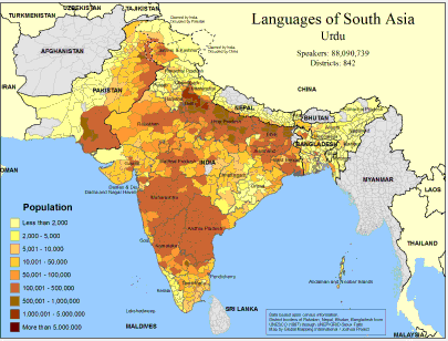 |
·Type: Maps ·Map Date: February 2008 ·Data Source: Census Information, UNESCO (1987) through UNEP/GRID-Sioux Falls ·Producer: Global Mapping International and The Joshua Project ·Size: 11.7 by 8.27 inches, landscape ·Categories: Type :: Maps Continent/Region :: Asia Topic :: Demography Country :: Nepal Country :: India Country :: Bangladesh Country :: Pakistan Partners :: Global Mapping International Topic :: Language and Translation Partners ::... |
... more info
Max: 1
|
|
 |
Progress Scale: Unreached Population: 30,548,000 Area Square Miles: 56,826 Capital: Kathmandu % Literacy: 68.00 % Hinduism: 81.33 % Professing Christian: 1.42 % Evangelical: 0.00 For more information go to Nepal on the Joshua Project website. The above link opens in a new tab. |
... more info
Max: 1
|
|
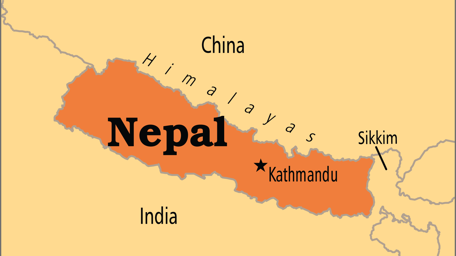 |
Largest Religion: Hinduism Number People Groups: 267 Number Languages: 127 Official Language: Nepali For more information go to Nepal on the Operation World website. The above link opens in a new tab. |

Max: 1
|
|
 |
Government: Federal Democratic Republic Major People Groups: South Asian, Tibetan-Himalayan GDP Per Capita: $2,700 Literacy Rate: 63.90% Unreached: 96.70% For more information go to Nepal on the Prayercast website. The above link opens in a new tab. |

Max: 1
|
|
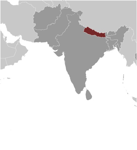 |
Area: 147,181 Population: 30,327,877 July 2020 est. Life Expectancy: 71.80 Net migration rate: -3.10 2020 est. GDP (real growth rate): 7.90 2017 est. Internet Users: 10,103,980 For more information go to Nepal on the World Factbook website. The above link opens in a new tab. |

Max: 1
|
|