| Product Image |
Resource Name- |
Price |
Manufacturer |
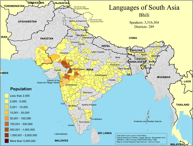 |
·Type: Maps ·Map Date: 2018 ·Data Source: Omid, based on census information ·Partners: OMID 2018 ·Size: 8.27 by 11.69 inches, landscape ·Categories: Type :: Maps Continent/Region :: Asia Country :: India Country :: Pakistan Partners :: OMID Collection :: Map Collections :: OMID 2018 Topic :: Language and Translation |
... more info
|
|
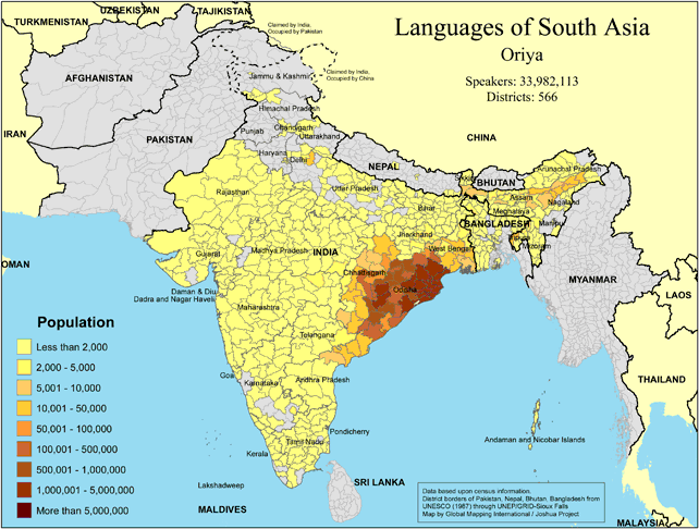 |
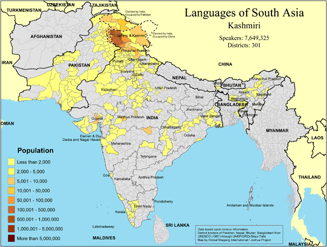
·Type: Maps ·Map Date: 2018 ·Data Source: Omid, based on census information ·Partners: OMID 2018 ·Size: 8.27 by 11.69 inches, landscape ·Categories: Type :: Maps Continent/Region :: Asia Country :: India Country :: Bangladesh Partners :: OMID Collection :: Map Collections :: OMID 2018 Topic :: Language and Translation |
... more info
|
|
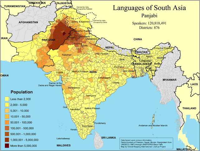 |
·Type: Maps ·Map Date: 2018 ·Data Source: Omid, based on census information ·Partners: OMID 2018 ·Size: 8.27 by 11.69 inches, landscape ·Categories: Type :: Maps Continent/Region :: Asia Country :: Pakistan Country :: India Country :: Bangladesh Partners :: OMID Collection :: Map Collections :: OMID 2018 Topic :: Language and Translation |
... more info
|
|
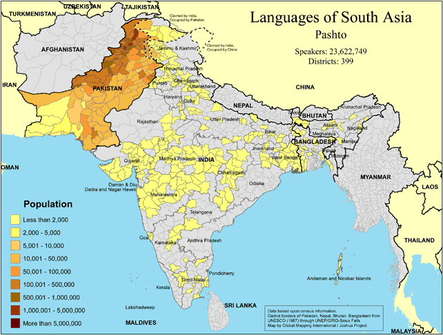 |
·Type: Maps ·Map Date: 2018 ·Data Source: Omid, based on census information ·Partners: OMID 2018 ·Size: 8.27 by 11.69 inches, landscape ·Categories: Type :: Maps Continent/Region :: Asia Country :: Pakistan Country :: India Partners :: OMID Collection :: Map Collections :: OMID 2018 Topic :: Language and Translation |
... more info
|
|
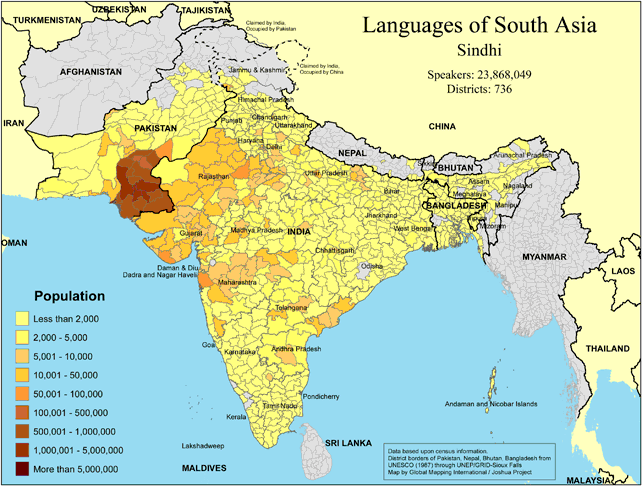 |
·Type: Maps ·Map Date: 2018 ·Data Source: Omid, based on census information ·Partners: OMID 2018 ·Size: 8.27 by 11.69 inches, landscape ·Categories: Type :: Maps Continent/Region :: Asia Country :: Pakistan Country :: India Country :: Bangladesh Partners :: OMID Collection :: Map Collections :: OMID 2018 Topic :: Language and Translation |
... more info
|
|
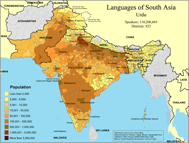 |
·Type: Maps ·Map Date: 2018 ·Data Source: Omid, based on census information ·Partners: OMID 2018 ·Size: 8.27 by 11.69 inches, landscape ·Categories: Type :: Maps Continent/Region :: Asia Country :: Pakistan Country :: India Country :: Nepal Country :: Bangladesh Partners :: OMID Collection :: Map Collections :: OMID 2018 Topic :: Language and Translation |
... more info
|
|
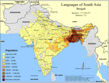 |
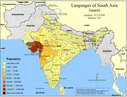
·Type: Maps ·Map Date: February 2008 ·Data Source: Census Information, UNESCO (1987) through UNEP/GRID-Sioux Falls ·Producer: Global Mapping International and The Joshua Project ·Size: 11.7 by 8.27 inches, landscape ·Categories: Type :: Maps Continent/Region :: Asia Topic :: Demography Country :: Nepal Country :: India Country :: Bangladesh Country :: Pakistan Partners :: Global Mapping International Topic :: Language and Translation Partners ::... |
... more info
Max: 1
|
|
 |
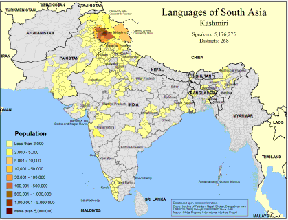
·Type: Maps ·Map Date: February 2008 ·Data Source: Census Information, UNESCO (1987) through UNEP/GRID-Sioux Falls ·Producer: Global Mapping International and The Joshua Project ·Size: 11.7 by 8.27 inches, landscape ·Categories: Type :: Maps Country :: Sri Lanka Continent/Region :: Asia Topic :: Demography Country :: Nepal Country :: India Country :: Bangladesh Country :: Pakistan Partners :: Global Mapping International Topic :: Language and... |
... more info
Max: 1
|
|
 |
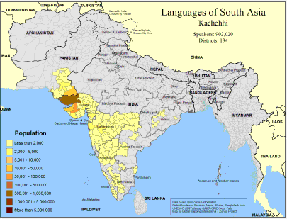
·Type: Maps ·Map Date: February 2008 ·Data Source: Census Information, UNESCO (1987) through UNEP/GRID-Sioux Falls ·Producer: Global Mapping International and The Joshua Project ·Size: 11.7 by 8.27 inches, landscape ·Categories: Type :: Maps Continent/Region :: Asia Topic :: Demography Country :: India Country :: Bangladesh Country :: Pakistan Partners :: Global Mapping International Topic :: Language and Translation Partners :: Joshua Project |
... more info
Max: 1
|
|
 |
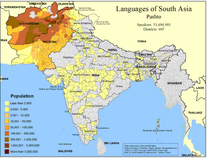
·Type: Maps ·Map Date: February 2008 ·Data Source: Census Information, UNESCO (1987) through UNEP/GRID-Sioux Falls ·Producer: Global Mapping International and The Joshua Project ·Size: 11.7 by 8.27 inches, landscape ·Categories: Type :: Maps Continent/Region :: Asia Topic :: Demography Country :: India Country :: Pakistan Partners :: Global Mapping International Topic :: Language and Translation Partners :: Joshua Project |
... more info
Max: 1
|
|
 |
·Type: Maps ·Map Date: February 2008 ·Data Source: Census Information, UNESCO (1987) through UNEP/GRID-Sioux Falls ·Producer: Global Mapping International and The Joshua Project ·Size: 11.7 by 8.27 inches, landscape ·Categories: Type :: Maps Continent/Region :: Asia Topic :: Demography Country :: India Country :: Afghanistan Country :: Bangladesh Country :: Pakistan Partners :: Global Mapping International Topic :: Language and Translation Partners ::... |
... more info
Max: 1
|
|
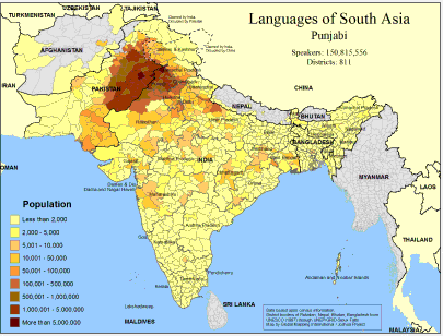 |
·Type: Maps ·Map Date: February 2008 ·Data Source: Census Information, UNESCO (1987) through UNEP/GRID-Sioux Falls ·Producer: Global Mapping International and The Joshua Project ·Size: 11.7 by 8.27 inches, landscape ·Categories: Type :: Maps Continent/Region :: Asia Topic :: Demography Country :: Nepal Country :: India Country :: Afghanistan Country :: Bangladesh Country :: Pakistan Partners :: Global Mapping International Topic :: Language and... |
... more info
Max: 1
|
|
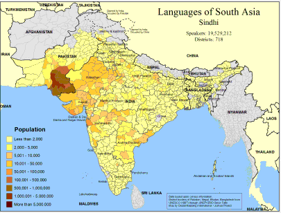 |
·Type: Maps ·Map Date: February 2008 ·Data Source: Census Information, UNESCO (1987) through UNEP/GRID-Sioux Falls ·Producer: Global Mapping International and The Joshua Project ·Size: 11.7 by 8.27 inches, landscape ·Categories: Type :: Maps Continent/Region :: Asia Topic :: Demography Country :: Nepal Country :: India Country :: Bangladesh Country :: Pakistan Partners :: Global Mapping International Topic :: Language and Translation Partners ::... |
... more info
Max: 1
|
|
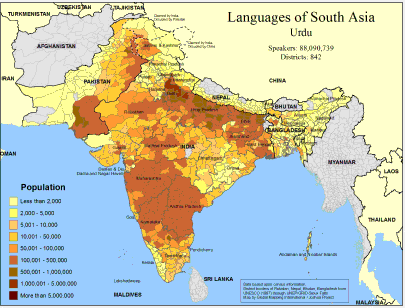 |
·Type: Maps ·Map Date: February 2008 ·Data Source: Census Information, UNESCO (1987) through UNEP/GRID-Sioux Falls ·Producer: Global Mapping International and The Joshua Project ·Size: 11.7 by 8.27 inches, landscape ·Categories: Type :: Maps Continent/Region :: Asia Topic :: Demography Country :: Nepal Country :: India Country :: Bangladesh Country :: Pakistan Partners :: Global Mapping International Topic :: Language and Translation Partners ::... |
... more info
Max: 1
|
|
 |
Progress Scale: Unreached Population: 235,825,000 Area Square Miles: 307,375 Capital: Islamabad % Literacy: 59.00 % Islam: 97.59 % Professing Christian: 1.05 % Evangelical: 0.00 For more information go to Pakistan on the Joshua Project website. The above link opens in a new tab. |
... more info
Max: 1
|
|
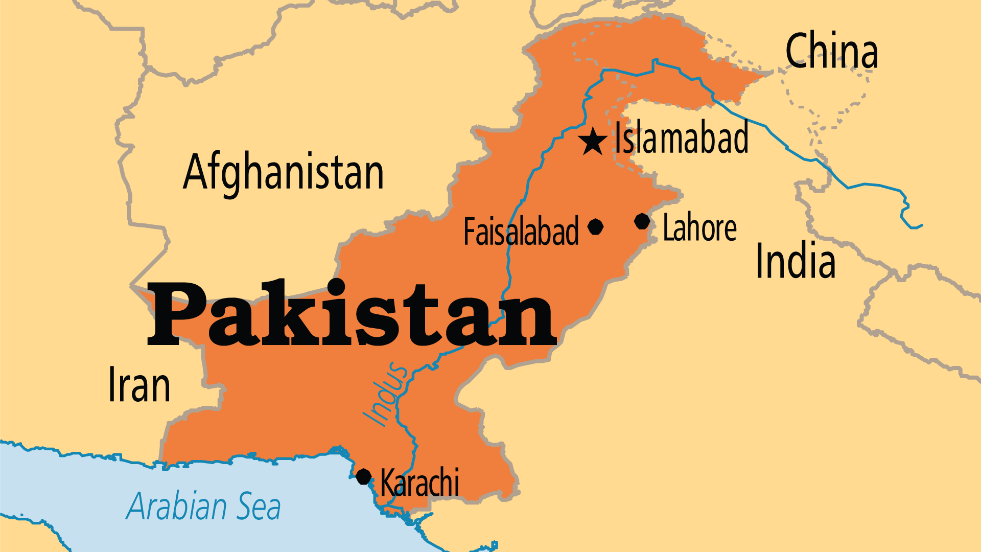 |
Largest Religion: Muslim Number People Groups: 394 Number Languages: 77 Official Language: English is the official government language, Urdu is the national language and becoming widely understood by most Pakistanis For more information go to Pakistan on the Operation World website. The above link opens in a new tab. |

Max: 1
|
|
 |
Government: Federal Republic Major People Groups: Punjab, Pashtan, Sindhi GDP Per Capita: $5,400 Literacy Rate: 57.90% Unreached: 98.10% For more information go to Pakistan on the Prayercast website. The above link opens in a new tab. |

Max: 1
|
|
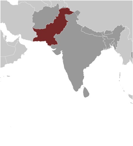 |
Area: 796,095 Population: 233,500,636 July 2020 est. Life Expectancy: 69.20 Net migration rate: -0.90 2020 est. GDP (real growth rate): 5.40 2017 est. Internet Users: 34,734,689 For more information go to Pakistan on the World Factbook website. The above link opens in a new tab. |

Max: 1
|
|
 |
NOTE: The most recent year's information is shown below. Click on the year to see all years for this indicator. COMMUNICATION2018 153,986,607 Mobile cellular subscriptions2017 16 Individuals using the Internet (% of population)ECONOMY2014 24 Energy imports, net (% of energy use)2014 448 Electric power consumption (kWh per capita)2016 0.70 Pump price for diesel fuel (US$ per... |
... more info
|
|
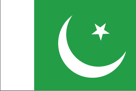 |
·Type: Images ·Collection: World Factbook country flags ·Small size: 81 x 54 px ·Large size: 453 x 302 px ·Categories: Collection :: World Factbook country flags Country :: Pakistan Partners :: U.S. Government Topic :: Flags Topic :: Images: Country :: Pakistan Type :: Images :: by country :: Pakistan |
... more info
Max: 1
|
|
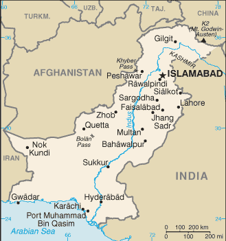 |
·Type: Maps ·Description: Pakistan (Factbook) ·Map Date: 2007 ·Producer: US Government ·Collection: World Factbook country maps ·Size: 330x355 px, landscape ·Categories: Type :: Maps Continent/Region :: Asia Collection :: World Factbook country maps Country :: Pakistan Partners :: U.S. Government |
... more info
Max: 1
|
|
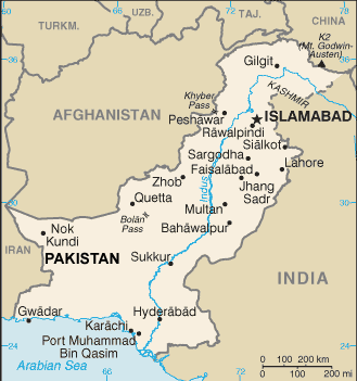 |
·Type: Maps ·Description: Pakistan (World Factbook, modified to add country name) ·Map Date: 2007 ·Producer: US Government modified by Joshua Project ·Collection: World Factbook country maps ·Size: 330x355 px, landscape ·Categories: Type :: Maps Continent/Region :: Asia Collection :: World Factbook country maps Country :: Pakistan Partners :: U.S. Government |
... more info
Max: 1
|
|
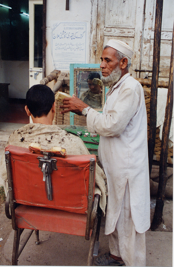 |
·Type: Images ·Data Source: YWAM/John Fries ·Collection: YWAM-John Fries ·Categories: Country :: Pakistan Collection :: YWAM-John Fries Partners :: YWAM-John Fries Topic :: Images: Country :: Pakistan Topic :: Peoples, specific :: P :: Pushtun Type :: Images :: by provider :: YWAM-John Fries Type :: Images :: by people group :: P :: Pushtun Type :: Images :: by country :: Pakistan |
... more info
Max: 1
|
|
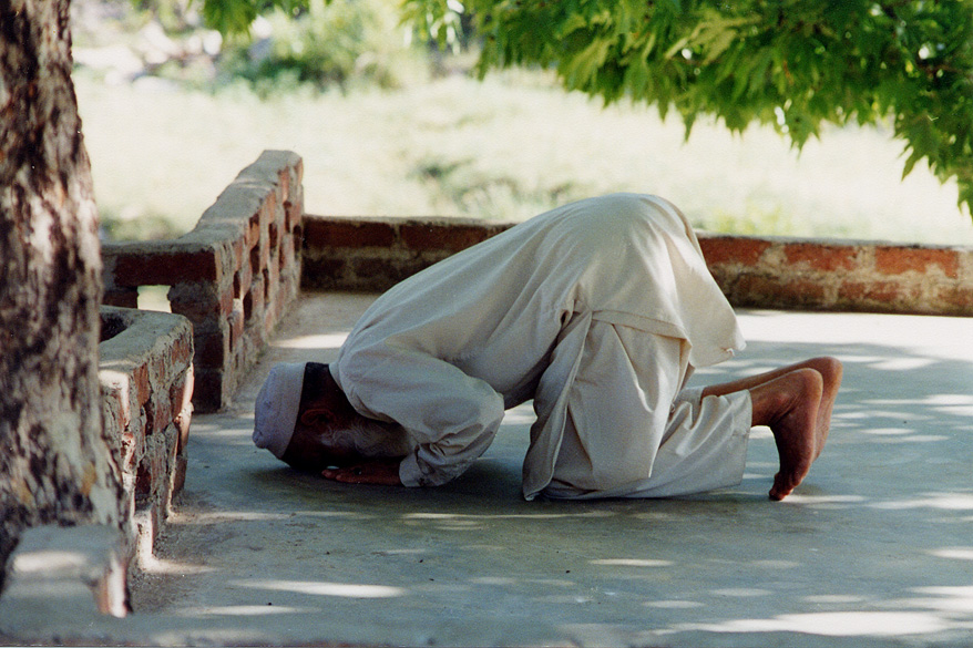 |
·Type: Images ·Data Source: YWAM/John Fries ·Collection: YWAM-John Fries ·Categories: Country :: Pakistan Collection :: YWAM-John Fries Partners :: YWAM-John Fries Topic :: Images: Country :: Pakistan Topic :: Peoples, specific :: P :: Pakistani Type :: Images :: by provider :: YWAM-John Fries Type :: Images :: by people group :: P :: Pakistani Type :: Images :: by country :: Pakistan |
... more info
Max: 1
|
|