Demography
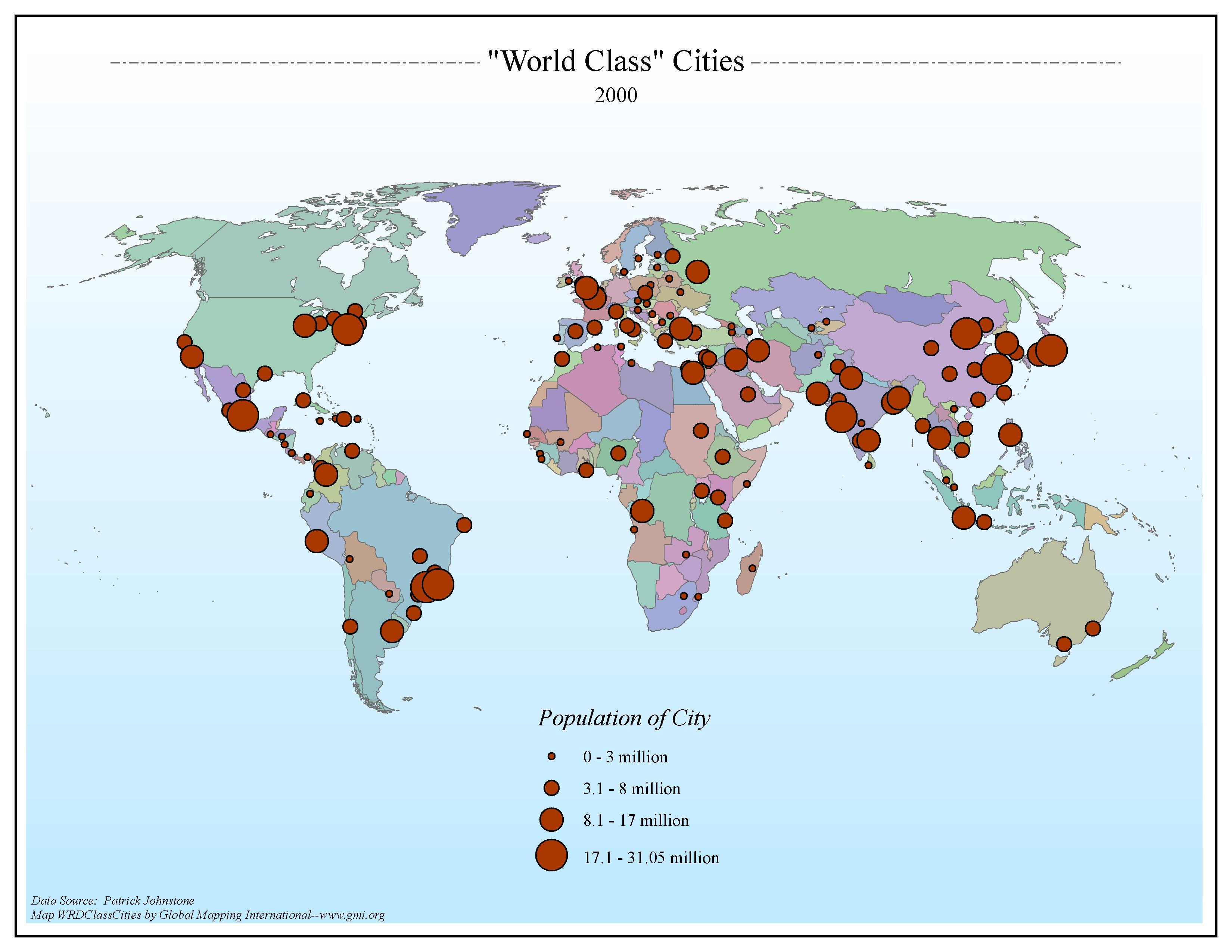
"World Class" Cities 2000
·Type: Maps ·Map Date: 2006 ·Data Source: Patrick Johnstone ·Producer: Global Mapping International ·Collection: General World Maps (GMMS 2007) ·Size: 8½ x 11 inches, landscape ·Categories:...
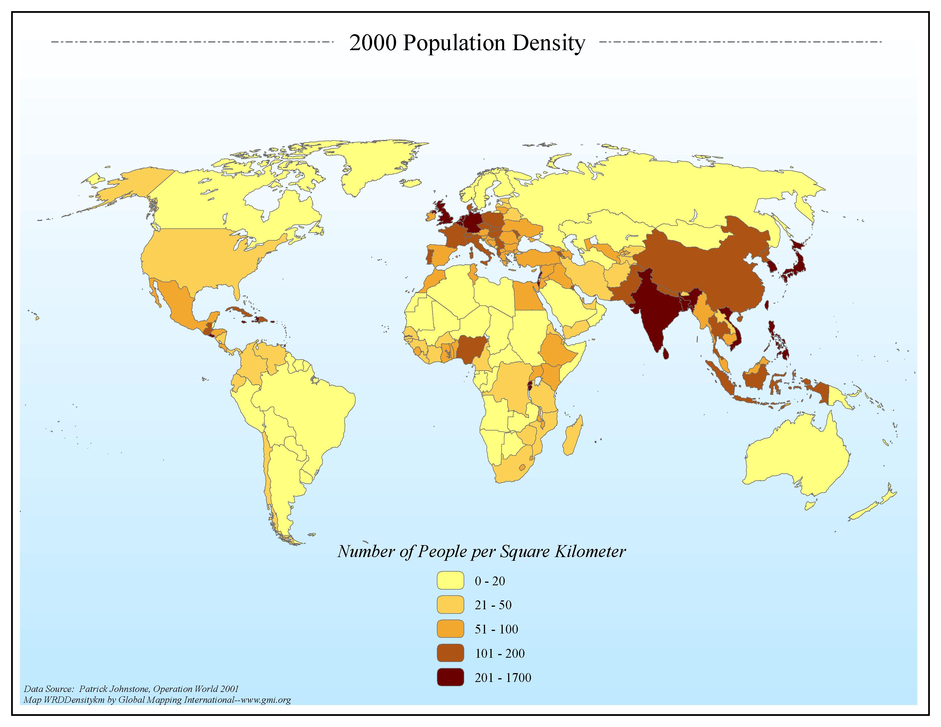
2000 Population Density per Square Kilometer
·Type: Maps ·Map Date: 2006 ·Data Source: Patrick Johnstone, Operation World 2001 ·Producer: Global Mapping International ·Collection: General World Maps (GMMS 2007) ·Size: 8½ x 11 inches, landscape...
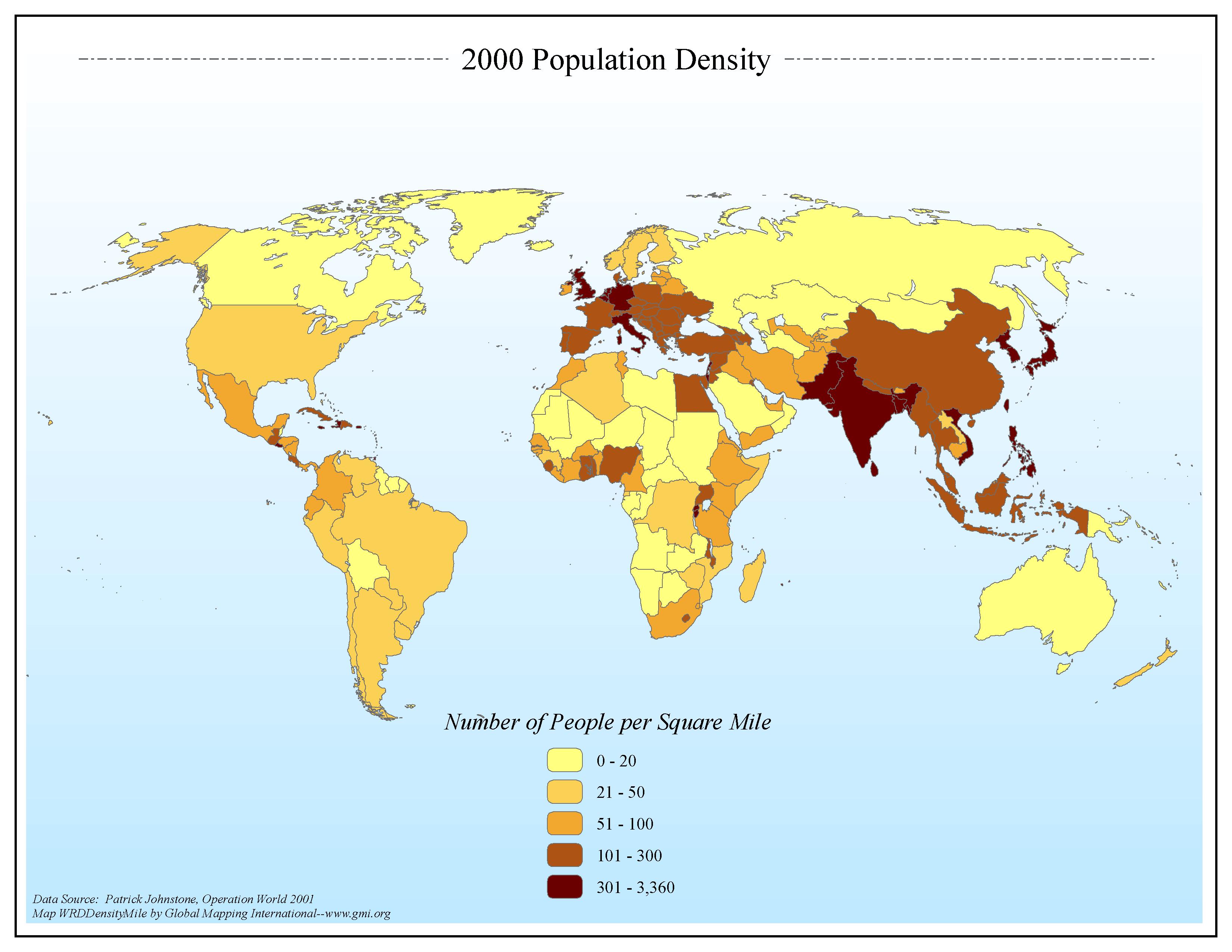
2000 Population Density per Square Mile
·Type: Maps ·Map Date: 2006 ·Data Source: Patrick Johnstone, Operation World 2001 ·Producer: Global Mapping International ·Collection: General World Maps (GMMS 2007) ·Size: 8½ x 11 inches, landscape...
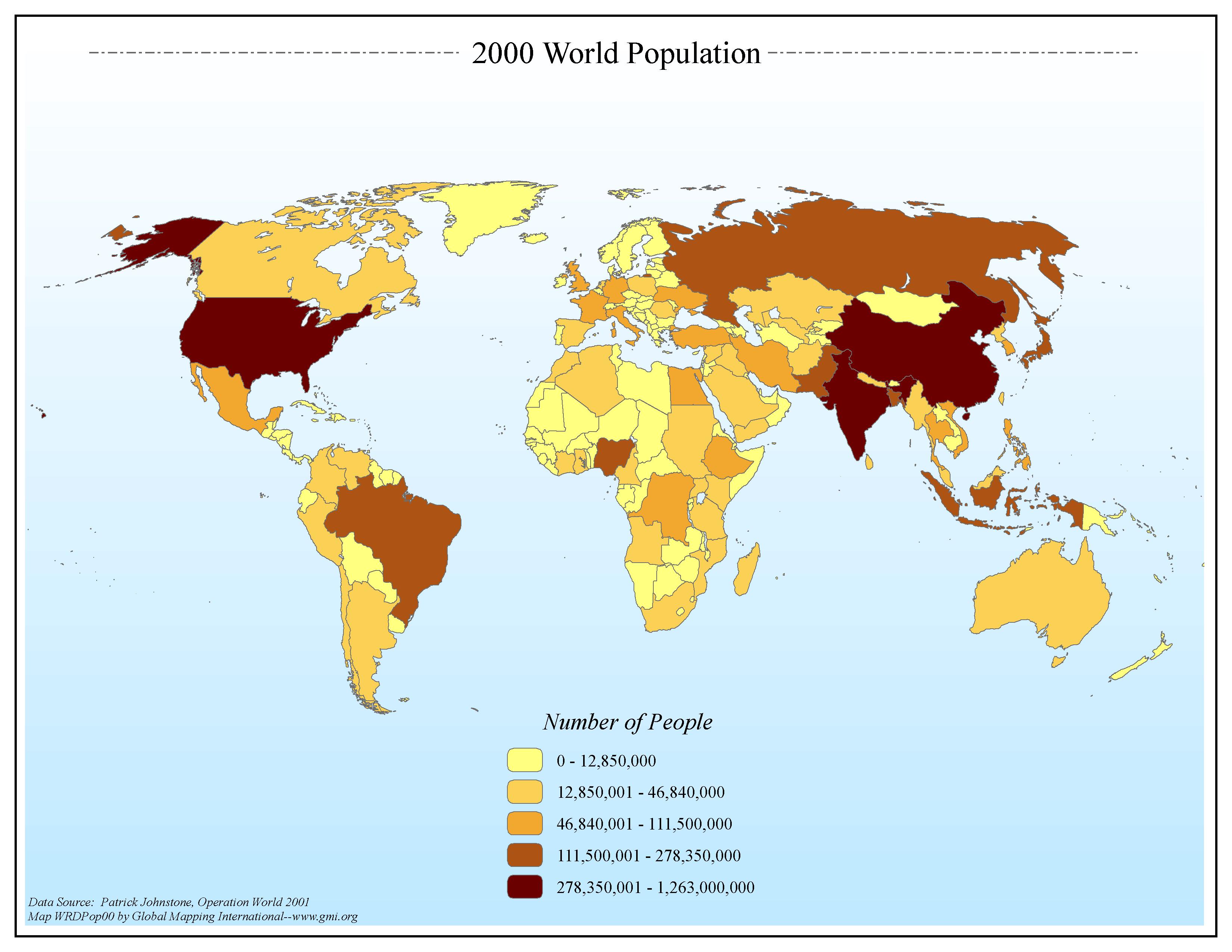
2000 World Population
·Type: Maps ·Map Date: 2006 ·Data Source: Patrick Johnstone, Operation World 2001 ·Producer: Global Mapping International ·Collection: General World Maps (GMMS 2007) ·Size: 8½ x 11 inches, landscape...
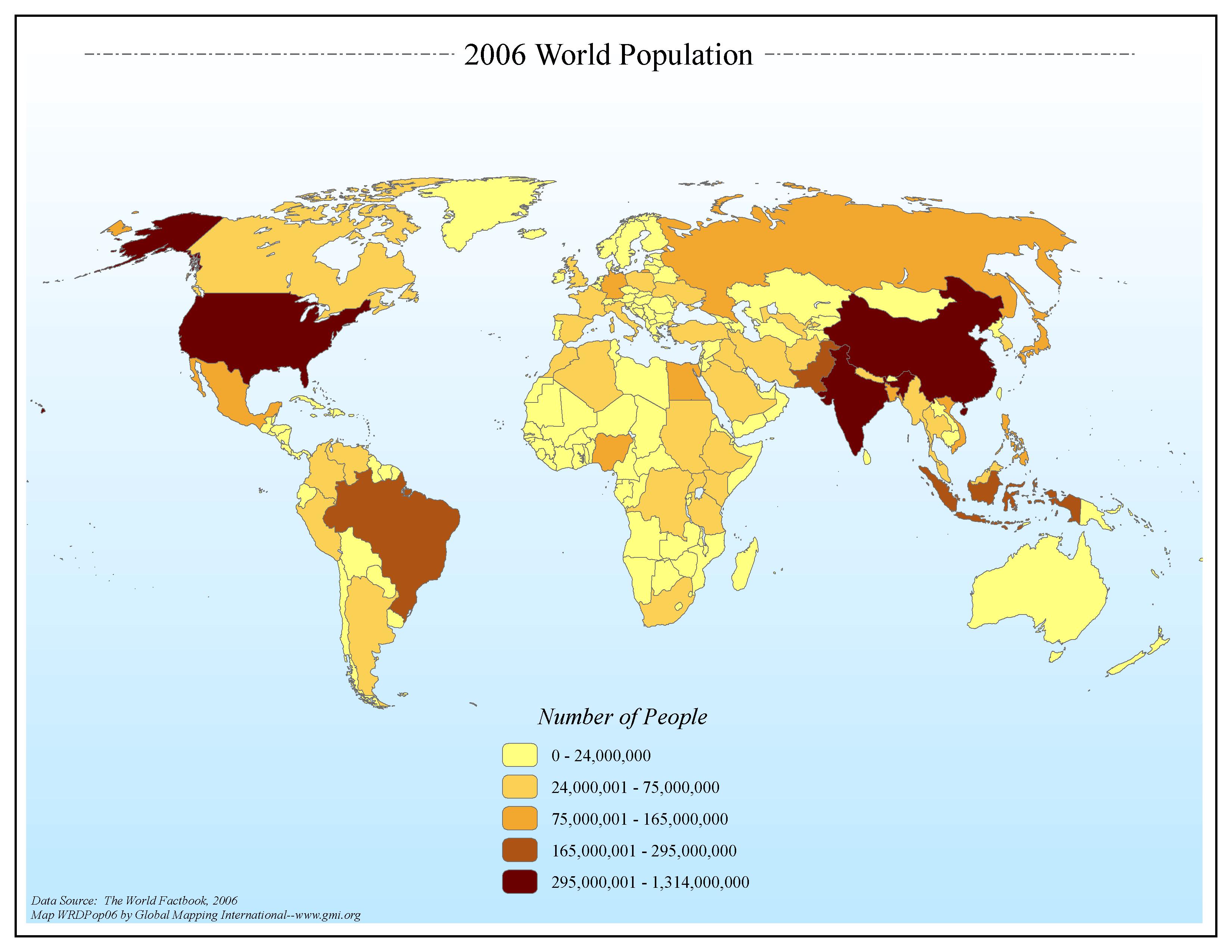
2006 World Population
·Type: Maps ·Map Date: 2006 ·Data Source: The World Factbook, 2006 ·Producer: Global Mapping International ·Collection: Factbook (GMMS 2007) ·Size: 8½ x 11 inches, landscape ·Categories: Type...
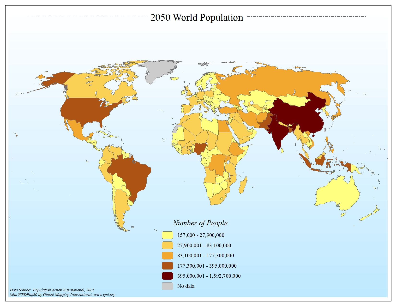
2050 World Population
·Type: Maps ·Map Date: 2006 ·Data Source: Population Action International, 2005 ·Producer: Global Mapping International ·Collection: General World Maps (GMMS 2007) ·Size: 8½ x 11 inches, landscape...
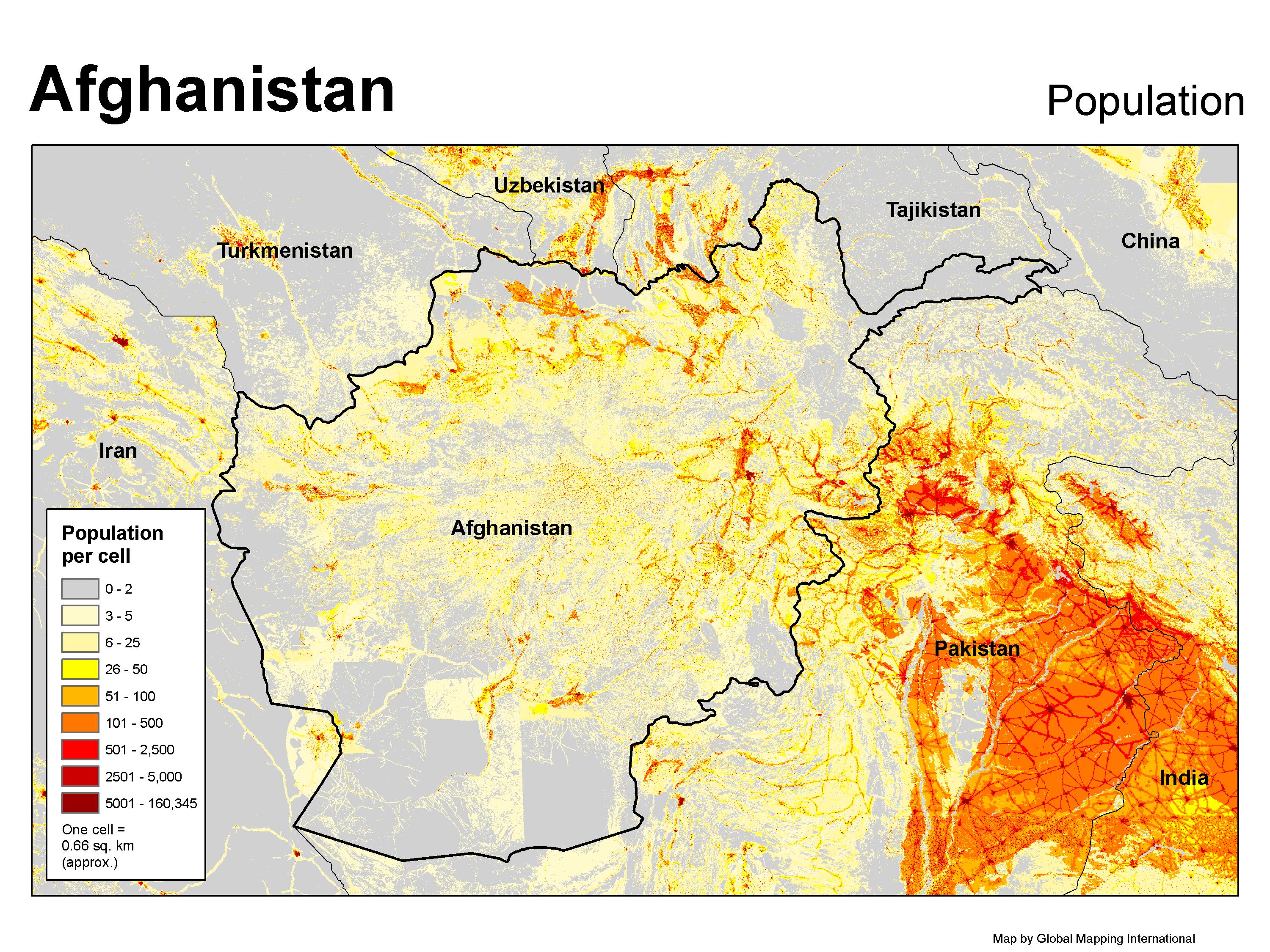
Afghanistan Population
·Type: Maps ·Map Date: 2007 ·Producer: GMI ·Collection: Projects 2007 ·Categories: Type :: Maps Topic :: Statistical Topic :: Demography Country :: Afghanistan Partners :: Global Mapping International Collection...
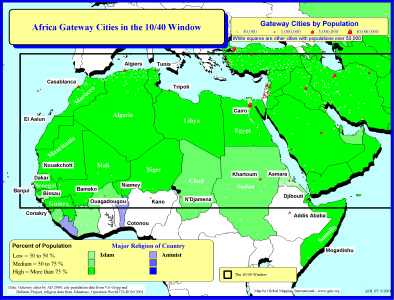
Africa Gateway Cities in The 10/40 Window
·Type: Maps ·Description: Gateway Cities in Africa to the 10/40 Window ·Map Date: 2001 ·Producer: Global Mapping International ·Collection: Reaching Africa (WorldVue 2002) ·Size: 8½ x 11 Inches,...
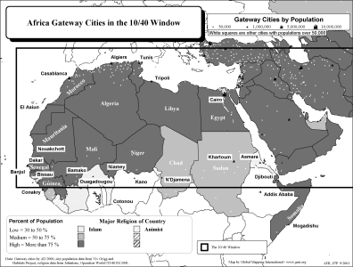
Africa Gateway Cities in The 10/40 Window (BW)
·Type: Maps ·Description: Gateway Cities in Africa to the 10/40 Window ·Map Date: 2002 ·Producer: Global Mapping International ·Collection: Reaching Africa (WorldVue 2002) ·Size: 8½ x 11 Inches,...
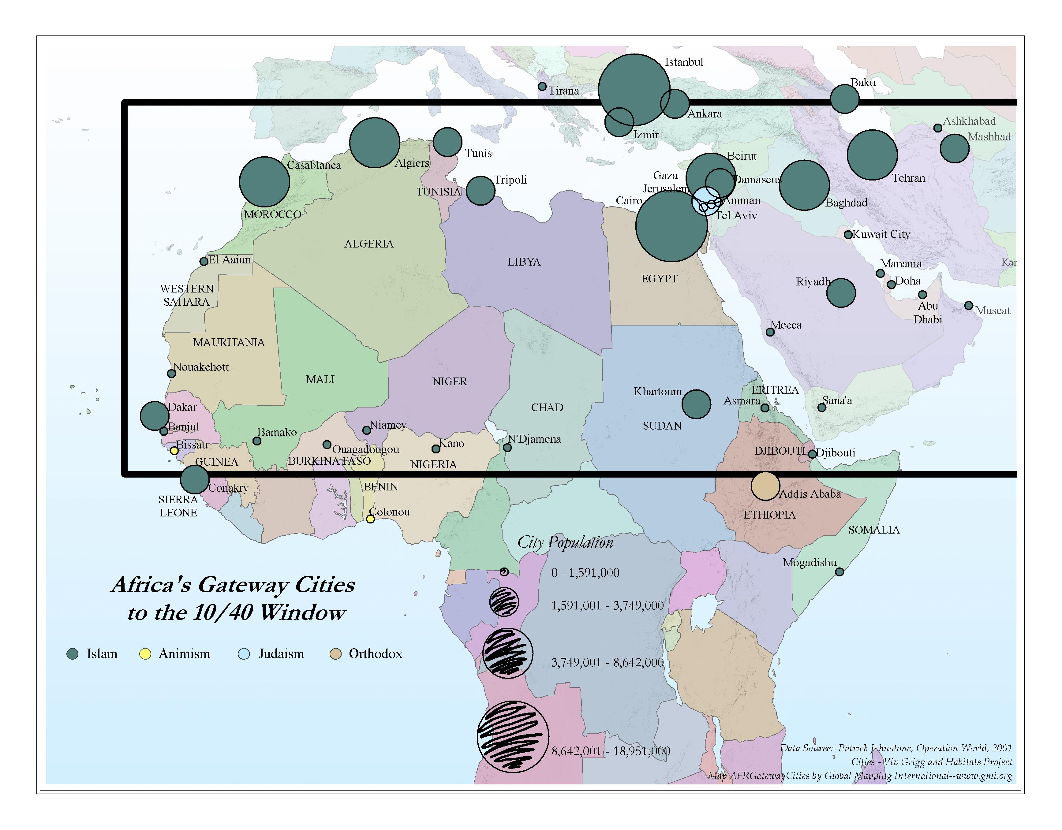
Africa Gateway Cities to the 10/40 Window
·Type: Maps ·Map Date: 2006 ·Data Source: Operation World 2001 Cities - Viv Grigg and Habitats Project ·Producer: Global Mapping International ·Collection: Reaching Africa (GMMS 2007) ·Size: 8½ x 11...
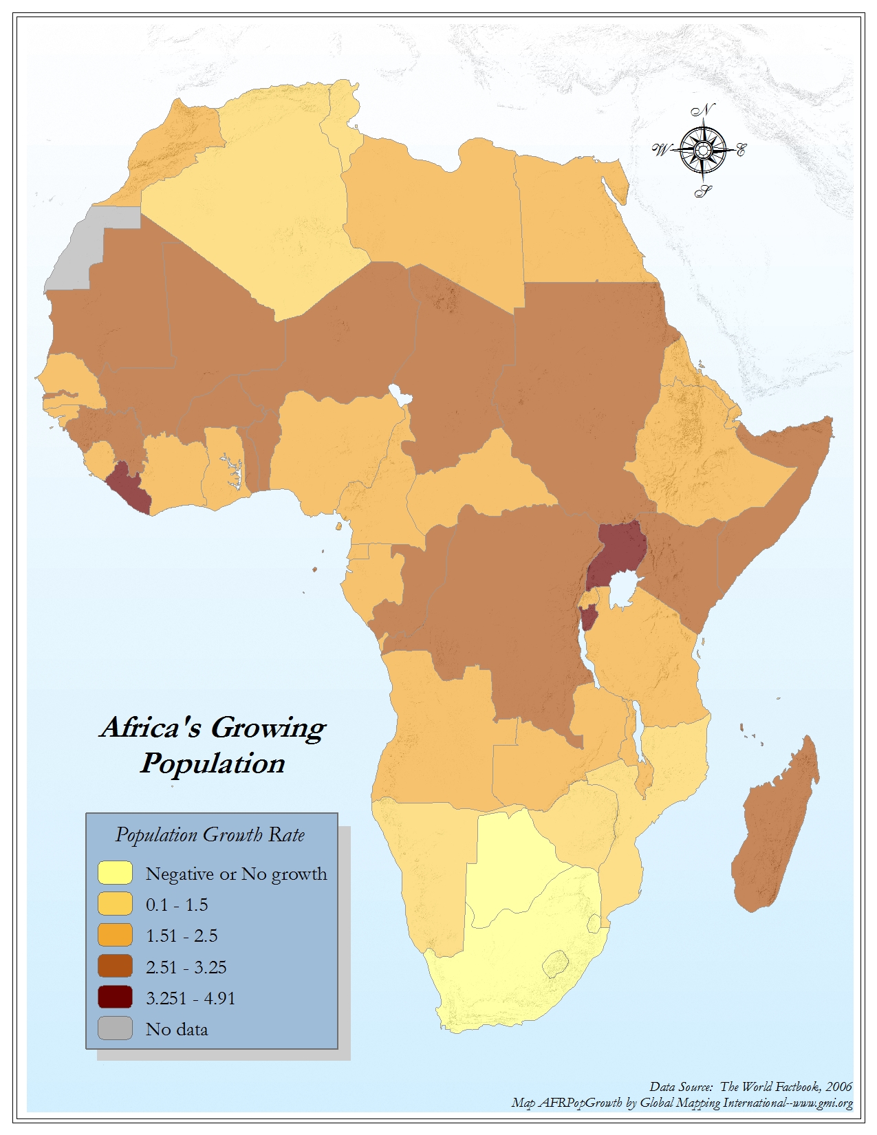
Africa's Growing Population
·Type: Maps ·Map Date: 2006 ·Data Source: The World Factbook, 2006 ·Producer: Global Mapping International ·Collection: Factbook (GMMS 2007) ·Size: 8½ x 11 inches, portrait ·Categories: Type...
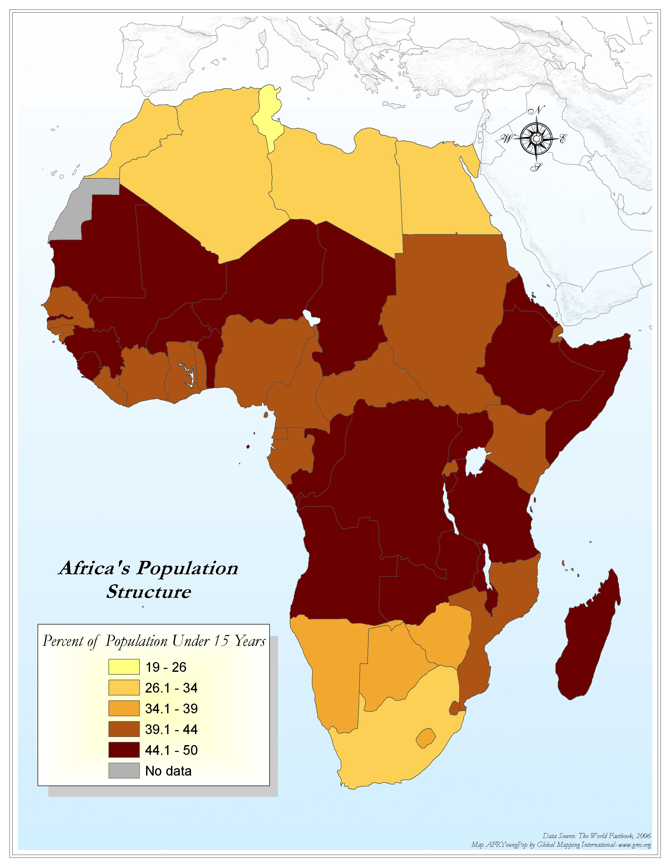
Africa's Population Structure
·Type: Maps ·Map Date: 2006 ·Data Source: World Factbook 2006 ·Producer: Global Mapping International ·Collection: Factbook (GMMS 2007) ·Size: 8½ x 11 inches, portrait ·Categories: Type ::...
.gif)
Africa- Population Density (Landscan)
·Type: Maps ·Map Date: 2008 ·Data Source: Landscan, 2002 ·Producer: Global Mapping International ·Collection: General Maps ·Size: 8.5 by 11 inches, portrait ·Categories: Type :: Maps...
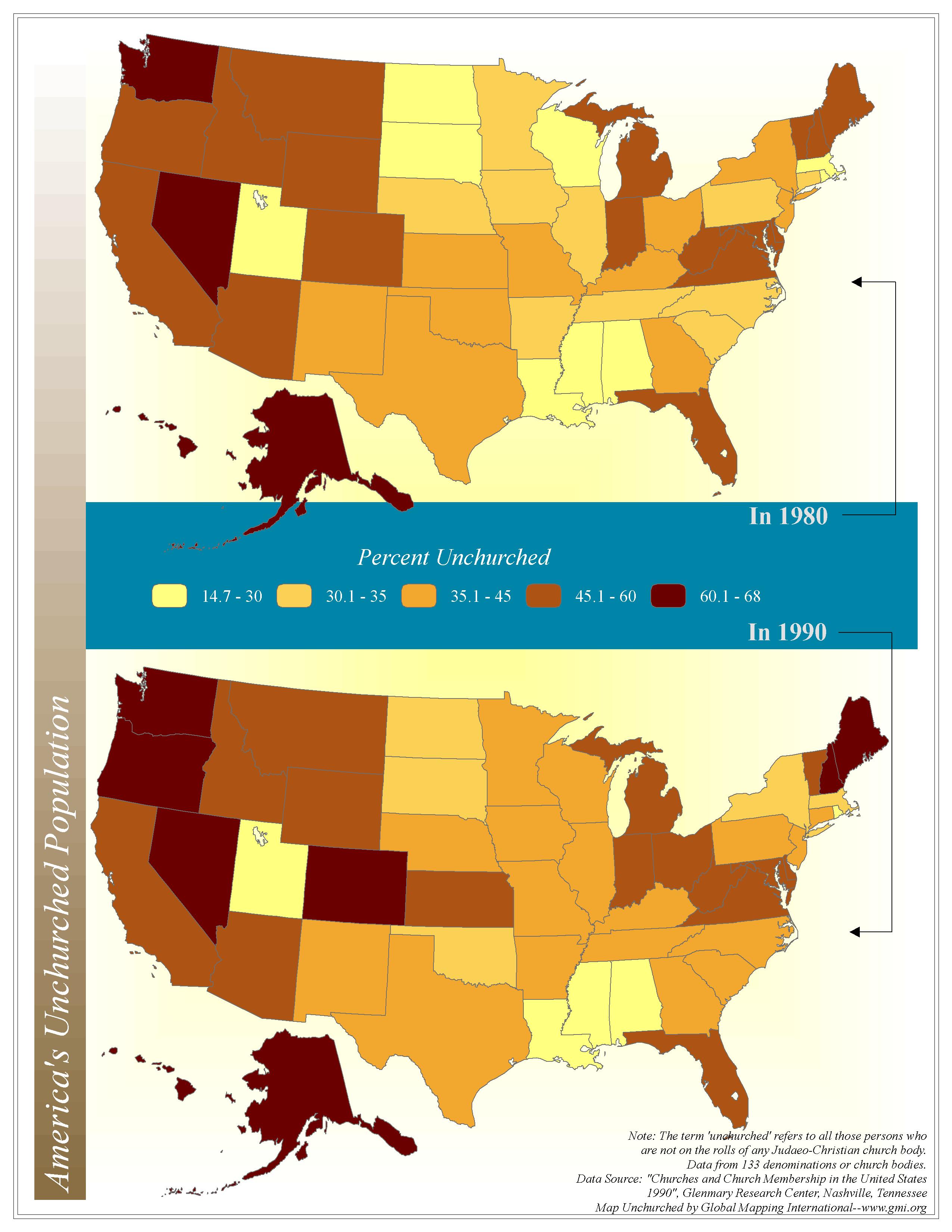
America's Unchurched Population
·Type: Maps ·Map Date: 2006 ·Data Source: Churches and Church Membership in the United States 1990, Glenmary Research Center, Nashville, Tennessee ·Producer: Global Mapping International ·Collection: Intro to...
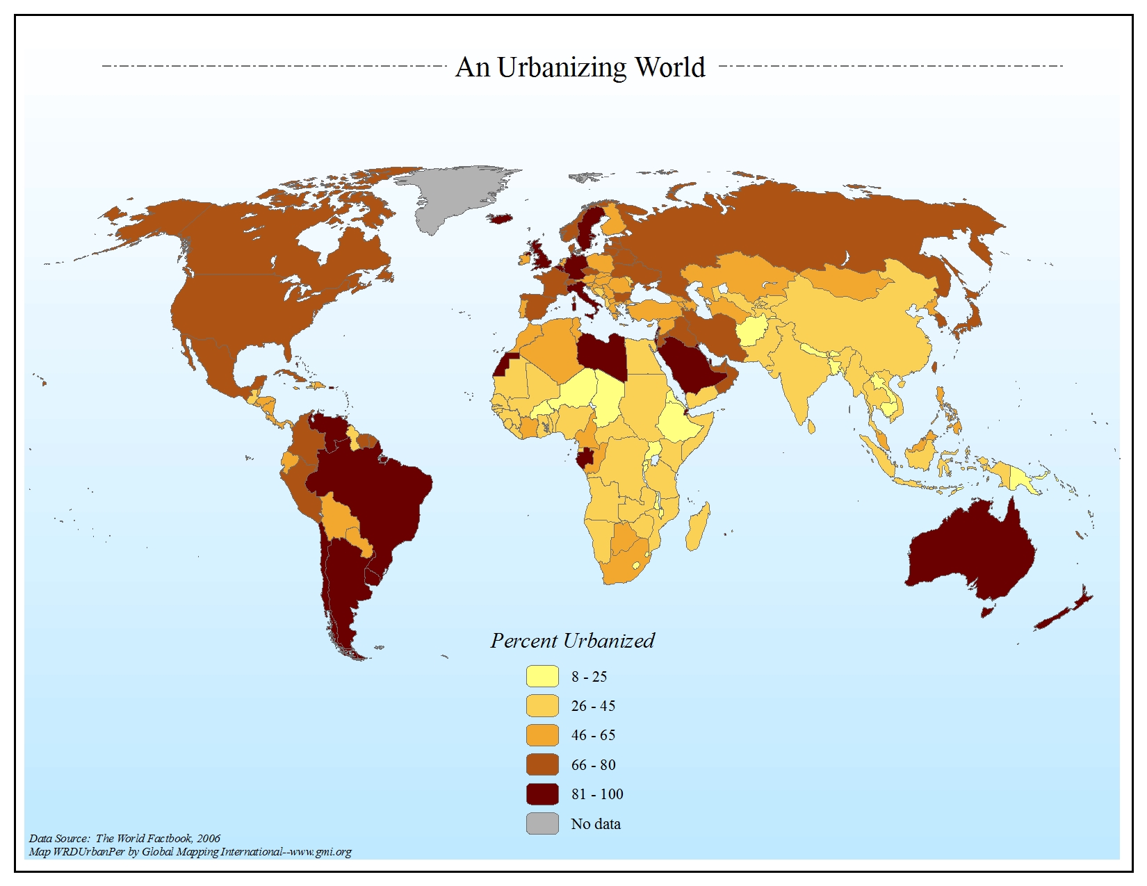
An Urbanizing World
·Type: Maps ·Map Date: 2006 ·Data Source: The World Factbook, 2006 ·Producer: Global Mapping International ·Collection: Factbook (GMMS 2007) ·Size: 8½ x 11 inches, landscape ·Categories: Type...
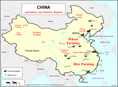
China - Agriculture and Industry Regions
·Type: Maps ·Description: Agricultural and Industrial Region Divisions ·Map Date: 2000 ·Producer: Global Mapping International ·Collection: China Mobilization (WV 2002) ·Size: 8½ x 11 Inches,...
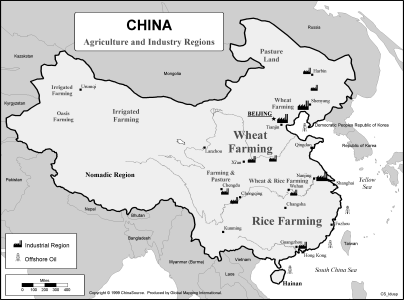
China - Agriculture and Industry Regions (BW)
·Type: Maps ·Description: Agricultural and Industrial Region Divisions ·Map Date: 2002 ·Data Source: ChinaSource ·Producer: Global Mapping International ·Collection: China Mobilization (WV 2002)...
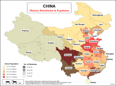
China - Ministry Distribution & Population
·Type: Maps ·Description: China - Divisions of the ministry distribution and population of China ·Map Date: 2000 ·Producer: Global Mapping International ·Collection: China Mobilization (WV 2002) ·Size:...
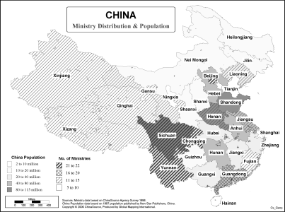
China - Ministry Distribution & Population (BW)
·Type: Maps ·Description: China - Divisions of the ministry distribution and population of China ·Map Date: 2002 ·Data Source: ChinaSource ·Producer: Global Mapping International ·Size: 8½ x 11...
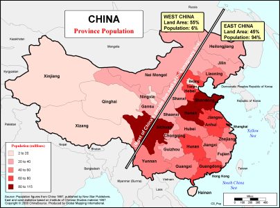
China - Province Population
·Type: Maps ·Description: Populations of Chinese Provinces ·Map Date: 2000 ·Producer: Global Mapping International ·Collection: China Mobilization (WV 2002) ·Size: 8½ x 11 Inches, landscape...
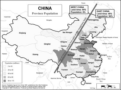
China - Province Population (BW)
·Type: Maps ·Description: Populations of Chinese Provinces ·Map Date: 2002 ·Data Source: ChinaSource ·Producer: Global Mapping International ·Collection: China Mobilization (WV 2002) ·Size: 8½...
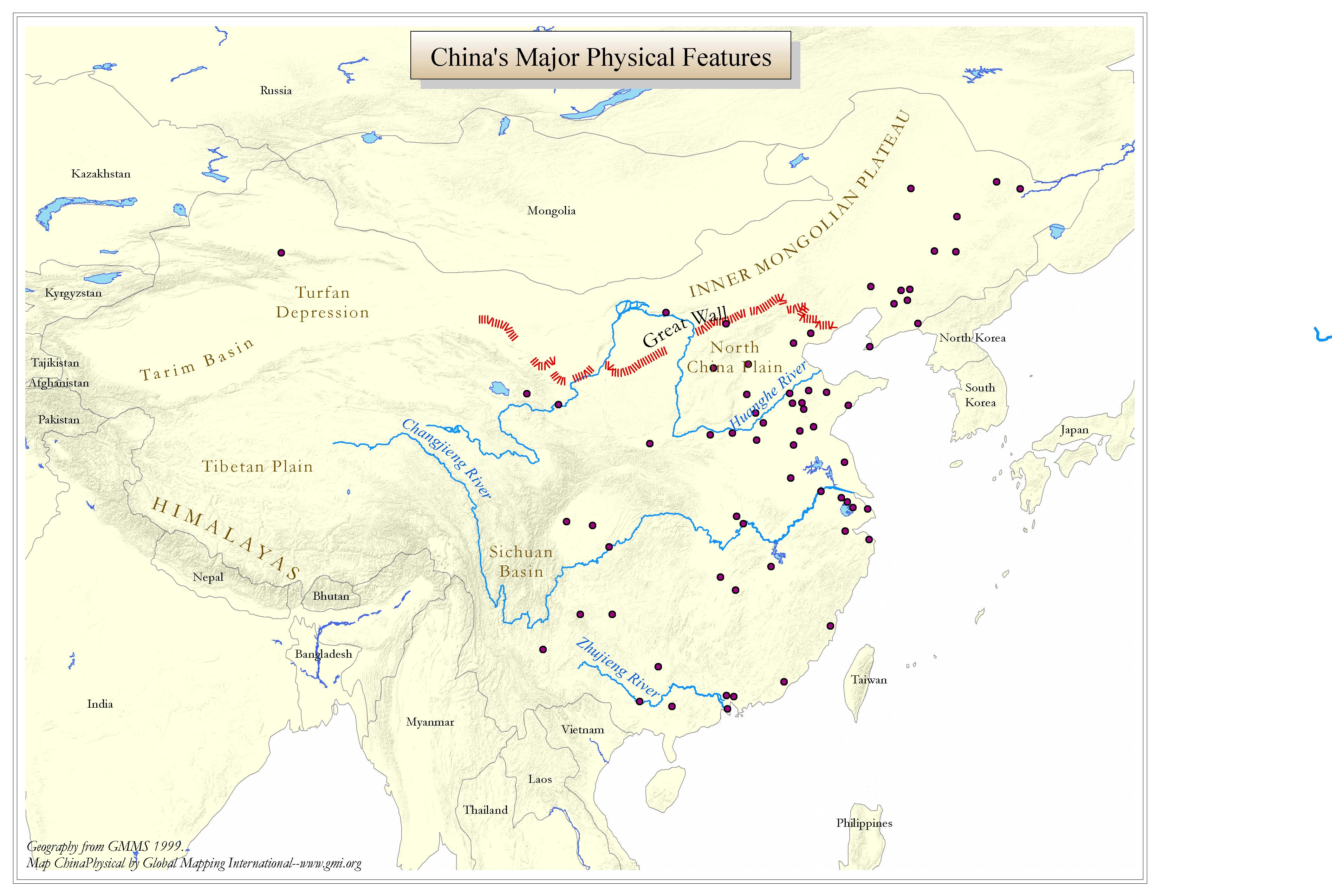
China's Major Physical Features
·Type: Maps ·Map Date: 2006 ·Data Source: GMMS 1999 ·Producer: Global Mapping International ·Collection: China Mobilization (GMMS 2007) ·Size: 8½ x 11 inches, landscape ·Categories: Type ::...
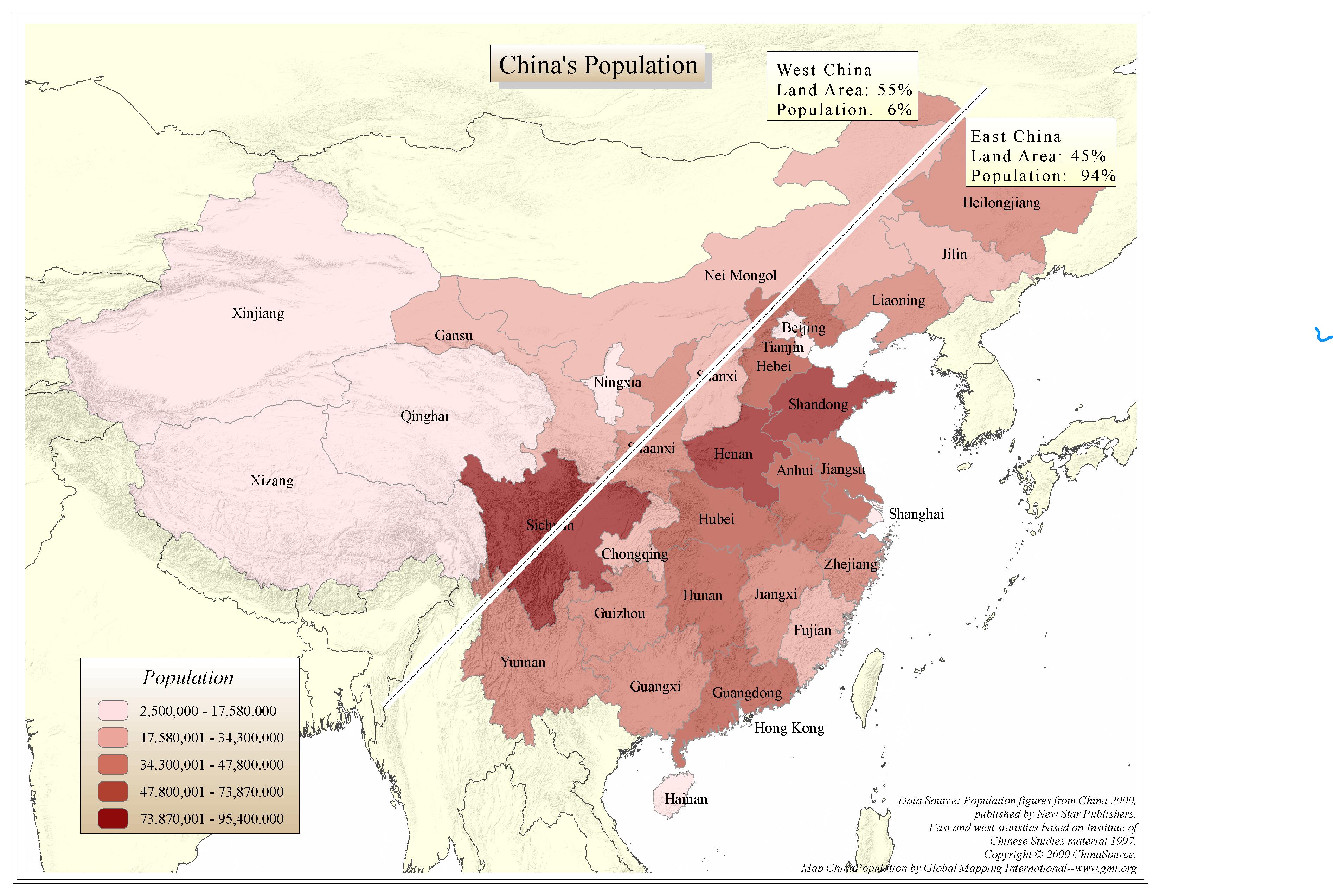
China's Population
·Type: Maps ·Map Date: 2006 ·Data Source: Various ·Producer: Global Mapping International ·Collection: China Mobilization (GMMS 2007) ·Size: 8½ x 11 inches, landscape ·Categories: Type :: Maps...
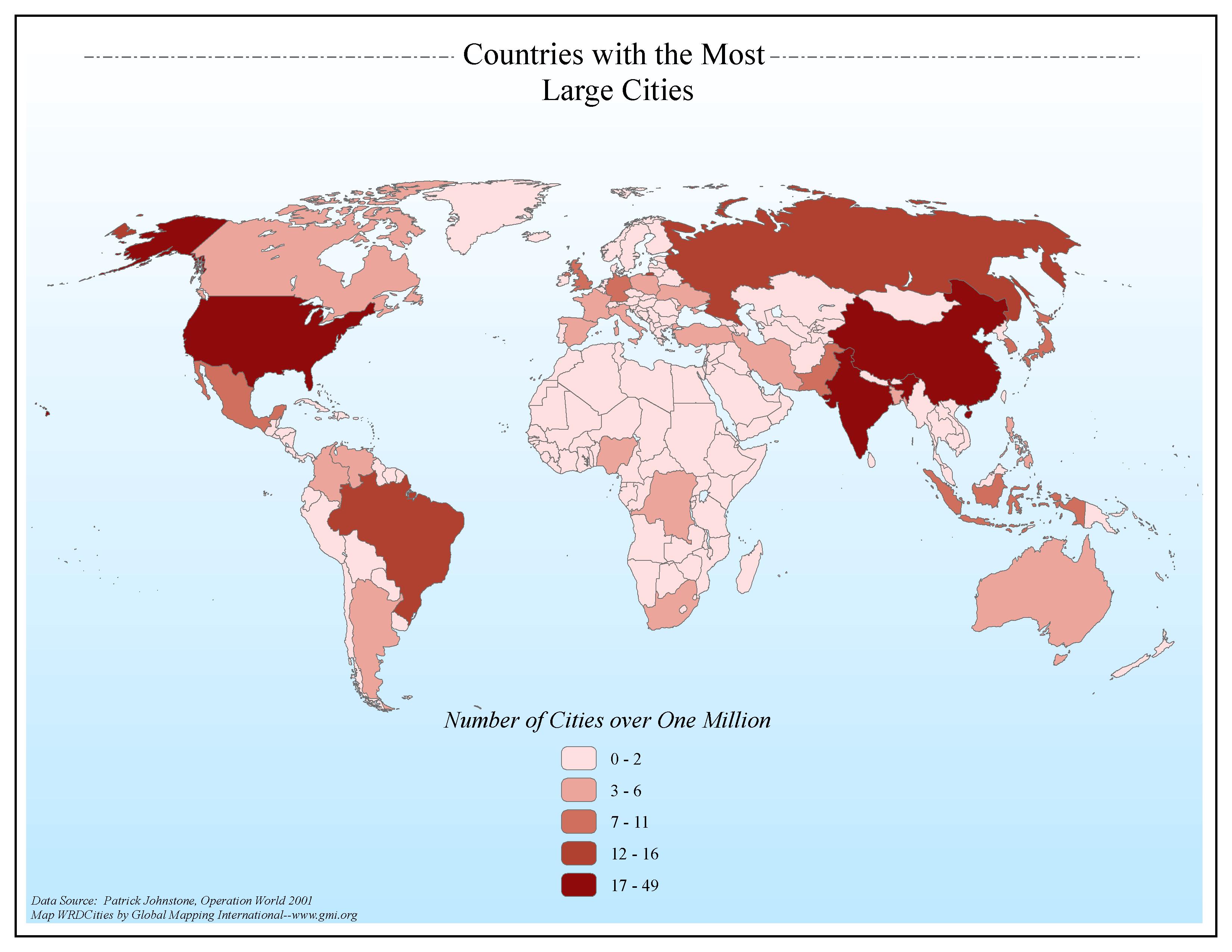
Countries with the Most Large Cities
·Type: Maps ·Map Date: 2006 ·Data Source: Patrick Johnstone, Operation World 2001 ·Producer: Global Mapping International ·Collection: General World Maps (GMMS 2007) ·Size: 8½ x 11 inches, landscape...
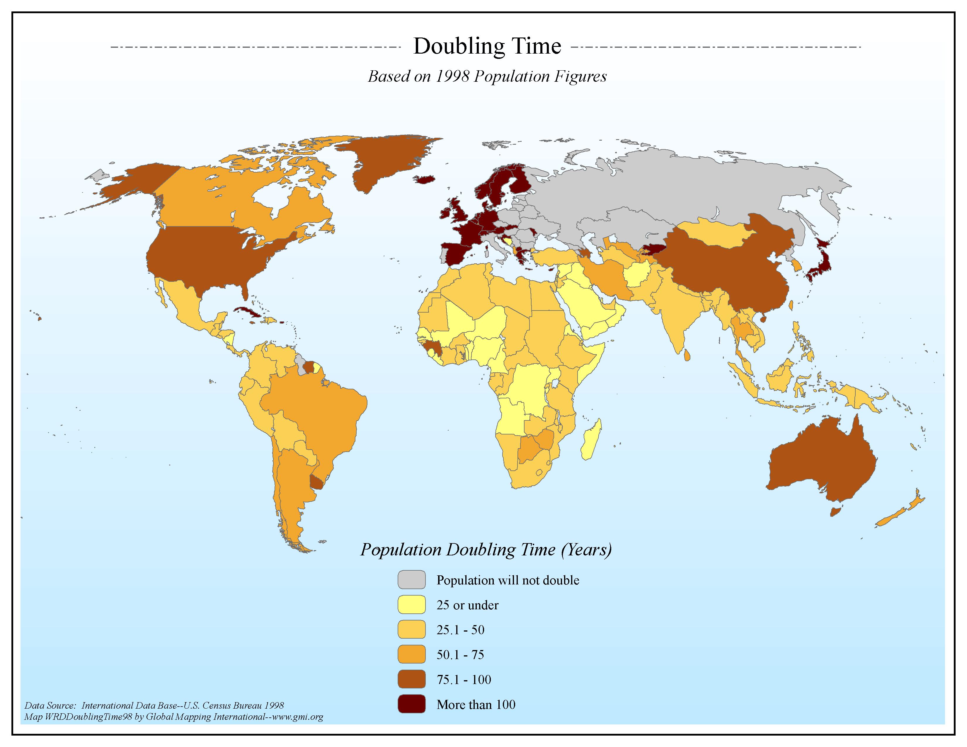
Doubling Time Based on 1998 Population Figures
·Type: Maps ·Map Date: 2006 ·Data Source: International Data Base--U.S. Census Bureau 1998 ·Producer: Global Mapping International ·Collection: General World Maps (GMMS 2007) ·Size: 8½ x 11 inches,...
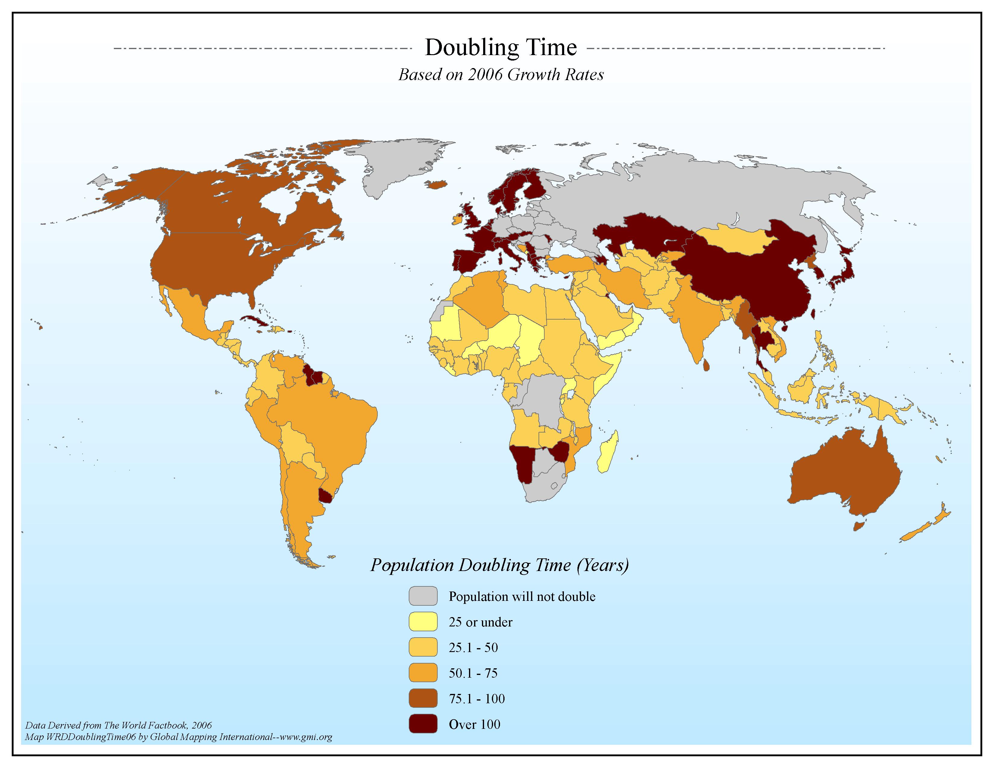
Doubling Time Based on 2006 Growth Rates
·Type: Maps ·Map Date: 2006 ·Data Source: Data Derived from The World Factbook, 2006 ·Producer: Global Mapping International ·Collection: Factbook (GMMS 2007) ·Size: 8½ x 11 inches, landscape...
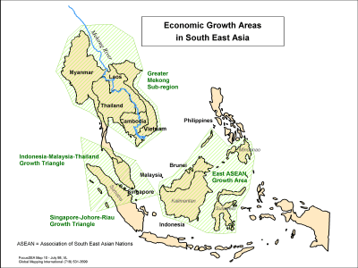
Economic Growth Areas in South East Asia
·Type: Maps ·Description: Areas of Economic Growth in Southeast asia ·Map Date: 1998 ·Producer: Global Mapping International ·Collection: Focus South East Asia (WV 2002) ·Size: 8½ x 11 Inches,...
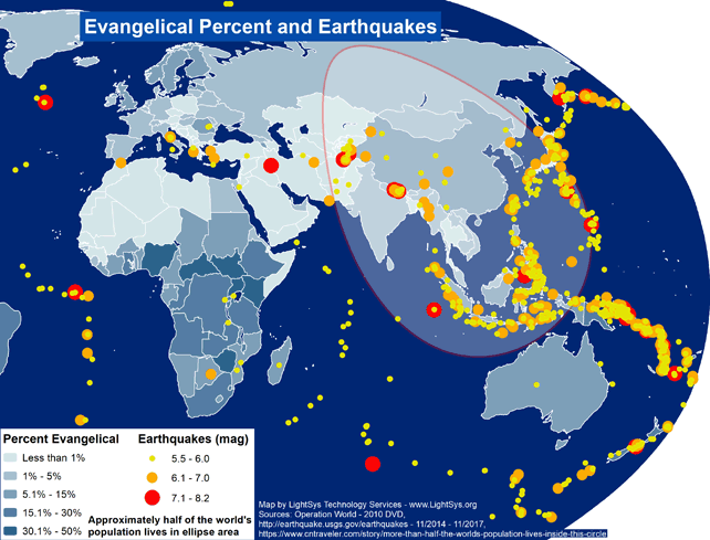
Evangelical Percent and Earthquakes - Asia
· Type: Maps · Map Date: 2017 · Data Source: Operation World (2010) DVD, http://earthquake.usgs.gov/earthquakes - 11/2014 – 11/2017,...
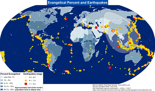
Evangelical Percent and Earthquakes - World
· Type: Maps · Map Date: 2017 · Data Source: Operation World (2010) DVD, http://earthquake.usgs.gov/earthquakes - 11/2014 – 11/2017,...
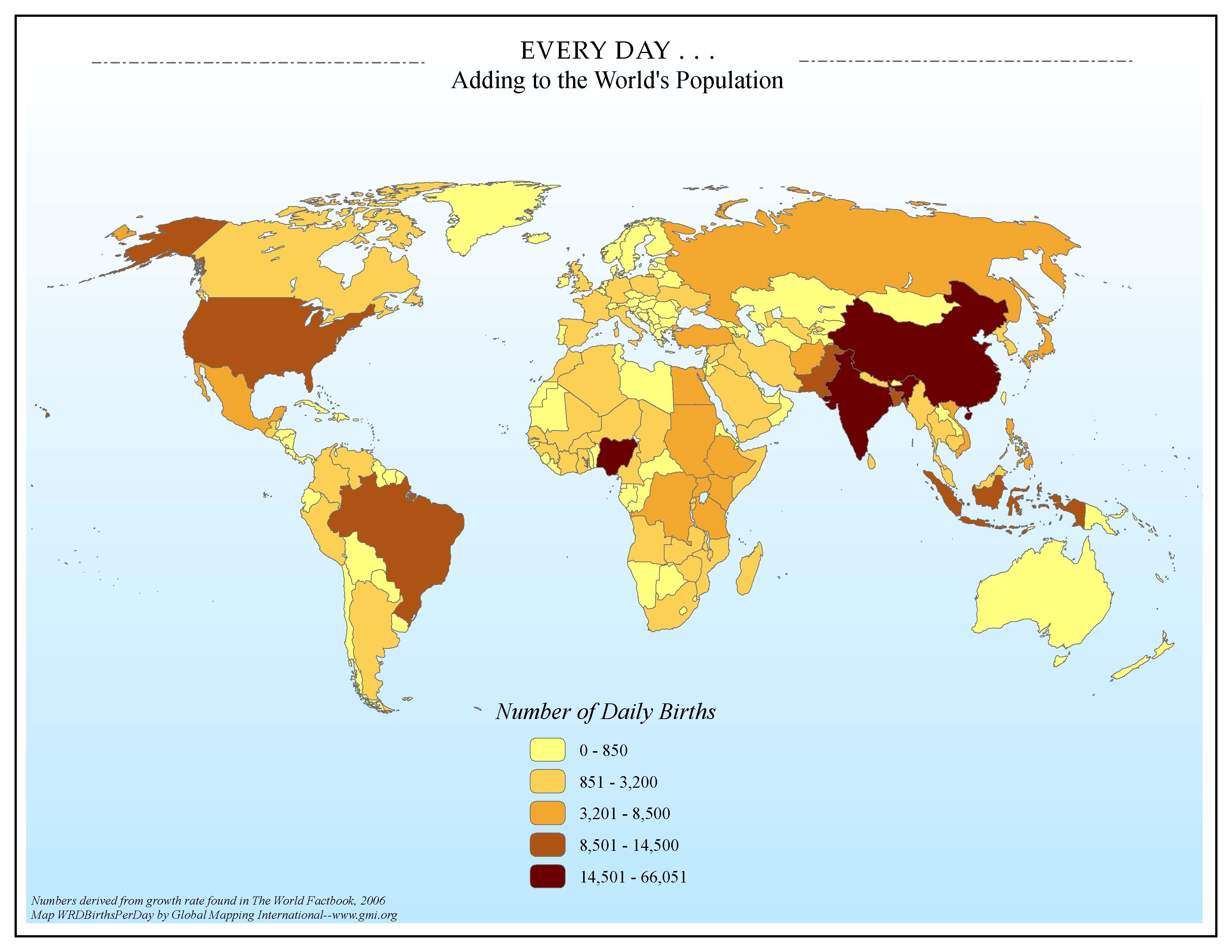
EVERY DAY . . . Adding to the World's Population
·Type: Maps ·Map Date: 2006 ·Data Source: Numbers derived from growth rate found in The World Factbook, 2006 ·Producer: Global Mapping International ·Collection: Factbook (GMMS 2007) ·Size: 8½ x 11 inches, landscape ·Categories: Type ::...

