| Product Image |
Resource Name- |
Price |
Manufacturer |
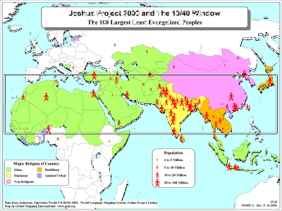 |
·Type: Maps ·Description: Joshua Project in the 10/40 Window ·Map Date: 2001 ·Producer: Global Mapping International ·Collection: The 10/40 Window (WorldVue 2002) ·Size: 8½ x 11 Inches, landscape ·Note: Windows Metafile and Metafile in Word forms of this map require the GMISym.ttf font ·Categories: Type :: Maps Collection :: GMI Map Collections :: The 10/40 Window (WorldVue 2002) Topic :: Statistical Topic :: Strategy Topic ::... |
... more info
Max: 1
|
|
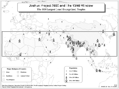 |
·Type: Maps ·Description: Joshua Project in the 10/40 Window ·Map Date: 2002 ·Producer: Global Mapping International ·Collection: The 10/40 Window (WorldVue 2002) ·Size: 8½ x 11 Inches, landscape ·Note: Windows Metafile and Metafile in Word forms of this map require the GMISym.ttf font ·Categories: Type :: Maps Collection :: GMI Map Collections :: The 10/40 Window (WorldVue 2002) Topic :: Statistical Topic :: Strategy Topic ::... |
... more info
Max: 1
|
|
 |
·Type: Documents ·Date: 5 October 1998 ·Authors: Dan Scribner ·Producer: AD2000 and Beyond Movement ·Collection: Historical Review Documents ·Pages: 1 ·Categories: Type :: Documents Topic :: Statistical Topic :: Peoples, multiple or unknown Partners :: AD2000 Collection :: AD2000 Movement Archives :: AD2000 Archive CD-ROM Selections :: Historical Review Documents |
... more info
Max: 1
|
|
 |
·Type: Data ·Date: 10 August 1999 ·Authors: Dan Scribner ·Producer: AD2000 and Beyond Movement ·Collection: Historical Review Documents ·Categories: Type :: Data Topic :: Statistical Topic :: History Partners :: AD2000 Collection :: AD2000 Movement Archives :: AD2000 Archive CD-ROM Selections :: Historical Review Documents ·Data rows: 30 |
... more info
Max: 1
|
|
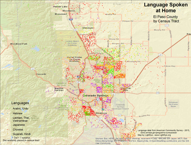 |
· Type Maps · Map Date: 2018 · Data Source: American Community Survey, 2015, https://www.census.gov/programs-surveys/acs · Partners: LightSys Technology Services, U.S. Government · Collection: Projects 2017 · Size: 8½ x 11 inches, landscape · Categories: Continent/Region :: North America Country :: United States Topic :: Statistical; Demography, Language and Translation |
... more info
|
|
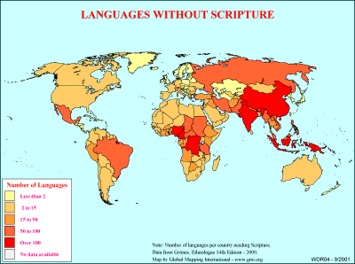 |
·Type: Maps ·Description: Number of languages without scripture on country level divisions. ·Map Date: 2000 ·Producer: Global Mapping International ·Collection: General World Maps (WV 2002) ·Size: 8½ x 11 Inches, landscape ·Categories: Type :: Maps Collection :: GMI Map Collections :: General World Maps (WV 2002) Continent/Region :: World Topic :: Statistical Topic :: Peoples, multiple or unknown Partners :: Global Mapping International... |
... more info
Max: 1
|
|
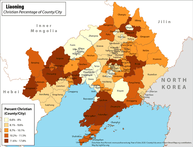 |
· Type: Maps · Map Date: 2019 · Data Source: Asia Harvest; county/city areas © OpenStreetMap contributors, http://www.openstreetmap.org/copyright. Data available under the Open Database License · Partners: LightSys Technology Services · Collection: Projects 2019 · Size: 8½ x 11 inches, landscape · Categories: Type :: Maps Continent/Region :: Asia Country :: China Topic :: Statistical Topic :: Religions,... |
... more info
|
|
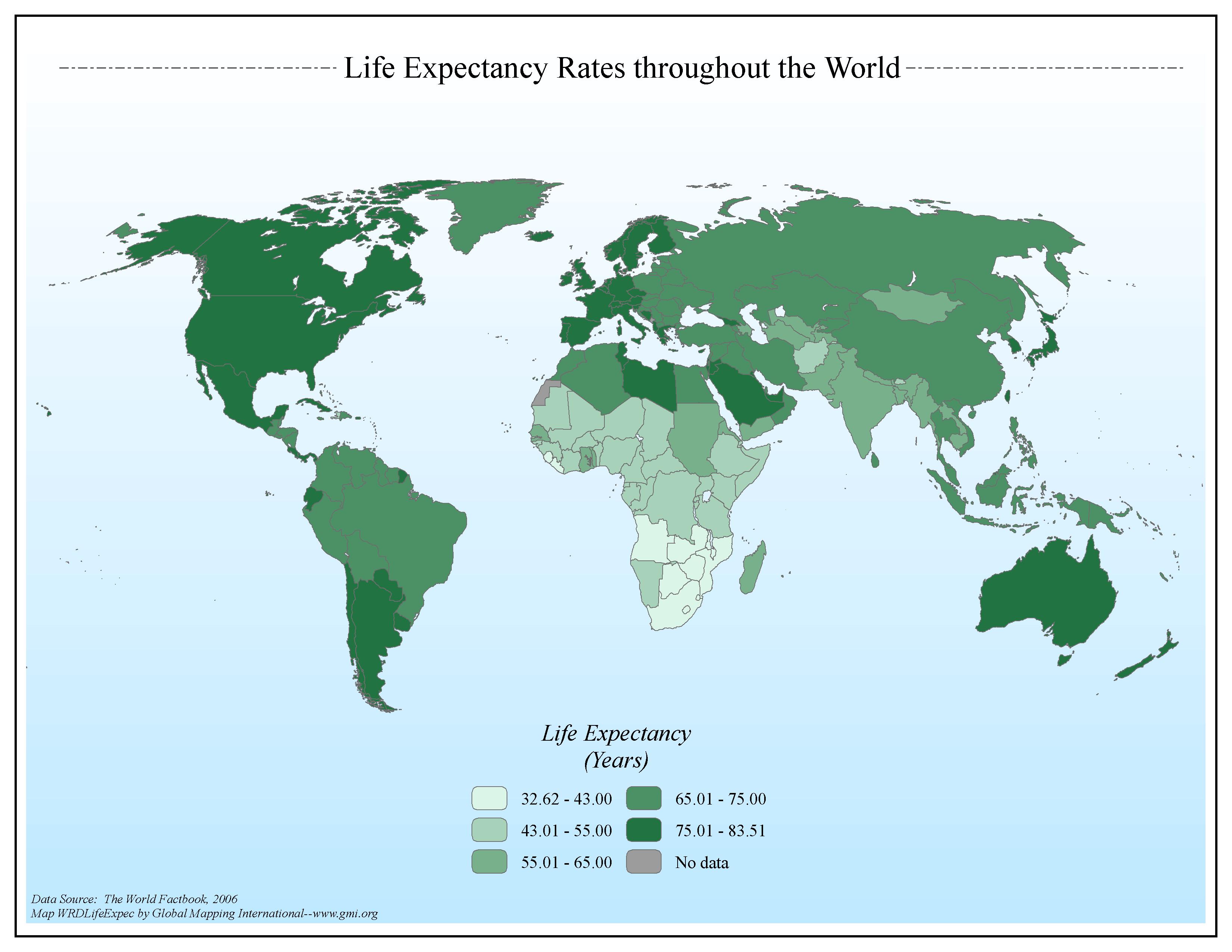 |
·Type: Maps ·Map Date: 2006 ·Data Source: The World Factbook, 2006 ·Producer: Global Mapping International ·Collection: Factbook (GMMS 2007) ·Size: 8½ x 11 inches, landscape ·Categories: Type :: Maps Continent/Region :: World Topic :: Statistical Topic :: Social Collection :: GMI Map Collections :: Factbook (GMMS 2007) Collection :: GMI Map Collections :: General World Maps (GMMS 2007) Partners :: Global Mapping International |
... more info
Max: 1
|
|
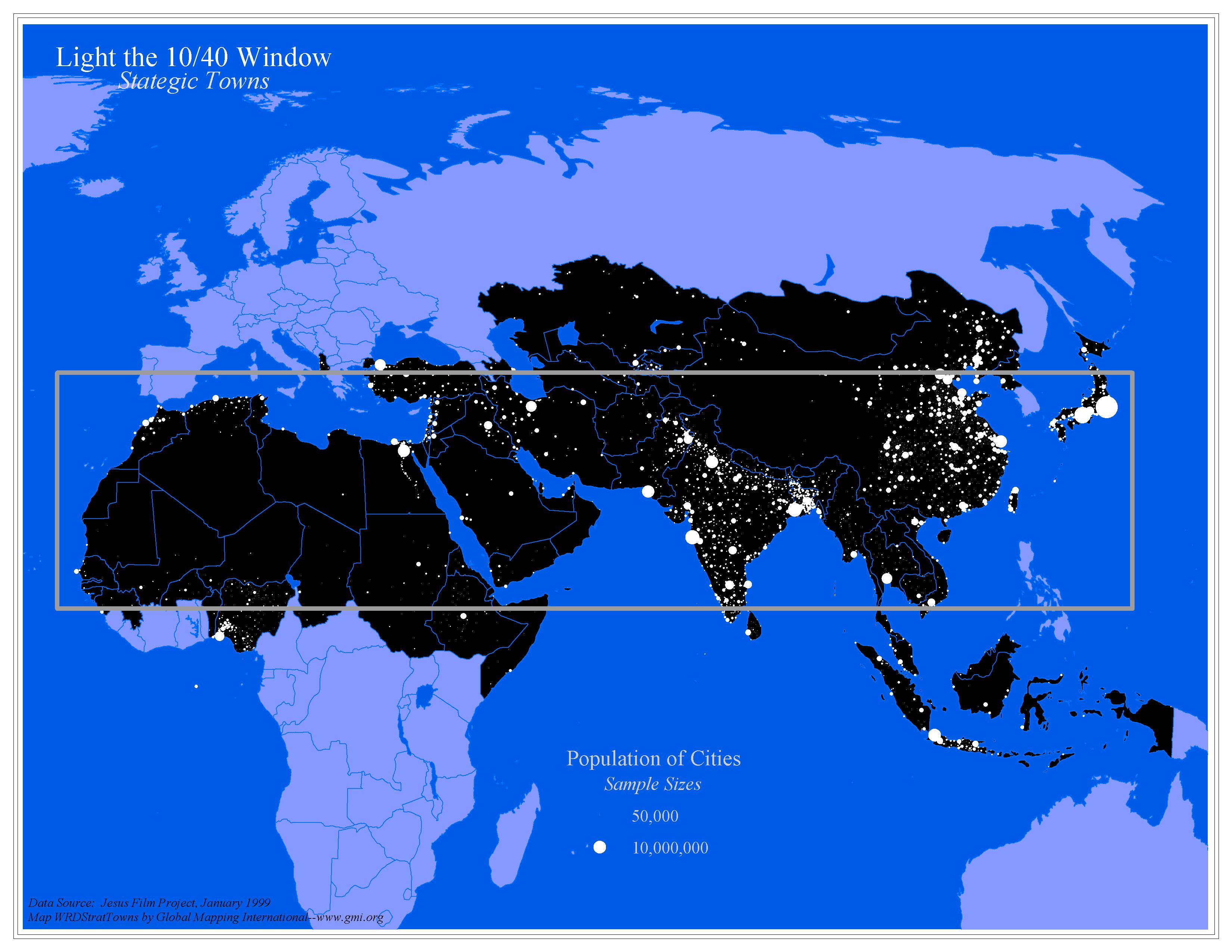 |
·Type: Maps ·Map Date: 2006 ·Data Source: Jesus Film Project, January 1999 ·Producer: Global Mapping International ·Collection: General World Maps (GMMS 2007) ·Size: 8½ x 11 inches, landscape ·Categories: Type :: Maps Topic :: Statistical Topic :: Strategy Topic :: Concepts Collection :: GMI Map Collections :: General World Maps (GMMS 2007) Partners :: Global Mapping International Continent/Region :: 10/40 Window |
... more info
Max: 1
|
|
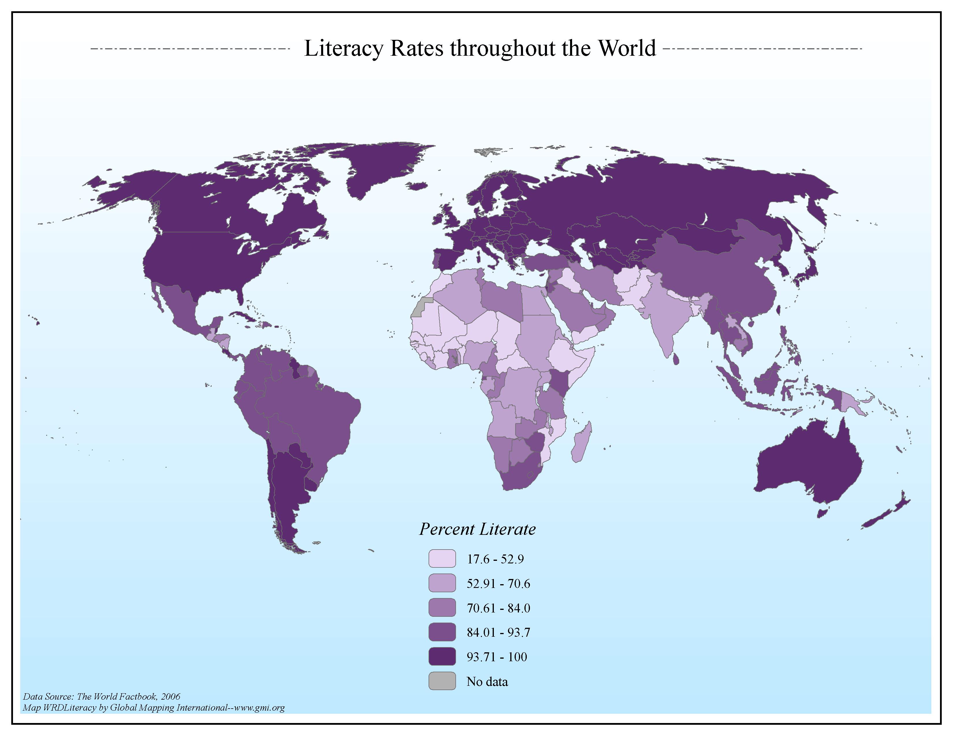 |
·Type: Maps ·Map Date: 2006 ·Data Source: The World Factbook, 2006 ·Producer: Global Mapping International ·Collection: Factbook (GMMS 2007) ·Size: 8½ x 11 inches, landscape ·Categories: Type :: Maps Continent/Region :: World Topic :: Statistical Topic :: Social Collection :: GMI Map Collections :: Factbook (GMMS 2007) Collection :: GMI Map Collections :: General World Maps (GMMS 2007) Partners :: Global Mapping International |
... more info
Max: 1
|
|
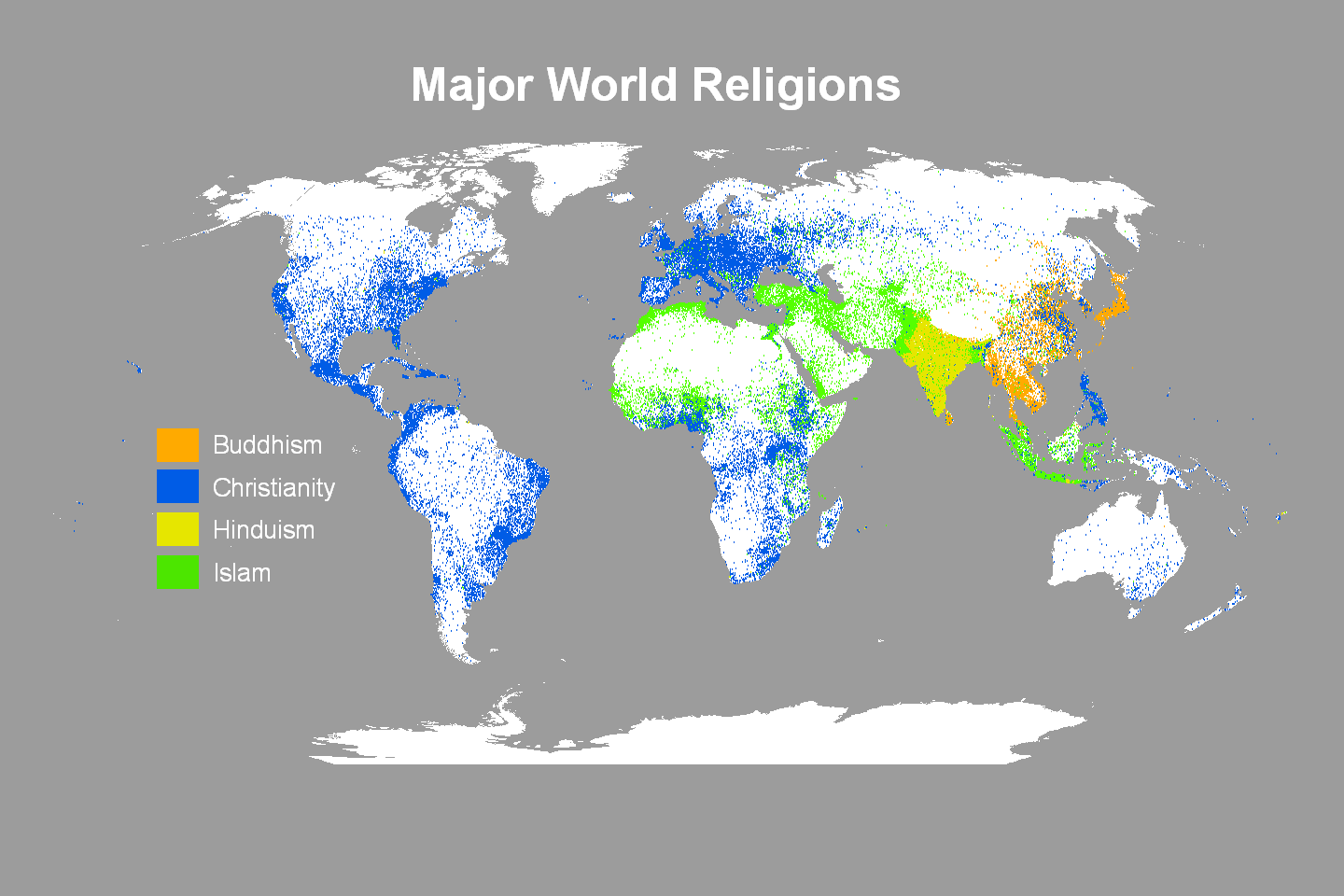 |
·Type: Maps ·Map Date: 2009 ·Data Source: Operation World 2001 ·Producer: Global Mapping International ·Collection: Projects 2009 ·Size: 30 by 20 inches, landscape ·Categories: Type :: Maps Continent/Region :: World Topic :: Statistical Partners :: Global Mapping International Topic :: Religions, General :: Multiple/Other Collection :: GMI Map Collections :: Projects 2009 |
... more info
Max: 1
|
|
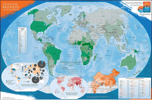 |
Disponible en francés, inglés, portugués y ruso. Este mapa en español de colores (60.96 cm por 91.44 cm) destaca información y estadística encontrada en Operación Muro Mundo y en Ora por el Mundo . El mapa principal incluye el porcentaje de Cristianos en los 30 países más grandes, el número de los pueblos menos-alcanzados en cada país, y el porcentaje de Cristianos por provincia de la China y de la India. ·Type: Maps ·Map Date: 2019 ·Categories: Collection ::... |
... more info
|
|
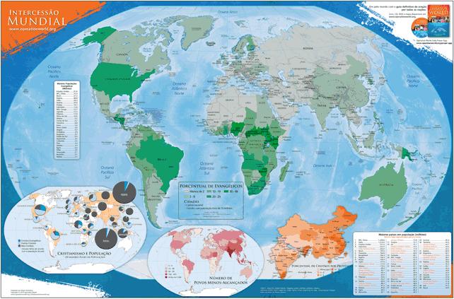 |
Disponível em inglês, francês, russo e et espanhol. Este mapa do mundo em cores do tamanho de 60,96 cm x 91,44 cm destaca as informações dos livros Intercessão Mundial (7ª edição - 2010) e Ore pelas Nações . O mapa principal mostra a porcentagem de evangélicos por país. Os mapas inseridos também mostram a porcentagem de cristãos nos 30 maiores países, o número de povos menos alcançados por país e a porcentagem de cristãos na China e na Índia por província. ·Type:... |
... more info
|
|
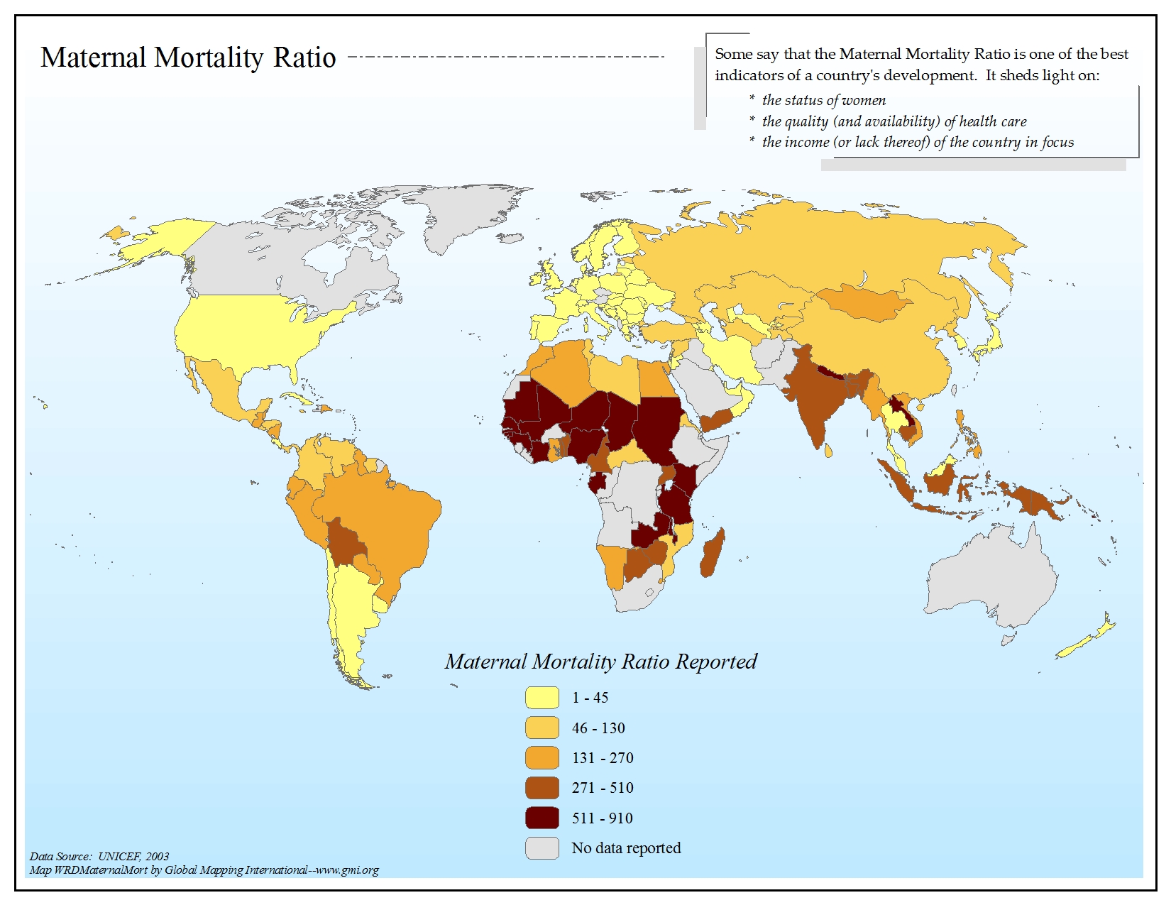 |
·Type: Maps ·Map Date: 2006 ·Data Source: UNICEF, 2003 ·Producer: Global Mapping International ·Collection: General World Maps (GMMS 2007) ·Size: 8½ x 11 inches, landscape ·Categories: Type :: Maps Continent/Region :: World Topic :: Statistical Topic :: Social Collection :: GMI Map Collections :: General World Maps (GMMS 2007) Partners :: Global Mapping International |
... more info
Max: 1
|
|
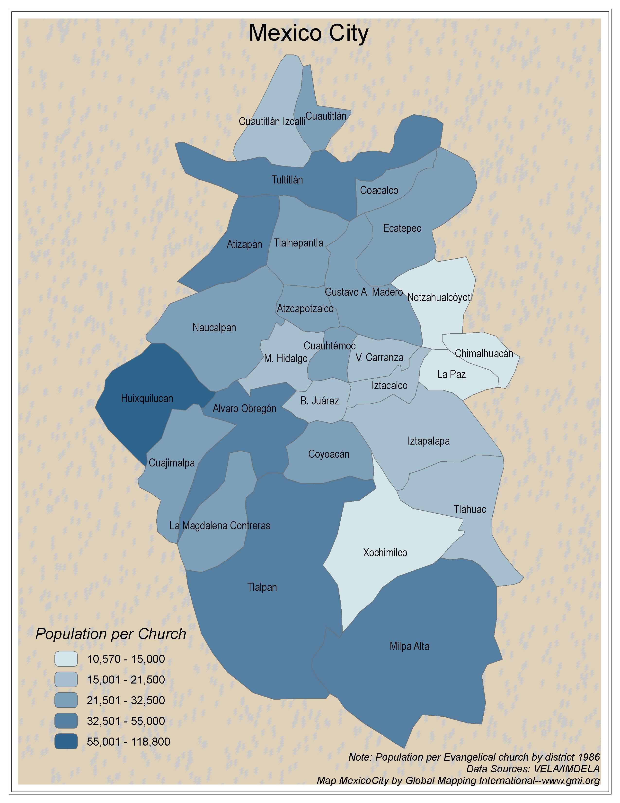 |
·Type: Maps ·Map Date: 2006 ·Data Source: VELA/IMDELA ·Producer: Global Mapping International ·Collection: Intro to Missions (GMMS 2007) ·Size: 8½ x 11 inches, portrait ·Categories: Type :: Maps Topic :: Statistical Topic :: Strategy Country :: Mexico Collection :: GMI Map Collections :: Intro to Missions (GMMS 2007) Partners :: Global Mapping International Topic :: Religions, Christianity :: Adherents, Churches, and Denoms |
... more info
Max: 1
|
|
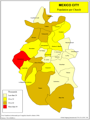 |
·Type: Maps ·Description: Population per church in Mexico City ·Map Date: 1986 ·Producer: Global Mapping International ·Collection: Intro to Mission (WorldVue 2002) ·Size: 8½ x 11 Inches, portrait ·Categories: Type :: Maps Collection :: GMI Map Collections :: Intro to Mission (WorldVue 2002) Topic :: Statistical Topic :: Strategy Country :: Mexico Partners :: Global Mapping International Topic :: Religions, Christianity :: Adherents,... |
... more info
Max: 1
|
|
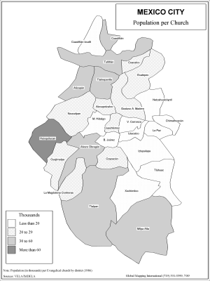 |
·Type: Maps ·Description: Population per church in Mexico City ·Map Date: 2002 ·Producer: Global Mapping International ·Collection: Intro to Mission (WorldVue 2002) ·Size: 8½ x 11 Inches, portrait ·Categories: Type :: Maps Collection :: GMI Map Collections :: Intro to Mission (WorldVue 2002) Topic :: Statistical Topic :: Strategy Country :: Mexico Partners :: Global Mapping International Topic :: Religions, Christianity :: Adherents,... |
... more info
Max: 1
|
|
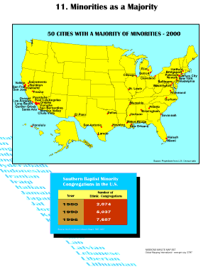 |
·Type: Maps ·Description: Minorities as a majority ·Map Date: 2001 ·Producer: Global Mapping International ·Collection: Missions Minute (WorldVue 2002) ·Size: 8½ x 11 Inches, portrait ·Categories: Type :: Maps Collection :: GMI Map Collections :: Missions Minute (WorldVue 2002) Continent/Region :: North America Country :: United States of America Topic :: Statistical Topic :: Concepts Topic :: Demography Type :: Graphs Partners :: Global... |
... more info
Max: 1
|
|
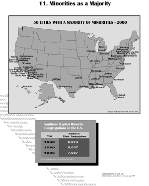 |
·Type: Maps ·Description: Minorities as a majority ·Map Date: 2002 ·Producer: Global Mapping International ·Collection: Missions Minute (WorldVue 2002) ·Size: 8½ x 11 Inches, portrait ·Categories: Type :: Maps Collection :: GMI Map Collections :: Missions Minute (WorldVue 2002) Continent/Region :: North America Country :: United States of America Topic :: Statistical Topic :: Concepts Topic :: Demography Type :: Graphs Partners :: Global... |
... more info
Max: 1
|
|
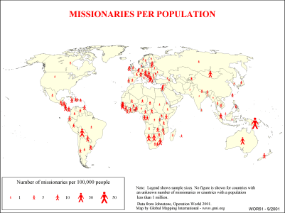 |
·Type: Maps ·Description: Country level divisions of missionaries per population ·Map Date: 2000 ·Producer: Global Mapping International ·Collection: General World Maps (WV 2002) ·Size: 8½ x 11 Inches, landscape ·Note: Windows Metafile and Metafile in Word forms of this map require the GMISym.ttf font ·Categories: Type :: Maps Collection :: GMI Map Collections :: General World Maps (WV 2002) Continent/Region :: World Topic ::... |
... more info
Max: 1
|
|
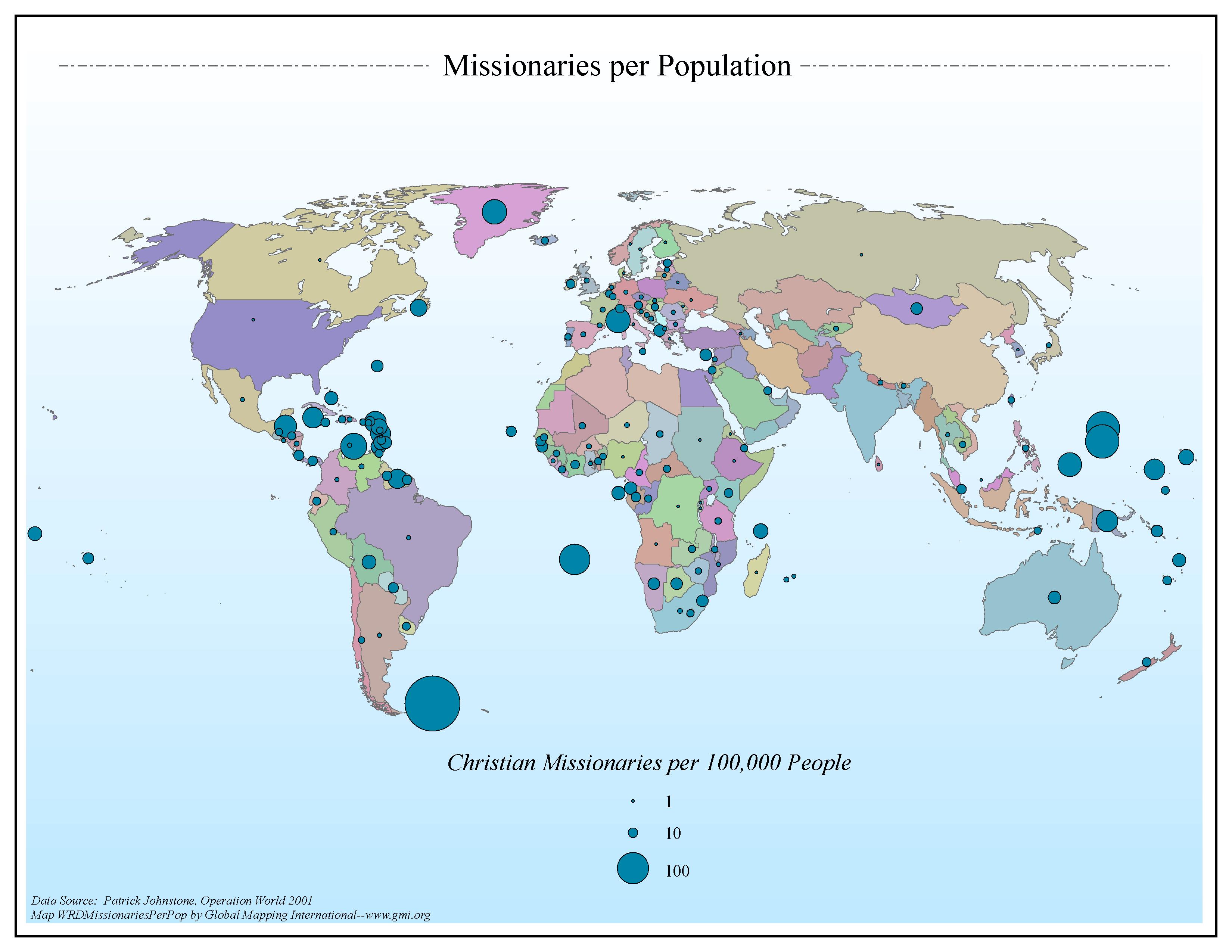 |
·Type: Maps ·Map Date: 2006 ·Data Source: Patrick Johnstone, Operation World 2001 ·Producer: Global Mapping International ·Collection: General World Maps (GMMS 2007) ·Size: 8½ x 11 inches, landscape ·Categories: Type :: Maps Continent/Region :: World Topic :: Statistical Topic :: Strategy Collection :: GMI Map Collections :: General World Maps (GMMS 2007) Partners :: Global Mapping International |
... more info
Max: 1
|
|
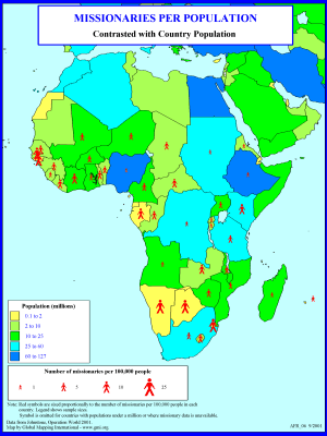 |
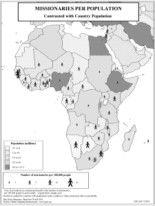
·Type: Maps ·Description: Missionaries per Population in 2000 ·Map Date: 2001 ·Producer: Global Mapping International ·Collection: Reaching Africa (WorldVue 2002) ·Size: 8½ x 11 Inches, portrait ·Note: Windows Metafile and Metafile in Word forms of this map require the GMISym.ttf font ·Categories: Type :: Maps Collection :: GMI Map Collections :: Reaching Africa (WorldVue 2002) Continent/Region :: Africa Topic :: Statistical Topic... |
... more info
Max: 1
|
|
 |
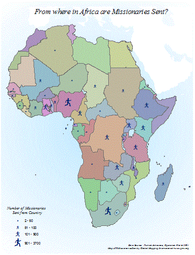
·Type: Maps ·Description: Missionaries per Population in 2000 ·Map Date: 2002 ·Producer: Global Mapping International ·Collection: Reaching Africa (WorldVue 2002) ·Size: 8½ x 11 Inches, portrait ·Note: Windows Metafile and Metafile in Word forms of this map require the GMISym.ttf font ·Categories: Type :: Maps Collection :: GMI Map Collections :: Reaching Africa (WorldVue 2002) Continent/Region :: Africa Topic :: Statistical Topic... |
... more info
Max: 1
|
|
 |
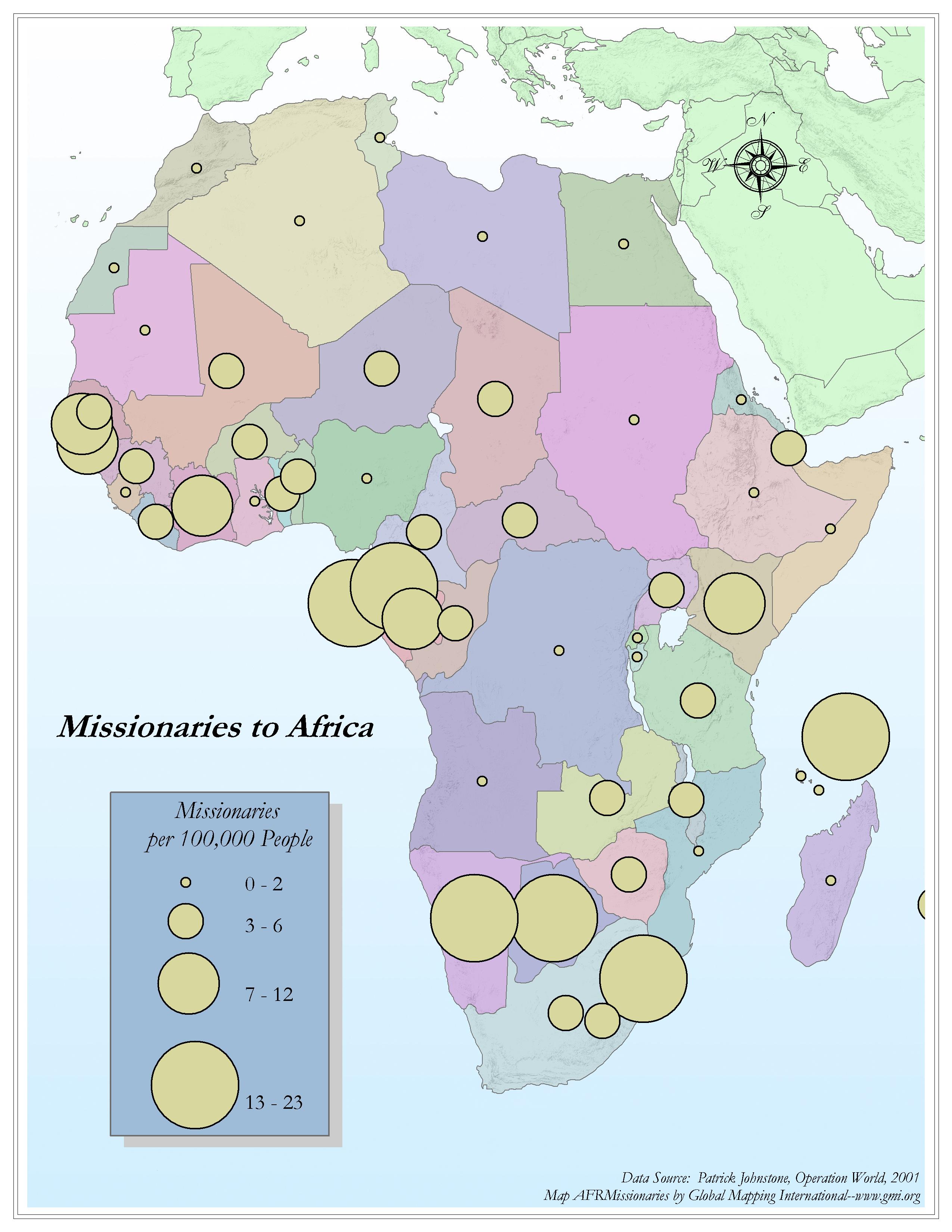
·Type: Maps ·Map Date: 2001 ·Data Source: Patrick Johnstone, Operation World 2001 ·Producer: Global Mapping International ·Collection: General Maps ·Size: 8.5 x 11 inches, portrait ·Categories: Type :: Maps Continent/Region :: Africa Topic :: Statistical Topic :: Strategy Partners :: Global Mapping International Topic :: Movements :: Continental Movements :: Africa |
... more info
Max: 1
|
|
 |
·Type: Maps ·Map Date: 2006 ·Data Source: Patrick Johnstone, Operation World, 2001 ·Producer: Global Mapping International ·Collection: Reaching Africa (GMMS 2007) ·Size: 8½ x 11 inches, portrait ·Categories: Type :: Maps Continent/Region :: Africa Topic :: Statistical Topic :: Strategy Collection :: GMI Map Collections :: Reaching Africa (GMMS 2007) Partners :: Global Mapping International |
... more info
Max: 1
|
|