| Product Image |
Resource Name- |
Price |
Manufacturer |
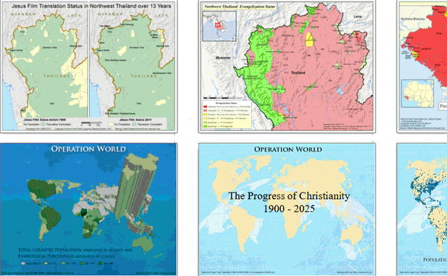 |
Powerpoint showing why mapping (GIS) is useful in research and missions. Different styles of thematic mapping are shown. Slides 19 - 45 are meant to automatically advance giving the impression of an animation (Percent Christian growing every five years). Data was made up for some individual sensitive country maps. Many of these maps and the animation are available on Mission Infobank as separate maps. ·Date :: June 2014 ·Producer :: Global Mapping International ·Slides ::... |
... more info
|
|
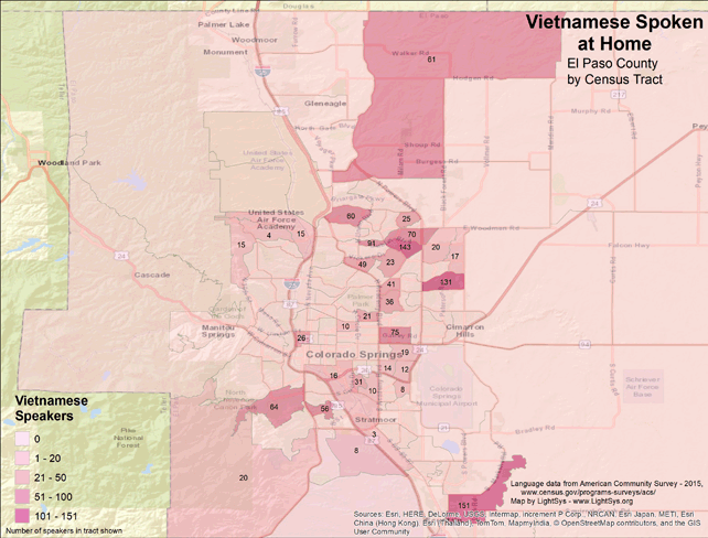 |
· Type Maps · Map Date: 2018 · Data Source: American Community Survey, 2015, https://www.census.gov/programs-surveys/acs · Partners: LightSys Technology Services, U.S. Government · Collection: Projects 2017 · Size: 8½ x 11 inches, landscape · Categories: Continent/Region :: North America Country :: United States Topic :: Statistical; Demography, Language and Translation |
... more info
|
|
 |
·Type: Documents ·Date: 31 May 2000 ·Authors: John Bendor-Samuel ·Producer: AD2000 and Beyond Movement ·Collection: Track Reports ·Pages: 3 ·Categories: Type :: Documents Partners :: AD2000 Topic :: Language and Translation Collection :: AD2000 Movement Archives :: AD2000 Archive CD-ROM Selections :: Track Reports |
... more info
Max: 1
|
|
 |
·Type: Documents ·Date: 16 September 2000 ·Authors: Unknown ·Producer: AD2000 and Beyond Movement ·Collection: Track Reports ·Pages: 1 ·Categories: Type :: Documents Country :: Congo, Democratic Republic of Partners :: AD2000 Topic :: Language and Translation Collection :: AD2000 Movement Archives :: AD2000 Archive CD-ROM Selections :: Track Reports Collection :: AD2000 Movement Archives :: AD2000 Archive CD-ROM Selections :: Regional/Country... |
... more info
Max: 1
|
|
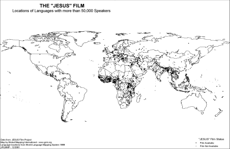 |
·Type: Maps ·Description: Translations of The "JESUS" Film ·Map Date: 2002 ·Producer: Global Mapping International ·Collection: Intro to Mission (WorldVue 2002) ·Size: 8½ x 11 Inches, landscape ·Note: Windows Metafile and Metafile in Word forms of this map require the GMISym.ttf font ·Categories: Type :: Maps Collection :: GMI Map Collections :: Intro to Mission (WorldVue 2002) Topic :: Statistical Topic :: Strategy Partners ::... |
... more info
Max: 1
|
|
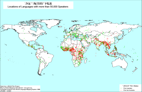 |
·Type: Maps ·Description: Translations of The "JESUS" Film ·Map Date: 2001 ·Producer: Global Mapping International ·Collection: Intro to Mission (WorldVue 2002) ·Size: 8½ x 11 Inches, landscape ·Note: Windows Metafile and Metafile in Word forms of this map require the GMISym.ttf font ·Categories: Type :: Maps Collection :: GMI Map Collections :: Intro to Mission (WorldVue 2002) Topic :: Statistical Topic :: Strategy Partners ::... |
... more info
Max: 1
|
|
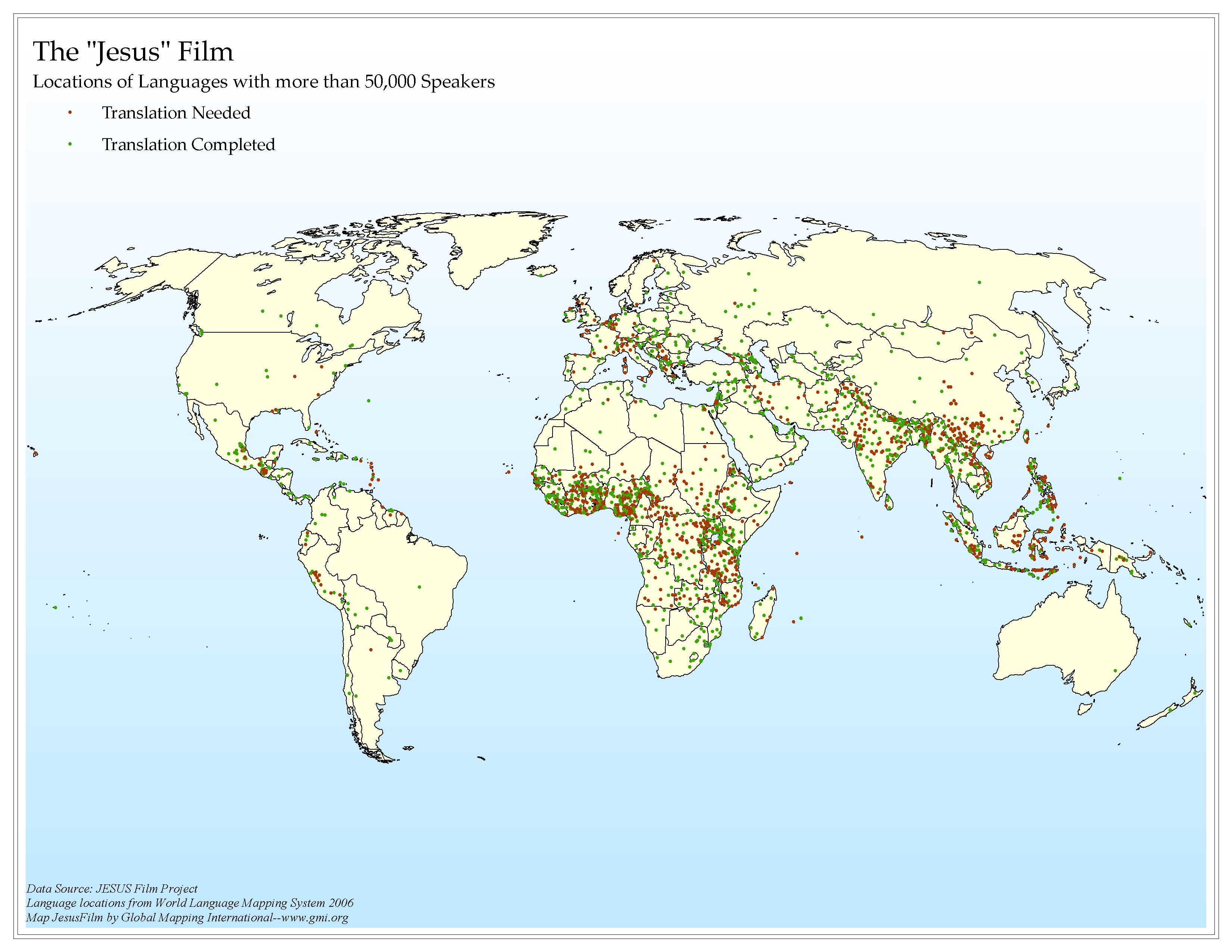 |
·Type: Maps ·Map Date: 2006 ·Data Source: JESUS Film Project Language locations from World Language Mapping System 2006 ·Producer: Global Mapping International ·Collection: Intro to Missions (GMMS 2007) ·Size: 8½ x 11 inches, landscape ·Categories: Type :: Maps Continent/Region :: World Topic :: Statistical Topic :: Strategy Collection :: GMI Map Collections :: Intro to Missions (GMMS 2007) Partners :: Global Mapping International Topic... |
... more info
Max: 1
|
|
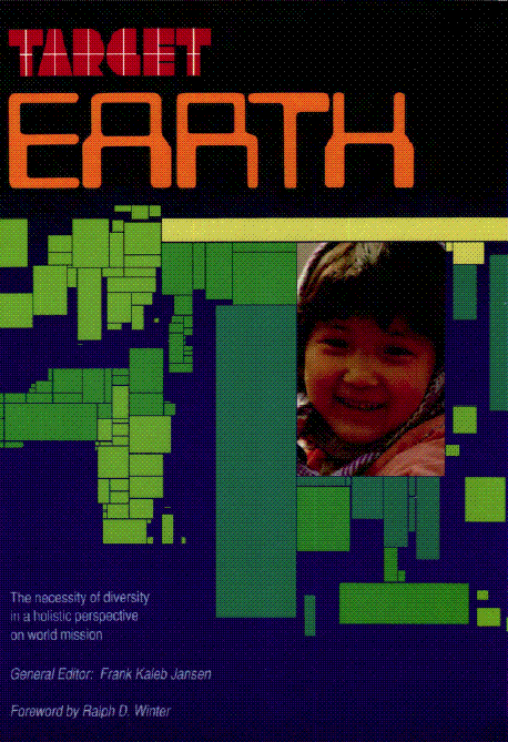 |
·Type: Maps ·Description: The necessity of diversity in a holistic perspective on world mission ·Date: 1989 ·General Editor: Frank Kaleb Jansen ·Producer: Global Mapping International ·Collection: Target Earth ·Size: Category: Collection/Target Earth ·Pages: 175 ·Note: This is a large (84 megabyte) file. ·Categories: Type :: Maps Type :: Documents Continent/Region :: World Topic :: Statistical Topic :: Strategy Topic ::... |
... more info
Max: 1
|
|
 |
·Type: Documents ·Date: 18 August 1997 ·Authors: Allan Starling ·Producer: AD2000 and Beyond Movement ·Collection: Track Reports ·Pages: 4 ·Categories: Type :: Documents Partners :: AD2000 Topic :: Language and Translation Collection :: AD2000 Movement Archives :: AD2000 Archive CD-ROM Selections :: Track Reports |
... more info
Max: 1
|
|
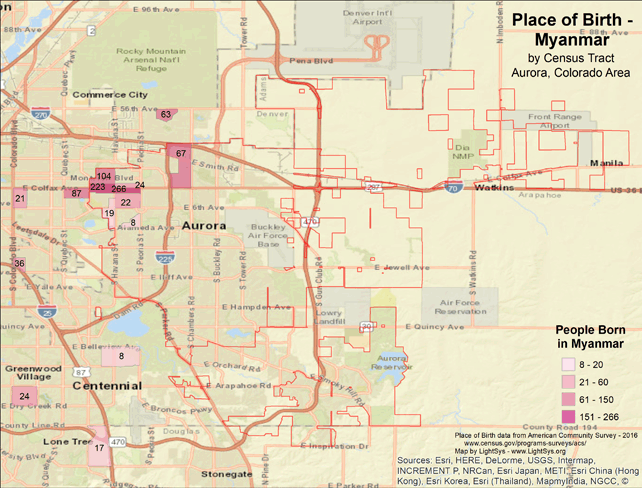 |
· Type Maps · Map Date: 2018 · Data Source: American Community Survey, 2015, https://www.census.gov/programs-surveys/acs · Partners: LightSys Technology Services, U.S. Government · Collection: Projects 2017 · Size: 8½ x 11 inches, landscape · Categories: Continent/Region :: North America Country :: United States Topic :: Statistical; Demography, Language and Translation |
... more info
|
|
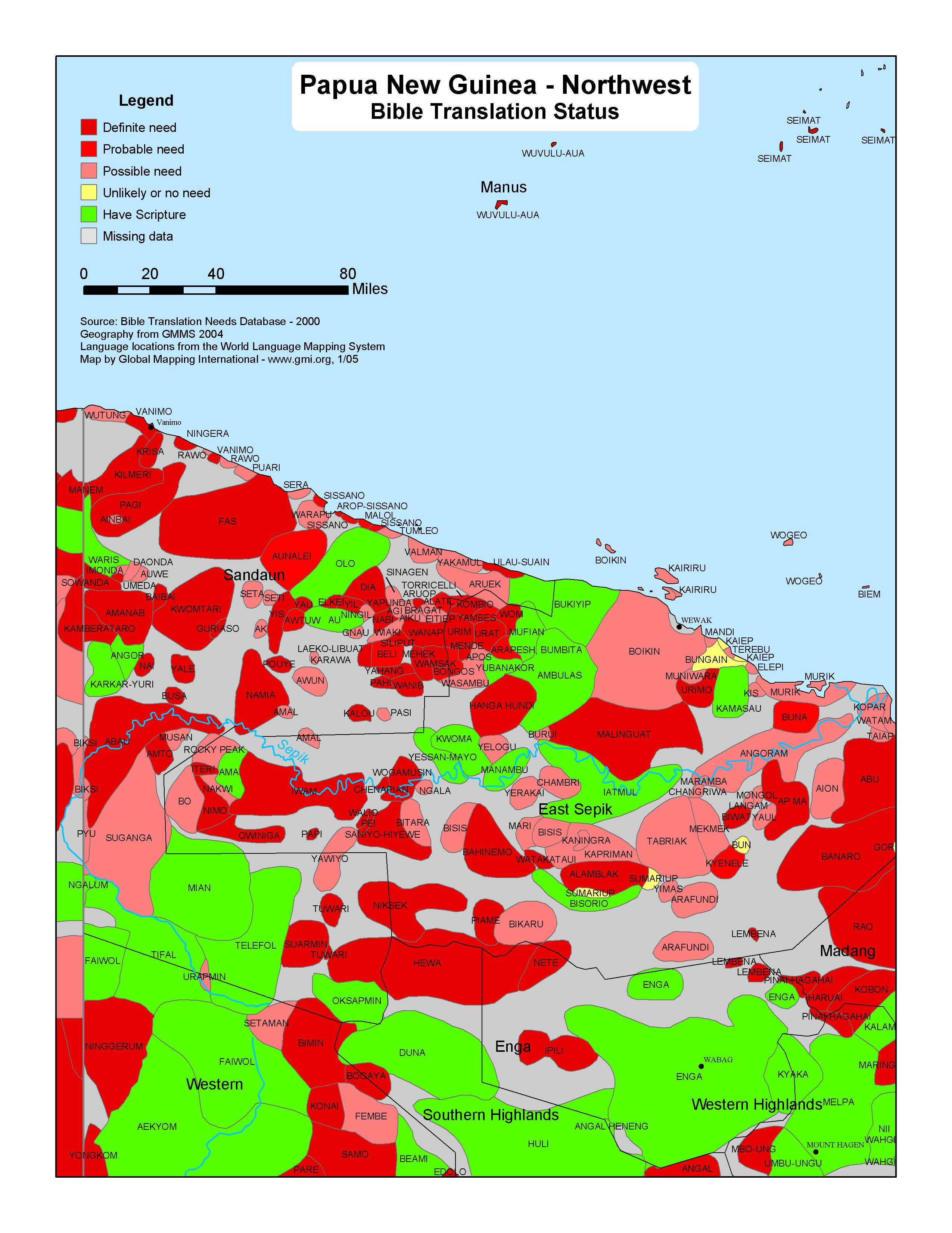 |
·Type: Maps ·Map Date: 2005 ·Data Source: Bible Translation Needs Database; World Language Mapping System ·Producer: GMI ·Collection: Projects 2005 ·Size: 8½ by 11 inches, portrait ·Categories: Type :: Maps Country :: Papua New Guinea Partners :: Global Mapping International Collection :: GMI Map Collections :: Projects 2005 Topic :: Language and Translation |
... more info
Max: 1
|
|
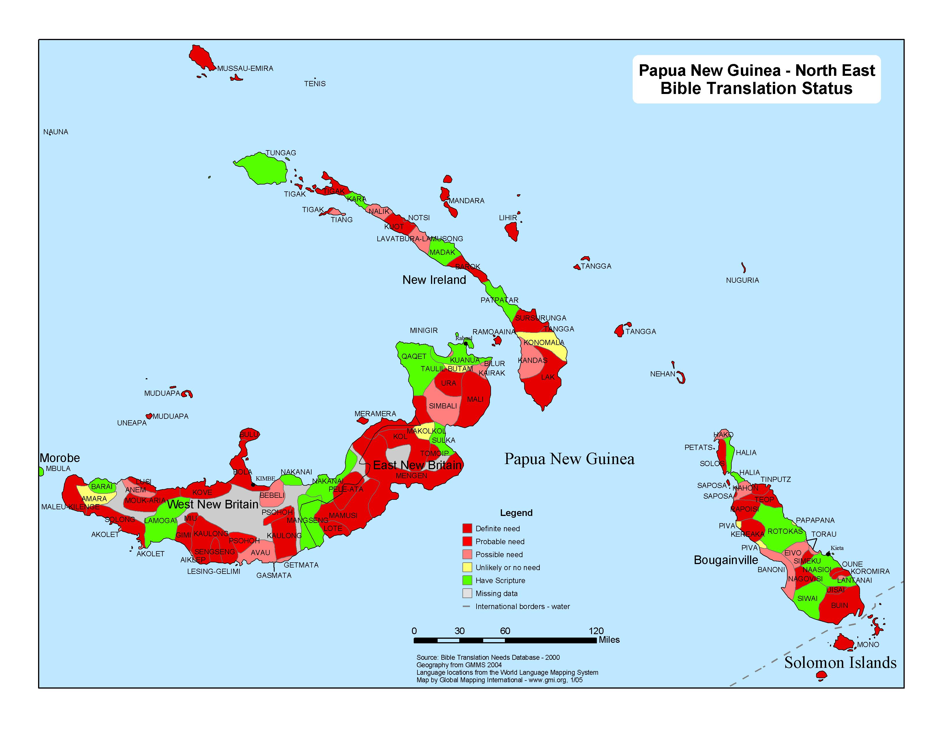 |
·Type: Maps ·Map Date: 2005 ·Data Source: Bible Translation Needs Database; World Language Mapping System ·Producer: GMI ·Collection: Projects 2005 ·Size: 8½ by 11 inches, landscape ·Categories: Type :: Maps Country :: Papua New Guinea Partners :: Global Mapping International Collection :: GMI Map Collections :: Projects 2005 Topic :: Language and Translation |
... more info
Max: 1
|
|
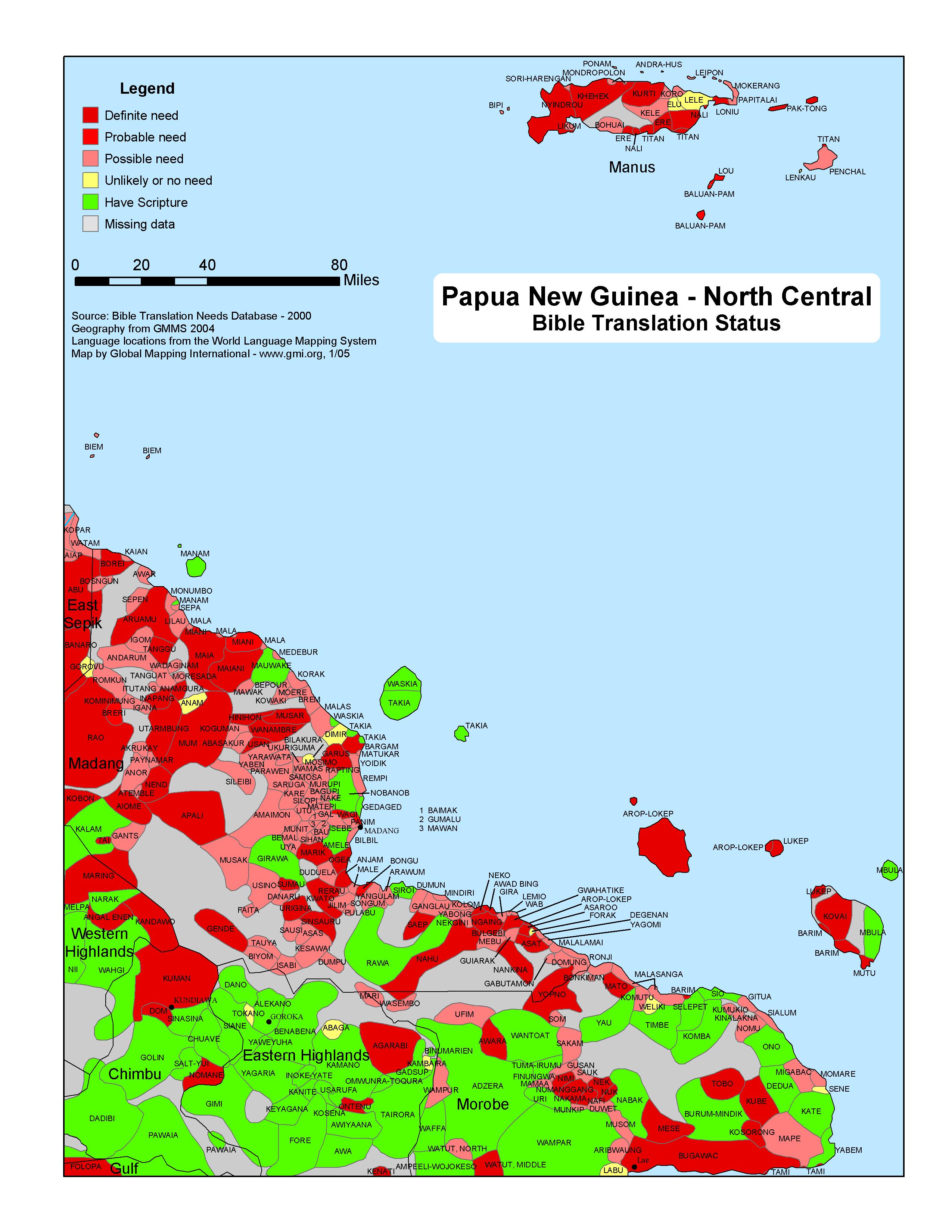 |
·Type: Maps ·Map Date: 2005 ·Data Source: Bible Translation Needs Database; World Language Mapping System ·Producer: GMI ·Collection: Projects 2005 ·Size: 8½ by 11 inches, portrait ·Categories: Type :: Maps Country :: Papua New Guinea Partners :: Global Mapping International Collection :: GMI Map Collections :: Projects 2005 Topic :: Language and Translation |
... more info
Max: 1
|
|
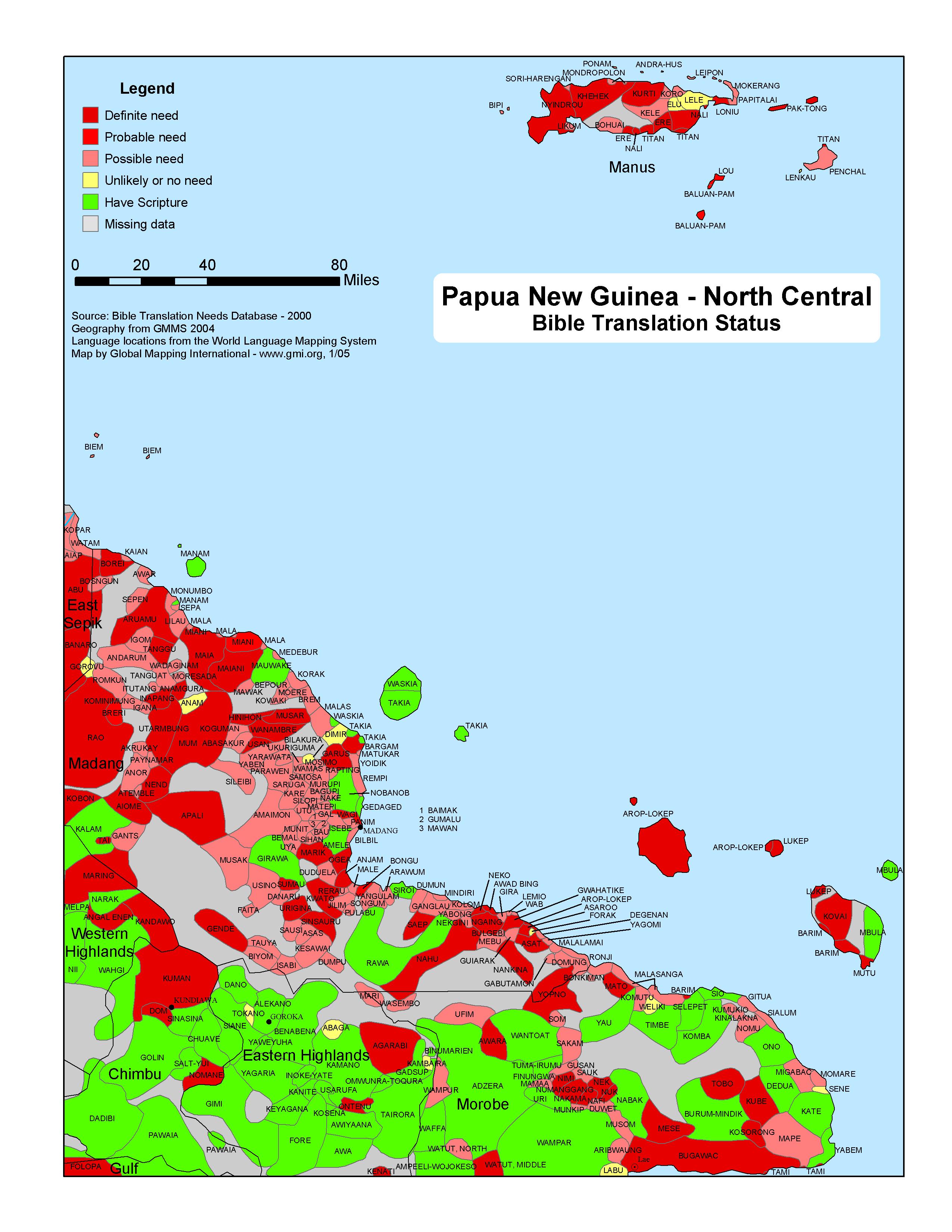 |
·Type: Maps ·Map Date: 2005 ·Data Source: Bible Translation Needs Database; World Language Mapping System ·Producer: GMI ·Collection: Projects 2005 ·Size: 8½ by 11 inches, portrait ·Categories: Type :: Maps Country :: Papua New Guinea Partners :: Global Mapping International Collection :: GMI Map Collections :: Projects 2005 Topic :: Language and Translation |
... more info
Max: 1
|
|
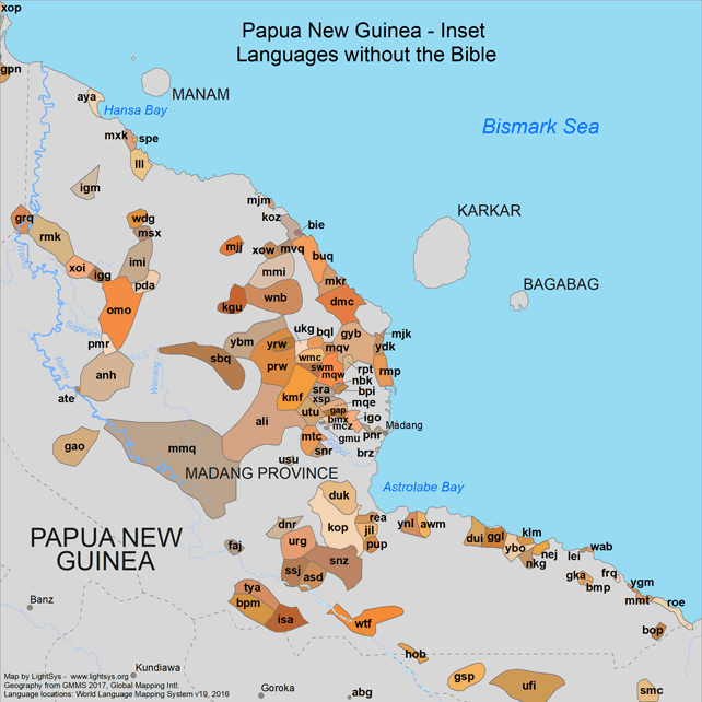 |
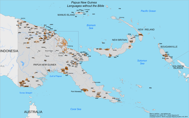
· Type: Maps · Map Date: 2020 · Data Sources: GMMS 2017, WLMS v. 19 2016, YWAM · Collection: Map Collections :: Projects 2020 · Size: 11 x 14 inches, landscape · Categories: Country :: Papua New Guinea Topic :: Languages :: Language and Translation Topic :: Strategy Partners :: LightSys Technology Services |
... more info
|
|
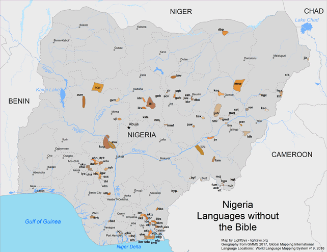 |
· Type: Maps · Map Date: 2020 · Data Sources: GMMS 2017, WLMS v. 19 2016, YWAM · Collection: Map Collections :: Projects 2020 · Size: 11 x 14 inches, landscape · Categories: Country :: Nigeria Topic :: Languages :: Language and Translation Topic :: Strategy Partners :: LightSys Technology Services |
... more info
|
|
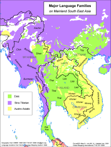 |
·Type: Maps ·Description: Major language groups in Mainland Southeast Asia ·Map Date: 1998 ·Producer: Global Mapping International ·Collection: Focus South East Asia (WV 2002) ·Size: 8½ x 11 Inches, portrait ·Categories: Type :: Maps Collection :: GMI Map Collections :: Focus South East Asia (WV 2002) Continent/Region :: Asia Topic :: Peoples, multiple or unknown Partners :: Global Mapping International Topic :: Language and Translation |
... more info
Max: 1
|
|
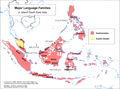 |
·Type: Maps ·Description: Major Language groups in Island Southeast Asia ·Map Date: 1998 ·Producer: Global Mapping International ·Collection: Focus South East Asia (WV 2002) ·Size: 8½ x 11 Inches, landscape ·Categories: Type :: Maps Collection :: GMI Map Collections :: Focus South East Asia (WV 2002) Continent/Region :: Asia Topic :: Peoples, multiple or unknown Partners :: Global Mapping International Topic :: Language and Translation |
... more info
Max: 1
|
|
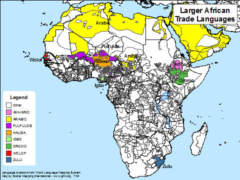 |
·Type: Maps ·Map Date: July 2004 ·Data Source: Language locations from World Language Mapping System ·Producer: Global Mapping International ·Collection: Projects 2004 ·Size: 8 1/2 by 11 inches, landscape ·Categories: Type :: Maps Continent/Region :: Africa Partners :: Global Mapping International Collection :: GMI Map Collections :: Projects 2004 Topic :: Language and Translation |
... more info
Max: 1
|
|
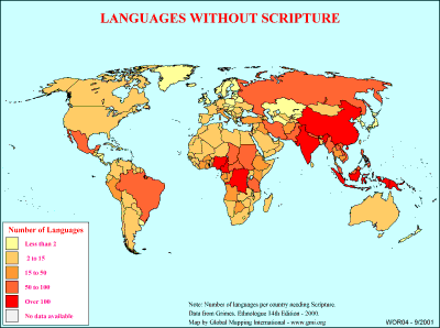 |
·Type: Maps ·Description: Number of languages without scripture on country level divisions. ·Map Date: 2000 ·Producer: Global Mapping International ·Collection: General World Maps (WV 2002) ·Size: 8½ x 11 Inches, landscape ·Categories: Type :: Maps Collection :: GMI Map Collections :: General World Maps (WV 2002) Continent/Region :: World Topic :: Statistical Topic :: Peoples, multiple or unknown Partners :: Global Mapping International... |
... more info
Max: 1
|
|
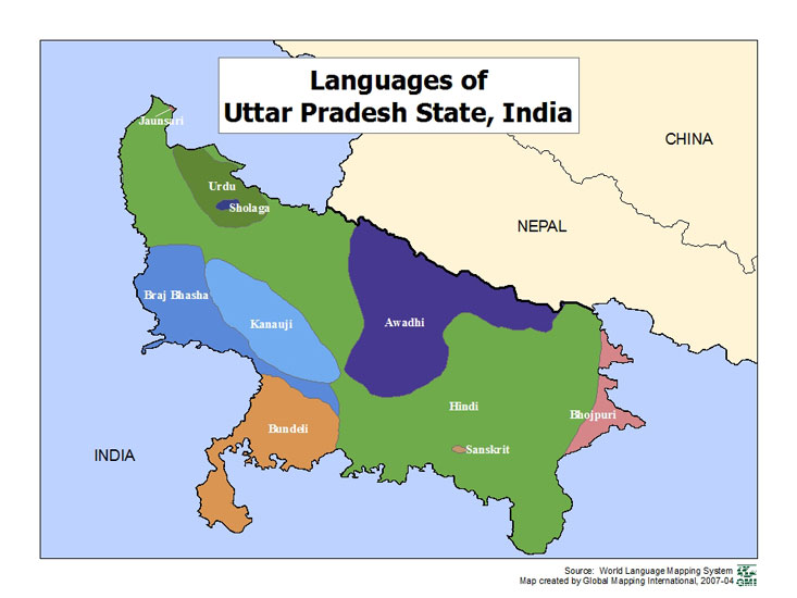 |
·Type: Maps ·Map Date: 2007 ·Data Source: World Language Mapping Systems ·Producer: GMI ·Collection: Projects 2007 ·Size: 7½ by 10 inches, landscape ·Categories: Type :: Maps Country :: India Partners :: Global Mapping International Collection :: GMI Map Collections :: Projects 2007 Topic :: Language and Translation |
... more info
Max: 1
|
|
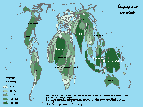 |
·Type: Maps ·Description: Countries are sized by number of languages. ·Map Date: 2007 ·Data Source: 15th Edition Ethnologue Producer: Global Mapping International ·Collection: Projects 2007 ·Size: Size: 8 1/2 by 11 inches, landscape ·Categories: Type :: Maps Continent/Region :: World Partners :: Global Mapping International Collection :: GMI Map Collections :: Projects 2007 Topic :: Language and Translation |
... more info
Max: 1
|
|
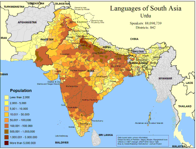 |
·Type: Maps ·Map Date: February 2008 ·Data Source: Census Information, UNESCO (1987) through UNEP/GRID-Sioux Falls ·Producer: Global Mapping International and The Joshua Project ·Size: 11.7 by 8.27 inches, landscape ·Categories: Type :: Maps Continent/Region :: Asia Topic :: Demography Country :: Nepal Country :: India Country :: Bangladesh Country :: Pakistan Partners :: Global Mapping International Topic :: Language and Translation Partners ::... |
... more info
Max: 1
|
|
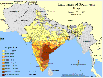 |
·Type: Maps ·Map Date: February 2008 ·Data Source: Census Information, UNESCO (1987) through UNEP/GRID-Sioux Falls ·Producer: Global Mapping International and The Joshua Project ·Size: 11.7 by 8.27 inches, landscape ·Categories: Type :: Maps Continent/Region :: Asia Topic :: Demography Country :: India Country :: Bangladesh Partners :: Global Mapping International Topic :: Language and Translation Partners :: Joshua Project |
... more info
Max: 1
|
|