Africa
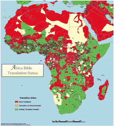
Africa Bible Translation Status
·Type: Maps ·Map Date: 2006 ·Data Source: World Language Mapping System ·Producer: Global Mapping International ·Collection: Wall Maps ·Size: 40 by 36 inches, portrait ·Categories: Type :: Maps...
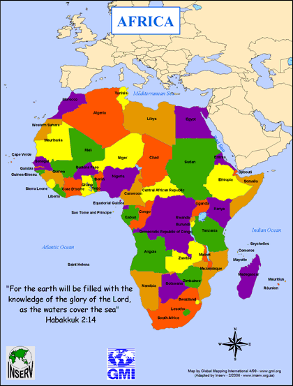
Africa Map (Coloring in Countries for MANI)
·Type: Maps ·Description: ·Collection: INSERV Maps ·Categories: Type :: Maps Continent/Region :: Africa Topic :: Geography :: Maps Topic :: Movements :: Continental Movements :: Africa Partners :: INSERV
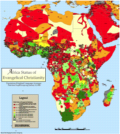
Africa Status of Evangelical Christianity
·Type: Maps ·Description: Global Status of Evangelical Christianity for ethnolinguistic peoples in Africa ·Date: 20 February 2008 ·Data Source: peoplegroups.org ·Producer: Global Mapping International...
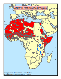
Africa's Least Reached Peoples (areas)
·Type: Maps ·Map Date: January 2008 ·Data Source: Statistics from Joshua Project ·Producer: Global Mapping International ·Collection: General Maps ·Size: 8.5 x 11 inches, portrait ·Categories: Type...
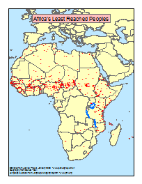
Africa's Least Reached Peoples (points)
·Type: Maps ·Map Date: January 2008 ·Data Source: Statistics from Joshua Project ·Producer: Global Mapping International ·Collection: General Maps ·Size: 8.5 x 11 inches, portrait ·Categories: Type...
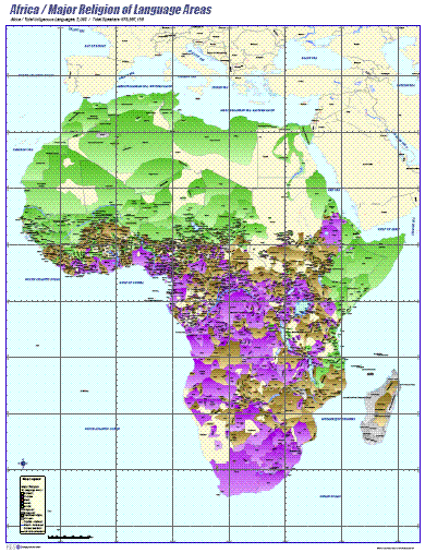
Africa- Major Religion of Language Areas
·Type: Maps ·Map Date: 2006 ·Data Source: ILS International ·Producer: ILS International ·Collection: Wall Maps ·Size: 36 by 46.6 inches, portrait ·Categories: Type :: Maps Continent/Region :: Africa...
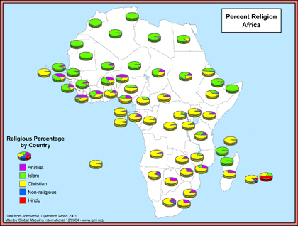
Africa- Percent Religion
·Type: Maps ·Map Date: December 2004 ·Data Source: Johnstone, Operation World 2001 ·Producer: Global Mapping International ·Collection: General Maps ·Size: 8.5 by 11 inches, landscape ·Categories:...
.gif)
Africa- Population Density (Landscan)
·Type: Maps ·Map Date: 2008 ·Data Source: Landscan, 2002 ·Producer: Global Mapping International ·Collection: General Maps ·Size: 8.5 by 11 inches, portrait ·Categories: Type :: Maps...
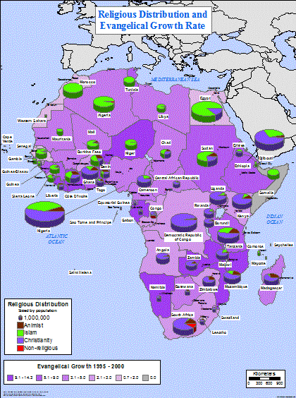
Africa- Religious Distribution and Evangelical Growth Rate
·Type: Maps ·Map Date: February 2004 ·Data Source: Johnstone, Operation World CD-Rom, 2001 ·Producer: Global Mapping International ·Collection: General Maps ·Size: 36 by 48 inches, portrait...
Cities of Africa - Population Report for over 4,700 Cities
·Type: Data ·Date: 6 February 2008 ·Author: Marv Bowers ·Producer: ILS International ·Collection: ILS Profiles ·Size: 4.8 megabytes ·Pages: 278 ·Note: Covers all 56 African nations - includes...
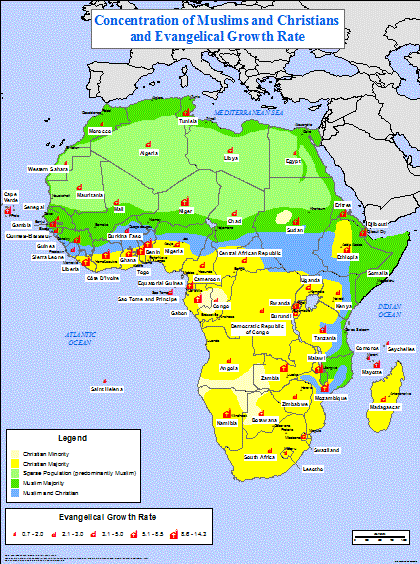
Concentration of Muslims and Christians, Evangelical Growth Rate
·Type: Maps ·Full title: Concentration of Muslims and Christians and Evangelical Growth Rate ·Map Date: 2006 ·Data Source: Muslim/Christian concentrations - Patrick Johnstone 1984, Evangelical Growth Rate - Johnstone,...
Country PROfiles - One page PROfiles for 56 African Nations
·Type: Data ·Date: 6 February 2008 ·Authors: Marv Bowers ·Producer: ILS International ·Collection: ILS Profiles ·Size: 3.6 megabytes ·Pages: 64 ·Categories: Type :: Data Topic :: Statistical...
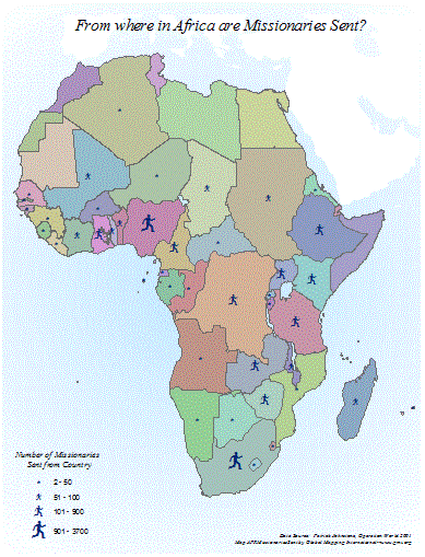
Missionaries Sent from Africa
·Type: Maps ·Map Date: 2001 ·Data Source: Patrick Johnstone, Operation World 2001 ·Producer: Global Mapping International ·Collection: General Maps ·Size: 8.5 x 11 inches, portrait ·Categories: Type...
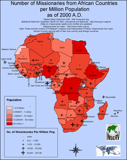
Number of Missionaries from African Countries
·Type: Maps ·Full title: Number of Missionaries from African Countries per Million Population as of 2000 A.D. ·Map Date: February 2008 ·Data Source: Operation World CD 2001 ·Producer: INSERV ·Collection:...
People PROfiles - One page for 3,760 African People Groups
·Type: Data ·Date: 6 February 2008 ·Authors: Marv Bowers ·Producer: ILS International ·Collection: ILS Profiles ·Size: 29.4 megabytes (large) ·Pages: 3779 ·Categories: Type :: Data Topic ::...
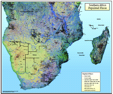
Southern Africa Populated Places
·Type: Maps ·Map Date: 2008 ·Data Source: Populated places from GMMS Populated Place Data 2008 ·Producer: Global Mapping International ·Collection: Wall Maps ·Size: 36 by 30 inches, landscape...
Target 2000 & Beyond: Impact on Zimbabwe
·Full title: Target 2000 & Beyond: The Impact of Saturation Church Planting on the Discipling of Zimbabwe ·Date: October, 2003 ·Author: Carlson, Dean ·Collection: South Asia Now Res Trn (select) ·Abstract: The...
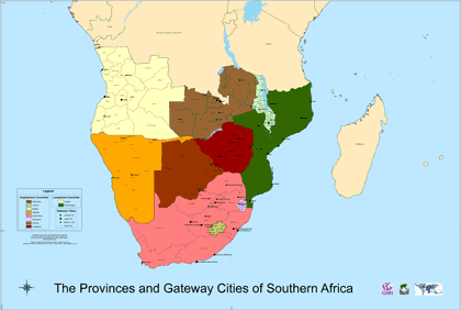
The Provinces and Gateway Cities of Southern Africa
·Type: Maps ·Map Date: February 2008 ·Data Source: Global Mapping International ·Producer: INSERV ·Collection: INSERV Maps ·Size: 39.37 by 59.05 inches, landscape ·Categories: Type :: Maps...
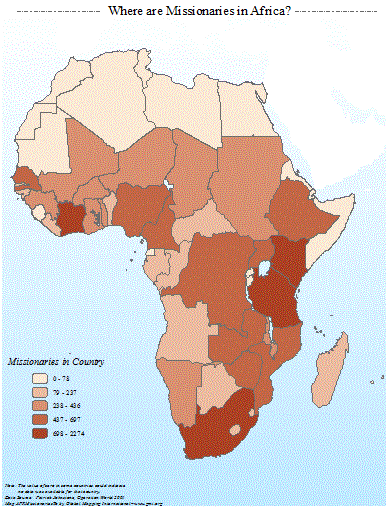
Where are Missionaries in Africa?
·Type: Maps ·Map Date: 2001 ·Data Source: Patrick Johnstone, Operation World 2001 ·Producer: Global Mapping International ·Collection: General Maps ·Size: 8.5 x 11 inches, portrait ·Categories: Type...
Women of the 10/40 Window: Greatest Untapped Resource
·Type: Documents ·Description: Women of the 10/40 Window: The Greatest Untapped Resource for Evangelism ·Date: 1999 ·Authors: Lorry Lutz ·Producer: AD2000 and Beyond Movement ·Collection: Publications...

