| Product Image |
Resource Name |
Price |
Manufacturer+ |
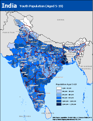 |
·Type: Maps ·Map Date: February 2009 ·Data Source: population - DevInfo India, v2, Census of India (2001) ·Producer: Global Mapping International ·Collection: Projects 2009 ·Size: 8.5 by 11 inches, portrait ·Categories: Type :: Maps Topic :: Demography Country :: India Partners :: Global Mapping International Topic :: Images: Country :: India Type :: Images :: by country :: India Collection :: GMI Map Collections :: Projects 2009 |
... more info
Max: 1
|
|
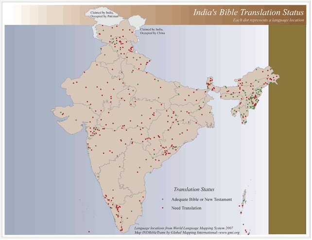 |
·Type: Maps ·Map Date: 2006 ·Data Source: World Language Mapping System 2006 ·Producer: Global Mapping International ·Collection: Reaching India (GMMS 2007) ·Size: 8½ x 11 inches, landscape ·Categories: Type :: Maps Continent/Region :: Asia Topic :: Statistical Country :: India Collection :: GMI Map Collections :: Reaching India (GMMS 2007) Partners :: Global Mapping International Topic :: Language and Translation |
... more info
Max: 1
|
|
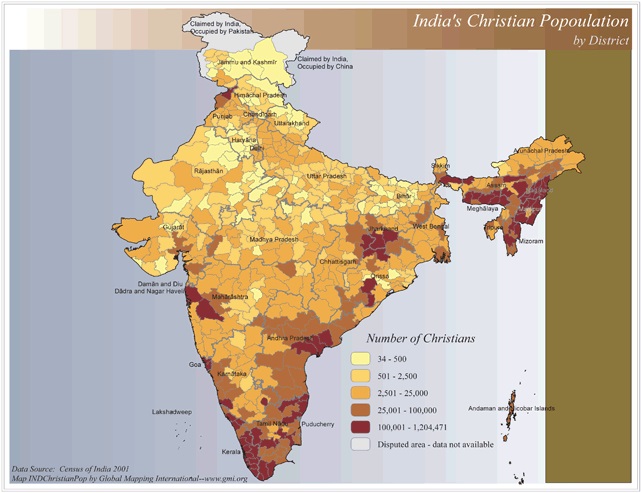 |
·Type: Maps ·Map Date: 2006 ·Data Source: Census of India 2001 ·Producer: Global Mapping International ·Collection: Reaching India (GMMS 2007) ·Size: 8½ x 11 inches, landscape ·Categories: Type :: Maps Continent/Region :: Asia Topic :: Statistical Country :: India Collection :: GMI Map Collections :: Reaching India (GMMS 2007) Partners :: Global Mapping International Topic :: Religions, Christianity :: Adherents, Churches, and Denoms |
... more info
Max: 1
|
|
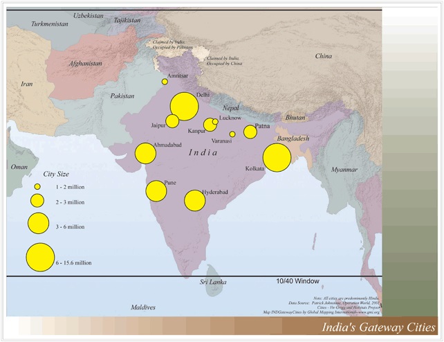 |
·Type: Maps ·Map Date: 2006 ·Data Source: Operation World 2001 Cities - Viv Grigg and Habitats Project ·Producer: Global Mapping International ·Collection: Reaching India (GMMS 2007) ·Size: 8½ x 11 inches, landscape ·Categories: Type :: Maps Continent/Region :: Asia Topic :: Statistical Topic :: Strategy Topic :: Concepts Topic :: Demography Country :: India Collection :: GMI Map Collections :: Reaching India (GMMS 2007) Partners ::... |
... more info
Max: 1
|
|
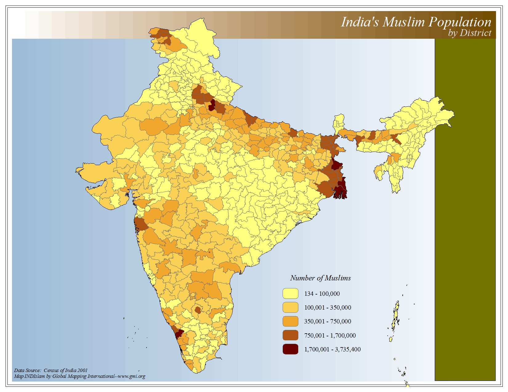 |
·Type: Maps ·Map Date: 2006 ·Data Source: Census of India 2001 ·Producer: Global Mapping International ·Collection: The World of Islam (GMMS 2007) ·Size: 8½ x 11 inches, landscape ·Categories: Type :: Maps Continent/Region :: Asia Topic :: Statistical Country :: India Collection :: GMI Map Collections :: The World of Islam (GMMS 2007) Partners :: Global Mapping International Topic :: Religions, General :: Islam |
... more info
Max: 1
|
|
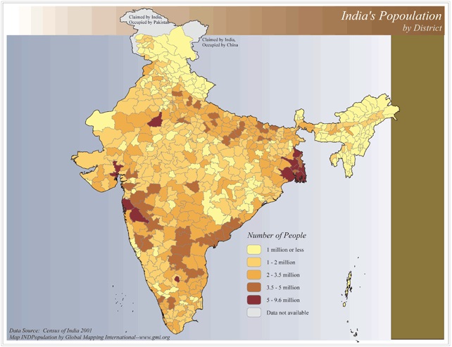 |
·Type: Maps ·Map Date: 2006 ·Data Source: Census of India 2001 ·Producer: Global Mapping International ·Collection: Reaching India (GMMS 2007) ·Size: 8½ x 11 inches, landscape ·Categories: Type :: Maps Continent/Region :: Asia Topic :: Statistical Topic :: Demography Country :: India Collection :: GMI Map Collections :: Reaching India (GMMS 2007) Partners :: Global Mapping International |
... more info
Max: 1
|
|
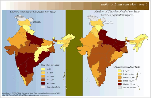 |
·Type: Maps ·Map Date: 2006 ·Data Source: CONS-INDIA, "Second All India Congress on Church Development" 1995 ·Producer: Global Mapping International ·Collection: Reaching India (GMMS 2007) ·Size: 8½ x 13 inches, landscape ·Categories: Type :: Maps Continent/Region :: Asia Topic :: Statistical Topic :: Strategy Country :: India Collection :: GMI Map Collections :: Reaching India (GMMS 2007) Partners :: Global Mapping International Topic ::... |
... more info
Max: 1
|
|
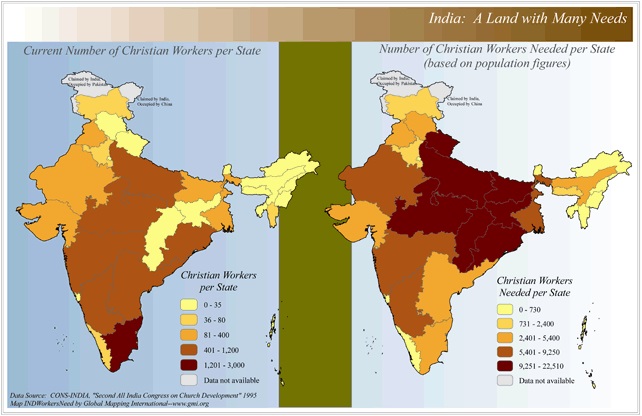 |
·Type: Maps ·Map Date: 2006 ·Data Source: CONS-INDIA, "Second All India Congress on Church Development" 1995 ·Producer: Global Mapping International ·Collection: Reaching India (GMMS 2007) ·Size: 8½ x 13 inches, landscape ·Categories: Type :: Maps Continent/Region :: Asia Topic :: Statistical Topic :: Strategy Country :: India Collection :: GMI Map Collections :: Reaching India (GMMS 2007) Partners :: Global Mapping International |
... more info
Max: 1
|
|
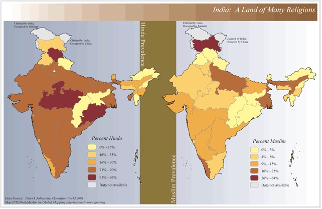 |
·Type: Maps ·Map Date: 2006 ·Data Source: Patrick Johnstone, Operation World 2001 ·Producer: Global Mapping International ·Collection: Reaching India (GMMS 2007) ·Size: 8½ x 13 inches, landscape ·Categories: Type :: Maps Continent/Region :: Asia Topic :: Statistical Country :: India Collection :: GMI Map Collections :: Reaching India (GMMS 2007) Partners :: Global Mapping International Topic :: Religions, General :: Multiple/Other |
... more info
Max: 1
|
|
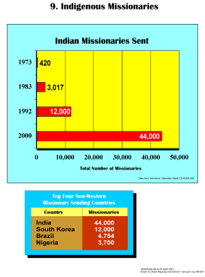 |
·Type: Maps ·Description: Indeigenous Missionaries ·Map Date: 2001 ·Producer: Global Mapping International ·Collection: Missions Minute (WorldVue 2002) ·Size: 8½ x 11 Inches, portrait ·Categories: Type :: Maps Collection :: GMI Map Collections :: Missions Minute (WorldVue 2002) Topic :: Statistical Topic :: Concepts Type :: Graphs Country :: India Partners :: Global Mapping International |
... more info
Max: 1
|
|
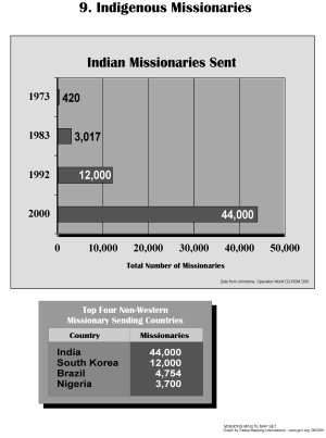 |
·Type: Maps ·Description: Indeigenous Missionaries ·Map Date: 2002 ·Producer: Global Mapping International ·Collection: Missions Minute (WorldVue 2002) ·Size: 8½ x 11 Inches, portrait ·Categories: Type :: Maps Collection :: GMI Map Collections :: Missions Minute (WorldVue 2002) Topic :: Statistical Topic :: Concepts Type :: Graphs Country :: India Partners :: Global Mapping International |
... more info
Max: 1
|
|
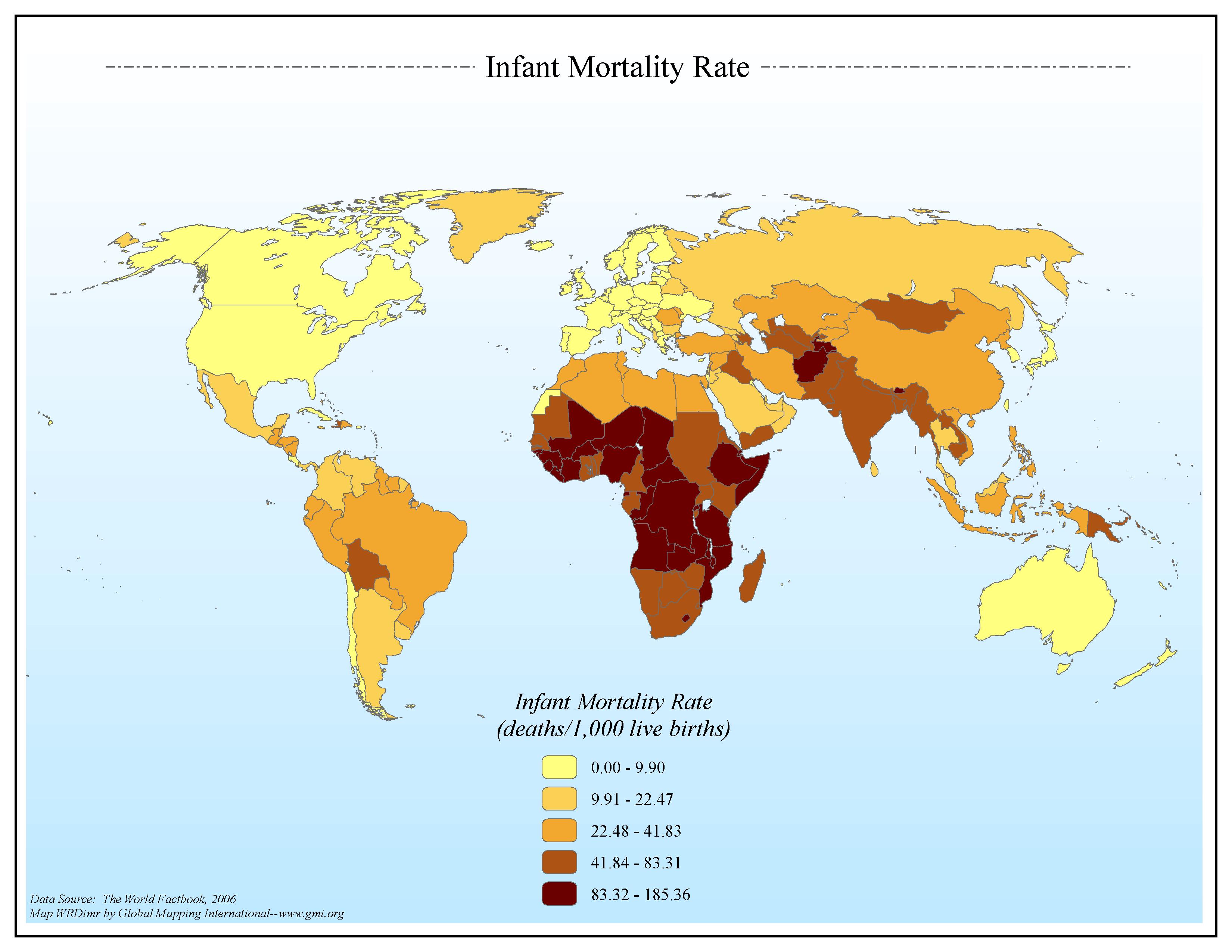 |
·Type: Maps ·Map Date: 2006 ·Data Source: The World Factbook, 2006 ·Producer: Global Mapping International ·Collection: Factbook (GMMS 2007) ·Size: 8½ x 11 inches, landscape ·Categories: Type :: Maps Continent/Region :: World Topic :: Statistical Topic :: Social Collection :: GMI Map Collections :: Factbook (GMMS 2007) Collection :: GMI Map Collections :: General World Maps (GMMS 2007) Partners :: Global Mapping International |
... more info
Max: 1
|
|
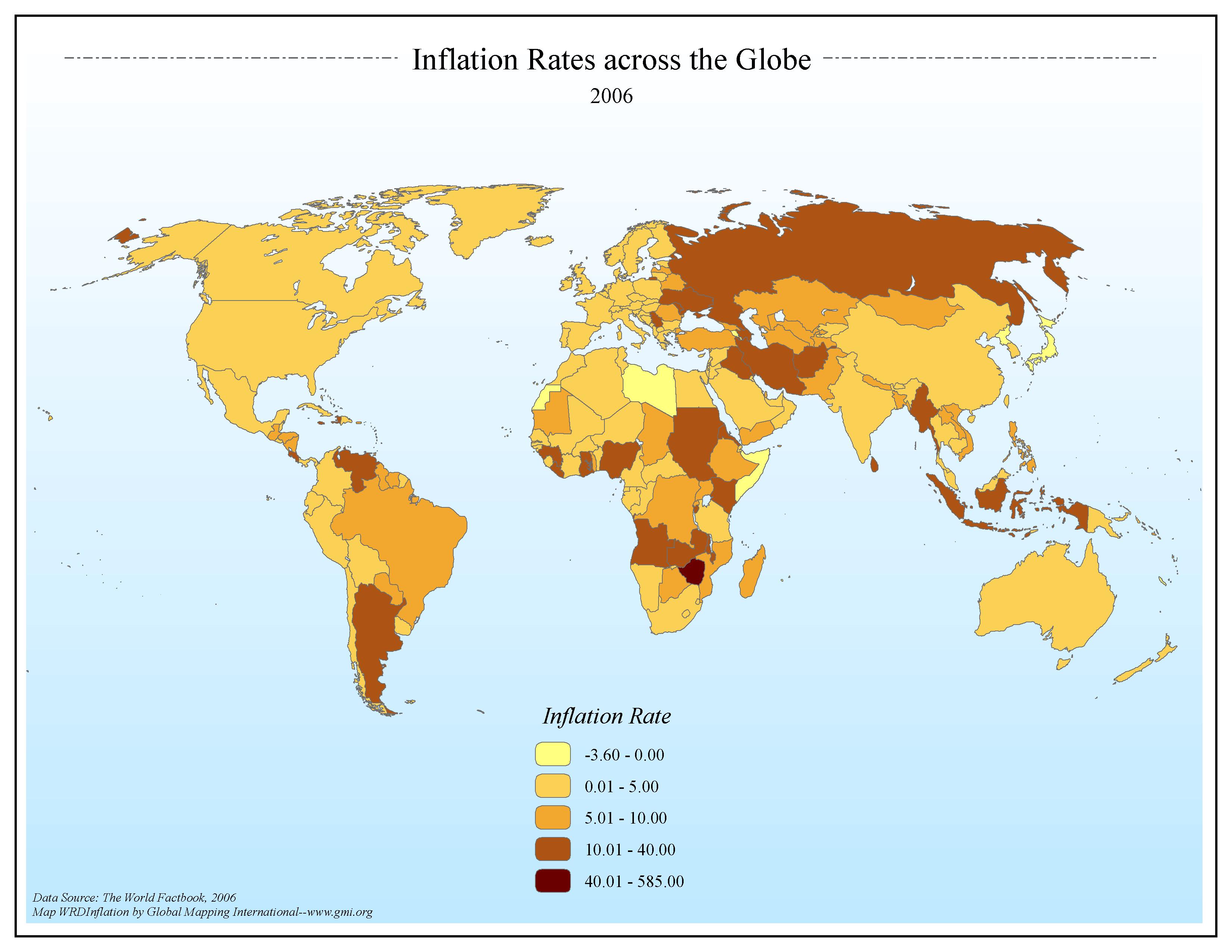 |
·Type: Maps ·Map Date: 2006 ·Data Source: The World Factbook, 2006 ·Producer: Global Mapping International ·Collection: Factbook (GMMS 2007) ·Size: 8½ x 11 inches, landscape ·Categories: Type :: Maps Continent/Region :: World Topic :: Statistical Collection :: GMI Map Collections :: Factbook (GMMS 2007) Collection :: GMI Map Collections :: General World Maps (GMMS 2007) Partners :: Global Mapping International Topic :: Economy |
... more info
Max: 1
|
|
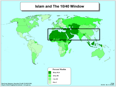 |
·Type: Maps ·Description: Islam majorities in the 10/40 Window ·Map Date: 2001 ·Producer: Global Mapping International ·Collection: The 10/40 Window (WorldVue 2002) ·Size: 8½ x 11 Inches, landscape ·Categories: Type :: Maps Collection :: GMI Map Collections :: The 10/40 Window (WorldVue 2002) Continent/Region :: World Topic :: Statistical Topic :: Concepts Partners :: Global Mapping International Topic :: Religions, General :: Islam... |
... more info
Max: 1
|
|
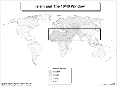 |
·Type: Maps ·Description: Islam majorities in the 10/40 Window ·Map Date: 2002 ·Producer: Global Mapping International ·Collection: The 10/40 Window (WorldVue 2002) ·Size: 8½ x 11 Inches, landscape ·Categories: Type :: Maps Collection :: GMI Map Collections :: The 10/40 Window (WorldVue 2002) Continent/Region :: World Topic :: Statistical Topic :: Concepts Partners :: Global Mapping International Topic :: Religions, General :: Islam... |
... more info
Max: 1
|
|
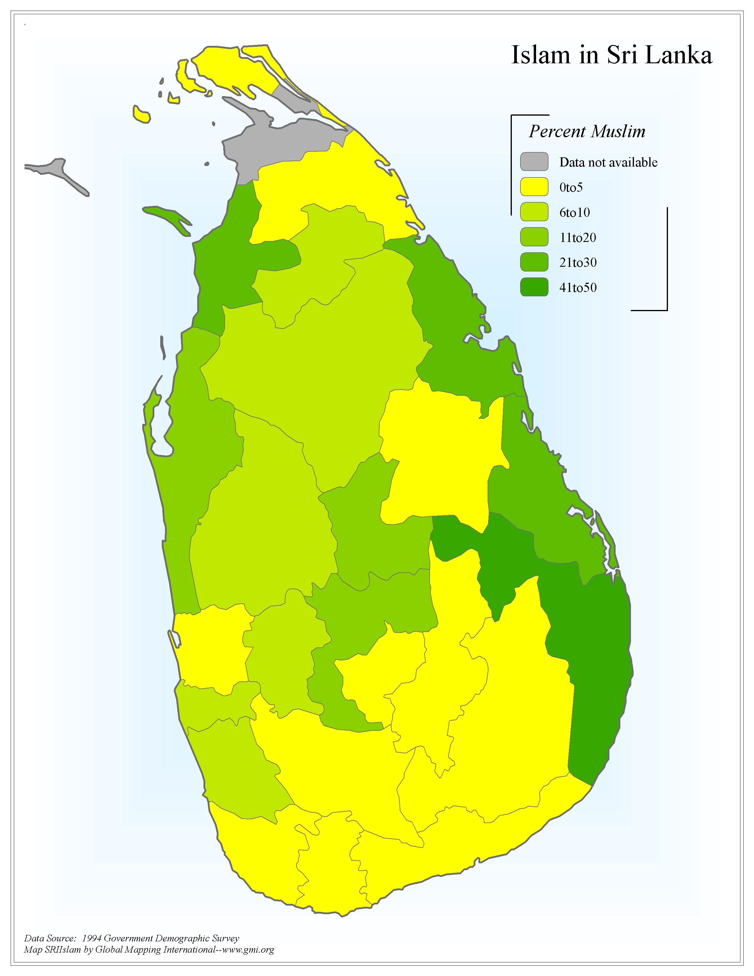 |
·Type: Maps ·Map Date: 2006 ·Data Source: 1994 Government Demographic Survey ·Producer: Global Mapping International ·Collection: Sri Lanka (GMMS 2007) ·Size: 8½ x 11 inches, portrait ·Categories: Type :: Maps Country :: Sri Lanka Continent/Region :: Asia Topic :: Statistical Collection :: GMI Map Collections :: Sri Lanka (GMMS 2007) Partners :: Global Mapping International Topic :: Religions, General :: Islam |
... more info
Max: 1
|
|
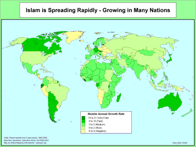 |
·Type: Maps ·Description: The Spread of Islam Growing in Many Nations ·Map Date: 2001 ·Producer: Global Mapping International ·Collection: The World of Islam (WV 2002) ·Size: 8½ x 11 Inches, landscape ·Categories: Type :: Maps Collection :: GMI Map Collections :: The World of Islam (WV 2002) Continent/Region :: World Topic :: Statistical Partners :: Global Mapping International Topic :: Religions, General :: Islam |
... more info
Max: 1
|
|
 |
·Type: Maps ·Description: The Spread of Islam Growing in Many Nations ·Map Date: 2002 ·Producer: Global Mapping International ·Collection: The World of Islam (WV 2002) ·Size: 8½ x 11 Inches, landscape ·Categories: Type :: Maps Collection :: GMI Map Collections :: The World of Islam (WV 2002) Continent/Region :: World Topic :: Statistical Partners :: Global Mapping International Topic :: Religions, General :: Islam |
... more info
Max: 1
|
|
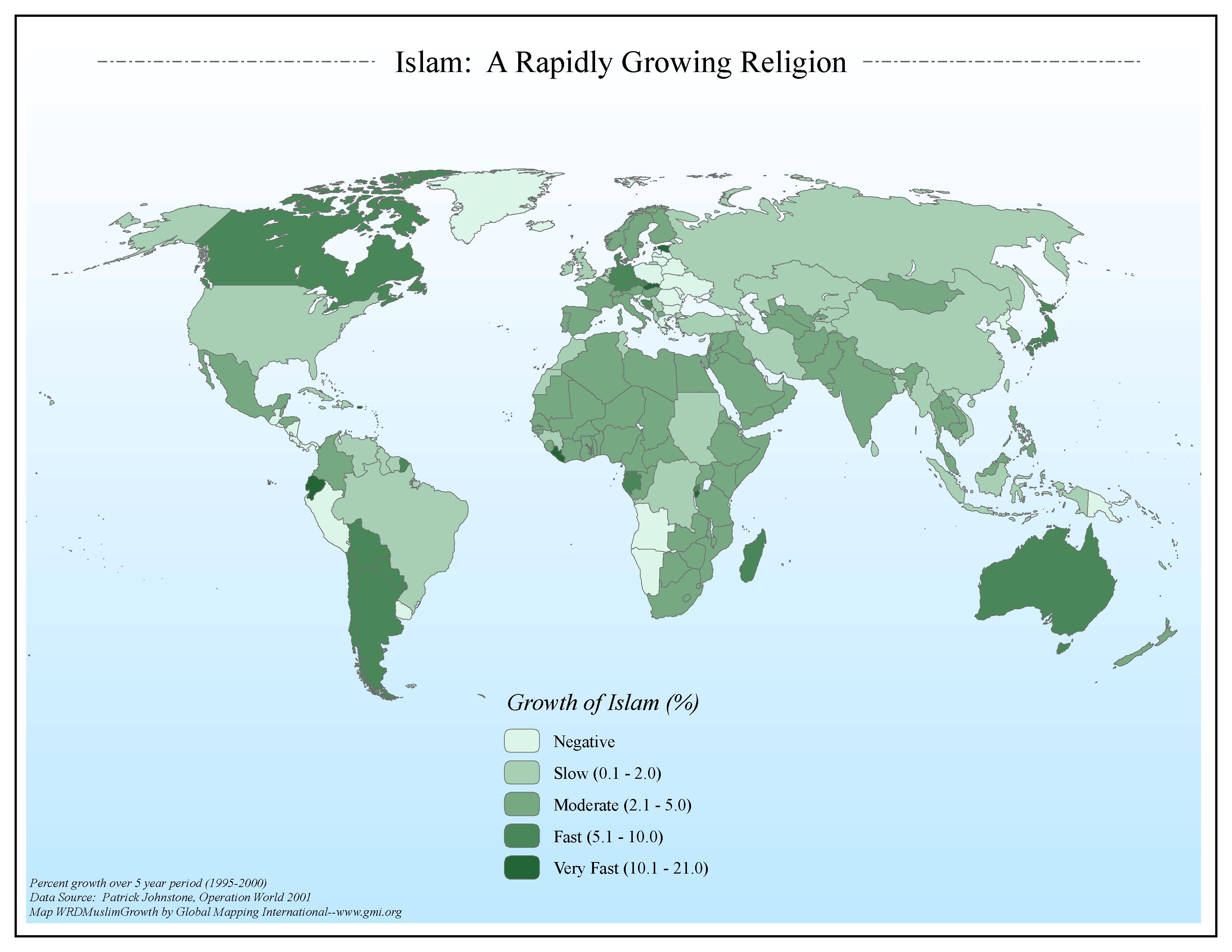 |
·Type: Maps ·Map Date: 2006 ·Data Source: Patrick Johnstone, Operation World 2001 ·Producer: Global Mapping International ·Collection: The World of Islam (GMMS 2007) ·Size: 8½ x 11 inches, landscape ·Categories: Type :: Maps Continent/Region :: World Topic :: Statistical Collection :: GMI Map Collections :: The World of Islam (GMMS 2007) Partners :: Global Mapping International Topic :: Religions, General :: Islam |
... more info
Max: 1
|
|
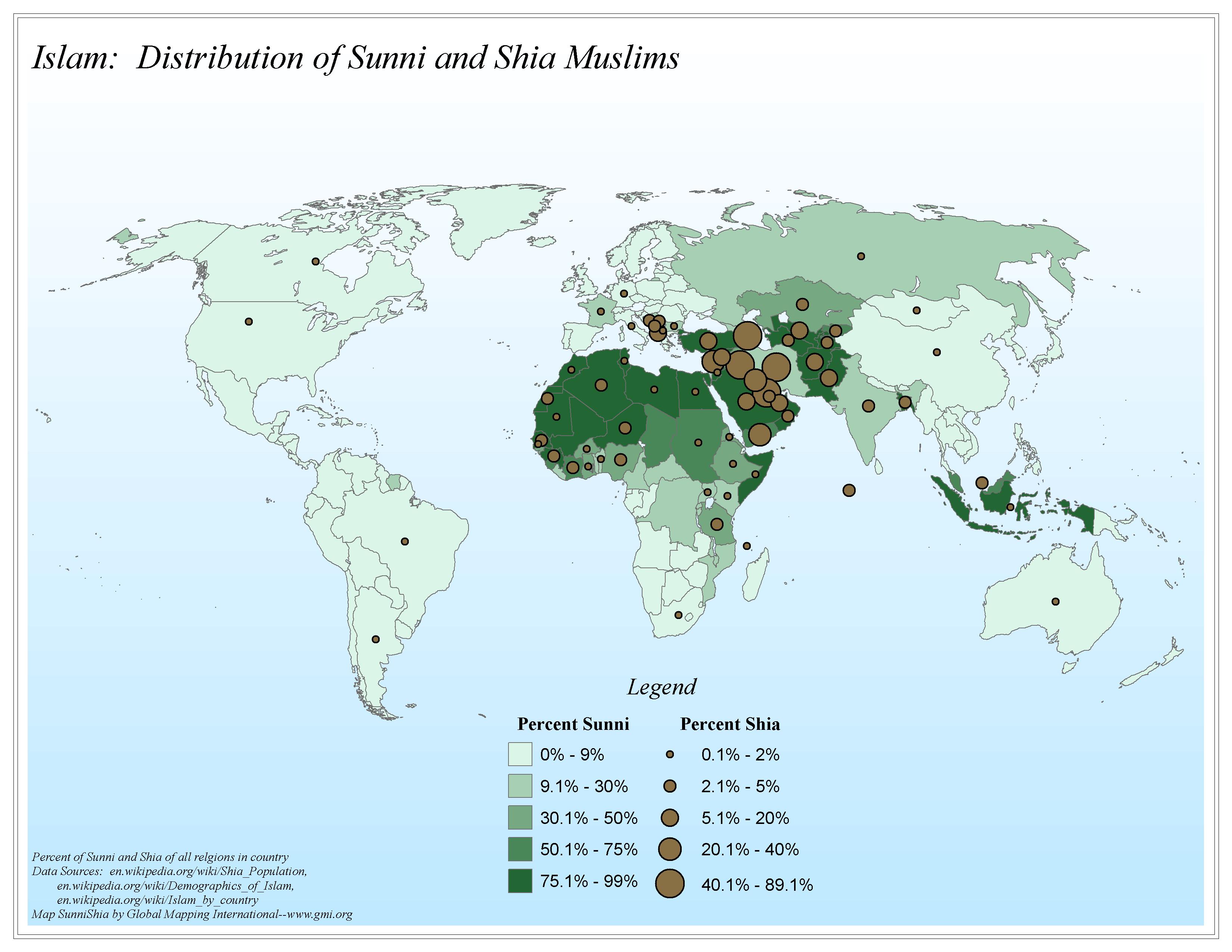 |
·Type: Maps ·Map Date: 2006 ·Data Source: en.wikipedia.org/wiki/Shia_Population, en.wikipedia.org/wiki/Demographics_of_Islam, en.wikipedia.org/wiki/Islam_by_country ·Producer: Global Mapping International ·Collection: The World of Islam (GMMS 2007) ·Size: 8½ x 11 inches, landscape ·Categories: Type :: Maps Continent/Region :: World Topic :: Statistical Collection :: GMI Map Collections :: The World of Islam (GMMS 2007) Partners :: Global... |
... more info
Max: 1
|
|
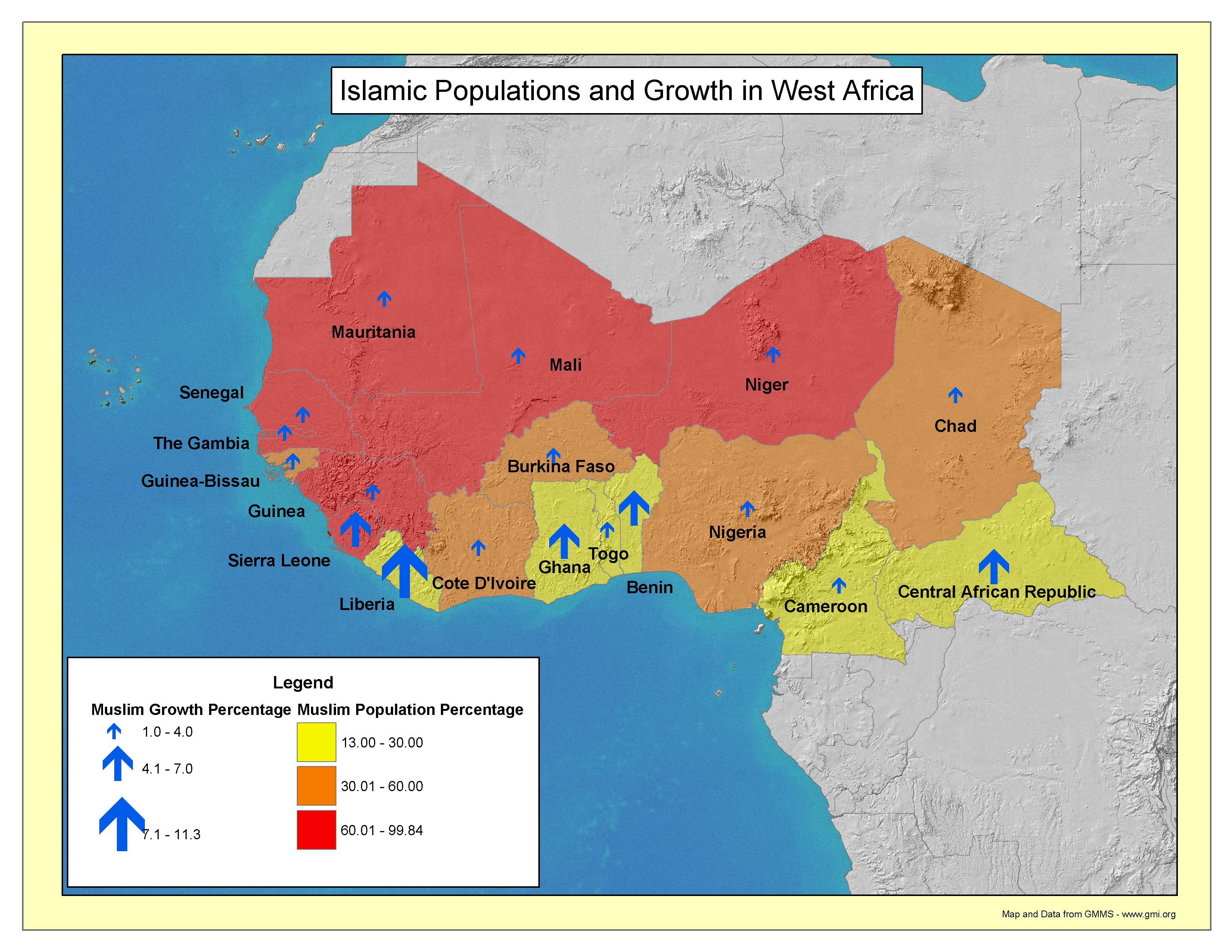 |
·Type: Maps ·Map Date: 2003 ·Producer: GMI ·Collection: Projects 2003 ·Size: 8½ by 11 inches, landscape ·Categories: Type :: Maps Continent/Region :: Africa Topic :: Statistical Partners :: Global Mapping International Collection :: GMI Map Collections :: Projects 2003 Topic :: Religions, General :: Islam |
... more info
Max: 1
|
|
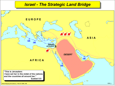 |
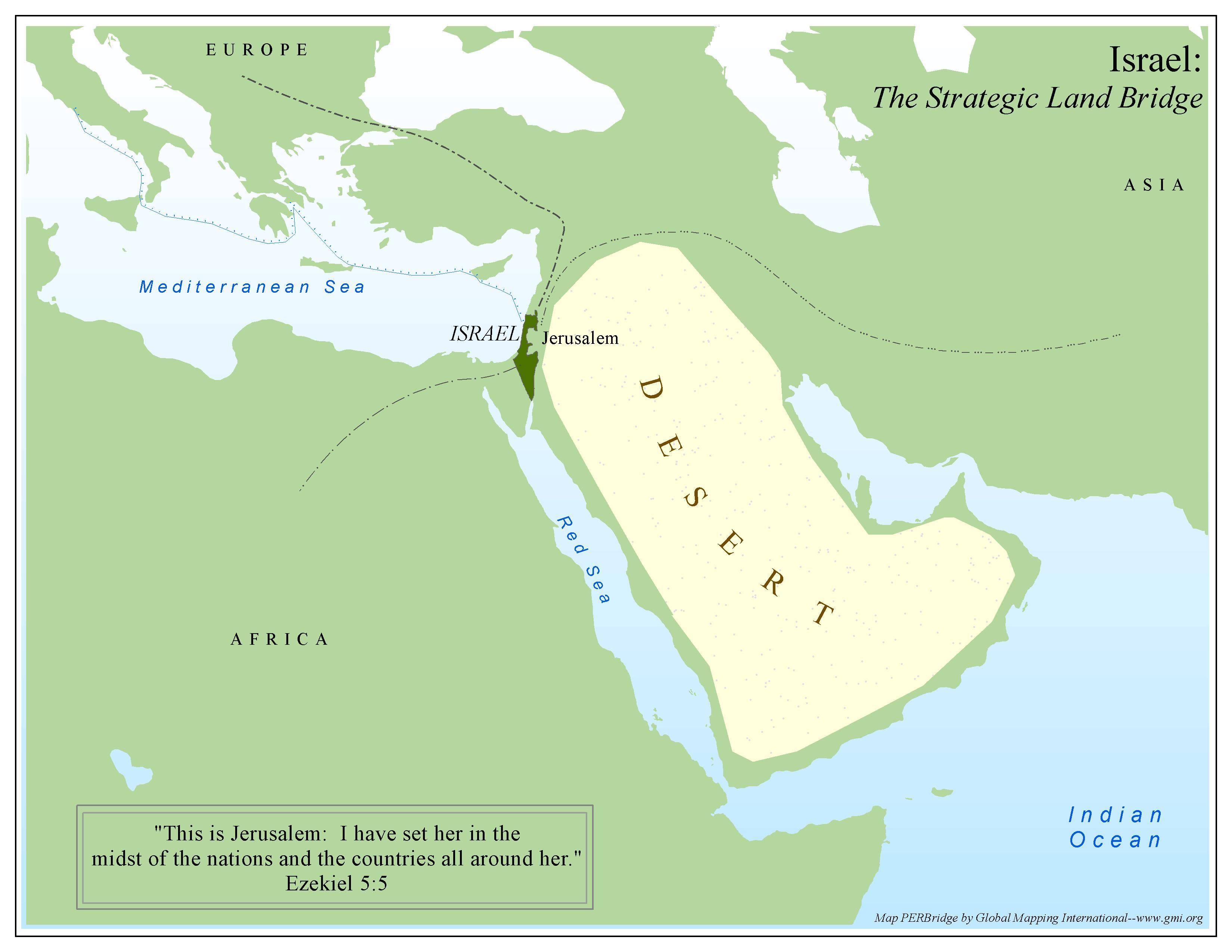
·Type: Maps ·Description: The Strategic Land Bridge, Israel ·Map Date: 2002 ·Producer: Global Mapping International ·Collection: Worldwide Perspectives (WV 2002) ·Size: 8½ x 11 Inches, landscape ·Note: Windows Metafile and Metafile in Word forms of this map require the GMISym.ttf font ·Categories: Type :: Maps Collection :: GMI Map Collections :: Worldwide Perspectives (WV 2002) Continent/Region :: Middle East Topic :: Concepts... |
... more info
Max: 1
|
|
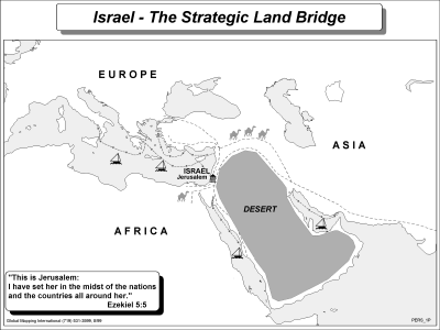 |
·Type: Maps ·Description: The Strategic Land Bridge, Israel ·Map Date: 2002 ·Producer: Global Mapping International ·Collection: Worldwide Perspectives (WV 2002) ·Size: 8½x11 Inches, landscape ·Note: Windows Metafile and Metafile in Word forms of this map require the GMISym.ttf font ·Categories: Type :: Maps Collection :: GMI Map Collections :: Worldwide Perspectives (WV 2002) Continent/Region :: Middle East Topic :: Concepts Topic... |
... more info
Max: 1
|
|
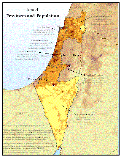 |
·Type: Maps ·Map Date: May 2008 ·Data Source: World Christian Database (2008), LandScan (2002) ·Producer: Global Mapping International ·Collection: Projects 2008 ·Size: 8.5 by 11 inches, portrait ·Categories: Type :: Maps Topic :: Demography Country :: Israel Partners :: Global Mapping International Collection :: GMI Map Collections :: Projects 2008 |
... more info
Max: 1
|
|
 |
·Type: Maps ·Map Date: 2006 ·Producer: Global Mapping International ·Collection: Worldwide Perspectives GMMS 2007 ·Size: 8½ x 11 inches, landscape ·Categories: Type :: Maps Continent/Region :: Middle East Topic :: Concepts Topic :: History Country :: Israel Partners :: Global Mapping International Collection :: GMI Map Collections :: Worldwide Perspectives GMMS 2007 Topic :: Geography :: Maps |
... more info
Max: 1
|
|