| Product Image |
Resource Name- |
Price |
Manufacturer |
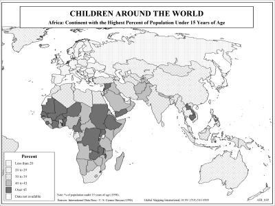 |
·Type: Maps ·Description: Percent Children in Africa ·Map Date: 2002 ·Producer: Global Mapping International ·Collection: Reaching Africa (WorldVue 2002) ·Size: 8½ x 11 Inches, landscape ·Categories: Type :: Maps Collection :: GMI Map Collections :: Reaching Africa (WorldVue 2002) Continent/Region :: Africa Topic :: Statistical Topic :: Demography Topic :: Social Partners :: Global Mapping International |
... more info
Max: 1
|
|
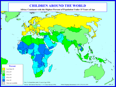 |
·Type: Maps ·Description: Percent Children in Africa ·Map Date: 1998 ·Producer: Global Mapping International ·Collection: Reaching Africa (WorldVue 2002) ·Size: 8½ x 11 Inches, landscape ·Categories: Type :: Maps Collection :: GMI Map Collections :: Reaching Africa (WorldVue 2002) Continent/Region :: Africa Topic :: Statistical Topic :: Demography Topic :: Social Partners :: Global Mapping International |
... more info
Max: 1
|
|
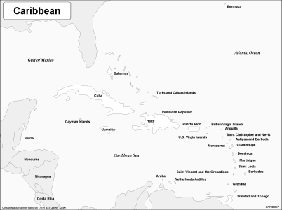 |
·Type: Maps ·Description: Political Map of The Caribbean ·Map Date: 2002 ·Producer: Global Mapping International ·Collection: Regions (WorldVue 2002) ·Size: 8½ x 11 Inches, landscape ·Categories: Type :: Maps Continent/Region :: Latin America Partners :: Global Mapping International Collection :: GMI Map Collections :: Regions (WorldVue 2002) Topic :: Geography :: Maps |
... more info
Max: 1
|
|
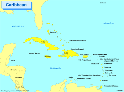 |
·Type: Maps ·Description: Political Map of The Caribbean ·Map Date: 2002 ·Producer: Global Mapping International ·Collection: Regions (WorldVue 2002) ·Size: 8½ x 11 Inches, landscape ·Categories: Type :: Maps Continent/Region :: Latin America Partners :: Global Mapping International Collection :: GMI Map Collections :: Regions (WorldVue 2002) Topic :: Geography :: Maps |
... more info
Max: 1
|
|
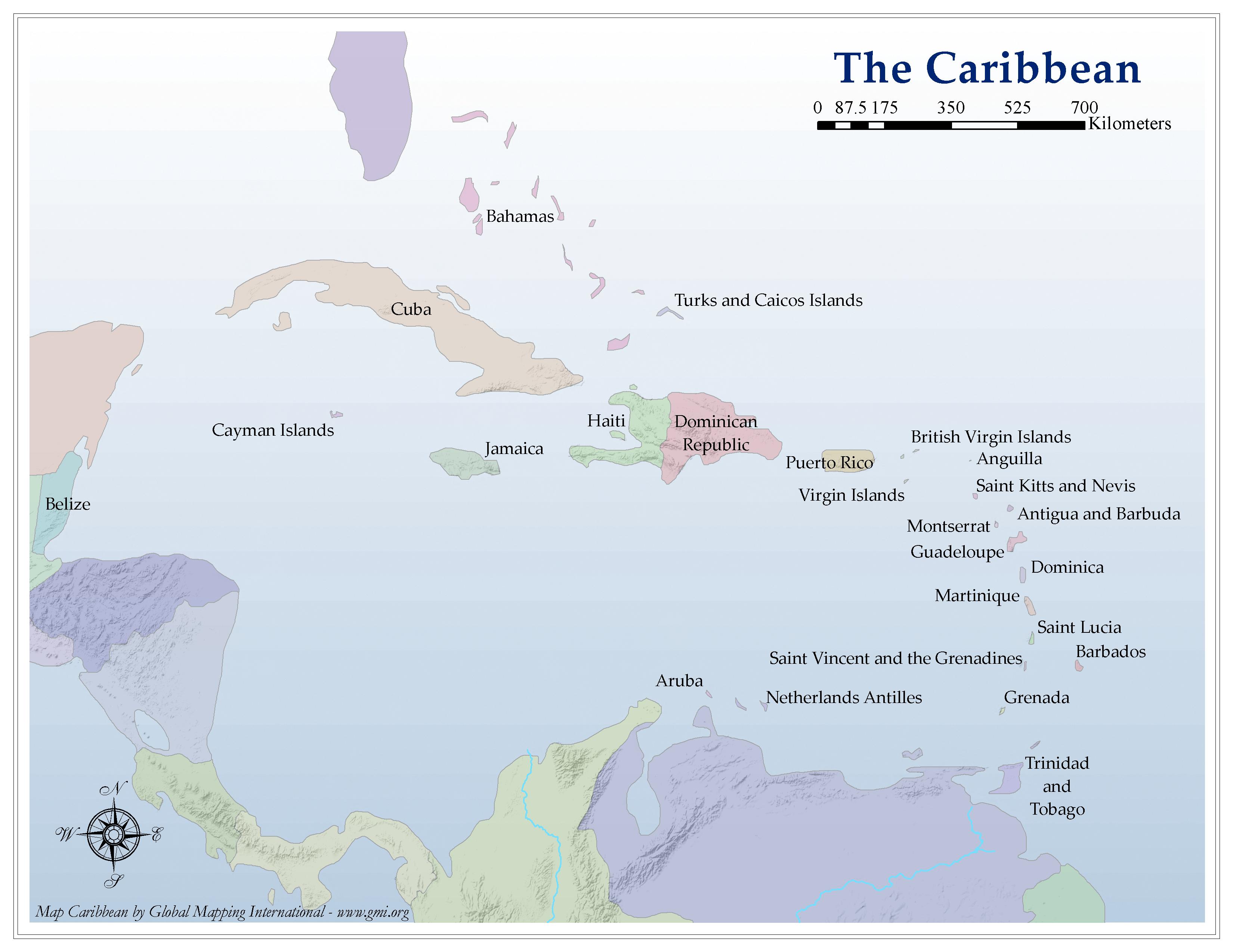 |
·Type: Maps ·Map Date: 2006 ·Producer: Global Mapping International ·Collection: Regions (GMMS 2007) ·Size: 8½ x 11 inches, landscape ·Categories: Type :: Maps Partners :: Global Mapping International Collection :: GMI Map Collections :: Regions (GMMS 2007) Topic :: Geography :: Maps |
... more info
Max: 1
|
|
 |
·Type: Maps ·Description: Books in Africa ·Map Date: 2002 ·Producer: Global Mapping International ·Collection: Reaching Africa (WorldVue 2002) ·Size: 8½ x 11 Inches, landscape ·Categories: Type :: Maps Collection :: GMI Map Collections :: Reaching Africa (WorldVue 2002) Continent/Region :: Africa Topic :: Social Partners :: Global Mapping International |
... more info
Max: 1
|
|
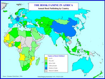 |
·Type: Maps ·Description: Books in Africa ·Map Date: 1994 ·Producer: Global Mapping International ·Collection: Reaching Africa (WorldVue 2002) ·Size: 8½ x 11 Inches, landscape ·Categories: Type :: Maps Collection :: GMI Map Collections :: Reaching Africa (WorldVue 2002) Continent/Region :: Africa Topic :: Social Partners :: Global Mapping International |
... more info
Max: 1
|
|
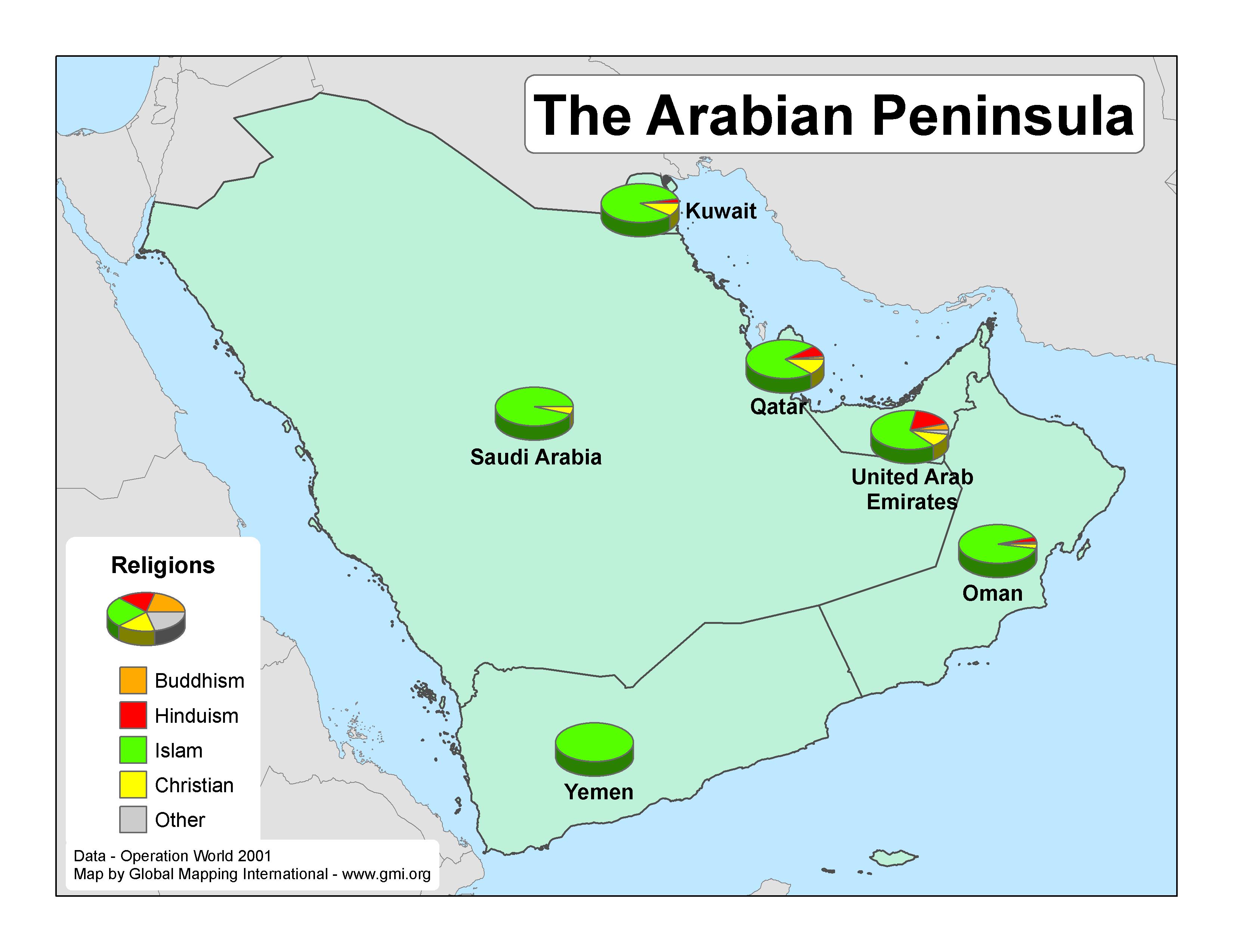 |
·Type: Maps ·Map Date: 2007 ·Data Source: Operation World 2001 ·Producer: GMI ·Collection: Projects 2007 ·Size: 8½ by 11 inches, landscape ·Categories: Type :: Maps Continent/Region :: Middle East Topic :: Statistical Partners :: Global Mapping International Collection :: GMI Map Collections :: Projects 2007 Topic :: Religions, General :: Multiple/Other |
... more info
Max: 1
|
|
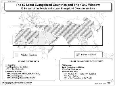 |
·Type: Maps ·Description: 52 Unevangelized Countries in the 10/40 Window ·Map Date: 2002 ·Producer: Global Mapping International ·Collection: The 10/40 Window (WorldVue 2002) ·Size: 8½ x 11 Inches, landscape ·Categories: Type :: Maps Collection :: GMI Map Collections :: The 10/40 Window (WorldVue 2002) Topic :: Statistical Topic :: Strategy Topic :: Concepts Partners :: Global Mapping International Continent/Region :: 10/40 Window |
... more info
Max: 1
|
|
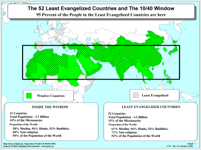 |
·Type: Maps ·Description: 52 Unevangelized Countries in the 10/40 Window ·Map Date: 2001 ·Producer: Global Mapping International ·Collection: The 10/40 Window (WorldVue 2002) ·Size: 8½ x 11 Inches, landscape ·Categories: Type :: Maps Collection :: GMI Map Collections :: The 10/40 Window (WorldVue 2002) Topic :: Statistical Topic :: Strategy Topic :: Concepts Partners :: Global Mapping International Continent/Region :: 10/40 Window |
... more info
Max: 1
|
|
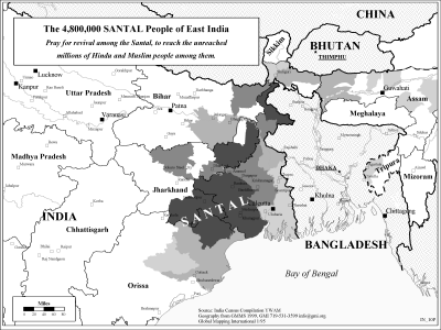 |
·Type: Maps ·Description: The Santal People in Eastern India ·Map Date: 2002 ·Producer: Global Mapping International ·Collection: Reaching India (WorldVue 2002) ·Size: 8½ x 11 Inches, landscape ·Note: Windows Metafile and Metafile in Word forms of this map require the GMISym.ttf font ·Categories: Type :: Maps Collection :: GMI Map Collections :: Reaching India (WorldVue 2002) Continent/Region :: Asia Topic :: Strategy Country ::... |
... more info
Max: 1
|
|
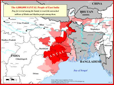 |
·Type: Maps ·Description: The Santal People in Eastern India ·Map Date: 1999 ·Producer: Global Mapping International ·Collection: Reaching India (WorldVue 2002) ·Size: 8½ x 11 Inches, landscape ·Note: Windows Metafile and Metafile in Word forms of this map require the GMISym.ttf font ·Categories: Type :: Maps Collection :: GMI Map Collections :: Reaching India (WorldVue 2002) Continent/Region :: Asia Topic :: Strategy Country ::... |
... more info
Max: 1
|
|
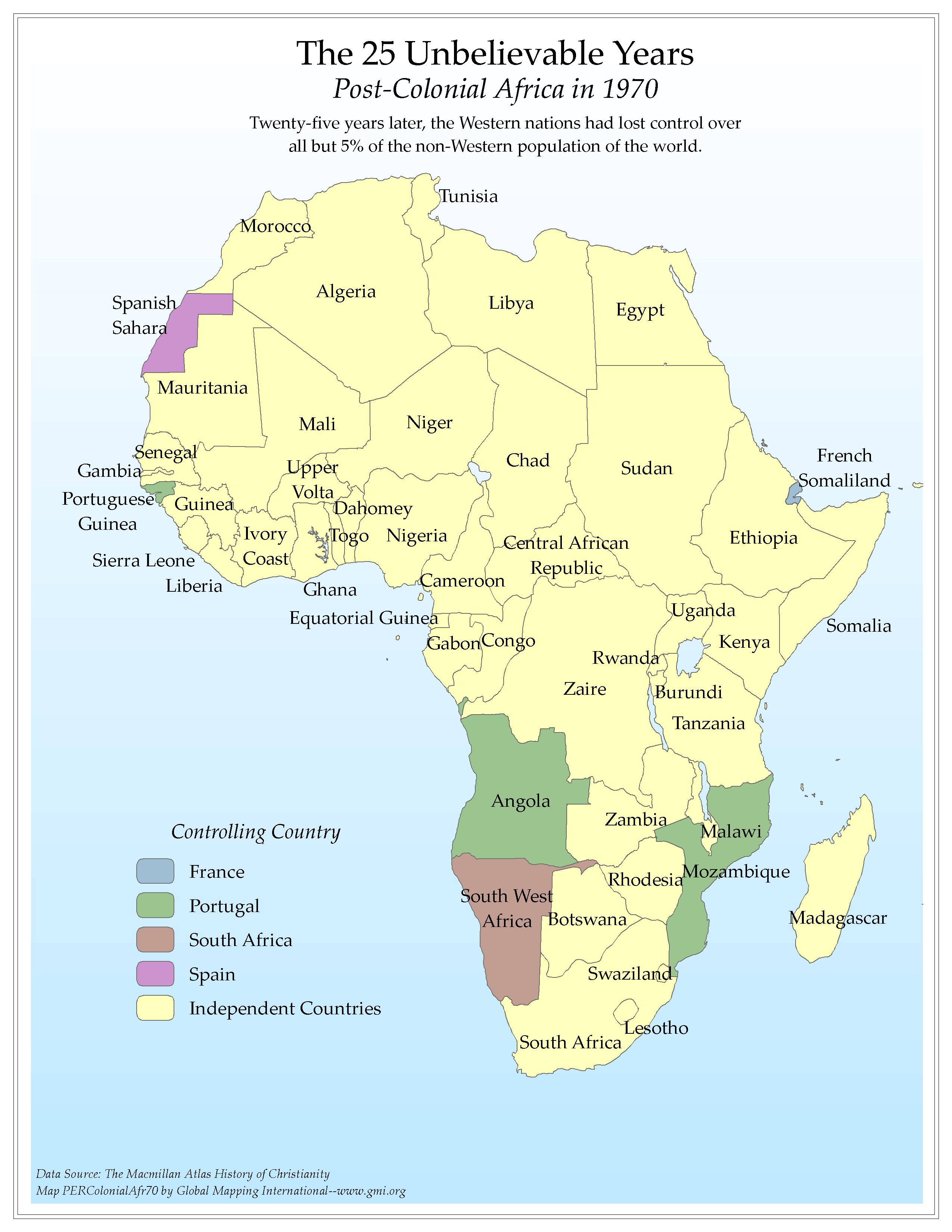 |
·Type: Maps ·Map Date: 2006 ·Data Source: The Macmillan Atlas History of Christianity ·Producer: Global Mapping International ·Collection: Worldwide Perspectives GMMS 2007 ·Size: 8½ x 11 inches, portrait ·Categories: Type :: Maps Continent/Region :: Africa Topic :: History Partners :: Global Mapping International Collection :: GMI Map Collections :: Worldwide Perspectives GMMS 2007 |
... more info
Max: 1
|
|
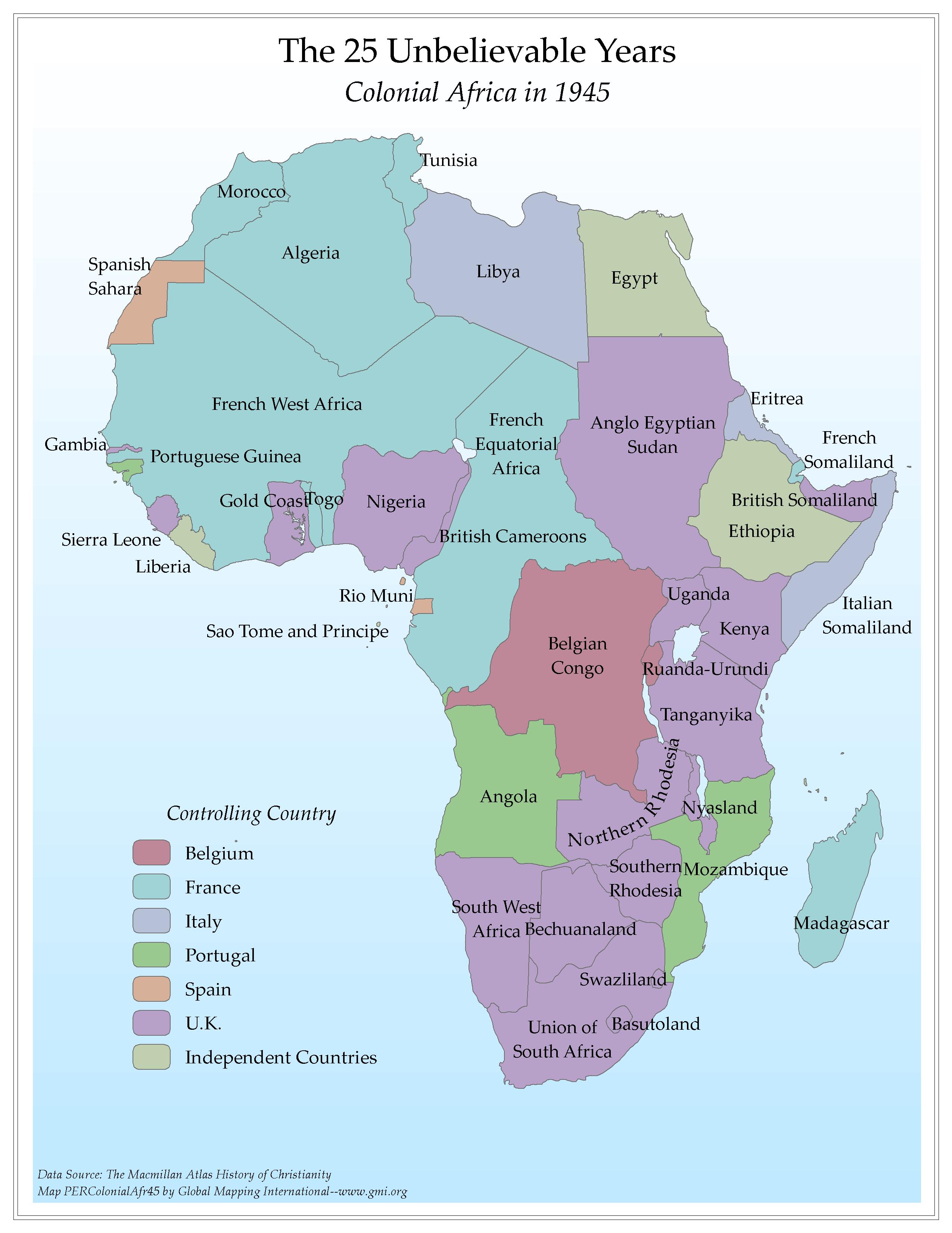 |
·Type: Maps ·Map Date: 2006 ·Data Source: The Macmillan Atlas History of Christianity ·Producer: Global Mapping International ·Collection: Worldwide Perspectives GMMS 2007 ·Size: 8½ x 11 inches, portrait ·Categories: Type :: Maps Continent/Region :: Africa Topic :: History Partners :: Global Mapping International Collection :: GMI Map Collections :: Worldwide Perspectives GMMS 2007 |
... more info
Max: 1
|
|
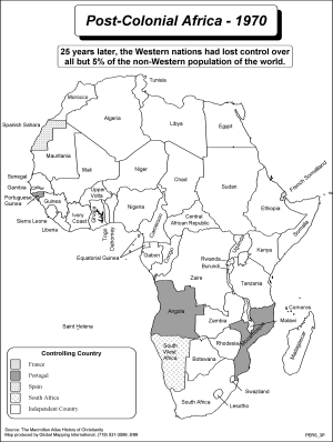 |
·Type: Maps ·Description: The 25 Unbelievible years of Post-Colonial Africa, 1970 ·Map Date: 2002 ·Producer: Global Mapping International ·Collection: Worldwide Perspectives (WV 2002) ·Size: 8½ x 11 Inches, portrait ·Categories: Type :: Maps Collection :: GMI Map Collections :: Worldwide Perspectives (WV 2002) Continent/Region :: Africa Topic :: History Partners :: Global Mapping International |
... more info
Max: 1
|
|
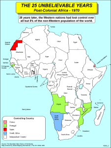 |
·Type: Maps ·Description: The 25 Unbelievible years of Post-Colonial Africa, 1970 ·Map Date: 2002 ·Producer: Global Mapping International ·Collection: Worldwide Perspectives (WV 2002) ·Size: 8½ x 11 Inches, portrait ·Categories: Type :: Maps Collection :: GMI Map Collections :: Worldwide Perspectives (WV 2002) Continent/Region :: Africa Topic :: History Partners :: Global Mapping International |
... more info
Max: 1
|
|
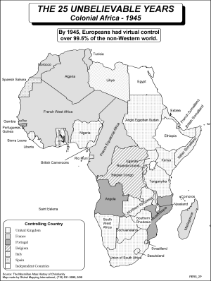 |
·Type: Maps ·Description: The 25 unbelievible years of Colonial Africa, 1945 ·Map Date: 2002 ·Producer: Global Mapping International ·Collection: Worldwide Perspectives (WV 2002) ·Size: 8½ x 11 Inches, portrait ·Categories: Type :: Maps Collection :: GMI Map Collections :: Worldwide Perspectives (WV 2002) Continent/Region :: Africa Topic :: History Partners :: Global Mapping International |
... more info
Max: 1
|
|
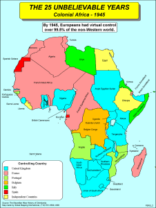 |
·Type: Maps ·Description: The 25 unbelievible years of Colonial Africa, 1945 ·Map Date: 2002 ·Producer: Global Mapping International ·Collection: Worldwide Perspectives (WV 2002) ·Size: 8½ x 11 Inches, portrait ·Categories: Type :: Maps Collection :: GMI Map Collections :: Worldwide Perspectives (WV 2002) Continent/Region :: Africa Topic :: History Partners :: Global Mapping International |
... more info
Max: 1
|
|
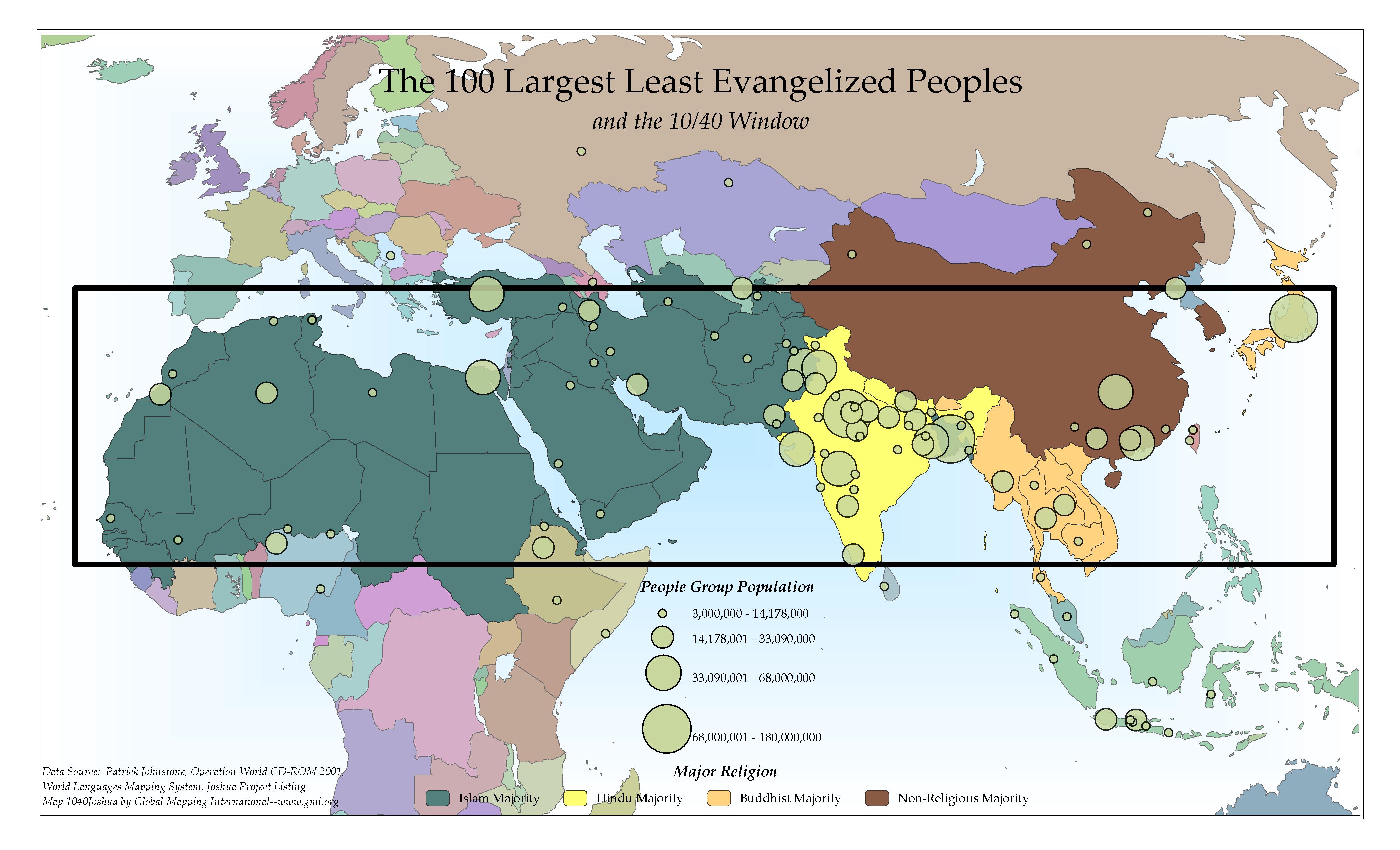 |
·Type: Maps ·Map Date: 2006 ·Data Source: Patrick Johnstone, Operation World CD-ROM 2001, World Languages Mapping System, Joshua Project Listing ·Producer: Global Mapping International ·Collection: The 10/40 Window (GMMS 2007) ·Size: 8½ x 14 inches, landscape ·Categories: Type :: Maps Topic :: Statistical Topic :: Strategy Topic :: Concepts Topic :: Peoples, multiple or unknown Collection :: GMI Map Collections :: The 10/40 Window (GMMS... |
... more info
Max: 1
|
|
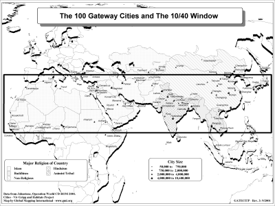 |
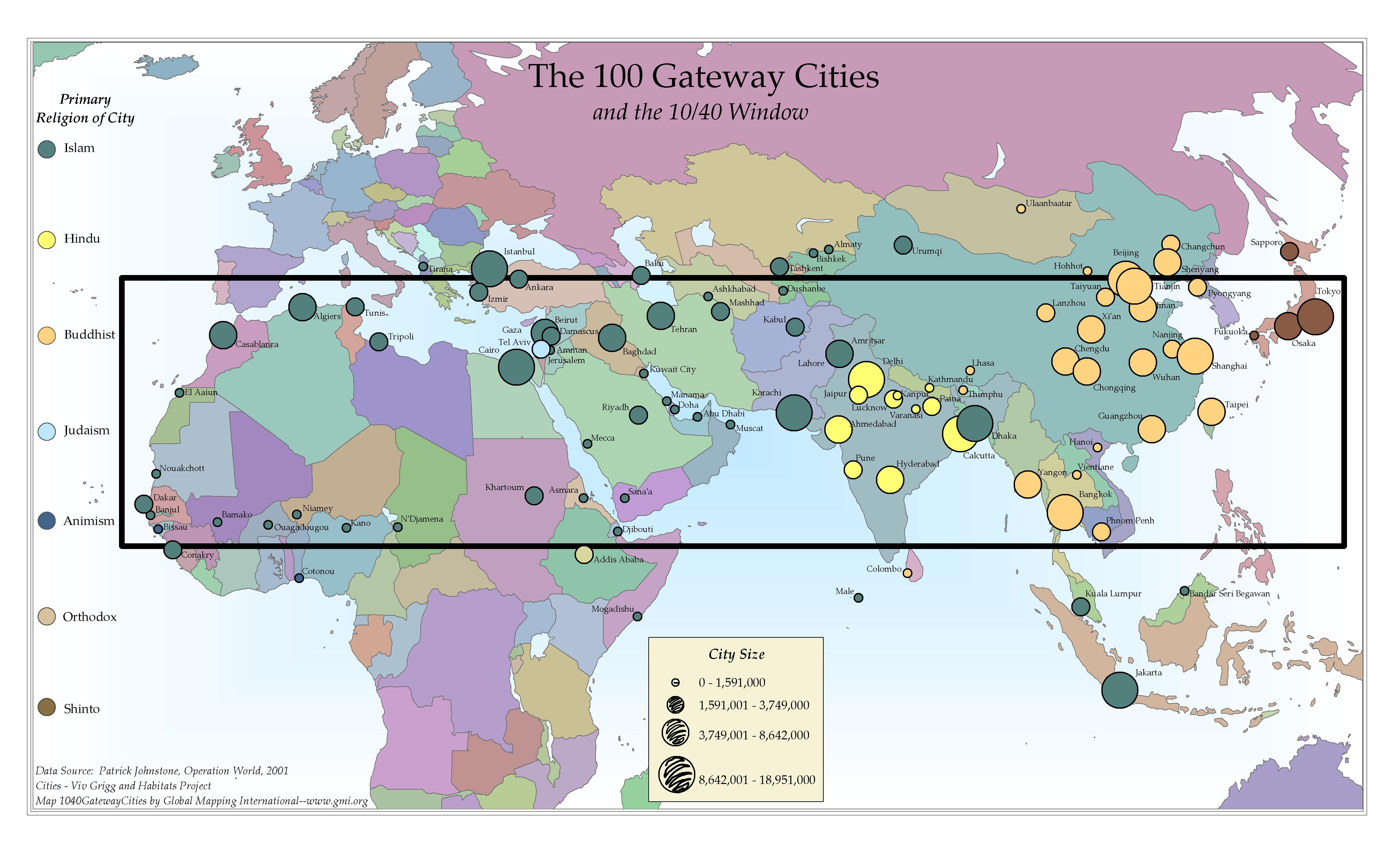
·Type: Maps ·Description: 100 Gateway Cities to the 10/40 Window ·Map Date: 2002 ·Producer: Global Mapping International ·Collection: The 10/40 Window (WorldVue 2002) ·Size: 8½ x 11 Inches, landscape ·Note: Windows Metafile and Metafile in Word forms of this map require the GMISym.ttf font ·Categories: Type :: Maps Collection :: GMI Map Collections :: The 10/40 Window (WorldVue 2002) Topic :: Statistical Topic :: Strategy Topic ::... |
... more info
Max: 1
|
|
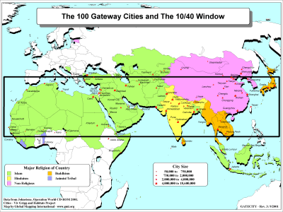 |
·Type: Maps ·Description: 100 Gateway Cities to the 10/40 Window ·Map Date: 2001 ·Producer: Global Mapping International ·Collection: The 10/40 Window (WorldVue 2002) ·Size: 8½ x 11 Inches, landscape ·Note: Windows Metafile and Metafile in Word forms of this map require the GMISym.ttf font ·Categories: Type :: Maps Collection :: GMI Map Collections :: The 10/40 Window (WorldVue 2002) Topic :: Statistical Topic :: Strategy Topic ::... |
... more info
Max: 1
|
|
 |
·Type: Maps ·Map Date: 2006 ·Data Source: Patrick Johnstone, Operation World, 2001 ·Producer: Global Mapping International ·Collection: The 10/40 Window (GMMS 2007) ·Size: 8½ x 14 inches, landscape ·Categories: Type :: Maps Topic :: Statistical Topic :: Strategy Topic :: Concepts Topic :: Demography Collection :: GMI Map Collections :: The 10/40 Window (GMMS 2007) Partners :: Global Mapping International Topic :: Religions, General ::... |
... more info
Max: 1
|
|
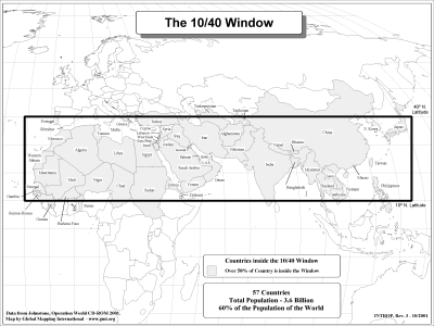 |
·Type: Maps ·Description: Political map of the 10/40 Window ·Map Date: 2002 ·Producer: Global Mapping International ·Collection: The 10/40 Window (WorldVue 2002) ·Size: 8½ x 11 Inches, landscape ·Categories: Type :: Maps Collection :: GMI Map Collections :: The 10/40 Window (WorldVue 2002) Topic :: Concepts Partners :: Global Mapping International Continent/Region :: 10/40 Window |
... more info
Max: 1
|
|
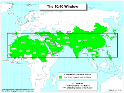 |
·Type: Maps ·Description: Political map of the 10/40 Window ·Map Date: 2001 ·Producer: Global Mapping International ·Collection: The 10/40 Window (WorldVue 2002) ·Size: 8½ x 11 Inches, landscape ·Categories: Type :: Maps Collection :: GMI Map Collections :: The 10/40 Window (WorldVue 2002) Topic :: Concepts Partners :: Global Mapping International Continent/Region :: 10/40 Window |
... more info
Max: 1
|
|
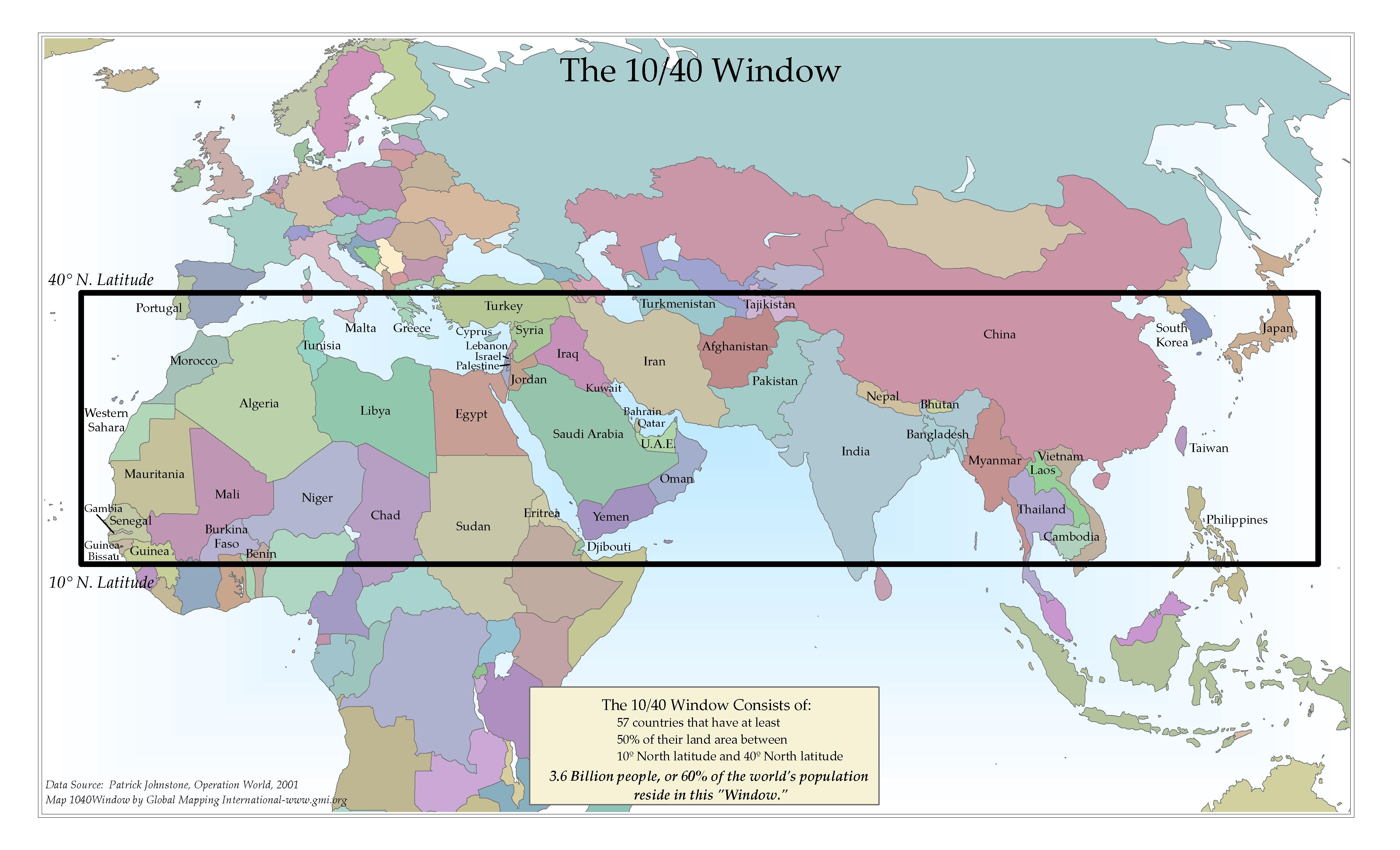 |
·Type: Maps ·Map Date: 2006 ·Data Source: Patrick Johnstone, Operation World, 2001 ·Producer: Global Mapping International ·Collection: The 10/40 Window (GMMS 2007) ·Size: 8½ x 14 inches, landscape ·Categories: Type :: Maps Topic :: Concepts Collection :: GMI Map Collections :: The 10/40 Window (GMMS 2007) Partners :: Global Mapping International Continent/Region :: 10/40 Window |
... more info
Max: 1
|
|