Projects 2007
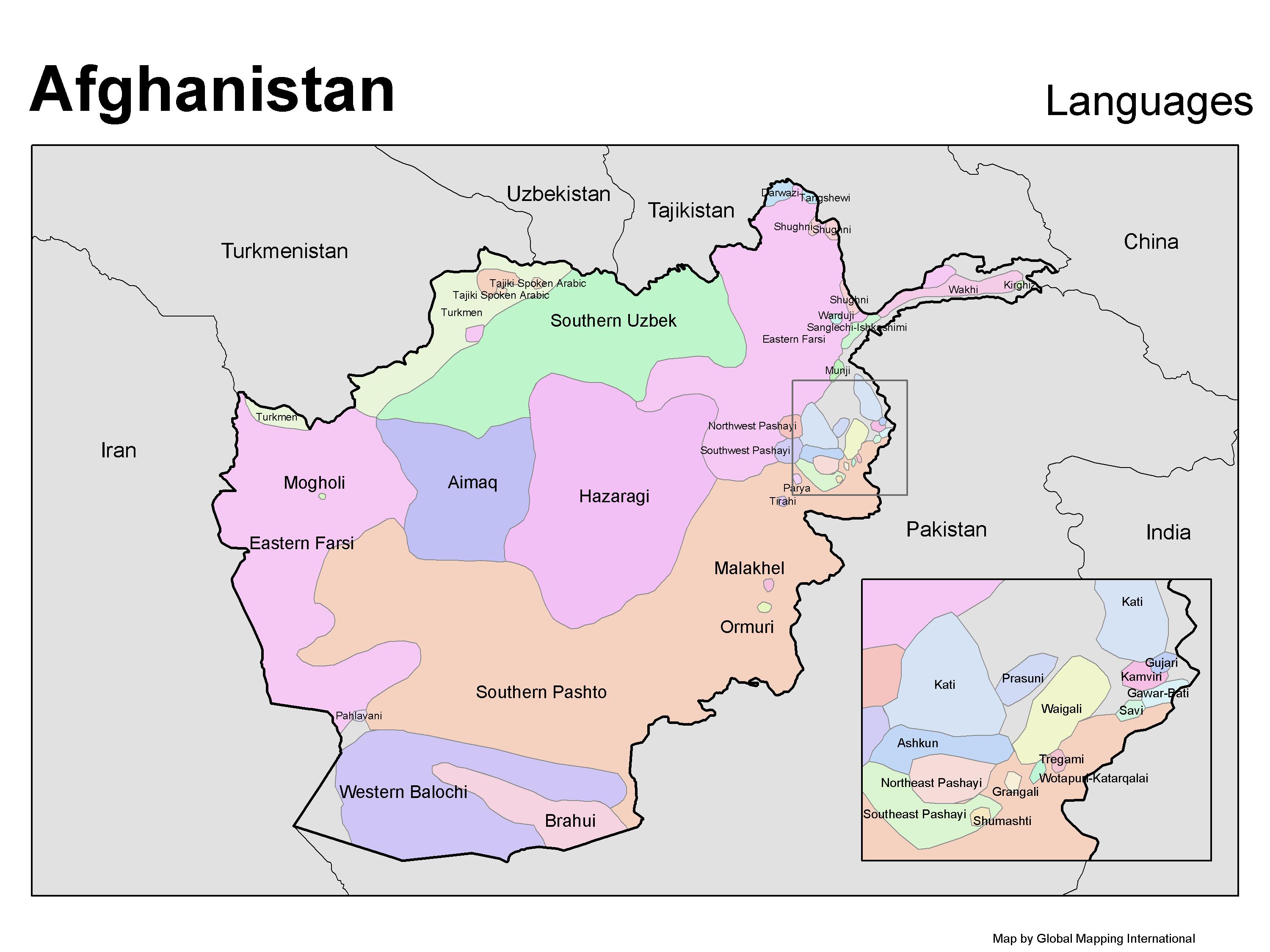
Afghanistan Languages
·Type: Maps ·Map Date: 2007 ·Producer: GMI ·Collection: Projects 2007 ·Categories: Type :: Maps Country :: Afghanistan Partners :: Global Mapping International Collection :: GMI Map Collections :: Projects 2007...
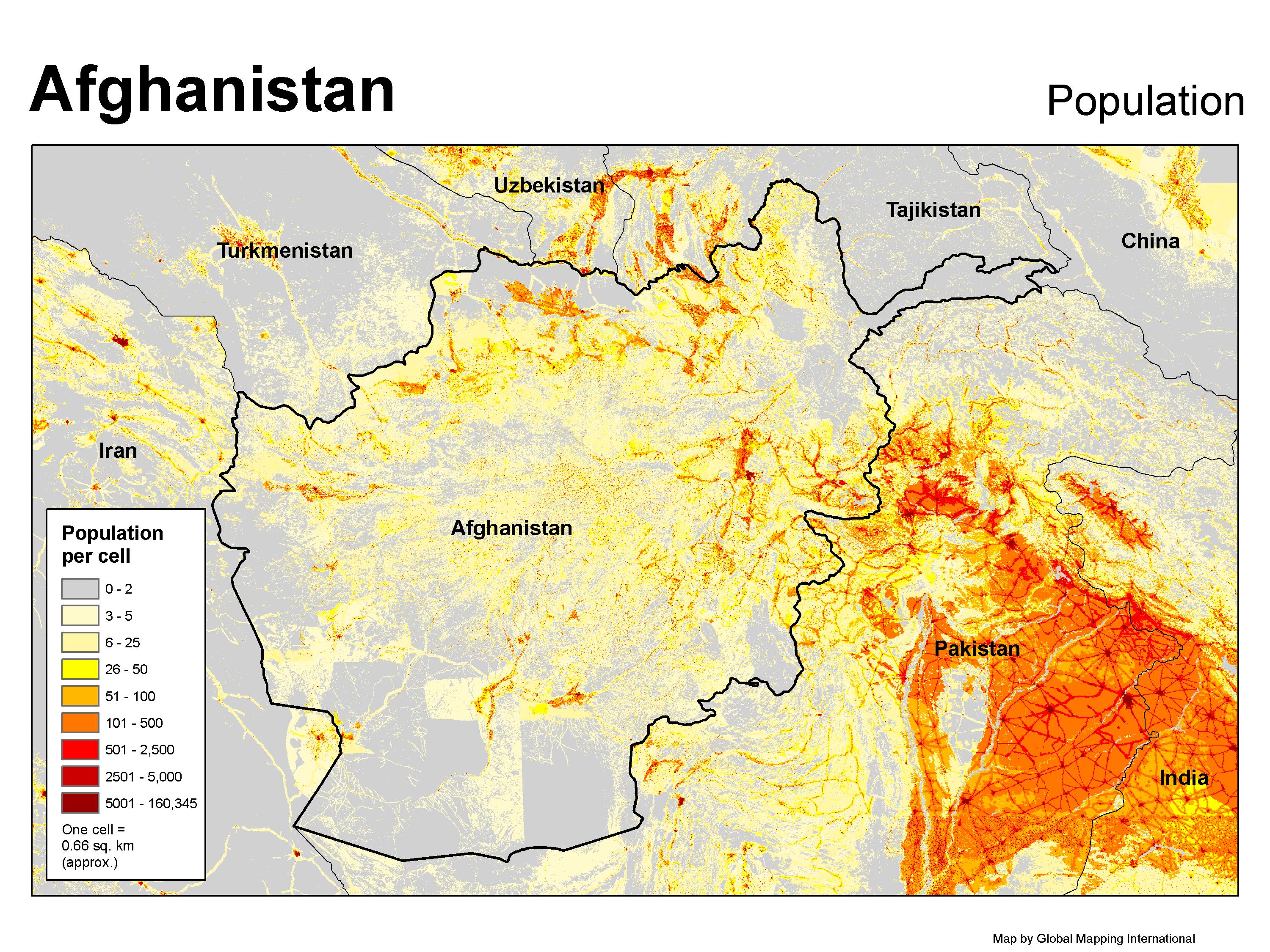
Afghanistan Population
·Type: Maps ·Map Date: 2007 ·Producer: GMI ·Collection: Projects 2007 ·Categories: Type :: Maps Topic :: Statistical Topic :: Demography Country :: Afghanistan Partners :: Global Mapping International Collection...
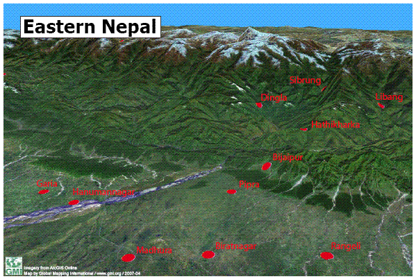
Eastern Nepal
·Type: Maps ·Map Date: 16 April 2007 ·Data Source: ·Producer: Global Mapping International ·Collection: Projects 2007 ·Size: 8½ by 11 inches, landscape ·Categories: Type :: Maps Country ::...
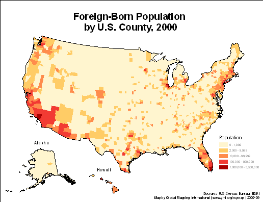
Foreign-Born Population by U.S. County, 2000
·Type: Maps ·Description: ·Collection: Projects 2007 ·Categories: Type :: Maps Country :: United States of America Topic :: Demography Partners :: Global Mapping International Collection :: GMI Map Collections ::...
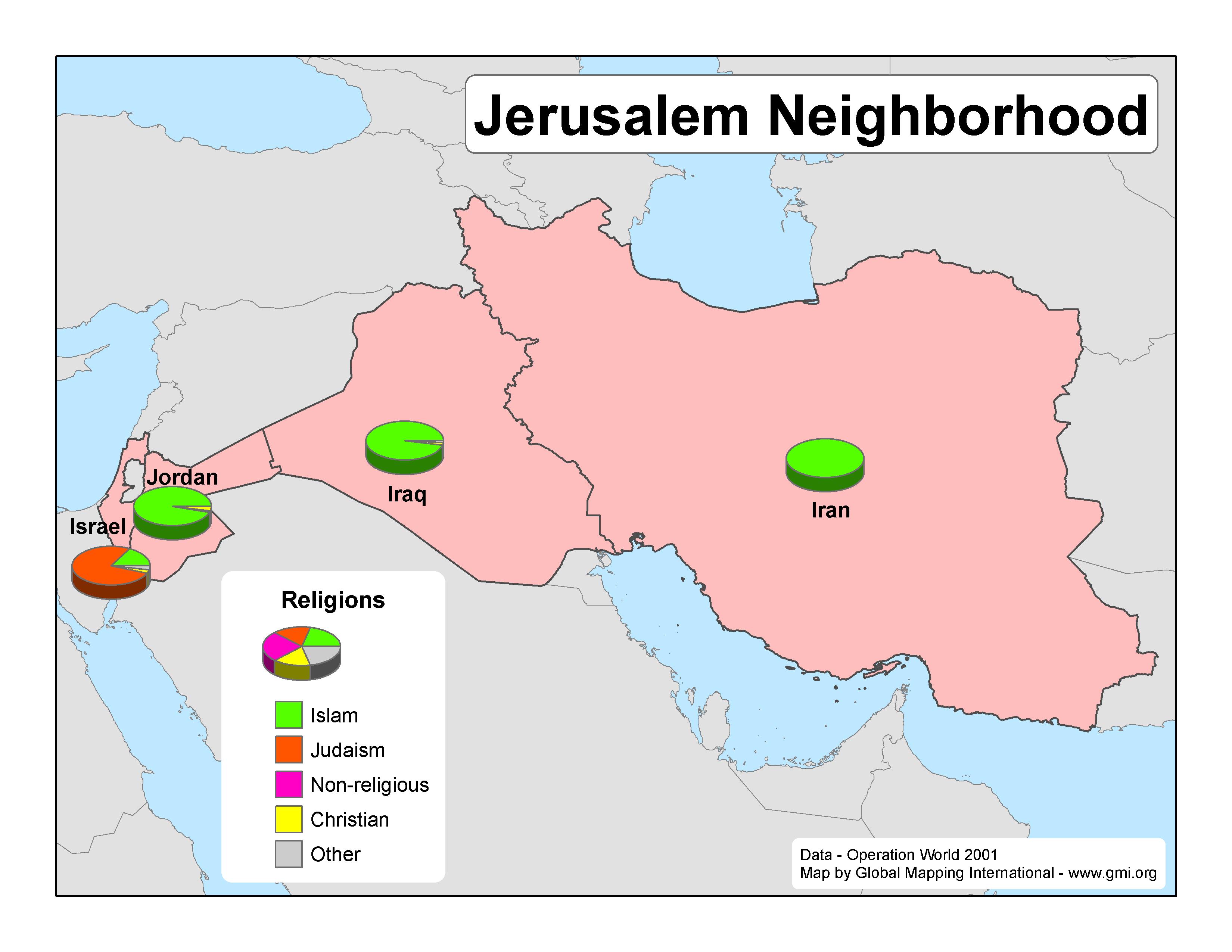
Jerusalem Neighborhood
·Type: Maps ·Map Date: 2007 ·Data Source: Operation World 2001 ·Producer: GMI ·Collection: Projects 2007 ·Size: 8½ by 11 inches, landscape ·Categories: Type :: Maps Continent/Region :: Middle...
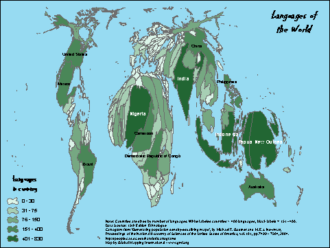
Languages of the World - Cartogram
·Type: Maps ·Description: Countries are sized by number of languages. ·Map Date: 2007 ·Data Source: 15th Edition Ethnologue Producer: Global Mapping International ·Collection: Projects 2007 ·Size: Size: 8...
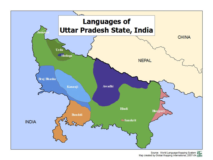
Languages of Uttar Pradesh State, India
·Type: Maps ·Map Date: 2007 ·Data Source: World Language Mapping Systems ·Producer: GMI ·Collection: Projects 2007 ·Size: 7½ by 10 inches, landscape ·Categories: Type :: Maps Country :: India...
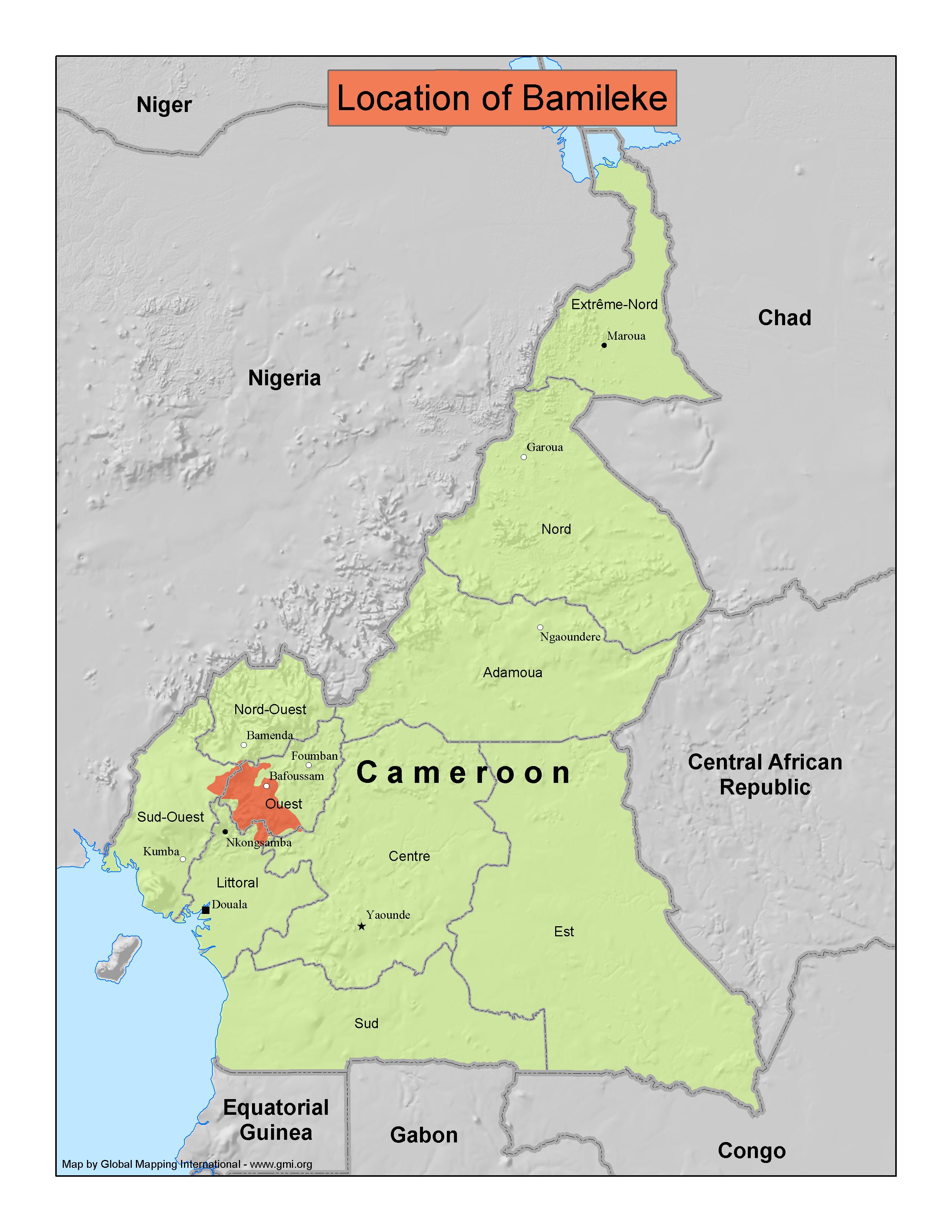
Location of Bamileke
·Type: Maps ·Map Date: 2007 ·Producer: GMI ·Collection: Projects 2007 ·Size: 8½ by 11 inches, portrait ·Categories: Type :: Maps Country :: Cameroon Partners :: Global Mapping International...
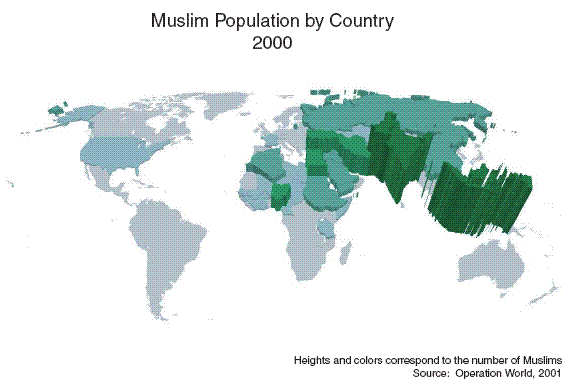
Muslim Population by Country 2000 (3D)
·Type: Maps ·Map Date: 27 February 2007 ·Data Source: Operation World 2001 ·Producer: Global Mapping International ·Collection: Projects 2007 ·Size: 8½ by 11 inches, landscape ·Categories:...
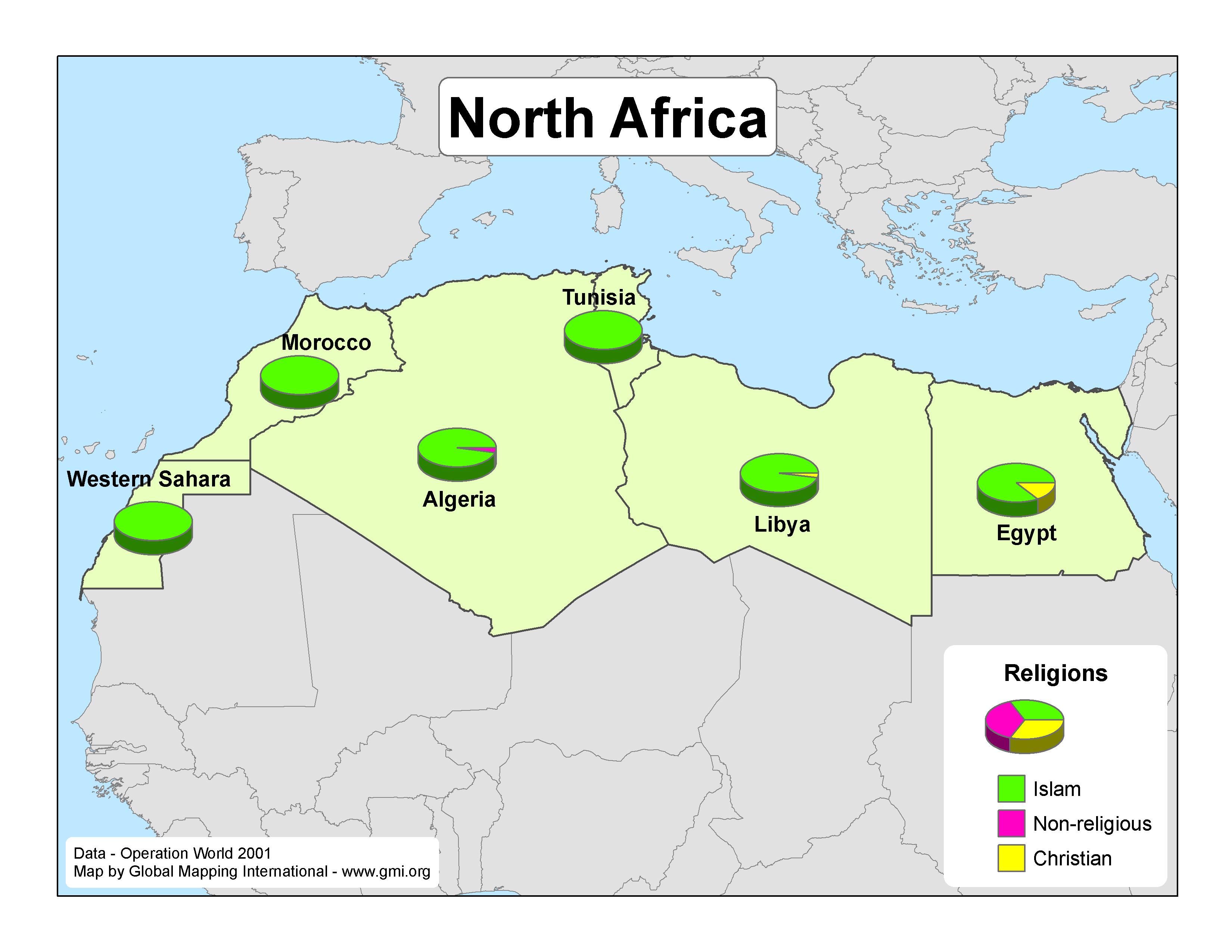
North Africa
·Type: Maps ·Map Date: 2007 ·Data Source: Operation World 2001 ·Producer: GMI ·Collection: Projects 2007 ·Size: 8½ by 11 inches, landscape ·Categories: Type :: Maps Continent/Region :: Africa...
Number of Internet Users - Europe
·Type: Maps ·Map Date: 29 March 2007 ·Data Source: World Factbook 2006 ·Producer: Global Mapping International ·Collection: Projects 2007 ·Size: 8½ by 11 inches, landscape ·Categories: Type...
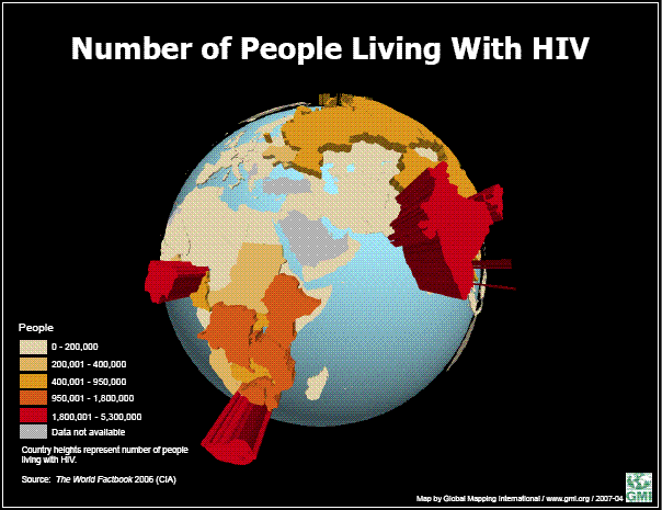
Number of People Living with HIV
·Type: Maps ·Map Date: June 2007 ·Data Source: World Factbook 2006 ·Producer: Global Mapping International ·Collection: Projects 2007 ·Size: 8 1/2 x 11, landscape ·Categories: Type :: Maps Topic ::...
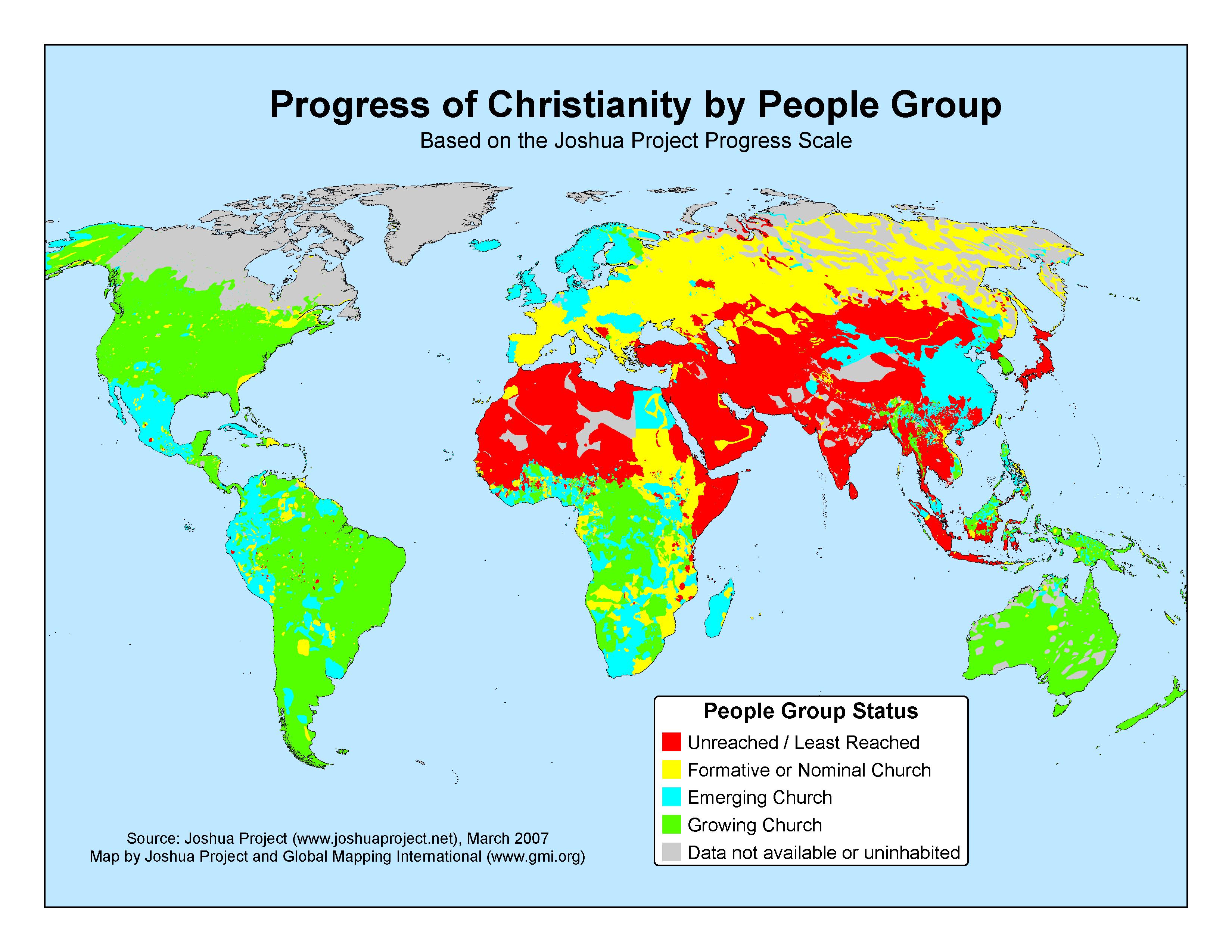
Progress of Christianity by People Group - March 2007
·Type: Maps ·Map Date: 2007 ·Data Source: The Joshua Project, March 2007 ·Producer: GMI; The Joshua Project ·Collection: Projects 2007 ·Categories: Type :: Maps Continent/Region :: World Topic ::...
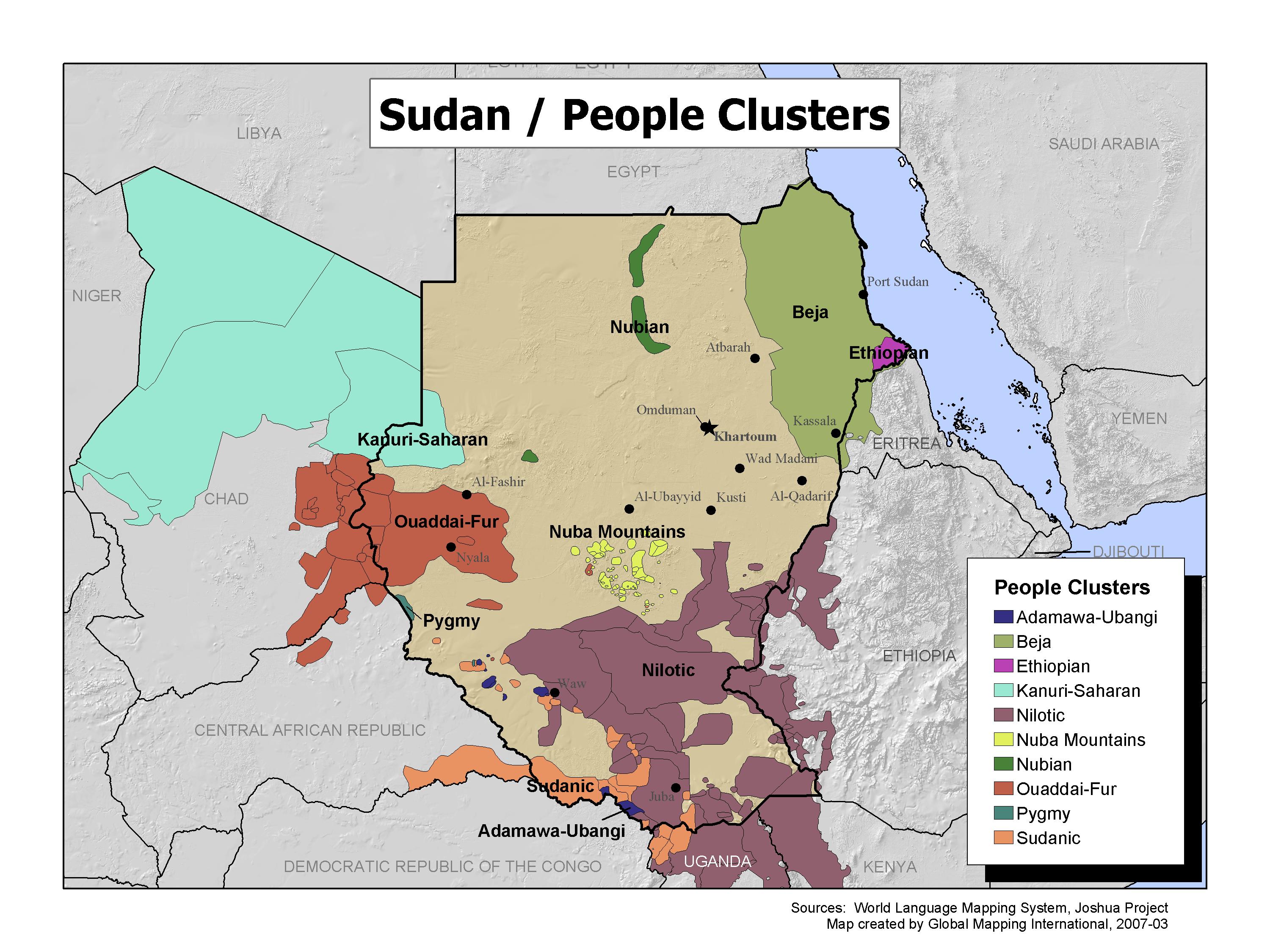
Sudan / People Clusters
·Type: Maps ·Map Date: 2007 ·Data Source: World Language Mapping System; Joshua Project ·Producer: GMI ·Collection: Projects 2007 ·Size: 7½ by 10 inches, landscape ·Categories: Type :: Maps...
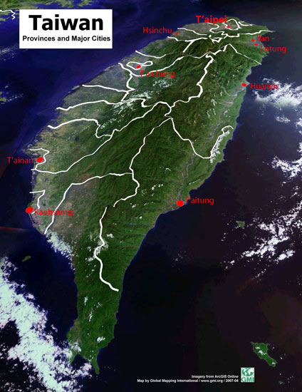
Taiwan Provinces and Major Cities
·Type: Maps ·Map Date: 16 April 2007 ·Data Source: ·Producer: Global Mapping International ·Collection: Projects 2007 ·Size: 8½ by 11 inches, portrait ·Categories: Type :: Maps Country ::...
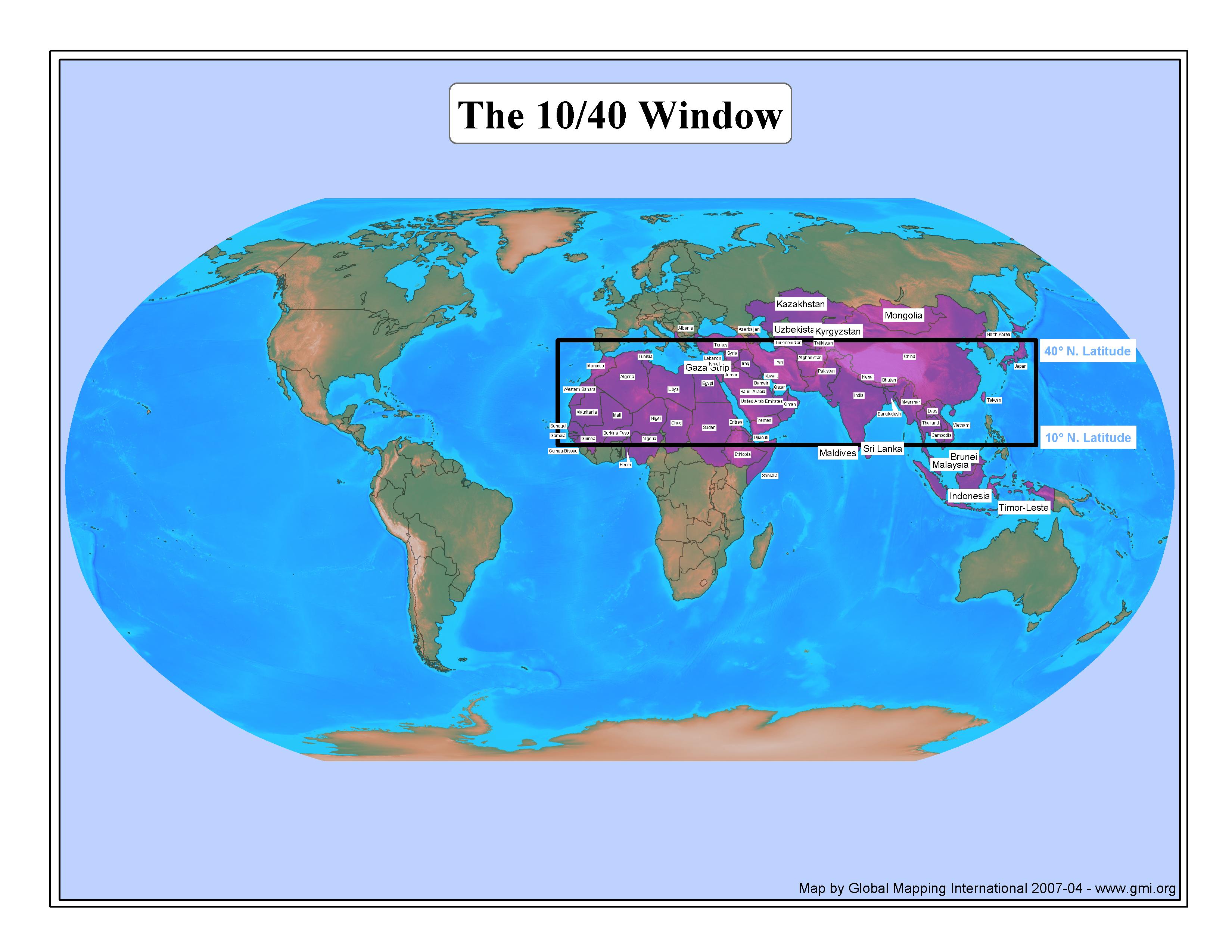
The 10/40 Window
·Type: Maps ·Description: This map colors and labels countries in the Pray Through the Window list. This list emphasizes the spiritual need of the country rather than just if the country is geographically inside The 10/40 Window. Thus...
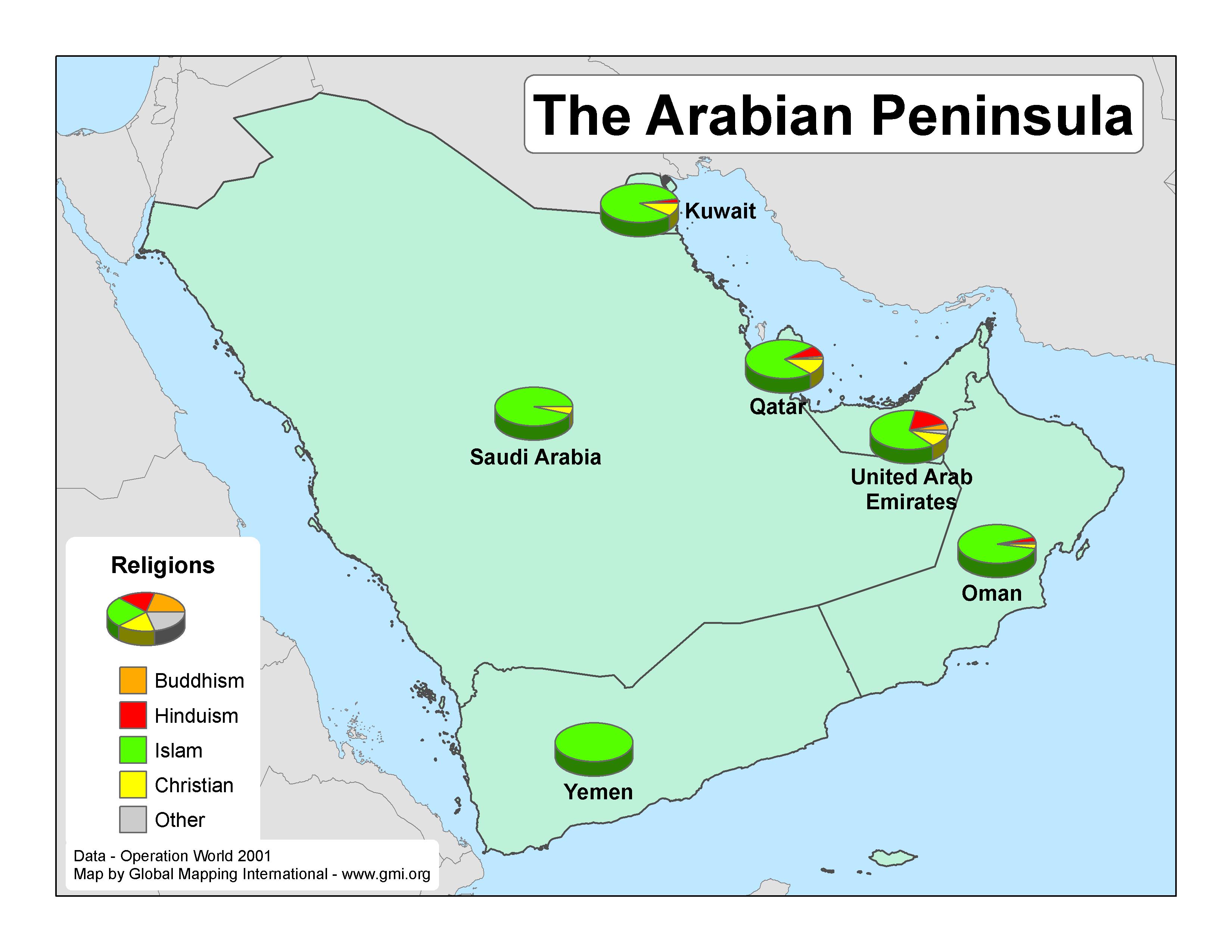
The Arabian Peninsula
·Type: Maps ·Map Date: 2007 ·Data Source: Operation World 2001 ·Producer: GMI ·Collection: Projects 2007 ·Size: 8½ by 11 inches, landscape ·Categories: Type :: Maps Continent/Region :: Middle...
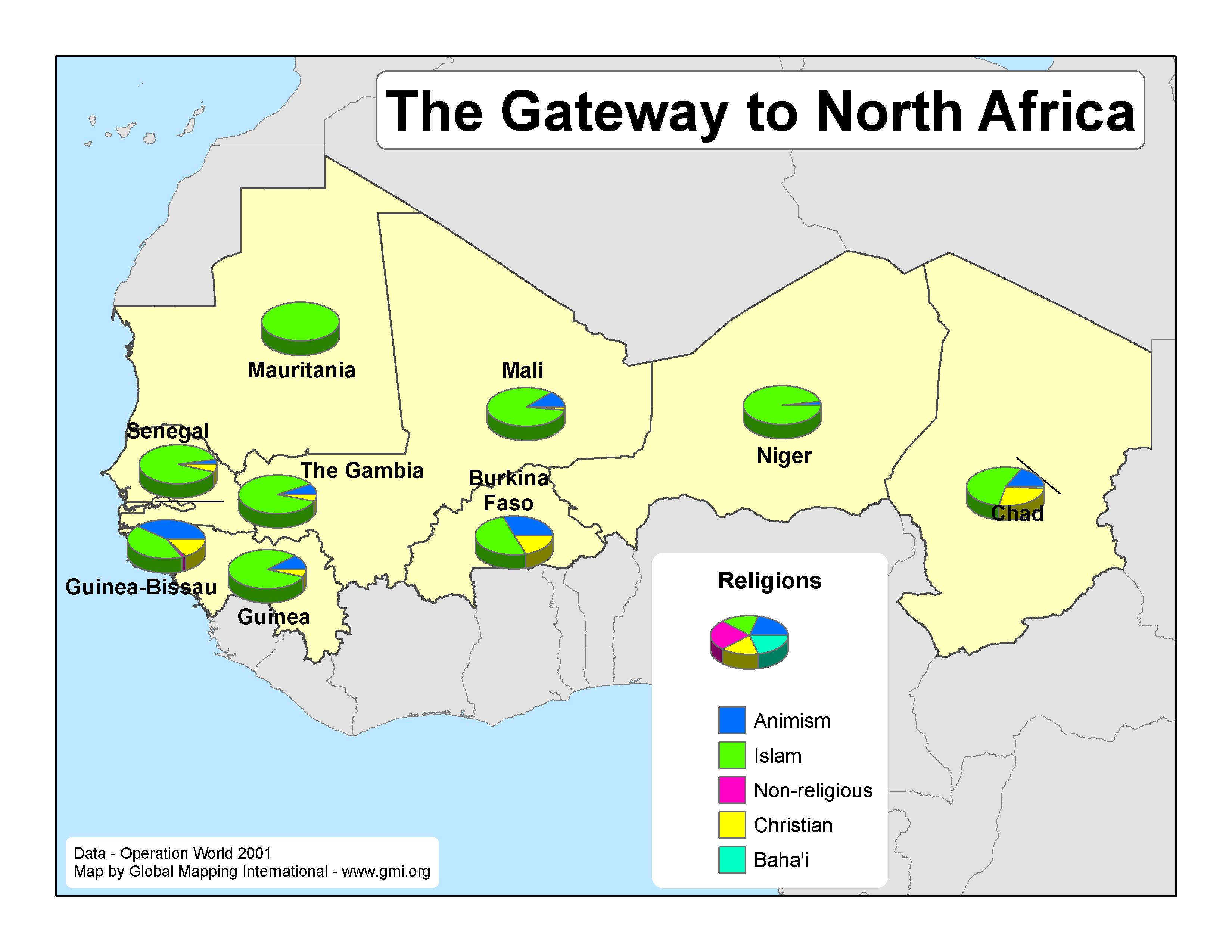
The Gateway to North Africa
·Type: Maps ·Map Date: 2007 ·Data Source: Operation World 2001 ·Producer: GMI ·Collection: Projects 2007 ·Size: 8½ by 11 inches, landscape ·Categories: Type :: Maps Continent/Region :: Africa...
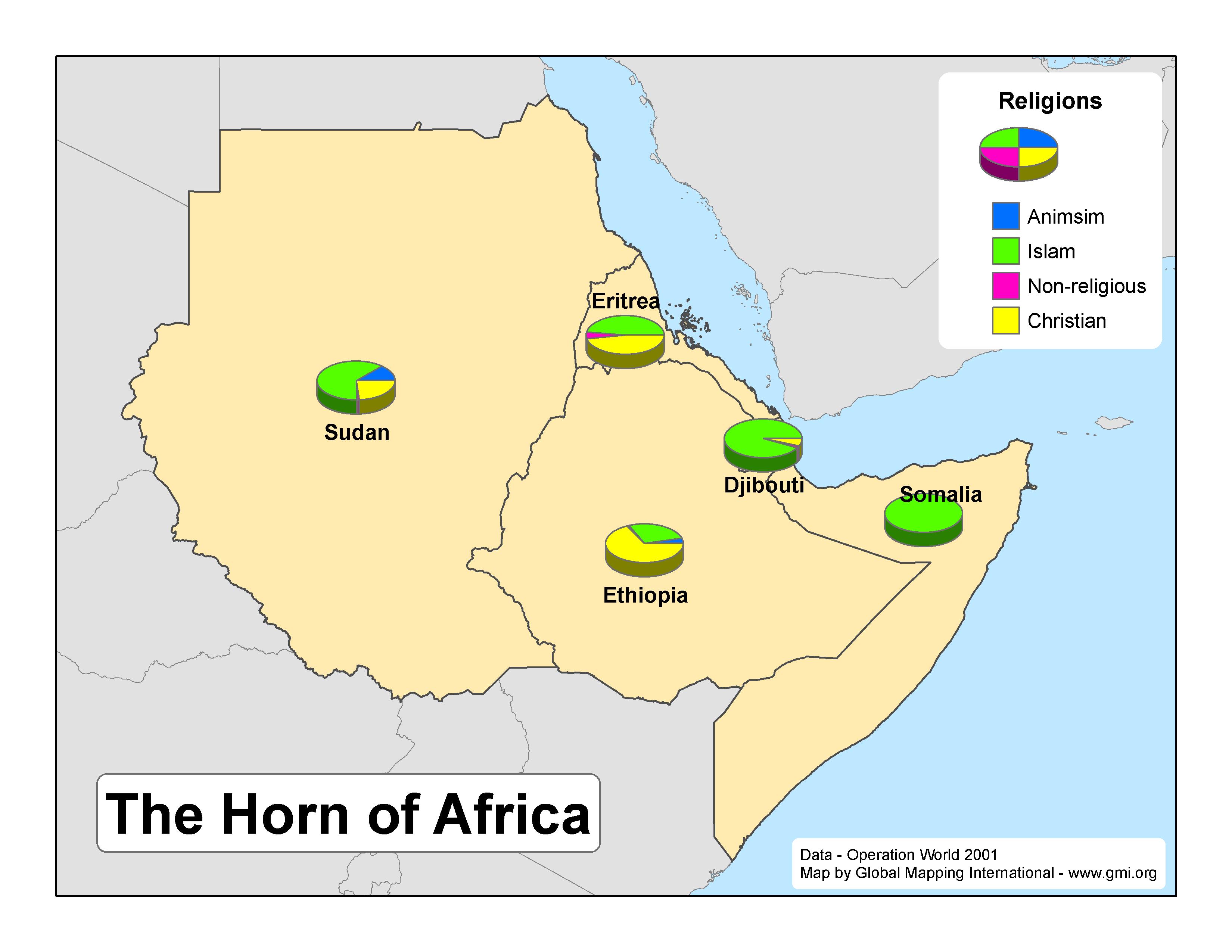
The Horn of Africa
·Type: Maps ·Map Date: 2007 ·Data Source: Operation World 2001 ·Producer: GMI ·Collection: Projects 2007 ·Size: 8½ by 11 inches, landscape ·Categories: Type :: Maps Continent/Region :: Africa...
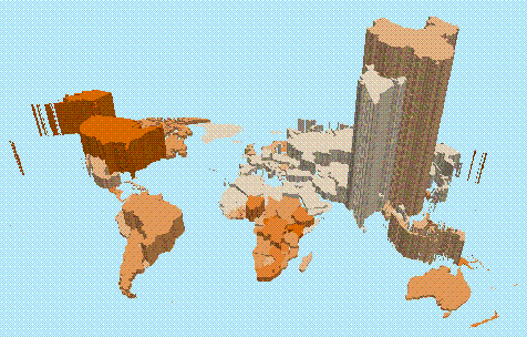
Total Population Classified by Percent Evangelical (animation)
·Type: Video ·Description: Note that file is extremely large (58 megabytes) so expect slow download. The animation doesn't have a legend, but you can find this information in the pdf file. In short, the heights of the countries...
Total Population Classified by Percent Evangelical (map)
·Type: Maps ·Description: Note that animated version of map is available under ·Map Date: February 2007 ·Data Source: Operation World 2001 and World Factbook 2006 ·Producer: Global Mapping International ...
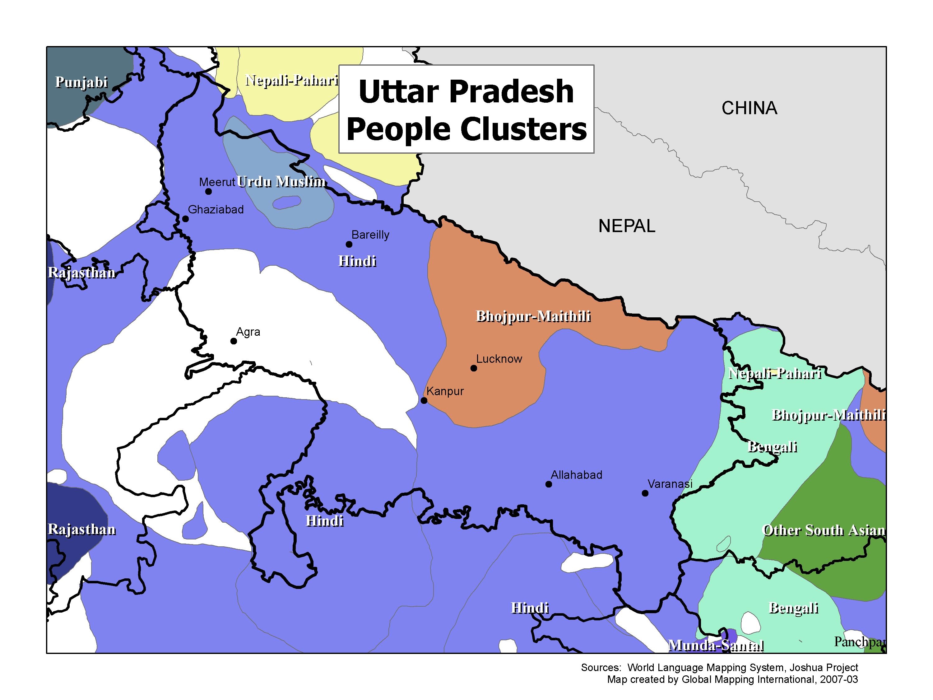
Uttar Pradesh People Clusters
·Type: Maps ·Map Date: 2007 ·Data Source: World Language Mapping System; Joshua Project ·Producer: GMI ·Collection: Projects 2007 ·Size: 7½ by 10 inches, landscape ·Categories: Type :: Maps...

