All Products
Marshall Islands (WorldBank)
NOTE: The most recent year's information is shown below. Click on the year to see all years for this indicator. COMMUNICATION2021 16,000 Mobile cellular subscriptions2017 39 Individuals using the...
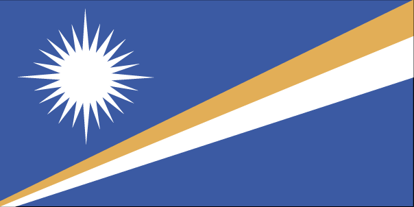
Marshall Islands flag
·Type: Images ·Collection: World Factbook country flags ·Small size: 108 x 54 px ·Large size: 604 x 302 px ·Categories: Collection :: World Factbook country flags Country :: Marshall Islands Partners :: U.S....
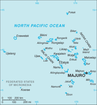
Marshall Islands map (World Factbook)
·Type: Maps ·Description: Marshall Islands (Factbook) ·Map Date: 2007 ·Producer: US Government ·Collection: World Factbook country maps ·Size: 328x352 px, landscape ·Categories: Type :: Maps...
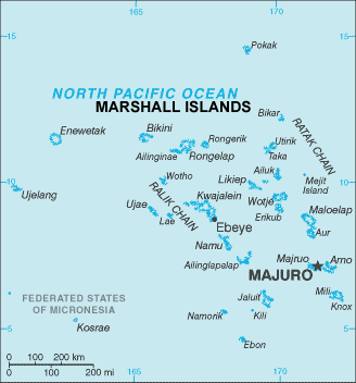
Marshall Islands map (World Factbook, modified)
·Type: Maps ·Description: Marshall Islands (World Factbook, modified to add country name) ·Map Date: 2007 ·Producer: US Government modified by Joshua Project ·Collection: World Factbook country maps ·Size:...
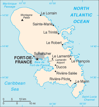
Martinique
For a more detailed listing click here Part of France Source: World Factbook 2020 Image: Maps Joshua Project · Martinique map...
Martinique (Joshua Project)
Progress Scale: Partially Reached Population: 355,000 % Literacy: 87.00 Primary Religion: Christianity Professing Christian: 94.83 % Evangelical: 6.93 Official Language:...
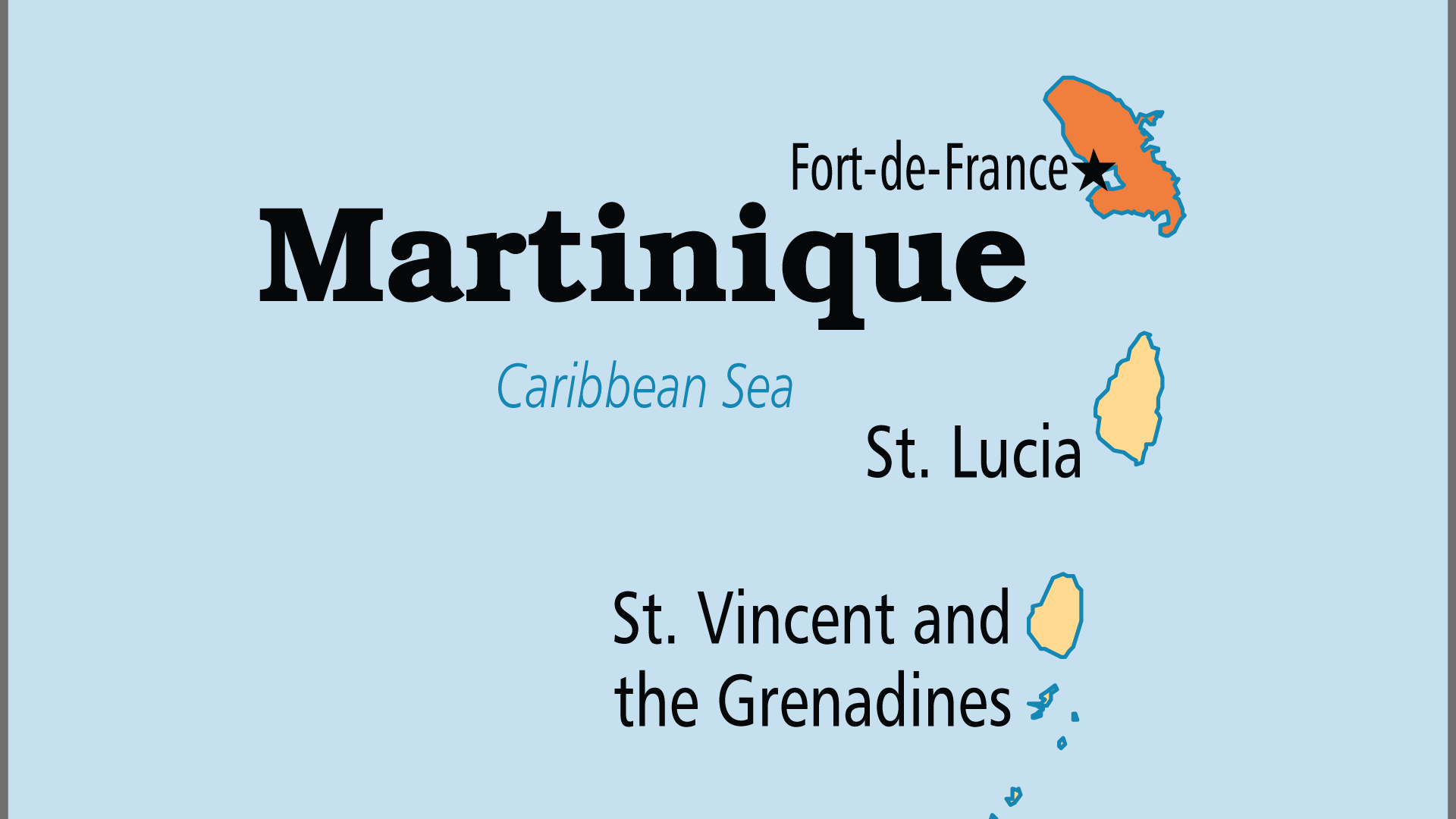
Martinique (Operation World)
Largest Religion: Christian Number People Groups: 7 Number Languages: 3 Official Language: French. Créole Martiniquais is widely spoken For more information go to Martinique on the Operation World website. The...
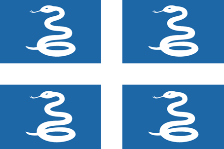
Martinique flag
·Type: Images ·Collection: World Factbook country flags ·Small size: 81 x 54 px ·Large size: 454 x 302 px ·Categories: Collection :: World Factbook country flags Country :: Martinique Partners :: U.S. Government...

Martinique map (World Factbook)
·Type: Maps ·Description: Martinique (Factbook) ·Map Date: 2007 ·Producer: US Government ·Collection: World Factbook country maps ·Size: 328x353 px, landscape ·Categories: Type :: Maps Collection ::...
Mastering the Art of Faith-Driven Fundraising: Best Practices, Networking and Raising Global and Local Support
Mastering the Art of Faith-Driven Fundraising: Best Practices, Networking and Raising Global and Local Support with Barbara Shantz Join us as we explore this topic with Barbara Shantz, a seasoned fundraiser and founder of GiveWayVisioneering. In...
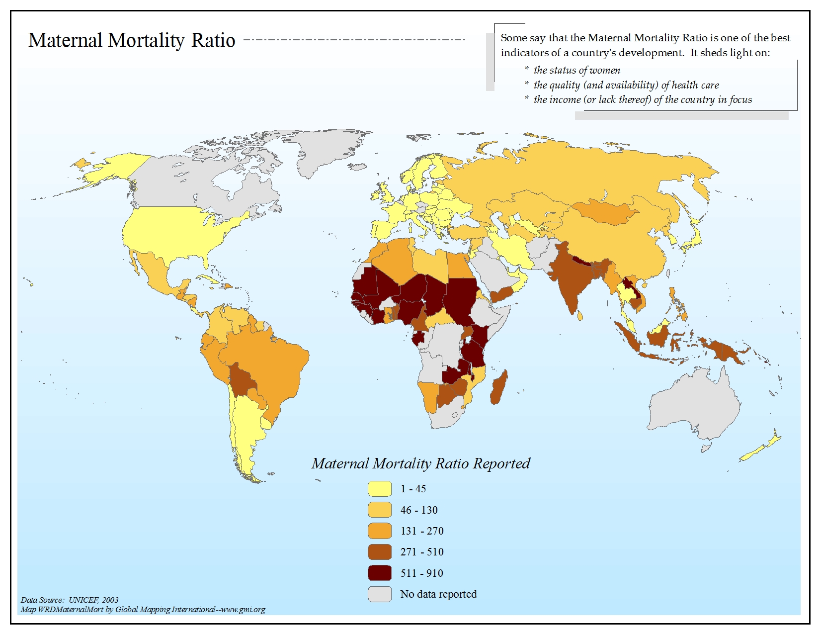
Maternal Mortality Ratio
·Type: Maps ·Map Date: 2006 ·Data Source: UNICEF, 2003 ·Producer: Global Mapping International ·Collection: General World Maps (GMMS 2007) ·Size: 8½ x 11 inches, landscape ·Categories: Type ::...
Mauritania
For a more detailed listing click here Berbers moved south into the area of today’s Mauritania beginning in the 3rd century. Beginning in the 8th century, Mauritania experienced a slow but constant infiltration of Arabs and Arab influence...
Mauritania (Joshua Project)
Progress Scale: Unreached Population: 4,830,000 % Literacy: 54.00 Primary Religion: Islam Professing Christian: 0.28 % Evangelical: 0.12 Official Language: Arabic,...
Mauritania (Operation World)
Largest Religion: Muslim Number People Groups: 19 Number Languages: 8 Official Language: Arabic; the Hassaniya dialect is used as the vernacular for two-thirds of the population. French is the language of government...

Mauritania (Prayercast)
Government: Presidential Republic Major People Groups: Black Moor (Maure), White Moor (Bidan), Arabized Berber, Trarza (Brakna), Tukulor (Takarir) GDP Per Capita: $5,000 Literacy Rate: 53.5% Unreached:...
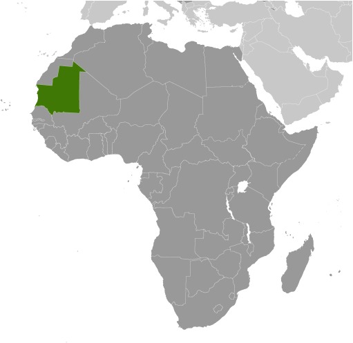
Mauritania (World Factbook website)
Area: 1,030,700 Population: 4,005,475 July 2020 est. Life Expectancy: 64.50 Net migration rate: -0.80 2020 est. GDP (real growth rate): 3.50 2017 est. Internet Users: 798,809 For more...
Mauritania (WorldBank)
NOTE: The most recent year's information is shown below. Click on the year to see all years for this indicator. COMMUNICATION2022 5,357,540 Mobile cellular subscriptions2021 59 Individuals using the...
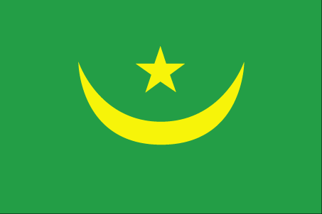
Mauritania flag
·Type: Images ·Collection: World Factbook country flags ·Small size: 81 x 54 px ·Large size: 453 x 302 px ·Categories: Collection :: World Factbook country flags Country :: Mauritania Partners :: U.S. Government...

Mauritania flag 2017
·Type: Images ·Collection: World Factbook country flags ·Small size: 110 x 56 px ·Large size: 500 x 333 px ·Categories: Collection :: World Factbook country flags Country :: Mauritania Partners :: U.S. Government...

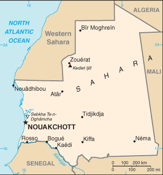
Mauritania map (World Factbook)
·Type: Maps ·Description: Mauritania (Factbook) ·Map Date: 2007 ·Producer: US Government ·Collection: World Factbook country maps ·Size: 330x355 px, landscape ·Categories: Type :: Maps...
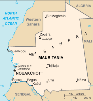
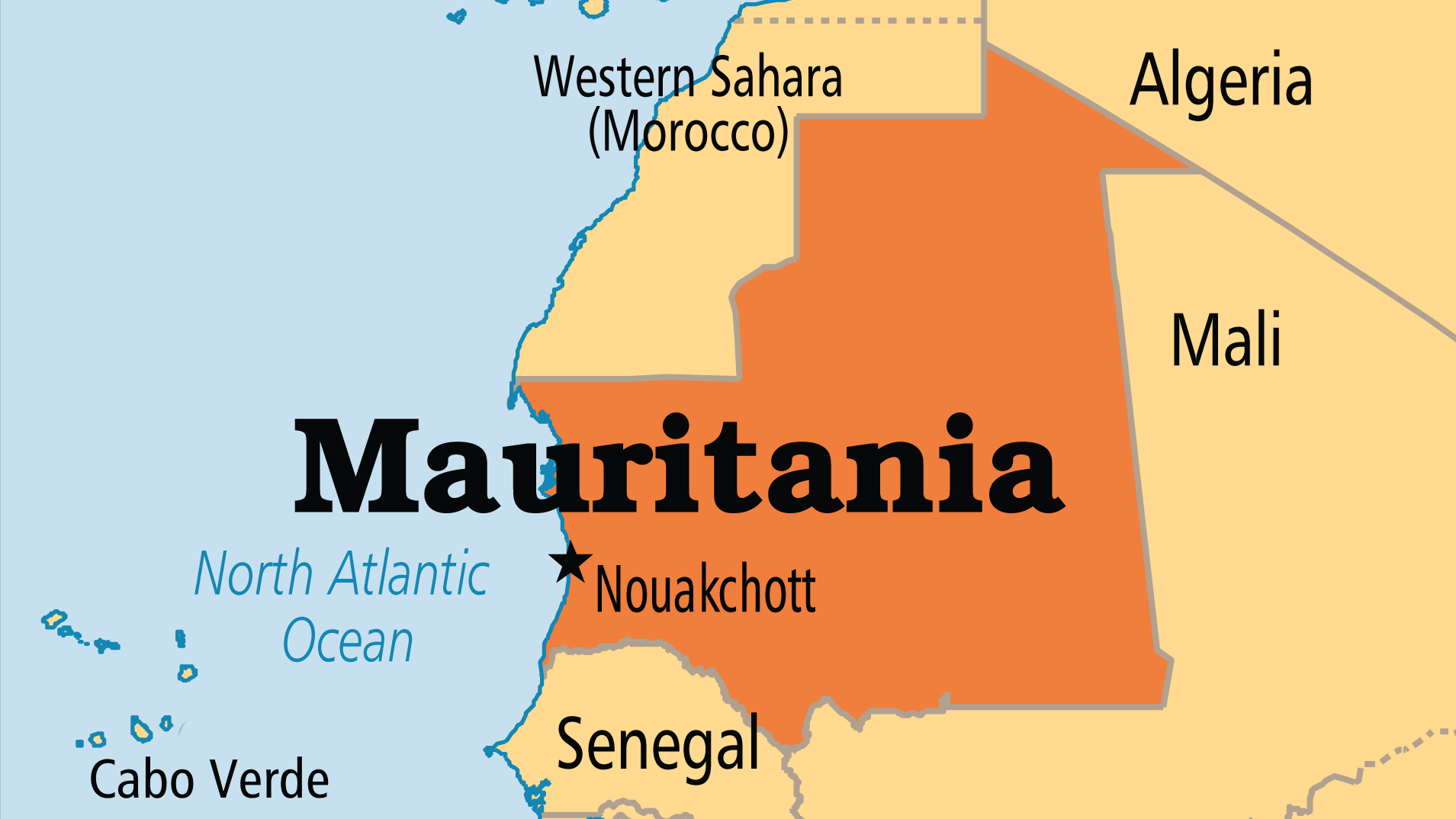
Mauritania map (World Factbook, modified)
·Type: Maps ·Description: Mauritania (World Factbook, modified to add country name) ·Map Date: 2007 ·Producer: US Government modified by Joshua Project ·Collection: World Factbook country maps ·Size:...
Mauritius
For a more detailed listing click here Although known to Arab and Malay sailors as early as the 10th century, the uninhabited island of Mauritius was first explored by the Portuguese in the 16th century and subsequently settled by the Dutch - who...

Mauritius (Joshua Project)
Progress Scale: Partially Reached Population: 1,268,000 % Literacy: 91.00 Primary Religion: Hinduism Professing Christian: 32.47 % Evangelical: 9.72 Official Language:...
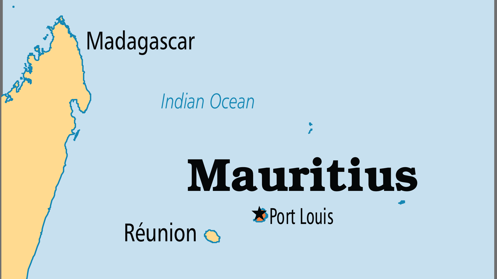
Mauritius (Operation World)
Largest Religion: Hinduism Number People Groups: 18 Number Languages: 13 Official Language: English For more information go to Mauritius on the Operation World website. The above link opens in a new tab.

Mauritius (Prayercast)
Government: Parliamentary Republic Major People Groups: Indo-Mauritian (Hindi), Franco-Mauritian, Indo-Mauritian, Indo-Mauritian (Urdu) GDP Per Capita: $19,500 Literacy Rate: 91.3% Unreached:...
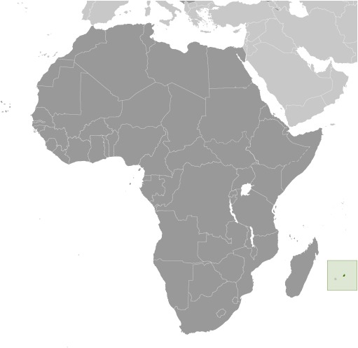
Mauritius (World Factbook website)
Area: 2,040 Population: 1,379,365 July 2020 est. Life Expectancy: 76.50 Net migration rate: 0.00 2020 est. GDP (real growth rate): 3.80 2017 est. Internet Users: 799,470 For more information go...
Mauritius (WorldBank)
NOTE: The most recent year's information is shown below. Click on the year to see all years for this indicator. COMMUNICATION2022 2,096,800 Mobile cellular subscriptions2021 68 Individuals using the...
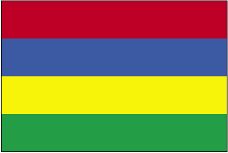
Mauritius flag
·Type: Images ·Collection: World Factbook country flags ·Small size: 81 x 54 px ·Large size: 451 x 302 px ·Categories: Collection :: World Factbook country flags Country :: Mauritius Partners :: U.S. Government...

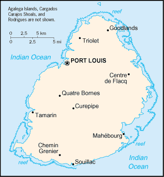
Mauritius map (World Factbook)
·Type: Maps ·Description: Mauritius (Factbook) ·Map Date: 2007 ·Producer: US Government ·Collection: World Factbook country maps ·Size: 330x355 px, landscape ·Categories: Type :: Maps...
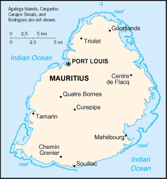
Mauritius map (World Factbook, modified)
·Type: Maps ·Description: Mauritius (World Factbook, modified to add country name) ·Map Date: 2007 ·Producer: US Government modified by Joshua Project ·Collection: World Factbook country maps ·Size: 330x355...

