Asia
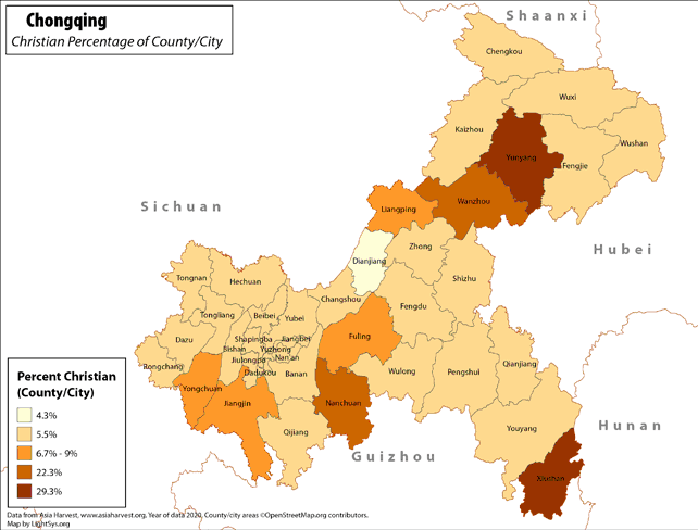
Chongqing - Christian Percentage of County/City
· Type: Maps · Map Date: 2018 · Data Source: Asia Harvest; county/city areas © OpenStreetMap contributors, http://www.openstreetmap.org/copyright. Data available under the Open Database License...
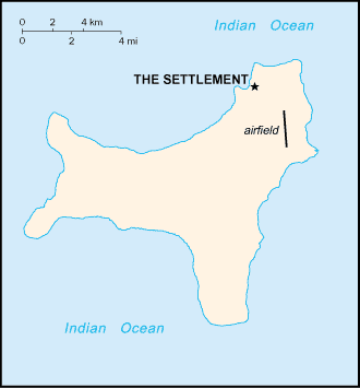
Christmas Island map (World Factbook)
·Type: Maps ·Description: Christmas Island (Factbook) ·Map Date: 2007 ·Producer: US Government ·Collection: World Factbook country maps ·Size: 330x354 px, portrait ·Categories: Type :: Maps...
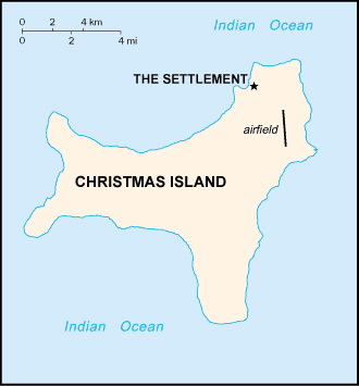
Christmas Island map (World Factbook, modified)
·Type: Maps ·Description: Christmas Island (World Factbook, modified to add country name) ·Map Date: 2007 ·Producer: US Government modified by Joshua Project ·Collection: World Factbook country maps ·Size:...
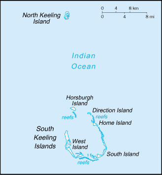
Cocos (Keeling) Islands map (World Factbook)
·Type: Maps ·Description: Cocos (Keeling) Islands (Factbook) ·Map Date: 2007 ·Producer: US Government ·Collection: World Factbook country maps ·Size: 327x713 px, portrait ·Categories: Type :: Maps...
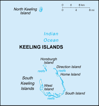
Cocos (Keeling) Islands map (World Factbook, modified)
·Type: Maps ·Description: Cocos (Keeling) Islands (World Factbook, modified to add country name) ·Map Date: 2007 ·Producer: US Government modified by Joshua Project ·Collection: World Factbook country maps...
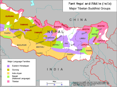
East Nepal and Sikkim (India) - Major Tibetan Buddhist Groups
·Type: Maps ·Description: Major Tibetan Buddhist Groups in East Nepal and Sikkim (India) ·Map Date: 2001 ·Producer: Global Mapping International ·Collection: Himalayan Buddhist Ppl (WV 2002) ·Size:...
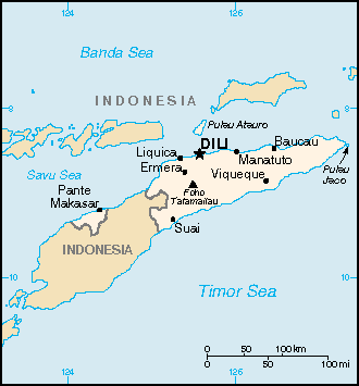
East Timor
·Type: Maps ·Description: East Timor ·Map Date: 2007 ·Producer: US Government ·Collection: World Factbook country maps ·Size: 330x355 px, landscape ·Categories: Type :: Maps Continent/Region :: Asia...
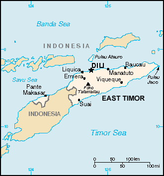
East Timor map (World Factbook, modified)
·Type: Maps ·Description: East Timor (World Factbook, modified to add country name) ·Map Date: 2007 ·Producer: US Government modified by Joshua Project ·Collection: World Factbook country maps ·Size:...
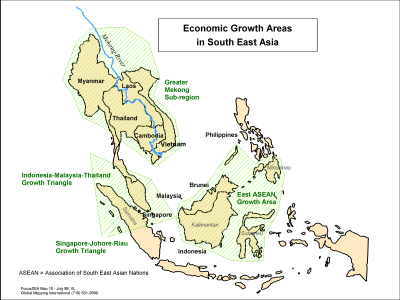
Economic Growth Areas in South East Asia
·Type: Maps ·Description: Areas of Economic Growth in Southeast asia ·Map Date: 1998 ·Producer: Global Mapping International ·Collection: Focus South East Asia (WV 2002) ·Size: 8½ x 11 Inches,...
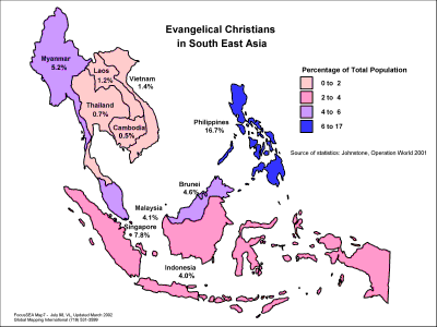
Evangelical Christians in South East Asia
·Type: Maps ·Description: Country level divisions of Evangelical Christians in Southeast Asi ·Map Date: 1998 ·Producer: Global Mapping International ·Collection: Focus South East Asia (WV 2002) ·Size:...
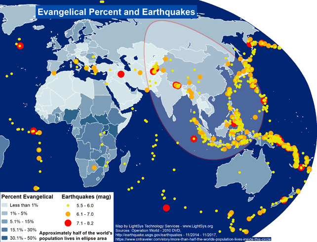
Evangelical Percent and Earthquakes - Asia
· Type: Maps · Map Date: 2017 · Data Source: Operation World (2010) DVD, http://earthquake.usgs.gov/earthquakes - 11/2014 – 11/2017,...
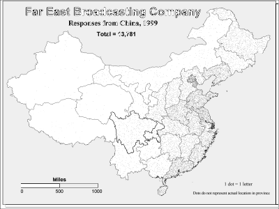
Far East Broadcasting Company - Responses from China 1999 (BW)
·Type: Maps ·Description: Responses from China in 1999 to the Far East Broadcasting Company ·Map Date: 2002 ·Producer: Global Mapping International ·Collection: Intro to Mission (WorldVue 2002) ·Size:...
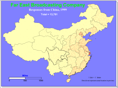
Far East Broadcasting Company - Responses from China, 1999
·Type: Maps ·Description: Responses from China in 1999 to the Far East Broadcasting Company ·Map Date: 1999 ·Producer: Global Mapping International ·Collection: Intro to Mission (WorldVue 2002) ·Size:...
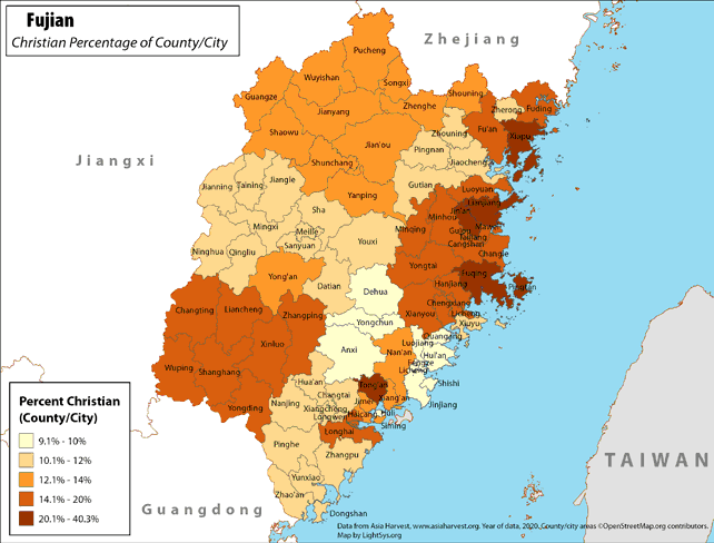
Fujian - Christian Percentage of County/City
· Type: Maps · Map Date: 2018 · Data Source: Asia Harvest; county/city areas © OpenStreetMap contributors, http://www.openstreetmap.org/copyright. Data available under the Open Database License...
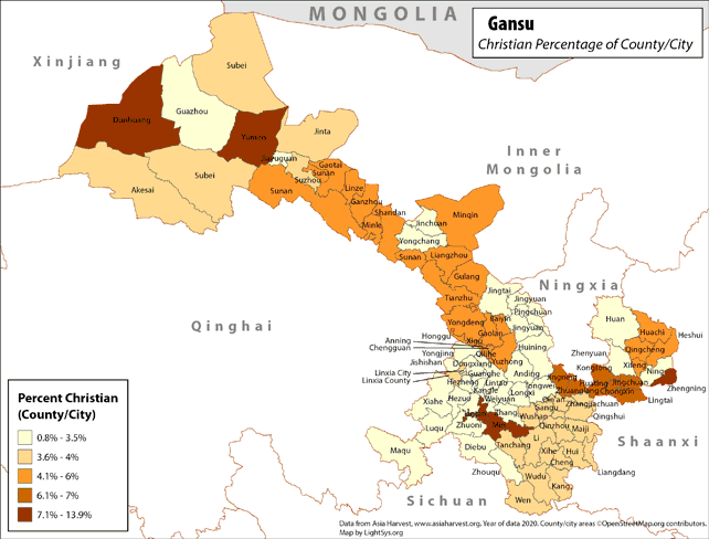
Gansu - Christian Percentage of County/City
· Type: Maps · Map Date: 2019 · Data Source: Asia Harvest; county/city areas © OpenStreetMap contributors, http://www.openstreetmap.org/copyright. Data available under the Open Database License...
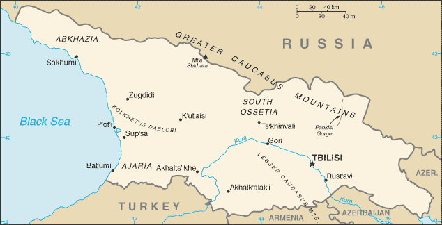
Georgia map (World Factbook)
·Type: Maps ·Description: Georgia (Factbook) ·Map Date: 2007 ·Producer: US Government ·Collection: World Factbook country maps ·Size: 634x323 px, landscape ·Categories: Type :: Maps Continent/Region...
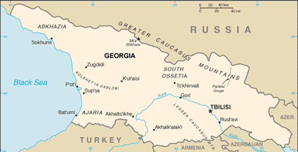
Georgia map (World Factbook, modified)
·Type: Maps ·Description: Georgia (World Factbook, modified to add country name) ·Map Date: 2007 ·Producer: US Government modified by Joshua Project ·Collection: World Factbook country maps ·Size: 634x323...
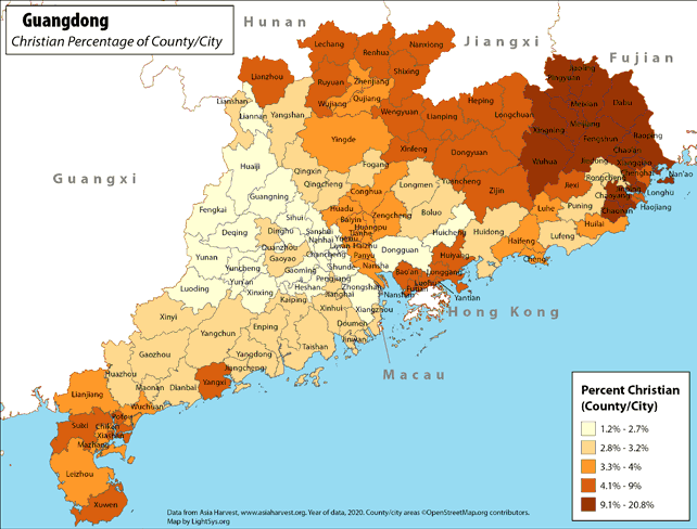
Guangdong - Christian Percentage of County/City
· Type: Maps · Map Date: 2018 · Data Source: Asia Harvest; county/city areas © OpenStreetMap contributors, http://www.openstreetmap.org/copyright. Data available under the Open Database License...
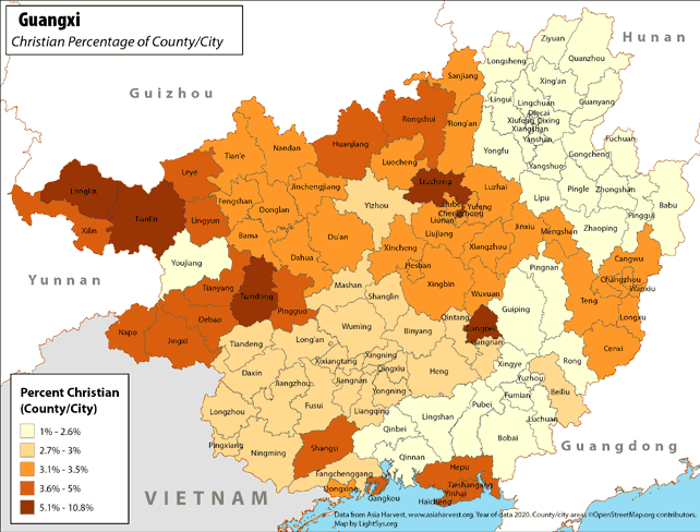
Guangxi - Christian Percentage of County/City
· Type: Maps · Map Date: 2018 · Data Source: Asia Harvest; county/city areas © OpenStreetMap contributors, http://www.openstreetmap.org/copyright. Data available under the Open Database License...
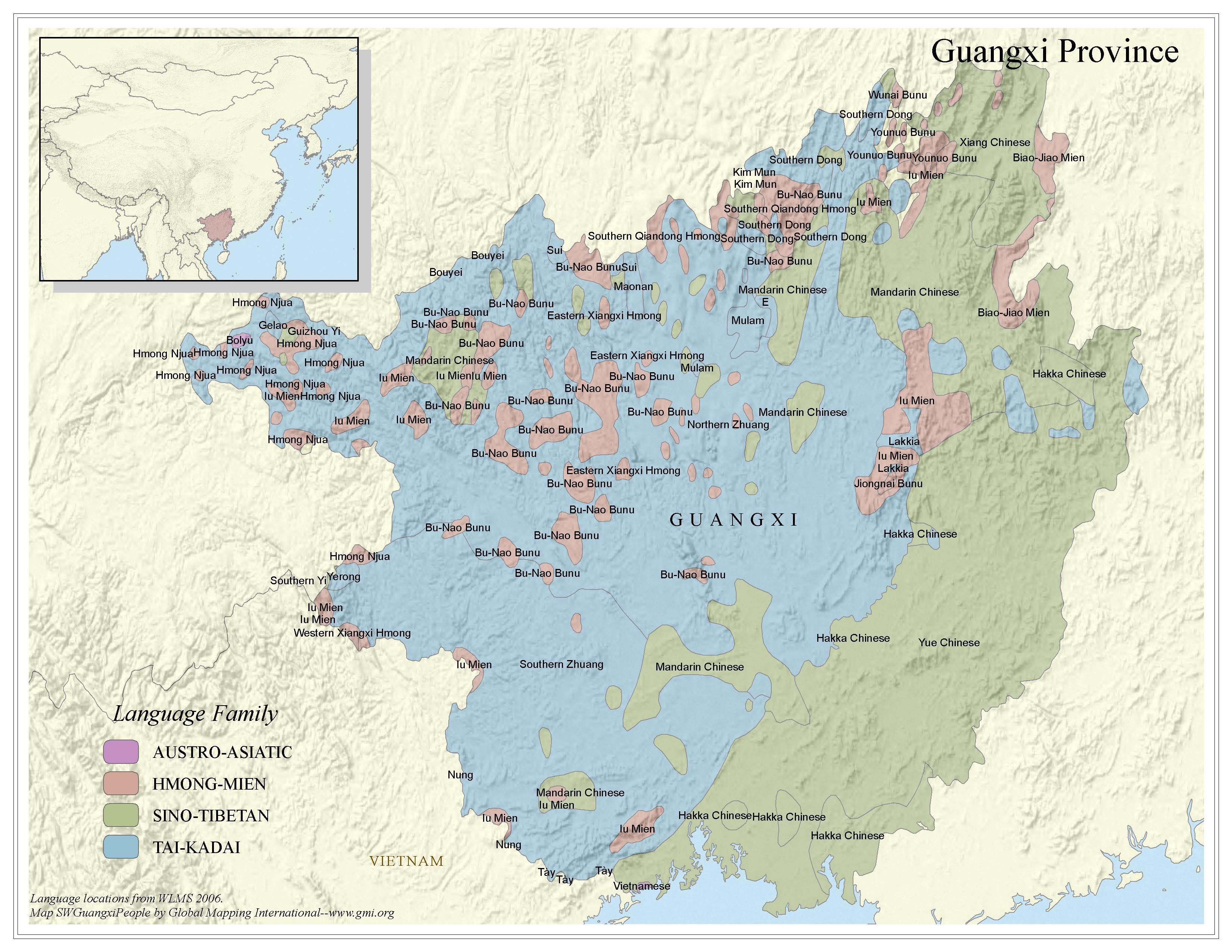
Guangxi Province - Peoples
·Type: Maps ·Map Date: 2006 ·Data Source: Language locations from WLMS 2006. ·Producer: Global Mapping International ·Collection: China SW Minorities (GMMS 2007) ·Size: 8½ x 11 inches, landscape...
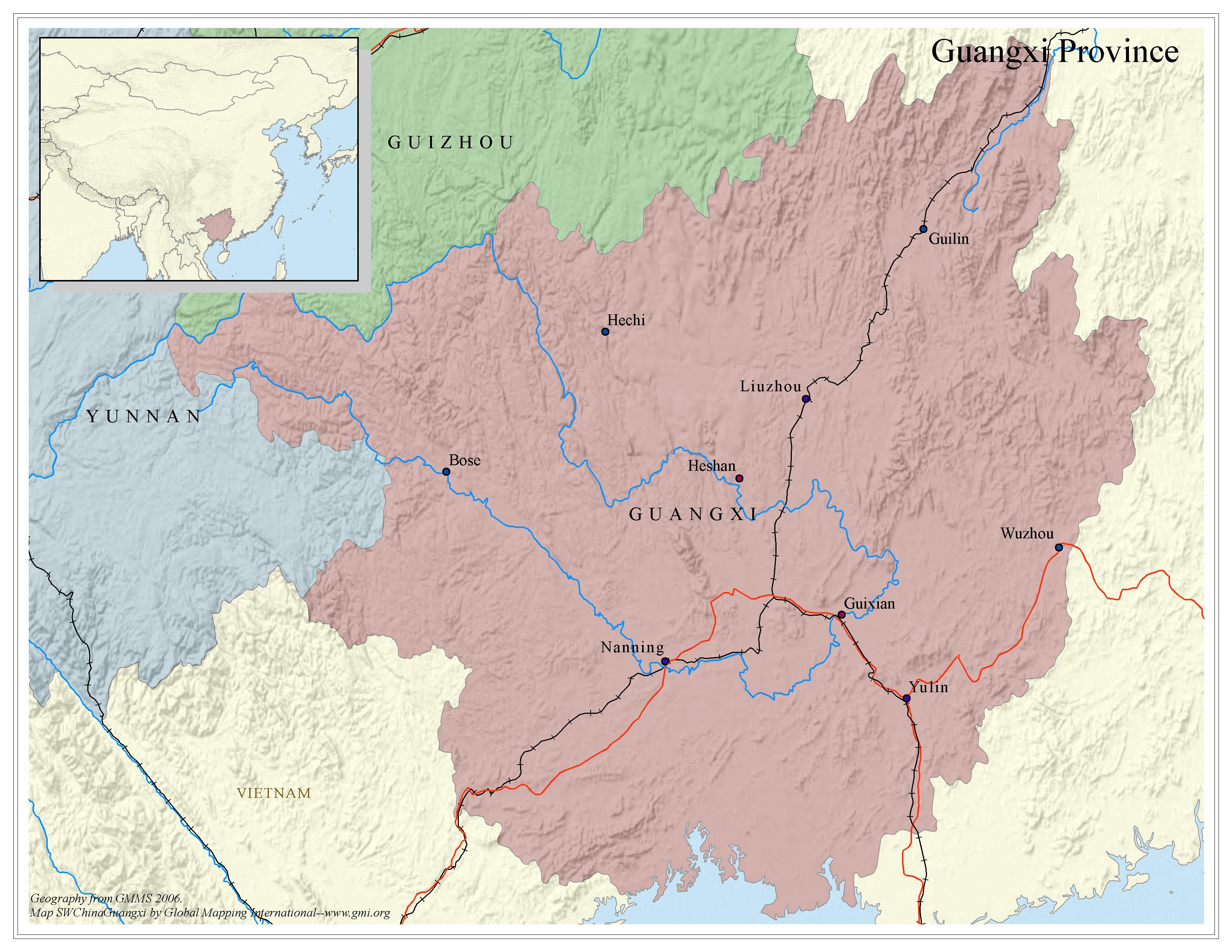
Guangxi Province - Political map
·Type: Maps ·Map Date: 2006 ·Data Source: Geography from GMMS 2006. ·Producer: Global Mapping International ·Collection: China SW Minorities (GMMS 2007) ·Size: 8½ x 11 inches, landscape...
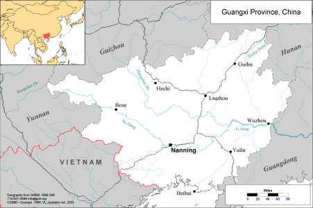
Guangxi Province, China
·Type: Maps ·Description: Political map of Guangxi Province in China ·Map Date: 2001 ·Producer: Global Mapping International ·Collection: China SW Minorities (WV 2002) ·Size: 8½ x 11 Inches,...
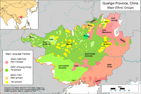
Guangxi Province, China - Major Ethnic Groups
·Type: Maps ·Description: Major Ethnic Groups of Guangxi Province in China ·Map Date: 2001 ·Producer: Global Mapping International ·Collection: China SW Minorities (WV 2002) ·Size: 8½ x 11 Inches,...
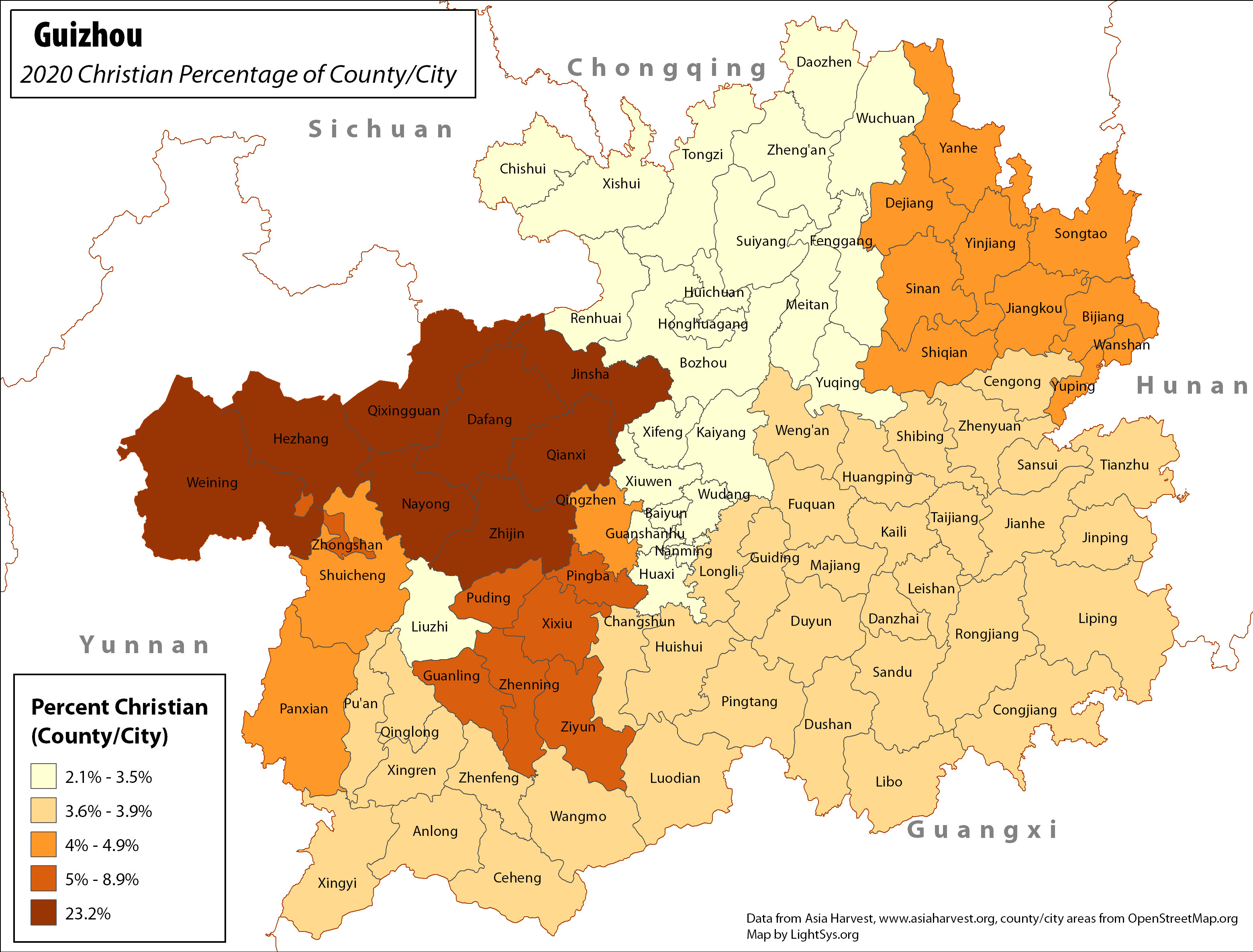
Guizhou - Christian Percentage of County/City
· Type: Maps · Map Date: 2017 · Data Source: Asia Harvest; county/city areas © OpenStreetMap contributors, http://www.openstreetmap.org/copyright. Data available under the Open Database License...
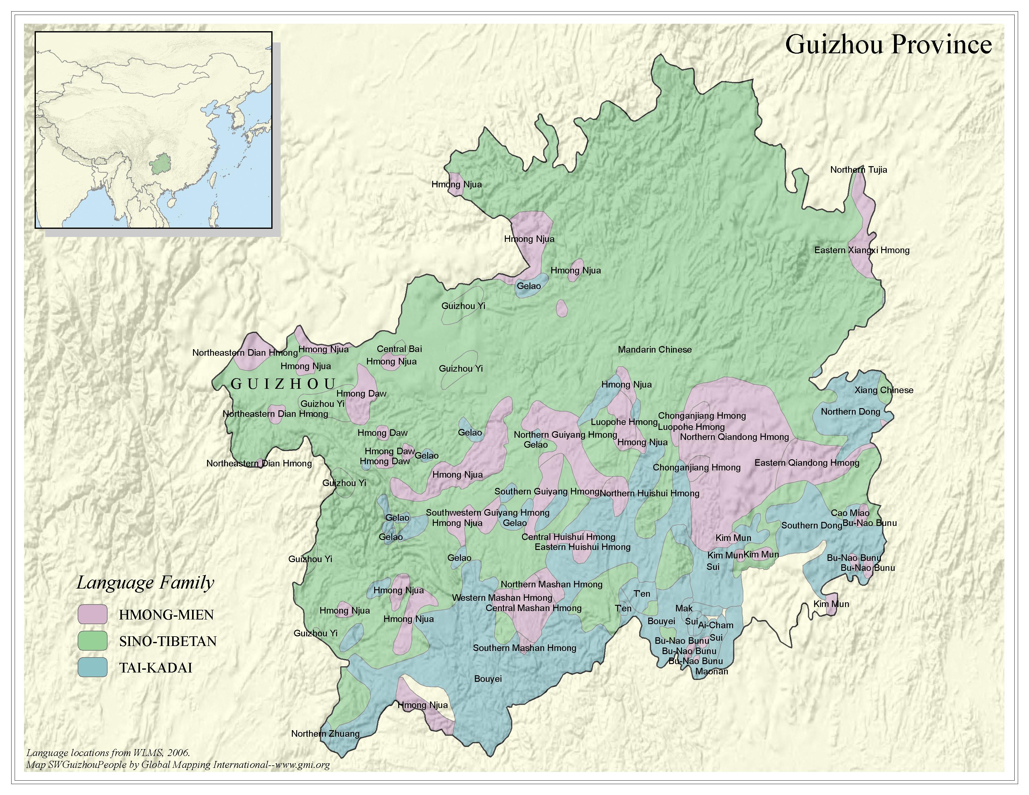
Guizhou Province - Peoples
·Type: Maps ·Map Date: 2006 ·Data Source: Language locations from WLMS 2006. ·Producer: Global Mapping International ·Collection: China SW Minorities (GMMS 2007) ·Size: 8½ x 11 inches, landscape...
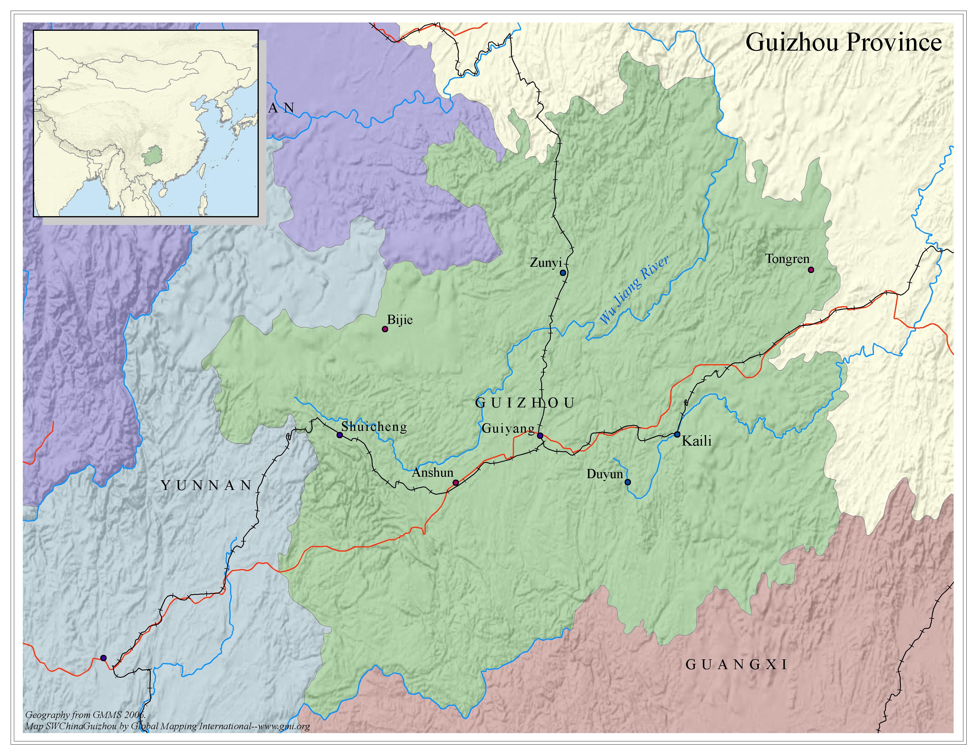
Guizhou Province - Political map
·Type: Maps ·Map Date: 2006 ·Data Source: Geography from GMMS 2006. ·Producer: Global Mapping International ·Collection: China SW Minorities (GMMS 2007) ·Size: 8½ x 11 inches, landscape...
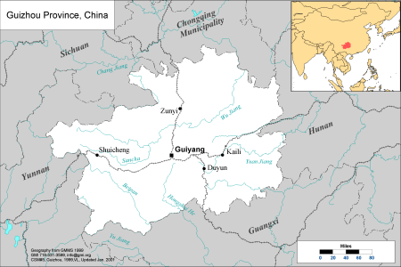
Guizhou Province, China
·Type: Maps ·Description: Political Map of Guizhou Province in China ·Map Date: 2001 ·Producer: Global Mapping International ·Collection: China SW Minorities (WV 2002) ·Size: 8½ x 11 Inches,...
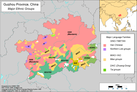
Guizhou Province, China - Major Ethnic Groups
·Type: Maps ·Description: Major Ethnic Groups of Guizhou Province in China ·Map Date: 2001 ·Producer: Global Mapping International ·Collection: China SW Minorities (WV 2002) ·Size: 8½ x 11 Inches,...
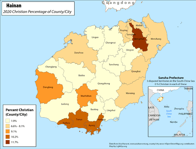
Hainan - Christian Percentage of County/City
· Type: Maps · Map Date: 2018 · Data Source: Asia Harvest; county/city areas © OpenStreetMap contributors, http://www.openstreetmap.org/copyright. Data available under the Open Database License...
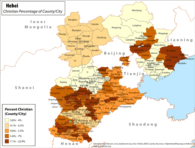
Hebei - Christian Percentage of County/City
· Type: Maps · Map Date: 2019 · Data Source: Asia Harvest; county/city areas © OpenStreetMap contributors, http://www.openstreetmap.org/copyright. Data available under the Open Database License...

