Demography
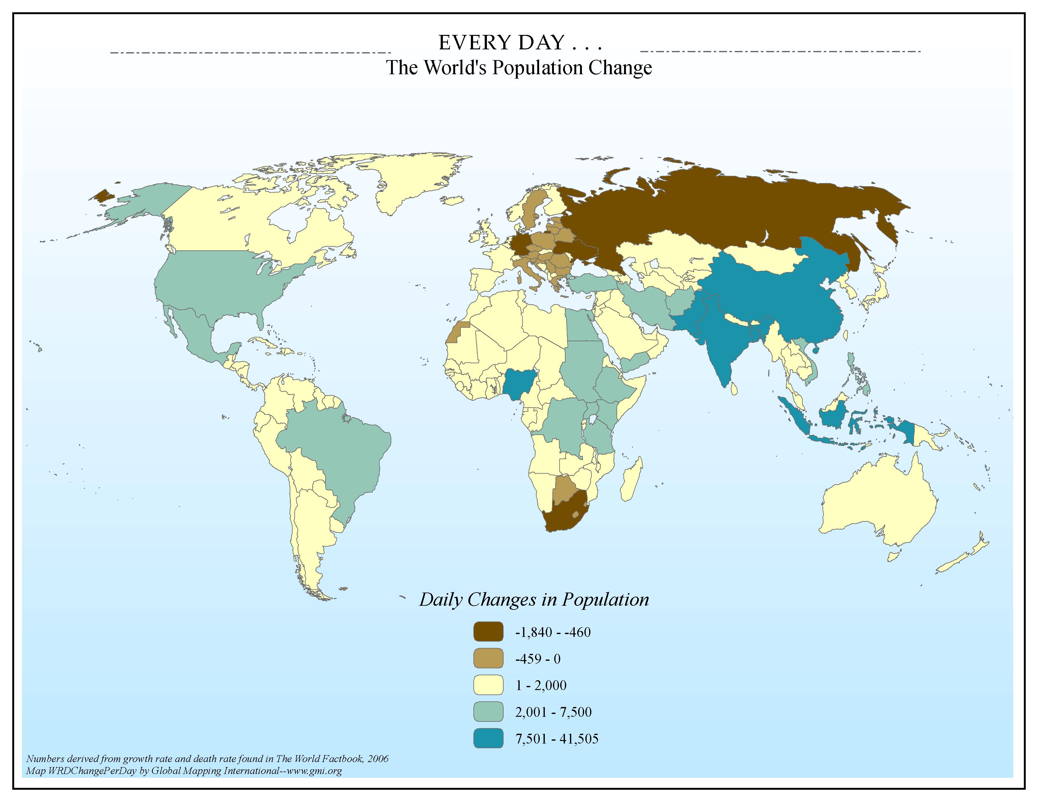
EVERY DAY . . . The World's Population Change
·Type: Maps ·Map Date: 2006 ·Data Source: Numbers derived from growth rate and death rate found in The World Factbook, 2006 ·Producer: Global Mapping International ·Collection: Factbook (GMMS 2007) ·Size: 8½ x 11 inches, landscape...
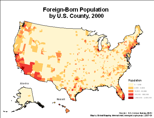
Foreign-Born Population by U.S. County, 2000
·Type: Maps ·Description: ·Collection: Projects 2007 ·Categories: Type :: Maps Country :: United States of America Topic :: Demography Partners :: Global Mapping International Collection :: GMI Map Collections ::...
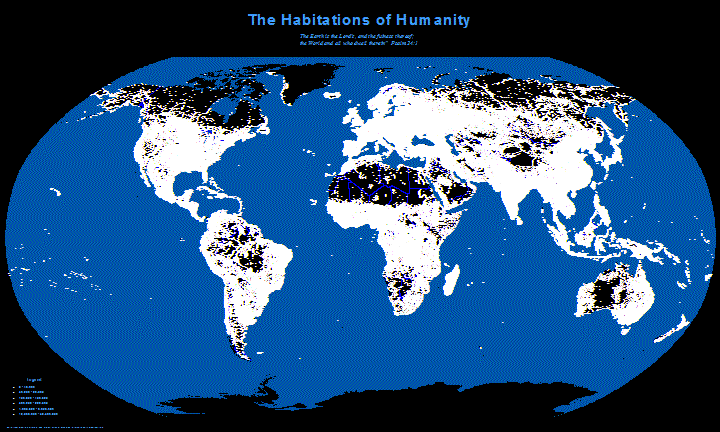
Habitations of Humanity
·Type: Maps ·Description: This map shows a view of how cities would look like at night over the whole world. The cities are white dots sized by population. ·Map Date: 23 January 2008 ·Data Source: City data from Habitats...
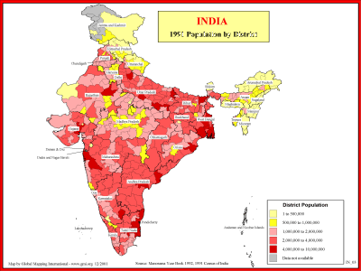
India - 1991 Population by District
·Type: Maps ·Description: 1991 Population by district in India ·Map Date: 2001 ·Producer: Global Mapping International ·Collection: Reaching India (WorldVue 2002) ·Size: 8½ x 11 Inches, landscape...
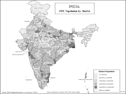
India - 1991 Population by District (BW)
·Type: Maps ·Description: 1991 Population by district in India ·Map Date: 2002 ·Producer: Global Mapping International ·Collection: Reaching India (WorldVue 2002) ·Size: 8½ x 11 Inches, landscape...
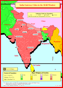
India Gateway Cities in The 10/40 Window
·Type: Maps ·Description: Gateway Cities in India to the 10/40 Window ·Map Date: 2001 ·Producer: Global Mapping International ·Collection: Reaching India (WorldVue 2002) ·Size: 8½ x 11 Inches,...
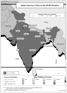
India Gateway Cities in The 10/40 Window (BW)
·Type: Maps ·Description: Gateway Cities in India to the 10/40 Window ·Map Date: 2002 ·Producer: Global Mapping International ·Collection: Reaching India (WorldVue 2002) ·Size: 8½ x 11 Inches,...
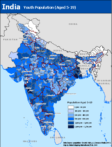
India Youth Population (Aged 5-19)
·Type: Maps ·Map Date: February 2009 ·Data Source: population - DevInfo India, v2, Census of India (2001) ·Producer: Global Mapping International ·Collection: Projects 2009 ·Size: 8.5 by 11 inches,...
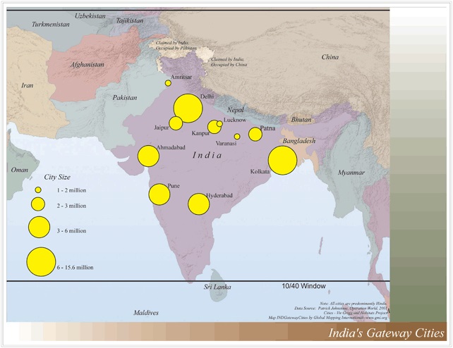
India's Gatway Cities
·Type: Maps ·Map Date: 2006 ·Data Source: Operation World 2001 Cities - Viv Grigg and Habitats Project ·Producer: Global Mapping International ·Collection: Reaching India (GMMS 2007) ·Size: 8½ x 11...
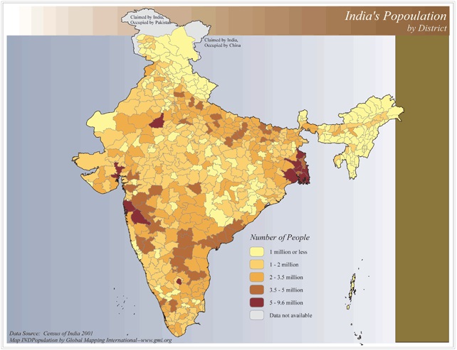
India's Population by District
·Type: Maps ·Map Date: 2006 ·Data Source: Census of India 2001 ·Producer: Global Mapping International ·Collection: Reaching India (GMMS 2007) ·Size: 8½ x 11 inches, landscape ·Categories:...
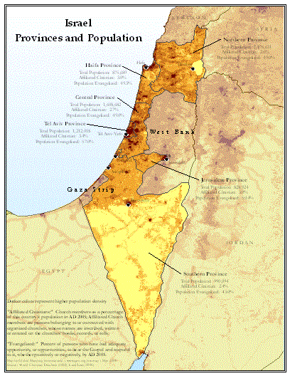
Israel Provinces and Population
·Type: Maps ·Map Date: May 2008 ·Data Source: World Christian Database (2008), LandScan (2002) ·Producer: Global Mapping International ·Collection: Projects 2008 ·Size: 8.5 by 11 inches, portrait...
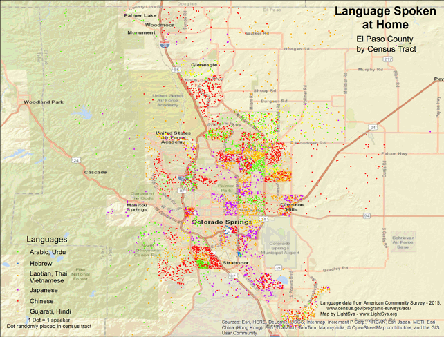
Language Spoken at Home - El Paso County
· Type Maps · Map Date: 2018 · Data Source: American Community Survey, 2015, https://www.census.gov/programs-surveys/acs · Partners: LightSys Technology Services, U.S. Government...
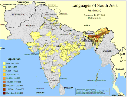
Languages of South Asia- Assamese
·Type: Maps ·Map Date: February 2008 ·Data Source: Census Information, UNESCO (1987) through UNEP/GRID-Sioux Falls ·Producer: Global Mapping International and The Joshua Project ·Size: 11.7 by 8.27 inches,...
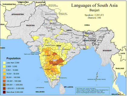
Languages of South Asia- Banjari
·Type: Maps ·Map Date: February 2008 ·Data Source: Census Information, UNESCO (1987) through UNEP/GRID-Sioux Falls ·Producer: Global Mapping International and The Joshua Project ·Size: 11.7 by 8.27 inches,...
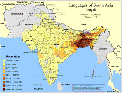
Languages of South Asia- Bengali
·Type: Maps ·Map Date: February 2008 ·Data Source: Census Information, UNESCO (1987) through UNEP/GRID-Sioux Falls ·Producer: Global Mapping International and The Joshua Project ·Size: 11.7 by 8.27 inches,...
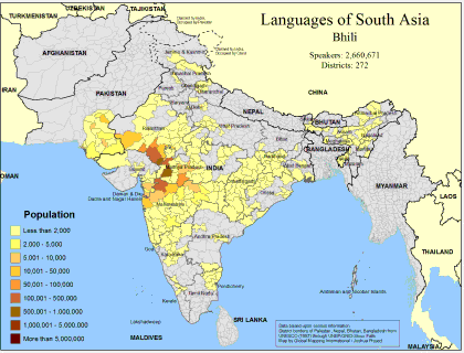
Languages of South Asia- Bhili
·Type: Maps ·Map Date: February 2008 ·Data Source: Census Information, UNESCO (1987) through UNEP/GRID-Sioux Falls ·Producer: Global Mapping International and The Joshua Project ·Size: 11.7 by 8.27 inches,...
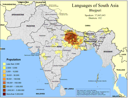
Languages of South Asia- Bhojpuri
·Type: Maps ·Map Date: February 2008 ·Data Source: Census Information, UNESCO (1987) through UNEP/GRID-Sioux Falls ·Producer: Global Mapping International and The Joshua Project ·Size: 11.7 by 8.27 inches,...
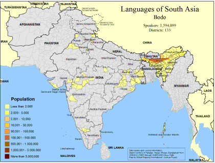
Languages of South Asia- Bodo
·Type: Maps ·Map Date: February 2008 ·Data Source: Census Information, UNESCO (1987) through UNEP/GRID-Sioux Falls ·Producer: Global Mapping International and The Joshua Project ·Size: 11.7 by 8.27 inches,...
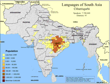
Languages of South Asia- Chhattisgarhi
·Type: Maps ·Map Date: February 2008 ·Data Source: Census Information, UNESCO (1987) through UNEP/GRID-Sioux Falls ·Producer: Global Mapping International and The Joshua Project ·Size: 11.7 by 8.27 inches,...
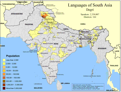
Languages of South Asia- Dogri
·Type: Maps ·Map Date: February 2008 ·Data Source: Census Information, UNESCO (1987) through UNEP/GRID-Sioux Falls ·Producer: Global Mapping International and The Joshua Project ·Size: 11.7 by 8.27 inches,...
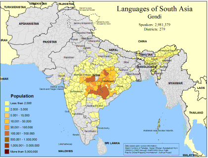
Languages of South Asia- Gondi
·Type: Maps ·Map Date: February 2008 ·Data Source: Census Information, UNESCO (1987) through UNEP/GRID-Sioux Falls ·Producer: Global Mapping International and The Joshua Project ·Size: 11.7 by 8.27 inches,...
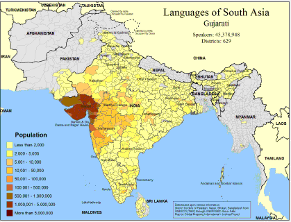
Languages of South Asia- Gujarati
·Type: Maps ·Map Date: February 2008 ·Data Source: Census Information, UNESCO (1987) through UNEP/GRID-Sioux Falls ·Producer: Global Mapping International and The Joshua Project ·Size: 11.7 by 8.27 inches,...
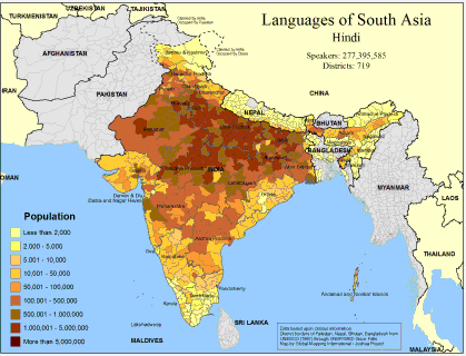
Languages of South Asia- Hindi
·Type: Maps ·Map Date: February 2008 ·Data Source: Census Information, UNESCO (1987) through UNEP/GRID-Sioux Falls ·Producer: Global Mapping International and The Joshua Project ·Size: 11.7 by 8.27 inches,...
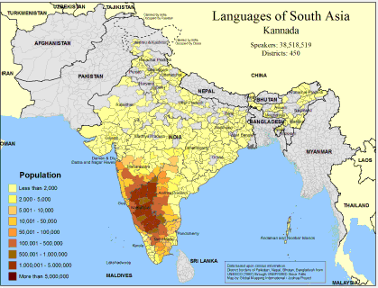
Languages of South Asia- Kannada
·Type: Maps ·Map Date: February 2008 ·Data Source: Census Information, UNESCO (1987) through UNEP/GRID-Sioux Falls ·Producer: Global Mapping International and The Joshua Project ·Size: 11.7 by 8.27 inches,...
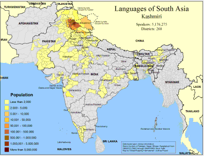
Languages of South Asia- Kashmiri
·Type: Maps ·Map Date: February 2008 ·Data Source: Census Information, UNESCO (1987) through UNEP/GRID-Sioux Falls ·Producer: Global Mapping International and The Joshua Project ·Size: 11.7 by 8.27 inches,...
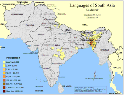
Languages of South Asia- Koch Borok
·Type: Maps ·Map Date: February 2008 ·Data Source: Census Information, UNESCO (1987) through UNEP/GRID-Sioux Falls ·Producer: Global Mapping International and The Joshua Project ·Size: 11.7 by 8.27 inches,...
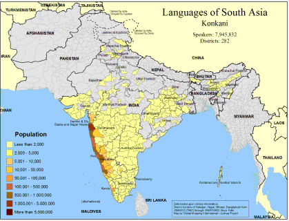
Languages of South Asia- Konkani
·Type: Maps ·Map Date: February 2008 ·Data Source: Census Information, UNESCO (1987) through UNEP/GRID-Sioux Falls ·Producer: Global Mapping International and The Joshua Project ·Size: 11.7 by 8.27 inches,...
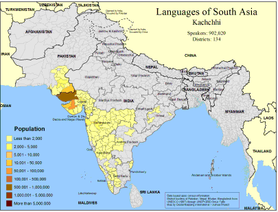
Languages of South Asia- Kutchi
·Type: Maps ·Map Date: February 2008 ·Data Source: Census Information, UNESCO (1987) through UNEP/GRID-Sioux Falls ·Producer: Global Mapping International and The Joshua Project ·Size: 11.7 by 8.27 inches,...
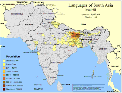
Languages of South Asia- Maithili
·Type: Maps ·Map Date: February 2008 ·Data Source: Census Information, UNESCO (1987) through UNEP/GRID-Sioux Falls ·Producer: Global Mapping International and The Joshua Project ·Size: 11.7 by 8.27 inches,...
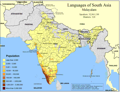
Languages of South Asia- Malayalam
·Type: Maps ·Map Date: February 2008 ·Data Source: Census Information, UNESCO (1987) through UNEP/GRID-Sioux Falls ·Producer: Global Mapping International and The Joshua Project ·Size: 11.7 by 8.27 inches,...

