Statistical
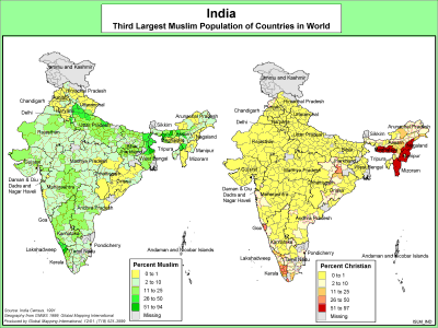
India - Third Largest Muslim Population
·Type: Maps ·Description: India's Muslim Population ·Map Date: 2000 ·Producer: Global Mapping International ·Collection: The World of Islam (WV 2002) ·Size: 8½ x 11 Inches, landscape...
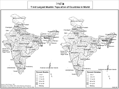
India - Third Largest Muslim Population (BW)
·Type: Maps ·Description: India's Muslim Population ·Map Date: 2002 ·Producer: Global Mapping International ·Collection: The World of Islam (WV 2002) ·Size: 8½ x 11 Inches, landscape...
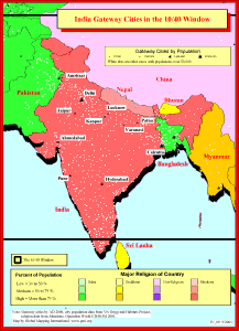
India Gateway Cities in The 10/40 Window
·Type: Maps ·Description: Gateway Cities in India to the 10/40 Window ·Map Date: 2001 ·Producer: Global Mapping International ·Collection: Reaching India (WorldVue 2002) ·Size: 8½ x 11 Inches,...
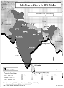
India Gateway Cities in The 10/40 Window (BW)
·Type: Maps ·Description: Gateway Cities in India to the 10/40 Window ·Map Date: 2002 ·Producer: Global Mapping International ·Collection: Reaching India (WorldVue 2002) ·Size: 8½ x 11 Inches,...
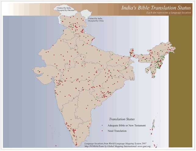
India's Bible Translation Status
·Type: Maps ·Map Date: 2006 ·Data Source: World Language Mapping System 2006 ·Producer: Global Mapping International ·Collection: Reaching India (GMMS 2007) ·Size: 8½ x 11 inches, landscape...
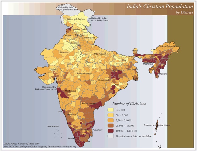
India's Christian Population by District
·Type: Maps ·Map Date: 2006 ·Data Source: Census of India 2001 ·Producer: Global Mapping International ·Collection: Reaching India (GMMS 2007) ·Size: 8½ x 11 inches, landscape ·Categories:...
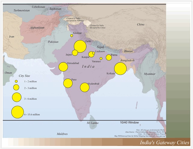
India's Gatway Cities
·Type: Maps ·Map Date: 2006 ·Data Source: Operation World 2001 Cities - Viv Grigg and Habitats Project ·Producer: Global Mapping International ·Collection: Reaching India (GMMS 2007) ·Size: 8½ x 11...
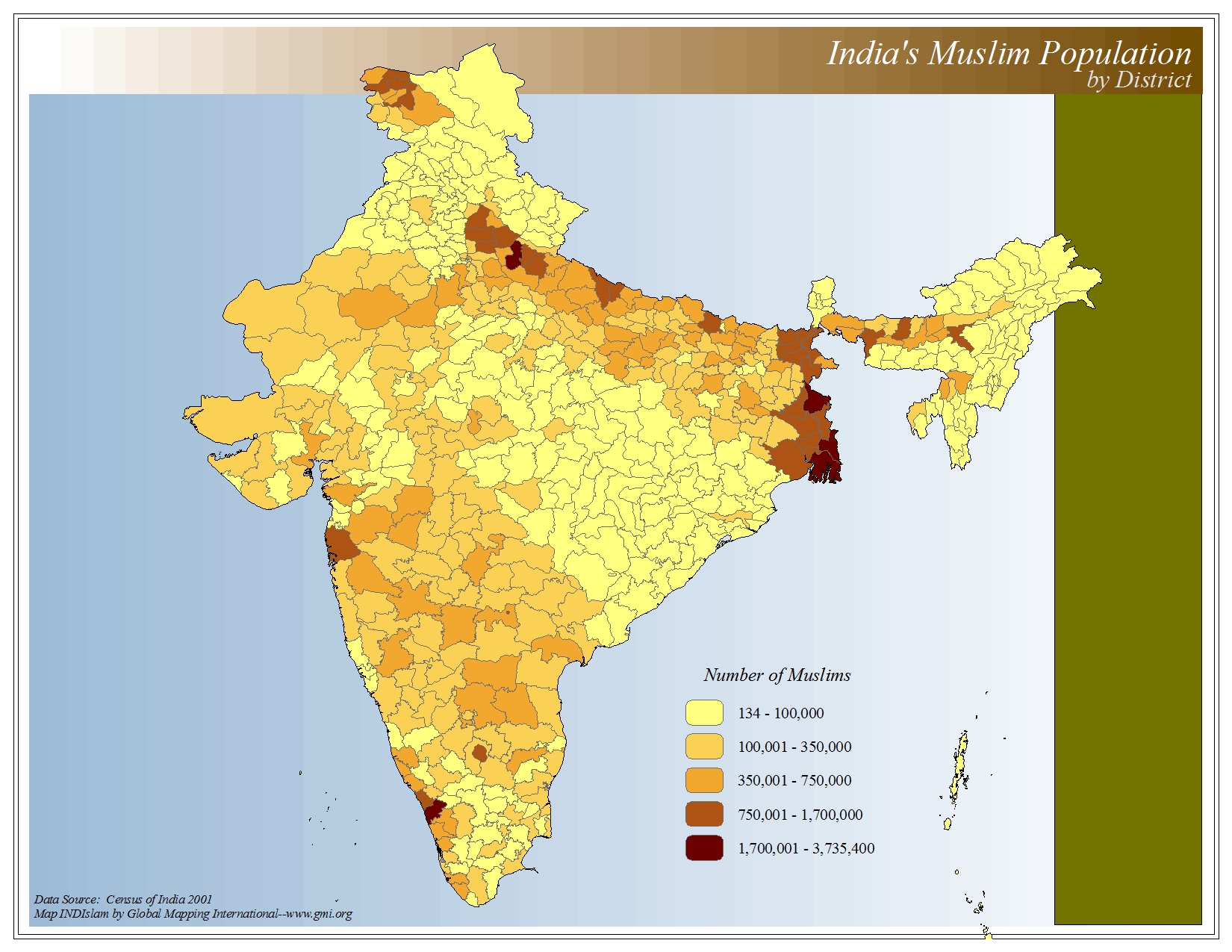
India's Muslim Population by District
·Type: Maps ·Map Date: 2006 ·Data Source: Census of India 2001 ·Producer: Global Mapping International ·Collection: The World of Islam (GMMS 2007) ·Size: 8½ x 11 inches, landscape ·Categories:...
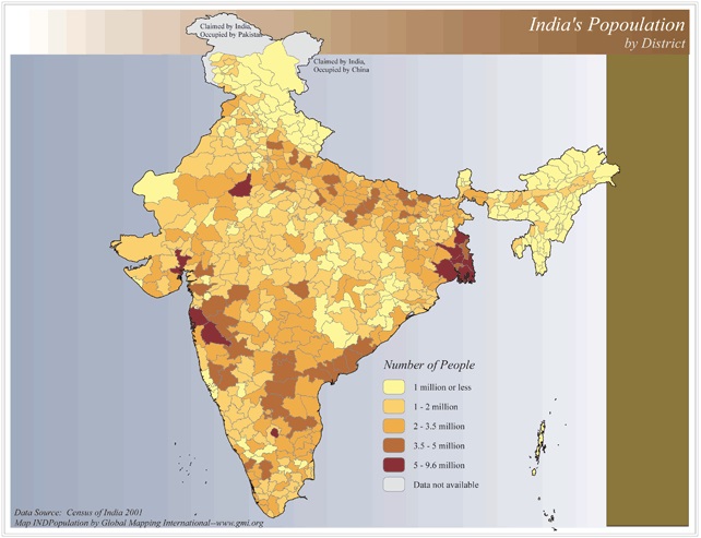
India's Population by District
·Type: Maps ·Map Date: 2006 ·Data Source: Census of India 2001 ·Producer: Global Mapping International ·Collection: Reaching India (GMMS 2007) ·Size: 8½ x 11 inches, landscape ·Categories:...
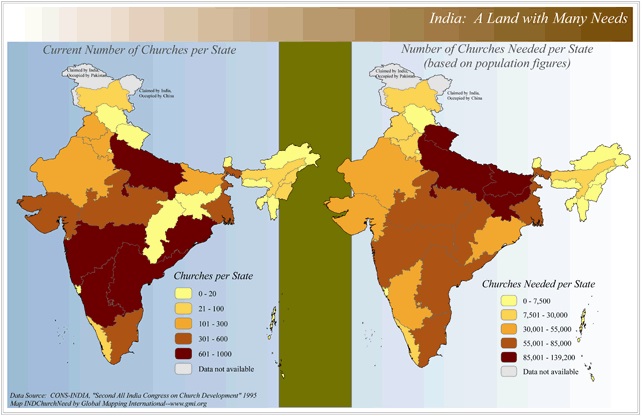
India: A Land in Need of Many Needs (Churches)
·Type: Maps ·Map Date: 2006 ·Data Source: CONS-INDIA, "Second All India Congress on Church Development" 1995 ·Producer: Global Mapping International ·Collection: Reaching India (GMMS 2007) ·Size: 8½...
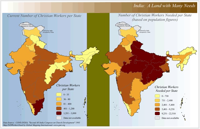
India: A Land in Need of Many Needs (Workers)
·Type: Maps ·Map Date: 2006 ·Data Source: CONS-INDIA, "Second All India Congress on Church Development" 1995 ·Producer: Global Mapping International ·Collection: Reaching India (GMMS 2007) ·Size: 8½...
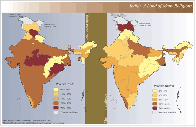
India: A Land of Many Religions
·Type: Maps ·Map Date: 2006 ·Data Source: Patrick Johnstone, Operation World 2001 ·Producer: Global Mapping International ·Collection: Reaching India (GMMS 2007) ·Size: 8½ x 13 inches, landscape...
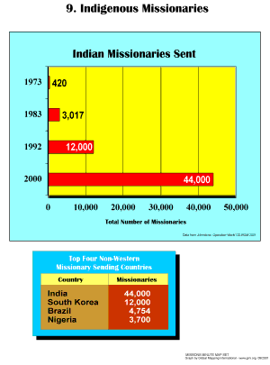
Indigenous Missionaries
·Type: Maps ·Description: Indeigenous Missionaries ·Map Date: 2001 ·Producer: Global Mapping International ·Collection: Missions Minute (WorldVue 2002) ·Size: 8½ x 11 Inches, portrait...
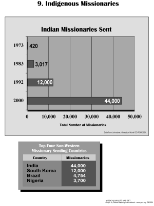
Indigenous Missionaries (BW)
·Type: Maps ·Description: Indeigenous Missionaries ·Map Date: 2002 ·Producer: Global Mapping International ·Collection: Missions Minute (WorldVue 2002) ·Size: 8½ x 11 Inches, portrait...
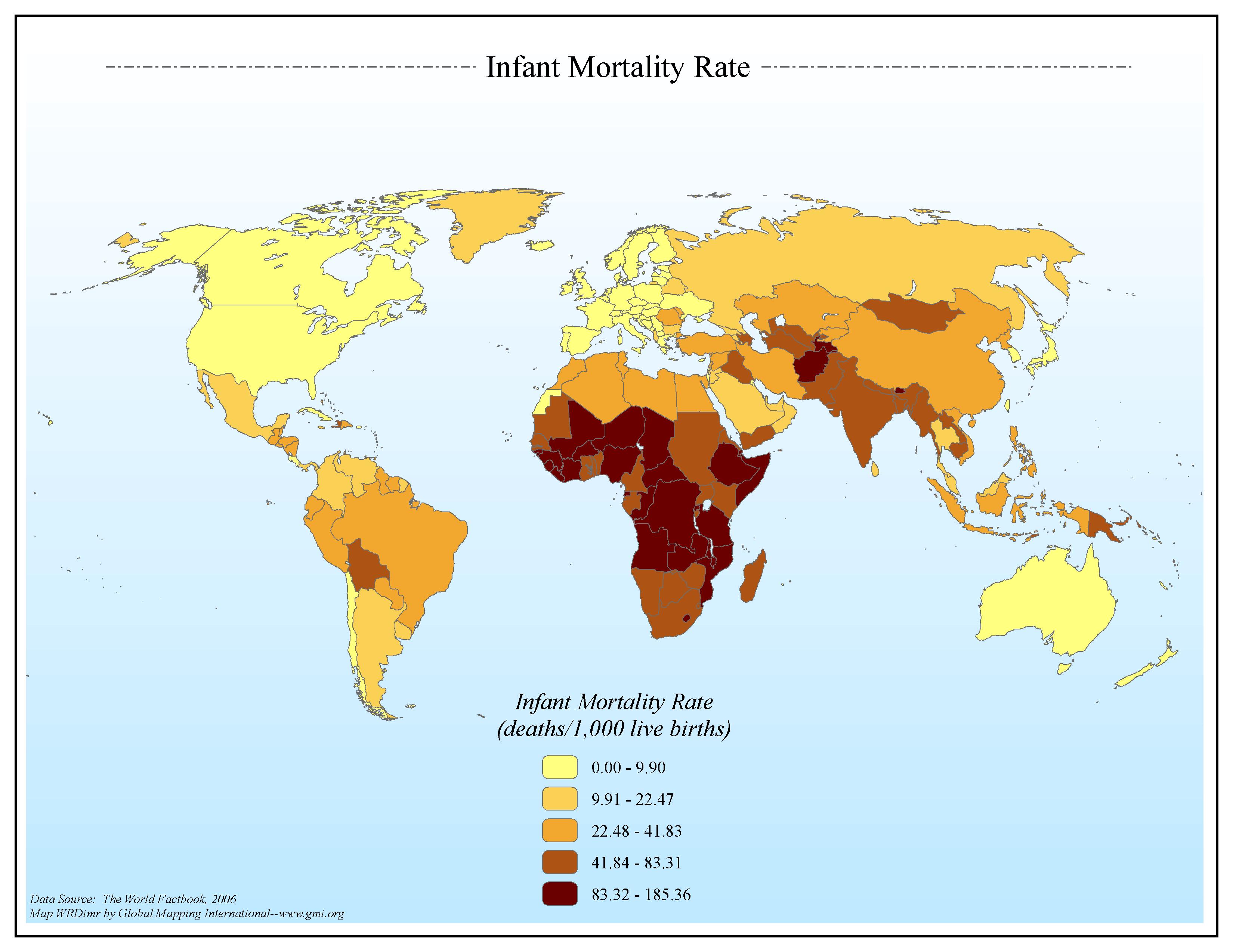
Infant Mortality Rate
·Type: Maps ·Map Date: 2006 ·Data Source: The World Factbook, 2006 ·Producer: Global Mapping International ·Collection: Factbook (GMMS 2007) ·Size: 8½ x 11 inches, landscape ·Categories: Type...
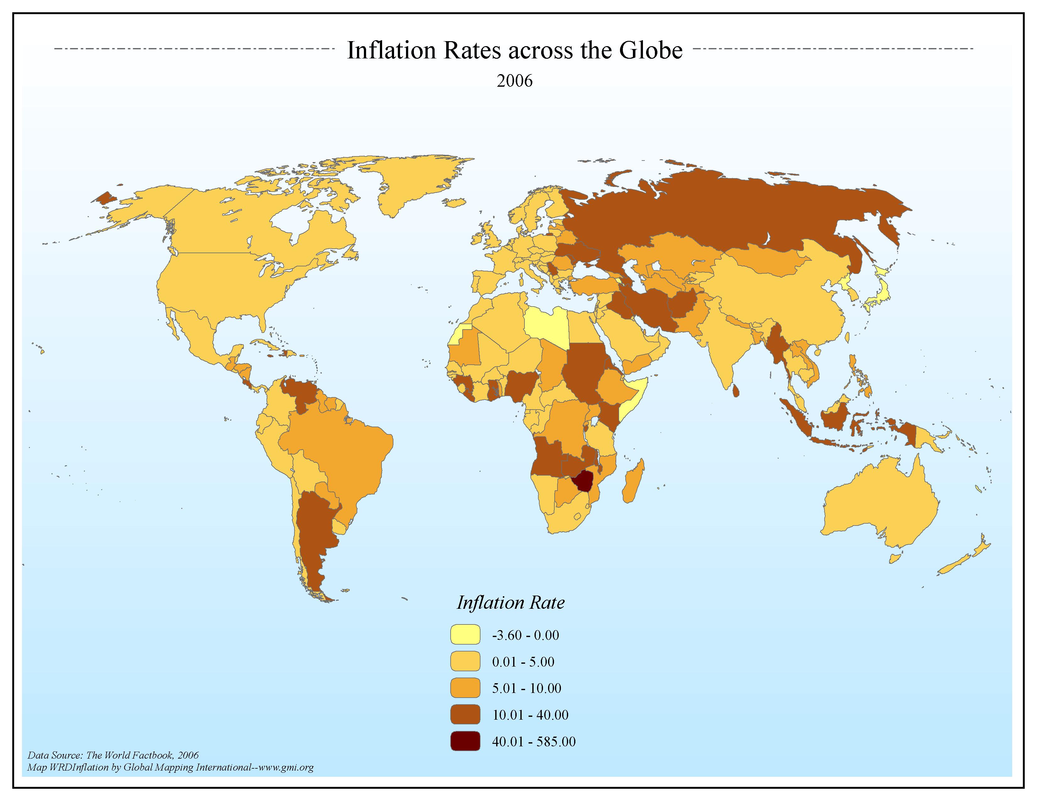
Inflation Rates across the Globe 2006
·Type: Maps ·Map Date: 2006 ·Data Source: The World Factbook, 2006 ·Producer: Global Mapping International ·Collection: Factbook (GMMS 2007) ·Size: 8½ x 11 inches, landscape ·Categories: Type...
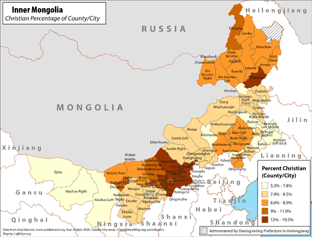
Inner Mongolia - Christian Percentage of County/City
· Type: Maps · Map Date: 2019 · Data Source: Asia Harvest; county/city areas © OpenStreetMap contributors, http://www.openstreetmap.org/copyright. Data available under the Open Database License...
INTERESTING GLOBAL STATISTICS
·Type: Documents ·Date: 4 January 2000 ·Authors: Patrick Johnstone ·Producer: AD2000 and Beyond Movement ·Collection: Global Overview ·Pages: 1 ·Categories: Type :: Documents Topic :: Statistical...
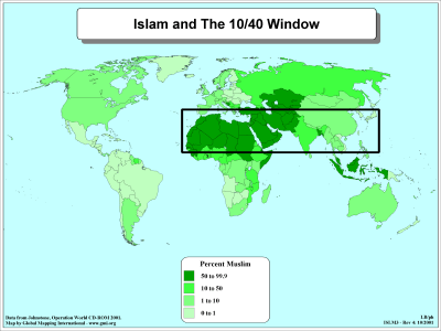
Islam and The 10/40 Window
·Type: Maps ·Description: Islam majorities in the 10/40 Window ·Map Date: 2001 ·Producer: Global Mapping International ·Collection: The 10/40 Window (WorldVue 2002) ·Size: 8½ x 11 Inches, landscape...
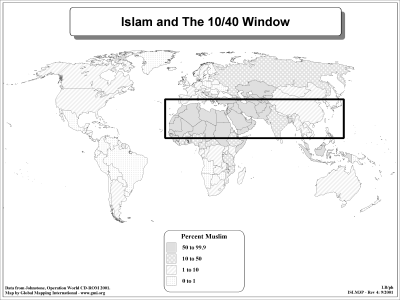
Islam and The 10/40 Window (BW)
·Type: Maps ·Description: Islam majorities in the 10/40 Window ·Map Date: 2002 ·Producer: Global Mapping International ·Collection: The 10/40 Window (WorldVue 2002) ·Size: 8½ x 11 Inches, landscape...
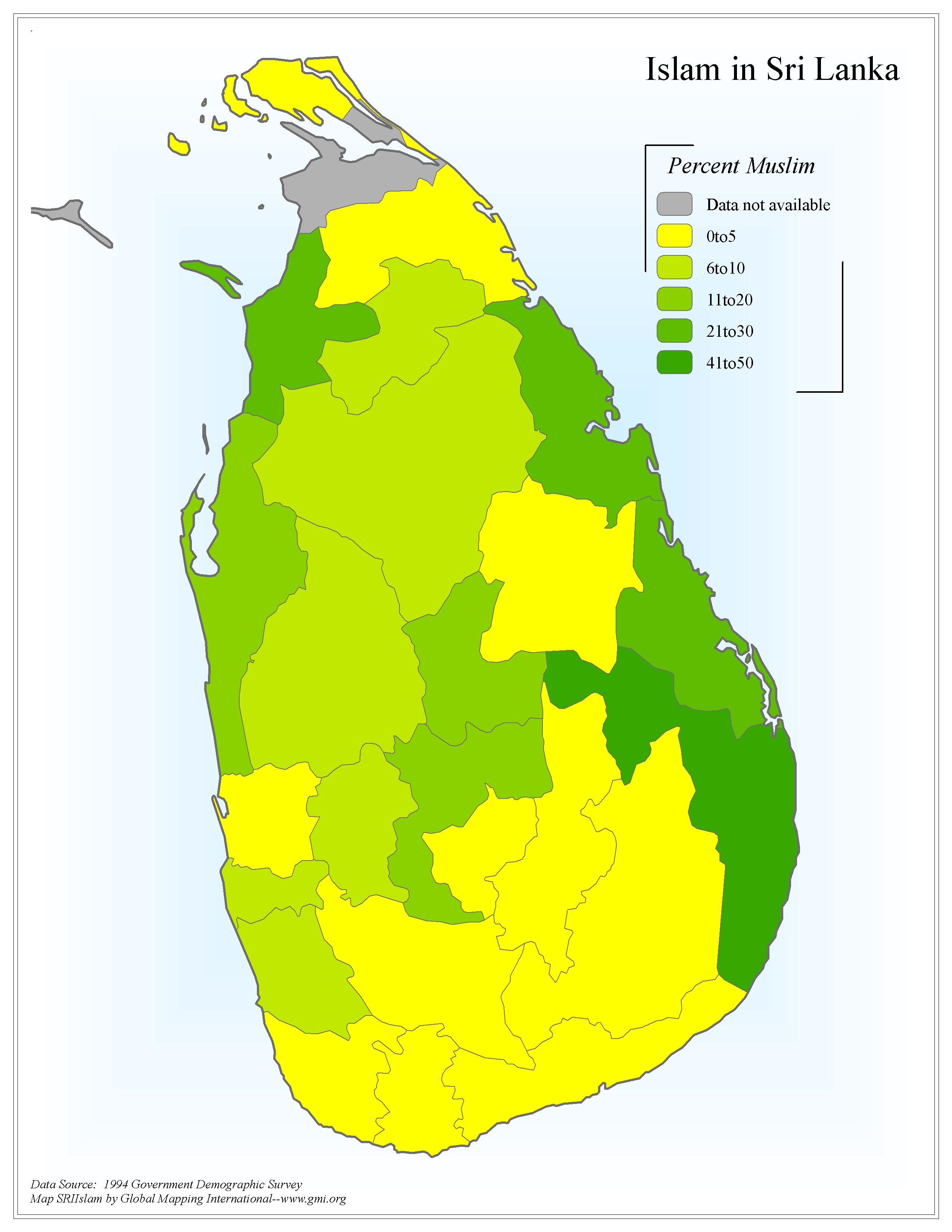
Islam in Sri Lanka
·Type: Maps ·Map Date: 2006 ·Data Source: 1994 Government Demographic Survey ·Producer: Global Mapping International ·Collection: Sri Lanka (GMMS 2007) ·Size: 8½ x 11 inches, portrait...
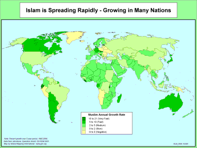
Islam Spreading Rapidly - Growing in Many Nations
·Type: Maps ·Description: The Spread of Islam Growing in Many Nations ·Map Date: 2001 ·Producer: Global Mapping International ·Collection: The World of Islam (WV 2002) ·Size: 8½ x 11 Inches,...
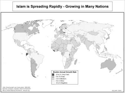
Islam Spreading Rapidly - Growing in Many Nations (BW)
·Type: Maps ·Description: The Spread of Islam Growing in Many Nations ·Map Date: 2002 ·Producer: Global Mapping International ·Collection: The World of Islam (WV 2002) ·Size: 8½ x 11 Inches,...
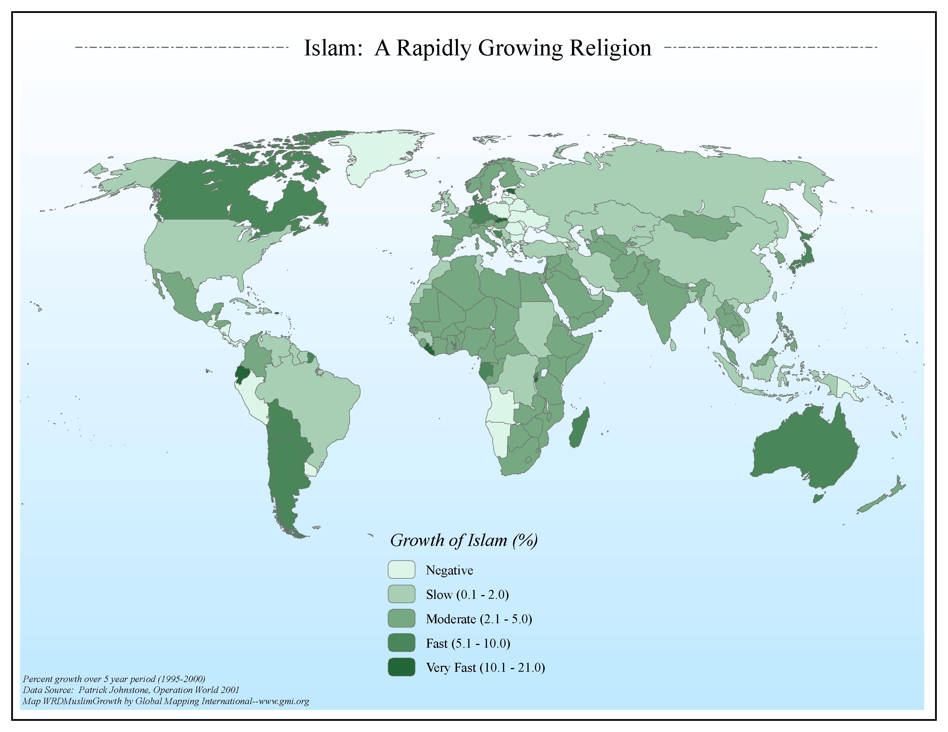
Islam: A Rapidly Growing Religion
·Type: Maps ·Map Date: 2006 ·Data Source: Patrick Johnstone, Operation World 2001 ·Producer: Global Mapping International ·Collection: The World of Islam (GMMS 2007) ·Size: 8½ x 11 inches, landscape...
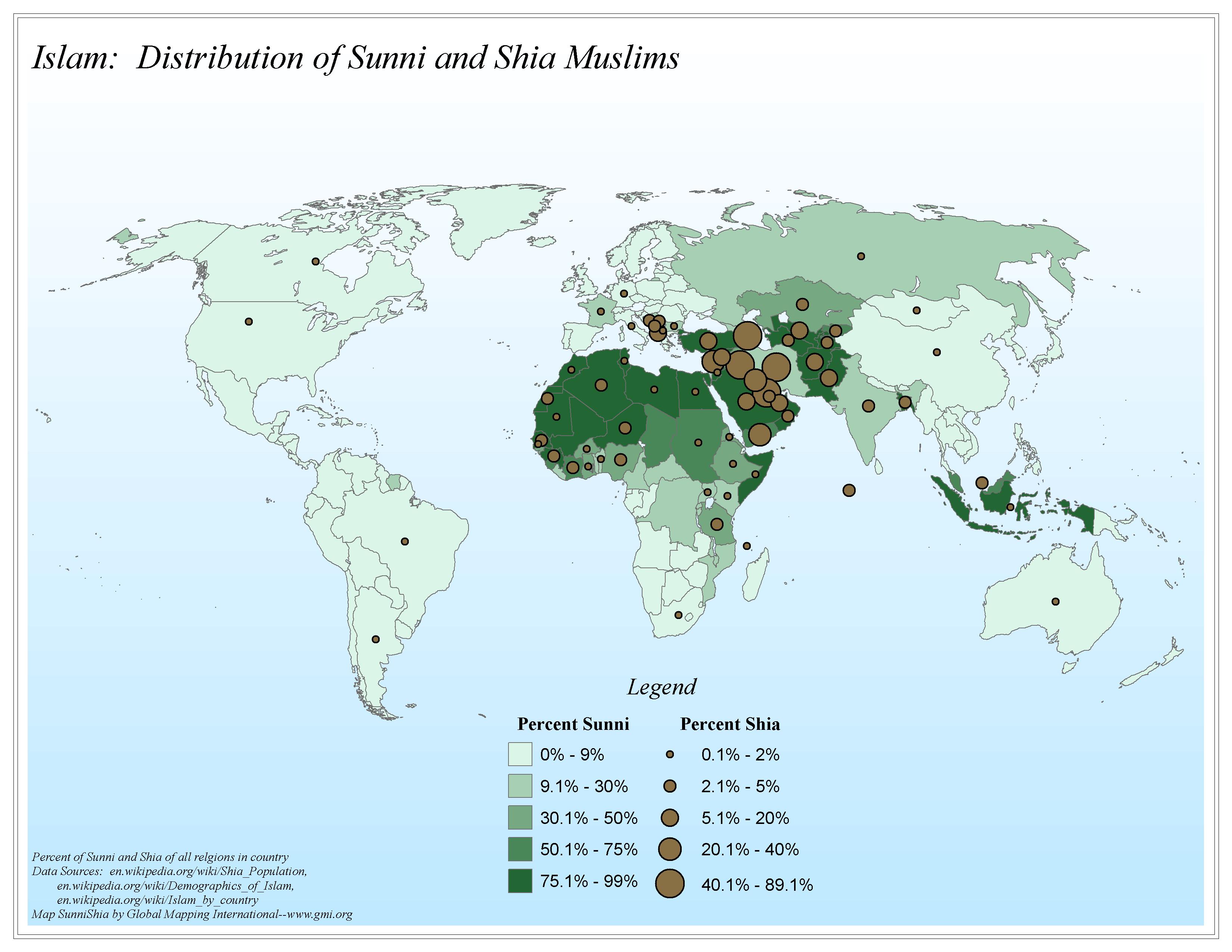
Islam: Distribution of Sunni and Shia Muslims
·Type: Maps ·Map Date: 2006 ·Data Source: en.wikipedia.org/wiki/Shia_Population, en.wikipedia.org/wiki/Demographics_of_Islam, en.wikipedia.org/wiki/Islam_by_country ·Producer: Global Mapping International...
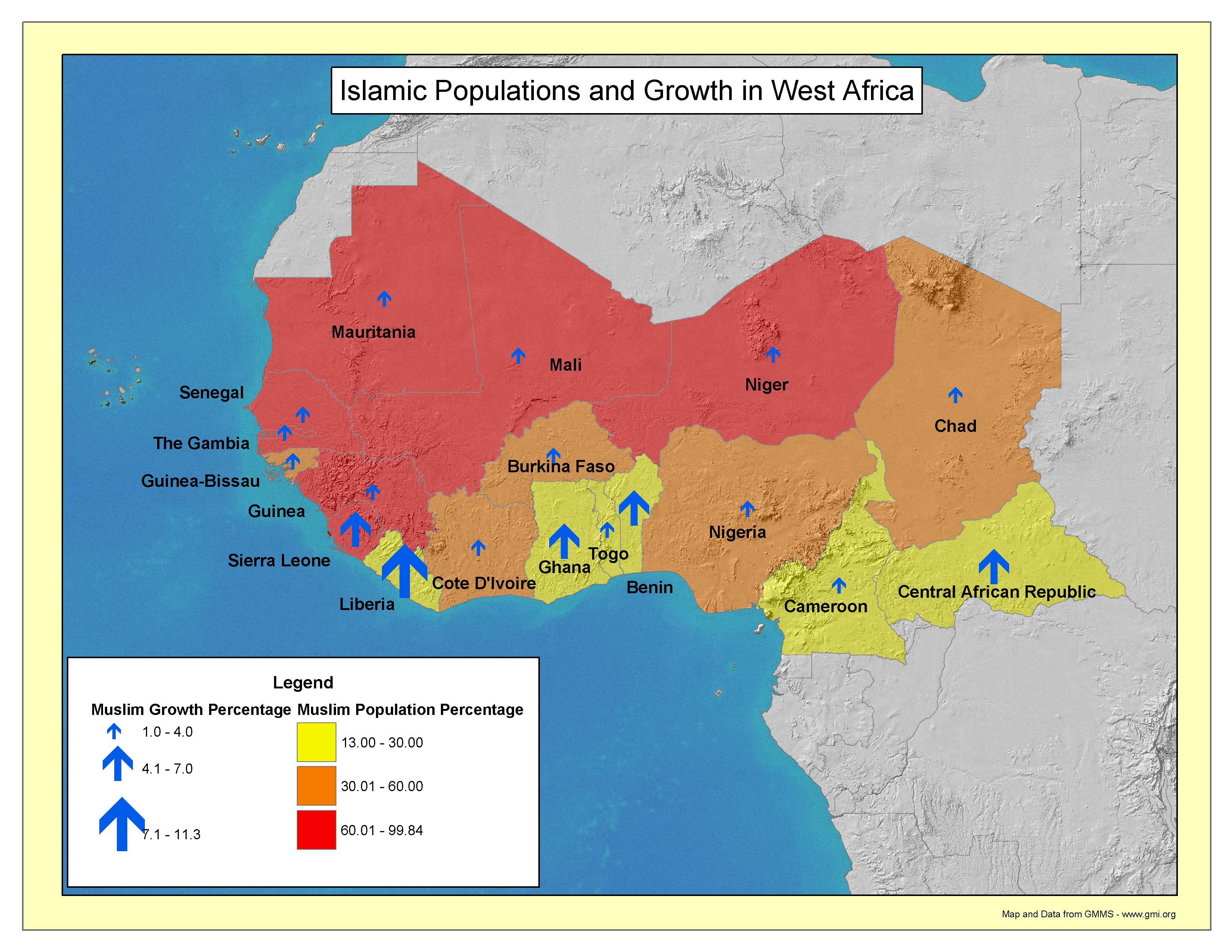
Islamic Populations and Growth in West Africa
·Type: Maps ·Map Date: 2003 ·Producer: GMI ·Collection: Projects 2003 ·Size: 8½ by 11 inches, landscape ·Categories: Type :: Maps Continent/Region :: Africa Topic :: Statistical Partners :: Global...
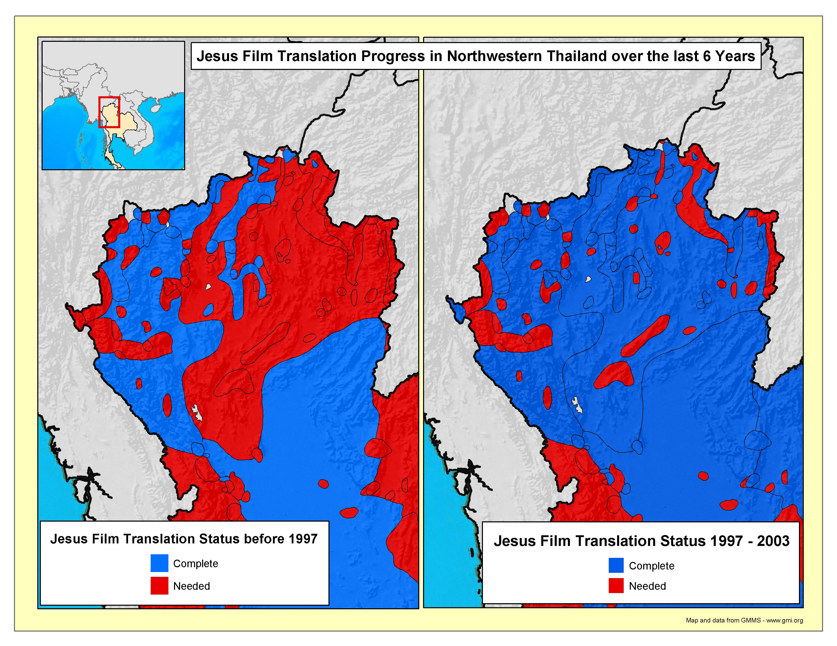
Jesus Film Translation Progress in Northwestern Thailand
·Type: Maps ·Map Date: 2003 ·Producer: GMI ·Collection: Projects 2003 ·Size: 8½ by 11 inches, landscape ·Categories: Type :: Maps Topic :: Statistical Country :: Thailand Partners :: Global Mapping...
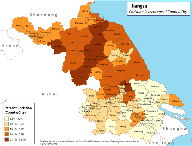
Jiangsu - Christian Percentage of County/City
· Type: Maps · Map Date: 2018 · Data Source: Asia Harvest; county/city areas © OpenStreetMap contributors, http://www.openstreetmap.org/copyright. Data available under the Open Database License...
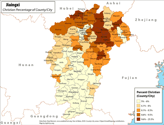
Jiangxi - Christian Percentage of County/City
· Type: Maps · Map Date: 2018 · Data Source: Asia Harvest; county/city areas © OpenStreetMap contributors, http://www.openstreetmap.org/copyright. Data available under the Open Database License...
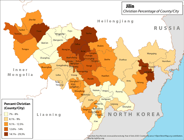
Jilin - Christian Percentage of County/City
· Type: Maps · Map Date: 2019 · Data Source: Asia Harvest; county/city areas © OpenStreetMap contributors, http://www.openstreetmap.org/copyright. Data available under the Open Database License...

