Adherents, Churches, and Denoms
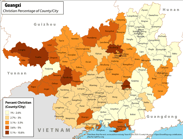
Guangxi - Christian Percentage of County/City
· Type: Maps · Map Date: 2018 · Data Source: Asia Harvest; county/city areas © OpenStreetMap contributors, http://www.openstreetmap.org/copyright. Data available under the Open Database License...
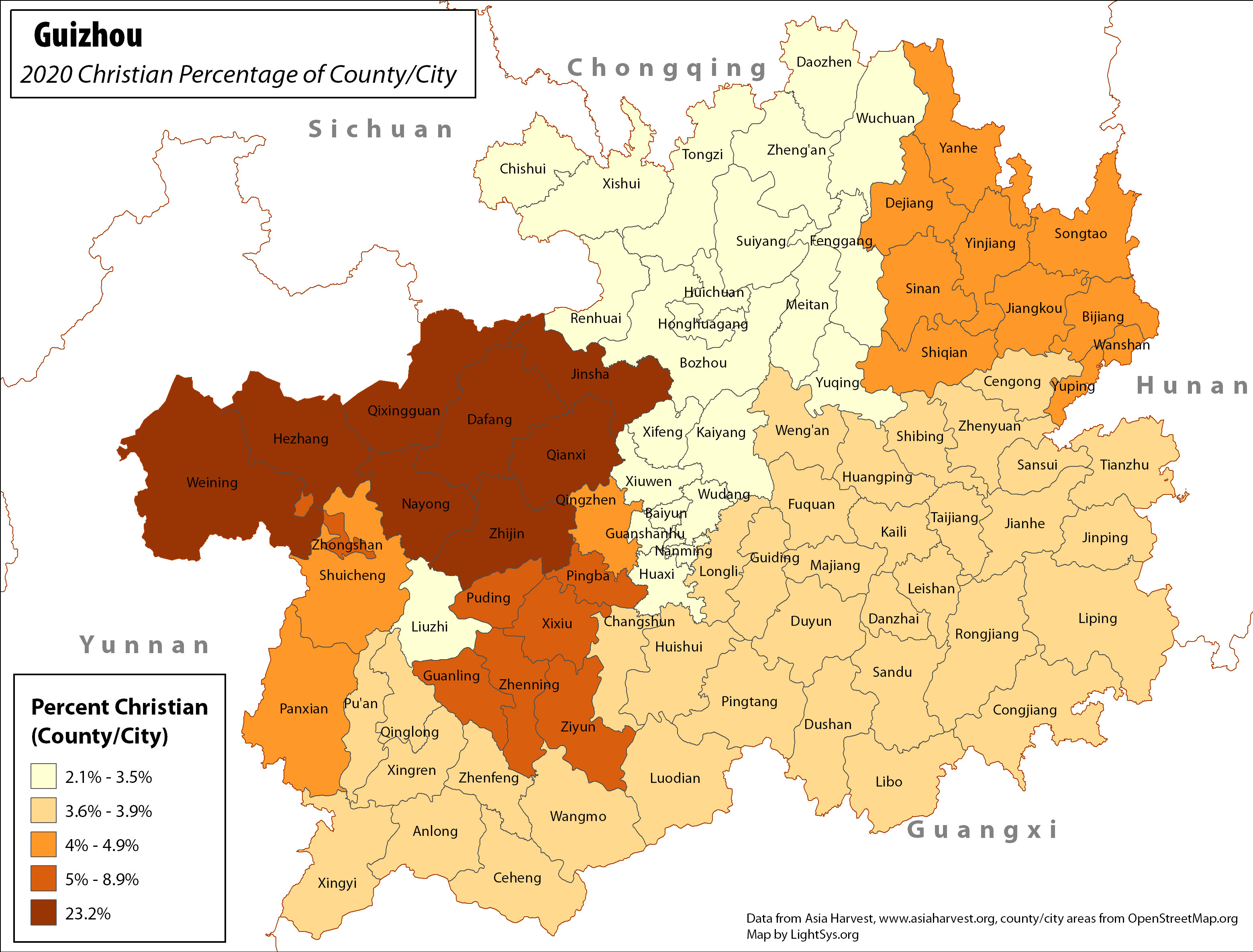
Guizhou - Christian Percentage of County/City
· Type: Maps · Map Date: 2017 · Data Source: Asia Harvest; county/city areas © OpenStreetMap contributors, http://www.openstreetmap.org/copyright. Data available under the Open Database License...
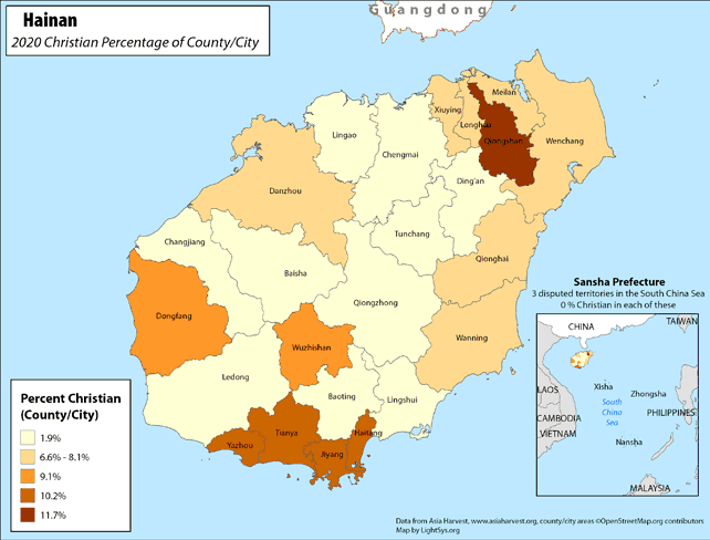
Hainan - Christian Percentage of County/City
· Type: Maps · Map Date: 2018 · Data Source: Asia Harvest; county/city areas © OpenStreetMap contributors, http://www.openstreetmap.org/copyright. Data available under the Open Database License...
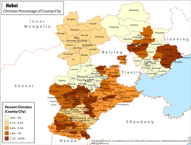
Hebei - Christian Percentage of County/City
· Type: Maps · Map Date: 2019 · Data Source: Asia Harvest; county/city areas © OpenStreetMap contributors, http://www.openstreetmap.org/copyright. Data available under the Open Database License...
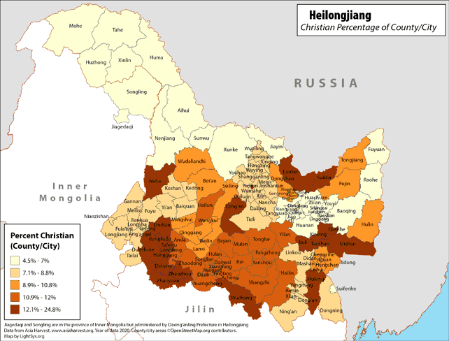
Heilongjiang - Christian Percentage of County/City
· Type: Maps · Map Date: 2019 · Data Source: Asia Harvest; county/city areas © OpenStreetMap contributors, http://www.openstreetmap.org/copyright. Data available under the Open Database License...
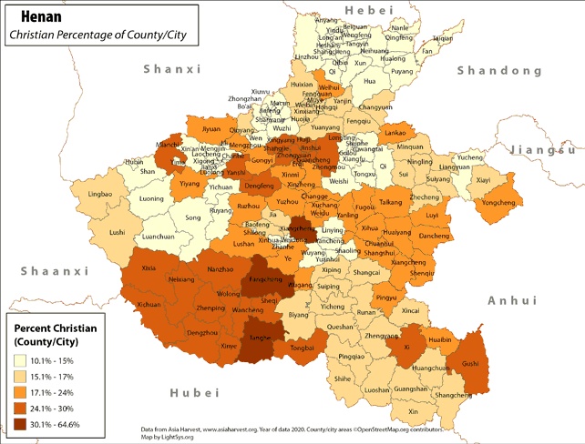
Henan - Christian Percentage of County/City
· Type: Maps · Map Date: 2018 · Data Source: Asia Harvest; county/city areas © OpenStreetMap contributors, http://www.openstreetmap.org/copyright. Data available under the Open Database License...
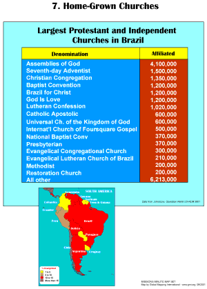
Home-Grown Churches
·Type: Maps ·Description: The Spread of Home Grown Churches ·Map Date: 2001 ·Producer: Global Mapping International ·Collection: Missions Minute (WorldVue 2002) ·Size: 8½ x 11 Inches, portrait...
Home-Grown Churches (BW)
·Type: Maps ·Description: The Spread of Home Grown Churches ·Map Date: 2002 ·Producer: Global Mapping International ·Collection: Missions Minute (WorldVue 2002) ·Size: 8½ x 11 Inches, portrait...
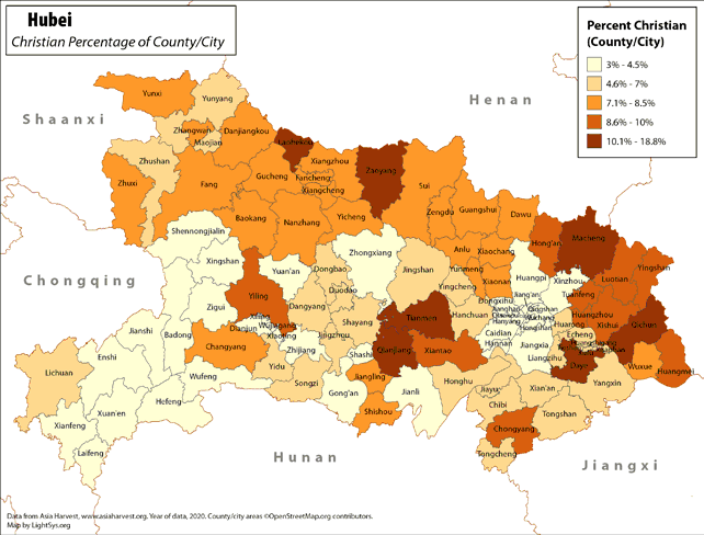
Hubei - Christian Percentage of County/City
· Type: Maps · Map Date: 2018 · Data Source: Asia Harvest; county/city areas © OpenStreetMap contributors, http://www.openstreetmap.org/copyright. Data available under the Open Database License...
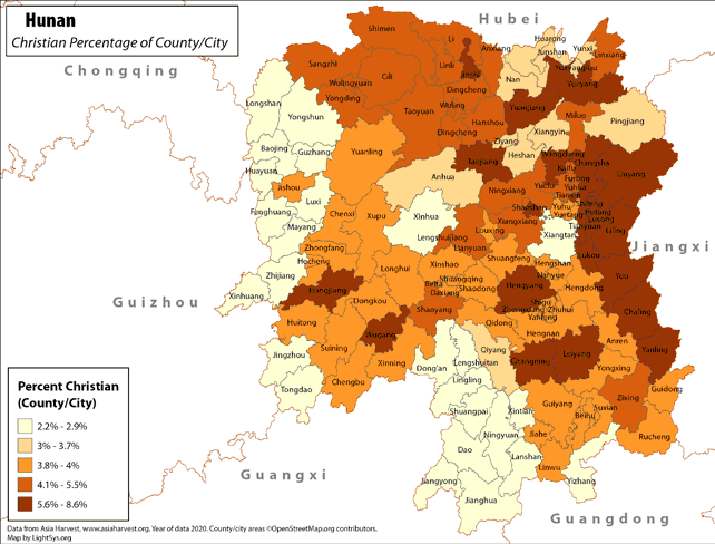
Hunan - Christian Percentage of County/City
· Type: Maps · Map Date: 2018 · Data Source: Asia Harvest; county/city areas © OpenStreetMap contributors, http://www.openstreetmap.org/copyright. Data available under the Open Database License...
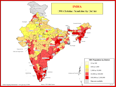
India - 1991 Christian Population by District
·Type: Maps ·Description: 1991 Chrisitian Population by district ·Map Date: 2001 ·Producer: Global Mapping International ·Collection: Reaching India (WorldVue 2002) ·Size: 8½ x 11 Inches, landscape...
India - 1991 Christian Population by District (BW)
·Type: Maps ·Description: 1991 Chrisitian Population by district ·Map Date: 2002 ·Producer: Global Mapping International ·Collection: Reaching India (WorldVue 2002) ·Size: 8½ x 11 Inches, landscape...
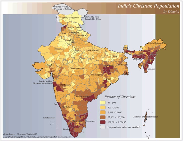
India's Christian Population by District
·Type: Maps ·Map Date: 2006 ·Data Source: Census of India 2001 ·Producer: Global Mapping International ·Collection: Reaching India (GMMS 2007) ·Size: 8½ x 11 inches, landscape ·Categories:...
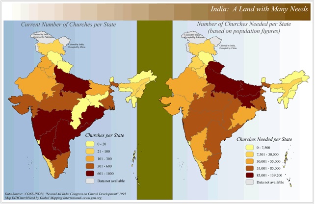
India: A Land in Need of Many Needs (Churches)
·Type: Maps ·Map Date: 2006 ·Data Source: CONS-INDIA, "Second All India Congress on Church Development" 1995 ·Producer: Global Mapping International ·Collection: Reaching India (GMMS 2007) ·Size: 8½...
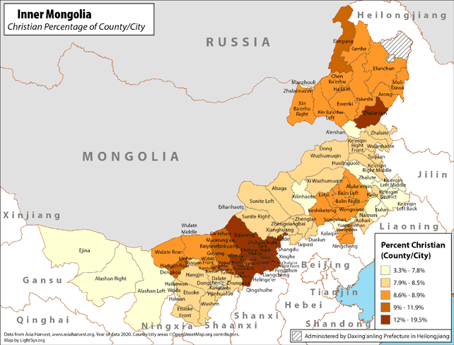
Inner Mongolia - Christian Percentage of County/City
· Type: Maps · Map Date: 2019 · Data Source: Asia Harvest; county/city areas © OpenStreetMap contributors, http://www.openstreetmap.org/copyright. Data available under the Open Database License...
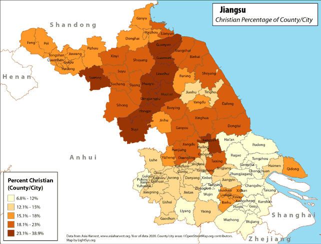
Jiangsu - Christian Percentage of County/City
· Type: Maps · Map Date: 2018 · Data Source: Asia Harvest; county/city areas © OpenStreetMap contributors, http://www.openstreetmap.org/copyright. Data available under the Open Database License...
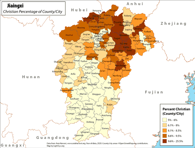
Jiangxi - Christian Percentage of County/City
· Type: Maps · Map Date: 2018 · Data Source: Asia Harvest; county/city areas © OpenStreetMap contributors, http://www.openstreetmap.org/copyright. Data available under the Open Database License...
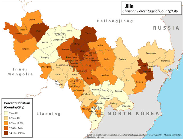
Jilin - Christian Percentage of County/City
· Type: Maps · Map Date: 2019 · Data Source: Asia Harvest; county/city areas © OpenStreetMap contributors, http://www.openstreetmap.org/copyright. Data available under the Open Database License...
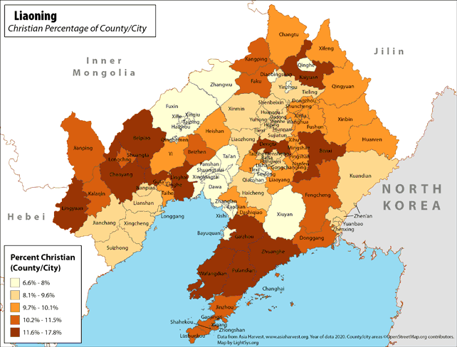
Liaoning - Christian Percentage of County/City
· Type: Maps · Map Date: 2019 · Data Source: Asia Harvest; county/city areas © OpenStreetMap contributors, http://www.openstreetmap.org/copyright. Data available under the Open Database License...
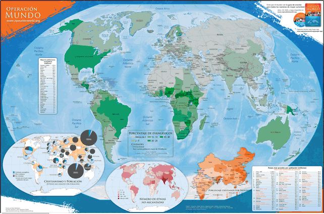
Mapa de la Operación Muro Mundo
Disponible en francés, inglés, portugués y ruso. Este mapa en español de colores (60.96 cm por 91.44 cm) destaca información y estadística encontrada en Operación Muro Mundo y en Ora por el Mundo . El mapa principal incluye el porcentaje de...
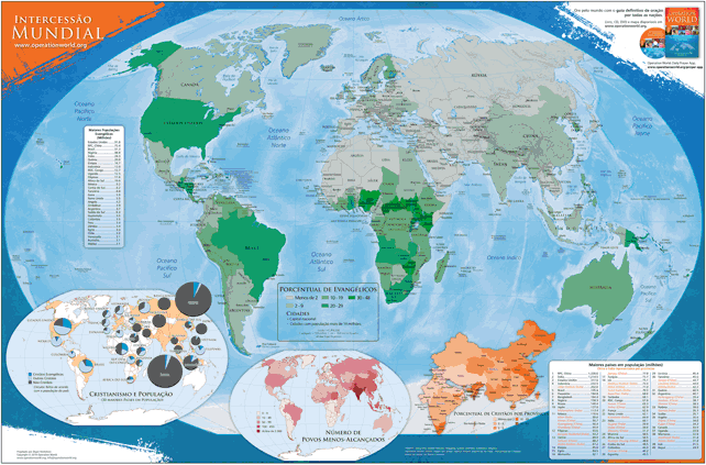
Mapa Intercessão Mundial
Disponível em inglês, francês, russo e et espanhol. Este mapa do mundo em cores do tamanho de 60,96 cm x 91,44 cm destaca as informações dos livros Intercessão Mundial (7ª edição - 2010) e Ore pelas Nações . O mapa principal mostra a...
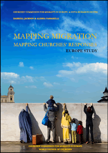
Mapping Migration Report
·Type: Documents ·Description: ·Categories: Type :: Documents Continent/Region :: Europe Topic :: Demography Topic :: Religions, Christianity :: Adherents, Churches, and Denoms Topic :: Research :: Reports/Studies Partners ::...
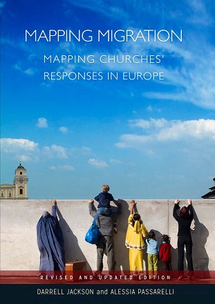
Mapping Migration Report 2016
·Type: Documents ·Description: ·Categories: Type :: Documents Continent/Region :: Europe Topic :: Demography Topic :: Religions, Christianity :: Adherents, Churches, and Denoms Topic :: Research :: Reports/Studies Partners ::...
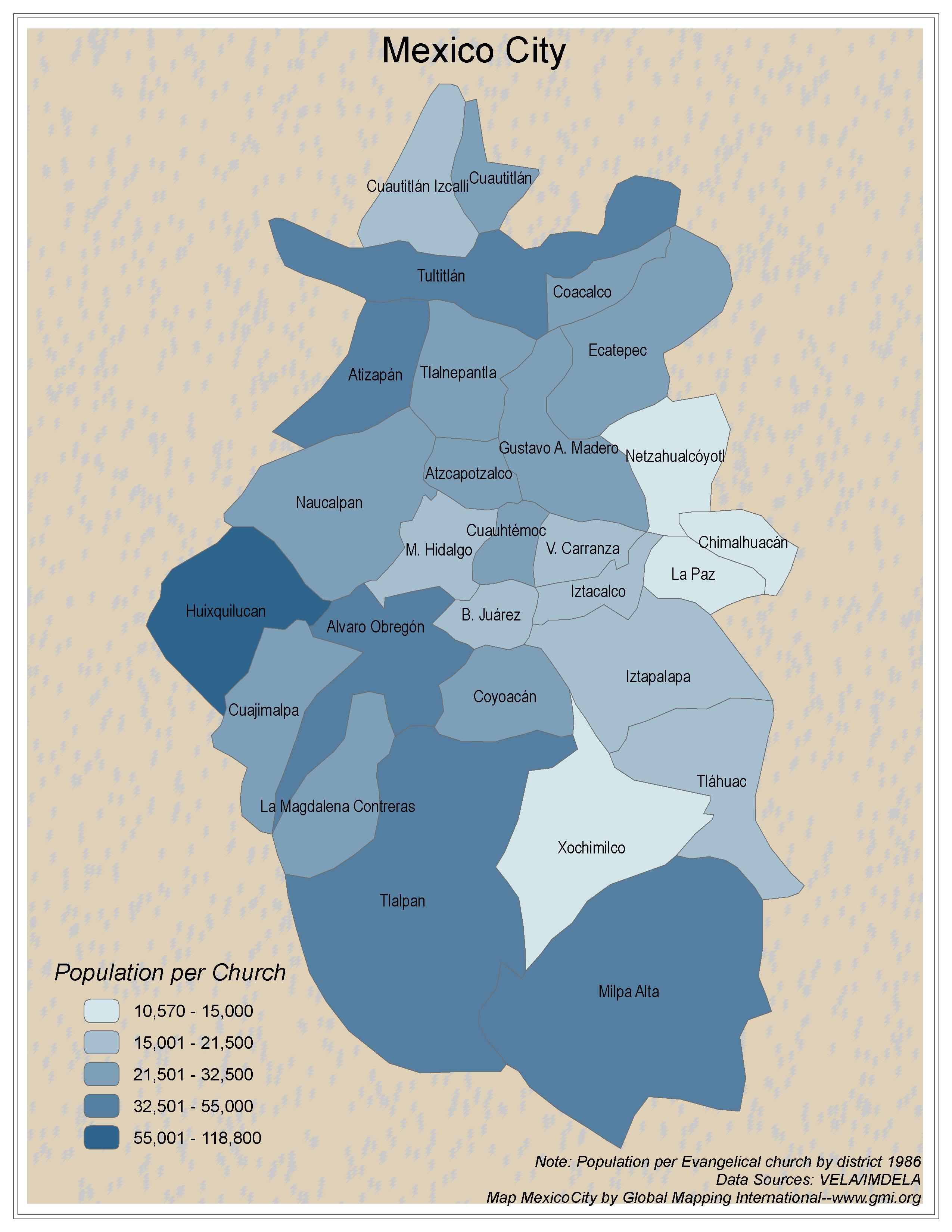
Mexico City
·Type: Maps ·Map Date: 2006 ·Data Source: VELA/IMDELA ·Producer: Global Mapping International ·Collection: Intro to Missions (GMMS 2007) ·Size: 8½ x 11 inches, portrait ·Categories: Type ::...
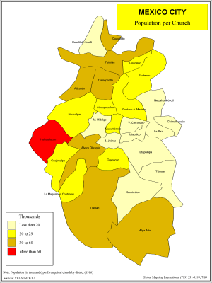
Mexico City - Population per Church
·Type: Maps ·Description: Population per church in Mexico City ·Map Date: 1986 ·Producer: Global Mapping International ·Collection: Intro to Mission (WorldVue 2002) ·Size: 8½ x 11 Inches, portrait...
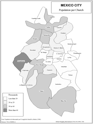
Mexico City - Population per Church (BW)
·Type: Maps ·Description: Population per church in Mexico City ·Map Date: 2002 ·Producer: Global Mapping International ·Collection: Intro to Mission (WorldVue 2002) ·Size: 8½ x 11 Inches, portrait...
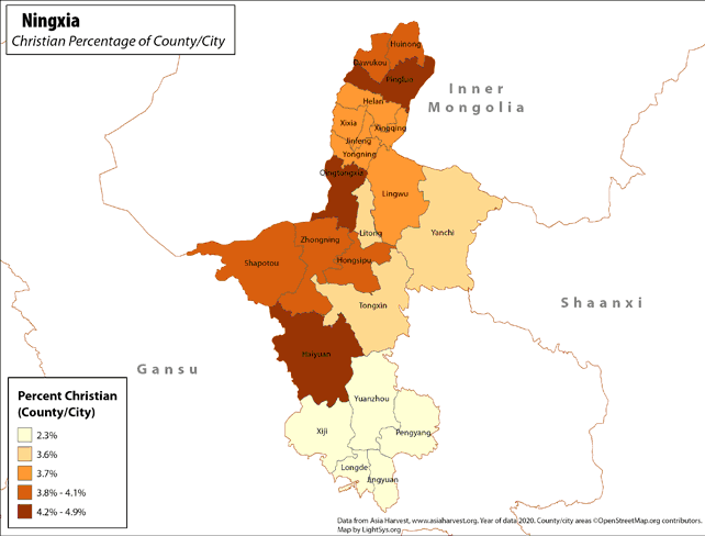
Ningxia - Christian Percentage of County/City
· Type: Maps · Map Date: 2019 · Data Source: Asia Harvest; county/city areas © OpenStreetMap contributors, http://www.openstreetmap.org/copyright. Data available under the Open Database License...
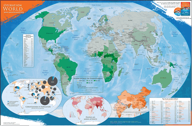
Operation World Wall Map
This colored Spanish map (60.96 cm by 91.44 cm) highlights information and statistics found in Operation Muro Mundo and in Pray for the World. The main map includes the percentage of Christians in the 30 largest countries, the number of the...
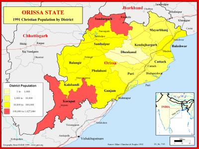
Orissa State - 1991 Christian Population by District
·Type: Maps ·Description: Christian Population of Orissa state in 1991 ·Map Date: 1999 ·Producer: Global Mapping International ·Collection: Reaching India (WorldVue 2002) ·Size: 8½ x 11 Inches,...
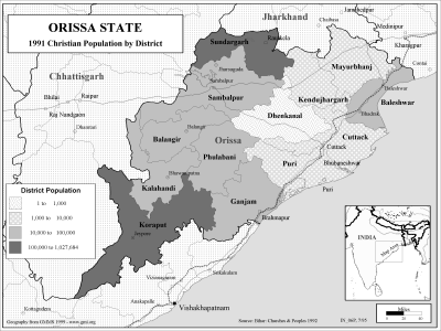
Orissa State - 1991 Christian Population by District (BW)
·Type: Maps ·Description: Christian Population of Orissa state in 1991 ·Map Date: 2002 ·Producer: Global Mapping International ·Collection: Reaching India (WorldVue 2002) ·Size: 8½ x 11 Inches,...

