| Product Image |
Resource Name |
Price |
Manufacturer+ |
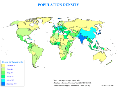 |
·Type: Maps ·Description: Country level distribution of Population density in 2000 (in miles ·Map Date: 2000 ·Producer: Global Mapping International ·Collection: General World Maps (WV 2002) ·Size: 8½ x 11 Inches, landscape ·Categories: Type :: Maps Collection :: GMI Map Collections :: General World Maps (WV 2002) Continent/Region :: World Topic :: Demography Partners :: Global Mapping International |
... more info
Max: 1
|
|
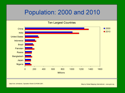 |
·Type: Maps ·Description: Ten Largest contries in 2000 and 2010 ·Map Date: 2001 ·Producer: Global Mapping International ·Collection: Intro to Mission (WorldVue 2002) ·Size: 8½ x 11 Inches, landscape ·Categories: Type :: Maps Collection :: GMI Map Collections :: Intro to Mission (WorldVue 2002) Continent/Region :: World Topic :: Demography Type :: Graphs Partners :: Global Mapping International |
... more info
Max: 1
|
|
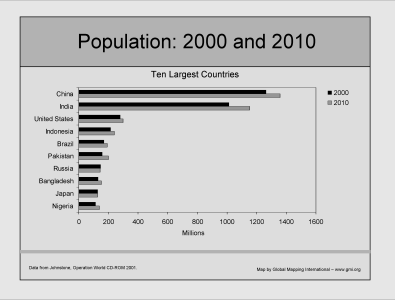 |
·Type: Maps ·Description: Ten Largest contries in 2000 and 2010 ·Map Date: 2002 ·Producer: Global Mapping International ·Collection: Intro to Mission (WorldVue 2002) ·Size: 8½ x 11 Inches, landscape ·Categories: Type :: Maps Collection :: GMI Map Collections :: Intro to Mission (WorldVue 2002) Continent/Region :: World Topic :: Demography Type :: Graphs Partners :: Global Mapping International |
... more info
Max: 1
|
|
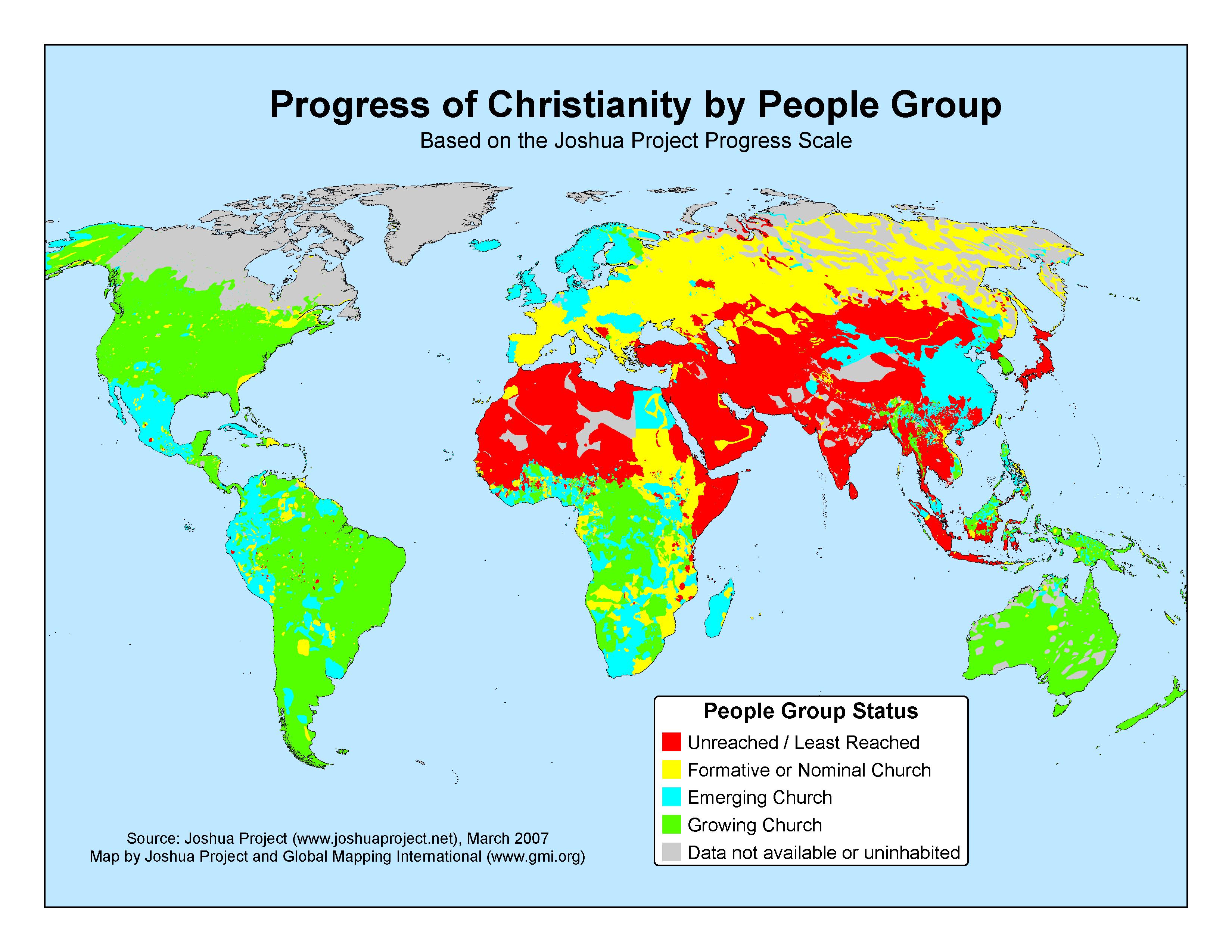 |
·Type: Maps ·Map Date: 2007 ·Data Source: The Joshua Project, March 2007 ·Producer: GMI; The Joshua Project ·Collection: Projects 2007 ·Categories: Type :: Maps Continent/Region :: World Topic :: Statistical Topic :: Peoples, multiple or unknown Partners :: Global Mapping International Collection :: GMI Map Collections :: Projects 2007 Partners :: Joshua Project |
... more info
Max: 1
|
|
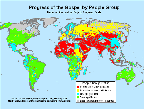 |
·Type: Maps ·Map Date: 2008 ·Data Source: The Joshua Project, February 2008 ·Producer: GMI; The Joshua Project ·Collection: Projects 2008 ·Categories: Type :: Maps Continent/Region :: World Topic :: Strategy Topic :: Peoples, multiple or unknown Partners :: Global Mapping International Collection :: GMI Map Collections :: Projects 2008 Partners :: Joshua Project |
... more info
Max: 1
|
|
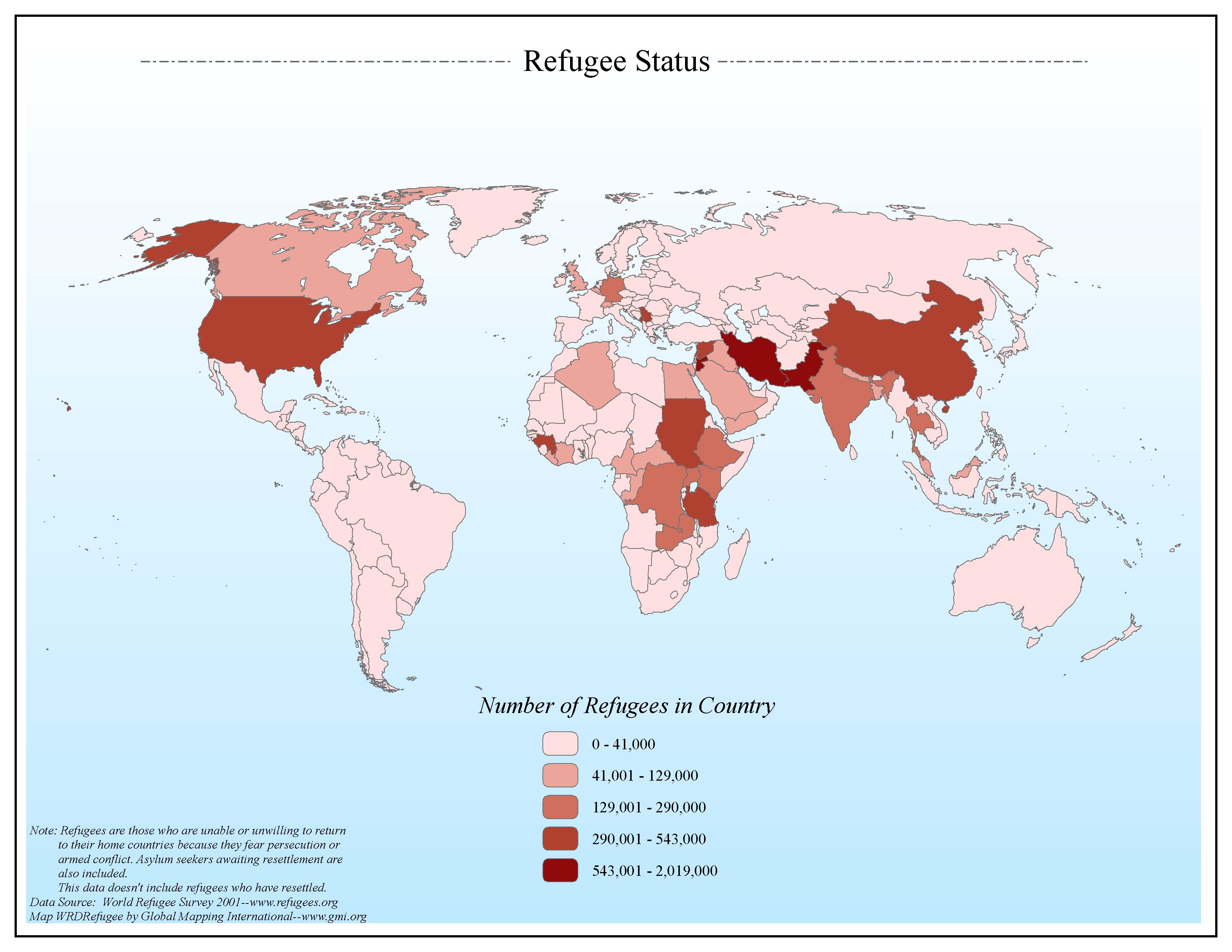 |
·Type: Maps ·Map Date: 2006 ·Data Source: World Refugee Survey 2001--www.refugees.org ·Producer: Global Mapping International ·Collection: General World Maps (GMMS 2007) ·Size: 8½ x 11 inches, landscape ·Categories: Type :: Maps Continent/Region :: World Topic :: Statistical Topic :: Social Collection :: GMI Map Collections :: General World Maps (GMMS 2007) Partners :: Global Mapping International |
... more info
Max: 1
|
|
 |
·Type: Maps ·Description: Awakening the Church-Oriented is the Second Frontier ·Map Date: 1999 ·Producer: Global Mapping International ·Collection: Omega Model of Mission (WV 2002) ·Size: 8½ x 11 Inches, landscape ·Categories: Type :: Maps Collection :: GMI Map Collections :: Omega Model of Mission (WV 2002) Continent/Region :: World Topic :: Strategy Topic :: Concepts Topic :: Peoples, multiple or unknown Partners :: Global Mapping... |
... more info
Max: 1
|
|
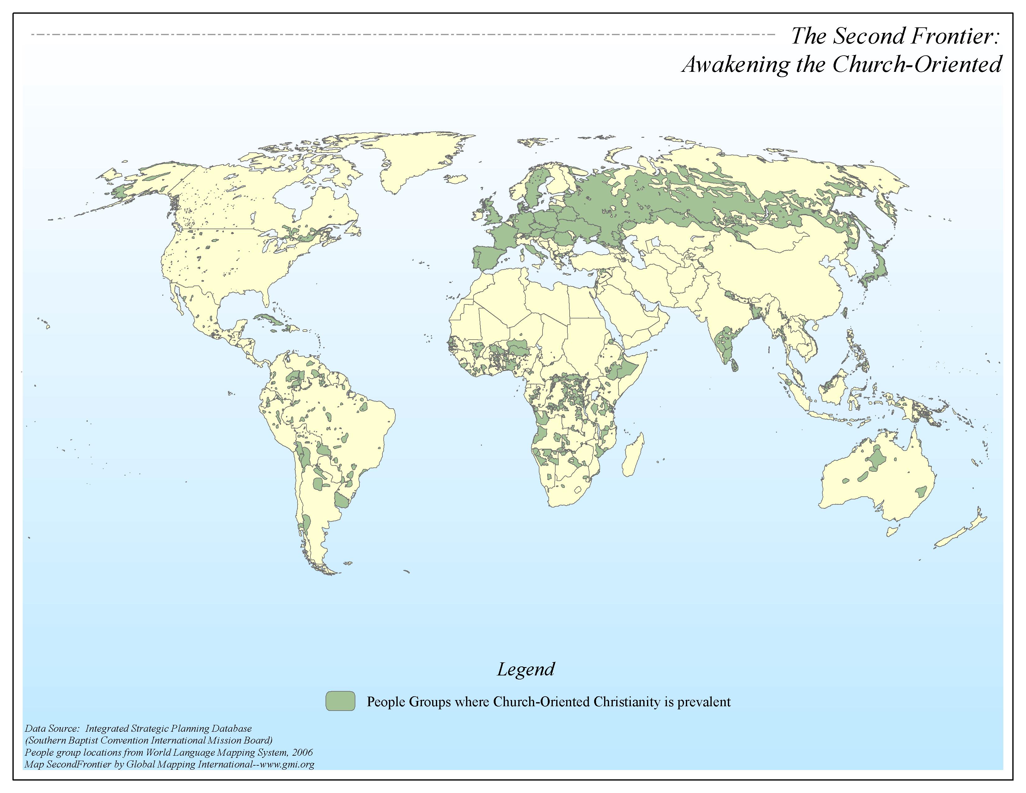 |
·Type: Maps ·Map Date: 2006 ·Data Source: Integrated Strategic Planning Database (SBC-IMB) People group locations from World Language Mapping System, 2006 ·Producer: Global Mapping International ·Collection: Omega Model of Mission GMMS 2007 ·Size: 8½ x 11 inches, landscape ·Categories: Type :: Maps Continent/Region :: World Topic :: Strategy Topic :: Concepts Collection :: GMI Map Collections :: Omega Model of Mission GMMS 2007 Partners... |
... more info
Max: 1
|
|
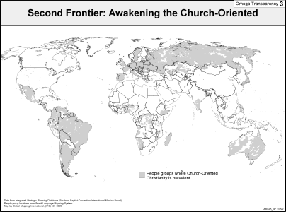 |
·Description: Awakening the Church-Oriented is the Second Frontier ·Map Date: 2002 ·Producer: Global Mapping International ·Collection: Omega Model of Mission (WV 2002) ·Size: 8½ x 11 Inches, landscape ·Categories: Collection :: GMI Map Collections :: Omega Model of Mission (WV 2002) Continent/Region :: World Topic :: Strategy Topic :: Concepts Topic :: Peoples, multiple or unknown Partners :: Global Mapping International |
... more info
Max: 1
|
|
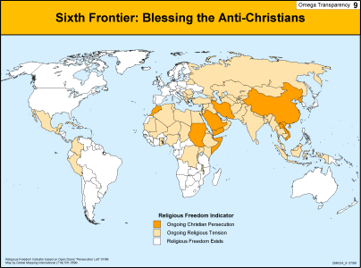 |
·Type: Maps ·Description: Blessing the Anti--Christians is the Sixth Frontier ·Map Date: 1999 ·Producer: Global Mapping International ·Collection: Omega Model of Mission (WV 2002) ·Size: 8½ x 11 Inches, landscape ·Categories: Type :: Maps Collection :: GMI Map Collections :: Omega Model of Mission (WV 2002) Continent/Region :: World Topic :: Strategy Topic :: Concepts Partners :: Global Mapping International |
... more info
Max: 1
|
|
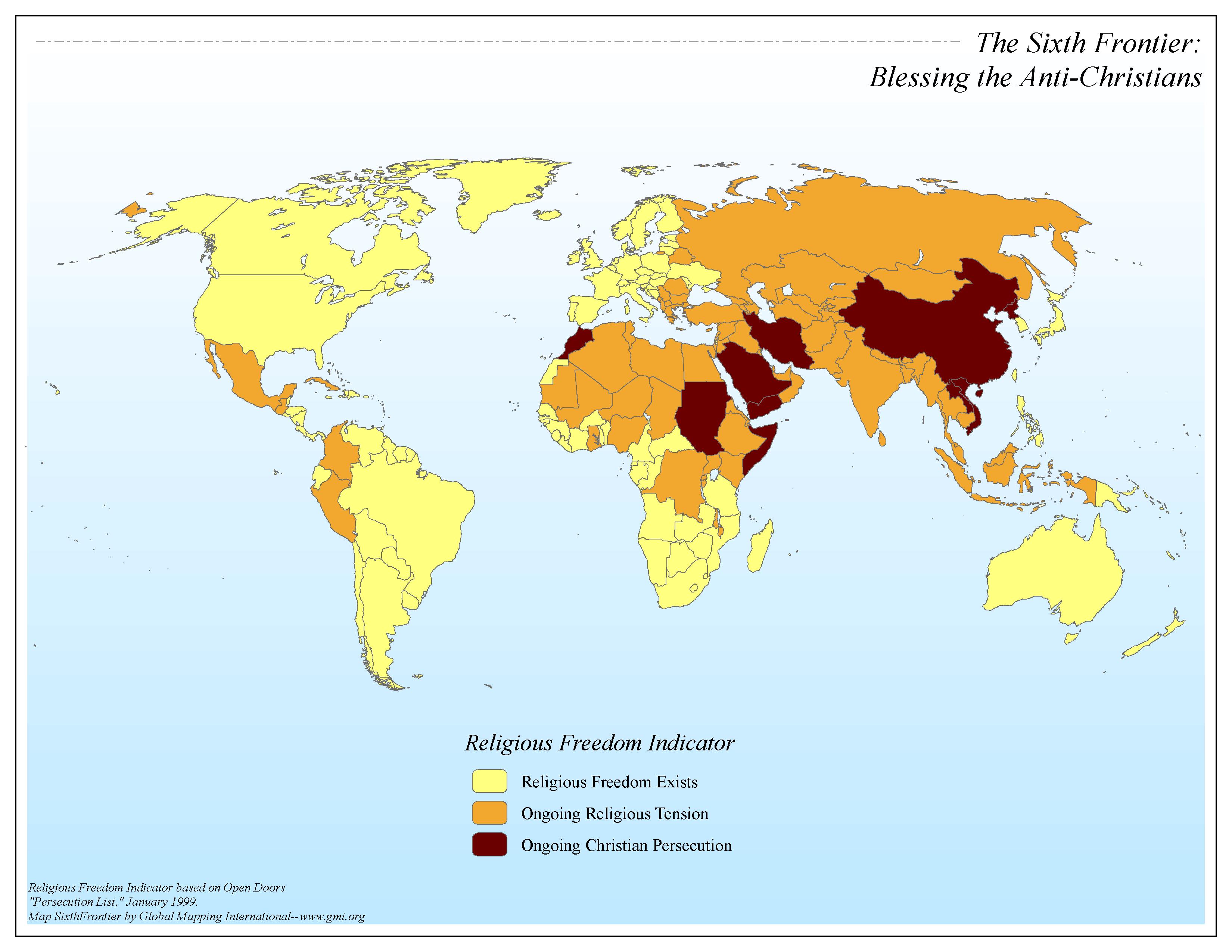 |
·Type: Maps ·Map Date: 2006 ·Data Source: Religious Freedom Indicator based on Open Doors "Persecution List," January 1999. ·Producer: Global Mapping International ·Collection: Omega Model of Mission GMMS 2007 ·Size: 8½ x 11 inches, landscape ·Categories: Type :: Maps Continent/Region :: World Topic :: Strategy Topic :: Concepts Collection :: GMI Map Collections :: Omega Model of Mission GMMS 2007 Partners :: Global Mapping International |
... more info
Max: 1
|
|
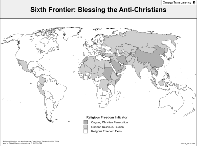 |
·Type: Maps ·Description: Blessing the Anti--Christians is the Sixth Frontier ·Map Date: 2002 ·Producer: Global Mapping International ·Collection: Omega Model of Mission (WV 2002) ·Size: 8½ x 11 Inches, landscape ·Categories: Type :: Maps Collection :: GMI Map Collections :: Omega Model of Mission (WV 2002) Continent/Region :: World Topic :: Strategy Topic :: Concepts Partners :: Global Mapping International |
... more info
Max: 1
|
|
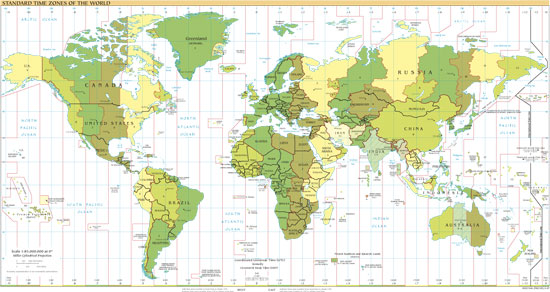 |
·Type: Maps ·Map Date: 2007 ·Producer: US Government ·Collection: World Factbook reference maps ·Size: 550x292 px, landscape ·Categories: Type :: Maps Collection :: World Factbook reference maps Continent/Region :: World Partners :: U.S. Government |
... more info
Max: 1
|
|
 |
·Type: Maps ·Description: Jason Mandryk's State of the Gospel presentation from the 2006 Younger Leader's Gathering (YLG) in Malysia. Video, Audio, and PowerPoint versions of the presentation are available. ·Date: 2006 ·Presenter: Jason Mandryk ·Producer: Harvest Media Ministries·Duration (H:M:S): 36:00 ·Play audio: Your browser does not support the audio element. ·Resolution: Low-320x240 High-640x480 ·Categories: Type :: Maps... |
... more info
Max: 1
|
|
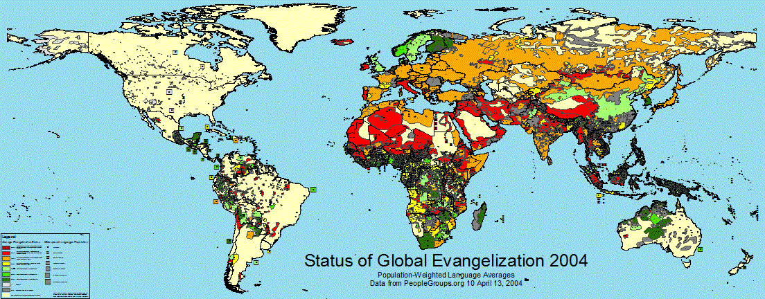 |
·Type: Maps ·Map Date: 13 April 2004 ·Data Source: PeopleGroups.org ·Producer: Global Mapping International ·Collection: Projects 2004 ·Size: 36 by 92 inches, landscape ·Categories: Type :: Maps Continent/Region :: World Partners :: Global Mapping International Collection :: GMI Map Collections :: Projects 2004 Topic :: Religions, Christianity :: Evangelism and Church Planting |
... more info
Max: 1
|
|
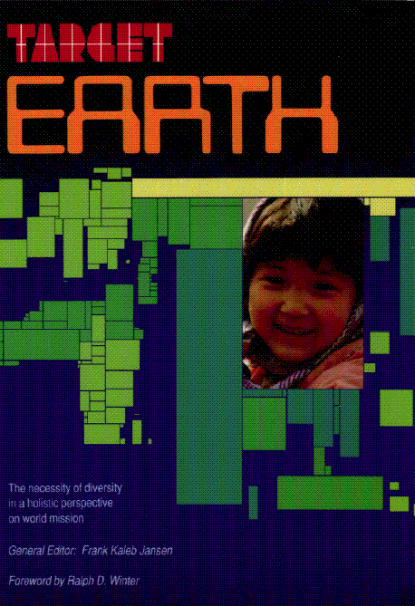 |
·Type: Maps ·Description: The necessity of diversity in a holistic perspective on world mission ·Date: 1989 ·General Editor: Frank Kaleb Jansen ·Producer: Global Mapping International ·Collection: Target Earth ·Size: Category: Collection/Target Earth ·Pages: 175 ·Note: This is a large (84 megabyte) file. ·Categories: Type :: Maps Type :: Documents Continent/Region :: World Topic :: Statistical Topic :: Strategy Topic ::... |
... more info
Max: 1
|
|
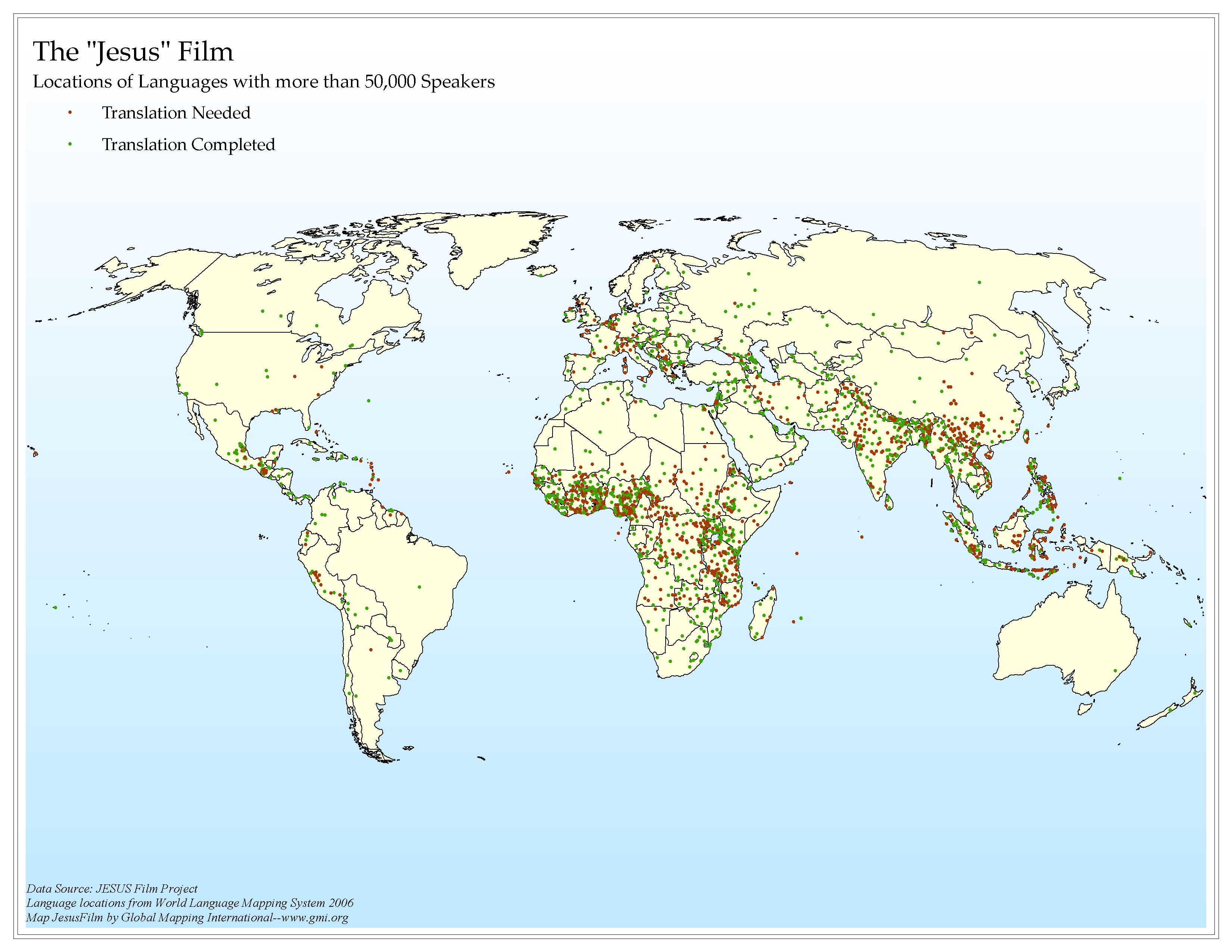 |
·Type: Maps ·Map Date: 2006 ·Data Source: JESUS Film Project Language locations from World Language Mapping System 2006 ·Producer: Global Mapping International ·Collection: Intro to Missions (GMMS 2007) ·Size: 8½ x 11 inches, landscape ·Categories: Type :: Maps Continent/Region :: World Topic :: Statistical Topic :: Strategy Collection :: GMI Map Collections :: Intro to Missions (GMMS 2007) Partners :: Global Mapping International Topic... |
... more info
Max: 1
|
|
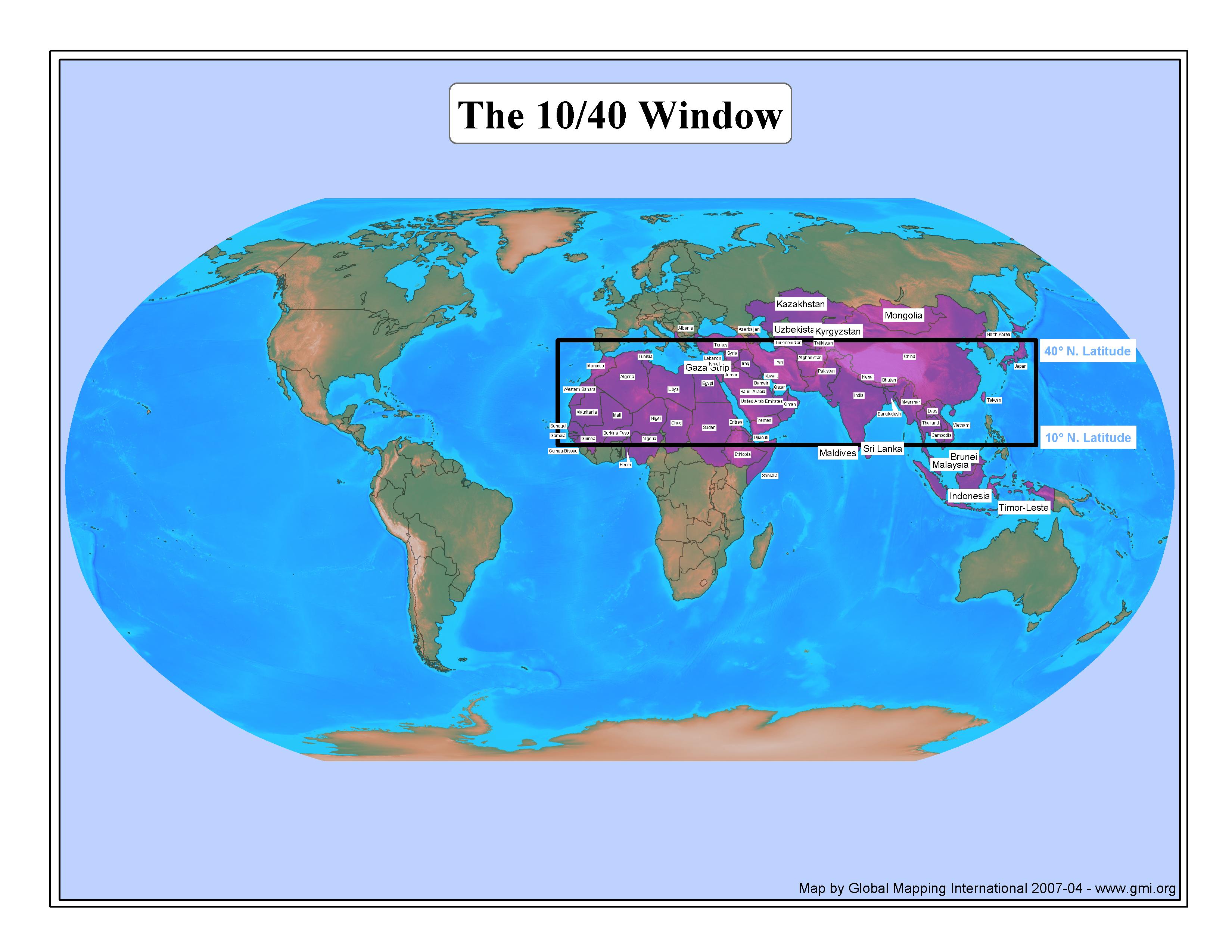 |
·Type: Maps ·Description: This map colors and labels countries in the Pray Through the Window list. This list emphasizes the spiritual need of the country rather than just if the country is geographically inside The 10/40 Window. Thus some spriritual needy countries not geographically inside the Window will be colored and labeled (e.g. North Korea) and some less spiritual needy countries geographically inside the Window (e.g. South Korea) will not be colored and labeled.... |
... more info
Max: 1
|
|
 |
·Full title: The Contribution of Christian Congregations to the Battle with HIV/AIDS at the Community Level ·Date: 23 May 2005 ·Author: Stan Nussbaum ·Producer: Global Mapping International ·Pages: 2 ·Note: At the request of the Oxford Centre for Mission Studies, GMI prepared a global research report on the churches’ response to the HIV/AIDS pandemic for presentation at the Centre's Summer Mission Briefing, June 7-9, 2005, in Oxford. In partnership... |
... more info
Max: 1
|
|
 |
·Full title: The Contribution of Christian Congregations to the Battle with HIV/AIDS at the Community Level (full report) ·Date: 23 May 2005 ·Author: Stan Nussbaum ·Producer: Global Mapping International ·Pages: 75 ·Note: At the request of the Oxford Centre for Mission Studies, GMI prepared a global research report on the churches’ response to the HIV/AIDS pandemic for presentation at the Centre's Summer Mission Briefing, June 7-9, 2005, in Oxford. In... |
... more info
Max: 1
|
|
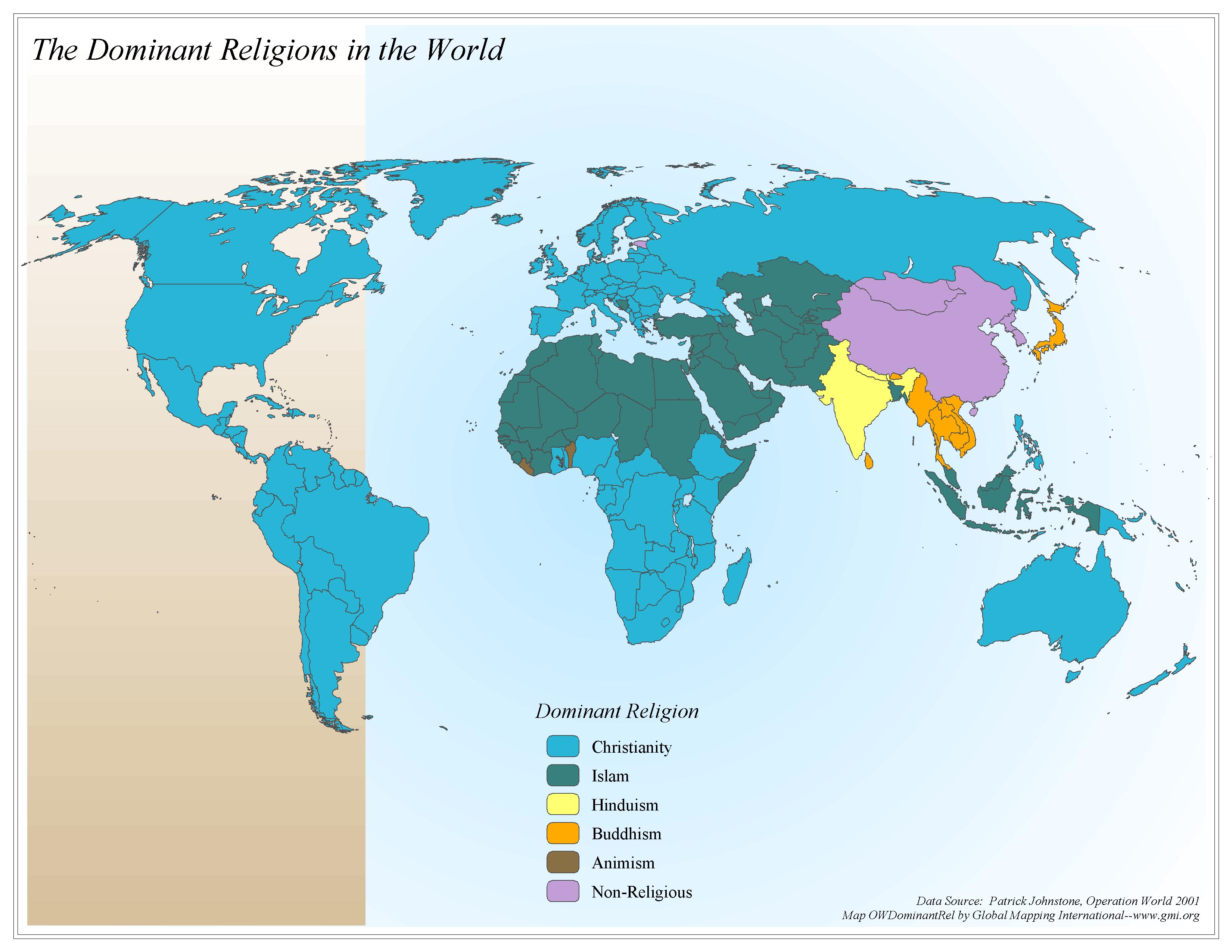 |
·Type: Maps ·Map Date: 2006 ·Data Source: Patrick Johnstone, Operation World 2001 ·Producer: Global Mapping International ·Collection: Operation World (GMMS 2007) ·Size: 8½ x 11 inches, landscape ·Categories: Type :: Maps Continent/Region :: World Topic :: Statistical Collection :: GMI Map Collections :: Operation World (GMMS 2007) Partners :: Global Mapping International Topic :: Religions, General :: Multiple/Other |
... more info
Max: 1
|
|
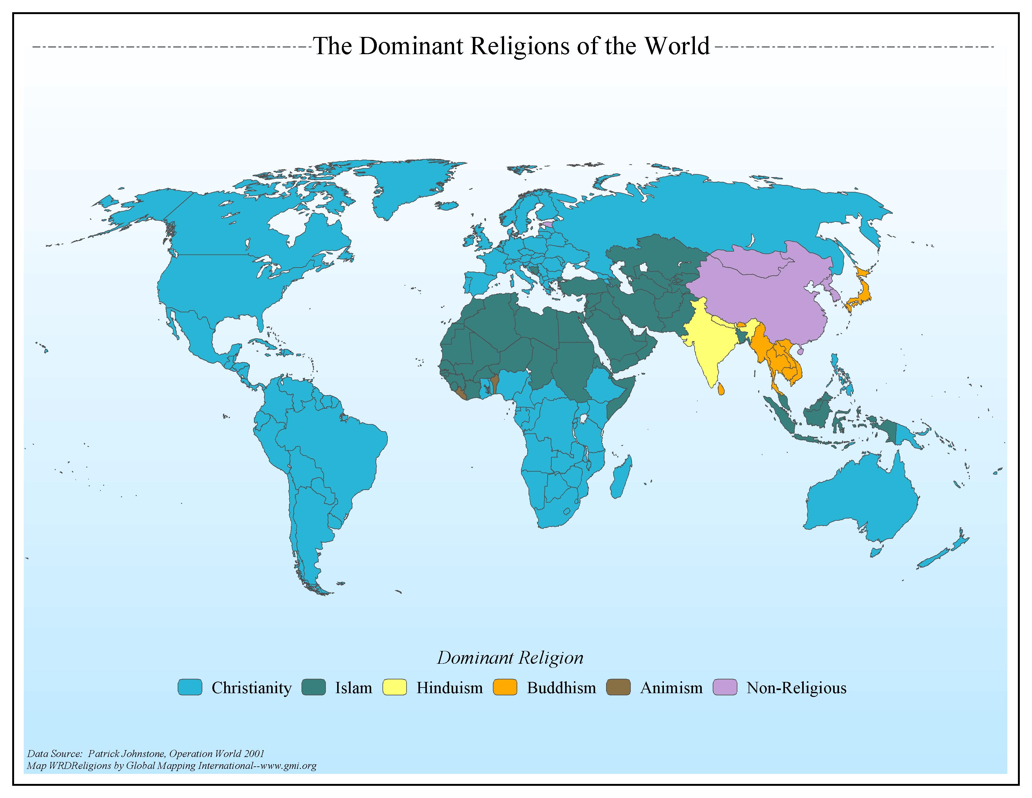 |
·Type: Maps ·Map Date: 2006 ·Data Source: Patrick Johnstone, Operation World 2001 ·Producer: Global Mapping International ·Collection: General World Maps (GMMS 2007) ·Size: 8½ x 11 inches, landscape ·Categories: Type :: Maps Continent/Region :: World Topic :: Statistical Collection :: GMI Map Collections :: General World Maps (GMMS 2007) Partners :: Global Mapping International Topic :: Religions, General :: Multiple/Other |
... more info
Max: 1
|
|
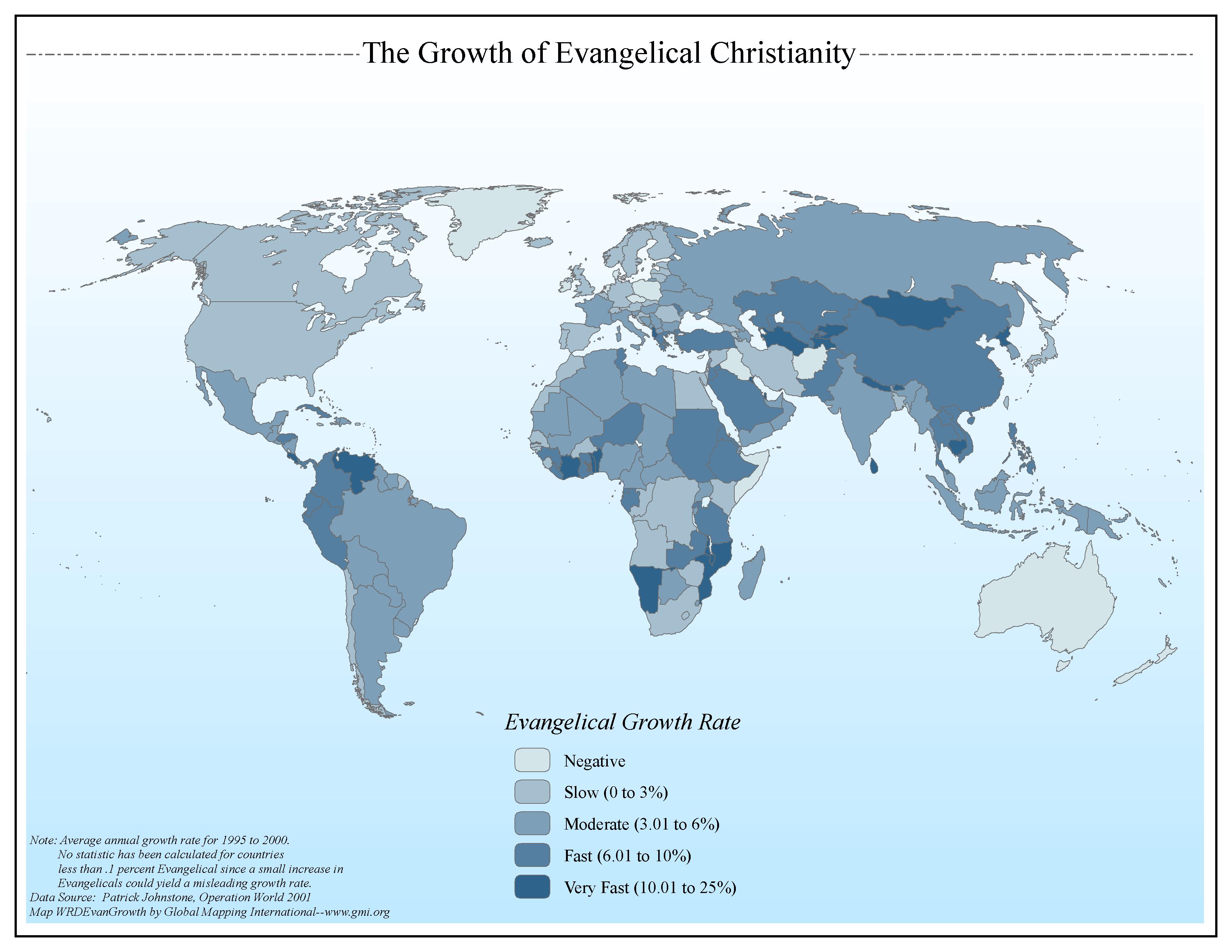 |
·Type: Maps ·Map Date: 2006 ·Data Source: Patrick Johnstone, Operation World 2001 ·Producer: Global Mapping International ·Collection: General World Maps (GMMS 2007) ·Size: 8½ x 11 inches, landscape ·Categories: Type :: Maps Continent/Region :: World Topic :: Statistical Collection :: GMI Map Collections :: General World Maps (GMMS 2007) Partners :: Global Mapping International Topic :: Religions, Christianity :: Adherents, Churches, and... |
... more info
Max: 1
|
|
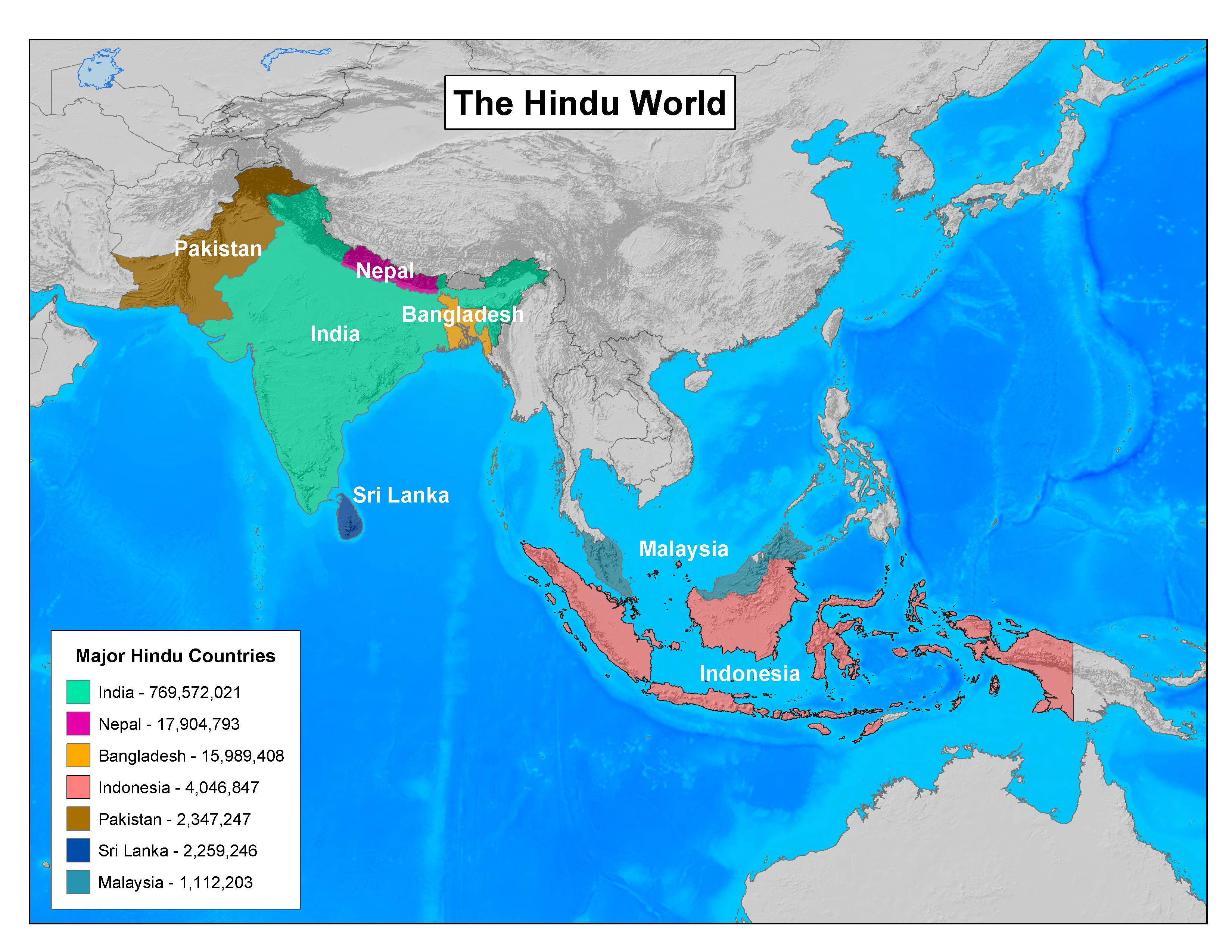 |
·Type: Maps ·Map Date: 2003 ·Producer: GMI ·Collection: Projects 2003 ·Size: 8½ by 11 inches, landscape ·Categories: Type :: Maps Continent/Region :: World Topic :: Statistical Partners :: Global Mapping International Collection :: GMI Map Collections :: Projects 2003 Topic :: Religions, General :: Hinduism |
... more info
Max: 1
|
|
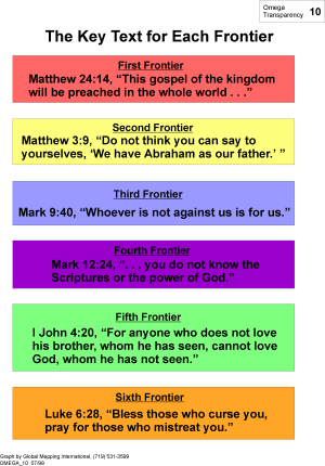 |
·Type: Maps ·Description: The Key Text for the Omega Model Frontiers ·Map Date: 1999 ·Producer: Global Mapping International ·Collection: Omega Model of Mission (WV 2002) ·Size: 8½ x 11 Inches, portrait ·Categories: Type :: Maps Collection :: GMI Map Collections :: Omega Model of Mission (WV 2002) Continent/Region :: World Topic :: Concepts Partners :: Global Mapping International |
... more info
Max: 1
|
|