| Product Image |
Resource Name- |
Price |
Manufacturer |
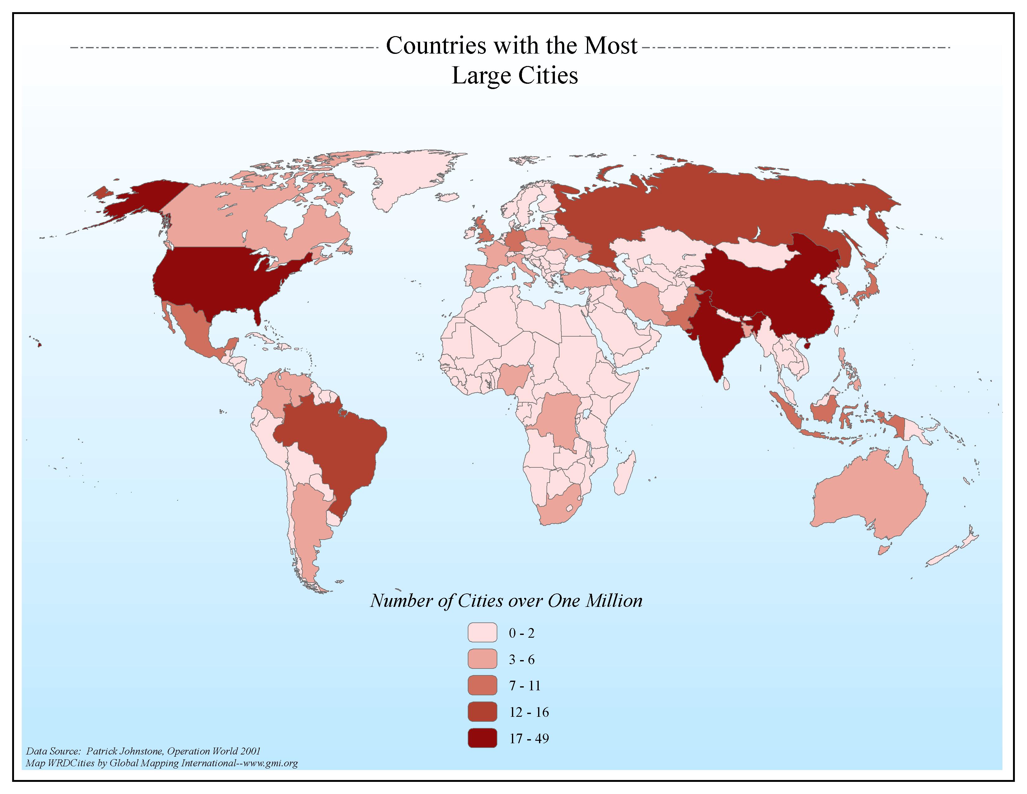 |
·Type: Maps ·Map Date: 2006 ·Data Source: Patrick Johnstone, Operation World 2001 ·Producer: Global Mapping International ·Collection: General World Maps (GMMS 2007) ·Size: 8½ x 11 inches, landscape ·Categories: Type :: Maps Continent/Region :: World Topic :: Statistical Topic :: Demography Collection :: GMI Map Collections :: General World Maps (GMMS 2007) Partners :: Global Mapping International |
... more info
Max: 1
|
|
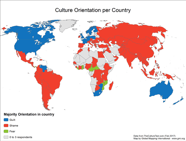 |
· Type: Maps · Map Date: 2017 2017 · Data Source: http://theculturetest.com · Producer: Global Mapping International · Collection: Projects 2017 · Size: 8½ x 11 inches, landscape · Categories: Type :: Maps Continent/Region :: World Topic :: Concepts Topic :: Social Topic :: Research :: Methods Partners :: Jayson Georges Collection :: GMI Map Collections :: Projects 2017 |
... more info
Max: 1
|
|
 |
For current people group data go to People Groups on the Joshua Project website. The above link opens in a new tab. |

Max: 1
|
|
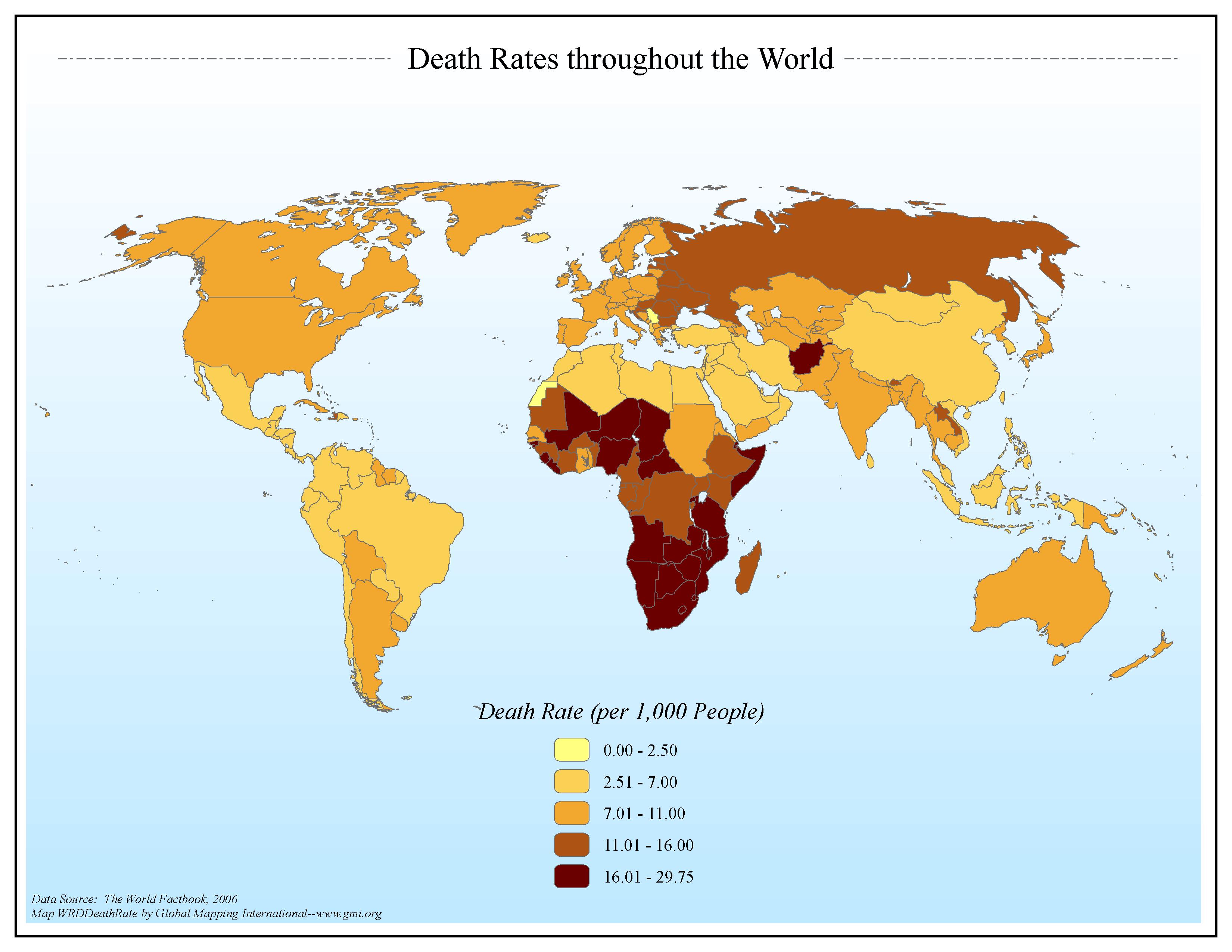 |
·Type: Maps ·Map Date: 2006 ·Data Source: The World Factbook, 2006 ·Producer: Global Mapping International ·Collection: Factbook (GMMS 2007) ·Size: 8½ x 11 inches, landscape ·Categories: Type :: Maps Continent/Region :: World Topic :: Statistical Topic :: Social Collection :: GMI Map Collections :: Factbook (GMMS 2007) Collection :: GMI Map Collections :: General World Maps (GMMS 2007) Partners :: Global Mapping International |
... more info
Max: 1
|
|
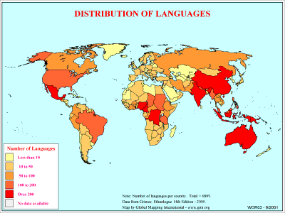 |
·Type: Maps ·Description: Country level divisions of languages in the world ·Map Date: 2000 ·Producer: Global Mapping International ·Collection: General World Maps (WV 2002) ·Size: 8½ x 11 Inches, landscape ·Categories: Type :: Maps Collection :: GMI Map Collections :: General World Maps (WV 2002) Continent/Region :: World Topic :: Statistical Topic :: Peoples, multiple or unknown Partners :: Global Mapping International Topic :: Language... |
... more info
Max: 1
|
|
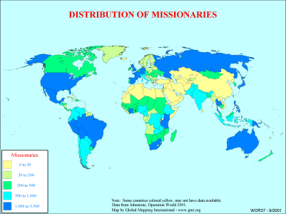 |
·Type: Maps ·Description: Country level distributions of missionaries ·Map Date: 2000 ·Producer: Global Mapping International ·Collection: General World Maps (WV 2002) ·Size: 8½ x 11 Inches, landscape ·Categories: Type :: Maps Collection :: GMI Map Collections :: General World Maps (WV 2002) Continent/Region :: World Topic :: Statistical Partners :: Global Mapping International Topic :: Religions, Christianity :: Adherents, Churches, and... |
... more info
Max: 1
|
|
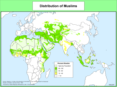 |
·Type: Maps ·Description: Distribution of Muslims ·Map Date: 2000 ·Producer: Global Mapping International ·Collection: The World of Islam (WV 2002) ·Size: 8½ x 11 Inches, landscape ·Categories: Type :: Maps Collection :: GMI Map Collections :: The World of Islam (WV 2002) Continent/Region :: World Topic :: Statistical Partners :: Global Mapping International Topic :: Religions, General :: Islam |
... more info
Max: 1
|
|
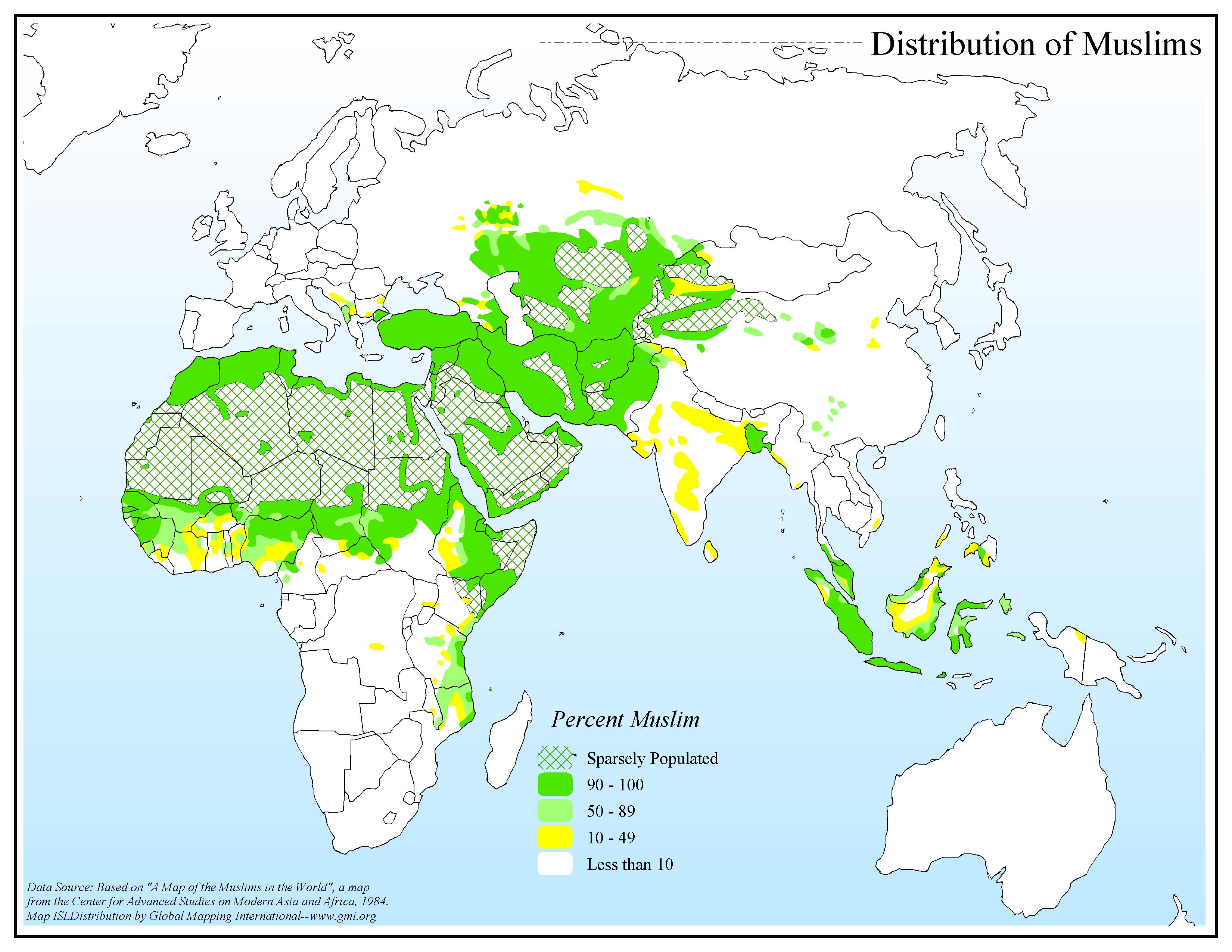 |
·Type: Maps ·Map Date: 2006 ·Data Source: Center for Advanced Studies on Modern Asia and Africa, 1984. ·Producer: Global Mapping International ·Collection: The World of Islam (GMMS 2007) ·Size: 8½ x 11 inches, landscape ·Categories: Type :: Maps Continent/Region :: World Topic :: Statistical Collection :: GMI Map Collections :: The World of Islam (GMMS 2007) Partners :: Global Mapping International Topic :: Religions, General :: Islam |
... more info
Max: 1
|
|
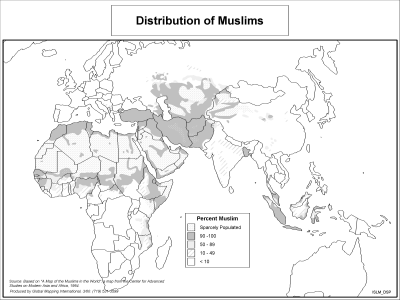 |
·Type: Maps ·Description: Distribution of Muslims ·Map Date: 2002 ·Producer: Global Mapping International ·Collection: The World of Islam (WV 2002) ·Size: 8½ x 11 Inches, landscape ·Categories: Type :: Maps Collection :: GMI Map Collections :: The World of Islam (WV 2002) Continent/Region :: World Topic :: Statistical Partners :: Global Mapping International Topic :: Religions, General :: Islam |
... more info
Max: 1
|
|
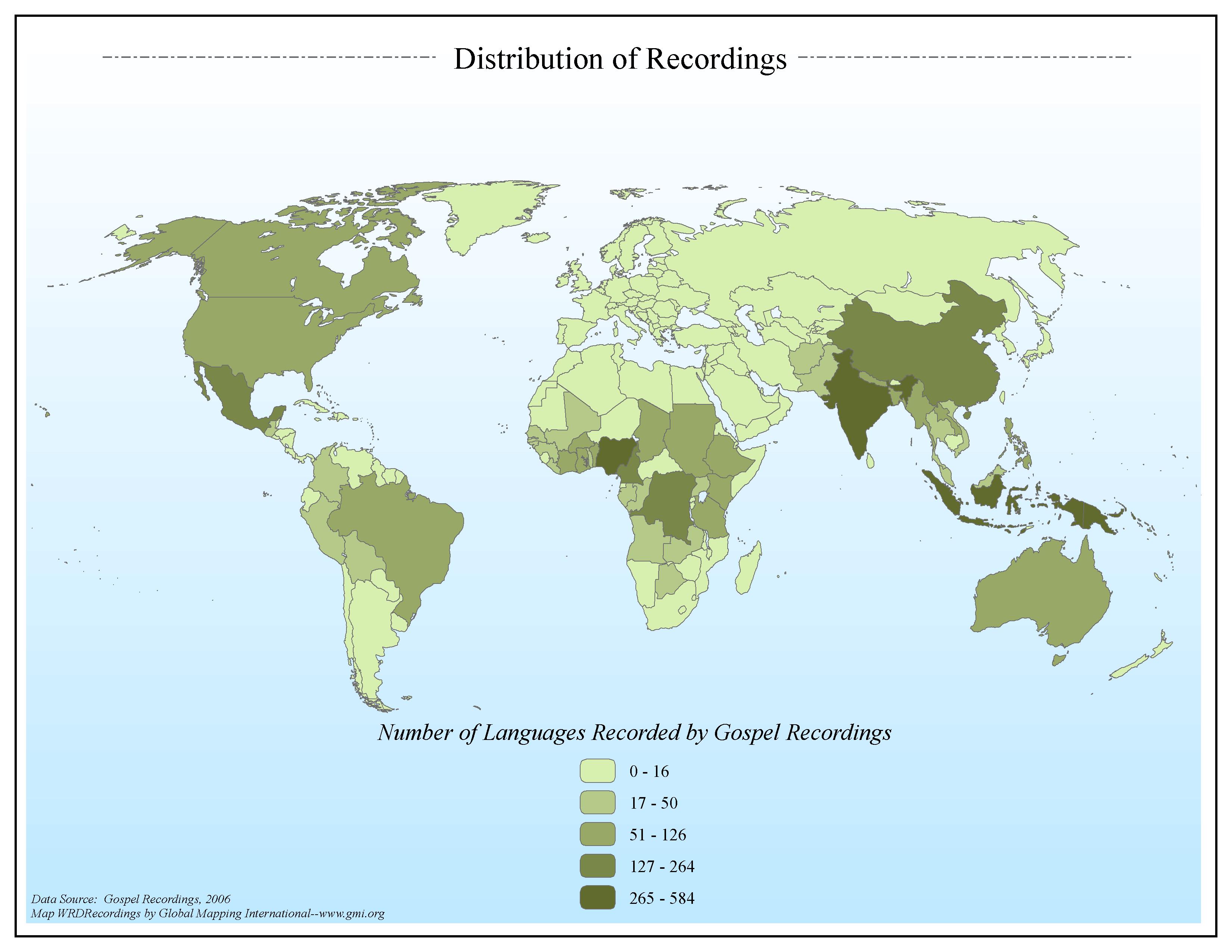 |
·Type: Maps ·Map Date: 2006 ·Data Source: Gospel Recordings, 2006 ·Producer: Global Mapping International ·Collection: General World Maps (GMMS 2007) ·Size: 8½ x 11 inches, landscape ·Categories: Type :: Maps Continent/Region :: World Topic :: Statistical Collection :: GMI Map Collections :: General World Maps (GMMS 2007) Partners :: Global Mapping International Topic :: Language and Translation |
... more info
Max: 1
|
|
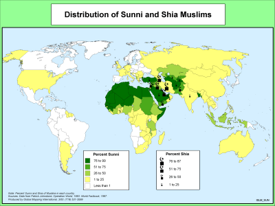 |
·Type: Maps ·Description: Distribution of Sunni and Shia Muslims ·Map Date: 2000 ·Producer: Global Mapping International ·Collection: The World of Islam (WV 2002) ·Size: 8½ x 11 Inches, landscape ·Note: Windows Metafile and Metafile in Word forms of this map require the GMISym.ttf font ·Categories: Type :: Maps Collection :: GMI Map Collections :: The World of Islam (WV 2002) Continent/Region :: World Topic :: Statistical Partners... |
... more info
Max: 1
|
|
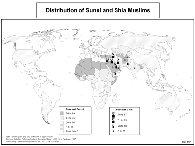 |
·Type: Maps ·Description: Distribution of Sunni and Shia Muslims ·Map Date: 2002 ·Producer: Global Mapping International ·Collection: The World of Islam (WV 2002) ·Size: 8½ x 11 Inches, landscape ·Note: Windows Metafile and Metafile in Word forms of this map require the GMISym.ttf font ·Categories: Type :: Maps Collection :: GMI Map Collections :: The World of Islam (WV 2002) Continent/Region :: World Topic :: Statistical Partners... |
... more info
Max: 1
|
|
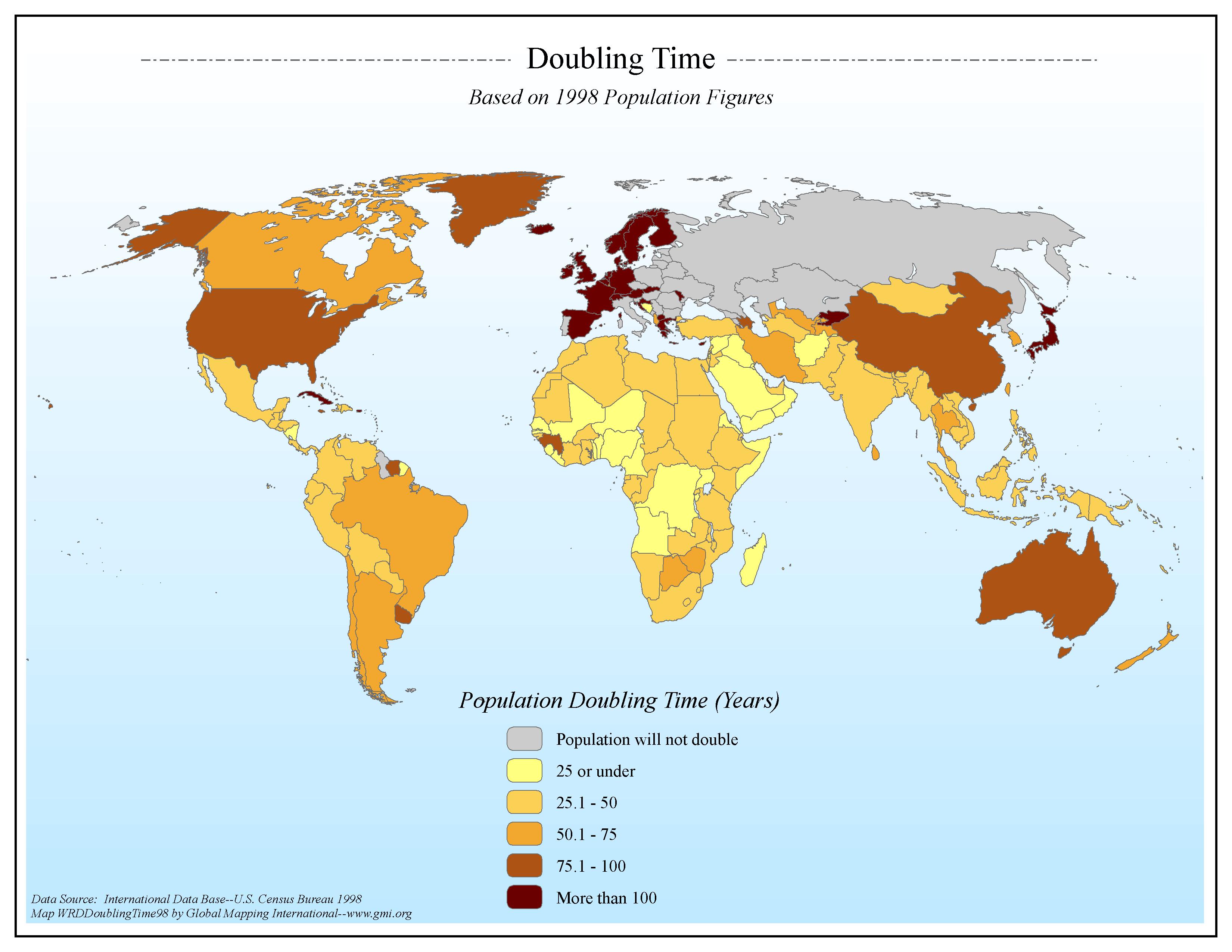 |
·Type: Maps ·Map Date: 2006 ·Data Source: International Data Base--U.S. Census Bureau 1998 ·Producer: Global Mapping International ·Collection: General World Maps (GMMS 2007) ·Size: 8½ x 11 inches, landscape ·Categories: Type :: Maps Continent/Region :: World Topic :: Statistical Topic :: Demography Collection :: GMI Map Collections :: General World Maps (GMMS 2007) Partners :: Global Mapping International |
... more info
Max: 1
|
|
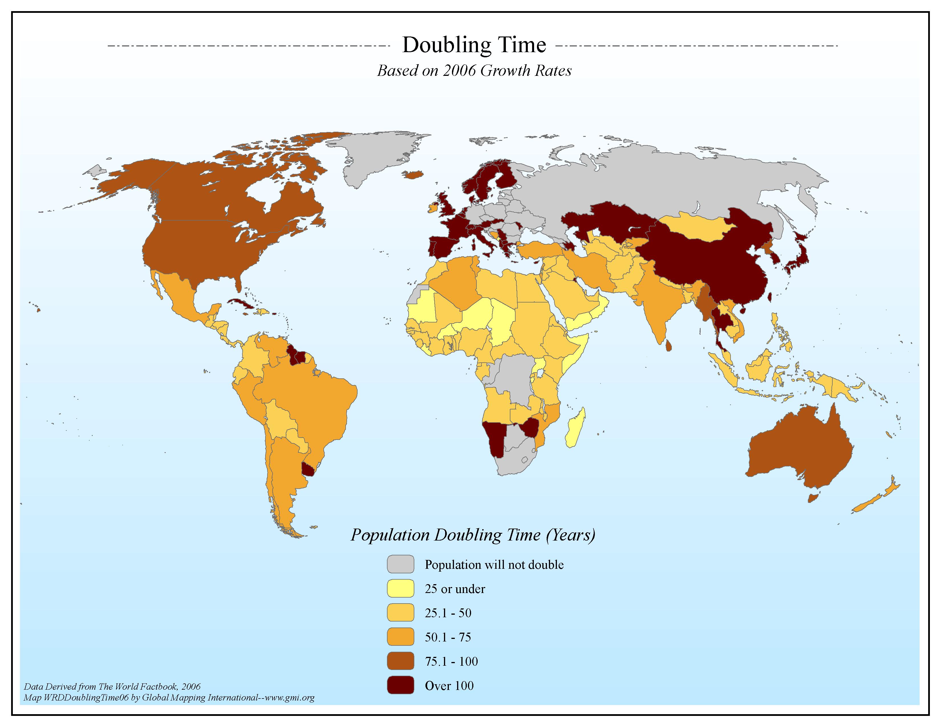 |
·Type: Maps ·Map Date: 2006 ·Data Source: Data Derived from The World Factbook, 2006 ·Producer: Global Mapping International ·Collection: Factbook (GMMS 2007) ·Size: 8½ x 11 inches, landscape ·Categories: Type :: Maps Continent/Region :: World Topic :: Statistical Topic :: Demography Collection :: GMI Map Collections :: Factbook (GMMS 2007) Collection :: GMI Map Collections :: General World Maps (GMMS 2007) Partners :: Global Mapping... |
... more info
Max: 1
|
|
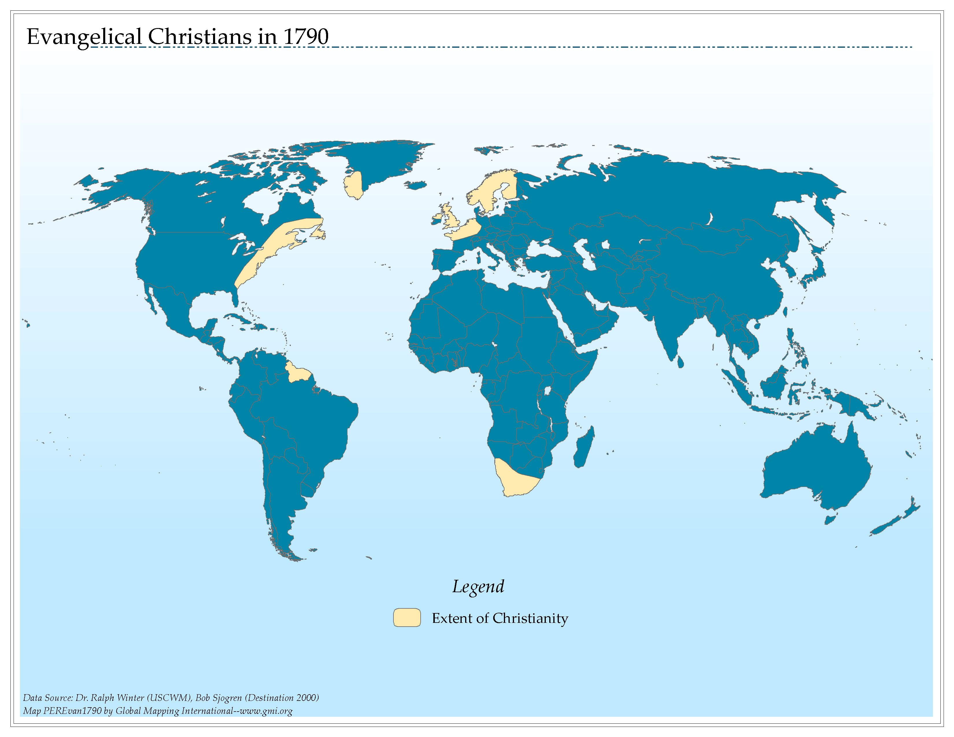 |
·Type: Maps ·Map Date: 2006 ·Data Source: Dr. Ralph Winter (USCWM), Bob Sjogren (Destination 2000) ·Producer: Global Mapping International ·Collection: Worldwide Perspectives GMMS 2007 ·Size: 8½ x 11 inches, landscape ·Categories: Type :: Maps Continent/Region :: World Topic :: History Partners :: Global Mapping International Collection :: GMI Map Collections :: Worldwide Perspectives GMMS 2007 Topic :: Religions, Christianity ::... |
... more info
Max: 1
|
|
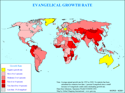 |
·Type: Maps ·Description: Country level divisions of the evangelical growth rate ·Map Date: 2000 ·Producer: Global Mapping International ·Collection: General World Maps (WV 2002) ·Size: 8½ x 11 Inches, landscape ·Categories: Type :: Maps Collection :: GMI Map Collections :: General World Maps (WV 2002) Continent/Region :: World Topic :: Statistical Partners :: Global Mapping International Topic :: Religions, Christianity :: Adherents,... |
... more info
Max: 1
|
|
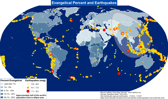 |
· Type: Maps · Map Date: 2017 · Data Source: Operation World (2010) DVD, http://earthquake.usgs.gov/earthquakes - 11/2014 – 11/2017, https://www.cntraveler.com/story/more-than-half-the-worlds-population-lives-inside-this-circle · Producer: Global Mapping International · Collection: Projects 2017 · Size: 8½ x 11 inches, landscape · Categories: Type :: Maps Continent/Region :: World Topic :: Demography... |
... more info
Max: 1
|
|
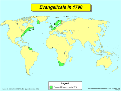 |
·Type: Maps ·Description: Evangelicals in 1790 ·Map Date: 2002 ·Producer: Global Mapping International ·Collection: Worldwide Perspectives (WV 2002) ·Size: 8½ x 11 Inches, landscape ·Categories: Type :: Maps Collection :: GMI Map Collections :: Worldwide Perspectives (WV 2002) Continent/Region :: World Topic :: History Partners :: Global Mapping International Topic :: Religions, Christianity :: Adherents, Churches, and Denoms |
... more info
Max: 1
|
|
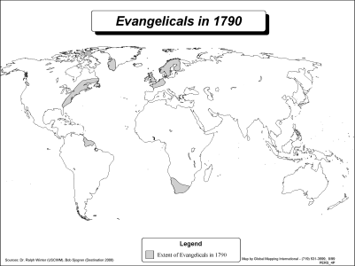 |
·Type: Maps ·Description: Evangelicals in 1790 ·Map Date: 2002 ·Producer: Global Mapping International ·Collection: Worldwide Perspectives (WV 2002) ·Size: 8½ x 11 Inches, landscape ·Categories: Type :: Maps Collection :: GMI Map Collections :: Worldwide Perspectives (WV 2002) Continent/Region :: World Topic :: History Partners :: Global Mapping International Topic :: Religions, Christianity :: Adherents, Churches, and Denoms |
... more info
Max: 1
|
|
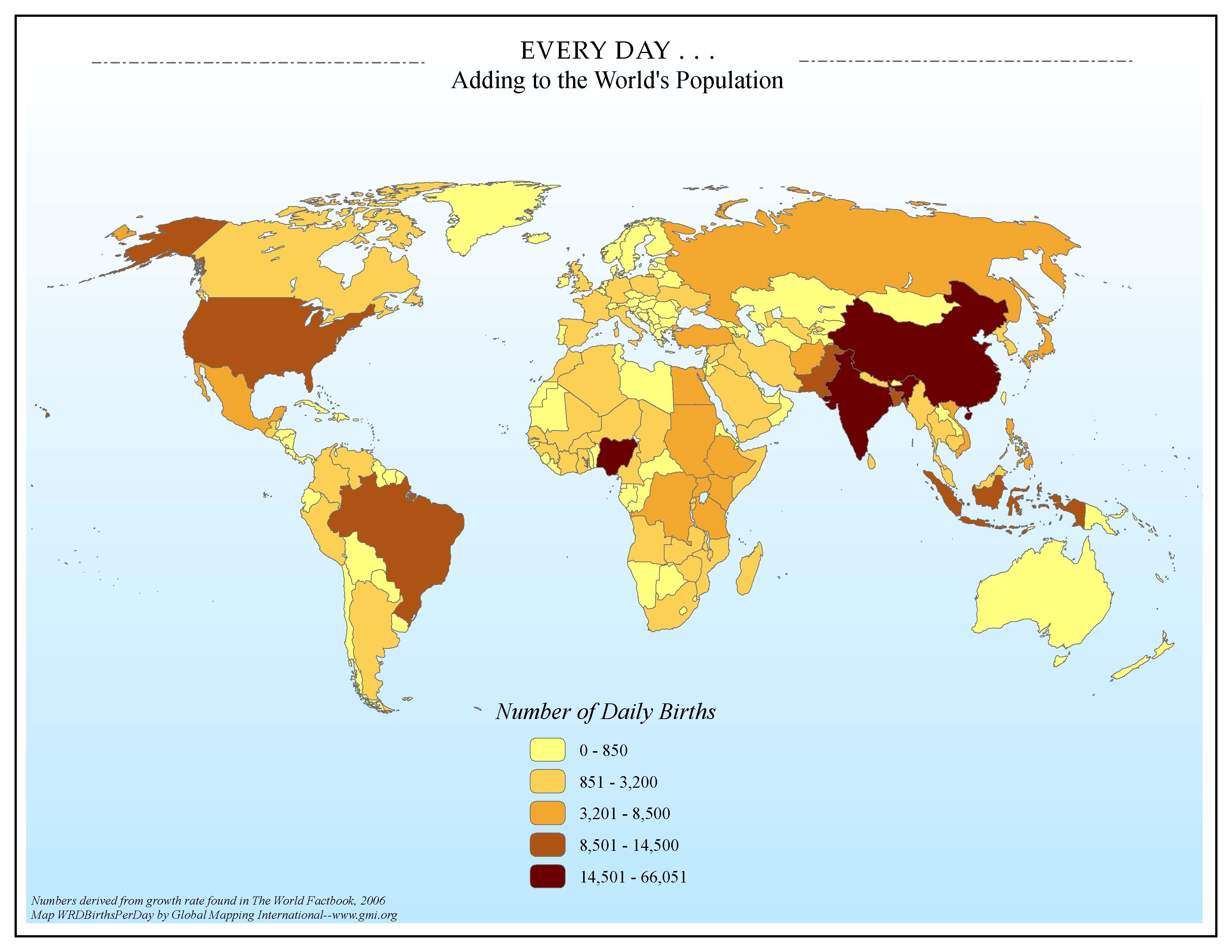 |
·Type: Maps ·Map Date: 2006 ·Data Source: Numbers derived from growth rate found in The World Factbook, 2006 ·Producer: Global Mapping International ·Collection: Factbook (GMMS 2007) ·Size: 8½ x 11 inches, landscape ·Categories: Type :: Maps Continent/Region :: World Topic :: Statistical Topic :: Demography Collection :: GMI Map Collections :: Factbook (GMMS 2007) Collection :: GMI Map Collections :: General World Maps (GMMS 2007) Partners :: Global Mapping International |
... more info
Max: 1
|
|
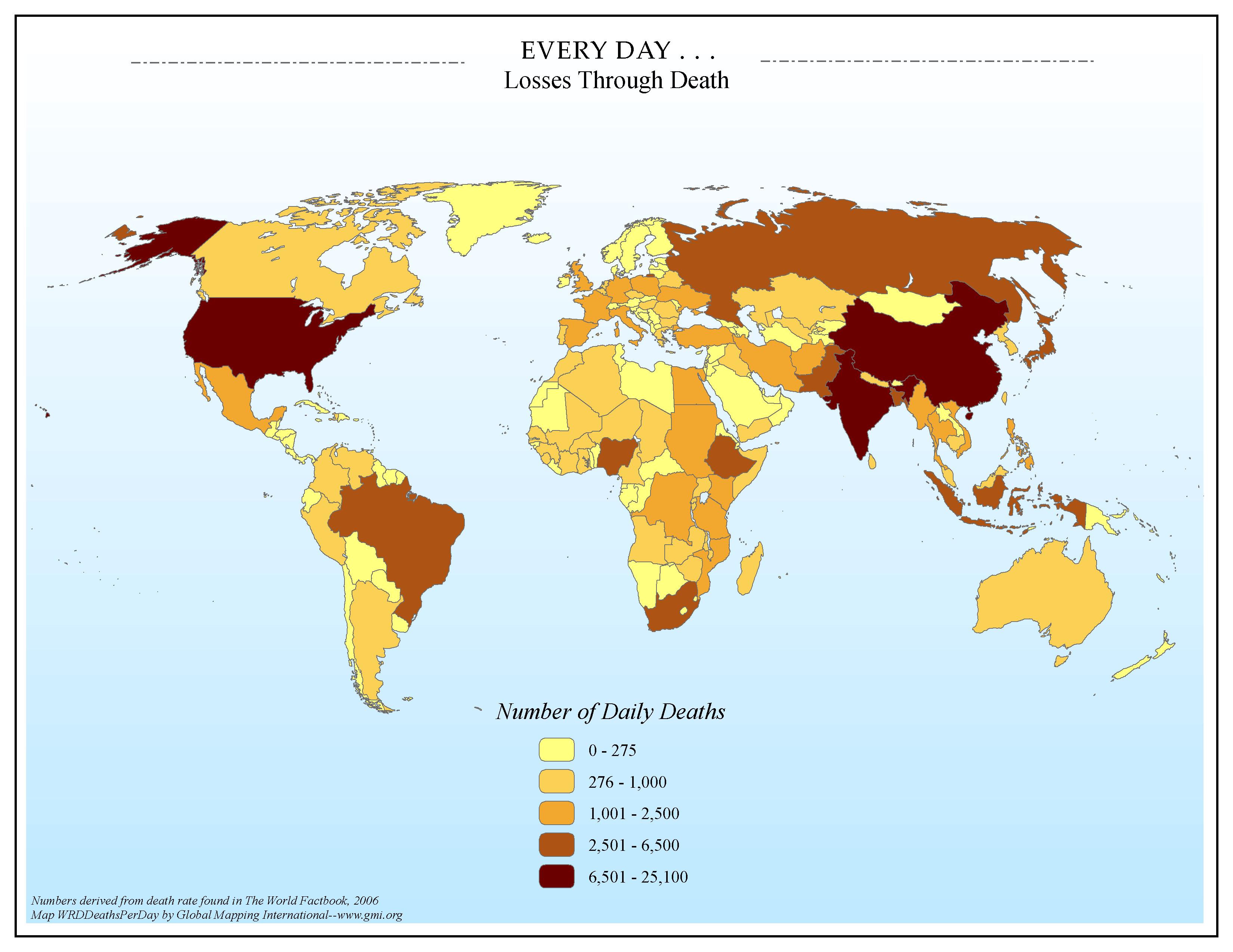 |
·Type: Maps ·Map Date: 2006 ·Data Source: Numbers derived from death rate found in The World Factbook, 2006 ·Producer: Global Mapping International ·Collection: Factbook (GMMS 2007) ·Size: 8½ x 11 inches, landscape ·Categories: Type :: Maps Continent/Region :: World Topic :: Statistical Topic :: Social Collection :: GMI Map Collections :: Factbook (GMMS 2007) Collection :: GMI Map Collections :: General World Maps (GMMS 2007) Partners ::... |
... more info
Max: 1
|
|
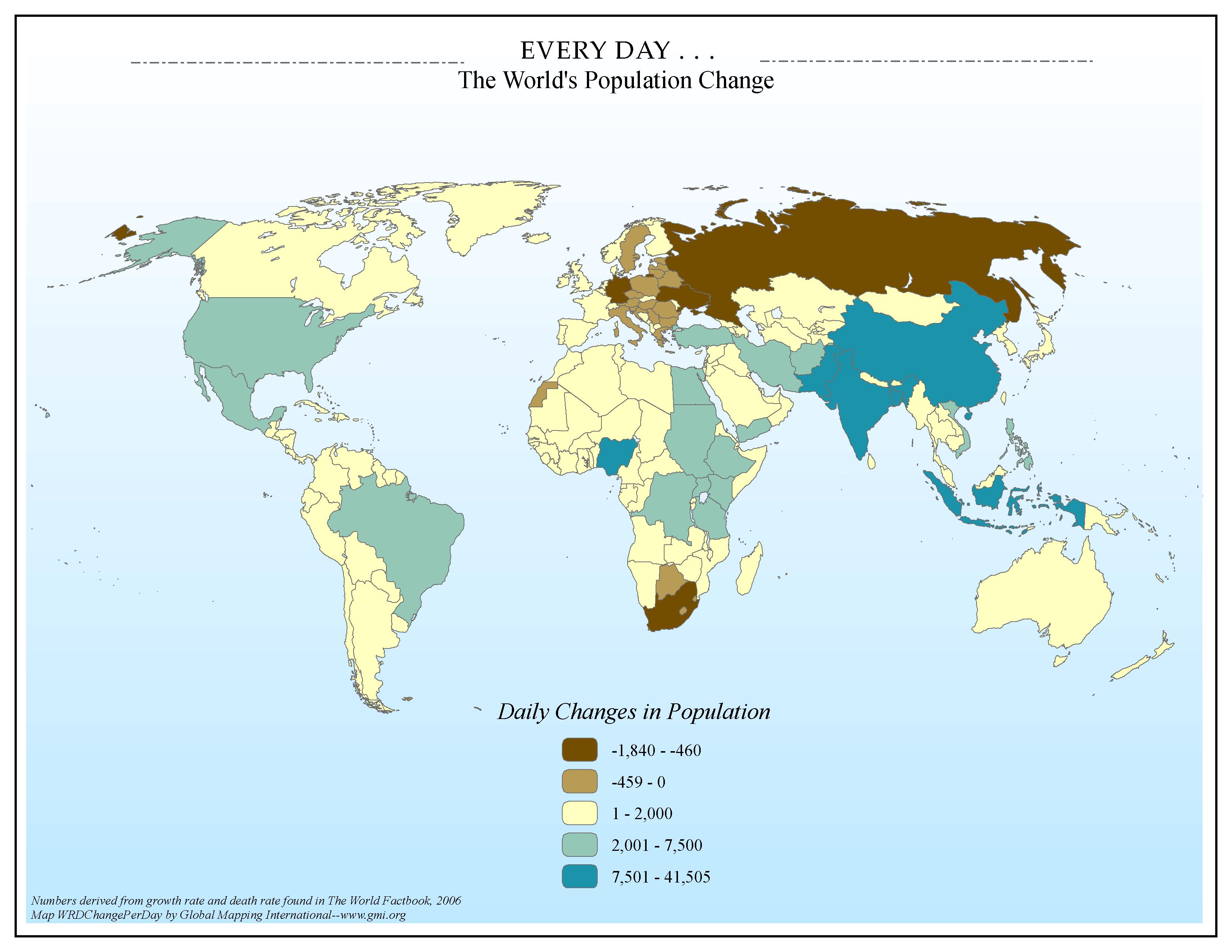 |
·Type: Maps ·Map Date: 2006 ·Data Source: Numbers derived from growth rate and death rate found in The World Factbook, 2006 ·Producer: Global Mapping International ·Collection: Factbook (GMMS 2007) ·Size: 8½ x 11 inches, landscape ·Categories: Type :: Maps Continent/Region :: World Topic :: Statistical Topic :: Demography Collection :: GMI Map Collections :: Factbook (GMMS 2007) Collection :: GMI Map Collections :: General World Maps (GMMS 2007) Partners :: Global Mapping International |
... more info
Max: 1
|
|
 |
·Type: Maps ·Description: Prophesying to the Bible-Oriented is the Fith Frontier ·Map Date: 1999 ·Producer: Global Mapping International ·Collection: Omega Model of Mission (WV 2002) ·Size: 8½ x 11 Inches, landscape ·Categories: Type :: Maps Collection :: GMI Map Collections :: Omega Model of Mission (WV 2002) Continent/Region :: World Topic :: Strategy Topic :: Concepts Partners :: Global Mapping International |
... more info
Max: 1
|
|
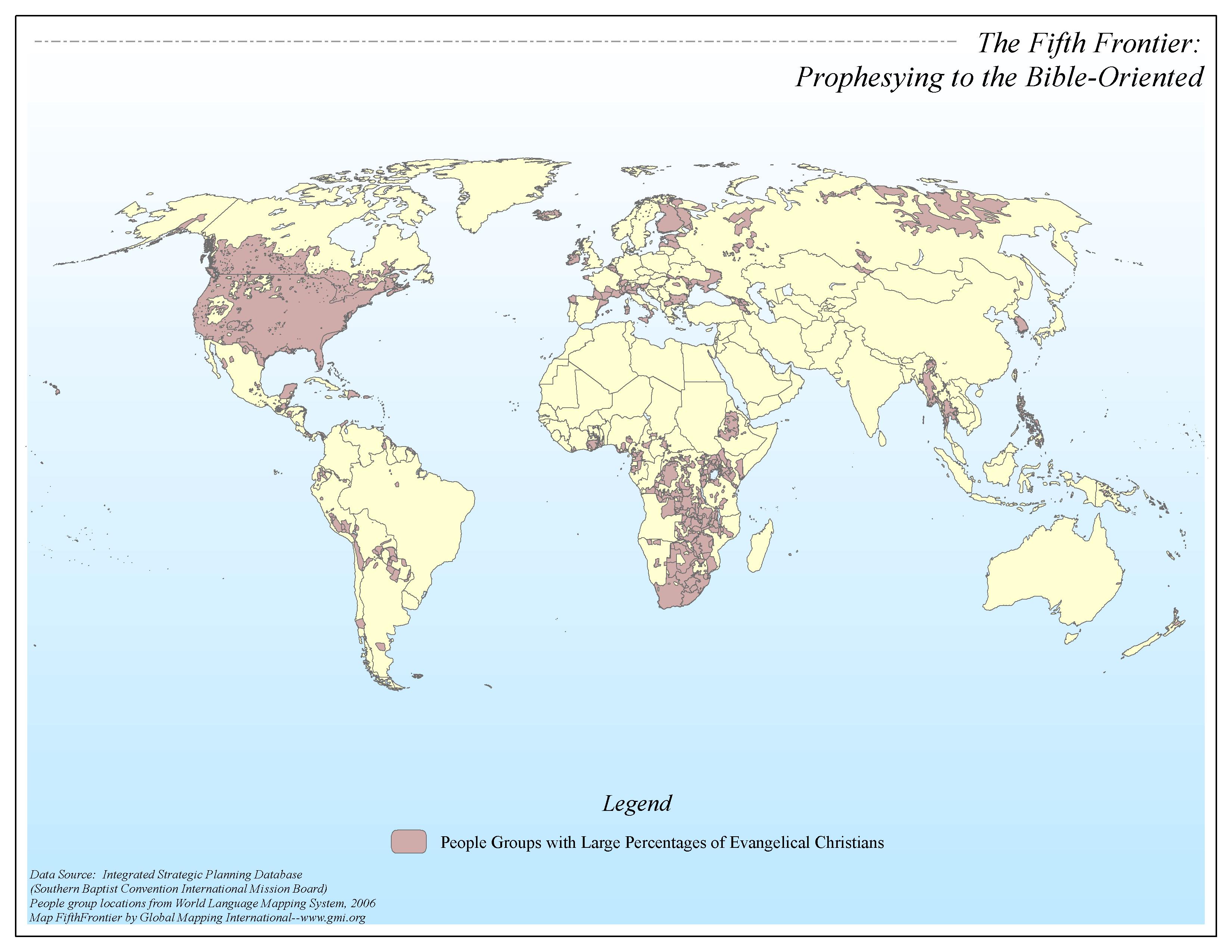 |
·Type: Maps ·Map Date: 2006 ·Data Source: Integrated Strategic Planning Database (SBC-IMB) People group locations from World Language Mapping System, 2006 ·Producer: Global Mapping International ·Collection: Omega Model of Mission GMMS 2007 ·Size: 8½ x 11 inches, landscape ·Categories: Type :: Maps Continent/Region :: World Topic :: Strategy Topic :: Concepts Collection :: GMI Map Collections :: Omega Model of Mission GMMS 2007 Partners... |
... more info
Max: 1
|
|
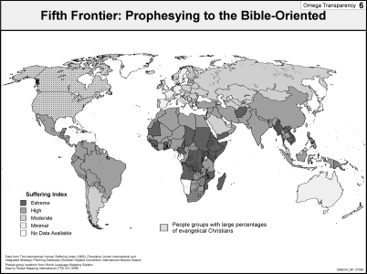 |
·Type: Maps ·Description: Prophesying to the Bible-Oriented is the Fith Frontier ·Map Date: 2002 ·Producer: Global Mapping International ·Collection: Omega Model of Mission (WV 2002) ·Size: 8½ x 11 Inches, landscape ·Categories: Type :: Maps Collection :: GMI Map Collections :: Omega Model of Mission (WV 2002) Continent/Region :: World Topic :: Strategy Topic :: Concepts Partners :: Global Mapping International |
... more info
Max: 1
|
|