| Product Image |
Resource Name |
Price |
Manufacturer+ |
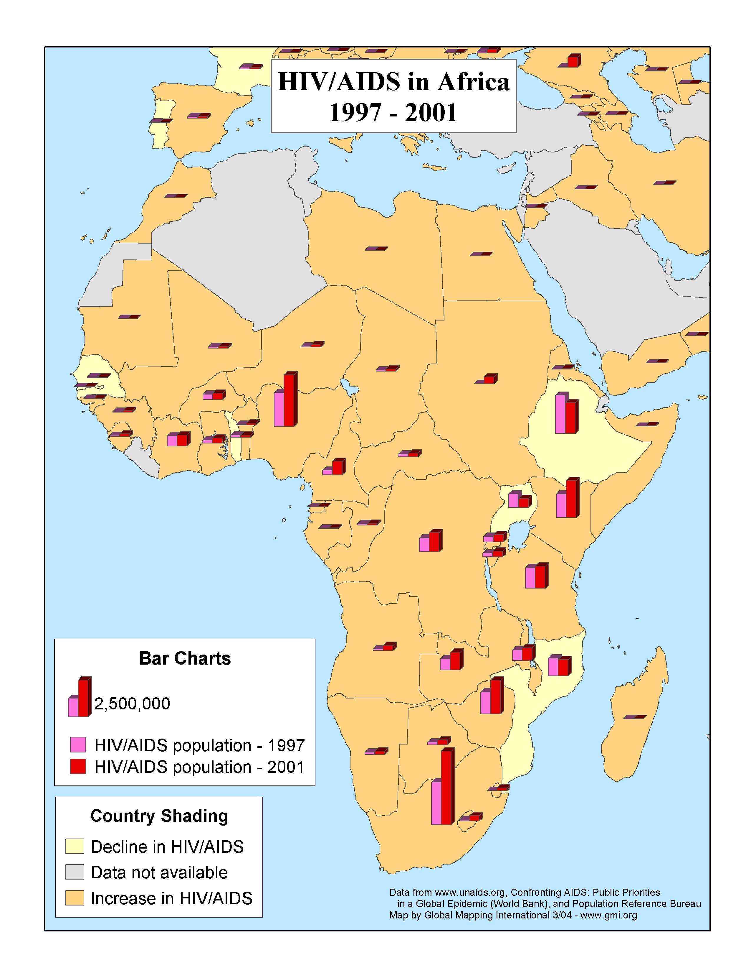 |
·Type: Maps ·Description: A comparison of AIDS/HIV prevalence rates in Africa in the years 1997 an ·Map Date: 2004 ·Data Source: www.unaids.org; Confronting AIDS: Public Priorities in a Global Epidemic (World Bank); Population Refer ·Producer: GMI ·Collection: Projects 2004 ·Size: Size: 8½ by 11 inches, portrait ·Categories: Type :: Maps Continent/Region :: Africa Topic :: Statistical Partners :: Global Mapping International... |
... more info
Max: 1
|
|
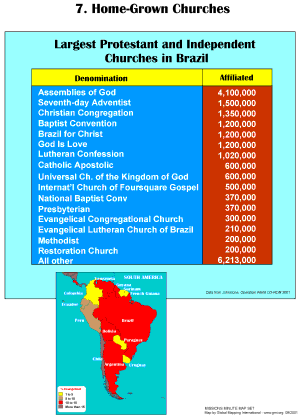 |
·Type: Maps ·Description: The Spread of Home Grown Churches ·Map Date: 2001 ·Producer: Global Mapping International ·Collection: Missions Minute (WorldVue 2002) ·Size: 8½ x 11 Inches, portrait ·Categories: Type :: Maps Collection :: GMI Map Collections :: Missions Minute (WorldVue 2002) Topic :: Statistical Topic :: Strategy Topic :: Concepts Type :: Graphs Country :: Brazil Partners :: Global Mapping International Topic :: Religions,... |
... more info
Max: 1
|
|
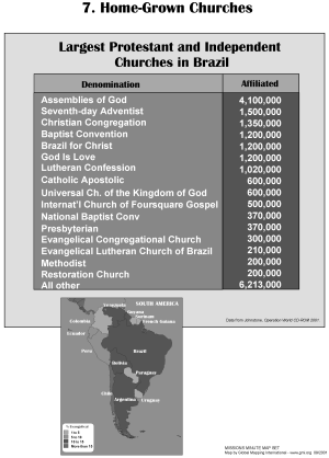 |
·Type: Maps ·Description: The Spread of Home Grown Churches ·Map Date: 2002 ·Producer: Global Mapping International ·Collection: Missions Minute (WorldVue 2002) ·Size: 8½ x 11 Inches, portrait ·Categories: Type :: Maps Collection :: GMI Map Collections :: Missions Minute (WorldVue 2002) Topic :: Statistical Topic :: Strategy Topic :: Concepts Type :: Graphs Country :: Brazil Partners :: Global Mapping International Topic :: Religions,... |
... more info
Max: 1
|
|
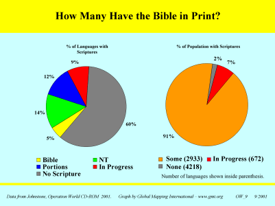 |
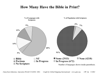
·Type: Maps ·Description: Countries with the Bible in Print ·Map Date: 2001 ·Producer: Global Mapping International ·Collection: Operation World (WorldVue 2002) ·Size: 8½ x 11 Inches, landscape ·Categories: Type :: Maps Collection :: GMI Map Collections :: Operation World (WorldVue 2002) Continent/Region :: World Topic :: Statistical Type :: Graphs Partners :: Global Mapping International |
... more info
Max: 1
|
|
 |
·Type: Maps ·Description: Countries with the Bible in Print ·Map Date: 2002 ·Producer: Global Mapping International ·Collection: Operation World (WorldVue 2002) ·Size: 8½ x 11 Inches, landscape ·Categories: Type :: Maps Collection :: GMI Map Collections :: Operation World (WorldVue 2002) Continent/Region :: World Topic :: Statistical Type :: Graphs Partners :: Global Mapping International |
... more info
Max: 1
|
|
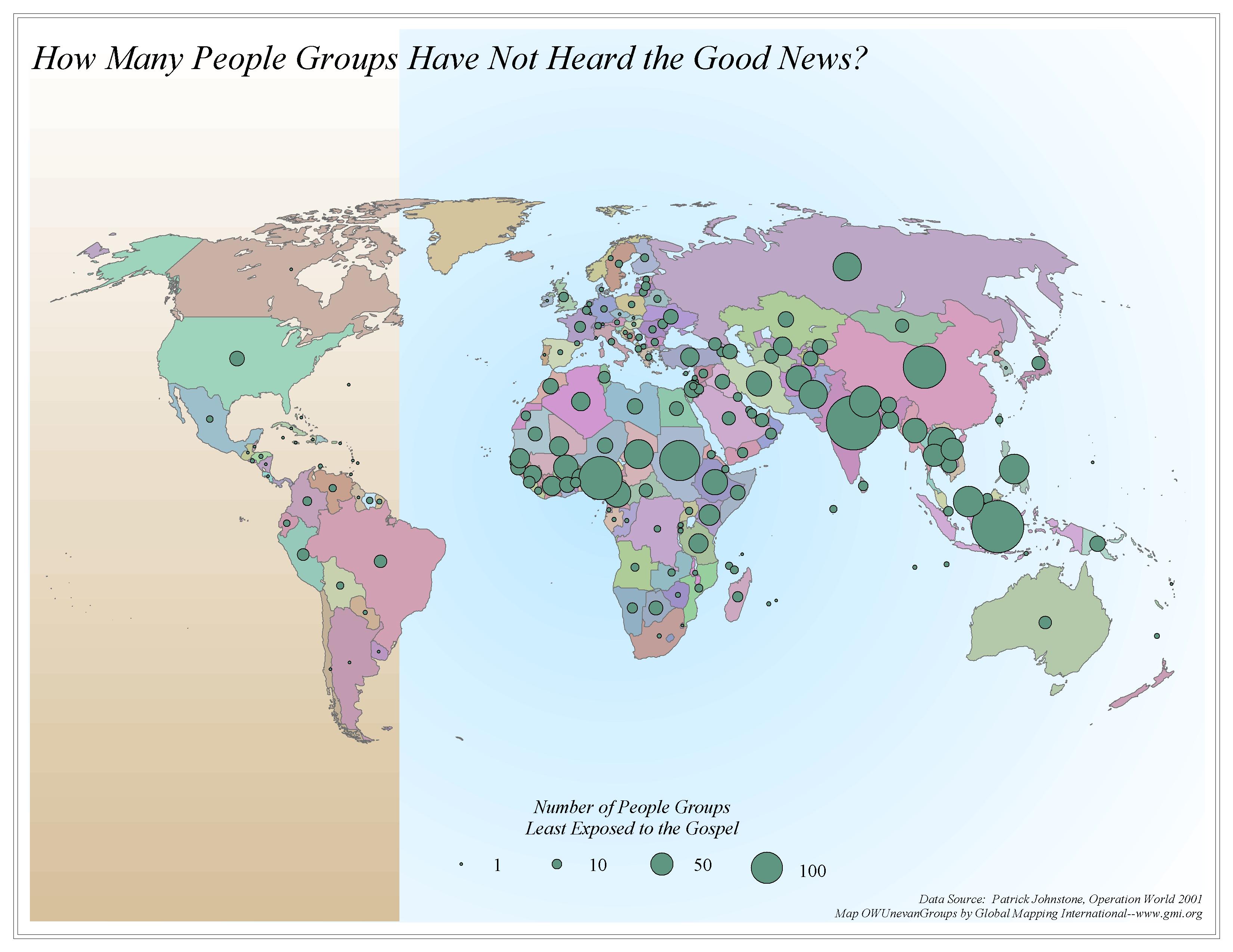 |
·Type: Maps ·Map Date: 2006 ·Data Source: Patrick Johnstone, Operation World 2001 ·Producer: Global Mapping International ·Collection: Operation World (GMMS 2007) ·Size: 8½ x 11 inches, landscape ·Categories: Type :: Maps Continent/Region :: World Topic :: Statistical Topic :: Peoples, multiple or unknown Collection :: GMI Map Collections :: Operation World (GMMS 2007) Partners :: Global Mapping International |
... more info
Max: 1
|
|
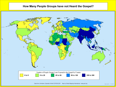 |
·Type: Maps ·Description: People groups that have not heard the gospel ·Map Date: 2001 ·Producer: Global Mapping International ·Collection: Operation World (WorldVue 2002) ·Size: 8½ x 11 Inches, landscape ·Categories: Type :: Maps Collection :: GMI Map Collections :: Operation World (WorldVue 2002) Continent/Region :: World Topic :: Statistical Topic :: Peoples, multiple or unknown Partners :: Global Mapping International |
... more info
Max: 1
|
|
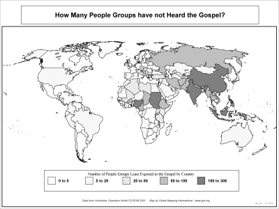 |
·Type: Maps ·Description: People groups that have not heard the gospel ·Map Date: 2002 ·Producer: Global Mapping International ·Collection: Operation World (WorldVue 2002) ·Size: 8½ x 11 Inches, landscape ·Categories: Type :: Maps Collection :: GMI Map Collections :: Operation World (WorldVue 2002) Continent/Region :: World Topic :: Statistical Topic :: Peoples, multiple or unknown Partners :: Global Mapping International |
... more info
Max: 1
|
|
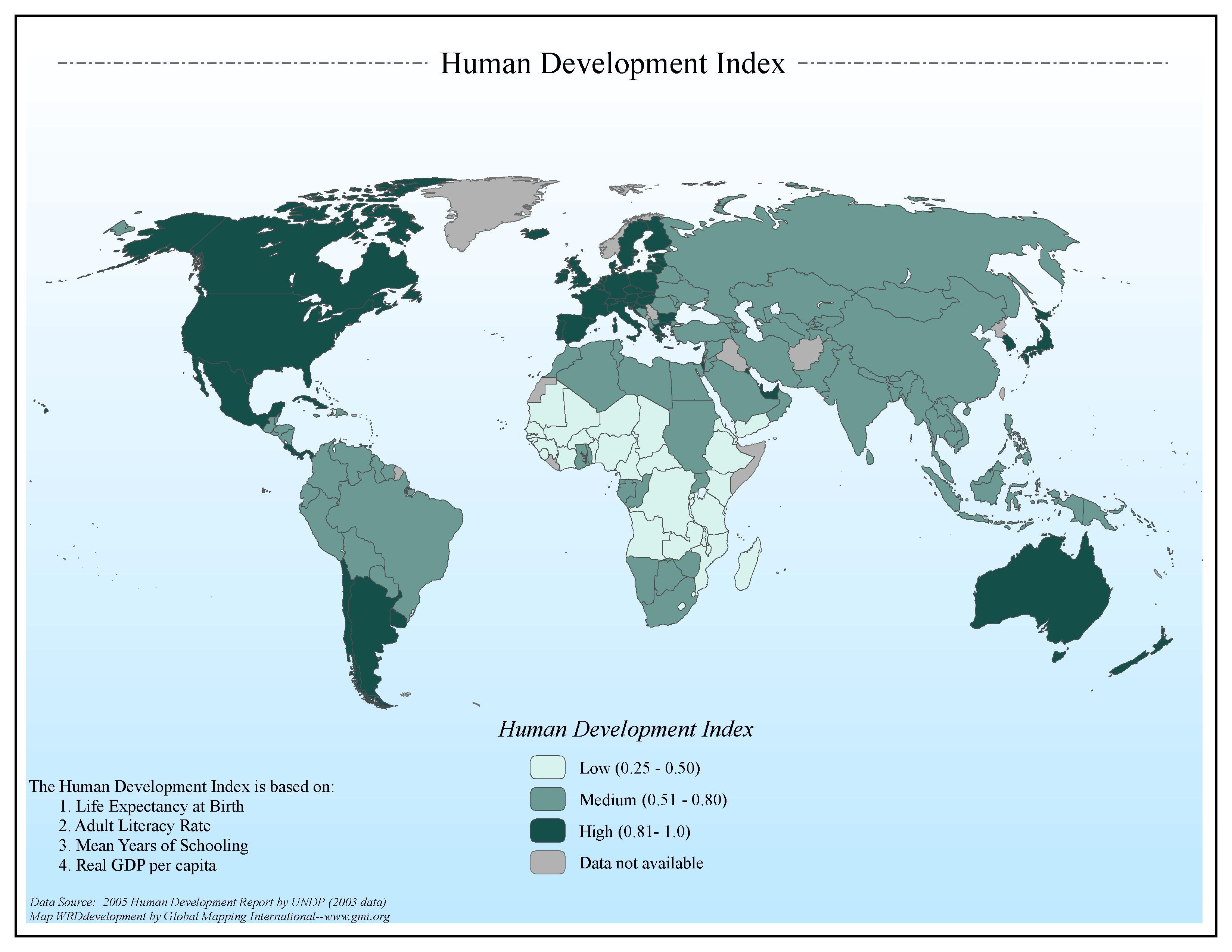 |
·Type: Maps ·Map Date: 2006 ·Data Source: 2005 Human Development Report by UNDP (2003 data) ·Producer: Global Mapping International ·Collection: General World Maps (GMMS 2007) ·Size: 8½ x 11 inches, landscape ·Categories: Type :: Maps Continent/Region :: World Topic :: Statistical Topic :: Social Collection :: GMI Map Collections :: General World Maps (GMMS 2007) Partners :: Global Mapping International |
... more info
Max: 1
|
|
 |
·Type: Maps ·Description: Index of Human Suffering Worldwide ·Map Date: 1992 ·Producer: Global Mapping International ·Collection: Intro to Mission (WorldVue 2002) ·Size: 8½ x 11 Inches, landscape ·Categories: Type :: Maps Collection :: GMI Map Collections :: Intro to Mission (WorldVue 2002) Continent/Region :: World Topic :: Statistical Topic :: Social Partners :: Global Mapping International |
... more info
Max: 1
|
|
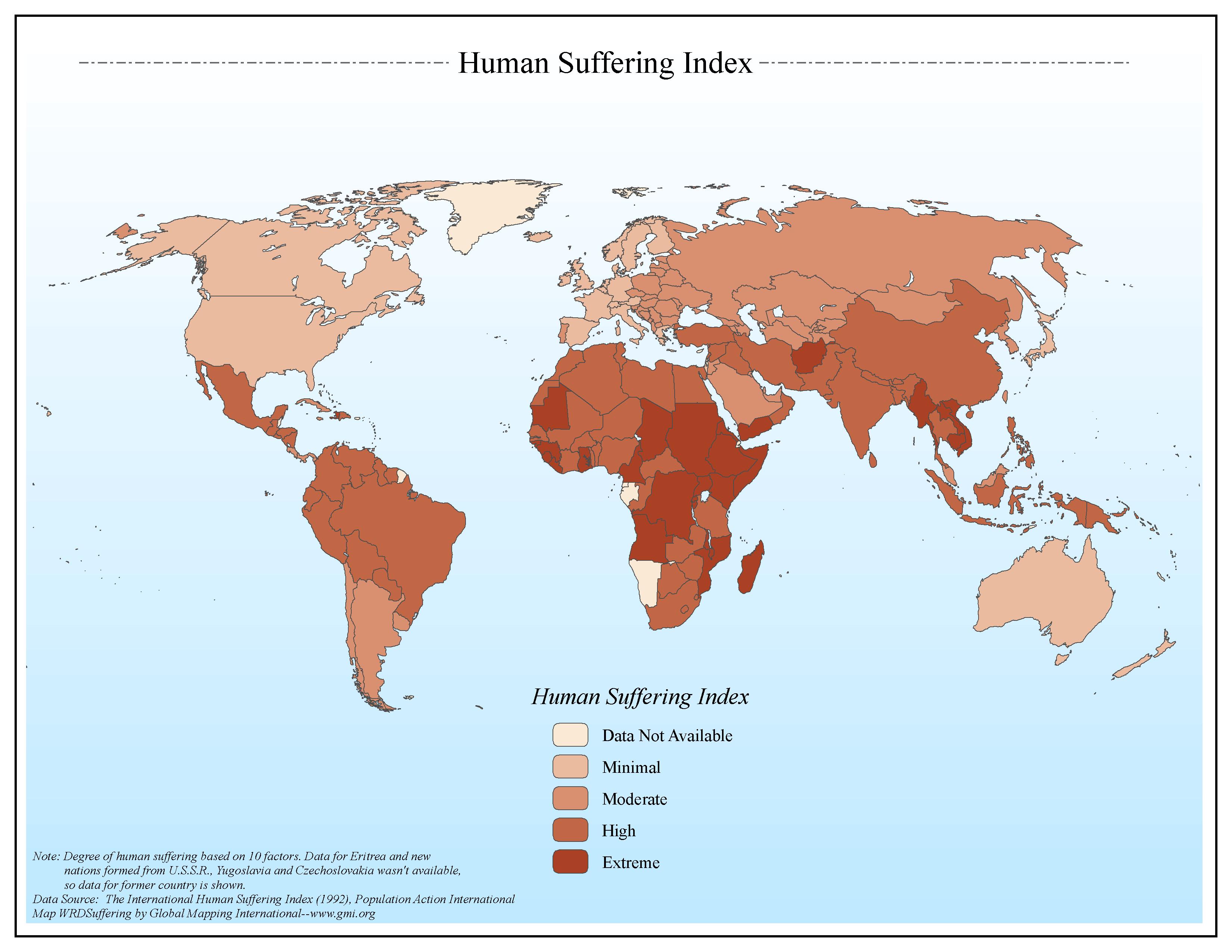 |
·Type: Maps ·Map Date: 2006 ·Data Source: The International Human Suffering Index (1992), Population Action International ·Producer: Global Mapping International ·Collection: Intro to Missions (GMMS 2007) ·Size: 8½ x 11 inches, landscape ·Categories: Type :: Maps Continent/Region :: World Topic :: Statistical Topic :: Social Collection :: GMI Map Collections :: Intro to Missions (GMMS 2007) Partners :: Global Mapping International |
... more info
Max: 1
|
|
 |
·Type: Maps ·Description: Index of Human Suffering Worldwide ·Map Date: 2002 ·Producer: Global Mapping International ·Collection: Intro to Mission (WorldVue 2002) ·Size: 8½ x 11 Inches, landscape ·Categories: Type :: Maps Collection :: GMI Map Collections :: Intro to Mission (WorldVue 2002) Continent/Region :: World Topic :: Statistical Topic :: Social Partners :: Global Mapping International |
... more info
Max: 1
|
|
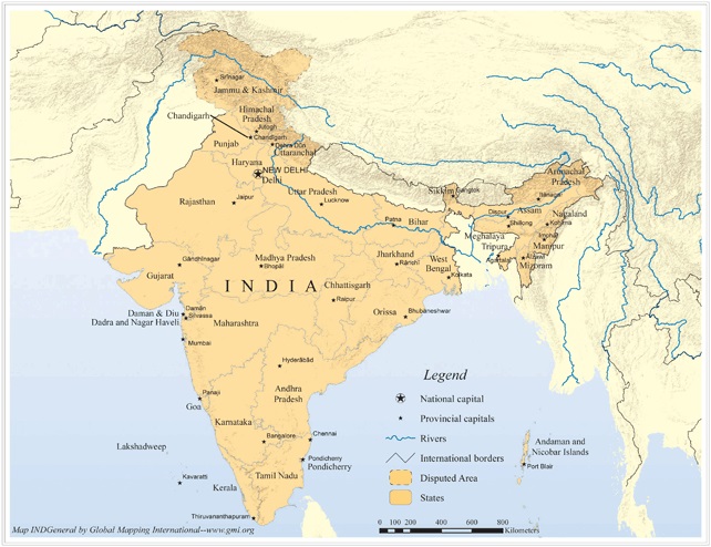 |
·Type: Maps ·Map Date: 2006 ·Producer: Global Mapping International ·Collection: Reaching India (GMMS 2007) ·Size: 8½ x 11 inches, landscape ·Categories: Type :: Maps Continent/Region :: Asia Country :: India Collection :: GMI Map Collections :: Reaching India (GMMS 2007) Partners :: Global Mapping International Topic :: Geography :: Maps |
... more info
Max: 1
|
|
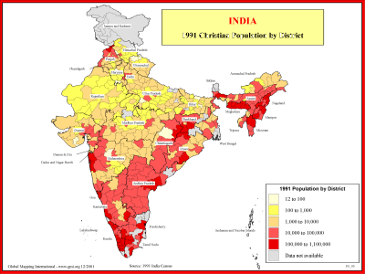 |
·Type: Maps ·Description: 1991 Chrisitian Population by district ·Map Date: 2001 ·Producer: Global Mapping International ·Collection: Reaching India (WorldVue 2002) ·Size: 8½ x 11 Inches, landscape ·Categories: Type :: Maps Collection :: GMI Map Collections :: Reaching India (WorldVue 2002) Continent/Region :: Asia Topic :: Statistical Country :: India Partners :: Global Mapping International Topic :: Religions, Christianity :: Adherents,... |
... more info
Max: 1
|
|
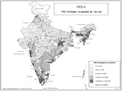 |
·Type: Maps ·Description: 1991 Chrisitian Population by district ·Map Date: 2002 ·Producer: Global Mapping International ·Collection: Reaching India (WorldVue 2002) ·Size: 8½ x 11 Inches, landscape ·Categories: Type :: Maps Collection :: GMI Map Collections :: Reaching India (WorldVue 2002) Continent/Region :: Asia Topic :: Statistical Country :: India Partners :: Global Mapping International Topic :: Religions, Christianity :: Adherents,... |
... more info
Max: 1
|
|
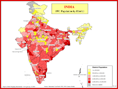 |
·Type: Maps ·Description: 1991 Population by district in India ·Map Date: 2001 ·Producer: Global Mapping International ·Collection: Reaching India (WorldVue 2002) ·Size: 8½ x 11 Inches, landscape ·Categories: Type :: Maps Collection :: GMI Map Collections :: Reaching India (WorldVue 2002) Continent/Region :: Asia Topic :: Statistical Topic :: Demography Country :: India Partners :: Global Mapping International |
... more info
Max: 1
|
|
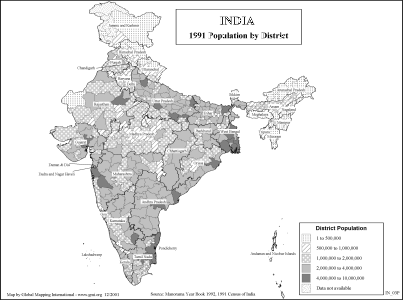 |
·Type: Maps ·Description: 1991 Population by district in India ·Map Date: 2002 ·Producer: Global Mapping International ·Collection: Reaching India (WorldVue 2002) ·Size: 8½ x 11 Inches, landscape ·Categories: Type :: Maps Collection :: GMI Map Collections :: Reaching India (WorldVue 2002) Continent/Region :: Asia Topic :: Statistical Topic :: Demography Country :: India Partners :: Global Mapping International |
... more info
Max: 1
|
|
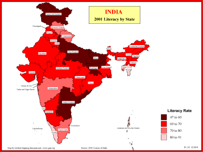 |
·Type: Maps ·Description: Statewide Literacy in 2001 ·Map Date: 2001 ·Producer: Global Mapping International ·Collection: Reaching India (WorldVue 2002) ·Size: 8½ x 11 Inches, landscape ·Categories: Type :: Maps Collection :: GMI Map Collections :: Reaching India (WorldVue 2002) Continent/Region :: Asia Topic :: Statistical Topic :: Social Country :: India Partners :: Global Mapping International |
... more info
Max: 1
|
|
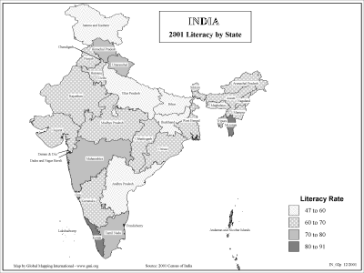 |
·Type: Maps ·Description: Statewide Literacy in 2001 ·Map Date: 2002 ·Producer: Global Mapping International ·Collection: Reaching India (WorldVue 2002) ·Size: 8½ x 11 Inches, landscape ·Categories: Type :: Maps Collection :: GMI Map Collections :: Reaching India (WorldVue 2002) Continent/Region :: Asia Topic :: Statistical Topic :: Social Country :: India Partners :: Global Mapping International |
... more info
Max: 1
|
|
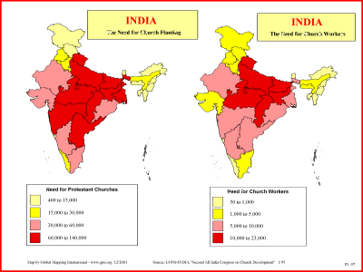 |
·Type: Maps ·Description: India's need for Church Planting Workers ·Map Date: 2001 ·Producer: Global Mapping International ·Collection: Reaching India (WorldVue 2002) ·Size: 8½ x 11 Inches, landscape ·Categories: Type :: Maps Collection :: GMI Map Collections :: Reaching India (WorldVue 2002) Continent/Region :: Asia Topic :: Statistical Topic :: Strategy Country :: India Partners :: Global Mapping International |
... more info
Max: 1
|
|
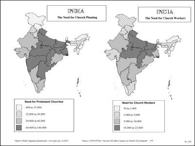 |
·Type: Maps ·Description: India's need for Church Planting Workers ·Map Date: 2002 ·Producer: Global Mapping International ·Collection: Reaching India (WorldVue 2002) ·Size: 8½ x 11 Inches, landscape ·Categories: Type :: Maps Collection :: GMI Map Collections :: Reaching India (WorldVue 2002) Continent/Region :: Asia Topic :: Statistical Topic :: Strategy Country :: India Partners :: Global Mapping International |
... more info
Max: 1
|
|
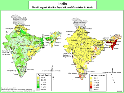 |
·Type: Maps ·Description: India's Muslim Population ·Map Date: 2000 ·Producer: Global Mapping International ·Collection: The World of Islam (WV 2002) ·Size: 8½ x 11 Inches, landscape ·Categories: Type :: Maps Collection :: GMI Map Collections :: The World of Islam (WV 2002) Continent/Region :: Asia Topic :: Statistical Country :: India Partners :: Global Mapping International Topic :: Religions, General :: Multiple/Other |
... more info
Max: 1
|
|
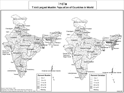 |
·Type: Maps ·Description: India's Muslim Population ·Map Date: 2002 ·Producer: Global Mapping International ·Collection: The World of Islam (WV 2002) ·Size: 8½ x 11 Inches, landscape ·Categories: Type :: Maps Collection :: GMI Map Collections :: The World of Islam (WV 2002) Continent/Region :: Asia Topic :: Statistical Country :: India Partners :: Global Mapping International Topic :: Religions, General :: Multiple/Other |
... more info
Max: 1
|
|
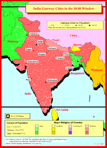 |
·Type: Maps ·Description: Gateway Cities in India to the 10/40 Window ·Map Date: 2001 ·Producer: Global Mapping International ·Collection: Reaching India (WorldVue 2002) ·Size: 8½ x 11 Inches, portrait ·Note: Windows Metafile and Metafile in Word forms of this map require the GMISym.ttf font ·Categories: Type :: Maps Collection :: GMI Map Collections :: Reaching India (WorldVue 2002) Continent/Region :: Asia Topic :: Statistical... |
... more info
Max: 1
|
|
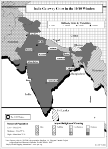 |
·Type: Maps ·Description: Gateway Cities in India to the 10/40 Window ·Map Date: 2002 ·Producer: Global Mapping International ·Collection: Reaching India (WorldVue 2002) ·Size: 8½ x 11 Inches, portrait ·Note: Windows Metafile and Metafile in Word forms of this map require the GMISym.ttf font ·Categories: Type :: Maps Collection :: GMI Map Collections :: Reaching India (WorldVue 2002) Continent/Region :: Asia Topic :: Statistical... |
... more info
Max: 1
|
|