| Product Image |
Resource Name |
Price |
Manufacturer+ |
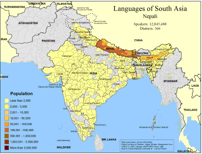 |
·Type: Maps ·Map Date: February 2008 ·Data Source: Census Information, UNESCO (1987) through UNEP/GRID-Sioux Falls ·Producer: Global Mapping International and The Joshua Project ·Size: 11.7 by 8.27 inches, landscape ·Categories: Type :: Maps Continent/Region :: Asia Topic :: Demography Country :: Nepal Country :: India Country :: Bangladesh Country :: Burma Partners :: Global Mapping International Topic :: Language and Translation Partners :: Joshua... |
... more info
Max: 1
|
|
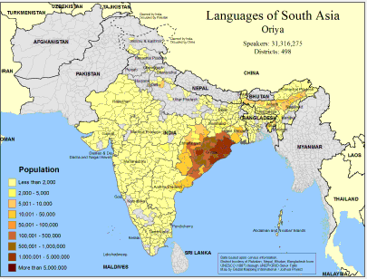 |
·Type: Maps ·Map Date: February 2008 ·Data Source: Census Information, UNESCO (1987) through UNEP/GRID-Sioux Falls ·Producer: Global Mapping International and The Joshua Project ·Size: 11.7 by 8.27 inches, landscape ·Categories: Type :: Maps Continent/Region :: Asia Topic :: Demography Country :: India Country :: Bangladesh Partners :: Global Mapping International Topic :: Language and Translation Partners :: Joshua Project |
... more info
Max: 1
|
|
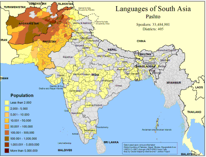 |
·Type: Maps ·Map Date: February 2008 ·Data Source: Census Information, UNESCO (1987) through UNEP/GRID-Sioux Falls ·Producer: Global Mapping International and The Joshua Project ·Size: 11.7 by 8.27 inches, landscape ·Categories: Type :: Maps Continent/Region :: Asia Topic :: Demography Country :: India Country :: Afghanistan Country :: Bangladesh Country :: Pakistan Partners :: Global Mapping International Topic :: Language and Translation Partners ::... |
... more info
Max: 1
|
|
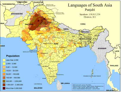 |
·Type: Maps ·Map Date: February 2008 ·Data Source: Census Information, UNESCO (1987) through UNEP/GRID-Sioux Falls ·Producer: Global Mapping International and The Joshua Project ·Size: 11.7 by 8.27 inches, landscape ·Categories: Type :: Maps Continent/Region :: Asia Topic :: Demography Country :: Nepal Country :: India Country :: Afghanistan Country :: Bangladesh Country :: Pakistan Partners :: Global Mapping International Topic :: Language and... |
... more info
Max: 1
|
|
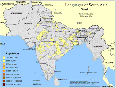 |
·Type: Maps ·Map Date: February 2008 ·Data Source: Census Information, UNESCO (1987) through UNEP/GRID-Sioux Falls ·Producer: Global Mapping International and The Joshua Project ·Size: 11.7 by 8.27 inches, landscape ·Categories: Type :: Maps Continent/Region :: Asia Topic :: Demography Country :: Nepal Country :: India Partners :: Global Mapping International Topic :: Language and Translation Partners :: Joshua Project |
... more info
Max: 1
|
|
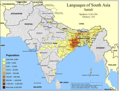 |
·Type: Maps ·Map Date: February 2008 ·Data Source: Census Information, UNESCO (1987) through UNEP/GRID-Sioux Falls ·Producer: Global Mapping International and The Joshua Project ·Size: 11.7 by 8.27 inches, landscape ·Categories: Type :: Maps Continent/Region :: Asia Topic :: Demography Country :: Nepal Country :: India Country :: Bangladesh Partners :: Global Mapping International Topic :: Language and Translation Partners :: Joshua Project |
... more info
Max: 1
|
|
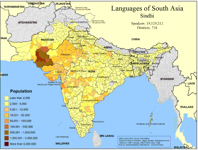 |
·Type: Maps ·Map Date: February 2008 ·Data Source: Census Information, UNESCO (1987) through UNEP/GRID-Sioux Falls ·Producer: Global Mapping International and The Joshua Project ·Size: 11.7 by 8.27 inches, landscape ·Categories: Type :: Maps Continent/Region :: Asia Topic :: Demography Country :: Nepal Country :: India Country :: Bangladesh Country :: Pakistan Partners :: Global Mapping International Topic :: Language and Translation Partners ::... |
... more info
Max: 1
|
|
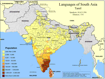 |
·Type: Maps ·Map Date: February 2008 ·Data Source: Census Information, UNESCO (1987) through UNEP/GRID-Sioux Falls ·Producer: Global Mapping International and The Joshua Project ·Size: 11.7 by 8.27 inches, landscape ·Categories: Type :: Maps Country :: Sri Lanka Continent/Region :: Asia Topic :: Demography Country :: India Partners :: Global Mapping International Topic :: Language and Translation Partners :: Joshua Project |
... more info
Max: 1
|
|
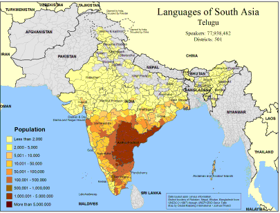 |
·Type: Maps ·Map Date: February 2008 ·Data Source: Census Information, UNESCO (1987) through UNEP/GRID-Sioux Falls ·Producer: Global Mapping International and The Joshua Project ·Size: 11.7 by 8.27 inches, landscape ·Categories: Type :: Maps Continent/Region :: Asia Topic :: Demography Country :: India Country :: Bangladesh Partners :: Global Mapping International Topic :: Language and Translation Partners :: Joshua Project |
... more info
Max: 1
|
|
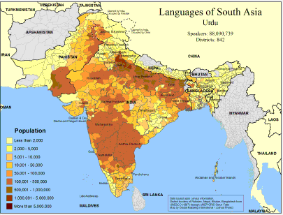 |
·Type: Maps ·Map Date: February 2008 ·Data Source: Census Information, UNESCO (1987) through UNEP/GRID-Sioux Falls ·Producer: Global Mapping International and The Joshua Project ·Size: 11.7 by 8.27 inches, landscape ·Categories: Type :: Maps Continent/Region :: Asia Topic :: Demography Country :: Nepal Country :: India Country :: Bangladesh Country :: Pakistan Partners :: Global Mapping International Topic :: Language and Translation Partners ::... |
... more info
Max: 1
|
|
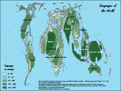 |
·Type: Maps ·Description: Countries are sized by number of languages. ·Map Date: 2007 ·Data Source: 15th Edition Ethnologue Producer: Global Mapping International ·Collection: Projects 2007 ·Size: Size: 8 1/2 by 11 inches, landscape ·Categories: Type :: Maps Continent/Region :: World Partners :: Global Mapping International Collection :: GMI Map Collections :: Projects 2007 Topic :: Language and Translation |
... more info
Max: 1
|
|
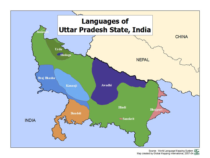 |
·Type: Maps ·Map Date: 2007 ·Data Source: World Language Mapping Systems ·Producer: GMI ·Collection: Projects 2007 ·Size: 7½ by 10 inches, landscape ·Categories: Type :: Maps Country :: India Partners :: Global Mapping International Collection :: GMI Map Collections :: Projects 2007 Topic :: Language and Translation |
... more info
Max: 1
|
|
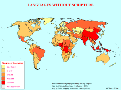 |
·Type: Maps ·Description: Number of languages without scripture on country level divisions. ·Map Date: 2000 ·Producer: Global Mapping International ·Collection: General World Maps (WV 2002) ·Size: 8½ x 11 Inches, landscape ·Categories: Type :: Maps Collection :: GMI Map Collections :: General World Maps (WV 2002) Continent/Region :: World Topic :: Statistical Topic :: Peoples, multiple or unknown Partners :: Global Mapping International... |
... more info
Max: 1
|
|
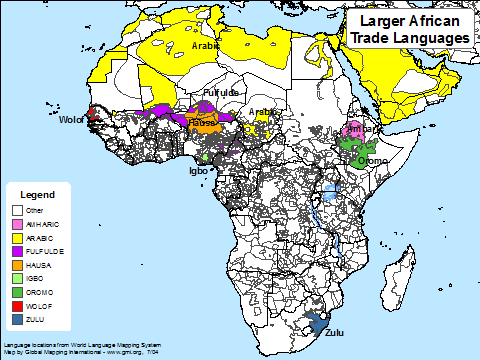 |
·Type: Maps ·Map Date: July 2004 ·Data Source: Language locations from World Language Mapping System ·Producer: Global Mapping International ·Collection: Projects 2004 ·Size: 8 1/2 by 11 inches, landscape ·Categories: Type :: Maps Continent/Region :: Africa Partners :: Global Mapping International Collection :: GMI Map Collections :: Projects 2004 Topic :: Language and Translation |
... more info
Max: 1
|
|
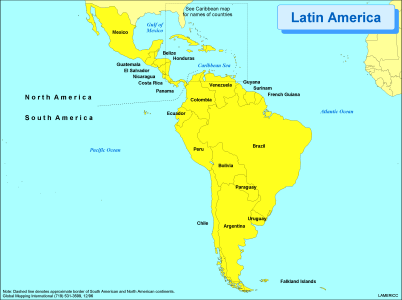 |
·Type: Maps ·Description: Political Map of Latin America ·Map Date: 2002 ·Producer: Global Mapping International ·Collection: Regions (WorldVue 2002) ·Size: 8½ x 11 Inches, landscape ·Categories: Type :: Maps Continent/Region :: Latin America Partners :: Global Mapping International Collection :: GMI Map Collections :: Regions (WorldVue 2002) Topic :: Geography :: Maps |
... more info
Max: 1
|
|
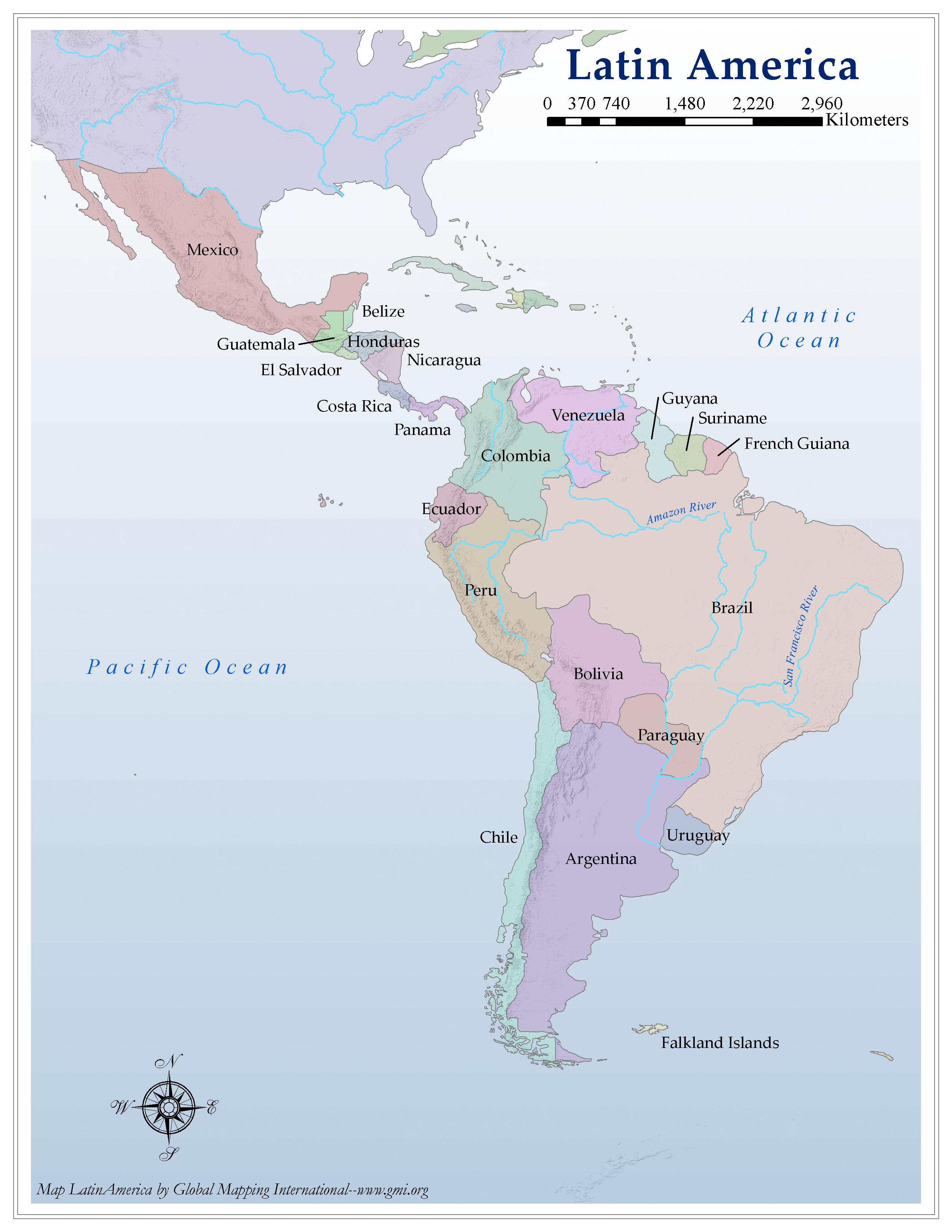 |
·Type: Maps ·Map Date: 2006 ·Producer: Global Mapping International ·Collection: Regions (GMMS 2007) ·Size: 8½ x 11 inches, portrait ·Categories: Type :: Maps Partners :: Global Mapping International Collection :: GMI Map Collections :: Regions (GMMS 2007) Topic :: Geography :: Maps |
... more info
Max: 1
|
|
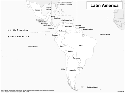 |
·Type: Maps ·Description: Political Map of Latin America ·Map Date: 2002 ·Producer: Global Mapping International ·Collection: Regions (WorldVue 2002) ·Size: 8½ x 11 Inches, landscape ·Categories: Type :: Maps Continent/Region :: Latin America Partners :: Global Mapping International Collection :: GMI Map Collections :: Regions (WorldVue 2002) Topic :: Geography :: Maps |
... more info
Max: 1
|
|
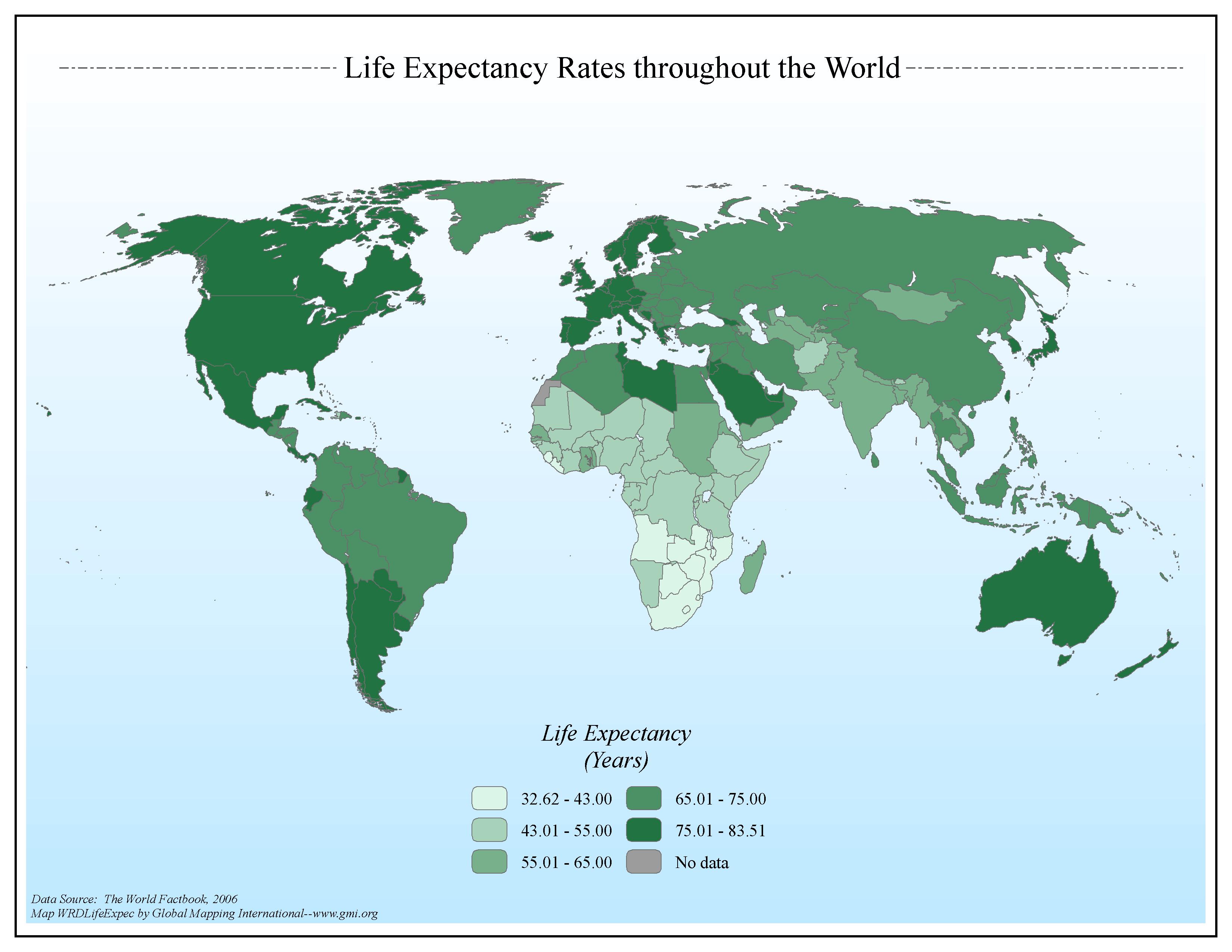 |
·Type: Maps ·Map Date: 2006 ·Data Source: The World Factbook, 2006 ·Producer: Global Mapping International ·Collection: Factbook (GMMS 2007) ·Size: 8½ x 11 inches, landscape ·Categories: Type :: Maps Continent/Region :: World Topic :: Statistical Topic :: Social Collection :: GMI Map Collections :: Factbook (GMMS 2007) Collection :: GMI Map Collections :: General World Maps (GMMS 2007) Partners :: Global Mapping International |
... more info
Max: 1
|
|
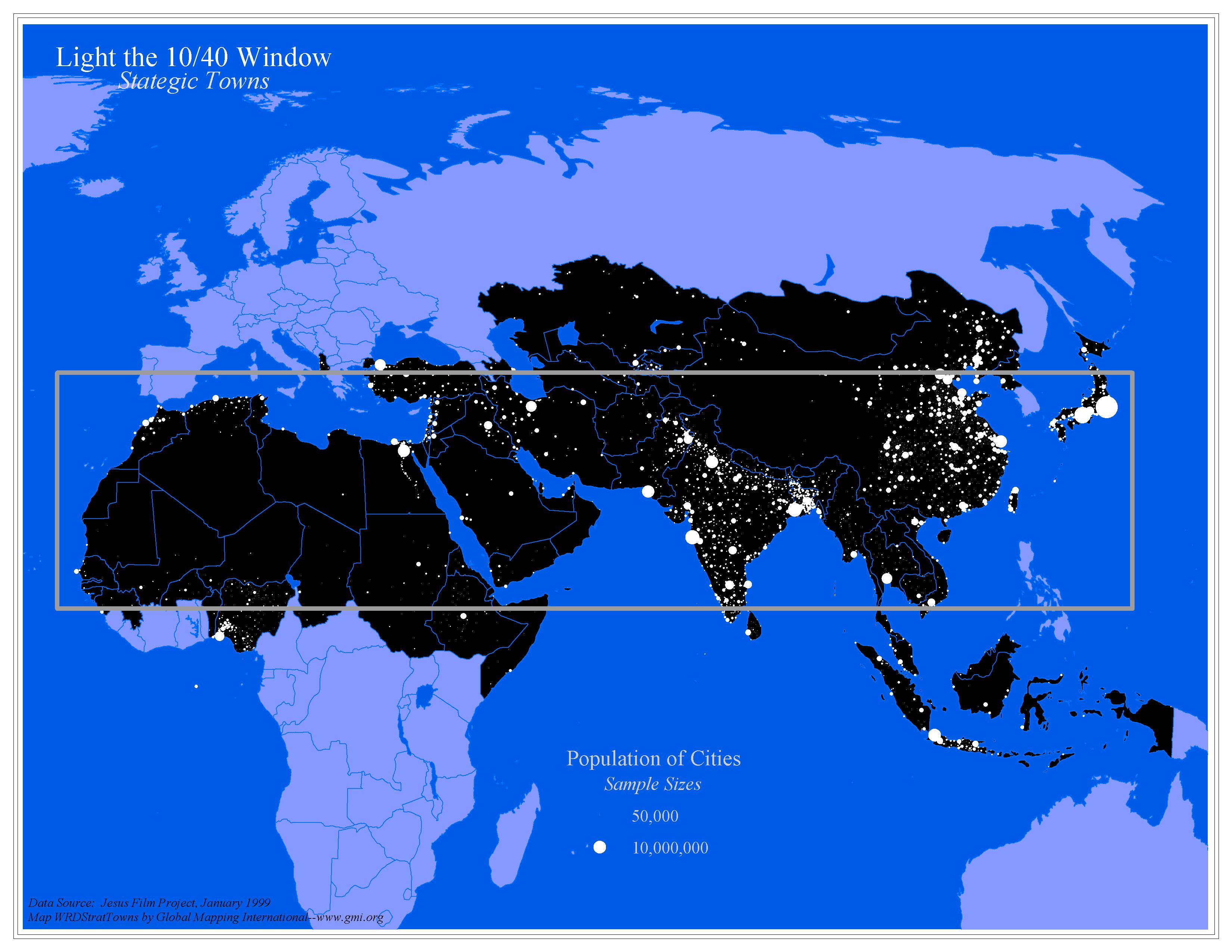 |
·Type: Maps ·Map Date: 2006 ·Data Source: Jesus Film Project, January 1999 ·Producer: Global Mapping International ·Collection: General World Maps (GMMS 2007) ·Size: 8½ x 11 inches, landscape ·Categories: Type :: Maps Topic :: Statistical Topic :: Strategy Topic :: Concepts Collection :: GMI Map Collections :: General World Maps (GMMS 2007) Partners :: Global Mapping International Continent/Region :: 10/40 Window |
... more info
Max: 1
|
|
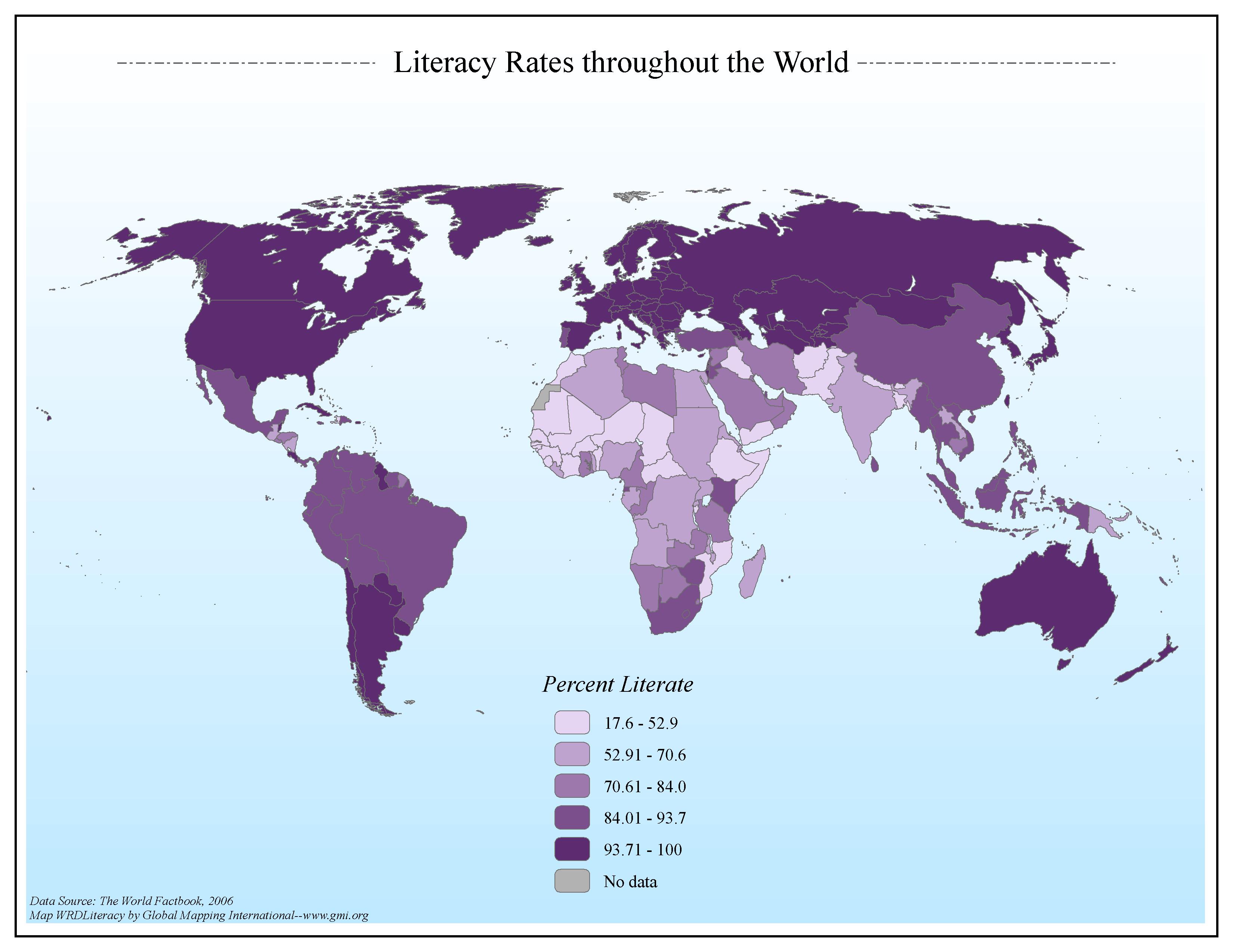 |
·Type: Maps ·Map Date: 2006 ·Data Source: The World Factbook, 2006 ·Producer: Global Mapping International ·Collection: Factbook (GMMS 2007) ·Size: 8½ x 11 inches, landscape ·Categories: Type :: Maps Continent/Region :: World Topic :: Statistical Topic :: Social Collection :: GMI Map Collections :: Factbook (GMMS 2007) Collection :: GMI Map Collections :: General World Maps (GMMS 2007) Partners :: Global Mapping International |
... more info
Max: 1
|
|
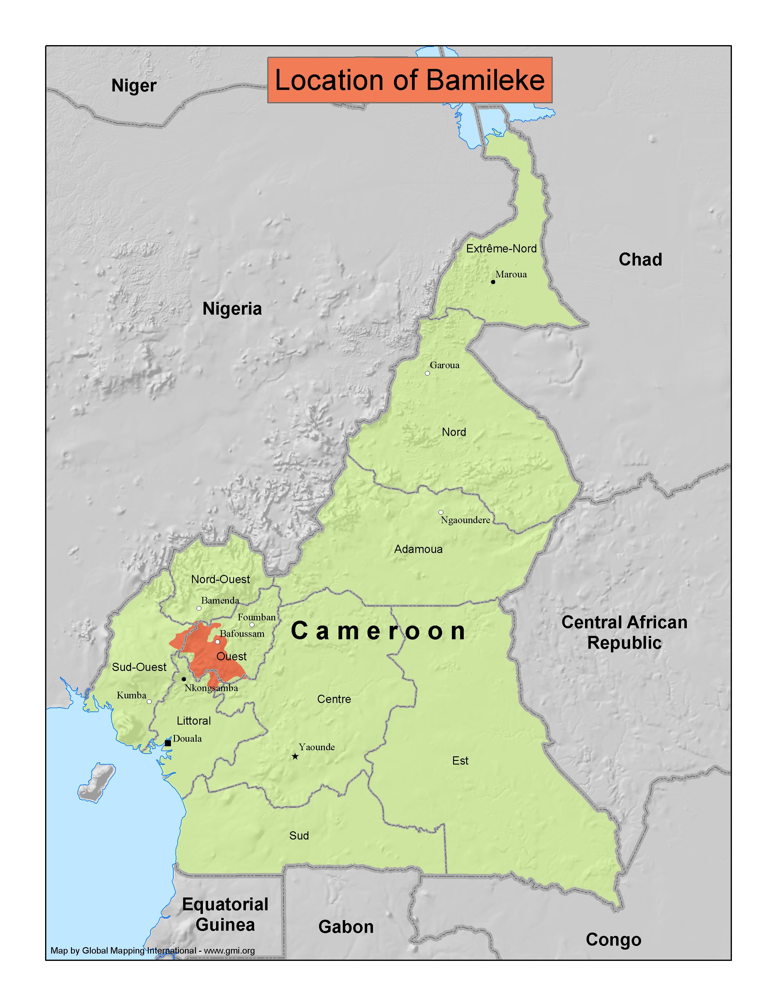 |
·Type: Maps ·Map Date: 2007 ·Producer: GMI ·Collection: Projects 2007 ·Size: 8½ by 11 inches, portrait ·Categories: Type :: Maps Country :: Cameroon Partners :: Global Mapping International Collection :: GMI Map Collections :: Projects 2007 Topic :: Peoples, specific :: B :: Bamileke |
... more info
Max: 1
|
|
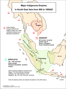 |
·Type: Maps ·Description: Major Indigenous Empires in South East Asia from 500 to 1500AD ·Map Date: 1998 ·Producer: Global Mapping International ·Collection: Focus South East Asia (WV 2002) ·Size: 8½ x 11 Inches, portrait ·Note: Windows Metafile and Metafile in Word forms of this map require the GMISym.ttf font ·Categories: Type :: Maps Collection :: GMI Map Collections :: Focus South East Asia (WV 2002) Continent/Region :: Asia... |
... more info
Max: 1
|
|
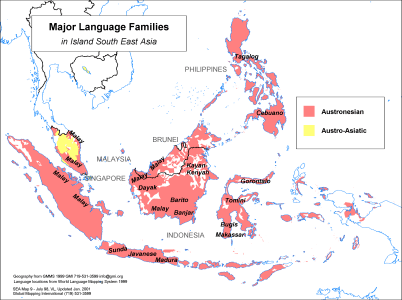 |
·Type: Maps ·Description: Major Language groups in Island Southeast Asia ·Map Date: 1998 ·Producer: Global Mapping International ·Collection: Focus South East Asia (WV 2002) ·Size: 8½ x 11 Inches, landscape ·Categories: Type :: Maps Collection :: GMI Map Collections :: Focus South East Asia (WV 2002) Continent/Region :: Asia Topic :: Peoples, multiple or unknown Partners :: Global Mapping International Topic :: Language and Translation |
... more info
Max: 1
|
|
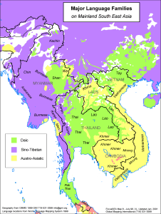 |
·Type: Maps ·Description: Major language groups in Mainland Southeast Asia ·Map Date: 1998 ·Producer: Global Mapping International ·Collection: Focus South East Asia (WV 2002) ·Size: 8½ x 11 Inches, portrait ·Categories: Type :: Maps Collection :: GMI Map Collections :: Focus South East Asia (WV 2002) Continent/Region :: Asia Topic :: Peoples, multiple or unknown Partners :: Global Mapping International Topic :: Language and Translation |
... more info
Max: 1
|
|
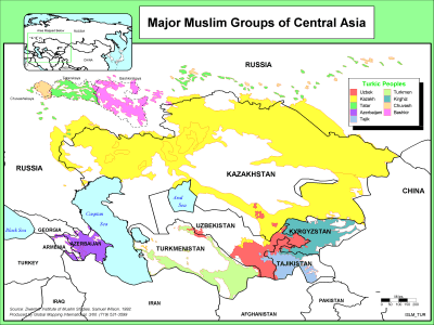 |
·Type: Maps ·Description: Major Muslim Groups in Central Asia ·Map Date: 2000 ·Producer: Global Mapping International ·Collection: The World of Islam (WV 2002) ·Size: 8½ x 11 Inches, landscape ·Categories: Type :: Maps Collection :: GMI Map Collections :: The World of Islam (WV 2002) Continent/Region :: Asia Topic :: Peoples, multiple or unknown Partners :: Global Mapping International Topic :: Religions, General :: Islam |
... more info
Max: 1
|
|