| Product Image |
Resource Name |
Price+ |
Manufacturer |
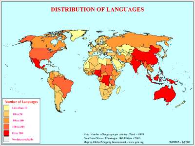 |
·Type: Maps ·Description: Country level divisions of languages in the world ·Map Date: 2000 ·Producer: Global Mapping International ·Collection: General World Maps (WV 2002) ·Size: 8½ x 11 Inches, landscape ·Categories: Type :: Maps Collection :: GMI Map Collections :: General World Maps (WV 2002) Continent/Region :: World Topic :: Statistical Topic :: Peoples, multiple or unknown Partners :: Global Mapping International Topic :: Language... |
... more info
Max: 1
|
|
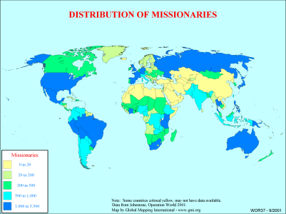 |
·Type: Maps ·Description: Country level distributions of missionaries ·Map Date: 2000 ·Producer: Global Mapping International ·Collection: General World Maps (WV 2002) ·Size: 8½ x 11 Inches, landscape ·Categories: Type :: Maps Collection :: GMI Map Collections :: General World Maps (WV 2002) Continent/Region :: World Topic :: Statistical Partners :: Global Mapping International Topic :: Religions, Christianity :: Adherents, Churches, and... |
... more info
Max: 1
|
|
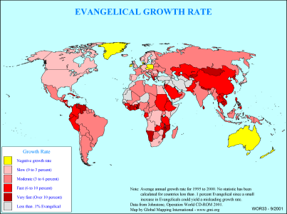 |
·Type: Maps ·Description: Country level divisions of the evangelical growth rate ·Map Date: 2000 ·Producer: Global Mapping International ·Collection: General World Maps (WV 2002) ·Size: 8½ x 11 Inches, landscape ·Categories: Type :: Maps Collection :: GMI Map Collections :: General World Maps (WV 2002) Continent/Region :: World Topic :: Statistical Partners :: Global Mapping International Topic :: Religions, Christianity :: Adherents,... |
... more info
Max: 1
|
|
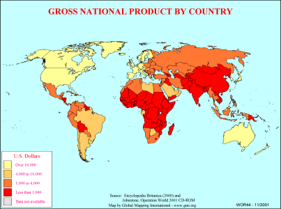 |
·Type: Maps ·Description: Country level divisions of gross national product ·Map Date: 2000 ·Producer: Global Mapping International ·Collection: General World Maps (WV 2002) ·Size: 8½ x 11 Inches, landscape ·Note: Windows Metafile and Metafile in Word forms of this map require the GMISym.ttf font ·Categories: Type :: Maps Collection :: GMI Map Collections :: General World Maps (WV 2002) Continent/Region :: World Partners :: Global... |
... more info
Max: 1
|
|
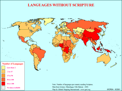 |
·Type: Maps ·Description: Number of languages without scripture on country level divisions. ·Map Date: 2000 ·Producer: Global Mapping International ·Collection: General World Maps (WV 2002) ·Size: 8½ x 11 Inches, landscape ·Categories: Type :: Maps Collection :: GMI Map Collections :: General World Maps (WV 2002) Continent/Region :: World Topic :: Statistical Topic :: Peoples, multiple or unknown Partners :: Global Mapping International... |
... more info
Max: 1
|
|
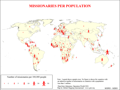 |
·Type: Maps ·Description: Country level divisions of missionaries per population ·Map Date: 2000 ·Producer: Global Mapping International ·Collection: General World Maps (WV 2002) ·Size: 8½ x 11 Inches, landscape ·Note: Windows Metafile and Metafile in Word forms of this map require the GMISym.ttf font ·Categories: Type :: Maps Collection :: GMI Map Collections :: General World Maps (WV 2002) Continent/Region :: World Topic ::... |
... more info
Max: 1
|
|
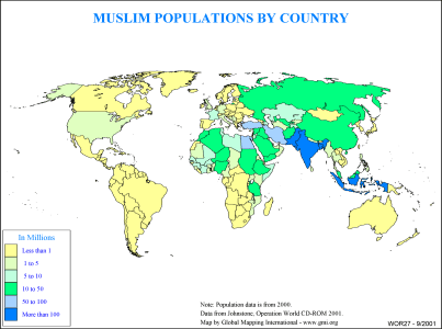 |
·Type: Maps ·Description: Muslim Populations by Country ·Map Date: 2000 ·Producer: Global Mapping International ·Collection: General World Maps (WV 2002) ·Size: 8½ x 11 Inches, landscape ·Categories: Type :: Maps Collection :: GMI Map Collections :: General World Maps (WV 2002) Continent/Region :: World Topic :: Statistical Partners :: Global Mapping International Topic :: Religions, General :: Islam |
... more info
Max: 1
|
|
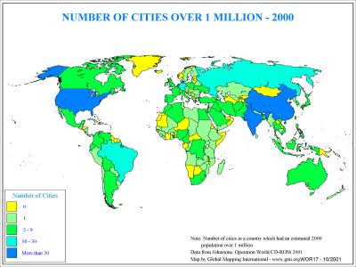 |
·Type: Maps ·Description: Country level distribution of number of cities over 1 million in 2 ·Map Date: 2000 ·Producer: Global Mapping International ·Collection: General World Maps (WV 2002) ·Size: 8½ x 11 Inches, landscape ·Categories: Type :: Maps Collection :: GMI Map Collections :: General World Maps (WV 2002) Continent/Region :: World Topic :: Demography Partners :: Global Mapping International |
... more info
Max: 1
|
|
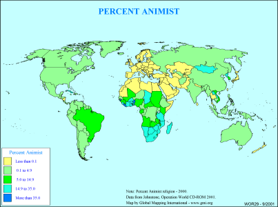 |
·Type: Maps ·Description: Country level divisions of the percent Animist ·Map Date: 2000 ·Producer: Global Mapping International ·Collection: General World Maps (WV 2002) ·Size: 8½ x 11 Inches, landscape ·Categories: Type :: Maps Collection :: GMI Map Collections :: General World Maps (WV 2002) Continent/Region :: World Topic :: Statistical Partners :: Global Mapping International Topic :: Religions, General :: Traditional/Animist |
... more info
Max: 1
|
|
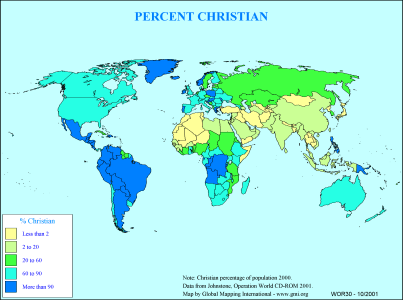 |
·Type: Maps ·Description: Country level divisions of the percent Christian ·Map Date: 2000 ·Producer: Global Mapping International ·Collection: General World Maps (WV 2002) ·Size: 8½ x 11 Inches, landscape ·Categories: Type :: Maps Collection :: GMI Map Collections :: General World Maps (WV 2002) Continent/Region :: World Topic :: Statistical Partners :: Global Mapping International Topic :: Religions, Christianity :: Adherents, Churches,... |
... more info
Max: 1
|
|
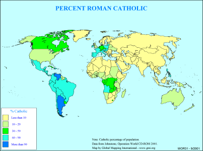 |
·Type: Maps ·Description: Country level divisions of the percent Roman Catholic ·Map Date: 2000 ·Producer: Global Mapping International ·Collection: General World Maps (WV 2002) ·Size: 8½ x 11 Inches, landscape ·Categories: Type :: Maps Collection :: GMI Map Collections :: General World Maps (WV 2002) Continent/Region :: World Topic :: Statistical Partners :: Global Mapping International Topic :: Religions, Christianity :: Adherents,... |
... more info
Max: 1
|
|
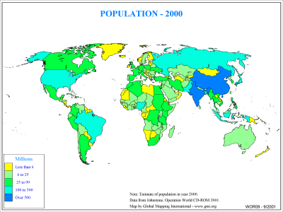 |
·Type: Maps ·Description: Country level distribution of Population in 2000 ·Map Date: 2000 ·Producer: Global Mapping International ·Collection: General World Maps (WV 2002) ·Size: 8½ x 11 Inches, landscape ·Categories: Type :: Maps Collection :: GMI Map Collections :: General World Maps (WV 2002) Continent/Region :: World Topic :: Demography Partners :: Global Mapping International |
... more info
Max: 1
|
|
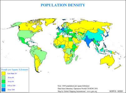 |
·Type: Maps ·Description: Country level distribution of Population density in 2000 (in kilom ·Map Date: 2000 ·Producer: Global Mapping International ·Collection: General World Maps (WV 2002) ·Size: 8½ x 11 Inches, landscape ·Categories: Type :: Maps Collection :: GMI Map Collections :: General World Maps (WV 2002) Continent/Region :: World Topic :: Demography Partners :: Global Mapping International |
... more info
Max: 1
|
|
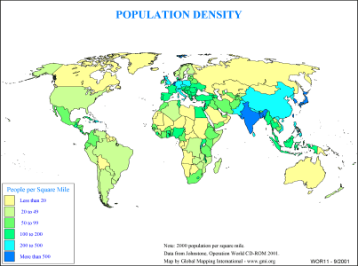 |
·Type: Maps ·Description: Country level distribution of Population density in 2000 (in miles ·Map Date: 2000 ·Producer: Global Mapping International ·Collection: General World Maps (WV 2002) ·Size: 8½ x 11 Inches, landscape ·Categories: Type :: Maps Collection :: GMI Map Collections :: General World Maps (WV 2002) Continent/Region :: World Topic :: Demography Partners :: Global Mapping International |
... more info
Max: 1
|
|